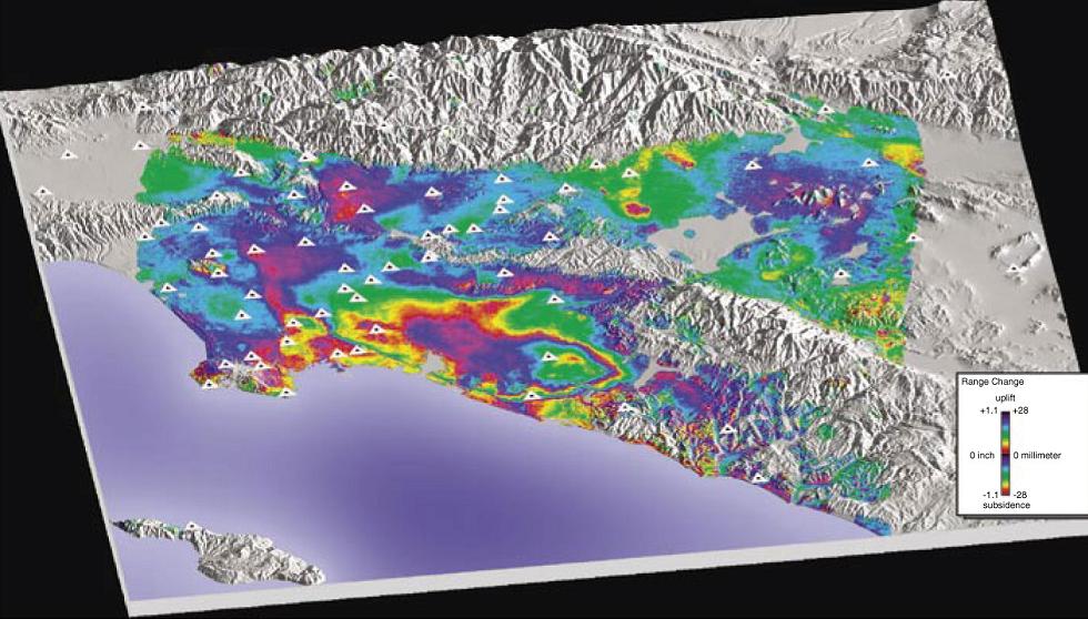
| Los Angeles Basin |
http://volcanoes.usgs.gov/activity/methods/insar/fact_sheet_figures.html california !!! ¢ monitoring ground deformation from space. Interferogram showing deformation in the Los Angeles basin, from April 1998 to May 1999, draped over shaded-relief map. Based on European Remote Sensing Satellite imagery. Triangles, Global Positioning System stations. Modified from Bawden and others, 2001. |