 |
Drowned tree stumps in intertidal zone. Sunset Bay State Park, Oregon. These tree stumps indicate that this beach was somewhat above sea level when the trees grew, but dropped to below sea level as the result of an earthquake. Carbon dating of the wood indicates the trees died in the year 1700. In fact, there are drowned tree trunks in the intertidal zone all up and down the Oregon coast, all of which died at about the same time. They are one of the main lines of evidence for the magnitude 8.7-9 earthquake on the Cascadia Subduction Zone in the year 1700 |
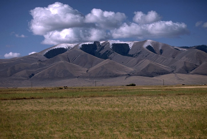
Triangular facets along the front of the Tendoy Range, SW Montana. Triangular facets are essentially cross-sections of ridges. They form when a ridge becomes offset by a fault. If the faulting is recent, then erosion has little time to degrade the facet |
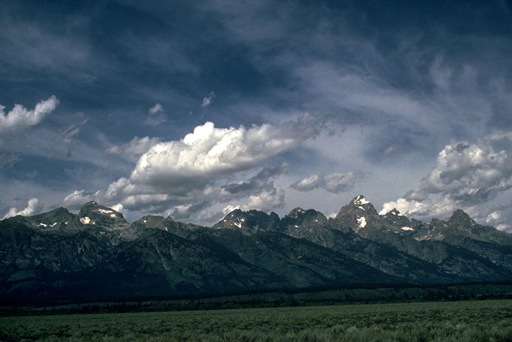
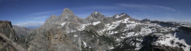
Teton Range, Wyoming. The Teton Range rises along the recently active Teton fault zone, which runs along the base of the mountains |
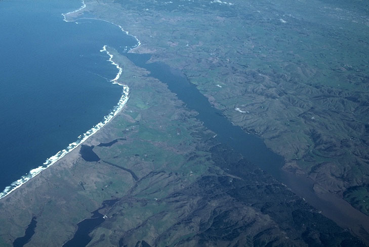
Aerial view of San Andreas fault, Point Reyes, California. Tomales Bay, the elongate, NW-trending bay in the center of this photo, follows the trace of the San Andreas fault. To the right (northeast) of the fault, the North American Plate is moving southeastward; to the left (southwest) of the fault, the Pacific plate is moving northwestward |
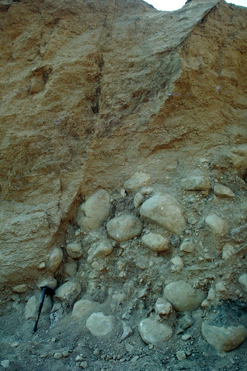
Exposure of the north branch of the San Andreas fault, San Bernardino Mtns., CA.The young age of these alluvial deposits attests to the recency of faulting |
Cretaceous granodiorite intruding Triassic metavolcanic rock in the southern Sierra Nevada. Note the irregularity of the contact. Also note the several small intrusions (apophyses) that extend from the main intrusive body into the overlying country rock. The Triassic rock was contact metamorphosed by the heat of the intrusion.roofpendant |
Pegmatite intruding basement gneiss , CaliforniaNote how irregular the contact is between the two, and the small sill of pegmatite intruding along foliation in the gneiss |
Intrusive Contact, sill intruding dolomite of the Helena Formation, Glacier National Park, MontanaThe dark band in the cliff face is the Purcell Sill, a diorite sill that intrudes dolomite of the Proterozoic Belt Supergroup in Glacier National Park. Note the bleached zone on either side of the sill from contact metamorphism during intrusion |
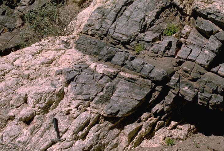
Normal fault in sandstone, Utah brittle faultThe key feature in fault contacts (besides the fact that you can see the actual offset here) is that the surface truncates the features on either side --because it shifted the rock along its surface |
Ductile shear zone in gneiss In this photo, individual foliations are deflected across a narrow zone, but they do not lose cohesion. By contrast, a brittle normal fault zone the rock and displaces it |
Thrust fault, Republic of KyrgyzstanAlthough we can''t see the same features on either side of this fault, we can tell it has to be a fault because it truncates the rock (and bedding) on both sides. We further know that it''s a thrust fault because it places older (Devonian) rock over younger (Tertiary) rock. Note how the Tertiary rock is folded into a syncline |
Teton Range as seen from the summit of Table Mountain |
Cambrian Flathead Sandstone unconformably overlying Precambrian gneiss. Teton Range, Wyoming |
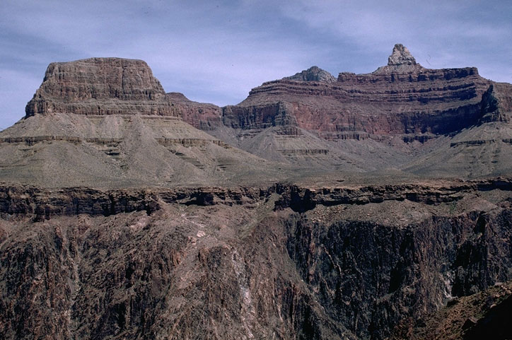
Nonconformity, Grand Canyon, Arizona. Nonconformities are types of unconformities in which sedimentary rock depositionally overlies metamorphic or intrusive igneous rock. In this photo, Cambrian Tapeats sandstone overlies Proterozoic schist, with an age greater than 1.7 Ga--which means that the erosional surface between the two represents more than a billion years of geologic time! Elsewhere in the Grand Canyon, the Tapeats Sandstone overlies tilted Proterozoic sedimentary rock to form an Angular Unconformity. |
Angular Unconformity, Grand Canyon, Arizona. Angular unconformities are ones in which the overlying and underlying rocks dip at different angles. We can therefore infer that the underlying rocks were tilted and eroded before the younger rocks were deposited. In the Grand Canyon, the Cambrian Tapeats Sandstone is nearly flat-lying, and overlies tilted Proterozoic sedimentary rock. Elsewhere, it overlies Proterozoic schist and granite as a nonconformity |
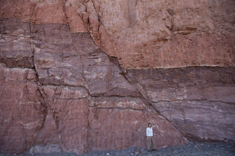
Buttress Unconformity, northern Arizona. In buttress unconformities, the younger material is deposited against the older material, resulting in the apparent truncation of the younger rock. On closer inspection, however, one can see erosional features along the contact to indicate its depositional origin |
Angular Unconformity in Pleistocene sediments, Tacoma, Washington Here, flat-lying coastal deposits overlie faulted and tilted gravel and sand |
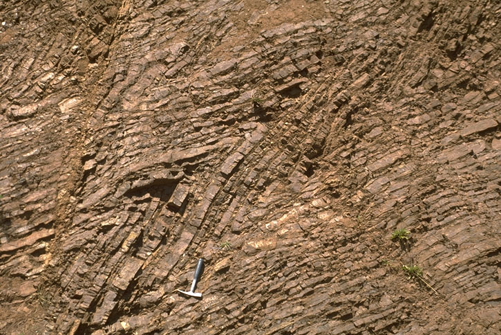
Ductile features: Syncline and anticline in Tertiary rock near Palmdale, California. This roadcut is adjacent to the San Andreas fault |
Ductile features: Chevron folds in ribbon chert, Marin Headlands, California |
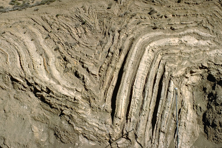
Ductile features: Chevron folds in ribbon chert, southern Oregon coast |
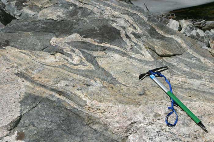
Folded gneiss. Teton Range, Wyoming |
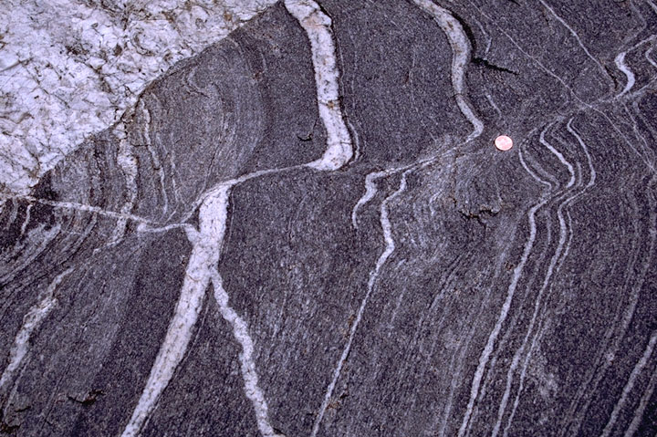
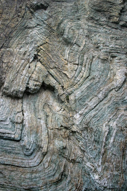
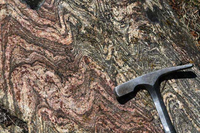
Migmatite gneiss, SW Montana |
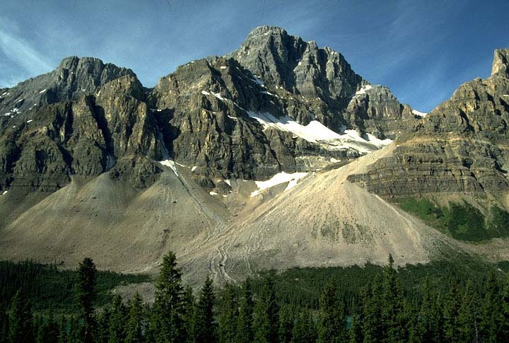
Talus Cones in Banff National Park, Alberta |
Braided Rivers: Kicking Horse River, eastern British Columbia. |
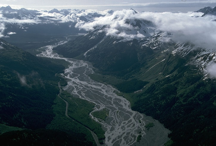
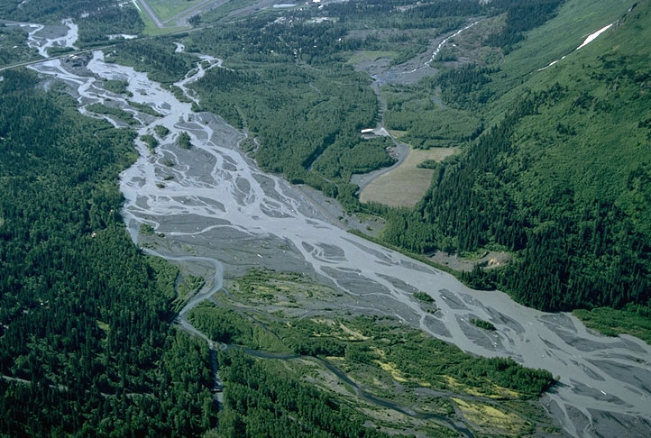
Braided Rivers:Rivers with numerous channels that repeatedly split and merge with each other. They typically form in high-gradient settings with coarse-grained sediment and fluctuating water dischargesResurrection River, SE Alaska |
Braided Rivers: Resurrection River, SE Alaska |
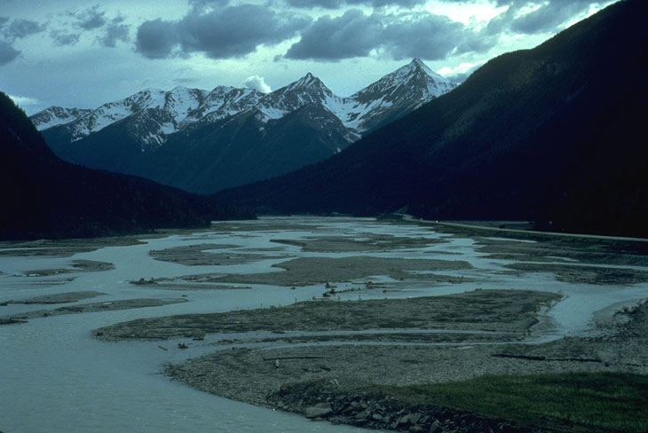
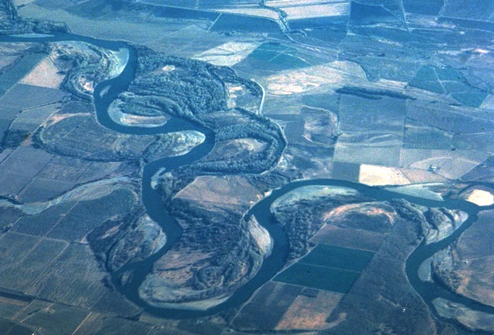
Meandering Rivers: Rivers in which the channel winds back and forth across its floodplain. They are generally found in low-gradient settings with fine-grained sedimentSacramento River, California |
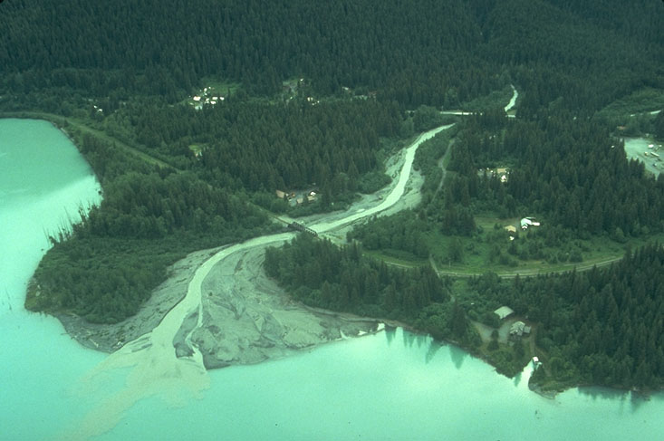
Delta at mouth of stream entering lake, SE Alaska |
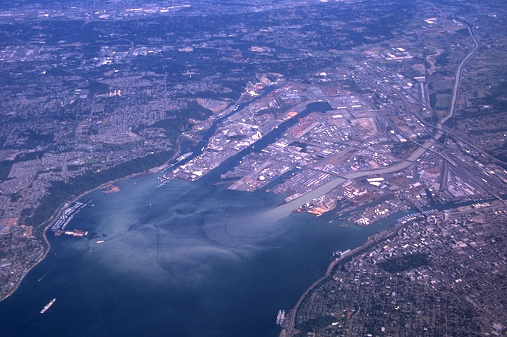
Sediment being deposited at mouth of Puyallup River, Tacoma, Washington |
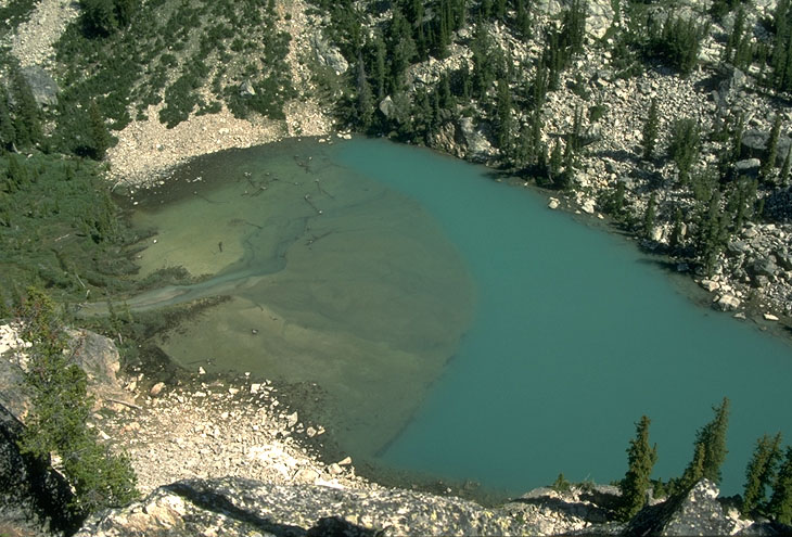
Delta in alpine lake. Grand Teton National Park, Wyoming |
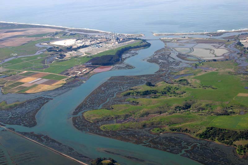
Estuary. Elkhorn Slough, California |
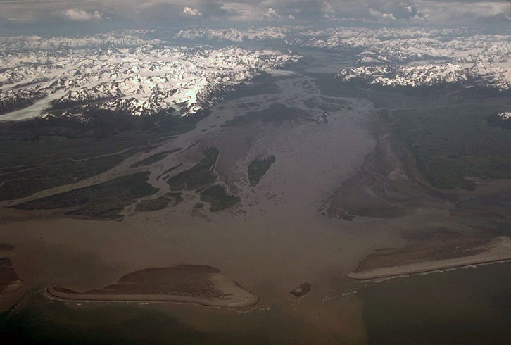
Estuary and barrier islands. Copper River, Alaska. |
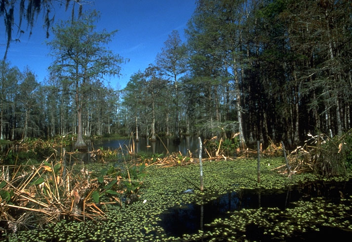
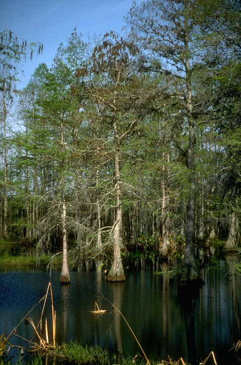
Cypress Swamp, SW Florida |
Cypress Swamp, SW Florida |
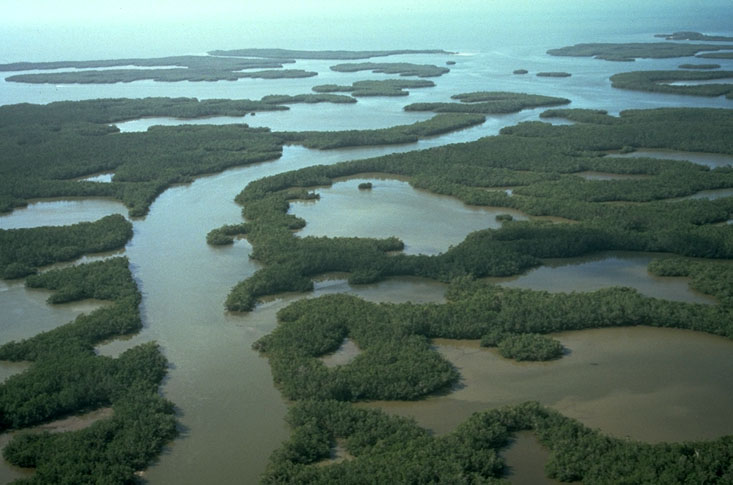
Aerial view of Mangrove Swamps and tidal channels, southern Florida |
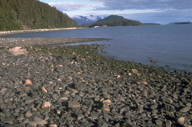
Gravel Beach. Haines, Alaska |
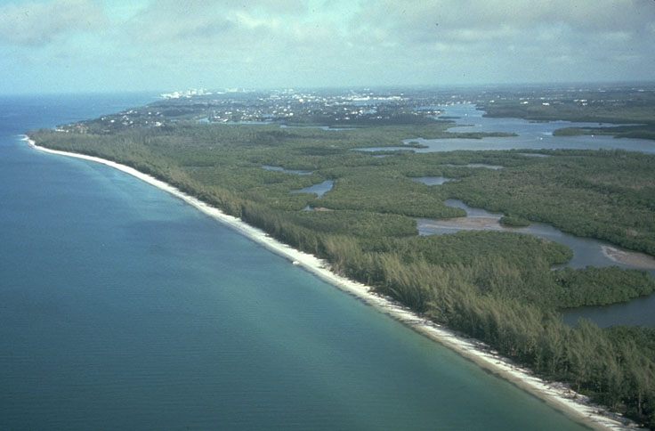
Beach in SW Florida |
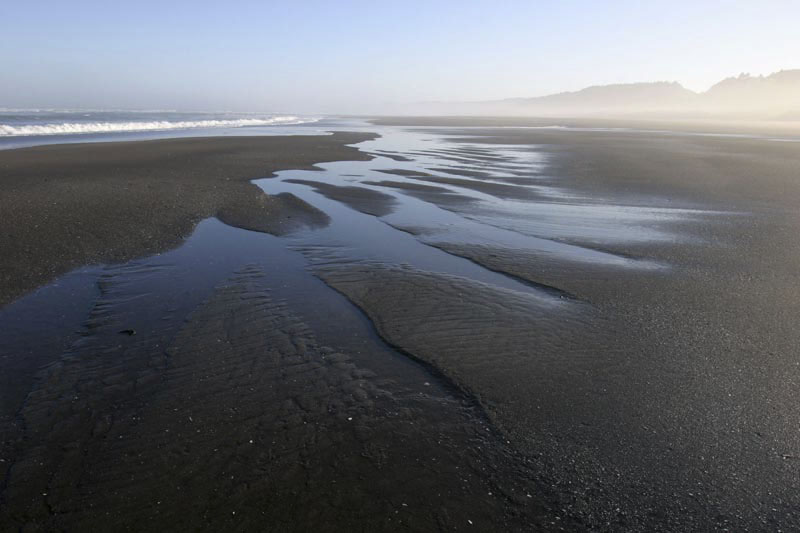
Beach at low tide, northern Oregon |
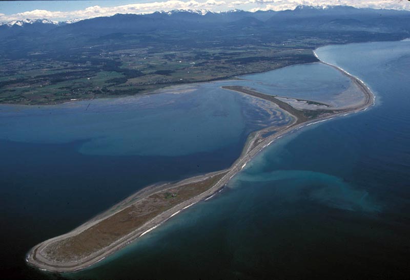
Dungeness Spit, Puget Sound, Washington. The mountains in the background are the Olympic Mtns |
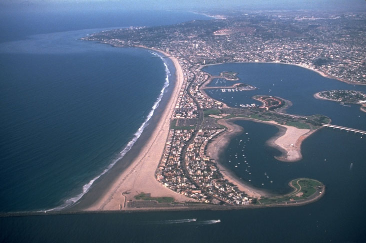
Sand Spit and coastal development. San Diego, California. |
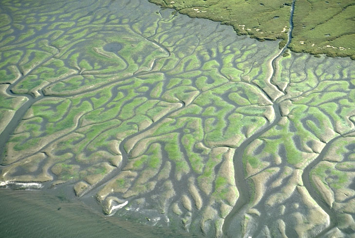
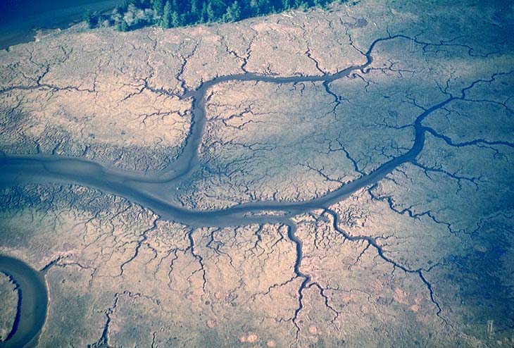
Tidal channels on tidal flat, Coos Bay, Oregon |
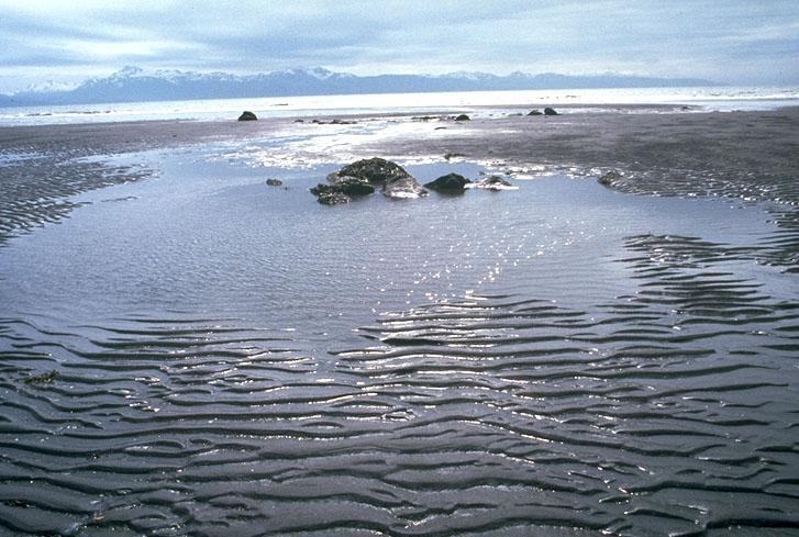
Ripples on tidal flat, SE Alaska |
Tidal channels on tidal flat, Coos Bay, Oregon |

Pictures of Geologic Contacts (author Marli Bryant Miller, http://www.marlimillerphoto.com/index.html)
Simply put, a geologic contact is where one rock type touches another --and as it turns out, they only do so in one of three ways. Depositional contacts are those where a sedimentary rock (or a lava flow) was deposited on an older rock; intrusive contacts are those where one rock has intruded another; fault (and shear zone) contacts are those where rocks come into contact across fault zones.
These photos highlight some of the key features associated with each type of geologic contact.
http://www.marlimillerphoto.com/searchstart.html
http://www.marlimillerphoto.com/Structuregeoimages.html