 |
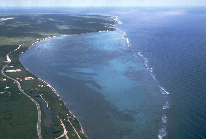
Fringing Reef. Grand Cayman Island |
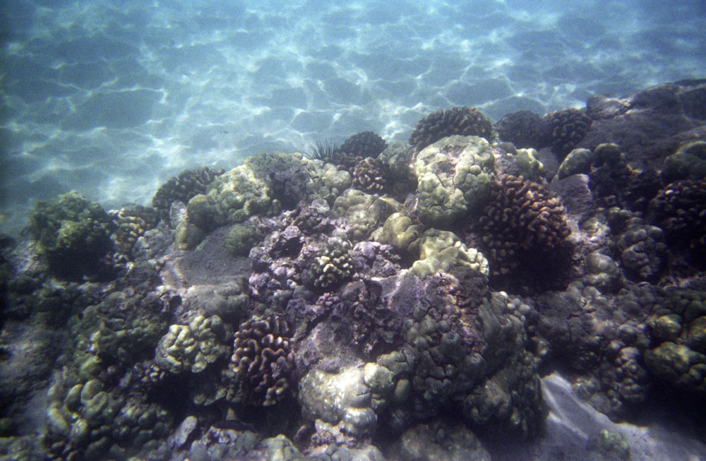
Coral Reef, Hawaii |
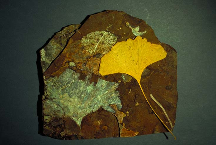
Modern and ancient Ginkgo leaves |
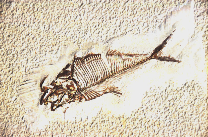
Eocene Herring |
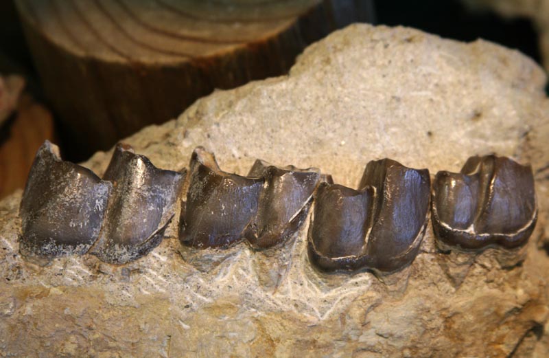
Oligocene Rhinocerus teeth |
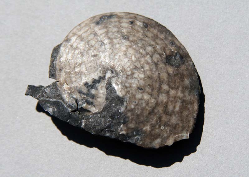
Triassic Ammonite |
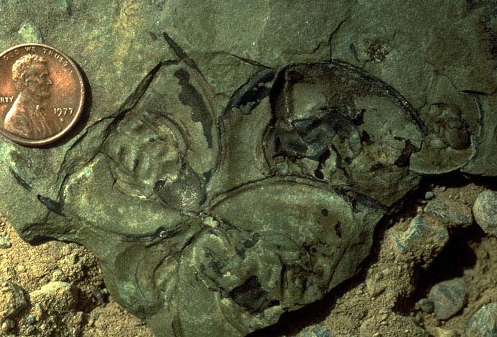
Cambrian trilobites |
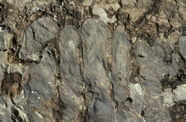
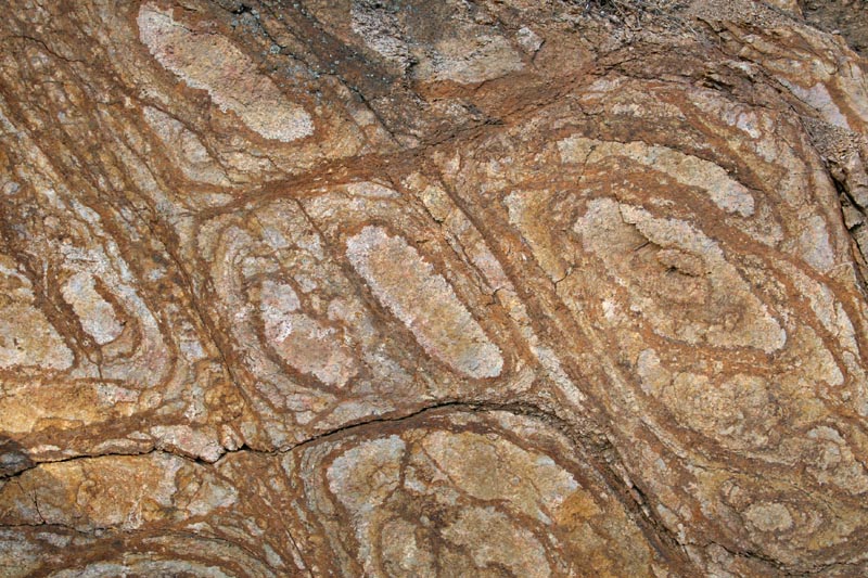
Proterozoic stromatalites |
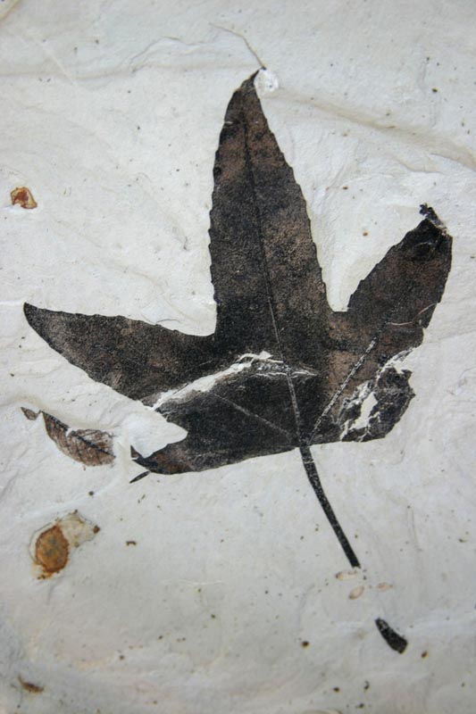
Eocene Maple leaf |
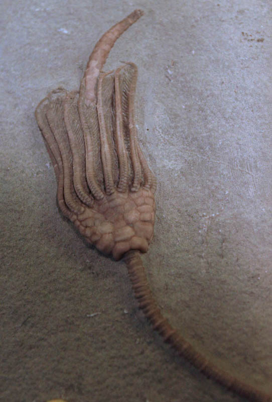
Mississippian Crinoid |
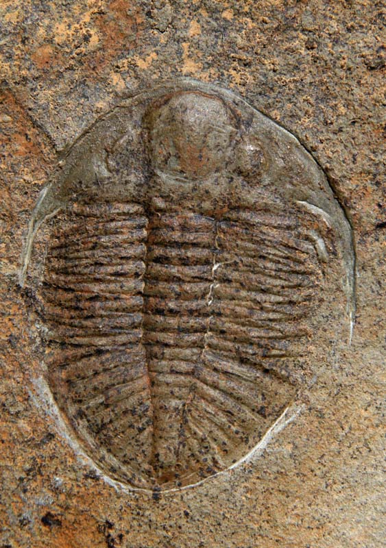
Ordovician Trilobite |
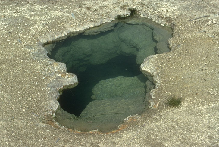
Hot spring and sinter deposits. Yellowstone National Park, Wyoming |
Hot spring and sinter deposits. Yellowstone National Park, Wyoming |
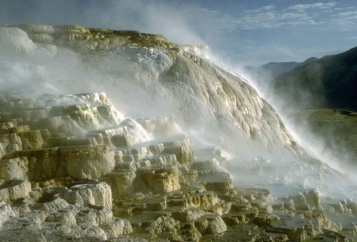
Minerva Terrace at Mammoth Hot Springs, Yellowstone National Park. These deposits are made of travertine, which is calcium carbonate that is typically precipitated from spring water |
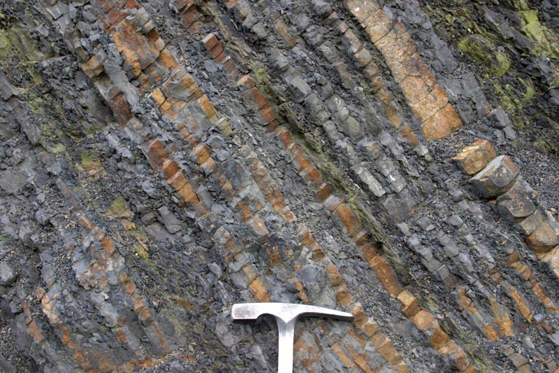
Liesegang banding from groundwater flow in granite. Note the concentration of iron oxide discoloration tends to be along fractures, sites of increased groundwater flow. This image is approximately 1 meter across. |
Sinkholes, W. Texas |
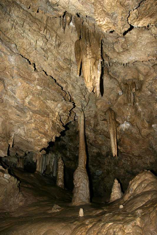
Speleothems. Oregon Caves National Monument, Oregon.This image depicts stalactites (growing down from the ceiling),stalagmites (growing up from the ground), and columns (where the two connect). |
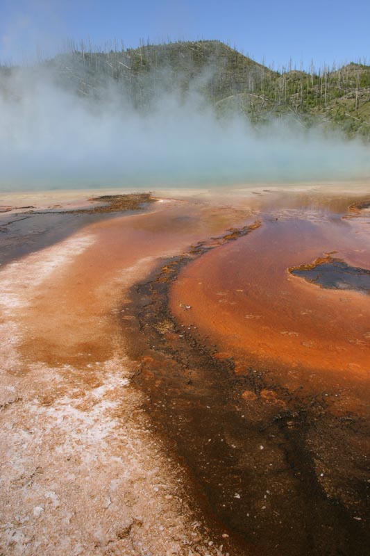
Bacteria-laden run-off from Grand Prismatic Spring, Yellowstone National Park, Wyoming |
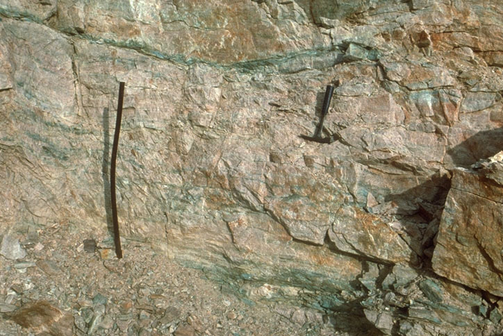
Stratiform copper deposit, SE California |
Effects of weathering and erosion along joint surfaces, SE Utah |
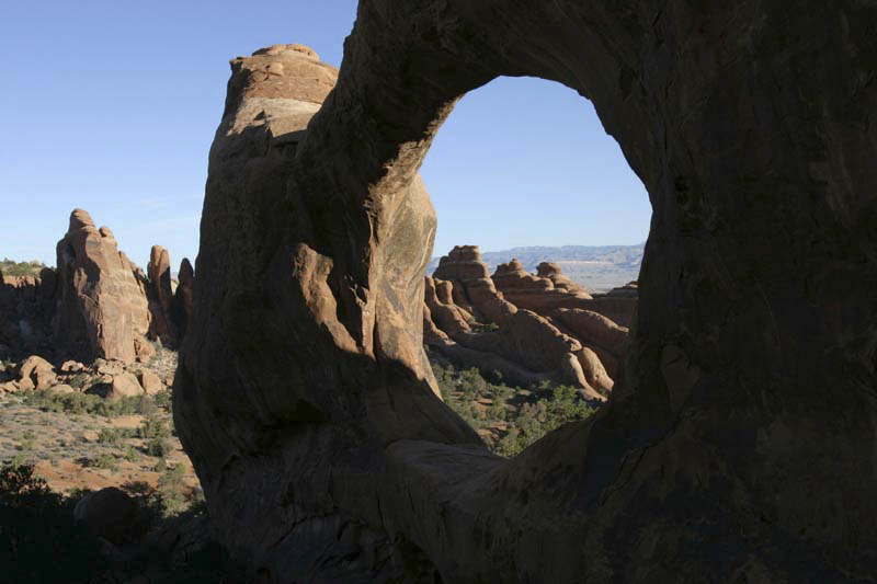
Development of arch along joint surface,Arches NP, Utah. Note fins in background |
Talus produced by frost-wedging, Montana |
Tree exploiting crack in rock, SE Utah |
Differential Erosion: "Mushroom" rock produced by differential erosion, |
Differential erosion of resistant sandstone overlying less resistant shale, Monument Valley, Arizona |
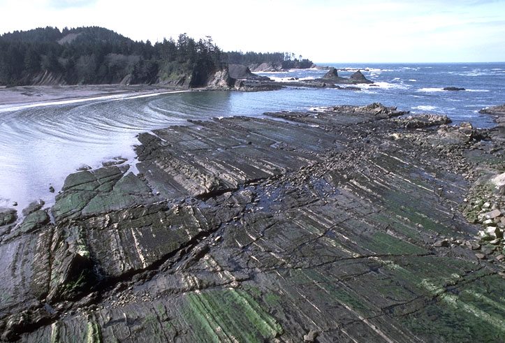
Wave-cut bench, Sunset Bay, Oregon |
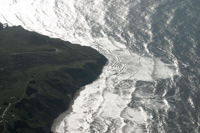
Wave refraction at headland, California |
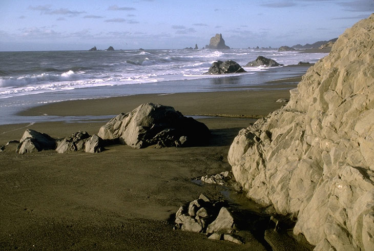
Coastal erosion and sea stacks, Oregon |
Sea Arch, Santa Cruz, California |
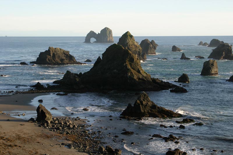
Sea Arch and Sea Stacks, Oregon |
Waves eroding headland, California |
Paleosols, John Day Fm., Oregon |
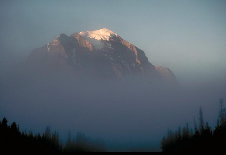
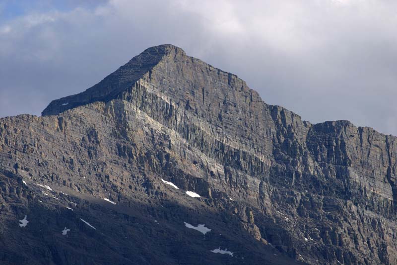
Mt. Temple, Banff NP |
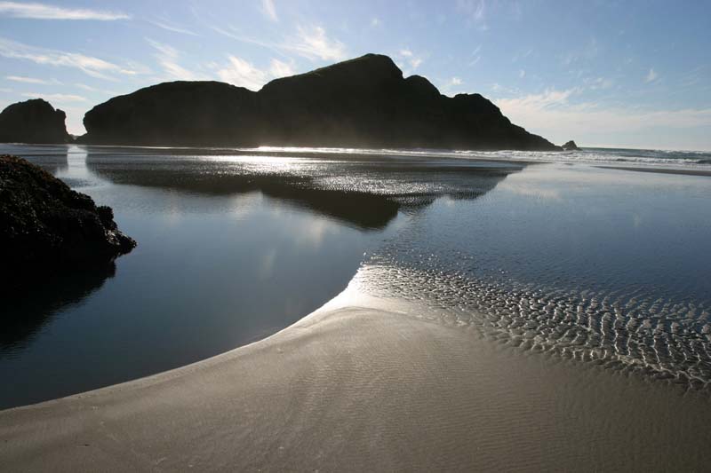
Oregon Coast |
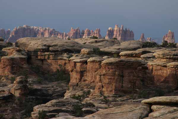
Canyonlands National Park, Utah |
Alternating beds of sandstone and shale--Turbidites. Pacifica, California |
Sill intruding Dolomite of the Helena Formation, Glacier National Park, Montana. The dark band in this cliff face is the Purcell Sill, and diorite sill that intrudes rock of the Proterozoic Belt Supergroup in Glacier National Park. The white rock on either side of the sill is bleached because of the contact metamorphism |
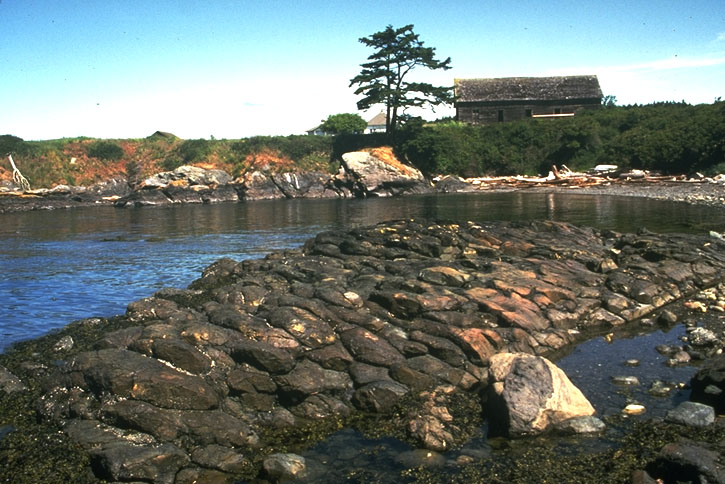
Pillow Basalt, Lopez Island, Washington.Pillow basalt, named because individual blocks resemble pillows, form underwater. Along the west coast of North America, there are many exposures of pillow basalt, because they formed in a marine environment and were subsequently accreted to the continent |
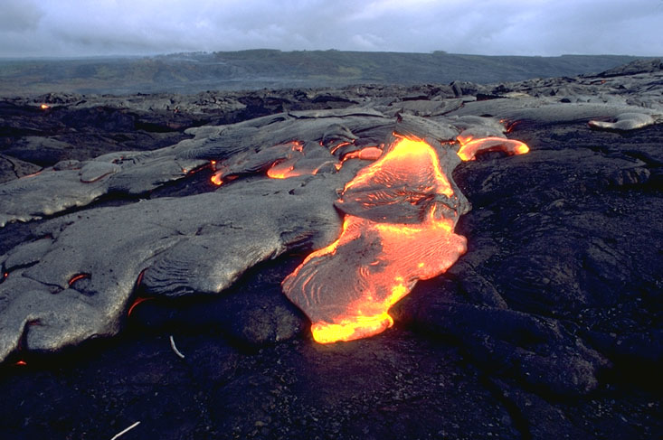
Active Pahoehoe lava flow, Kilauea Volcano, Hawai''i . Many pahoehoe flows advance slowly, with the flowing lava "breaking out" from a crust of overlying, recently chilled lava. This photo shows one such breakout. In the background, the shield shape of Kilauea Volcano can be seen |
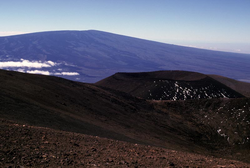
Mauna Loa Shield Volcano and Cinder Cone.This view of Mauna Loa Volcano, from the adjacent Mauna Kea Volcano, only begins to show the incredible mass of the mountain. It rises to an elevation of 13,679'' from a depth of about 18,000 feet below sea level to make it the tallest mountain from base to summit on the planet. Moreover, its relatively low gradient makes Mauna Loa the largest landform on Earth. |
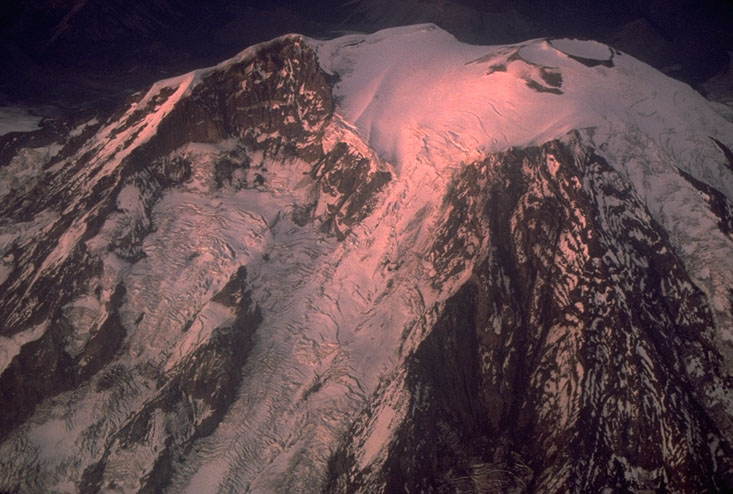
Aerial view of Mt. Rainier, Washington.At an elevation of greater than 14, 400 feet, Mt. Rainier is the highest Cascade Volcano, and one of the highest peaks in the conterminous United States. It consists primarily of andesite lava flows with a minor amount of interlayered pyroclastic flows. This photo affords a clear view of the Willis Wall and the summit crater. |
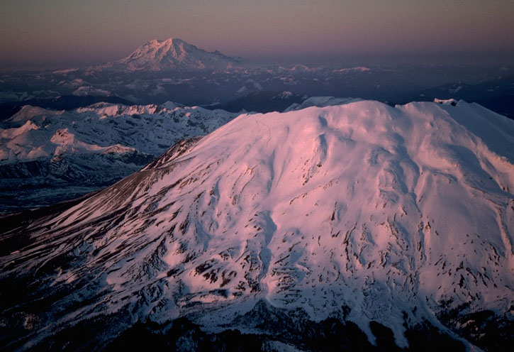
Aerial view of Mt. St. Helens and Mt. Rainier, Washington.The 1980 eruption of Mt. St. Helens removed the top 2000'' of the mountain, which is why the summit area of the peak now ends so abruptly. In the background is Mt. Rainier. |
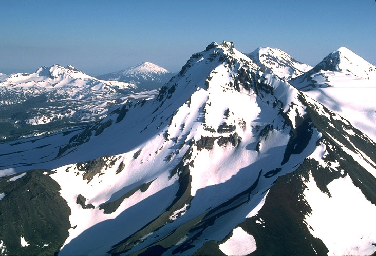
Aerial view of Three Sisters Volcanoes, Oregon, view southward.On the right side of this photo are the Three Sisters Volcanoes, three composite volcanoes in the central Oregon Cascades. North Sister has a deeply eroded northern face because it has been dormant the longest. In the far left background of the photo is Broken Top, a deeply eroded extinct volcano. In the middle background is Mt. Bachelor |
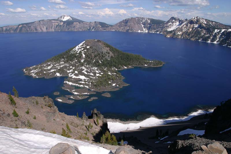
Crater Lake and Wizard Island, Oregon.Crater Lake formed by the catastrophic eruption of Mt. Mazama, a medium-sized stratovolcano of the Oregon Cascades, about 6850 years ago. During this eruption, so much material was emptied from the underlying magma chamber that much of the volcano collapse downward, forming the caldera, which later filled in with water. Wizard Island formed as a series of andesitic eruptions soon after the caldera collapse. Crater Lake is now the deepest lake in the United States, with at depth of 1949 feet |
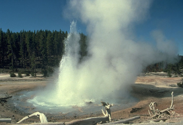
Echinus Geyser erupting, Yellowstone National Park, WyomingYellowstone National Park hosts an incredible variety of hydrothermal features, some of the most spectacular being geysers. Geysers are essentially hot springs that periodically erupt by shooting jets of hot water into the air. Echinus Geyser, shown here, lies in the Norris Basin area of the park, on the north side of the Yellowstone Caldera |
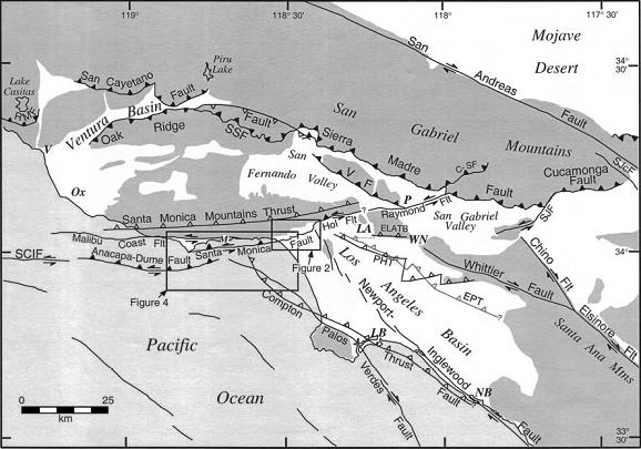
Regional neotectonic map for metropolitan southern California showing major active faults. The Santa Monica fault is a 40-km-long active fault within the 215-km-long Transverse Ranges Southern Boundary fault system (TRSBFS), which encompasses the Raymond,Hollywood, Santa Monica, Malibu Coast, Anacapa-Dume, Santa Cruz Island, and Santa Rosa Island faults as well as several blind thrust faults. Fault locations are from Ziony and Jones (1989), Vedder et al. (1986), Dolan and Sieh (1992), Sorlien (1994), and Dolan et al. (1997). Santa Rosa Island fault is off figure to west. Closed teeth denote reverse fault surface trace; open teeth on dashed lines show upper edge of blind thrust fault ramps. Strike-slip fault surface traces are shown by double arrows. C-SFŚClamshell-Sawpit fault; ELATBŚEast Los Angeles blind thrust system; EPTŚElysian park blind thrust fault; Hol FltŚHollywood fault; PHTŚPuente Hills blind thrust fault; RMFŚRed Mountain fault; SCIFŚSanta Cruz Island fault; SSFŚSanta Susana fault; SJcFŚSan Jacinto fault;SJFŚSan Jose fault; VFŚVerdugo fault; LAŚLos Angeles; LBŚLong Beach; NBŚNewport Beach; OxŚOxnard; PŚPasadena; VŚVentura; WNŚWhittier Narrows. Point Dume is at west end of Santa Monica fault. Downtown Hollywood is centered between Hol and Flt in figure. Dark shading shows Santa Monica Mountains. http://www.gps.caltech.edu/~sieh/pubs_docs/papers/P00c.pdf |
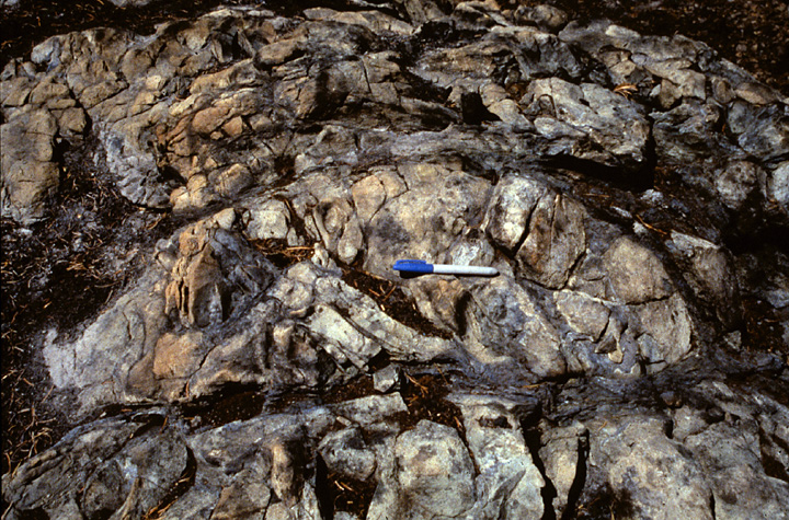
Blueschist-facies rocks are often incompletely reacted to the high-pressure assemblage, leading to variable preservation of igneous textures and/or minerals, as exhibited by this outcrop from the Klamath Mountains |


All photos of Marli Bryant Miller, http://www.marlimillerphoto.com/index.html