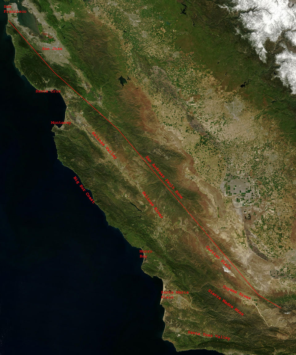
 | Central California Coast |
Parallel ridges and valleys trend SE-NW |
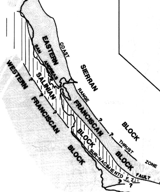
Center Bounded by San Andreas Fault on east, may have originated south of Sierra Nevada salinian block. Two different geologic provinces separated by fault zones. Salinian granitic block, Similar in composition to Sierra Nevada. Bounded by San Andreas Fault on east, may have originated south of Sierra Nevada |
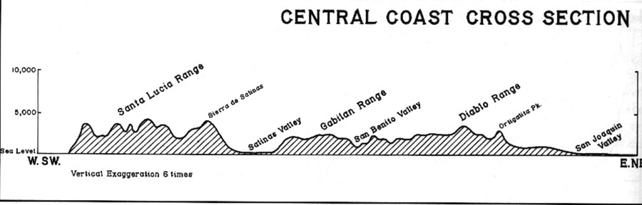
Broad belt extending from coast to San Joaquin Valley |
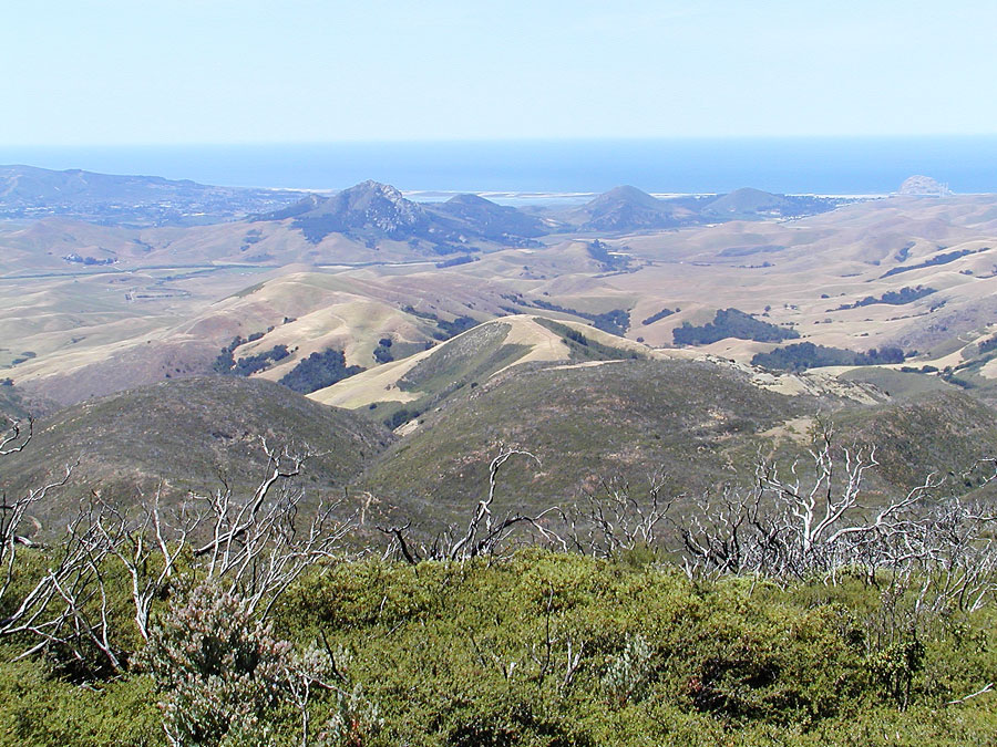
Line of volcanic remnants runs northwest from San Luis Obispo to Morro Rock |
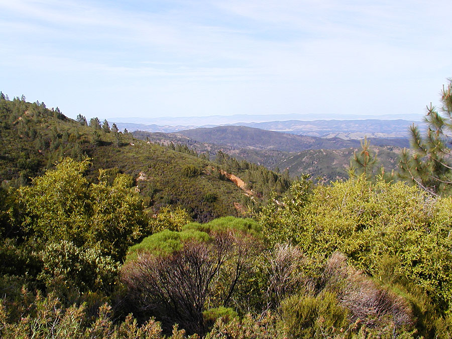
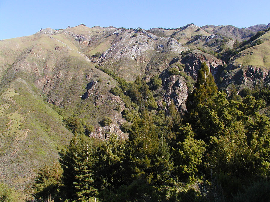
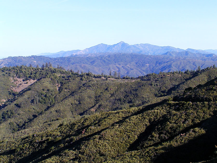
Mountain ranges generally low elevation but high relief . Central Souse Coast Ridge |
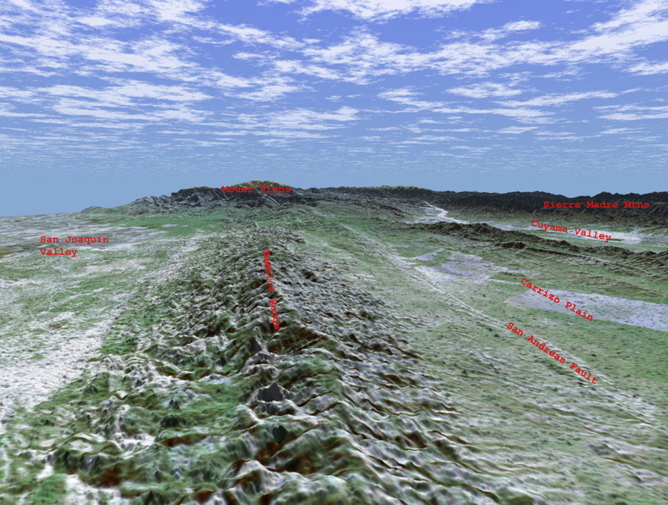
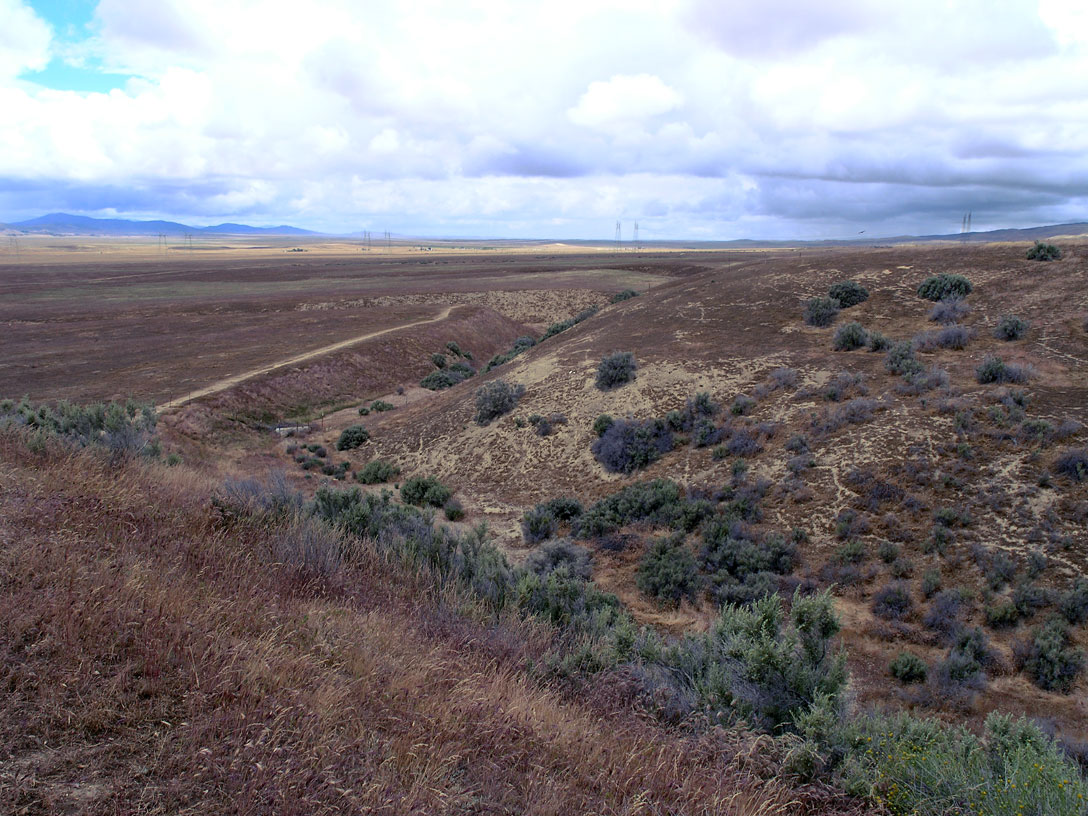
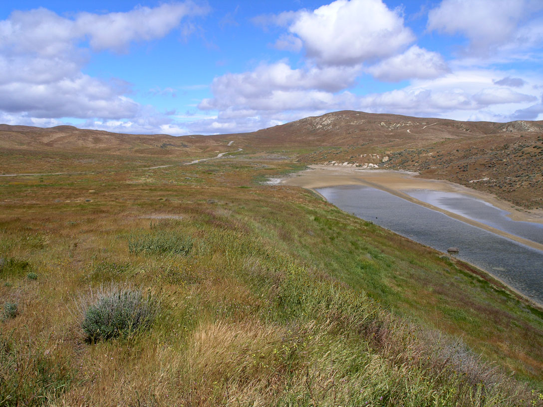
Large scale trends parallel San Andreas Fault zone.Fault trace runs northwest out of big bend area into Carrizo Plain |
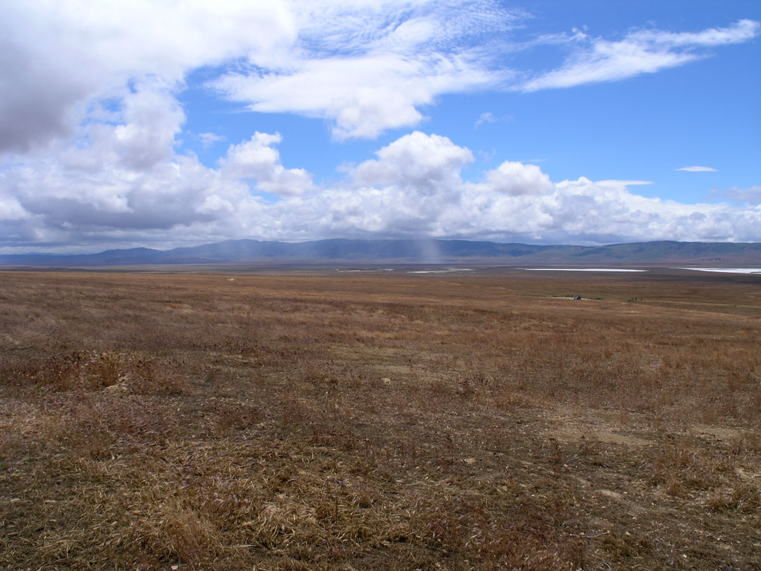
Large scale trends parallel San Andreas Fault zone. Fault trace runs northwest out of big bend area into Carrizo Plain . Fault-related landforms well preserved in arid Carrizo Plain National Monument |
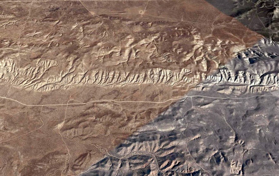
Large scale trends parallel San Andreas Fault zone. Fault trace runs northwest out of big bend area into Carrizo Plain Offset and truncated drainage features along fault zone |
Large scale trends parallel San Andreas Fault zone. Fault trace runs northwest out of big bend area into Carrizo Plain Offset and truncated drainage features along fault zone .Wallace Creek channel offset |
Large scale trends parallel San Andreas Fault zone. Fault trace runs northwest out of big bend area into Carrizo Plain. Sag pond formed in depression along fault line |
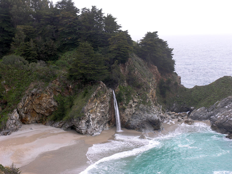
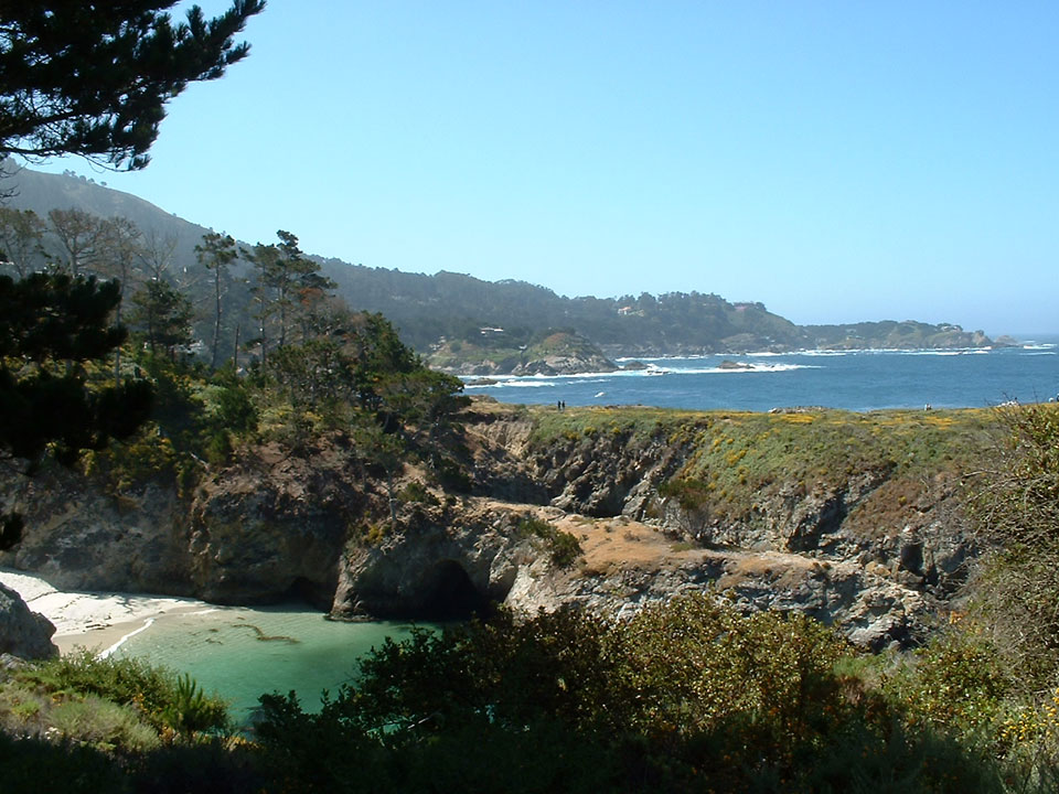
Big Sur Coast . McWay Falls cascades onto beach in steep-walled cove |
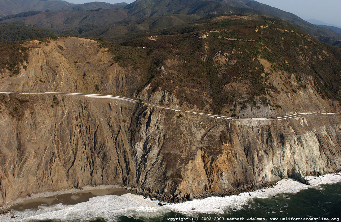
Large scale trends parallel San Andreas Fault zone. Devil''s Slide area on Hwy 1 south of San Francisco in rock fractured by faults in San Andreas zone. Mountains rise abruptly as Hwy 1 climbs high above the ocean north of Ragged Point |
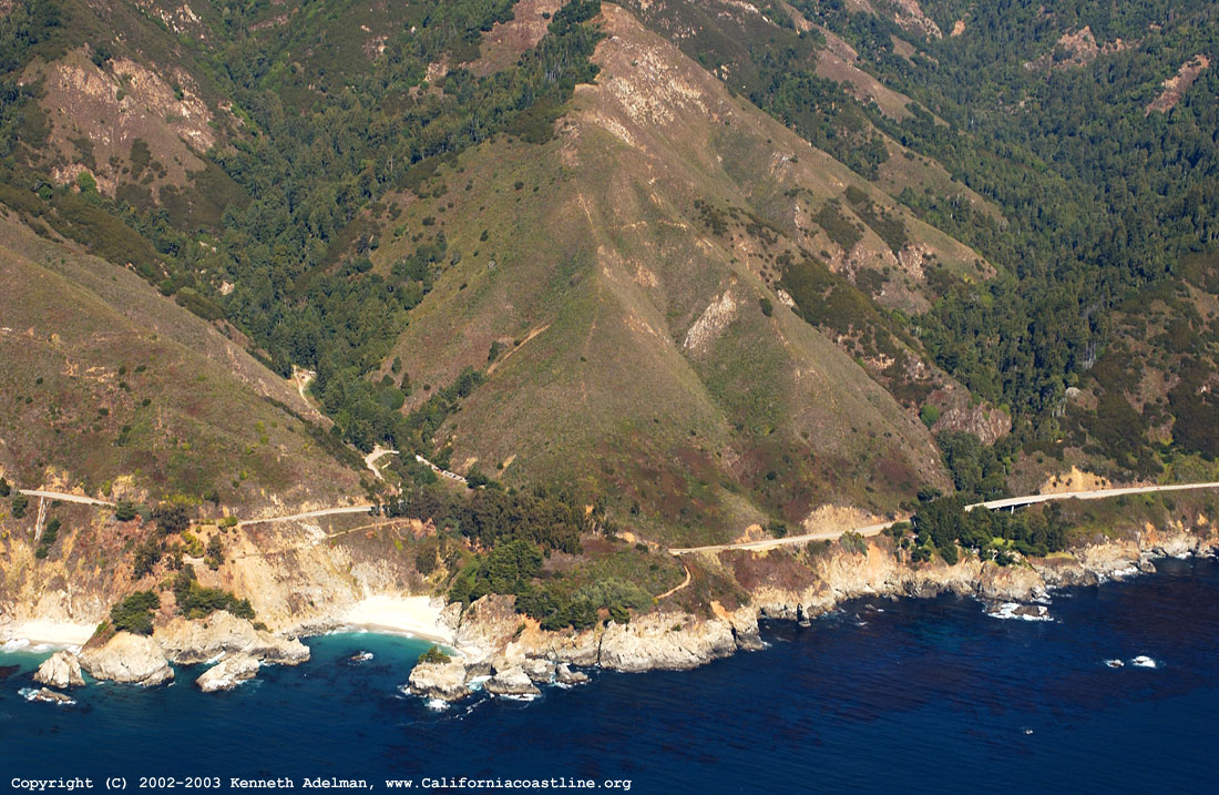
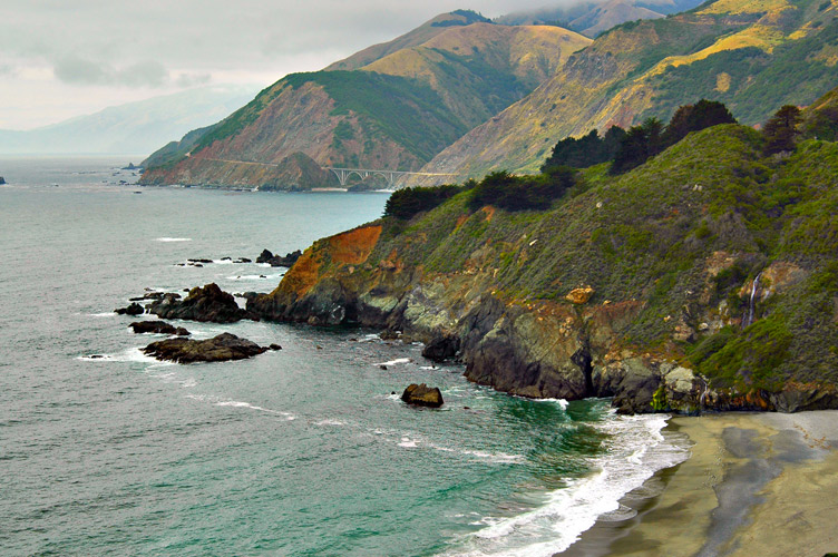
Big Sur Coast . Mountains rise abruptly as Hwy 1 climbs high above the ocean north of Ragged Point . Resistent components of Franciscan form steep cliffs. Resistent components of Franciscan form steep cliffs, Sur Nacimiento |
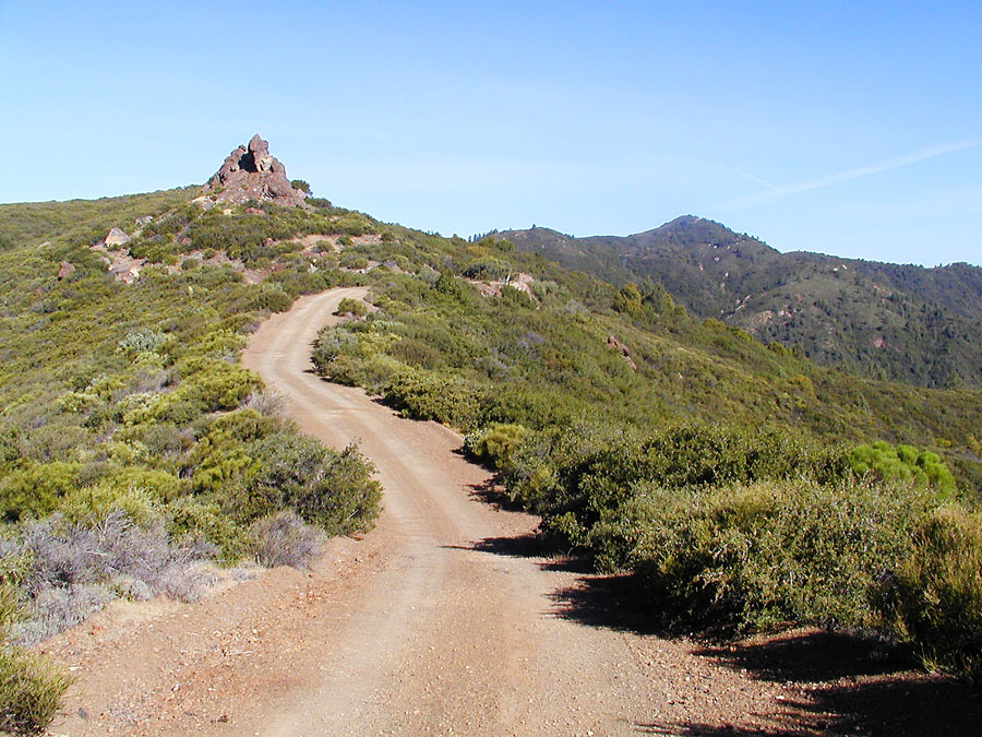
Sur-Nacimiento Road |
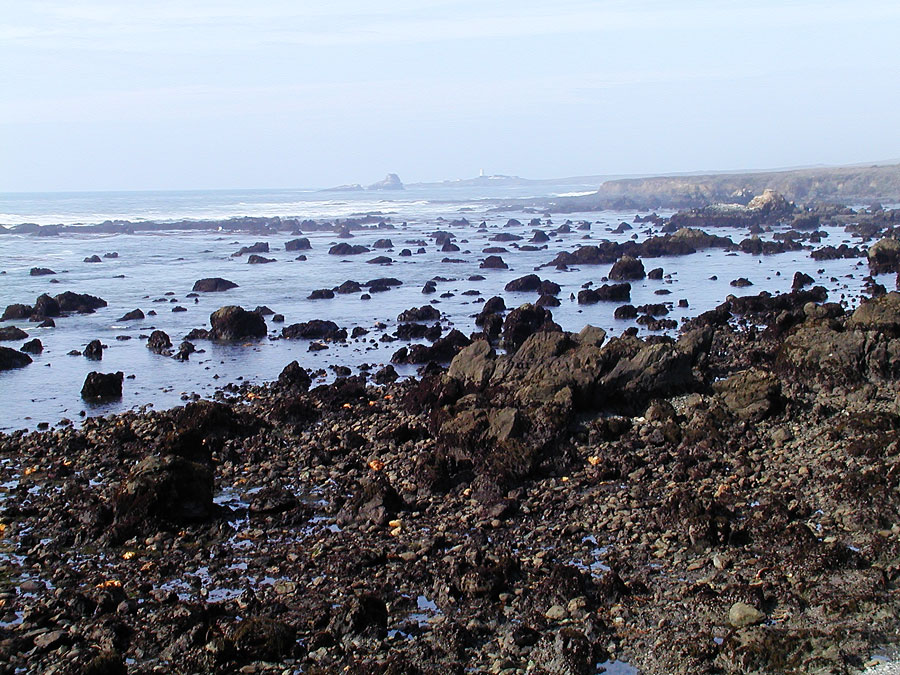
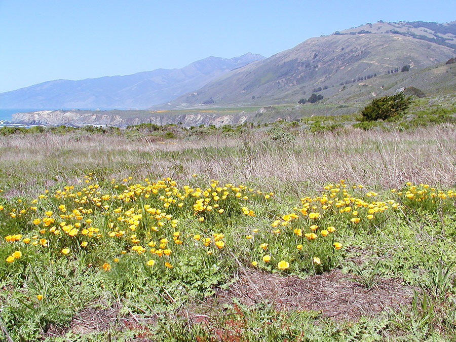
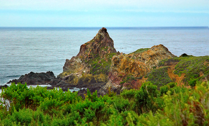
San Simeon Beach, Big Sur Coast . Southern approach to Big Sur runs along expansive marine terrace, Franciscan melange breaks down in high energy surf, produces rocky coastline. |
Big Sur Coast . Southern approach to Big Sur runs along expansive marine terrace. Hurst castle |
Big Sur Coast South Coast Ridge Route |
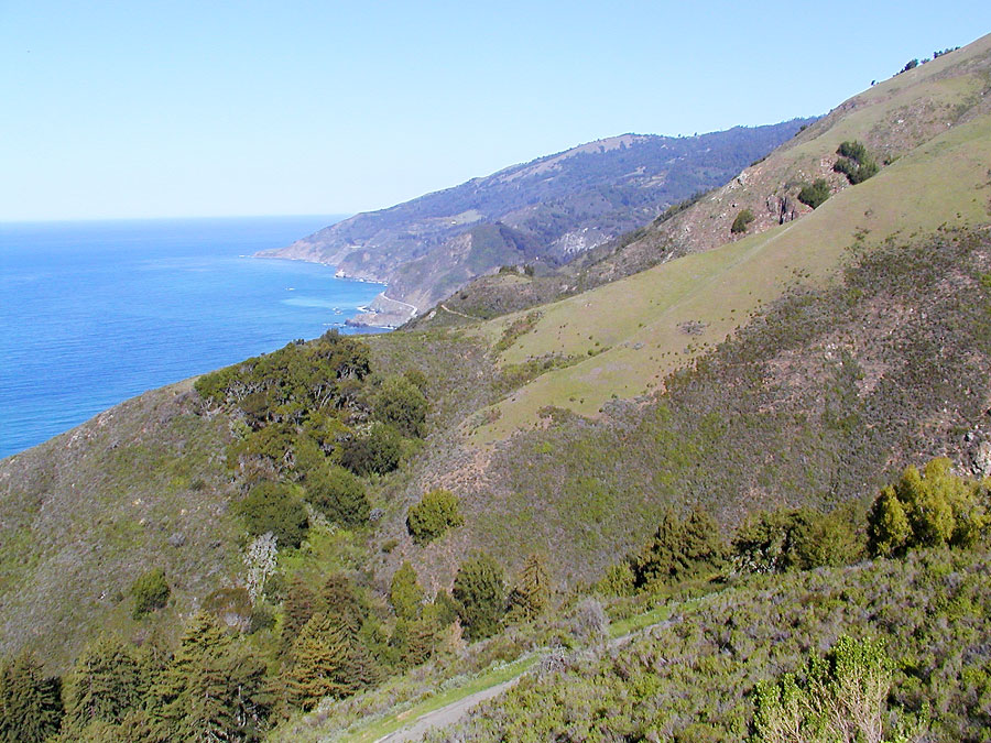
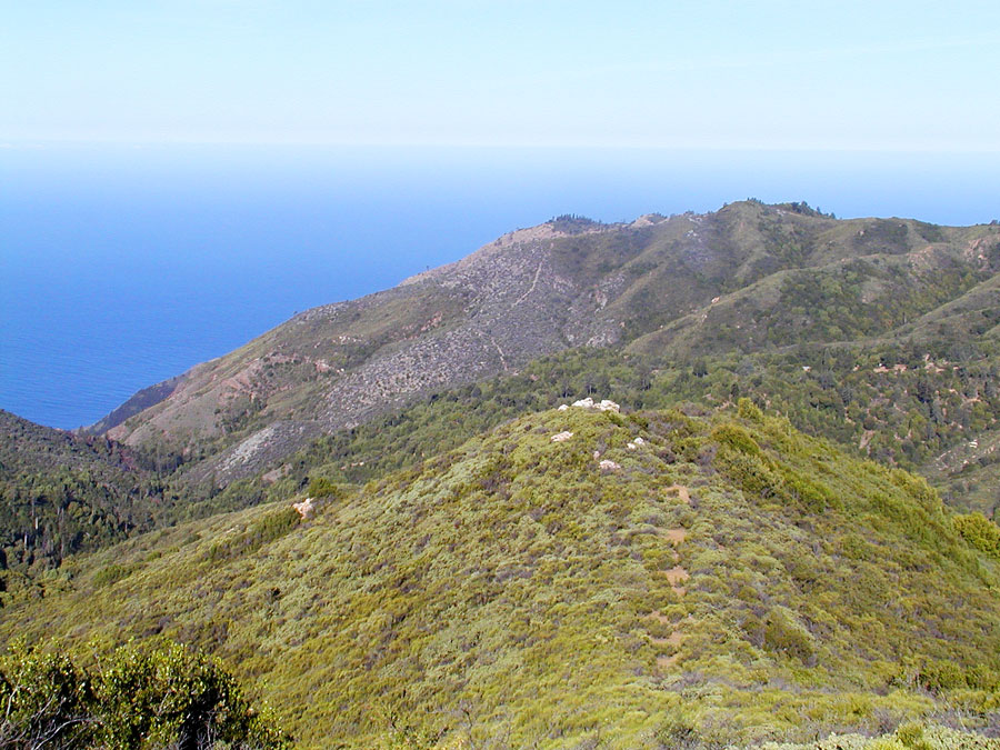
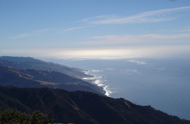
o Big Sur Coast . Rapid uplift of Santa Lucia Range produces spectacular scenery |
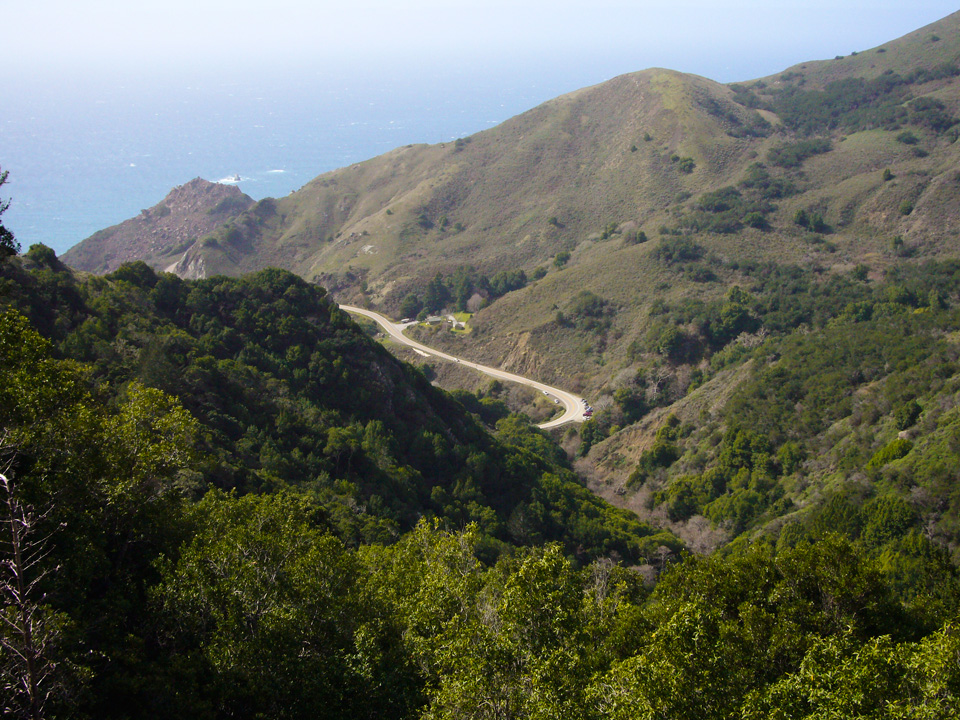
Big Sur Coast . Great views from few routes that climb inland |
Big Sur Coast . Exceptionally steep cliffs climb up from ocean |
Big Sur Coast . Cone Peak with elevation of more than 1.800m |
Cone Peac, Santa Lusia Mountains |
Big Sur Coast . Julia Pfeiffer Burns State Park |
Big Sur Coast |
Big Creek Bridge |
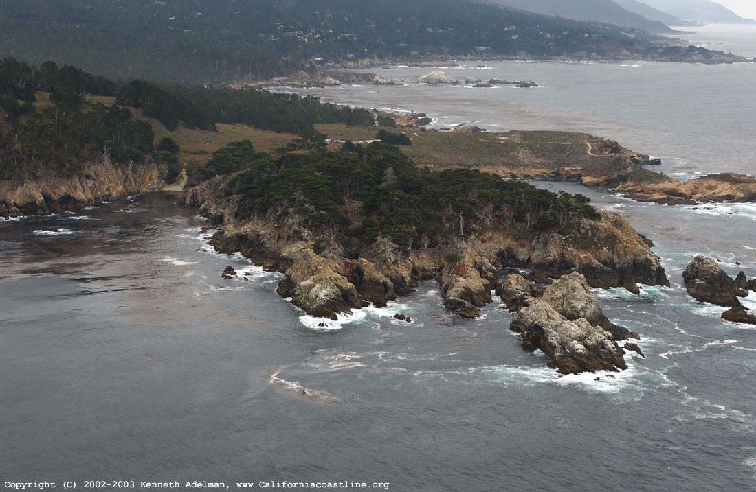
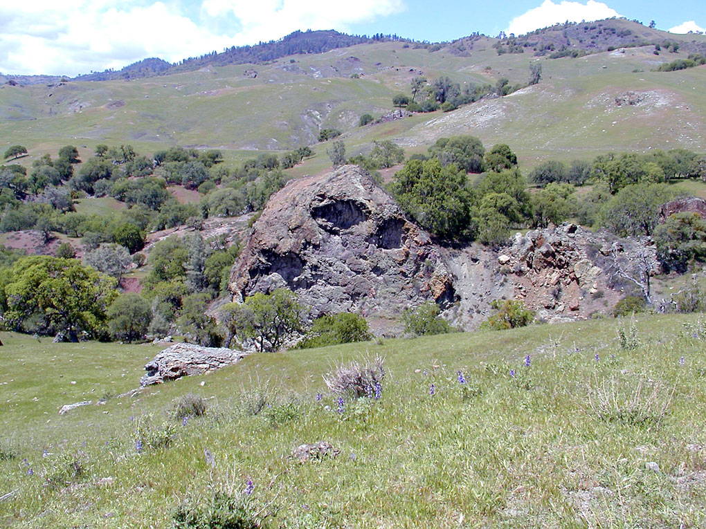
Two different geologic provinces separated by fault zones. Salinian granitic block, Similar in composition to Sierra Nevada. Granitic outcrops at Point Lobos south of Monterey |
Two different geologic provinces separated by fault zones. Salinian granitic block, Similar in composition to Sierra Nevada. Granitic outcrops at Point Lobos south of Monterey. View from ground level |
Jade Cove serpentinite |
Franciscan formation. Figueroa Serpentinite |
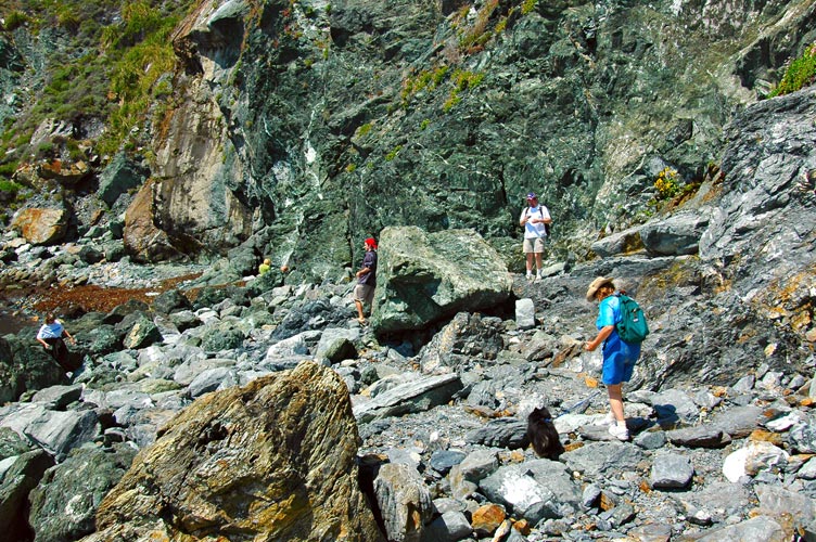
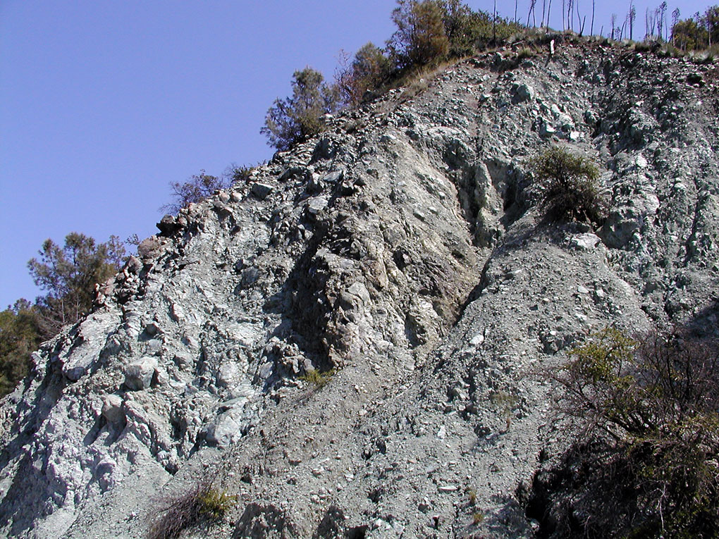
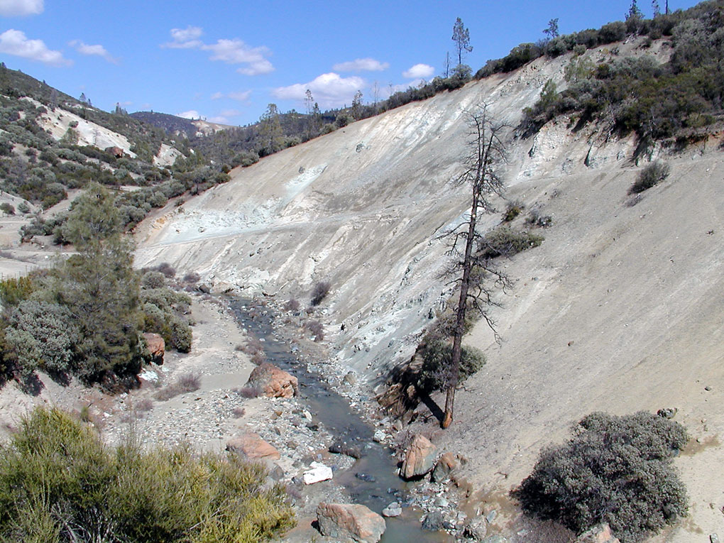
Two different geologic provinces separated by fault zones (Salinian granitic block and Franciscan formation). Franciscan formation on both sides of Salinian. Complex, diverse melange of deep sea floor material apparently scraped up from subduction zone . Produces unique landscapes throughout coast ranges. Often weathers into landslide-prone clay soils. Sea floor and mantle rock with strange mineral compositions. Parkfield grade |
Franciscan formation on both sides of Salinian. Clear Creek in San Benito County environmental hazard zone.Center Clear Creek in San Benito County environmental hazard zone clear creek |
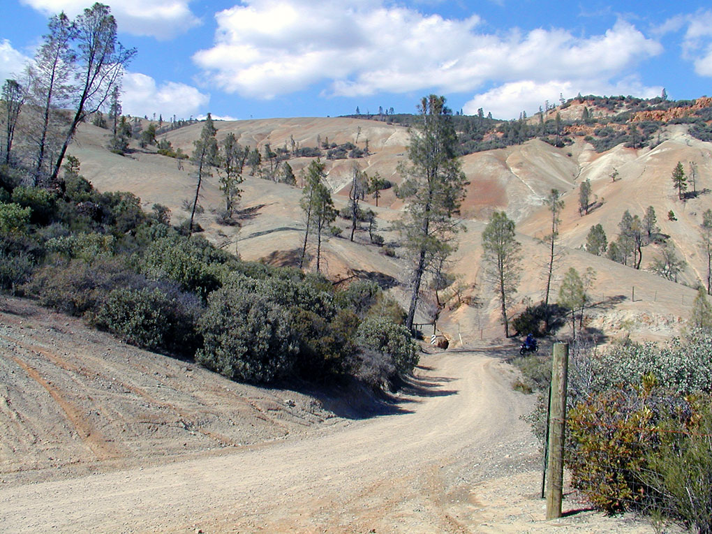
Franciscan formation on both sides of Salinian. Off-highway vehicle area in toxic dust zone |
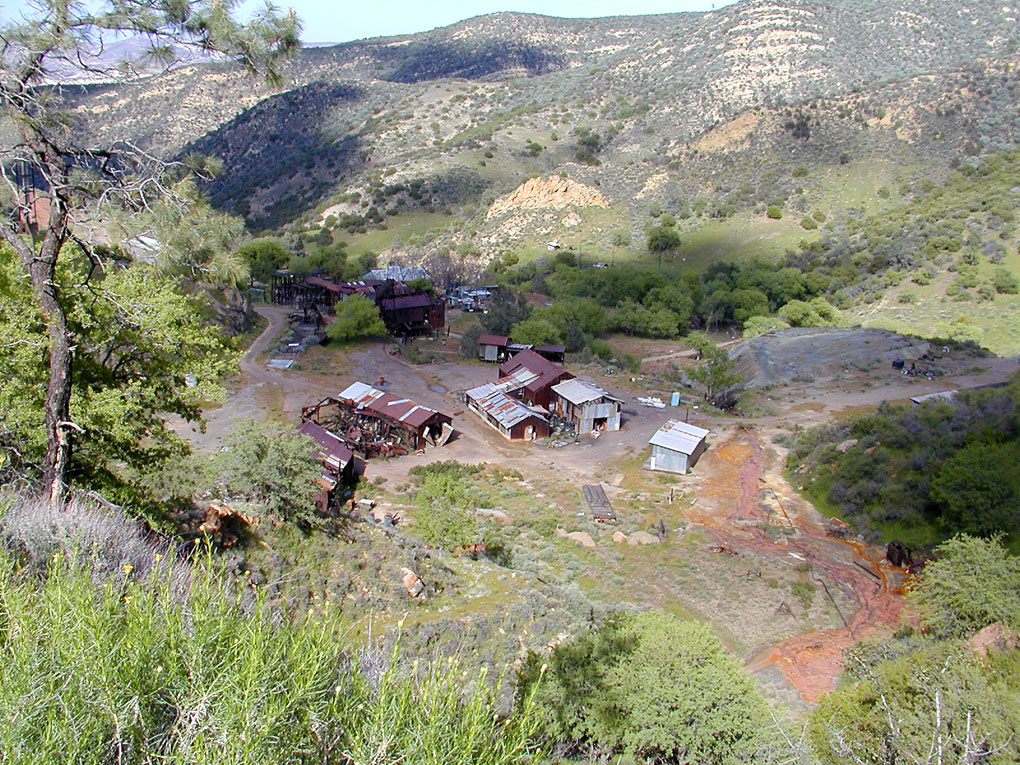
Franciscan formation. New Idria mercury mine |
(English only)
The Santa Lucia Mountains or Santa Lucia Range is a mountain range in coastal California, running from Monterey southeast for 170 km to San Luis Obispo. The highest summit is Junipero Serra Peak, 1,784 m in Monterey County. It is part of the Pacific Coast Ranges. The rock of the Santa Lucias is dominated by granitic basement of the Salinian Block, between the San Andreas Fault and Sur-Nacimiento Fault. According to plate tectonic theory, the core of the Salinian block formed as part of the same batholith which forms the core of the Sierra Nevada Mountains and the Peninsular Ranges of Baja California. It was broken off the North American Plate and transported north by the action of the San Andreas Fault from an original position. It is predominantly Mesozoic granitic and pre-Cretaceous metamorphic rocks. There is some Cretaceous sedimentary rock of the Great Valley Sequence, considerable Miocene marine sediments, and some other Tertiary sediments. Units west of the Sur-Nacimiento fault are dominated by rocks of the Franciscan Assemblage.
http://educationally.narod.ru/moresvetphotoalbum.html - San Simeon Crek light
http://www.natureinthecity.org/coppermine/displayimage.php?album=3&pos=49 - Monterey nature
http://www.californiaherps.com/salamanders/pages/b.luciae.html - Salamanders
http://www.geog.ucsb.edu/~joel/g148_f09/lecture_notes/central_coast/central_coast1.html - Central Coast Ranges Geology and Landforms
Parallel ridges and valleys trend SE-NW
o Broad belt extending from coast to San Joaquin Valley
o Mountain ranges generally low elevation but high relief
o Large scale trends parallel San Andreas Fault zone
Fault trace runs northwest out of big bend area into Carrizo Plain
Fault-related landforms well preserved in arid Carrizo Plain National Monument
Offset and truncated drainage features along fault zone
Wallace Creek channel offset
Sag pond formed in depression along fault line
Devil''s Slide area on Hwy 1 south of San Francisco in rock fractured by faults in San Andreas zone
Two different geologic provinces separated by fault zones
o Salinian granitic block
Similar in composition to Sierra Nevada
Bounded by San Andreas Fault on east, may have originated south of Sierra Nevada
Granitic outcrops at Point Lobos south of Monterey
View from ground level
o Franciscan formation on both sides of Salinian
Complex, diverse melange of deep sea floor material apparently scraped up from subduction zone
Produces unique landscapes throughout coast ranges
Often weathers into landslide-prone clay soils
Sea floor and mantle rock with strange mineral compositions
Serpentinite - California''s state mineral
Clear Creek in San Benito County environmental hazard zone
Off-highway vehicle area in toxic dust zone
New Idria mercury mine
• Big Sur Coast
o Rapid uplift of Santa Lucia Range produces spectacular scenery
o Exceptionally steep cliffs climb up from ocean
o Cone Peak with elevation of more than 5,000''
o Line of volcanic remnants runs northwest from San Luis Obispo to Morro Rock
o Southern approach to Big Sur runs along expansive marine terrace
Franciscan melange breaks down in high energy surf, produces rocky coastline
o Mountains rise abruptly as Hwy 1 climbs high above the ocean north of Ragged Point
Resistent components of Franciscan form steep cliffs
o Julia Pfeiffer Burns State Park
McWay Falls cascades onto beach in steep-walled cove
o Great views from few routes that climb inland
Sur-Nacimiento Road
Los Burros Road
South Coast Ridge Route
Dune fields in Santa Maria Plain
o Drift patterns reflect strong northwest winds
o Guadalupe Dunes and Oso Flaco Lake
o Oceano Dunes Off Highway Vehicle area
Davidson Seamount is located 75 miles west of San Simeon. It stands at 7,800 feet above the ocean floor and 3,600 feet below the surface of the water. It was named after George Davidson a leading scientist in the fields of geodesy study and geography who participated in the first official study of the Pacific Coast. This is also the first time the word "seamount" was used to describe an underwater feature. It was once thought that Davidson Seamount was part of the Morros Chain but in the late 1990s David Clague, a geologist with the Monterey Bay Aquarium Research Institute, said the Morros and the Seamount were not created during the same period of intense volcanic activity. Davidson Seamount, at eight miles wide and 26 miles long, is much larger than any of the Morros and was created as a result of multiple volcanic eruptions that built up the sea floor.
Santa Lusia Ridge
Nature
Morro Bay
Central Coast Nature
Davidson Seamount