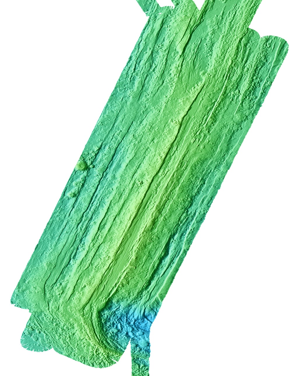
 | Cleft Segment |
Cleft Segment perspective view from the south-southwest |
see - http://www.mbari.org/data/mapping/seamounts/cleft_a.htm |
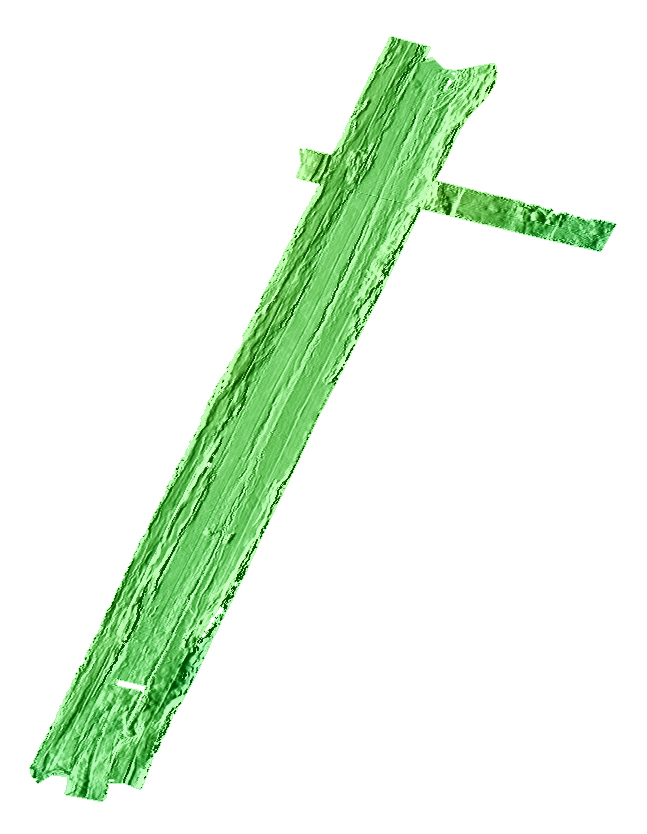
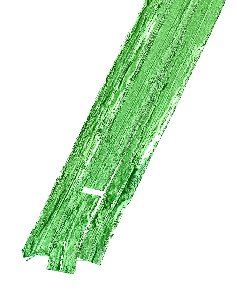
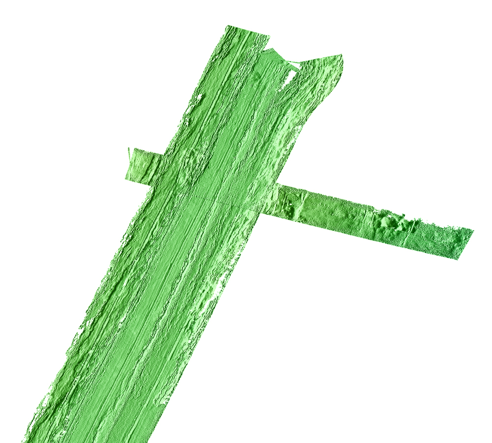
Picture 2 - south central part of picture 1 |
The southern half of picture 2 fragment |
The northern part of the picture 2 |

From MBARI http://www.mbari.org/data/mapping/seamounts/cleft_a.htm
The Cleft Segment of the southern Juan de Fuca Ridge is a highly symmetrical intermediate-rate spreading center (6 cm/yr full rate) with a well-defined axial valley cut by the cleft which is 30-50 meters wide and 10-15 meters deep (Normark et al., 1987). Two well-documented hydrothermal sites are confined to the cleft (North Cleft and South Cleft) and were the apparent source of a megaplume event observed in 1989 (Chadwick et al., 1991; Embley et al., 1991, Baker, 1994). The northern terminus of the Cleft Segment is an overlapping spreading center with the Vance Segment. At the southern end, the Cleft Segment terminates in the Blanco Transform Zone (Embley and Wilson, 1992).
During 1998, the Cleft Segment was examined by three different, successively higher-resolution mapping systemsŚthe Simrad EM300, DSL120, and Imagenex. The EM300 is a hull-mounted 30 khz multibeam sonar mapping system. It was used to survey the entire Cleft segment. For the Juan de Fuca Ridge, the swath width was 3 kilometers and pixel size was approximately 30 meters. The DSL120 is a near-bottom, towed sidescan system that provides interferometric bathymetry. Swath widths for sidescan are 1 kilometer with a 1-meter pixel size. The derived bathymetry has an effective swath width of 800 meters with a 5-meter pixel size. The area imaged by the DSL120 included the entire axial valley, from the southern Cleft vent sites to the intersection with the Blanco Fracture Zone. The Imagenex is a 675 khz, pencil-beam, scanning sonar that was mounted on the ROV Jason. The Imagenex can produce bathymetry with resolution of 1-2 meters. The Imagenex data has been published by Chadwick et al. (2001).
Approximately 0.3 to 0.5 million years of crustal evolution is displayed on the EM300 data. The oldest structures are major outward-facing faults with curved boundaries reminiscent of propagating rift pseudofaults. These coalesce into or truncate curved ridges that form the northern wall of the West Blanco Deep. Inward-facing faults are continuous with hooked ridges that form the southern wall of the West Blanco Deep. Volcanic structures evident on the EM300 include thick lobate pillow flows that appear to originate near the axial valley and flow out and overrun the outward facing faults and the intersection with the fracture zone. The axial valley walls are steeply dipping on the east and stepped on the west. The floor of the axial valley is an unfissured and unfaulted lobate sheet flow that is partially drained-out and collapsed, especially near the cleft. Discontinuous ridges on the edges of the axial valley appear to be down-dropped sections of the valley walls partially buried by younger lava. The youngest flows within the axial valley lap onto the large pillowed flows at the southern end. These structures have been suggested to be products of the episodic process of crustal formation and deformation (Kappel and Ryan, 1986).