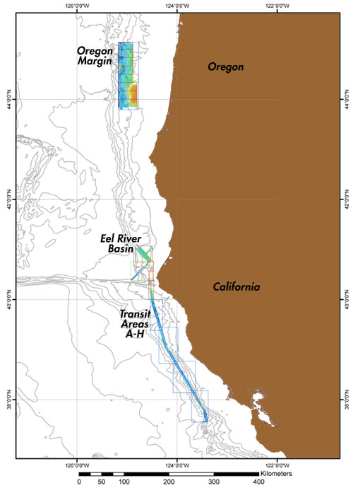
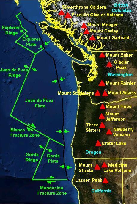
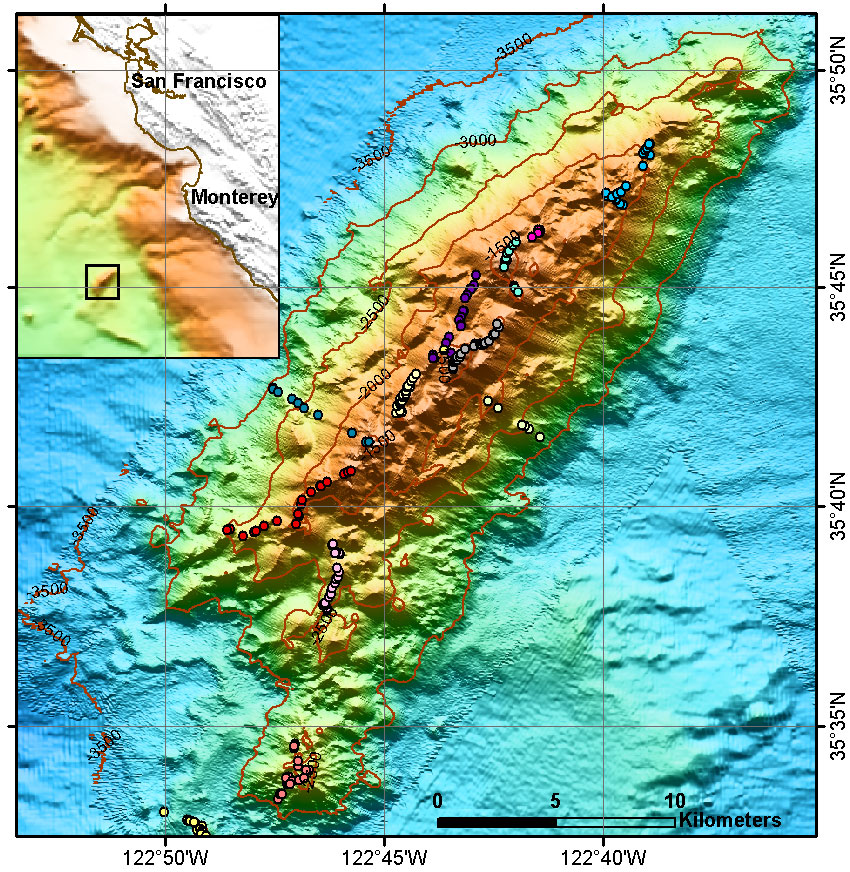
 | California margin transit zone and Eel River Basin |
|
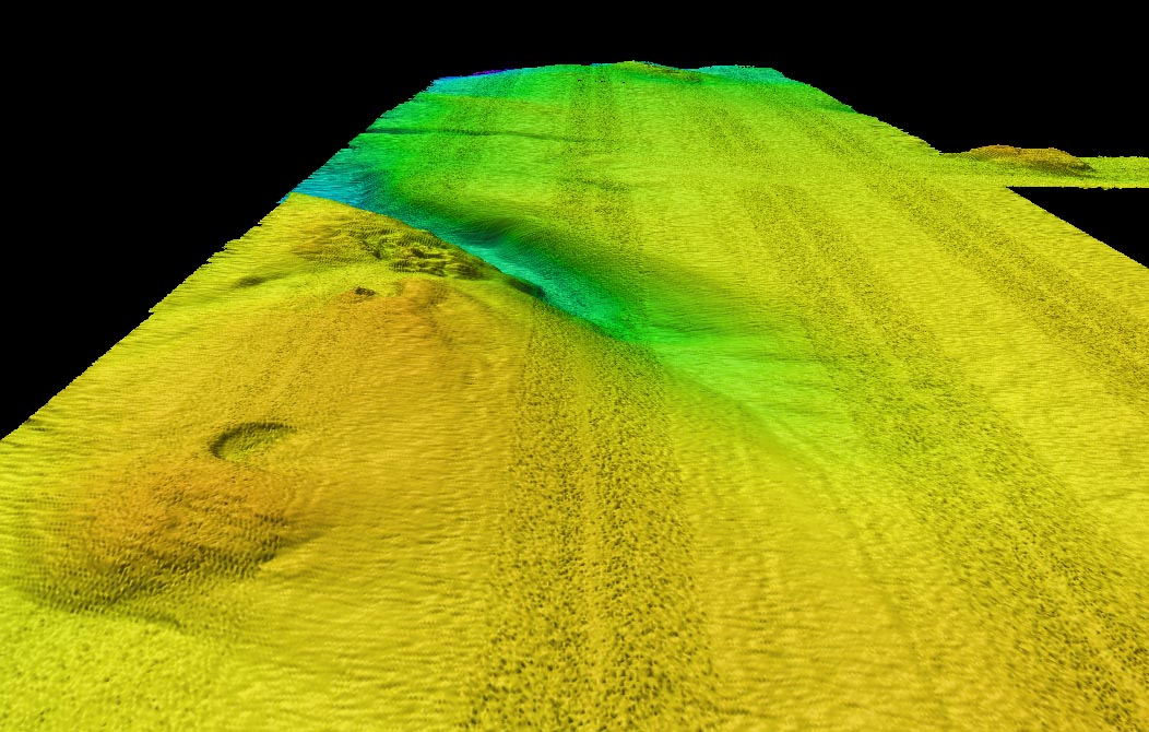
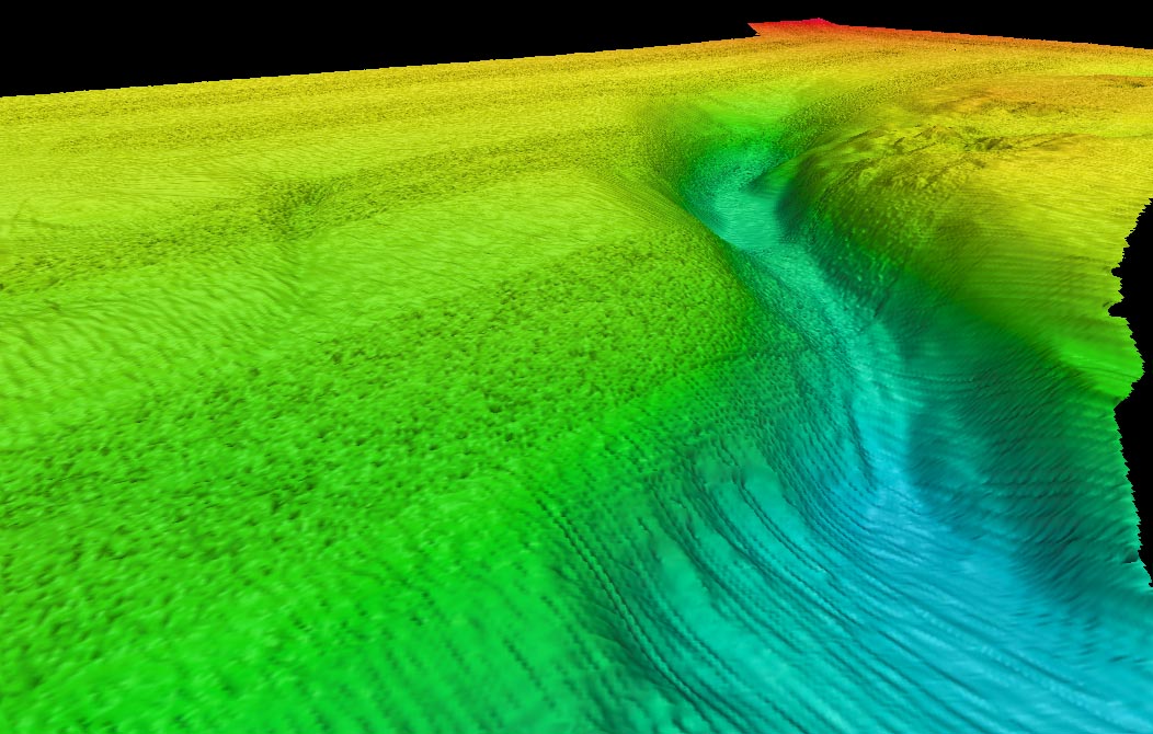
Eel River Basin perspective view from the southeast |
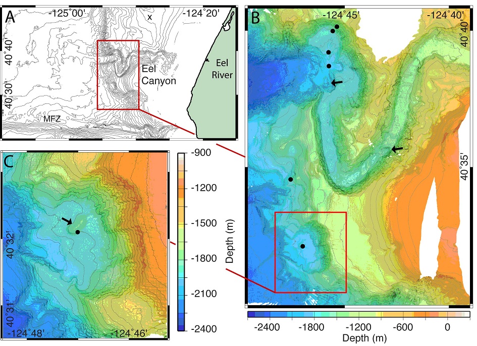
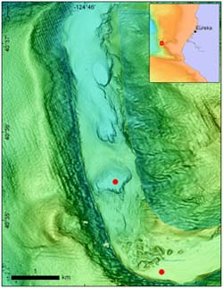
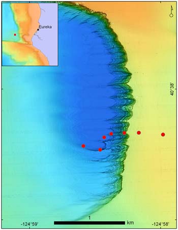
Part A shows bathymetry at 100 m contour interval of the continental margin offshore of Eureka California and locations of Eel River, Mendocino Fracture Zone (MFZ) and Eel Canyon. The location of the æclassic Eel River seepsÆ are indicated with an X. The area indicated with the red box is shown in more detail in Part B. Part B shows multibeam bathymetry of the area where six huge water column plumes were discovered (black dots; Gardner et al., 2009). Two emanate from a slide scars to the south of Eel Canyon, and four emanate from the seafloor and northern flanks of Eel Canyon. Arrows indicate steps within the canyon floor. Part C is a detailed map of the slide scar area where a Santa Monica mound-like feature occurs (black arrow) -http://www.mbari.org/expeditions/Northern11/L4/background_L4.htm |
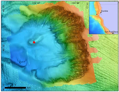
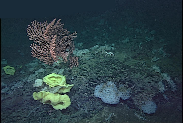
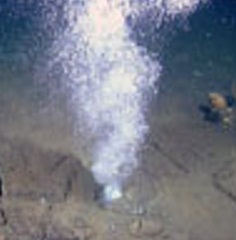
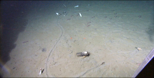
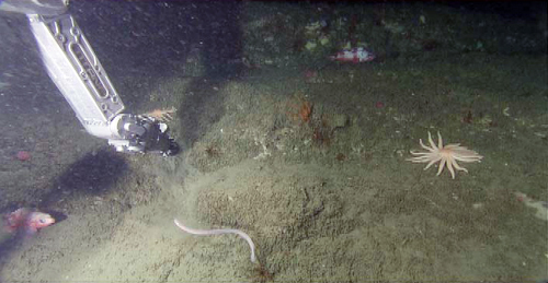
Gas Hydrates,Location: 2 miles south of Eel Canyon,Eel Slump South is a large scar that we think was left by a landslide. It has an oblong mound at its base with a rough texture suggesting the presence of gas in the seafloor. The sediment near and on top of the mound was black. This is indicative of a reducing environment with high organic activity and high oxygen consumption. Throughout the dive we saw chemosynthetic clam beds and active vents bubbling gas and releasing oil droplets, This map shows in amazing detail the mound that turned out to have several large gas plumes. The red dot shows our first dive site. http://www.mbari.org/expeditions/Northern11/L4/logbook/day2.htm |
Map of today''s dive sites (red dots) in Eel Canyon Bend. The southern site is just upslope from a large debris flow (landslide) deposit, and the northern site is in the middle of a large scour featureŚan area cleared of sedimentŚin the canyon |
Eel River Basin perspective view from the southwest |
|
Tranzit zone |
Tranzit A |
Tranzit B |
Transit C |
Transit D |
Tranzit E |
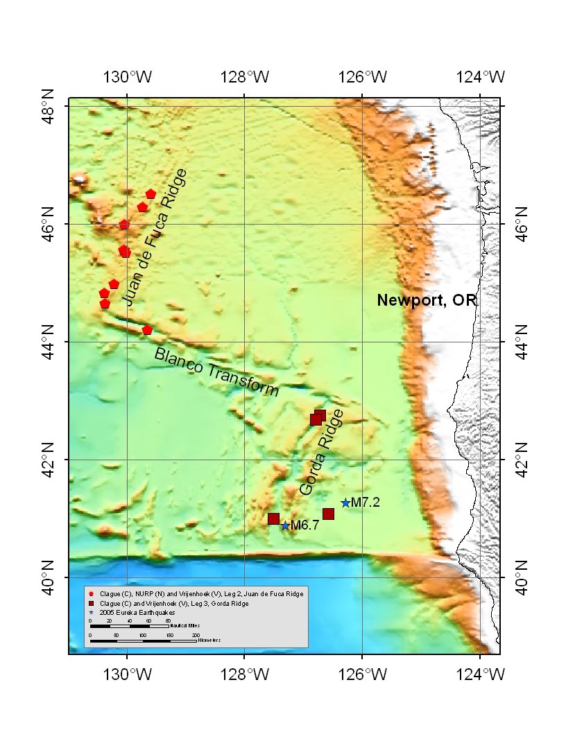
Southward of Mendocino transform fault |
|
|
|
|
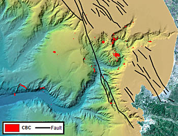
Black lines are faults mapped within the bay. Contrary to scientists'' expectations, many of the CBCs are not located near known faults. Image: (c) 2005 MBARI |
|
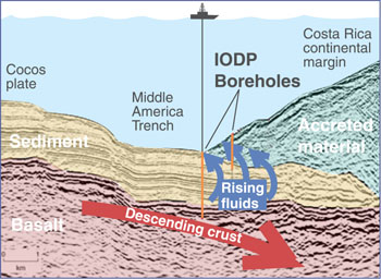
Sampling fluids from Earth''s crust-Cross section of the Costa Rica Subduction Zone (not to scale) showing the location of the IODP boreholes where pore waters were sampled. Image: (c) 2004 MBARI,As oceanic crust and sediments descend within the Costa Rica Subduction Zone, they are heated and squeezed, forcing out fluids that eventually migrate back up toward the seafloor. By studying the temperature, pressure, composition, and flow rates of these fluids, scientists hope to discover what conditions exist deep in the crust, beyond the reach of their drilling rigs. This information will help them understand how the area''s earthquakes and volcanoes are generated -http://www.mbari.org/news/homepage/2004/osmo_iodp.html |
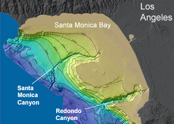
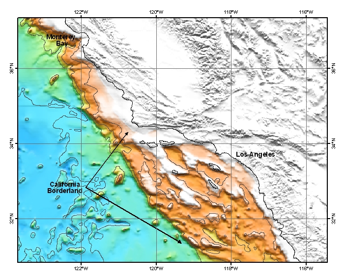
Map of the California Borderland, which is a broad area of basins and ranges with some islands off Southern California.Map ® MBARI 2006 -http://www.mbari.org/volcanism/Margin/Marg-Borderland.htm |
|
Davidson seamounth |
Diverse invertebrate community on Davidson Seamount. Image ® MBARI 2000 -http://www.mbari.org/volcanism/Seamounts/Seam-ContlMarg.htm |
Gaz hydrates in Eel River canyon |
|
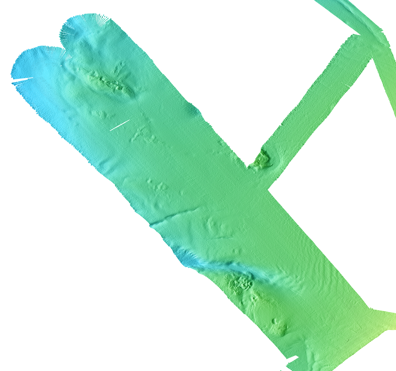
Location: Eel Canyon deep sea fan, a giant scour on the deep-sea fan west of Eel Canyon, in about 2,700 meters water depth, our deepest site! The giant scour is a three-kilometer-long, one-kilometer-wide, and 90-meter-deep asymmetric depression. Going into the depression we saw numerous chemosynthetic clam communities frequently noted to be around rotting wood. The clams in this area left a distinct trail in the sediment (they must have been in a hurry to get somewhere!). On the other side of the scour is a steep outcrop exposing a beautiful succession of deep-sea turbidities. A geologist on land almost never has access to a fresh exposure like this.red dots roughly represent the ROV dive trail. We dove in a giant scour on the deep-sea fan west of Eel Canyon-http://www.mbari.org/expeditions/Northern11/L4/logbook/day4.htm |
Great frame grab from the ROV video exhibiting a distinctive clam trail. Eel Canyon |
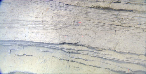
Eeel Canyon.Another great frame grab from the ROV video outlining the sediment layering along one of the smaller scraps on the giant scour |
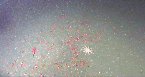
Location: Southern finger of Delgada Canyon.Latitude: 39░ 54.5791 N Longitude: 124░ 10.0561 W muddy canyon floor-beautiful fields of red brittle stars, lots of flat fish, and hundreds of little red shrimp in the water column.http://www.mbari.org/expeditions/Northern11/L4/logbook/day6.htm |
Location: Noyo Canyon Latitude: 39░ 34.5307 N Longitude: 123░ 57.2575 W,a part of the San Andreas Fault that dips off the continental shelf into Noyo Canyon, off the coast of Fort Bragg. Because our dive sites were considerably shallow (~400 m water depth), we were able to dive three times in the head of Noyo Canyon ROV Doc Ricketts takes a push core along a transect across what we believed to be the San Andreas Fault. Throughout all our dives in Noyo Canyon there was an abundance of beautiful animals. Everyone was wishing Lonny Lundsten was on board to identify all the cool species -http://www.mbari.org/expeditions/Northern11/L4/logbook/day7.htm |
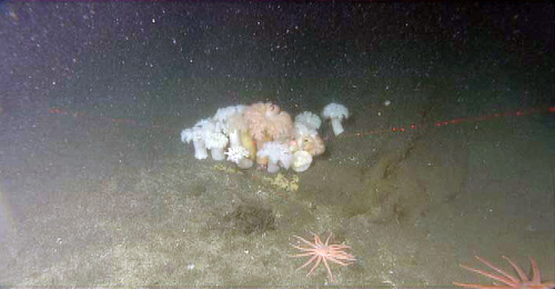
Location: Noyo Canyon As we followed what we believed to be a trace of the San Andreas Fault, we found this beautiful ōoasisö of Metridium sea anemones |
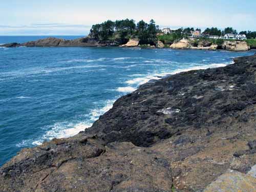
Seacliff at Depoe Bay, Oregon. Eroded lava pillows outcrop as oval shaped blobs of darker rock (center). The brown volcanic mudstone with clasts of lava (foreground) is breccia, which means broken rock. The pillows are each about 1.5 meters in diameter. At Depoe Bay it entered the sea to become lava pillows, some of which shattered into volcanic breccia (pieces of lava and mud) when it hit the cold water. At Yaquina Head there are basalt pillows and breccia, and also massive, jointed lava flows.-http://www.mbari.org/expeditions/Northern11/L2/logbook/day1.htm |
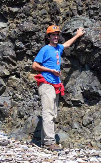
Depoe Bay, Oregon, a lava pillow, which is surrounded by breccia and exposed in a cliff at Yaquina Head |
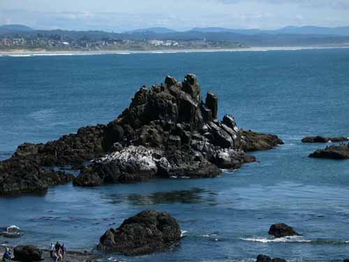
Depoe Bay, Oregon. Massive, columnar jointed flow forms a resistant sea stack off Yaquina Head, Oregon. The columns offer great roosting sites for sea birds. People in foreground for scale. |
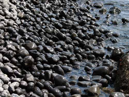
Depoe Bay, Oregon, Cobble beach at Yaquina Head, made entirely of basalt eroded from the headland''s lava flows |
From MBARI-http://www.mbari.org/data/mapping/margin/eel_river.htm
http://www.mbari.org/data/mapping/margin/Transit_1AtoH.htm
Transits 1A to 1F consist of two adjacent swaths collected along the continental margin of California from San Francisco to Eureka. The most common features observed in the data are a series of submarine canyons aligned roughly perpendicular to the coast. Transit 1A covers from offshore San Francisco Bay to Bodega Bay and crosses Bodega Canyon. Transit 1B covers from Bodega Bay to Pt. Arena. Transit 1C crosses the Arena Canyon. Transit 1D crosses the Noyo and Vizcaino Canyons that carry sediment to the Delgada deep sea fan. Transit 1E crosses the Gorda Escarpment, the easternmost part of the Mendocino Ridge and the Mendocino Canyon. Transit 1F crosses a large canyon, the Eel Canyon, southwest of Eureka. The westernmost line in Transit 1F crosses the Eel Canyon again as well as providing data on the continental slope offshore Cape Mendocino. Transits 1G and 1H are higher resolution views of parts of Transit 1F. The large-scale setting of these transit lines can be seen in GLORIA sidescan imagery of the region