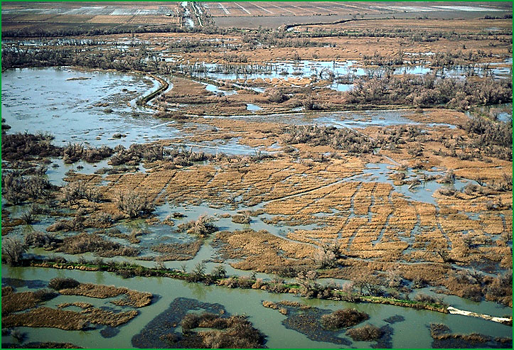
 | Butte Sink - Sutter Basin |
Butte sink area Ś James R. Nelson |
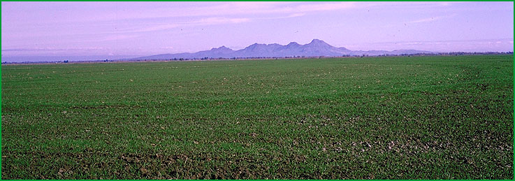
near Robbins, Sutter Buttes in background (262Ae) Ś Charles B. Goudey |
http://www.fs.fed.us/r5/projects/ecoregions/262ac.htm
This subsection is on the alluvial plain between the Feather and the Sacramento Rivers. It has a hot and subhumid climate. MLRAs 17d and 17e.
Lithology and Stratigraphy. This subsection contains recent alluvium. The alluvium is from granitic, volcanic, sedimentary, and metamorphic rock sources, but from mostly volcanic rocks at the northern end of the subsection. Extensive areas are underlain by siltstone.
Geomorphology. This subsection is on very gently sloping to nearly level alluvial fans, floodplains, and basin floors. The subsection elevation range is from about 30 to about 150 feet. Fluvial erosion and deposition are the main geomorphic processes.
Soils. The soils are mostly Typic Pelloxererts. Also, Typic and Aquic Chromoxererts, Aquic Haploxerolls, Typic Argixerolls and soils with duripans are common. The soils are mostly moderately well to poorly drained. Soil temperature regimes are thermic, and soil moisture regimes are xeric and aquic. Some poorly drained soils have been artificially drained.
Vegetation. The predominant natural plant communities are Needlegrass grasslands. Fremont cottonwood series occurs along streams. Emergent aquatic communities are common in low areas.
Characteristic series by lifeform include:
Grasslands: California annual grassland series, Purple needlegrass series.
Vernal pools: Northern hardpan vernal pools.
Wetlands: Bulrush series, Bulrush - cattail series, Cattail series, Sedge series.
Forests and woodlands: Fremont cottonwood series, Mixed willow series.
Climate. The mean annual precipitation is about 15 to 20 inches; it is practically all rain. Mean annual temperature is about 60░ to 62░ F. The mean freeze-free period is about 250 to 275 days.
Surface Water. The larger part of the subsection, which is north of the Sutter Buttes, is drained by Butte Creek. Butte creek runs parallel to the Feather River on the east and the Sacramento River on the west. Much of the area that was naturally flooded in winter and spring is now protected by artificial levees. There are no lakes, but winter ponding occurs.