 | River Alluvium |
Sacramento River bottom Ś USDA |
http://www.fs.fed.us/r5/projects/ecoregions/262af.htm
This subsection is an alluvial plain and natural levees adjacent to the Sacramento and Feather Rivers. The climate is hot and subhumid. MLRA 17e.
Lithology and Stratigraphy. This subsection contains recent alluvium. The alluvium is from granitic, volcanic, sedimentary, and metamorphic rock sources.
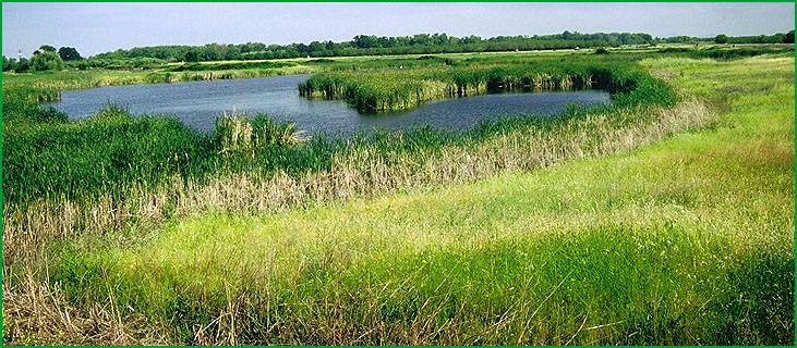
Geomorphology. This subsection is on nearly level floodplains and very gently sloping levees. The natural levees have been almost completely obliterated by construction of artificial levees on them. The subsection elevation range is about 25 to 150 feet. Fluvial erosion and deposition are the main geomorphic processes.
Soils. The soils are mostly Aquic and Mollic Xerofluvents and Fluventic and Cumulic Haploxerolls on frequently flooded plains and Typic and Pachic Haploxerolls and Mollic Haploxeralfs on levees and infrequently flooded plains. The soils are mostly moderately well to somewhat poorly drained; there are minor amounts of poorly drained soils. Soil temperature regimes are thermic, and soil moisture regimes are xeric.
Vegetation. The predominant natural plant communities are Fremont cottonwood series and Emergent aquatic communities along streams and Needlegrass grasslands on levees and floodplains.
Characteristic series by lifeform include:
Grasslands: California annual grassland series, Purple needlegrass series.
Wetlands: Bulrush series, Bulrush - cattail series, Cattail series, Sedge series.
Forests and woodlands: Fremont cottonwood series, Mixed willow series.
Climate. The mean annual precipitation is about 15 to 18 inches. It is practically all rain. Mean annual temperature is about 60░ to 62░ F. The mean freeze-free period is about 250 to 275 days.
Surface Water. The Sacramento and Feather Rivers are large perennial streams that flooded large areas annually before their flows were artificially controlled. There are no lakes in the subsection.