 | Point Arena-Coastal Hills - Santa Rosa Plain-Point Reyes-Marin Hills and Valleys |
Coastal Hills - Santa Rosa Plain-west of Petaluma near Fallon Ś Charles B. Goudey |
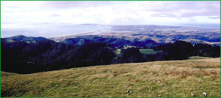
Point Reyes-Point Reyes area Ś James R. Nelson |
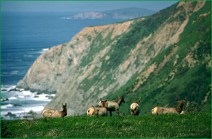
Point Reyes-Point Reyes...Drakes Bay Ś Robert Ettner |
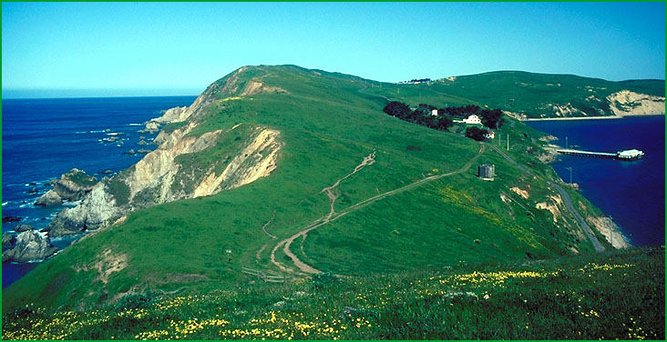
Point Reyes-Point Reyes area Ś James R. Nelson |
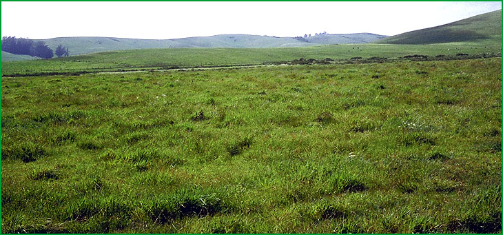
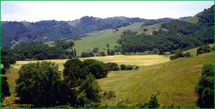
Marin Hills and Valleys-Hicks Valley area northwest of Novato Ś Charles B. Goudey |
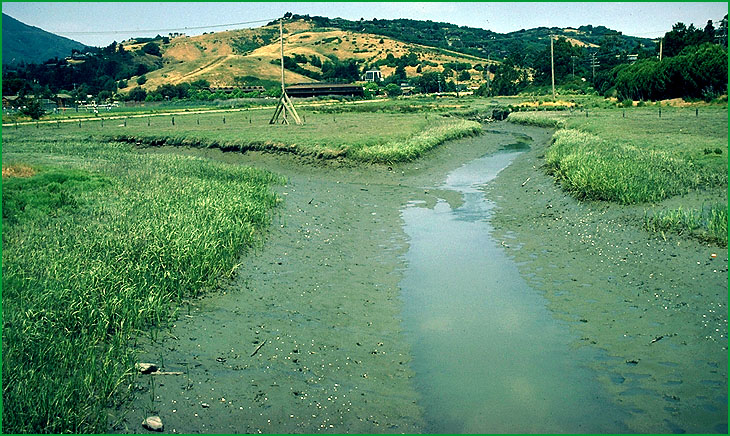
Marin Hills and Valleys-Tidal salt marsh Ś James R. Nelson |
Subsection 263Ai
Point Arena
This subsection is a narrow strip of coastal plain stretching from Point Arena southeast to about Fort Ross. It is southwest of the San Andreas fault, between the fault and the Pacific Ocean. The climate is temperate and humid. MLRA 4b.
Lithology and Stratigraphy. This subsection contains Eocene marine and nonmarine deposits and some Quaternary marine terrace deposits and Franciscan marine sedimentary rocks of the Coastal Belt.
Geomorphology. This subsection is on an elevated coastal plain with thin Quaternary terrace deposits over Eocene sedimentary rocks that have been eroded to exposed Cretaceous sedimentary rocks. The surface is gently sloping to moderately steep, with some steep-sided ravines crossing the plain. The elevation range is from sea-level up to about 1400 feet. Ocean currents, waves, and wind are active along the outer edges of the coastal plain. Fluvial erosion is the main geomorphic processes on the coastal plain, although eolian erosion and deposition has been active in the past. Mass wasting is another process that is active on steep ravine slopes.
Soils. The soils on terraces are mostly Typic and Plinthic Tropohumults and Dystropepts. Those on Cretaceous sedimentary rocks are mostly Ultic Hapudalfs. There are very small areas of Albaqults. The soil temperature regimes are isomesic. Soil moisture regimes are mostly udic with some aquic.
Vegetation. The predominant natural plant community is Redwood series. There are minor occurrences of Bishop pine series and Pygmy cypress series. Dune lupine - goldenbush series is common on coastal bluffs.
Characteristic series by lifeform include:
Dune vegetation: Native dunegrass series, European beachgrass series, Sand-verbena - beach bursage series.
Grasslands: Introduced perennial grassland series, Pacific reedgrass series.
Shrublands: Dune lupine - goldenbush series.
Forests and woodlands: Grand fir series, Pygmy cypress series, Red alder series.
Climate. The mean annual precipitation is about 30 to 50 inches; there is considerable summer fog. Mean annual temperature is about 50░ to 53░ F, and there is less than 14░ F difference between lowest and highest monthly means. The mean freeze-free period is about 300 days.
Surface Water. Water runs off of the coastal plain moderately slowly to moderately rapidly, with the exception of a few terraces that drain very slowly.
Subsection 263Aj
Coastal Hills - Santa Rosa Plain
This subsection consists of a broad northwest-southeast aligned valley in which the Santa Rosa Plain is located, and the rolling hills between the Pacific Ocean and the Santa Rosa Plain. The description of subsection 263Ak is applicable to Bodega Head and the sand spit that is southwest of the San Andreas Fault. The climate is temperate to hot and humid, with marine air advancing over the hills most of the time. MLRAs 14c and 15c.
Lithology and Stratigraphy. This subsection contains predominantly Pliocene and Quaternary marine and nonmarine sediments and recent alluvium in inland valleys and on the Santa Rosa Plain; and upper Pliocene marine sediments on the hills between the Santa Rosa Plain and the Pacific Ocean. Franciscan rocks of the Central and Coastal Belts are minor components in this subsection.
Geomorphology. This subsection contains moderately steep hills on upper Pliocene sediments that have been faulted and eroded to expose rocks of the Franciscan Complex, Quaternary nonmarine terraces, and floodplains. The elevation range is from sea-level up to about 900 feet. Fluvial erosion is the main geomorphic process on the coastal plain and nonmarine terraces. Fluvial erosion and deposition are active on the alluvial plains.
Soils. The soils on the rolling hills are mostly Ultic Haplustalfs. On upper Pliocene sediments of the Santa Rosa Plain they are Haploxerults, Pelloxererts, and Palexeralfs. On Quaternary terraces they are Durixeralfs, Albaqualfs, and Haploxeralfs. And on recent alluvium they are Fluvaquentic Haploxerolls and Pelloxererts. The soil temperature regimes are mesic and thermic inland, mesic on the rolling hills between the Santa Rosa plain and the Pacific Ocean, and isomesic along the coast. Soil moisture regimes are xeric (nearly ustic) and aquic on the Santa Rosa Plain and vicinity, and ustic, and possibly some udic, on the rolling hills west of the Santa Rosa plain and along the coast.
Vegetation. The predominant natural plant communities are Needlegrass grasslands and Valley oak series in the inland valleys. Northern claypan vernal pools occur on the Santa Rosa Plain, and Pacific reedgrass series and Needlegrass grasslands occur on the rolling hills westward to the coast. Coast live oak series is common on some leeward slopes in the rolling hills.
Characteristic series by lifeform include:
Dune vegetation: European beachgrass series, Sand - verbena - beach bursage series.
Saltmarsh vegetation: Pickleweed series, Saltgrass series.
Grasslands: California annual grassland series, Foothill needlegrass series, Introduced perennial grassland series, Pacific reedgrass series, Purple needlegrass series.
Vernal pools: Northern claypan vernal pools.
Shrublands: Dune lupine - goldenbush series.
Forests and woodlands: Coast live oak series, Oregon white oak series, Red alder series, Valley oak series.
Climate. The mean annual precipitation is about 20 to 40 inches; there is summer fog. Mean annual temperature is about 50░ to 58░ F. The mean freeze-free period is about 225 to 300 days.
Surface Water. Water runs off to streams and alluvial plains moderately rapidly, but it accumulates in slight depressions on alluvial plains. The ephemerally flooded depressions are called vernal pools
Subsection 263Ak
Point Reyes
This subsection is on the Point Reyes Peninsula. It is bounded by the San Andreas fault on the northeast and by the Pacific Ocean on all other sides. The climate is temperate and humid; it is greatly modified by marine air. MLRA 15c.
Lithology and Stratigraphy. This subsection contains predominantly Mesozoic granitic rocks and middle Miocene marine sedimentary rocks adjacent to the San Andreas fault and middle and lower Pliocene marine sedimentary rocks southwest of the Miocene rocks. Also, there are substantial areas of beach and dune deposits along the northwestern ocean shoreline.
Geomorphology. This subsection is on steep hills and mountains adjacent to the San Andreas fault, and an elevated coastal plain from there southwest to Point Reyes. Slopes on the coastal plain are nearly level on remnants of the Pliocene marine surface, to moderately steep below that surface. The elevation ranges from sea-level up to 1407 feet on Mt. Wittenberg. Ocean currents, waves, and wind (coastal marine and eolian processes) are active along the outer edges of the coastal plain. Fluvial erosion is the main geomorphic processes on the coastal plain, although eolian erosion and deposition has been active in the past. Mass wasting is another process that is active on steep slopes in the hills and mountains adjacent to the San Andreas fault.
Soils. The soils of the granitic terrain are mostly Pachic Haplustolls and Ultic Haplustalfs. On the Miocene sedimentary rocks they are Typic Dystropepts and some Lithic Haplustolls. On the Pliocene sedimentary rocks they are Ultic Haplustalfs and Mollisols. And on the recent dunes they are Psamments and Ustic Dystropepts. The soil temperature regimes are mostly isomesic, with some mesic. Soil moisture regimes are mostly ustic, and possibly some udic.
Vegetation. The predominant natural plant communities of granitic terrain are mainly Douglas-fir - tanoak series, Bishop pine series, and Coast live oak series. Plant communities of the Pliocene sedimentary rock terrain are mainly Pacific reedgrass series and Coyote brush series. All of the plant communities of these two terrains may be present in the Miocene sedimentary rock terrain. The dunes support a succession of plant communities, from bare dune through European beachgrass series and Sand - verbena - beach bursage series to Dune lupine - goldenbush series or Yellow bush lupine series.
Characteristic series by lifeform include:
Dune vegetation: Native dunegrass series, European beachgrass series, Sand - verbena - beach bursage series.
Saltmarsh vegetation: Cordgrass series, Ditch-grass series, Pickleweed series, Saltgrass series.
Grasslands: California annual grassland series, Introduced perennial grassland series, Pacific reedgrass series
Shrublands: Dune lupine - goldenbush series.
Forests and woodlands: Bishop pine series, Douglas-fir - tanoak series.
Climate. The mean annual precipitation is about 20 to 40 inches; there is considerable summer fog. Mean annual temperature is about 50░ to 53░ F, and there is less than 14░ F difference between lowest and highest monthly means. The mean freeze-free period is about 275 to 300 days.
Surface Water. Water runs off rapidly, and most of the streams, which are small, are dry by the end of the summer. There are no natural ponds or lakes in the subsection
Subsection 263Al
Marin Hills and Valleys
This subsection is on mountains and hills between San Francisco Bay and the San Andreas fault that are north of the Golden Gate. The climate is temperate and humid, with substantial marine influence on climate, particularly on the south and west sides of the subsection. MLRA 15c.
Lithology and Stratigraphy. This subsection is dominated by Franciscan sedimentary, minor volcanic, and metamorphic rocks of the Central, Coastal, and Eastern Belts. Most of them are intensely deformed. The Franciscan strata are poorly dated, but they range from Jurassic through Cretaceous, and in the Coastal Belt, into the early Tertiary. Ultramafic rocks are scattered through the Franciscan Complex. There are small areas of Pliocene andesite on the northeast, opposite the Sonoma volcanics, and recent alluvium.
Geomorphology. This is a subsection of mountains and hills with rounded ridges, steep and moderately steep sides, and narrow canyons. Most of the mountains are elongated in north-northwest to northwest directions, although Mt. Tamalpais is oriented southwest-northeast. The elevation ranges from sea-level up to 2604 feet on Mt. Tamalpais. Mass wasting and fluvial erosion are the main geomorphic processes.
Soils. The soils are mostly Typic Haploxerolls, Entic Haploxerolls, and Ultic Argixerolls, and, in the southwestern part of the subsection, Lithic Haplustolls and Typic and Pachic Argiustolls. The soil temperature regimes are mostly mesic and thermic, and in the southwestern part of the subsection, isomesic. Soil moisture regimes are mostly xeric and, in the southwestern part of the subsection, ustic. Udic soil moisture regimes are common on the lower slopes in steep canyons.
Vegetation. The natural plant communities, from isomesic and udic to thermic and xeric soil temperature and moisture regimes, are mainly Redwood series, Douglas-fir - tanoak series, and Coast live oak series. Grasslands are predominantly California oatgrass series or Pacific reedgrass series in the southwestern part and Needlegrass grasslands in the remainder of the subsection. Chamise series is present on shallow soils.
Characteristic series by lifeform include:
Grasslands: California annual grassland series, Foothill needlegrass series, Introduced perennial grassland series, Pacific reedgrass series, Purple needlegrass series.
Shrublands: Chamise series, Leather oak series.
Forests and woodlands: Bishop pine series, Black oak series, California bay series, Coast live oak series, Douglas-fir - tanoak series, Mixed oak series, Redwood series, Sergeant cypress series, Tanoak series, Valley oak series.
Climate. The mean annual precipitation is about 20 to 60 inches; there is considerable summer fog. Mean annual temperature is about 50░ to 59░ F. The mean freeze-free period is about 250 to 300 days.
Surface Water. Water runs off rapidly, and most of the smaller streams are dry by the end of the summer, except in the southwestern part of the subsection. There are no natural ponds or lakes in the subsection, but several reservoirs.