 | Searles Valley - Owlshead Mountains- High Desert Plains and Hills |
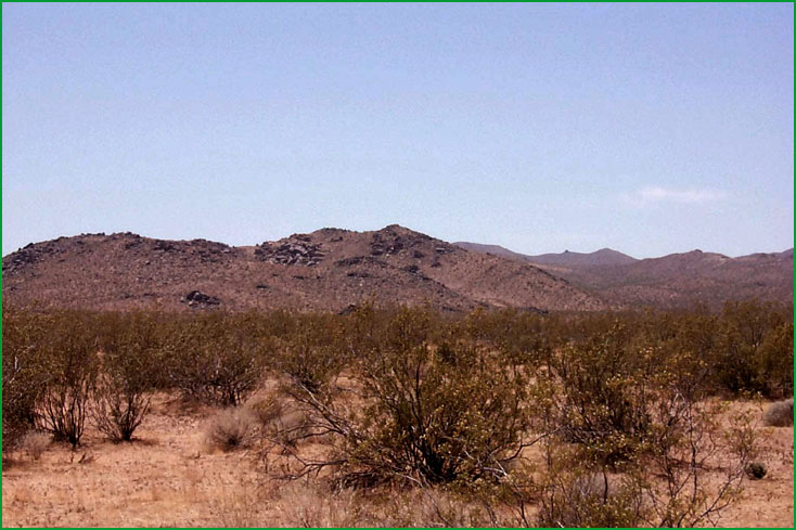
Searles Valley - Owlshead Mountains:El Paso Mountains west of the town of Ridgecrest Ś Scott Miles |
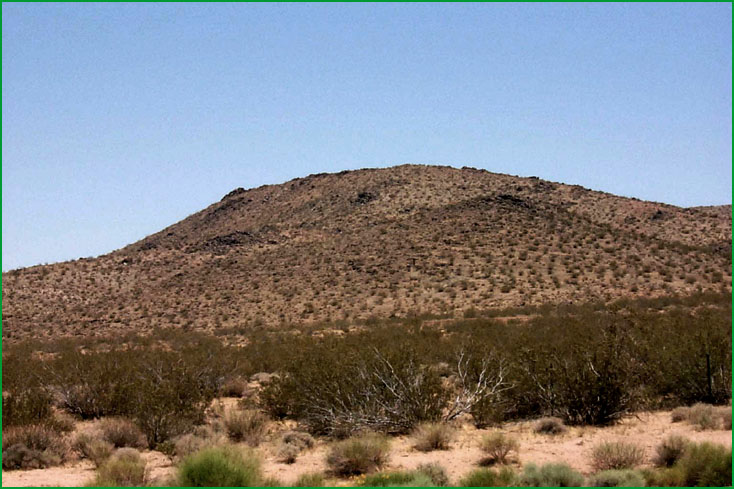
Searles Valley - Owlshead Mountains: El Paso Mountains west of the town of Ridgecrest Ś Scott Miles |
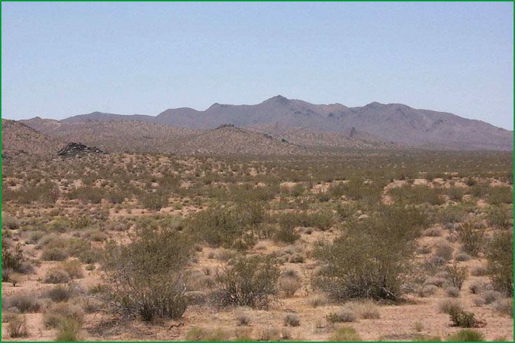
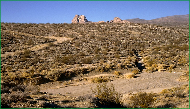
Searles Valley - Owlshead Mountains: El Paso Mountains west of the town of Ridgcrest Ś Scott Miles |
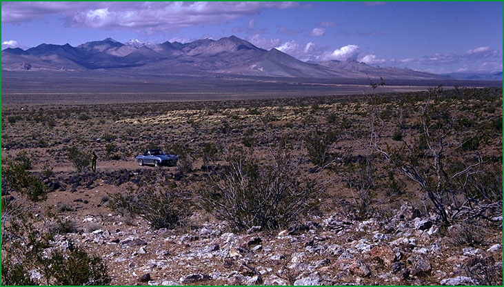
High Desert Plains and Hills -Indian Wells area Ś James R. Nelson |
Subsection 322Ag Ś USDA |
High Desert Plains and Hills -Indian Wells Valley Ś USDA |
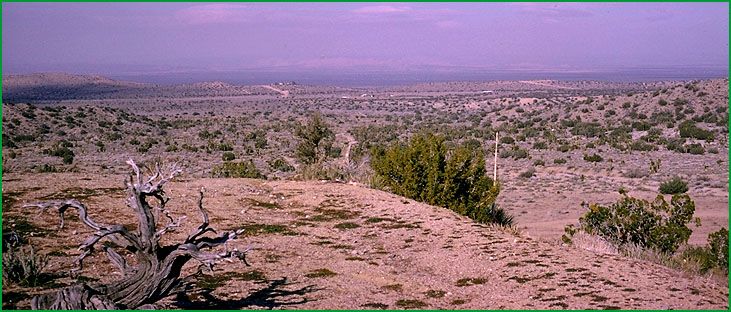
High Desert Plains and Hills --Juniper Hills area Ś Charles B. Goudey |
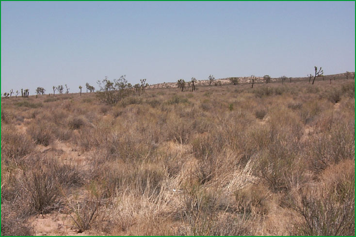
High Desert Plains and Hills --North of Edwards Air Force Base Ś Scott Miles |
High Desert Plains and Hills --North of Edwards Air Force Base Ś Scott Miles |
Subsection 322Af
Searles Valley - Owlshead Mountains
This subsection includes the Slate Range, El Paso Mountains, Quail Mountains, Owlshead Mountains, southern ends of the Argus and Panamint Ranges, Searles Valley, Long Valley, and the southern end of Panamint Valley. It has a hot, arid climate. MLRA 30g.
Lithology and Stratigraphy. This subsection consists of about half upland and half alluvial plain. The upland is mainly Pre-Cenozoic granitic and metamorphic rocks, largely Mesozoic granitic rocks; Tertiary and Quaternary volcanic rocks; and Paleozoic marine and Paleocene nonmarine sedimentary rocks. The alluvial plain is Pliocene and Quaternary nonmarine sediments, mostly alluvial fan deposits; late Quaternary alluvial fan and basin-fill deposits; and late Quaternary lacustrine deposits, including salt.
Geomorphology. This section is on steep to very steep mountains and valleys with very gently to moderately sloping alluvial fans and nearly level basin floor and dry lake bed. The Argus, Slate, and Panamint Ranges are oriented north-south, or toward the north-northwest; the El Paso Mountains, Spangler Hills, Straw Peak in the Slate Range, and Quail Mountains are oriented east-west, parallel to the Garlock Fault; and the Owlshead Mountains are arranged in a semi-circular pattern that is attenuated by the Garlock Fault. The elevation range is from about 1200 feet in Long Valley up to 5578 feet on Straw Peak in the Slate Range. There are many peaks higher than 5000 feet above sea-level. Mass wasting, fluvial erosion and deposition, and eolian deflation and deposition are the main geomorphic processes.
Soils. The soils are mostly Lithic Torriorthents and Lithic Haplocambids on granitic and Pre-Cenozoic metamorphic rocks; Lithic Torriorthents and Lithic Haplargids on volcanic and sedimentary rocks; Typic Torriorthents, Typic Haplocalcids, and "badlands" on alluvial fans; and Typic Torrifluvents and Typic Torripsamments on basin floor. The soils are well drained, except on poorly drained playas. There are Salids on poorly drained playas lacking vascular plants. Soil temperature regimes are thermic; and soil moisture regimes are aridic.
Vegetation. The predominant natural plant communities are Creosote bush series on fans and lower mountain slopes and Shadscale series on higher mountain slopes. Also, there is some Black bush series on high mountain slopes. Mixed saltbush series is common on basin floor and Iodine bush series and Saltgrass series are present on wet basin-fill and lacustrine deposits. Greasewood series occurs in riparian areas and around saltmarsh.
Characteristic series by lifeform include:
Grasslands: Alkali sacaton series, Big galleta series, Indian ricegrass series, Saltgrass series.
Shrublands: Black bush series, Brittlebrush series, Catclaw acacia series, Creosote bush series, Creosote bush - white bursage series, Desert-holly series, Fourwing saltbrush series, Greasewood series, Hop-sage series, Iodine bush series, Mixed saltbush series, Scadscale series, White bursage series.
Forests and woodlands: Mesquite series.
Climate. The mean annual precipitation is about 4 to 10 inches. It is all rain in the valleys, but some snow at higher elevations. Mean annual temperature is about 50░ to 70░ F. The mean freeze-free period is about 200 to 300 days.
Surface Water. Runoff is rapid from mountains and alluvial fans and slow from basin-fill. The water drains to Searles Valley on the west, to Panamint Valley through the middle of the subsection, and through Long Valley to Death Valley on the east. Streams are dry most of each year. There is temporary ponding on playas, or dry lake beds
Subsection 322Ag
High Desert Plains and Hills
This subsection consists of the western Mojave Desert, which is mostly alluvial plain and pediment, with relatively small areas of hills and low mountains. It includes Indian Wells Valley north of the Garlock Fault; otherwise it is between the Garlock Fault on the north and northwest, the San Andreas Fault on the southwest, the Mojave River on the southeast, and about the Harper Valley Fault on the northeast. It has a hot, arid climate. MLRAs 29f and 30g.
Lithology and Stratigraphy. This subsection contains mainly Mesozoic granitic rocks and Quaternary alluvium and lacustrine deposits. Eolian sand deposits are common. There are small areas of Precambrian gneiss and schist and Miocene and Pliocene nonmarine sedimentary rocks. There is a large Quaternary basalt flow in the northwestern part of Indian Wells Valley.
Geomorphology. This subsection is on mostly very gently to moderately sloping pediments and alluvial fans and nearly level basin floor and dry lake bed. There are a few moderately steep hills and steep mountains. Pediments are quite extensive. Some of the larger dry lake beds are China Lake in Indian Wells Valley, Koehn Lake in Fremont Valley, Cuddleback Lake, Harper Lake, Rodgers Dry Lake, Rosamond Lake, and El Mirage Lake. The elevation range is mostly from about 2000 to 3000 feet, but up to about 4000 feet adjacent to the Tehachapi Mountains and 4584 feet on Fremont Peak. Fluvial erosion and deposition and eolian deflation and deposition are the main geomorphic processes.
Soils. The soils are mostly shallow Typic Torriorthents, Lithic Haplocambids, Typic Haplargids, shallow Typic Haplodurids, and Typic Torripsamments on granitic hills and pediments; Typic Torrifluvents, Typic Torripsamments, Typic Torriorthents, Typic Haplargids, and Typic Argidurids on alluvial fans; and Typic Torrifluvents and Typic Torripsamments on basin floor. Soils on the rocky basalt flow in Indian Wells Valley are mainly Lithic Torriorthents. The soils are well drained, except on poorly drained playas. Salids occur on poorly drained playas lacking vascular plants. Soil temperature regimes are thermic; and soil moisture regimes are aridic.
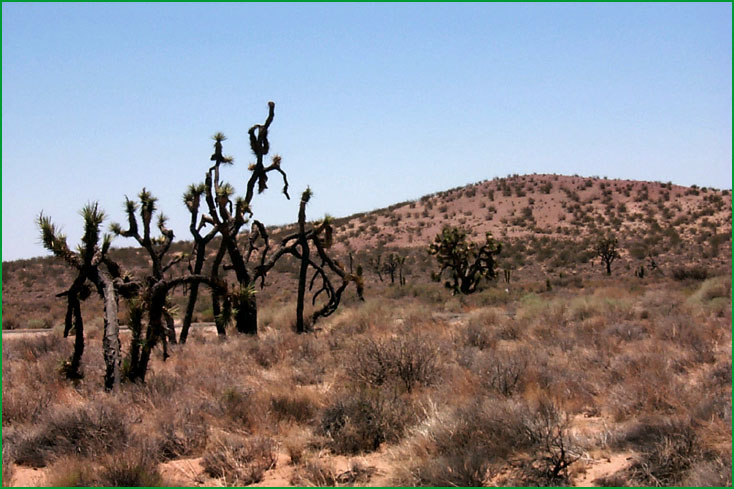
Vegetation. The predominant natural plant community is Creosote bush series on hills, pediments, and fans. Joshua tree series is common on pediments and fans. California juniper series predominates above about 3000 feet near the San Andreas Fault. Mixed saltbush series is common on basin floor and Iodine bush series and Saltgrass series are present on wet basin-fill and lacustrine deposits. Greasewood series occurs in riparian areas and around saltmarsh.
Characteristic series by lifeform include:
Grasslands: Alkali sacaton series, Big galleta series, Desert needlegrass series, Desert sand - verbena series, Indian ricegrass series, Saltgrass series.
Shrublands: Allscale series, Birchleaf mountain-mahogany - California buckwheat series, Brittlebrush series, California buckwheat series, Chamise series, Creosote bush series, Creosote bush - white bursage series, Desert-holly series, Fourwing saltbrush series, Greasewood series, Hop-sage series, Iodine bush series, Joshua tree series, Mixed saltbush series, Mojave yucca series, Rubber rabbitbrush series, Scalebroom series, Scadscale series, Spinescale series, White bursage series, Winter fat series.
Forests and woodlands: California juniper series, California sycamore series, Mesquite series.
Climate. The mean annual precipitation is about 4 to 10 inches. It is mostly rain. Mean annual temperature is about 60░ to 66░ F. The mean freeze-free period is about 250 to 275 days.
Surface Water. Runoff is rapid from mountains and alluvial fans and slow from basin-fill. All drainage is internal, to closed basins in the Mojave Desert. Streams are dry most of each year. There is temporary ponding on playas, or dry lake beds.