 | Mojave Valley - Granite Mountains -Silurian Valley - DevilÆs Playground- Kingston Range - Valley Wells |
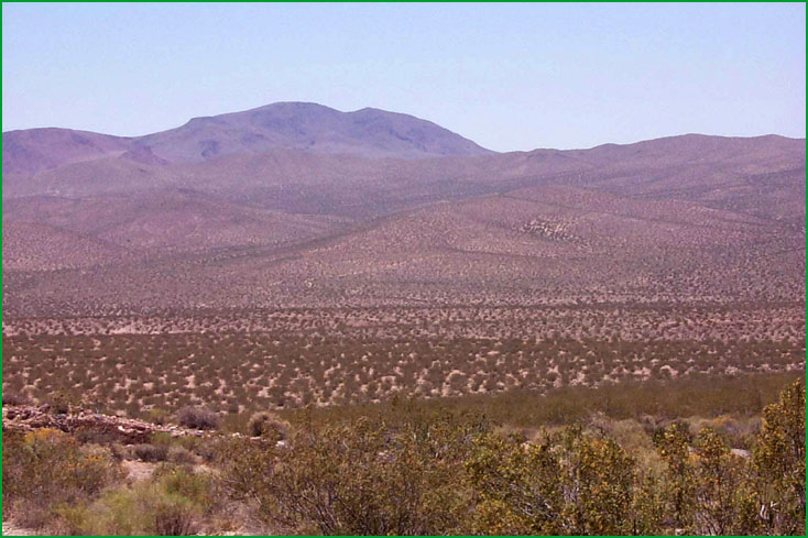
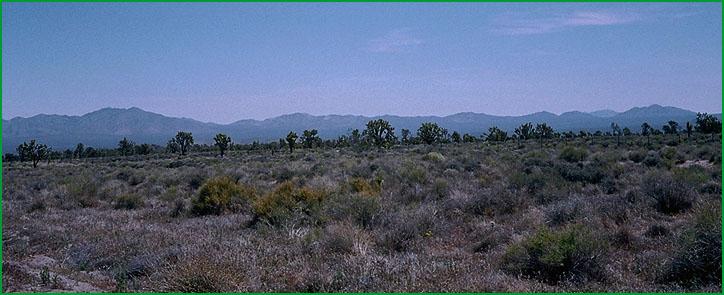
Mojave Valley - Granite Mountains- North of Johannesburg Ś Scott Miles |
Mojave Valley - Granite Mountains- North of Johannesburg Ś Scott Miles |
Mojave Valley - Granite Mountains- North of Johannesburg Ś Scott Miles |
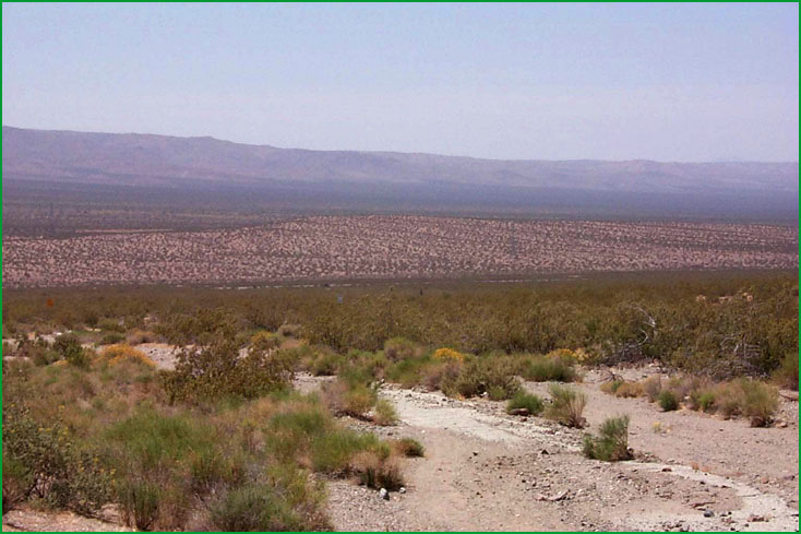
Silurian Valley - DevilÆs Playground-near Baker Ś Charles B. Goudey |
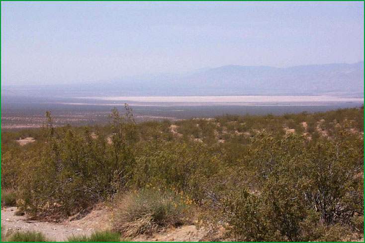
near Holloran Springs Ś Charles B. Goudey |
http://www.fs.fed.us/r5/projects/ecoregions/322ah.htm
Subsection 322Ah
Mojave Valley - Granite Mountains
This subsection consists of about half upland, including pediments, and half alluvial plain. There are many small mountain ranges and hills with many different orientation patterns. The subsection is bounded by the Garlock Fault Zone on the north, Avawatz Mountains on the northeast, Silurian Valley (outside of this subsection) on the east, the Soda Mountains on the southeast, Mojave Valley on the south, Harper Valley Fault on the southwest, and Rand Mountains on the west. It has a hot, arid climate. MLRA 30g.
Lithology and Stratigraphy. This subsection contains mainly Mesozoic plutonic rocks, Tertiary volcanic rocks, and Quaternary alluvium. Lacustrine and eolian sand deposits are common. The Mesozoic plutonic rocks are mostly granitic, but include some mafic rocks. There are areas of Quaternary volcanic, Tertiary nonmarine sedimentary, Pre-Cretaceous metamorphic, Paleozoic marine sedimentary, and Precambrian metamorphic rocks, too.
Geomorphology. This subsection is largely on very gently to moderately sloping pediments and alluvial fans and nearly level basin floor and dry lake bed. Less than half of the subsection is on steep mountains and moderately steep hills. Some of the dry lake beds are Bicycle, Coyote, East Cronese, West Cronese, Goldstone, Langford Wells, Leach, Manix, Nelson, Pilot Knob Valley, Red Pass, and Superior Lakes. The elevation range is from about 1080 feet on Cronese Lakes to about 5600 feet in the Avawatz Mountains. Mass wasting, fluvial erosion and deposition, and eolian deflation and deposition are the main geomorphic processes.
Soils. The upland soils are mostly shallow Typic Torriorthents on granitic rocks and Typic Haplargids on volcanic rocks. Also, there are ōbadlandsö on Miocene marine sedimentary rocks. Soil on floodplains and on younger fans are Typic subgroups of Torrifluvents, Torripsamments, and Torriorthents. Those on older fans are Typic Torriorthents, Typic Haplargids, and Durinodic Calciargids. Soil on basin floor and dune sand are Typic Torriorthents and Typic Torripsamments. The soils are well drained, except on poorly drained playas. Soil temperature regimes are thermic; and soil moisture regimes are aridic.
Vegetation. The predominant natural plant community is Creosote bush series on hills, pediments, and fans. Joshua tree series is common on pediments and fans. Black bush series occurs at higher elevations, particularly in the Avawatz Mountains. Mixed saltbush series is common on basin floor and Iodine bush series and Saltgrass series are present on wet basin-fill and lacustrine deposits. Greasewood series occurs in riparian areas and around saltmarsh. Catclaw acacia series is common along the Mojave River.
Characteristic series by lifeform include:
Grasslands: Alkali sacaton series, Big galleta series, Desert needlegrass series, Desert sand - verbena series, Indian ricegrass series, Saltgrass series.
Shrublands: Allscale series, Brittlebrush series, Creosote bush series, Creosote bush - white bursage series, Desert-holly series, Fourwing saltbrush series, Greasewood series, Hop-sage series, Iodine bush series, Joshua tree series, Mixed saltbush series, Mojave yucca series, Rubber rabbitbrush series, Scadscale series, Spinescale series, White bursage series, Winter fat series.
Forests and woodlands: Mesquite series.
Climate. The mean annual precipitation is about 4 to 6 inches. It is mostly rain. Mean annual temperature is about 55░ to 70░ F. The mean freeze-free period is about 200 to 300 days.
Surface Water. Runoff is rapid from mountains and alluvial fans and slow from basin-fill. All drainage is internal, to closed basins in the Mojave Desert. The Mojave River, the only large stream in the western Mojave Desert, drains toward Cronese Valley, or toward Soda Lake. During the Pleistocene it drained through Silurian Valley to Death Valley. Streams are dry most of each year, and most of the water in the Mojave River drains beneath the river bed, surfacing only where there are bedrock constrictions, such as in Afton Canyon. There is temporary ponding on playas, or dry lake beds.
Subsection 322Ai
Silurian Valley - DevilÆs Playground
This subsection includes the alluvial plain of the Silurian Valley, from where the Amargosa River enters it on the north to where the Mojave River enters it on the south, and the DevilÆs Playground just southeast of Silurian Valley and up Kelso Wash toward Ivanpah Valley. There are a few hills protruding through the alluvial plain. It has a very hot, arid climate. MLRA 30g.
Lithology and Stratigraphy. This subsection contains mainly Quaternary fluvial, lacustrine, and eolian sand deposits. Hills protruding through the alluvial plain are mostly Mesozoic granitic, Paleozoic marine, and Precambrian metamorphic rocks.
Geomorphology. This subsection is mainly on very gently to moderately sloping alluvial fans, nearly level basin floor and dry lake bed, and sloping to steep sand dunes. There are large playas on Soda Lake, Silver Lake, and Silurian Lake. The elevation range is about 300 to 1200 feet on alluvial plains and up to about 2400 feet on the highest hill. Fluvial erosion and deposition and eolian deflation and deposition are the main geomorphic processes.
Soils. The soils are mostly Typic subgroups of Torrifluvents, Torripsamments, and Torriorthents on younger fans and basin-fill and Typic subgroups of Torriorthents, Calciorthids, Camborthids, and Haplargids on older fans. Soils on hills are mostly Lithic Torriorthents, plus Lithic Camborthids on granitic rocks. Soils on dune sand are Typic Torripsamments. The soils are well drained, except on poorly drained playas. Soil temperature regimes are hyperthermic; and soil moisture regimes are aridic.
Vegetation. The predominant natural plant community is Creosote bush series on hills and fans. Mixed saltbush series is common on basin floor and Iodine bush series and Saltgrass series are present on wet basin-fill and lacustrine deposits. The Desert sand - verbena series is common on stabilized dunes.
Characteristic series by lifeform include:
Grasslands: Alkali sacaton series, Big galleta series, Desert sand - verbena series, Indian ricegrass series, Saltgrass series.
Shrublands: Brittlebrush series, Creosote bush series, Creosote bush - white bursage series, Desert-holly series, Fourwing saltbrush series, Greasewood series, Iodine bush series, Joshua tree series, Mixed saltbush series, Scadscale series, White bursage series, Winter fat series.
Forests and woodlands: Mesquite series.
Climate. The mean annual precipitation is about 4 to 6 inches. It is mostly rain. Mean annual temperature is about 70░ to 75░ F. The mean freeze-free period is about 300 to 325 days.
Surface Water. Runoff is rapid from mountains and alluvial fans and slow from basin-fill. All drainage is internal, to closed basins in Silurian Valley or in Death Valley. Some water from the Mojave River, reaches Soda Lake in wet years, even though it might not flow overland (above-ground). During the Pleistocene the Mojave and Amargosa Rivers drained through Silurian Valley to Death Valley. Streams are dry most of each year. There is temporary ponding on playas, or dry lake beds.
Subsection 322Aj
Kingston Range - Valley Wells
This subsection includes mountains, hills, pediments, and high alluvial plains between Silurian Valley and DevilÆs Playground on the west and southwest, California Valley on the northwest, Pahrump Valley on the north, Mesquite Valley and Ivanpah Fault on the northeast, and Ivanpah Valley on the southeast, plus the southern part of the Spring Mountains. The subsection is on about half upland and half alluvial plain. It has a hot, arid climate that is moderated by elevation on the higher mountains. MLRAs 29f and 30g.
Lithology and Stratigraphy. The upland in this subsection contains mainly Mesozoic granitic, Quaternary volcanic, Paleozoic marine sedimentary, and Precambrian sedimentary and metamorphic rocks. There are Pleistocene and recent basalt flows along the ridge on the east side of Shadow Valley. The alluvial plain is mostly fluvial deposits, with a small area of lacustrine deposits at Valley Wells in Shadow Valley.
Geomorphology. This subsection is on steep to very steep mountains, gently to moderately sloping pediments and alluvial fans, and nearly level basin floor. Some of the pediments are capped by Quaternary lava flows, and there are many volcanic cones on the flows. The mountains and ridges are oriented north-south or toward the north-northwest. The elevation range is about 1000 to 4000 feet on alluvial plains and up to 7324 feet in the Kingston Range and 7929 feet on Clark Mountain. Mass wasting, fluvial erosion and deposition, and volcanism are the main geomorphic processes.
Soils. The upland soils are mostly Lithic Torriorthents, plus Lithic Camborthids on granitic rocks and Lithic Haplargids on volcanic rocks. At higher elevations, the upland soils are Lithic Xeric Torriorthents, shallow Xeric Torriorthents, and shallow Xeric Haplargids; shallow Aridic Argixerolls are less common. Soils on alluvial plains are mostly Typic Torriorthents and Typic Torripsamments on younger fans and Typic Calciorthids and Typic Haplargids on older fans. The soils are well drained. Soil temperature regimes are mostly thermic, and mesic at higher elevations. Soil moisture regimes are aridic.
Vegetation. The predominant natural plant communities are Creosote bush series on fans, Shadscale series on lower mountain slopes, Singleleaf pinyon series on higher mountain slopes, and White fir series on the highest mountains. Joshua tree series is common on alluvial plains. Black bush series occurs on mountain slopes.
Characteristic series by lifeform include:
Grasslands: Alkali sacaton series, Big galleta series, Indian ricegrass series, Saltgrass series.
Shrublands: Big sagebrush series, Bitterbrush series, Black bush series, Black sagebrush series, Brittlebrush series, Catclaw acacia series, Creosote bush series, Creosote bush - white bursage series, Desert-holly series, Fourwing saltbrush series, Greasewood series, Hop-sage series, Iodine bush series, Joshua tree series, Mixed saltbush series, Nolina series, Scadscale series, White bursage series.
Forests and woodlands: Mesquite series, Singleleaf pinyon series, Singleleaf pinyon - Utah juniper series, Utah juniper series, White fir series.
Climate. The mean annual precipitation is about 5 to 8 inches. It is mostly rain, but snow at higher elevations. Mean annual temperature is about 45░ to 72░ F. The mean freeze-free period is about 150 to 300 days.
Surface Water. Runoff is rapid from mountains and alluvial fans and slow from basin-fill. Most of the runoff drains to closed basin around the subsection. Runoff from Valley Wells is through Kingston Wash to Silurian Valley. Streams are dry most of each year; water flows in few of them except following intense rain. There is temporary ponding on playas, or dry lake beds.