 | Carson Valley - Truckee Meadows- Pine Nut Mountains-Antelope - Mason Valley and Hills |
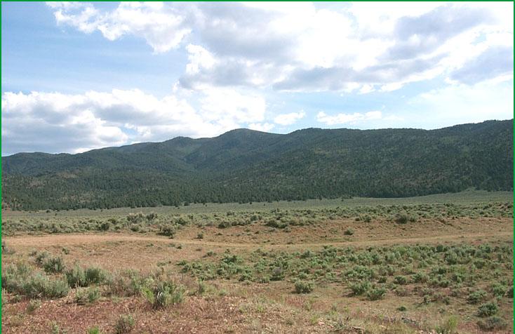
Nut Mountains north of Topaz Lake Ś Scott Miles |
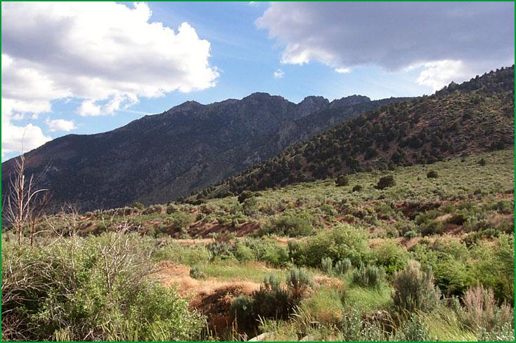
Pine Nut Mountains south of Topaz Ś Scott Miles |
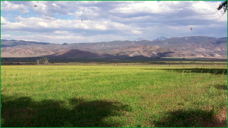
Antelope - Mason Valley and Hills - Topaz area Ś Scott Miles |
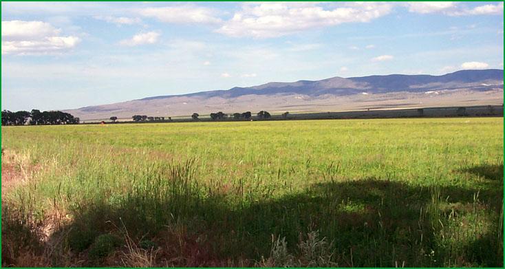
Coleville area Ś Scott Miles |
http://www.fs.fed.us/r5/projects/ecoregions/341da.htm
Subsection 341Da
Carson Valley - Truckee Meadows
This subsection consists mostly of an alluvial plain in Truckee Meadows and the Spanish Springs, Washoe, Carson, and Diamond Valleys. The climate is temperate and semi-arid. MLRA 26f.
Lithology and Stratigraphy. Quaternary alluvium predominates in this subsection. Hot Springs Mountain in Carson Valley is Triassic and Jurassic volcanic and sedimentary rocks, and there are Mesozoic granitic rocks and Tertiary andesite and silicic tuffs on Huffaker Hills, Prison Hill, Steamboat Hills, and on the divide between Carson and Washoe Valleys.
Geomorphology. This subsection is predominantly on gently to moderately sloping alluvial fans and pediments and nearly level floodplain, terraces, and basin floor. There are outwash fans at the foot of Mt. Rose and pediments on glacial outwash along the Truckee River. Moderately steep to steep hills are prominent but only small parts of the subsection. The elevation range is from 4400 to about 6000 feet. Fluvial erosion and deposition and freeze-thaw are the main geomorphic processes.
Soils. The soils are mostly Typic Torriorthents, Aridic Haploxerolls, and Xerollic and Durixerollic Haplargids on alluvial fans and pediments; Typic and Aquentic Haploxerolls and Typic Haplaquolls on floodplains and basin floors; and Aridic Lithic Haploxerolls, Aridic Haploxerolls, and Xerollic Haplargids on hills. They are Entic Xerumbrepts and Haploxerolls on younger and Aridic Argixerolls on older outwash fans at the foot of Mt. Rose. The soils are well to poorly drained. Soil temperature regimes are mesic. Soil moisture regimes are mostly aridic, and some xeric (nearly aridic), plus wet soils in basin-fill that have aquic moisture regimes.
Vegetation. The predominant natural plant communities are Big sagebrush series on alluvial fans and Sedge meadow alliances on basin floors and floodplains. Low sagebrush series is common on shallow soils in hills. Jeffrey pine series occurs of some soils with xeric soil moisture regimes.
Characteristic series by lifeform include:
Grasslands: Alkali sacaton series, Ashy ryegrass series, Beaked sedge series, Creeping ryegrass series, Indian ricegrass series, Needle-and-thread series, Saltgrass series.
Shrublands: Big sagebrush series, Bitterbrush series, Low sagebrush series, Parry rabbitbrush series, Rubber rabbitbush series, Tobacco brush series.
Forests and woodlands: Curlleaf mountain-mahogany series, Jeffrey pine series.
Climate. The mean annual precipitation is about 7 to 20 inches. Much of the precipitation is snow. Mean annual temperature is about 45░ to 54░ F. The mean freeze-free period is in the range from 100 to 125 days.
Surface Water. Runoff is rapid from alluvial fans and slow from basin-fill. Truckee Meadows and Spanish Springs Valley drain to the Truckee River, which flows from Lake Tahoe in the Sierra Nevada to Pyramid Lake in the Great Basin. Diamond and Carson Valleys are drained by the Carson River, which flows to the Carson Sink. Washoe Lake in Washoe Valley has an ephemeral outlet to Steamboat Creek, which drains to the Truckee River.
Subsection 341Db
Pine Nut Mountains
This subsection comprises the Pine Nut Mountains. It has a temperate to cold, semi-arid climate. MLRA 26f.
Lithology and Stratigraphy. The mountains contain mostly Pliocene volcanic rocks, largely andesite, and Triassic and Jurassic volcanic and sedimentary rocks. Also, there are Mesozoic granitic and Pre-Cretaceous metasedimentary rocks and some Quaternary alluvium in the subsection.
Geomorphology. Steep mountain slopes predominate in this subsection. There are some gently to moderately sloping pediments and alluvial fans. The mountains are oriented north-south. The elevation range is from about 5000 feet up to 9005 feet on Mt. Como. Mass wasting, fluvial erosion and deposition, and freeze-thaw are the main geomorphic processes.
Soils. The soils are mostly Lithic Xerollic Haplargids, Aridic Haploxerolls, Aridic Argixerolls, Xerollic Haplargids, and Xerollic Paleargids. The soils are well drained. Soil temperature regimes are mesic at lower and frigid at higher elevations. Soil moisture regimes are mostly aridic, bordering xeric, and some xeric.
Vegetation. The predominant natural plant communities are Big sagebrush series on lower mountain slopes and Singleleaf pinyon series on higher mountain slopes. Utah juniper series occurs at intermediate elevations and some open Jeffrey pine series occurs at higher elevations.
Characteristic series by lifeform include:
Grasslands: Indian ricegrass series, Needle-and-thread series.
Shrublands: Big sagebrush series, Bitterbrush series, Low sagebrush series, Parry rabbitbrush series, Rubber rabbitbrush series.
Forests and woodlands: Curlleaf mountain-mahogany series, Jeffrey pine series, Singleleaf pinyon series, Singleleaf pinyon - Utah juniper series, Utah juniper series.
Climate. The mean annual precipitation is about 8 to 16 inches. Much of the precipitation is snow. Mean annual temperature is about 40░ to 50░ F. The mean freeze-free period is in the range from 75 to 100 days.
Surface Water. Runoff is rapid. It drains to the Carson River on the west or to the Walker River on the east side of the mountains. Streams in the mountains are dry most of each year. There is are no natural lakes in the subsection.
Subsection 341Dc
Antelope - Mason Valley and Hills
This subsection includes Mason and Smith Valleys between the Pine Nut Mountains on the west and the Wassuck Range on the east, the valley of the Carson River north of the Pine Nut Mountains, Antelope Valley south of the Pine Nut Mountains, and the Singatse Range between Mason and Smith Valleys. The climate is temperate and arid to semi-arid. MLRA 26f.
Lithology and Stratigraphy. Quaternary alluvium predominates in this subsection. Bedrock in the Singatse Range and hills between the Wassuck Range and the Pine Nut Mountains is Triassic and Jurassic volcanic and sedimentary rocks and Tertiary andesite and tuffaceous sediments, plus some Jurassic and Cretaceous granitic rocks. Hills at the north end of the Pine Nut Range are mostly Tertiary andesite, basalt, and tuffaceous sediments.
Geomorphology. This subsection contains steep mountains, moderately steep hills, gently to moderately sloping alluvial fans and pediments, and nearly level floodplains, terraces, and basin floor. The Singatse Range and valleys on both sides of it are aligned north-south. The Carson River runs across this trend. The elevation range is from about 4200 feet up to 6778 feet on Mt. Wilson in the Singatse Range and on alluvial fans adjacent to the Wassuck Range. Mass wasting, fluvial erosion and deposition, and freeze-thaw are the main geomorphic processes.
Soils. The soils on mountains and hills are mostly Lithic Camborthids; Lithic and Aridic Argixerolls; Lithic Xerollic and Xerollic Haplargids; and Typic, Xerollic, and Mollic Durorthids and Durargids. Those on alluvial fans are mostly Duric Mollic Camborthids, Mollic and Duric Haplargids, and Typic and Mollic Durargids. Those on floodplains and basin floors are mostly Aquic Xerorthents and Typic subgroups of Haplaquents, Haplaquepts, and Haplaquolls; also, there are Aquic Natrixerolls and Aquic Natrargids. There are Typic Torripsamments on eolian sand. The soils are well to poorly drained. Soil temperature regimes are mesic. Soil moisture regimes are aridic, except for wet soils on floodplains and basin floors that have xeric or aquic moisture regimes.
Vegetation. The predominant natural plant communities are Shadscale series and, on floodplains and basin floors, Greasewood series, Saltgrass series, and Sedge meadow alliances. Low sagebrush series is common on shallow soils. Some Big sagebrush series and Singleleaf pinyon series occur at higher elevations. Indian ricegrass series predominates on eolian sand.
Characteristic series by lifeform include:
Grasslands: Alkali sacaton series, Ashy ryegrass series, Cordgrass series, Creeping ryegrass series, Indian ricegrass series, Needle-and-thread series, Saltgrass series.
Shrublands: Allscale series, Bush seepweed series, Greasewood series, Low sagebrush series, Mixed saltbrush series, Scadscale series, Winter fat series.
Forests and woodlands: Bittlebrush series, Curlleaf mountain-mahogany series, Singleleaf pinyon series.
Climate. The mean annual precipitation is about 5 to 10 inches. Much of the precipitation is snow. Mean annual temperature is about 42░ to 54░ F. The mean freeze-free period is in the range from 125 to 150 days.
Surface Water. Runoff is rapid from alluvial fans and slow from basin-fill. All runoff drains to the Walker River, except on the north side of the Pine Nut Mountains where runoff drains to the Carson River. Topaz Lake in Antelope Valley and Artesia Lake in Smith Valley are natural lakes, and there are some smaller ones on floodplain or basin floor along the Walker River in Mason Valley.