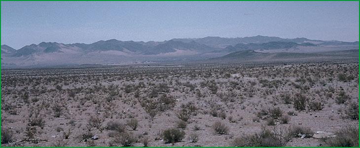
 | Bullion Mountains - Bristol Lake -Pinto Basin and Mountains |
looking south from Mannix area. 322Ah in foreground Ś Charles B. Goudey |
Subsection 322Ao
Bullion Mountains - Bristol Lake
This subsection includes alluvial fans, basin floor, volcanic flows, and mountains and hills in a linear depression that stretches from Troy Lake southeastward to Bristol Lake and beyond, plus the lower part of Fenner Valley. It has a very hot arid climate. MLRAs 30g and 30h.
Lithology and Stratigraphy. Quaternary alluvial, lacustrine, and eolian deposits and Cenozoic volcanic rocks predominate in this subsection. The volcanic rocks are mostly Miocene andesite and basalt and Quaternary basalt. The mountains are mostly Mesozoic granitic and Pre-Cenozoic metamorphic rocks.
Geomorphology. This subsection is on very gently to moderately sloping alluvial fans and volcanic flows, nearly level basin floor and dry lake bed, steep mountains, and moderately steep hills. Fenner Valley is aligned toward the northeast. The Sheep Hole and Calumet Mountains south of Bristol Lake and Bullion Mountains (subsection 322An) are aligned toward the northwest to north-northwest and the Ship Mountains in Fenner Valley are oriented toward the north-northeast. Bristol Lake is the largest dry lake bed; others are Troy, Broadwell, Lavic, and Dale Lakes. Two prominent craters on recent basalt flows are Pisgah Crater in the northwest part of the subsection and Amboy Crater on a flow over Bristol Lake. The elevation range is from about 620 feet on Bristol Lake up to 3726 feet in the Calumet Mountains, 4685 feet in the Sheep Hole Mountains, and 3300 feet in the Ship Mountains. Fluvial erosion and deposition, eolian deflation and deposition, and mass wasting are the main geomorphic processes.
Soils. The soils are mostly Lithic Torriorthents and Lithic Haplocambids on mountains and the rocky recent basalt flows, plus Lithic Haplargids on older volcanic flows and on north-facing slopes in granitic terrain. The soils are mostly Typic Torrifluvents, Typic Torripsamments, and Typic Torriorthents on younger fans and Durinodic Haplocalcids and Durinodic Calciargids on older fans. Typic Torripsamments and Arenic Haplargids occur in eolian sand. The soils are well drained, except on poorly drained playas. There are Salorthids on poorly drained playas lacking vascular plants. Soil temperature regimes are mostly thermic on the mountains and hyperthermic on large basin floors and on south-facing slopes at lower elevations. Soil moisture regimes are aridic.
Vegetation. The predominant natural plant communities are Creosote bush series and Creosote bush - white bursage series. Mixed saltbush series is common on basin floor and Iodine bush series and Saltgrass series are present on wet basin-fill and lacustrine deposits.
Characteristic series by lifeform include:
Grasslands: Alkali sacaton series, Big galleta series, Desert sand - verbena series, Indian ricegrass series, Saltgrass series.
Shrublands: Brittlebrush series, Bush seepweed series, Creosote bush series, Creosote bush - white bursage series, Desert-holly series, Fourwing saltbrush series, Greasewood series, Iodine bush series, Joshua tree series, Mixed saltbush series, Scadscale series, White bursage series, Winter fat series.
Forests and woodlands: Blue palo verde - ironwood - smoke tree series, Mesquite series.
Climate. The mean annual precipitation is about 3 to 5 inches. It is all rain. Mean annual temperature is about 56░ to 74░ F. The mean freeze-free period is about 250 to 300 days.
Surface Water. Runoff is rapid from mountains and alluvial fans and slow from basin-fill. All drainage is internal, to closed basins in the subsection. Streams are dry most of each year; they may have no water in them some years. There is temporary ponding on playas, or dry lake beds.
Subsection 322Ap
Pinto Basin and Mountains
This subsection consists of steep mountains and broad valleys west of the northwest trending Little San Bernardino Mountains. It includes the Pinto Basin, Pleasant Valley, and the Pinto, Coxcomb, Eagle, Hexie, and Cottonwood Mountains. It has a hot to very hot, arid climate. MLRA 30g.
Lithology and Stratigraphy. The bedrock in this subsection is mainly Mesozoic granitic, Pre-Cretaceous metasedimentary, and Precambrian metamorphic rocks. Alluvium and basin-fill predominate in the valleys; lacustrine deposits are not extensive.
Geomorphology. This subsection is on steep mountains, moderately steep hills; very gently to moderately sloping pediments and alluvial fans; and nearly level basin floor. Dry lake bed and dune sand are not extensive. The general orientation of the hills is not clear, except the north-south aligned Coxcomb Mountains on the eastern edge of the subsection and the Pinto Mountains which are along the east-west Pinto Mountain Fault that is the northern boundary of the subsection. The Pinto basin and southern edge of the subsection along Shaver Valley are aligned east-west. The elevation range is from about 1000 feet up to 5350 feet in the Eagle Mountains, 4834 feet on Monument Mountain, and 5687 feet on Queen Mountain. Mass wasting and fluvial erosion and deposition are the main geomorphic processes.
Soils. The soils are mostly Lithic Torriorthents and Lithic Camborthids on uplands. Soils on younger fans and basin-fill are mostly Typic Torrifluvents, Typic Torripsamments, and Typic Torriorthents. The soils on older fans are mostly Typic Calciorthids and Typic Haplargids. Soil temperature regimes are mostly thermic on mountains and hyperthermic in valleys. Soil moisture regimes are aridic.
Vegetation. The predominant natural plant communities are Creosote bush series and Creosote bush - white bursage series. California juniper series is common on higher mountains and Joshua tree series is common on pediments and fans. Fan palm series occurs in riparian areas near the southern edge of the subsection.
Characteristic series by lifeform include:
Grasslands: Big galleta series, Desert needlegrass series, Indian ricegrass series.
Shrublands: Birchleaf mountain-mahogany - California buckwheat series, Brittlebush series, California buckwheat series, Creosote bush series, Creosote bush - white bursage series, Desert-holly series, Joshua tree series, Mojave yucca series, Nolina series, Rubber rabbitbrush series, Teddybear cholla series, White bursage series.
Forests and woodlands: Blue palo verde - ironwood - smoke tree series, California juniper series, Fan palm series, Mesquite series, Singleleaf pinyon series
Climate. The mean annual precipitation is about 4 to 8 inches. It is practically all rain. Mean annual temperature is about 50░ to 72░ F. The mean freeze-free period is about 200 to 300 days.
Surface Water. Runoff is rapid from mountains and alluvial fans and slow from basin-fill. Runoff from Pinto Basin and most of the mountains is to Chuckawalla Valley. Streams are dry most of each year. There is temporary ponding on playas, or dry lake beds.