 | North Trinity Mountain-Trinity Mountain - Hayfork-Pelletreau Ridge |
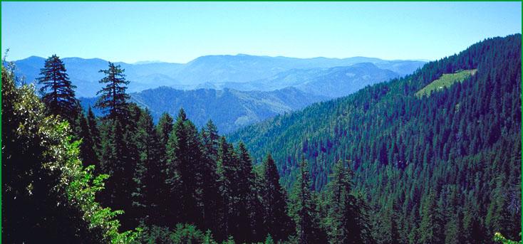
North Trinity Mountain-Subsection M261Aq, Red Cap Creek area Ś Scott Miles |
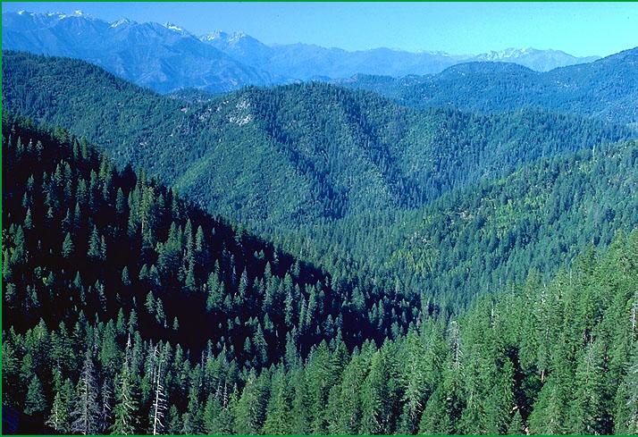
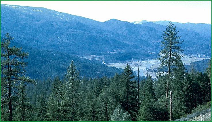
Trinity Mountain - Hayfork-Subsection M261Ar, upper Price Creek area Ś Robert Ettner |
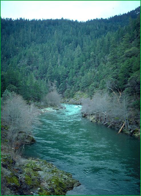
Subsection M261Ar, Trinity River Ś USDA |
Subsection M261Ar, Big Bar Ranger District, Shasta-Trinity National Forests, Tributaries to Trinity River Ś USDA |
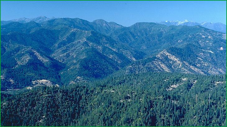
Pelletreau Ridge-Subsection M261As, Hyampom Valley area Ś Scott Miles |
http://www.fs.fed.us/r5/projects/ecoregions/m261aq.htm
Subsection M261Aq
North Trinity Mountain
This subsection is in the Western Paleozoic and Triassic Belt. It is high terrain just west of the Trinity Alps. The climate is cold and humid. MLRA 5c.
Lithology and Stratigraphy. This subsection is dominated by Mesozoic granitic rocks and by Paleozoic to Jurassic gabbro and metavolcanic and metasedimentary rocks, including serpentinized peridotite, of the Western Hayfork and the Sawyers Bar terranes. The granitic rocks are generally quartz diorite to slightly more silicic rocks.
Geomorphology. This is a subsection of mountains with rounded ridges, steep sides, and narrow canyons. There are a few cirques on the north sides of the higher mountains. The elevation range is from about 4000 feet up to 7478 feet on Limestone Ridge. Mass wasting and fluvial erosion are the main geomorphic processes.
Soils. The soils are mostly Typic, Lithic, and Pachic Xerumbrepts. Typic and Dystric Lithic Xerochrepts occur at lower elevations. There are some Haploxeralfs, particularly on highly serpentinized peridotite. Rocky Lithic, Entic, and Typic Cryorthents occur at higher elevations. The soils are well drained. Soil temperature regimes are mostly frigid, with some cryic at higher elevations. Soil moisture regimes are xeric.
Vegetation. The predominant natural plant communities are White fir series, and at higher elevations, Red fir series. Jeffrey pine series occurs on serpentinized peridotite. Mountain hemlock series, Mixed subalpine forest series, and Subalpine meadow habitats occur at higher elevations.
Characteristic series by lifeform include:
Grasslands: Montane meadow habitat, Subalpine meadow habitat.
Shrublands: Brewer oak series, Bush chinquapin series, Greenleaf manzanita series, Holodisus series, Huckleberry oak series, Montane wetland shrub habitat, Montane wetland shrub habitat, Mountain alder series, Sadler oak series, Sitka alder series, Subalpine upland shrub habitat. Subalpine wetland shrub habitat, Tobacco brush series, Wedgeleaf ceanothus series.
Forests and woodlands: Black oak series, Douglas-fir series, Incense-cedar series, Jeffrey pine series, Mixed conifer series, Mountain hemlock series, Red fir series, Western white pine series, White fir series.
Climate. The mean annual precipitation is about 60 to 70 inches. Much of the precipitation is snow, and it is mostly snow at higher elevations. Mean annual temperature is about 35░ to 46░ F. The mean freeze-free period is about 50 days at higher elevations to 100 days at lower elevations.
Surface Water. Runoff is rapid. It drains to the Trinity and Klamath Rivers and their tributaries. Streams are mostly perennial. There are some small lakes in the subsection.
Subsection M261Ar
Trinity Mountain - Hayfork
This subsection is in the Western Paleozoic and Triassic Belt. It stretches from the Trinity Mountains southeasterly between the Siskiyou and the Salt Creek faults to the Great Valley. The climate is temperate and humid. MLRAs 5c and 5d.
Lithology and Stratigraphy. This subsection is dominated by Mesozoic granitic rocks and Paleozoic to Jurassic gabbro and metavolcanic and metasedimentary rocks, including serpentinized peridotite, of the Sawyers Bar and Western Hayfork terranes. It is between Siskiyou fault on the east and the Salt Creek fault on the west and southwest. The granitic rocks are generally quartz diorite to slightly more silicic rocks. There are nonmarine sedimentary rocks of the Weaverville Formation in a graben occupied by Hayfork Valley. Quaternary alluvium occurs in Hayfork Valley and along the Trinity River and its tributaries.
Geomorphology. This is a subsection of mountains with rounded summits, steep sides, and narrow canyons. The mountains are generally aligned toward the north, although the Hayfork graben and Hayfork Divide are aligned toward the northeast. Slopes in the Hayfork graben are nearly level on floodplains to moderately steep on the Weaverville Formation. There are floodplains and terraces in Hayfork Valley and along the Trinity River and its tributaries. The elevation range is from about 1800 feet up to 6273 feet on Hayfork Bally. Mass wasting and fluvial erosion are the main geomorphic processes.
Soils. The soils are mostly Dystric and Dystric Lithic Xerochrepts and Ultic Haploxeralfs, plus shallow Dystric Lithic Xerochrepts on granitic rocks and Mollic Haploxeralfs on serpentinized peridotite. Palexeralfs and Mollic Haploxeralfs predominate on the Weaverville Formation. Soils at higher elevations are mostly Typic and Lithic Xerumbrepts. Lithic Xerochrepts, Lithic Argixerolls, and Mollic Haploxeralfs occur at lower elevations, adjacent to the Great Valley. Soils on alluvium in Hayfork Valley are mostly Argixerolls and Aquic Xerofluvents. The soils are well drained, except somewhat poorly drained soils in Hayfork Valley. Soil temperature regimes are mostly mesic, with some frigid at higher elevations and thermic at lower elevations. Soil moisture regimes are xeric.
Vegetation. The predominant natural plant communities are Douglas-fir series, Mixed conifer series, Douglas fir - ponderosa pine series, and Ponderosa pine series. White fir series is predominant at higher elevations. Jeffrey pine series occurs on serpentinized peridotite. Oregon white series is predominant in Hayfork Valley. Chamise series and Mixed chaparral communities occur at lower elevations.
Characteristic series by lifeform include:
Grasslands: California annual grassland series, Montane meadow habitat.
Shrublands: Brewer oak series, Bush chinquapin series, Chamise series, Greenleaf manzanita series, Holodiscus series, Huckleberry oak series, Tobacco brush series, Wedgeleaf ceanothus series, Whiteleaf manzanita series.
Forests and woodlands: Black oak series, Birchleaf mountain-mahogany series, Canyon live oak series, Douglas-fir series, Douglas-fir - ponderosa pine series, Foothill pine series, Interior live oak series, Jeffrey pine series, Knobcone pine series, Mixed conifer series, Oregon white oak series, Ponderosa pine series, White alder series, White fir series.
Climate. The mean annual precipitation is about 30 to 70 inches. Most of the precipitation is rain; much of it is snow at higher elevations. Mean annual temperature is about 40░ to 54░ F. The mean freeze-free period is about 75 days at higher elevations to 200 days at lower elevations.
Surface Water. Runoff is rapid. Most of it drains to the Trinity River and its tributaries. Runoff from the southeast end of the subsection drains to Cottonwood Creek, a tributary of the Sacramento River. The streams are mostly perennial on the west, and many of the smaller ones are ephemeral on the east. There are no lakes in the subsection.
Subsection M261As
Pelletreau Ridge
This subsection is in the Western Jurassic Belt. It is a narrow, arcuate strip of land along the southwest edge of the Klamath Mountains that is between South Fork Mountain fault on the southwest and the Bear Wallow fault on the northeast. The climate is temperate and humid. MLRA 5c.
Lithology and Stratigraphy. This subsection is dominated by clastic Jurassic marine sedimentary rocks of the Galice formation. These sedimentary rocks have been slightly metamorphosed to form metagraywacke and phyllite. There are small areas of serpentinized peridotite and Mesozoic granitic rocks in the subsection. The rocks are intensely folded and faulted.
Geomorphology. This is a subsection of mountains with rounded ridges, steep sides, and narrow canyons. The elevation range is about 1500 to 5000 feet. Mass wasting and fluvial erosion are the main geomorphic processes.
Soils. The soils are mostly Dystric and Dystric Lithic Xerochrepts, Ultic Haploxeralfs, and Typic Haploxerults. Shallow Dystric Xerochrepts on granitic rocks generally have paralithic contacts, rather than lithic contacts. The soils well drained. Soil temperature regimes are mesic. Soil moisture regimes are xeric.
Vegetation. The predominant natural plant communities are Douglas-fir series and Douglas-fir - tanoak series. White fir series occurs at the higher elevations. Canyon live oak series is common on very steep rocky slopes with stony soils. Oregon white oak series occurs on clayey soils and south-facing slopes at the lower elevations.
Characteristic series by lifeform include:
Grasslands: Montane meadow habitat.
Shrublands: Greenleaf manzanita series, Tobacco brush series, Wedgeleaf ceanothus series.
Forests and woodlands: Black oak series, Douglas-fir series, Douglas-fir - tanoak series, Douglas-fir - ponderosa pine series, Jeffrey pine series, White fir series.
Climate. The mean annual precipitation is about 60 to 80 inches. Most of the precipitation is rain. Mean annual temperature is about 45░ to 54░ F. The mean freeze-free period is about 100 days at higher elevations to 200 days at lower elevations.
Surface Water. Runoff is rapid. It drains to the South Fork Trinity River. Larger tributaries are perennial and smaller streams are mostly ephemeral. There are no natural lakes in the subsection.