 | Blacks Mountain - Susanville Peak-Butte Valley-High Cascades |
Blacks Mountain - Susanville Peak-Subsection M261Dd, northern part of upper Susan River area Ś Earl Alexander |
Subsection M261Dd, Bogard area Ś Scott Miles |
Butte Valley-Subsection M261De, Butte Valley area Ś Joe Jahnke |
High Cascades-Subsection M261Df, Mt. Shasta from McKenzie Butte area Ś Robert Ettner |
http://www.fs.fed.us/r5/projects/ecoregions/m261dd.htm
Subsection M261Dd
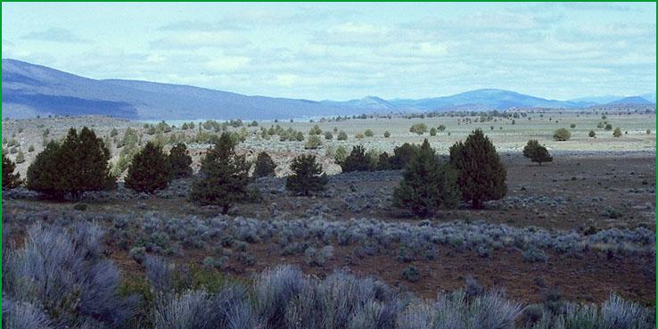
Blacks Mountain - Susanville Peak
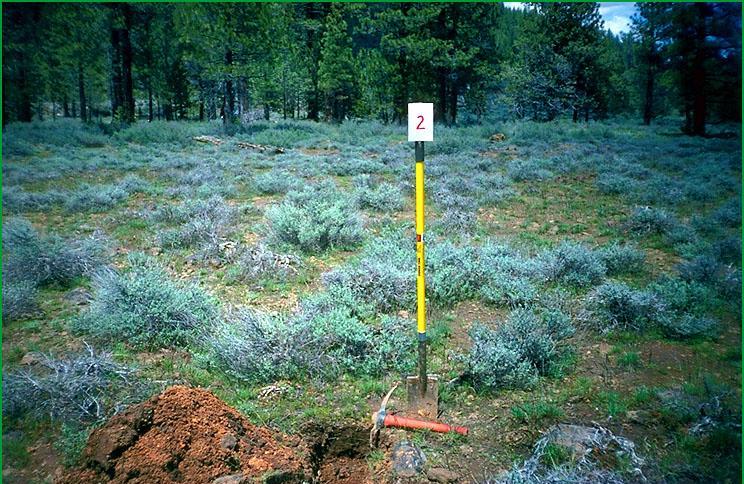
This subsection is on a mountain studded volcanic plateau comprising the southeastern part of the Southern Cascade Ranges. The climate is temperate to cold and subhumid. MLRA 22e.
Lithology and Stratigraphy. Quaternary basalt flows dominate this subsection, except the southeastern corner, which is dominated by Pliocene andesite flows. Also, there is an inlier of Mesozoic granitic rock in the southeastern corner of the subsection. Recent basalt covers Crater Mountain. Fluvial and lacustrine deposits occur in basins that are less than a few thousand acres each.
Geomorphology. Moderately steep to steep shield and composite volcanoes rise above an undulating lava plateau in this subsection. Most of the major faults are aligned toward the north or the northwest. A few cinder cones are scattered across the subsection. Alluvial and lacustrine basin-fill has accumulated in small depressions on lava flows and larger depressions between lava flows. Eolian sand has accumulated on the northeast sides of some of the larger basins. The elevation range is from about 5000 feet up to 7687 feet on Antelope Mountain. Volcanic, tectonic, mass wasting, and fluvial erosion processes predominate, with fluvial and lacustrine deposition in depressions.
Soils. Soils from lower to higher elevations on basalt and andesite are mostly Ultic Argixerolls on undulating plateau, Andic Haploxeralfs and Andic Argixerolls on lower mountain slopes, and Andic Xerumbrepts on higher mountain slopes. Haploxerands occur in cinder deposits. Soils in basins include Dystric Fluventic Xerochrepts, Mollic Haploxeralfs, Aquic Haploxeralfs, Aquic Haploxererts, and Xeric Endoaquerts. The soils are well drained, except somewhat poorly to poorly drained soils in basins. Soil temperature regimes are mostly frigid, with some mesic at lower elevations. Soil moisture regimes are mostly xeric, with some aquic in basins.
Vegetation. The predominant natural plant communities from hotter and drier to wetter and cooler sites are Jeffrey pine - ponderosa pine series, White fir series, and Red fir series. Low sagebrush series occurs on shallow soils and soils with dense subsoils. Curlleaf mountain-mahogany series occurs on very rocky soils. Silver sagebrush series occurs in some drainage-ways and on the margins of some basins. Native grassland communities occur in dry basins and Emergent aquatic communities, including Spikerush series, occur in wet basins.
Characteristic series by lifeform include:
Grasslands: Beaked sedge series, Idaho fescue series, Nebraska sedge series, Sedge series, Spikerush series, Tufted hairgrass series.
Shrublands: Big sagebrush series, Bitterbrush series, Curlleaf mountain-mahogany series, Greenleaf manzanita series, Low sagebrush series, Rubber rabbitbrush series, proposed Silver sagebrush series, Wedgeleaf ceanothus series.
Forests and woodlands: Baker cypress stands, Black oak series, Jeffrey pine series, Jeffrey pine - ponderosa pine series, Ponderosa pine series, White fir series, Red fir series, Washoe pine series.
Climate. The mean annual precipitation is about 20 to 45 inches. Much of the precipitation is snow. Mean annual temperature is about 40░ to 48░ F. The mean freeze-free period is about 50 to 100 days.
Surface Water. Runoff is rapid to moderate on lava flows. Water drains down through joints in the basalt to the ground water reservoir, limiting overland flow of water and development of stream channels. Water that does flow overland drains to ephemerally ponded closed basins, to the Susan River, which is a perennial stream that flows to Honey Lake, or to Pine Creek, which is an intermittent stream that flows to Eagle Lake.
Subsection M261De
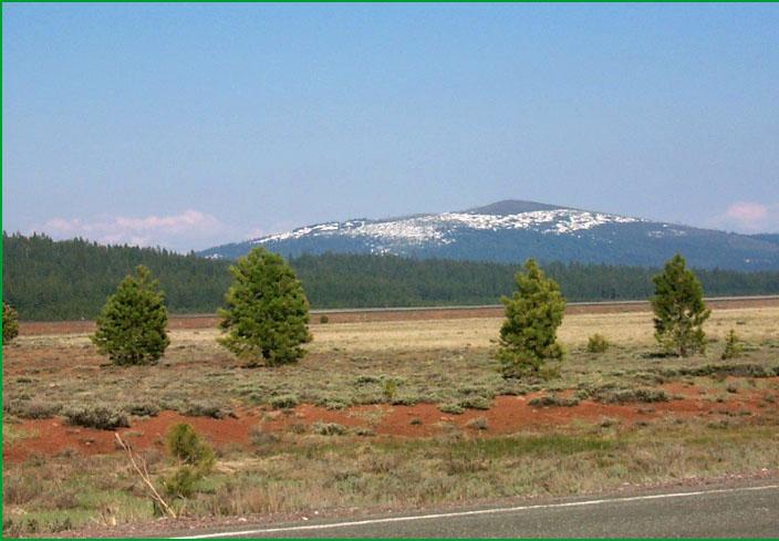
Butte Valley
This subsection corresponds to an intermountain valley floor on the eastern side of the Southern Cascade Ranges. It is northwest of the Medicine Lake Highlands. The climate is temperate and semi-arid. MLRAs 21e and 21f.
Lithology and Stratigraphy. Quaternary alluvial and lacustrine deposits dominate this subsection. Eolian deposits occur on the east side of the valley.
Geomorphology. Nearly level basin floor, largely a lake plain, dominates this subsection. There are very gently to moderately sloping alluvial fans around the margins and dunes on the east side of the basin. Small closed depressions occur among the dunes. The elevation range is about 4230 to 4300 feet. Fluvial, lacustrine, eolian, and freeze-thaw processes predominate.
Soils. Soils are mostly Haplic and Haploxeralfic Natrargids, and Aridic Durixerolls. Torripsamments occur on dunes. The soils are mostly well drained. Soil temperature regimes are mesic. Soil moisture regimes are mostly aridic. Some soils are poorly drained and have been artificially drained.
Vegetation. The predominant natural plant communities are Native grassland communities, Big sagebrush series, Silver sagebrush series, and, on the dunes, Western juniper series.
Characteristic series by lifeform include:
Grasslands: Beaked sedge series, Idaho fescue series, Nebraska sedge series, Sedge series, Tufted hairgrass series.
Shrublands: Big sagebrush series, Bitterbrush series, Low sagebrush series, Rubber rabbitbrush series.
Forests and woodlands: Western juniper series.
Climate. The mean annual precipitation is about 10 to 18 inches. Much of the precipitation is snow. Mean annual temperature is about 44░ to 45░ F. The mean freeze-free period is about 75 to 100 days.
Surface Water. All drainage is internal, to Meiss Lake on the west side of the valley. Most water entering the basin flows in from the High Cascades on the west.
Subsection M261Df
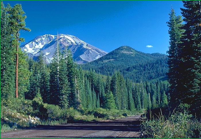
High Cascades
This subsection comprises an area of late Tertiary and Quaternary volcanic rocks that geologists refer to as the High Cascades. The subsection is on the higher parts of the Southern Cascade Ranges from Mt. Shasta northward into Oregon. Also, it extends southeastward to Bear Mountain. The climate is temperate to very cold and subhumid to humid. MLRA 22d.
Lithology and Stratigraphy. Pliocene and Pleistocene basalt and andesite flows dominate this subsection. Recent basalt flows and thick pyroclastic deposits are much less extensive, although volcanic ash has been scattered across entire area. Quaternary glacial till, outwash, and debris flow deposits are extensive on Mt. Shasta and around the foot of the mountain, although debris flow deposits are more widely distributed.
Geomorphology. Steep to moderately steep composite volcanoes dominate this subsection. Many of the volcanoes have cinder cones and plug domes on them. Mt. Shasta is an active stratovolcano that has five main glaciers on it. Pleistocene cirques and moraines are extensive on Mt. Shasta, particularly on the older south side of the mountain. Glacial outwash is extensive around the base of Mt. Shasta, and well beyond the mountain on the northeast side. The elevation range is from about 3000 feet on the southwest side of Mt. Shasta up to 14,162 feet on its summit. Volcanic, mass wasting, fluvial, and glacial processes predominate.
Soils. Soils are mostly Dystric Xerorthents, Andic Xerumbrepts, Typic and Umbric Haploxerands, Pachic Ultic Argixerolls, Typic Haplocryands, and, on Mt. Shasta, Typic Vitricryands. Lithic Argixerolls occur on Recent basalt. Rock and rubble land dominate the upper slopes of Mt. Shasta and the summits of Whaleback, Goosenest, and Ash Creek Butte. On lower slopes of the southwest side of Mt. Shasta, soils are mostly ashy Typic Xeropsamments and Typic Vitrixerands. The soils are well drained. Soil temperature regimes are mostly frigid, with mesic on the lower southwest side of Mt. Shasta and cryic on the upper part of Mt. Shasta and the summits of other high mountains. Soil moisture regimes are xeric.
Vegetation. The predominant natural plant communities, from lower to higher elevations, are Mixed conifer series, White fir series, Red fir series, Mountain hemlock series, and Whitebark pine series. Lodgepole pine series occurs near timberline and in areas where cold air collects. Barren land and Alpine habitat predominate above about 8000 to 8500 feet on Mt. Shasta and Whaleback.
Characteristic series by lifeform include:
Grasslands: Alpine habitat, Beaked sedge series, Green fescue series, Nebraska sedge series, Rocky Mountain sedge series, Tufted hairgrass series.
Shrublands: Bush chinquapin series, Greenleaf manzanita series, Huckleberry oak series, Mountain heather - bilberry series, Mountain whitethorn series, Parry rabbitbrush series, Tobacco brush series, Wedgeleaf ceanothus series.
Forests and woodlands: Douglas-fir series, Incense-cedar series, Lodgepole pine series, Mixed conifer series, Mixed subalpine forest series, Mountain hemlock series, Red fir series, Western white pine series, White fir series, Whitebark pine series.
Climate. The mean annual precipitation is about 20 to 70 inches. Most of the precipitation is snow. Mean annual temperature ranges from less than 30░ to about 50░ F. The mean freeze-free period ranges from less than 25 days to about 150 days.
Surface Water. Runoff is rapid. Much of the water drains through the ground, contributing to springs around the bases of the mountains. Ultimately, water drains to the Sacramento River, the Klamath River, or closed basins on the east side of the subsection. Some of the larger streams, such as Horsethief, Mud, Ash and Butte Creeks, are perennial