 | Greenville - Graeagle-Bucks Lake-Granitic and Metamorphic Hills |
Greenville - Graeagle-Subsection M261Ed, Quincy area Ś Scott Miles |
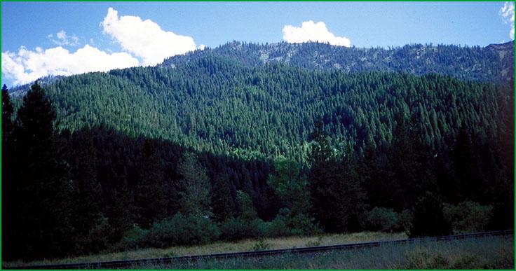
Subsection M261Ed, Quincy area Ś Scott Miles |
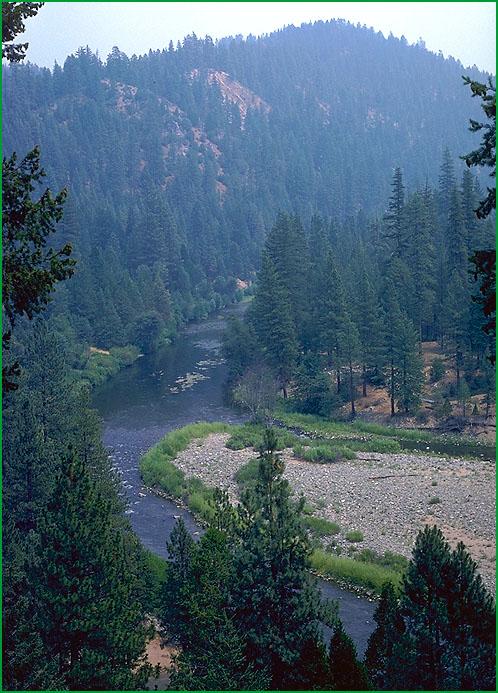
Subsection M261Ed, looking northeast from Greenville Ś Scott Miles |
Subsection M261Ed, looking northeast from Greenville Ś Scott Miles |
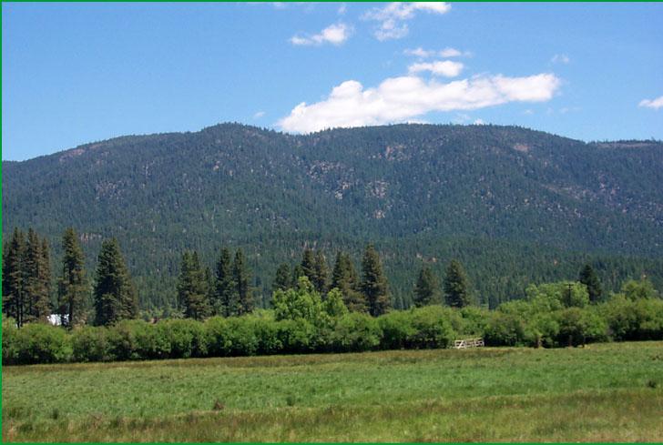
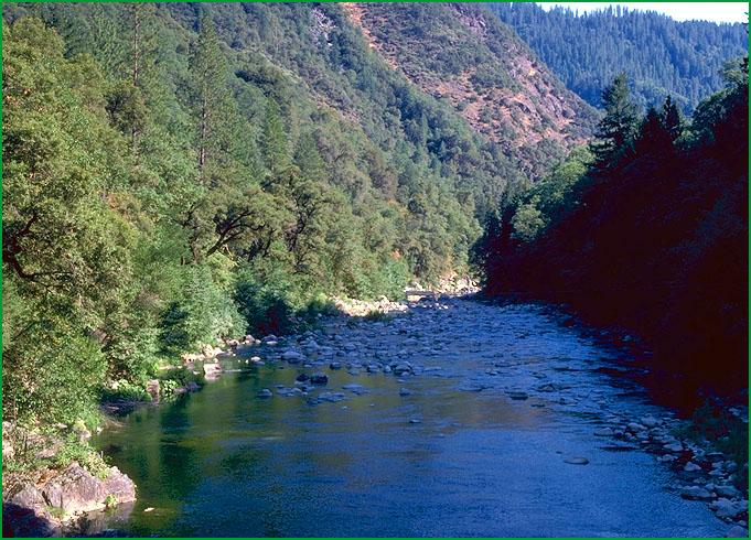
Granitic and Metamorphic Hills-Subsection M261Ef, Middle Fork of Feather River area Ś James R. Nelson |
Subsection M261Ef, Middle Fork of Feather River Ś James R. Nelson |
http://www.fs.fed.us/r5/projects/ecoregions/m261ed.htm
Subsection M261Ed
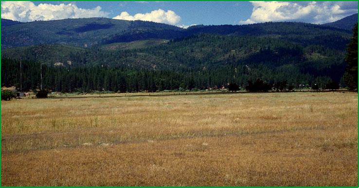
Greenville - Graeagle
This subsection extends from the northwestern edge of the Sierra Nevada, adjacent to Lake Almanor, along the Plumas Trough to Mohawk Valley. It has a temperate to cold, subhumid to humid climate. MLRAs 22d and 22e.
Lithology and Stratigraphy. Strongly folded basement rocks predominate in this subsection. They include Triassic marine sedimentary and Paleozoic marine sedimentary and metavolcanic rocks. There is a large intrusion of Mesozoic ultramafic rock in the Red Hill area. Quaternary alluvial and lacustrine deposits are moderately extensive in Indian, Genessee, Meadow, American, and Mohawk Valleys.
Geomorphology. Steep mountain and moderately steep hill slopes in the Plumas trough and on both sides of it predominate in this subsection. Alluvial fans, floodplains, terraces, and basin floors are moderately extensive. The Plumas trough is an active northwest trending tectonic zone that separates the main part of the Sierra Nevada on the southwest from the block faulted part of the Sierra Nevada on the northeast. The elevation ranges from about 2500 feet along the Feather River up to 6341 feet on Red Hill and 6362 feet on Rush Creek Hill. Faulting, mass wasting, and fluvial erosion and deposition are the main geomorphic processes.
Soils. The soils are mostly Ultic Haploxeralfs, Dystric Lithic Xerochrepts, Ultic Palexeralfs, and Typic Haploxerults. They are mostly Lithic Haploxerolls, Typic Xerochrepts, and Ultic Haploxeralfs on ultramafic rocks. There are Cumulic Endoaquolls and Typic and Cumulic Haplaquolls on basin floors. The soils are mostly well drained, but mostly poorly drained on basin floors. Soil temperature regimes are mostly mesic. Soil moisture regimes are mostly xeric, but aquic on basin floors.
Vegetation. The predominant natural plant community is Mixed conifer series with Ponderosa pine series on south-facing slopes and Jeffrey pine series on ultramafic rocks. Jeffrey pine series is also common in the drier southeast part of the subsection. There is some White fir series at higher elevations. Canyon live oak series occurs on steep rocky slopes. The most common streamside riparian communities are Black cottonwood series in the northwestern part and White alder series in the southeastern part of the subsection. Sedge meadow communities occur in wet areas.
Characteristic series by lifeform include:
Grasslands: Ashy ryegrass series, California oatgrass series, Darlingtonia series, Idaho fescue series, Montane meadow habitat, Needle-and-thread series.
Shrublands: Birchleaf mountain-mahogany series, Bush chinquapin series, Deerbrush series, Greenleaf manzanita series, Huckleberry oak series, Interior live oak series, Mountain whitethorn series, Tobacco brush series, Wedgeleaf ceanothus series.
Forests and woodlands: Birchleaf mountain-mahogany series, Black oak series, Canyon live oak series, Douglas-fir series, Douglas-fir - Ponderosa pine series, Douglas-fir - tanoak series, Incense-cedar series, Jeffrey pine series, Jeffrey pine - Ponderosa pine series, Mixed conifer series, Ponderosa pine series, Red fir series, White fir series.
Climate. The mean annual precipitation is about 30 to 60 inches; much of it falls as snow. Mean annual temperature is about 45░ to 55░ F. The mean freeze-free period is about 75 to 150 days.
Surface Water. Runoff is rapid from most of the area, but slow on basin floors. Most of the runoff flows to the Feather River or its tributaries. The Feather River flows across the Sierra Nevada to the Sacramento Valley.
Subsection M261Ee
Bucks Lake
This subsection is the higher part of a granitic pluton and surrounding rocks in the vicinity of Bucks Lake. It has a temperate to cold, humid climate. MLRAs 22c and 22d.
Lithology and Stratigraphy. Mesozoic granitic rocks predominate in this subsection. Also, there are Paleozoic marine sedimentary and metavolcanic rocks. Quaternary alluvium and glacial till are present, but not extensive.
Geomorphology. This subsection is on a gently sloping to moderately steep plateau that is bisected by the North Fork of the Feather River. The North Fork has cut across the plateau and runs in the bottom of a very steep sided canyon, about 2000 to 4000 feet below the plateau surface. Higher parts of the plateau and the northern edge of it were glaciated during the Pleistocene. The elevation ranges from about 2000 feet along Feather River up to 7176 feet on Bald Eagle Hill. Fluvial erosion and, in the Feather River canyon, mass wasting are the main geomorphic processes.
Soils. The soils on granitic rocks are mostly Dystric, Lithic, and shallow Typic Xeropsamments and Typic and Dystric Xerochrepts. On other kinds of rocks they are mostly Dystric Xerochrepts; Andic Xerumbrepts; Lithic Ultic and Ultic Haploxerolls; and Ultic Haploxeralfs. The soils are well drained. Soil temperature regimes are frigid on the plateau and mostly mesic in the canyon of the Feather River. Soil moisture regimes are mostly xeric.
Vegetation. The predominant natural plant communities are Mixed conifer series and White fir series. Jeffrey pine series is common in glacially eroded, or scoured, terrain. There is some Red fir series at higher elevations. Huckleberry oak series occurs on very stony colluvium, or talus. Wet areas with Sedge meadow communities and Mountain alder series or Lodgepole pine series are common, but not extensive.
Characteristic series by lifeform include:
Grasslands: Ashy ryegrass series, Green fescue series, Idaho fescue series, Montane meadow habitat, Nebraska sedge series, Needle-and-thread series, Rocky Mountain sedge series.
Shrublands: Bush chinquapin series, Deerbrush series, Greenleaf manzanita series, Huckleberry oak series, , Mountain whitethorn series, Tobacco brush series, Wedgeleaf ceanothus series.
Forests and woodlands: Douglas-fir series, Douglas-fir - Ponderosa pine series, Douglas-fir - tanoak series, Incense-cedar series, Jeffrey pine series, Lodgepine pine series, Mixed conifer series, Red fir series, Western white pine series, White fir series.
Climate. The mean annual precipitation is about 60 to 90 inches. Much of the precipitation is snow; it is mostly snow on the high plateau. Mean annual temperature is about 40░ to 55░ F. The mean freeze-free period is about 50 to 150 days.
Surface Water. Runoff is rapid from most of the area. Most of the runoff flows to the North Fork of the Feather River or its tributaries. There are some small lakes, or ponds, in the glaciated terrain, and a large reservoir (Bucks Lake).
Subsection M261Ef
Granitic and Metamorphic Hills
This subsection is the low to intermediate elevations of the western slope of the Sierra Nevada where it is crossed by the Feather and Yuba Rivers. It has a temperate and humid climate. MLRA 22c.
Lithology and Stratigraphy. Mesozoic granitic rocks and Jurassic - Triassic metavolcanic rocks are most extensive in this subsection. Paleozoic marine sedimentary, ultramafic, and mafic plutonic rocks are moderately extensive. There are small areas of basalt and andesite in the northern part of the subsection, and andesitic lahar along the southeastern edge of the subsection. Quaternary alluvium and glacial till are present, but not extensive.
Geomorphology. This subsection is on a gently sloping to moderately steep plateau that is crossed by the North, Middle, and South Forks of the Feather River and the North Yuba, Middle Yuba, and South Yuba Rivers. These rivers run in the bottom of very steep sided canyons that are as much as 2000 feet below the plateau surface. The elevation ranges from about 1000 feet up to 6095 feet on Table Mountain, but most of the rolling plateau is below 5000 feet in this subsection. Fluvial erosion and, in the river canyons, mass wasting are the main geomorphic processes.
Soils. The soils are mostly Typic, Dystric, and shallow Dystric Xerochrepts; Mollic and Ultic Haploxeralfs; Lithic Xeropsamments; and shallow Entic Haploxerolls on granitic rocks; plus Typic Haploxerults; Xeric Haplohumults; Lithic and Dystric Lithic Xerochrepts; and Ultic Palexeralfs on other kinds of rocks. The soils are well drained. Soil temperature regimes are mostly mesic. Soil moisture regimes are xeric.
Vegetation. The predominant natural plant community is Mixed conifer series. Douglas-fir - tanoak series is common in areas of greater precipitation. There is some Ponderosa pine series at lower elevations, Canyon live oak series on very steep, rocky canyon sideslopes, and Mixed chaparral shrublands on steep south-facing slopes with shallow soils.
Characteristic series by lifeform include:
Grasslands: Ashy ryegrass series, California oatgrass series, Idaho fescue series, Montane meadow habitat, Needle-and-thread series.
Shrublands: Brewer oak series, Chamise series, Deerbrush series, Greenleaf manzanita series, Interior live oak series, Tobacco brush series, Wedgeleaf ceanothus series.
Forests and woodlands: Birchleaf mountain-mahogany series, Black oak series, Canyon live oak series, Douglas-fir series, Douglas-fir - Ponderosa pine series, Douglas-fir - tanoak series, Incense-cedar series, Mixed conifer series, Ponderosa pine series, Tanoak series.
Climate. The mean annual precipitation is about 40 to 80 inches; much of it falls as snow. Mean annual temperature is about 45░ to 60░ F. The mean freeze-free period is about 100 to 200 days.
Surface Water. Runoff is rapid from most of the area. Most of the runoff flows to the Feather River or Yuba River or tributaries of them. There are no natural lakes, but some reservoirs.