 | Upper Foothills Metamorphic Belt- Upper Batholith and Volcanic Flows-Sierra Valley |
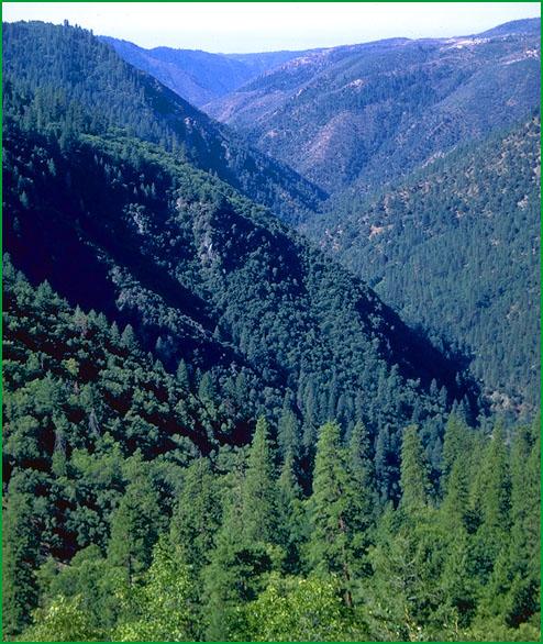
Upper Foothills Metamorphic Belt-Subsection M261Eg, North Fork of Middle Fork of American River area Ś Robert Ettner |
Subsection M261Eg, Shuteye Peak from Katie Dome Ś USDA |
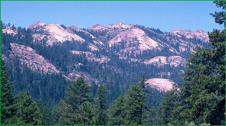
Upper Batholith and Volcanic Flows-Subsection M261Eh, Grouse Ridge area northwest of Cisco Grove Ś Howdy Goudey |
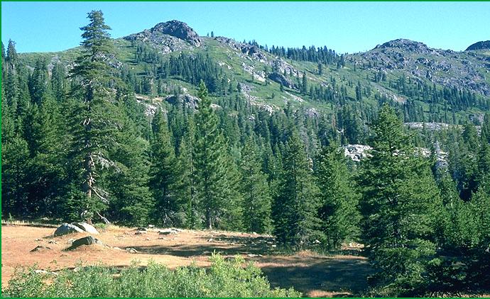
Subsection M261Eh, near Strawberry Peak Ś Howdy Goudey |
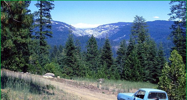
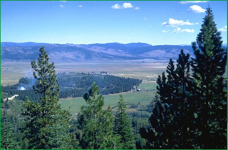
Sierra Valley-Subsection M261Ei, Sierra Valley north of Sierraville Ś Robert Ettner |
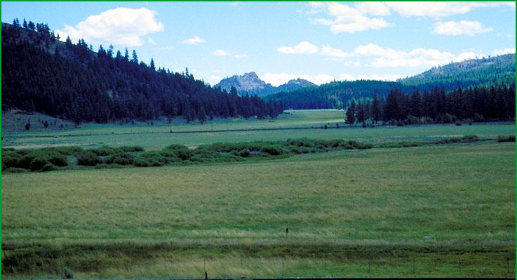
Subsection M261Ei, Sierra Valley looking west toward Graeagle Ś Scott Miles |
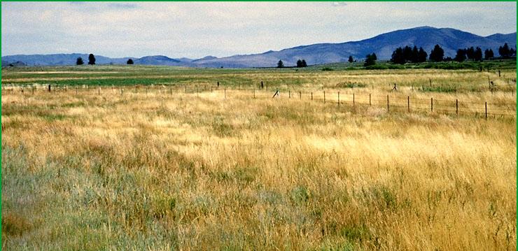
Subsection M261Ei, west side of Sierra Valley looking east Ś Scott Miles |
http://www.fs.fed.us/r5/projects/ecoregions/m261eg.htm
Subsection M261Eg
Upper Foothills Metamorphic Belt
This subsection is the intermediate elevations of the western slope of the Sierra Nevada where it is crossed by the Yuba, American, Cosumnes, Mokelumne, Stanislaus, and Tuolumne Rivers. It has a temperate and humid climate. MLRAs 22c and 22d.
Lithology and Stratigraphy. Metamorphosed Paleozoic marine sedimentary rocks predominate in this subsection; they are in the Shoo Fly and Calaveras Complexes. Also, Mesozoic granitic and late Tertiary volcanic rocks are moderately extensive, and there are some Jurassic - Triassic metavolcanic and Jurassic marine sedimentary rocks. The volcanic rocks are mostly Miocene and Pliocene lahars. There is a strip of ultramafic rocks along the west side of the Melones Fault Zone and a few patches of them east of the fault zone.
Geomorphology. This subsection is on a gently sloping to moderately steep plateau that is crossed by the Yuba, American, Cosumnes, Mukelumne, Stanislaus, and Tuolumne Rivers. These rivers and the north, south, and middle forks of them run in the bottoms of very steep sided canyons that are as much as 2000 feet below the plateau surface. The elevation ranges about 2000 to 7000 feet, but is mostly below 6000 feet. Fluvial erosion and, in the river canyons, mass wasting are the main geomorphic processes.
Soils. The soils are mostly Typic Haploxerults and Dystric and Dystric Lithic Xerochrepts on sedimentary and metamorphic rocks. The Dystric Lithic Xerochrepts are mostly on steep canyon sideslopes. Soils on granitic rocks are mostly Ultic Haploxeralfs; Dystric and shallow Dystric Xerochrepts; and Entic Xerumbrepts. Soils on volcanic rocks are mostly Andic and Lithic Xerumbrepts; Ultic Haploxeralfs; and Xeric Haplohumults. Mollic Haploxeralfs predominate on ultramafic rocks. The soils are well drained. Soil temperature regimes are mostly mesic. Soil moisture regimes are xeric.
Vegetation. The predominant natural plant communities are Mixed conifer series and, at lower elevations, Ponderosa pine series. There is some White fir series at higher elevations, Canyon live oak series on very steep, rocky canyon sideslopes, and Mixed chaparral shrublands on steep south-facing slopes with shallow soils. The northernmost grove of trees in the Giant sequoia series is in this subsection.
Characteristic series by lifeform include:
Grasslands: Ashy ryegrass series, California oatgrass series, Idaho fescue series, Montane meadow habitat, Needle-and-thread series.
Shrublands: Brewer oak series, Chamise series, Deerbrush series, Greenleaf manzanita series, Interior live oak series, Tobacco brush series, Wedgeleaf ceanothus series.
Forests and woodlands: Birchleaf mountain-mahogany series, Black oak series, Canyon live oak series, Douglas-fir series, Douglas-fir - Ponderosa pine series, Douglas-fir - tanoak series, Incense-cedar series, Knobcone pine series, Mixed conifer series, Ponderosa pine series, Sequoia series, Tanoak series, White fir series.
Climate. The mean annual precipitation is about 40 to 80 inches. Much of the precipitation is snow; it is mostly snow above about 4000 feet. Mean annual temperature is about 45░ to 55░ F. The mean freeze-free period is about 100 to 150 days.
Surface Water. Runoff is rapid from most of the area. Most of the runoff flows to the Yuba, American, Cosumnes, Mukelumne, Stanislaus, or Tuolumne Rivers or tributaries of them. Maximum flow in these rivers is much later than that in tributaries that head within the subsection, because of snow melt at higher elevation east of this subsection. There are no natural lakes, but some reservoirs.
Subsection M261Eh
Upper Batholith and Volcanic Flows
This subsection is the moderately high elevations of the western slope of the Sierra Nevada. It is just west of a fault zone from Mohawk Valley, which is in the Plumas Trough, to Lake Tahoe; and it is west of the crest of the Sierra Nevada south of Lake Tahoe as far as the Middle Fork of the Stanislaus River. It has a cold and humid climate. MLRAs 22d and 22e.
Lithology and Stratigraphy. Mesozoic granitic and post-batholith volcanic rocks predominate in this subsection, but pre-batholith rocks are common, too. The volcanic rocks are mostly Miocene and Pliocene andesitic lahars of the Mehrten Formation. The pre-batholith rocks are mostly metamorphosed Paleozoic and Jurassic marine sedimentary and volcanic rocks. Pleistocene glacial till and outwash are common and there are small areas of Quaternary alluvial and lacustrine deposits.
Geomorphology. This subsection is on a gently sloping to moderately steep plateau with steep canyon slopes. Glacial erosion has modified the valleys in at least the higher parts of the subsection. Several large rivers between the Feather and Stanislaus Rivers head in or cross the subsection. Some of these rivers flow in the bottoms of very steep sided canyons. Many canyons U-shaped from glacial erosion. The elevation ranges from about 4000 or 5000 to 8000 feet, and up to 8587 feet on Sierra Buttes and 9006 feet on Granite Chief. Mass wasting and fluvial erosion are the main geomorphic processes.
Soils. The soils are mostly Entic, Lithic, Typic, Andic, and Pachic Xerumbrepts; Dystric Xeropsamments; and Dystric Xerochrepts. There are some Cryumbrepts at the highest elevations. The soils are mostly well drained. Soil temperature regimes are mostly frigid, but some are cryic. Soil moisture regimes are mostly xeric. Soils have udic moisture regimes where snow persists through spring, and melts to keep soils moist well into the summer. Soils with aquic moisture regimes are present in glaciated terrain and small valleys.
Vegetation. The predominant natural plant communities are, from lower to higher elevations, Mixed conifer series, White fir series, and Red fir series. Jeffrey pine series occurs on shallow and rocky soils. There are a few small patches of Mountain hemlock series at higher elevations. Lodgepole pine series prevails on many wet soils and on drier soils where cold air drainage and frost limit the regeneration of other conifers. Aspen series and Mountain alder series are common in riparian or wet areas. Sedge meadow communities are common, but they are not extensive.
Characteristic series by lifeform include:
Grasslands: Alpine habitat, Breaked sedge series, Fen habitat, Green fescue series, Montane meadow habitat, Nebraska sedge series, Rocky Mountain sedge series, Shorthair reedgrass series, Shorthair sedge series.
Shrublands: Bush chinquapin series, Greenleaf manzanita series, Huckleberry oak series, Mountain whitethorn series, Tobacco brush series.
Forests and woodlands: Aspen series, Jeffrey pine series, Mixed conifer series, Mountain hemlock series, Red fir series, Western white pine series, White fir series, Whitebark pine series.
Climate. The mean annual precipitation is about 40 to 80 inches; most of it falls as snow. Mean annual temperature is about 35░ to 50░ F. The mean freeze-free period is about 25 to 100 days.
Surface Water. Runoff is rapid from most of the area. Most of the runoff flows to the Feather, Yuba, American, Cosumnes, Mukelumne, or Stanislaus Rivers or their tributaries. Some flows from the eastern margin of the subsection to the Truckee River. Maximum flow in these rivers is during spring when snow melt is rapid. There are many small natural lakes or ponds in glaciated terrain, and some reservoirs
Subsection M261Ei
Sierra Valley
This subsection comprises Sierra Valley, which is in the block-faulted part of the Sierra Nevada, at the head of the Middle Fork of the Feather River. It has a temperate, semi-arid to subhumid climate. MLRA 21e.
Lithology and Stratigraphy. Quaternary lacustrine deposits dominate this subsection. There are small areas of Quaternary alluvial deposits around the margins of Sierra Valley and in tributary valleys.
Geomorphology. Most of the subsection is on nearly level basin floor that was occupied by a shallow Pleistocene lake. There are sloping to nearly level alluvial fans and floodplains around the margins of the basin and in tributary valleys. The elevation ranges from about 4900 feet on the basin floor up to about 5400 feet on alluvial fans. Faulting and fluvial erosion and deposition are the main geomorphic processes.
Soils. The soils are mostly Pachic and Aquic Argixerolls, Aridic Haploxerolls, Typic Haplaquolls, and Aquic Natrargids, plus Abruptic Xerollic Durargids on alluvial fans on the east side of the valley. The soils are well to poorly drained. Soil temperature regimes are mesic. Soil moisture regimes are xeric on the west side, commonly aquic on the basin floor, and aridic on the east side of the valley.
Vegetation. The predominant natural plant communities are Big sagebrush series and Sedge meadow communities. Jeffrey pine series occurs on the south and west margins of Sierra Valley.
Characteristic series by lifeform include:
Grasslands: Ashy ryegrass series, Breaked sedge series, Idaho fescue series, Montane meadow habitat, Needle-and-thread series, Rocky Mountain sedge series.
Shrublands: Big sagebrush series, Bitterbrush series, Low sagebrush series, Parry rabbitbrush series, Rubber rabbitbrush series.
Forests and woodlands: Aspen series, Jeffrey pine series.
Climate. The mean annual precipitation is about 10 to 25 inches; most of it falls as snow. Mean annual temperature is about 45░ to 48░ F. The mean freeze-free period is about 50 to 100 days.
Surface Water. Runoff is slow from most of the area. The runoff flows through the Middle Fork of the Feather River