 | Tahoe - Truckee-Glaciated Batholith and Volcanic Flows-Tahoe Valley |
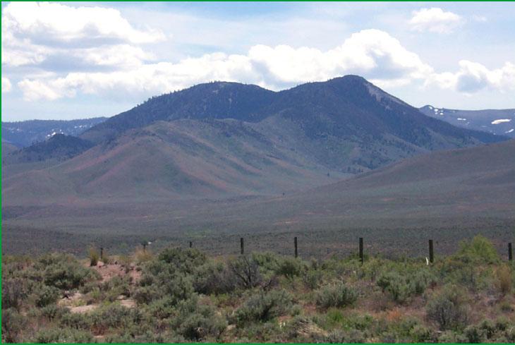
Tahoe - Truckee-Subsection M261Ej, Hallelujah Junction area Ś Scott Miles |
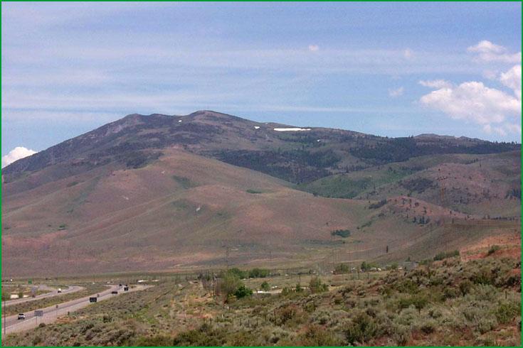
Subsection M261Ej, Bordertown area Ś Scott Miles |
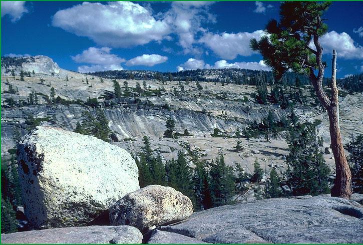
Glaciated Batholith and Volcanic Flows-Subsection M261Ek, Silver Lake area Ś James R. Nelson |
Subsection M261Ek, Leavitt Creek Ś USDA |
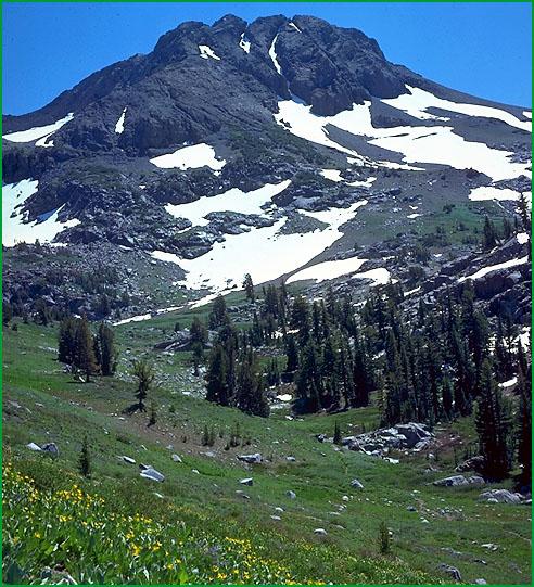
Subsection M261Ek, Carson Pass looking south to Round Top Ś James R. Nelson |
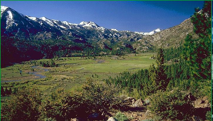
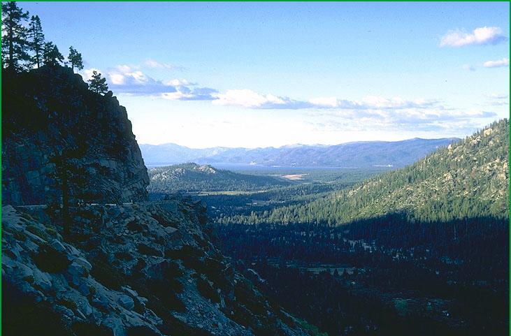
Tahoe Valley-Subsection M261El, Upper Truckee River area from Echo Summit Ś Robert Ettner |
http://www.fs.fed.us/r5/projects/ecoregions/m261ej.htm
Subsection M261Ej
Tahoe - Truckee
This subsection is near the southern end of the block-faulted northeastern part of the Sierra Nevada. It is between Sierra Valley and Lake Tahoe. It has a cold and semi-arid to humid climate. MLRA 22e.
Lithology and Stratigraphy. Cenozoic volcanic rocks predominate in this subsection. There are some Mesozoic granitic rocks, Jurassic marine sedimentary rocks, and Jurassic and older metavolcanic rocks. The Cenozoic volcanic rocks are mostly Pliocene andesite, basalt and pyroclastic rocks and Pleistocene basalt. Pleistocene glacial till and outwash are common and there are small areas of Quaternary alluvial and lacustrine deposits.
Geomorphology. This subsection is on a gently sloping to moderately steep plateau with some steep mountains that is dissected by streams in canyons that have steep to very steep sideslopes. Most of the canyons on the west side of the subsection have been modified by glacial erosion and are U-shaped there. The elevation ranges from about 5000 along the Truckee River and adjacent to Sierra Valley up to 9143 feet on Mt. Lola. Faulting, mass wasting, and fluvial erosion and deposition are the main geomorphic processes.
Soils. The soils are mostly Ultic and Mollic Haploxeralfs; Lithic Ultic Haploxerolls; Ultic and Lithic Ultic Argixerolls; Andic Xerochrepts; and Andic Xerumbrepts. There are some Cryumbrepts at the highest elevations. Soils on granitic rocks are mostly Entic Haploxerolls and shallow Typic Xeropsamments, but they are not extensive. Soils on glacial till are mostly Pachic, Entic, and Typic Xerumbrepts. The soils are mostly well drained, but some on basin floors are somewhat poorly drained. Soil temperature regimes are mostly frigid, but some are cryic. Soil moisture regimes are mostly xeric. Soils with aquic moisture regimes are present in glaciated terrain and small valleys, but they are not extensive.
Vegetation. The predominant natural plant communities are Ponderosa pine series, Mixed conifer series, White fir series, Red fir series, and Big sagebrush series. Jeffrey pine series is common in drier areas on shallow and rocky soils. There are a few small patches of Mountain hemlock series at the highest elevations. Lodgepole pine series prevails on many wet soils and on drier soils where cold air drainage and frost limit the regeneration of other trees. Sedge meadow communities are common, but they are not extensive. Black cottonwood series is common in riparian areas and there is some Aspen series.
Characteristic series by lifeform include:
Grasslands: Alpine habitat, Ashy ryegrass series, Breaked sedge series, Fen habitat, Idaho fescue series, Montane meadow habitat, Needle-and-thread series, Rocky Mountain sedge series, Shorthair reedgrass series, Shorthair sedge series.
Shrublands: Big sagebrush series, Bitterbrush series, Low sagebrush series, Parry rabbitbrush series, Rubber rabbitbrush series.
Forests and woodlands: Aspen series, Jeffrey pine series, Lodgepole pine series, Mixed conifer series, Mountain hemlock series, Ponderosa pine series, Red fir series, Washoe pine series, Western white pine series, White fir series, Whitebark pine series.
Climate. The mean annual precipitation is about 20 to 40 inches; most of it falls as snow. Mean annual temperature is about 35░ to 45░ F. The mean freeze-free period is about 25 to 75 days.
Surface Water. Runoff is rapid from most of the area. Most of it flows to the Truckee River, but runoff from the northern part of the subsection flows to Sierra Valley, which is at the head of the Middle Fork of the Feather River. Maximum flow in these rivers is during spring when snow is melting rapidly. There are many small and a few large natural lakes or ponds in glaciated terrain, and some reservoirs
Subsection M261Ek
Glaciated Batholith and Volcanic Flows
This subsection is along the crest of the Sierra Nevada from the Crystal Range southwest of Lake Tahoe to Kennedy Peak just south of Sonora Pass. It has a cold to very cold and humid climate. MLRA 22e.
Lithology and Stratigraphy. Mesozoic granitic and post-batholith volcanic rocks predominate in this subsection; pre-batholith rocks are sparse. Mesozoic mafic plutonic rocks are common. The volcanic rocks are mostly Pliocene andesite and lahars of the Mehrten Formation. The pre-batholith rocks are mostly metamorphosed Jurassic marine sedimentary and early Mesozoic volcanic rocks. Pleistocene glacial till and outwash are common and there are small areas of Quaternary alluvial and lacustrine deposits.
Geomorphology. This subsection is characterized by steep mountains that rise above the plateau west of the crest and have deep V- to U-shaped canyons. Glacial erosion has modified most of the landforms. Cirques, aretes, cols, horns, and smooth, striated bedrock are common. The moraines have been modified by fluvial erosion. Some of the rivers flow in the bottoms of very steep sided canyons. The elevation ranges from about 7000 up to 11,570 feet on Leavitt Peak. Mass wasting and fluvial erosion are the main geomorphic processes.
Soils. The soils are mostly Dystric Xeropsamments; Entic, Typic, and Pachic Xerumbrepts; and Cryumbrepts. Much of the granitic rock is barren, lacking soil. There are Andic and Lithic Cryumbrepts on volcanic rocks. The soils are mostly well drained. Soil temperature regimes are mostly frigid and cryic. Soil moisture regimes are mostly xeric. Soils have udic moisture regimes where snow persists through spring, melting to keep soils moist through much of the summer. Soils with aquic moisture regimes are present in glaciated terrain and small valleys, but they are not extensive.
Vegetation. Most of this subsection is sparsely vegetated. The main natural plant communities are Mixed subalpine forest series and Red fir series and communities of Subalpine meadow habitats. Jeffrey pine series is common on shallow and rocky soils. There are a few small patches of Mountain hemlock series at high elevations, and Aspen series occurs at lower elevations. Lodgepole pine series prevails on many wet soils and on drier soils where cold air drainage and frost limit the regeneration of other conifers. Aspen series is common where drifted snow accumulates and provides water during summer. Sedge meadow communities are common, but they are not extensive.
Characteristic series by lifeform include:
Grasslands: Alpine habitat, Breaked sedge series, Fen habitat, Green fescue series, Montane meadow habitat, Mountain heather - bilberry series, Nebraska sedge series, Rocky Mountain sedge series, Rothrock sagebrush series, Shorthair reedgrass series, Shorthair sedge series, Subalpine meadow habitat.
Shrublands: Bush chinquapin series, Greenleaf manzanita series, Huckleberry oak series, Mountain whitethorn series, Subalpine upland shrub habitat, Subalpine wetland shrub habitat, Tobacco brush series.
Forests and woodlands: Aspen series, Lodgepole pine series, Mixed subalpine forest series, Mountain hemlock series, Red fir series, Western white pine series, Whitebark pine series.
Climate. The mean annual precipitation is about 40 to 60 inches; most of it falls as snow. Mean annual temperature is about 30░ to 40░ F. The mean freeze-free period ranges from less than 25 to about 50 days.
Surface Water. Runoff is rapid from most of the area. Most of the runoff flows to the American, Cosumnes, Mukelumne, or Stanislaus Rivers on the west or to Lake Tahoe or the Carson or Walker Rivers on the east. Maximum flow in these rivers is during spring when snow is melting rapidly. There are many small natural lakes or ponds in glaciated terrain, and some reservoirs.
Subsection M261El
Tahoe Valley
This subsection is a valley at the southern end of Lake Tahoe. It has a cold subhumid climate. MLRA 22e.
Lithology and Stratigraphy. Quaternary glacial till, outwash, lacustrine deposits, and alluvium dominate this subsection. A small hill of Mesozoic granitic and Jurassic marine sedimentary rocks sticks up through the Quaternary deposits.
Geomorphology. The main landforms are gently sloping to moderately steep glacial moraines and nearly level to very gently sloping outwash plain, lake plain, floodplain, and alluvial fans. The elevation ranges from 6230 feet along the shore of Lake Tahoe up to about 7500 feet. Fluvial and lacustrine erosion and deposition are the main geomorphic processes.
Soils. The soils are mostly Entic and Pachic Xerumbrepts on till and Alfic Xeropsamments, Entic Xerumbrepts, and Aquic Cryumbrepts on alluvial deposits. The soils are mostly well to somewhat poorly drained with some poorly drained soils. Soil temperature regimes are mostly frigid, but cryic in somewhat poorly drained soils. Soil moisture regimes are mostly xeric, with some aquic.
Vegetation. The predominant natural plant communities on well drained soils are Jeffrey pine series and White fir series, with the latter increasing in dominance toward the west. Sedge meadow communities and Willow thickets predominate in wet areas, with Lodgepole pine series around the margins of wet areas. Aspen series occurs in moist habitats.
Characteristic series by lifeform include:
Grasslands: Ashy ryegrass series, Breaked sedge series, Idaho fescue series, Montane meadow habitat, Needle-and-thread series, Rocky Mountain sedge series.
Shrublands: Big sagebrush series, Bitterbrush series, Low sagebrush series, Rubber rabbitbrush series.
Forests and woodlands: Aspen series, Jeffrey pine series, Lodgepole pine series, White fir series.
Climate. The mean annual precipitation is about 20 to 30 inches; most of it falls as snow. Mean annual temperature is about 40░ to 45░ F. The mean freeze-free period is in the range from 50 to 75 days.
Surface Water. Runoff is slow from most of the area. The runoff flows to Lake Tahoe, which is drained by the Truckee River