 | Tehachapi - Piute Mountains-Carson Range-Kern Plateau |
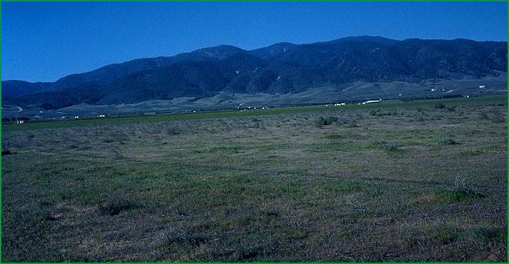
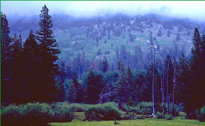
Tehachapi - Piute Mountains-Subsection M261Es, near Tehachapi Ś Charles B. Goudey |
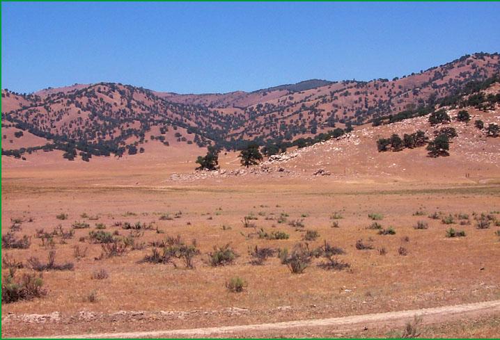
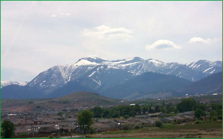
Subsection M261Es, area around the town of Tehachapi Ś Scott Miles |
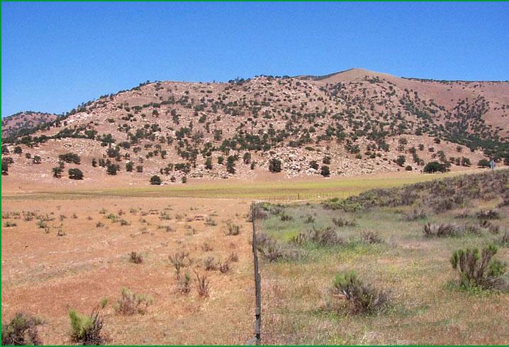
Subsection M261Es, area around the town of Tehachapi Ś Scott Miles |
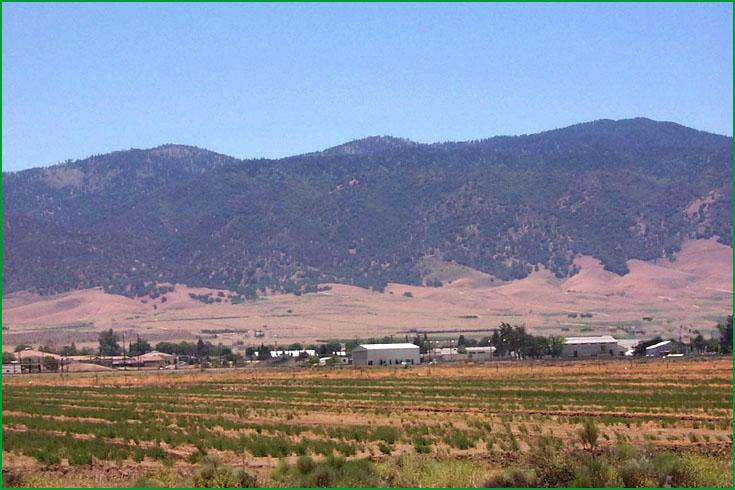
Subsection M261Es, area around the town of Tehachapi Ś Scott Miles |
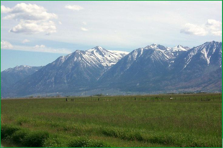
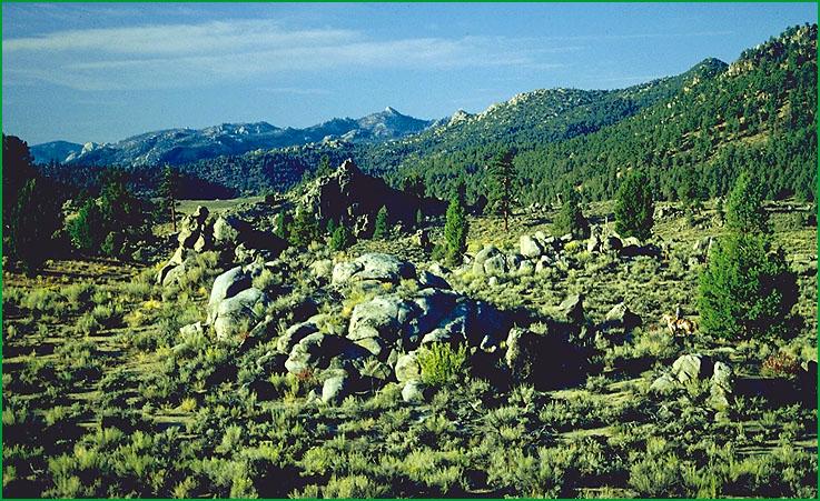
Carson Range-Subsection M261Et, Fountain Place area Ś James R. Nelson |
Subsection M261Et, area north of Carson City, Nevada Ś Scott Miles |
Subsection M261Et, area south of Gardnerville Ś Scott Miles |
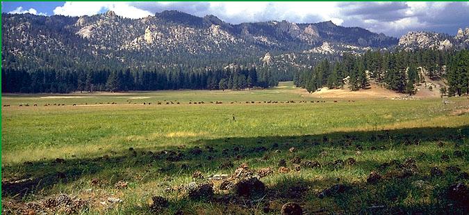
Kern Plateau-Subsection M261Eu, Manter Meadow area on Kern Plateau Ś Robert Ettner |
Subsection M261Eu, Kern River watershed Ś USDA |
http://www.fs.fed.us/r5/projects/ecoregions/m261es.htm
Subsection M261Es
Tehachapi - Piute Mountains
This subsection is the southern end of the Sierra Nevada. It includes most of the Tehachapi and Piute Mountains. It has a hot to cold and semi-arid to subhumid climate. MLRAs 18e and 22d.
Lithology and Stratigraphy. Mesozoic granitic rocks predominate in this subsection, but there are some areas of pre-batholith metamorphic rocks. There is a large area post-batholith volcanic rocks, mostly Miocene and Pliocene, on and around Emerald Mountain. Quaternary alluvium is extensive in Walker, Tehachapi, Cummings, and Bear Valleys.
Geomorphology. This subsection is characterized by steep mountains. Many ridges are slightly elongated with many different orientations, but those in the Piute Mountains are generally aligned near north-south and those in the Tehachapi Mountains are generally aligned near east-west. There is a small area of rolling plateau surface above 6000 feet in the Piute Mountains. Slopes are gently sloping to moderately steep on Quaternary volcanic rocks, which are not extensive, and nearly level to moderately sloping on Quaternary alluvial fans and basin floors. The elevation ranges from about 3500 up to 7981 feet on Double Mountain in the Tehachapi Mountains and 8318 feet in the Piute Mountains. Mass wasting and fluvial erosion are the main geomorphic processes.
Soils. The soils are mostly Typic and Pachic Haploxerolls and Lithic and Typic Argixerolls. There are Umbrepts at higher elevations in the Piute Mountains, but they are not extensive. Soils are mostly Xeric Torripsamments and Xeralfic Haplargids in Walker Basin and Mollic Xerofluvents and Typic and Pachic Argixerolls in the other large valleys. The soils are well drained. Soil temperature regimes are mostly thermic and mesic, but frigid at the highest elevations. Soil moisture regimes are mostly xeric, but aridic in Walker Basin.
Vegetation. The predominant natural plant communities are Blue oak series, and Singleleaf pinyon series on the southeast edge of the subsection and north of Walker Basin. Canyon live oak series is common on very steep rocky slopes and Mixed chaparral shrublands are common on shallow soils. There is some Ponderosa pine series on Breckenridge Mountain and some Jeffrey pine series and White fir series in the higher parts of the Piute and Tehachapi Mountains. Black oak series and Valley oak series are common on mountain footslopes and in valleys.
Characteristic series by lifeform include:
Grasslands: California annual grassland series, Montane meadow habitat.
Shrublands: Brewer oak series, Chamise series, Deerbrush series, Greenleaf manzanita series, Interior live oak series, Tobacco brush series, Wedgeleaf ceanothus series.
Forests and woodlands: Birchleaf mountain-mahogany series, Black oak series, Blue oak series, Canyon live oak series, Fox pine series, Jeffrey pine series, Piute cypress stands, Ponderosa pine series, Singleleaf pinyon series, Valley oak series, White fir series.
Climate. The mean annual precipitation is about 12 to 30 inches. Most of the precipitation is snow at higher elevations. Mean annual temperature is about 42░ to 56░ F. The mean freeze-free period is in the range from 75 to 175 days.
Surface Water. Runoff is rapid from most of the area. It flows to the Kern River or to closed basins in the southern end of the Great Valley or in the Mojave Desert. All streams are dry through the summer. There are no natural lakes or ponds in the subsection.
Subsection M261Et
Carson Range
This subsection is a mountain range east and northeast of lake Tahoe. It has a cold to very cold and semi-arid to subhumid climate. MLRAs 22e and 22f.
Lithology and Stratigraphy. Mesozoic granitic rocks and, in the northern part of the subsection, Tertiary andesite and lahar predominate in this subsection. There are some pre-batholith metamorphic rocks, too. Pleistocene glacial till and outwash are common on both sides of the Carson Range. There is little Holocene alluvium.
Geomorphology. Steep mountain slopes predominate in this subsection. The Carson Range is elongated parallel to high-angle, or normal, faults and is aligned north-south. There is small area of gently to moderately sloping subsummit plateau at the north end of the Carson Range. Also, there are small areas of gently sloping to moderately steep glacial moraines and nearly level to moderately sloping outwash plain, floodplain, and alluvial fans. The elevation ranges from 5500 or 6000 feet at the northern end of the Carson range, or 6230 feet along the shore of Lake Tahoe, up to 10,776 feet on Mt. Rose and 10,881 feet on Freel Peak. Faulting, mass wasting, and fluvial erosion and deposition are the main geomorphic processes.
Soils. The soils are mostly shallow Typic and Dystric Xeropsamments; shallow Typic Cryopsamments; Typic Cryorthents; Typic, Entic, and Andic Xerumbrepts; Lithic, Typic, and Entic Cryumbrepts; and, around the north end of the Carson Range, Aridic Pachic Haploxerolls and Aridic Argixerolls. Mollic Cryoboralfs are common on the subsummit plateau, with Humic Cryaquepts in swales. Soils on moraines are mostly Entic and Pachic Xerumbrepts. The soils are mostly well drained; poorly drained soils are not extensive. Soil temperature regimes are mostly frigid and cryic. Soil moisture regimes are mostly xeric, but aridic at lower elevations at the north end of the Carson Range.
Vegetation. The predominant natural plant communities are Jeffrey pine series and White fir series at lower elevations. At higher elevations, there is Red fir series and, on north-facing slopes, small areas of Mountain hemlock series. Whitebark pine series is common at the highest elevations. Sedge meadow communities and Willow thickets predominate in wet areas, with Lodgepole pine series around the margins of wet areas.
Characteristic series by lifeform include:
Grasslands: Alpine habitat, Ashy ryegrass series, Montane meadow habitat, Nebraska sedge series, Needle-and-thread series, Rocky Mountain sedge series.
Shrublands: Big sagebrush series, Bitterbush series, Greenleaf manzanita series, Low sagebrush series, Parry rabbitbrush series, Rubber rabbitbrush series, Tobacco brush series.
Forests and woodlands: Jeffrey pine series, Lodgepole pine series, Mountain hemlock series, Red fir series, Washoe pine series, Western white pine series, White fir series, Whitebark pine series.
Climate. The mean annual precipitation is about 15 to 40 inches; most it falls as snow. Mean annual temperature is about 35░ to 45░ F. The mean freeze-free period is about 25 to 100 days.
Surface Water. Runoff is rapid from most of the area. The runoff flows to the Carson River, Truckee River, or Lake Tahoe, which is drained by the Truckee River.
Subsection M261Eu
Kern Plateau
This subsection is a high plateau west of the main crest of the Sierra Nevada. It is between the Kern Canyon Fault and the eastern slope of the Sierra Nevada from near Golden Trout Creek south to South Fork Valley. The higher part of the Scodie Mountains is included in this subsection. It has a temperate to cold and semi-arid to subhumid climate. MLRA 22e.
Lithology and Stratigraphy. Mesozoic granitic rocks predominate in this subsection. Also, pre-batholith metamorphic rocks are moderately extensive. Monache and Templeton Mountains are small Tertiary andesitic cones. There are small Pleistocene basalt flows along Golden Trout Creek and the South Fork of the Kern River and two cinder cones associated with them. Quaternary alluvium is common in small areas along streams, but Pleistocene glacial till is sparse.
Geomorphology. This subsection is characterized by gentle to moderately steep slopes on a rolling plateau and steep to very steep slopes in the canyon of the Kern River and on edges of the plateau. The Kern River runs from north to south in nearly a straight line along the Kern Canyon Fault. The plateau is not deeply incised, except near the edge of it and along the Kern River. The subsection elevation ranges from about 3000 or 4000 feet up to 11371 feet. Fluvial erosion and deposition are the main geomorphic processes.
Soils. The soils are mostly Dystric Xeropsamments; Dystric and shallow Typic Xerorthents; Dystric Xerochrepts; Typic, Ultic, Pachic, and shallow Entic Haploxerolls; and, in the southeastern part of the subsection, shallow Xeric Torripsamments, Torriorthentic Haploxerolls, and Aridic Argixerolls. There are Andic Xerumbrepts and Typic Vitrandepts on the volcanic rocks of Templeton and Monache Mountains. The soils are well drained. Soil temperature regimes are mostly mesic and frigid. Soil moisture regimes are mostly xeric, but some are aridic.
Vegetation. The predominant natural plant communities are Jeffrey pine series, Mixed conifer series, and White fir series, and, in the southeastern part of the subsection, Singleleaf pinyon series. Canyon live oak series and Mixed chaparral shrublands occur on very steep rocky slopes along the Kern River and the southern edge of the plateau. Sedge meadow communities are common, but not extensive.
Characteristic series by lifeform include:
Grasslands: Ashy ryegrass series, Montane meadow habitat, Nebraska sedge series, Needle-and-thread series, Rocky Mountain sedge series.
Shrublands: Brewer oak series, Chamise series, Deerbrush series, Greenleaf manzanita series, Interior live oak series, Tobacco brush series, Wedgeleaf ceanothus series.
Forests and woodlands: Birchleaf mountain-mahogany series, Canyon live oak series, Foxtail pine series, Incense-cedar series, Jeffrey pine series, Mixed conifer series, Singleleaf pinyon series, White fir series.
Climate. The mean annual precipitation is about 10 to 30 inches. Most of the precipitation is snow at higher elevations. Mean annual temperature is about 35░ to 55░ F. The mean freeze-free period is about 25 to 150 days.
Surface Water. Runoff is rapid from most of the area. It flows through the Kern River to a closed basin in the southern end of the Great Valley. Maximum flow in the streams is during spring when snow is melting rapidly. There are very few small natural lakes or ponds in the subsection, but many on the same plateau further up in the Kern River basin.