 | Tuscan Flows-Lower Foothills Metamorphic Belt |
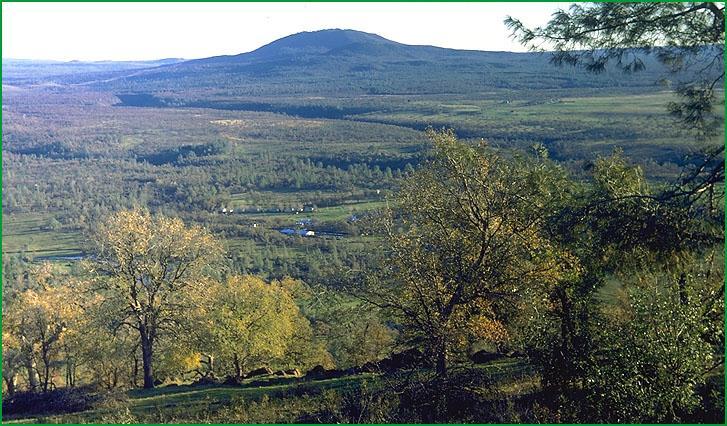
Tuscan Flows-Subsection M261Fa, Battle Creek area near Darrah State Hatchery Ś Robert Ettner |
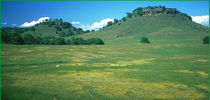
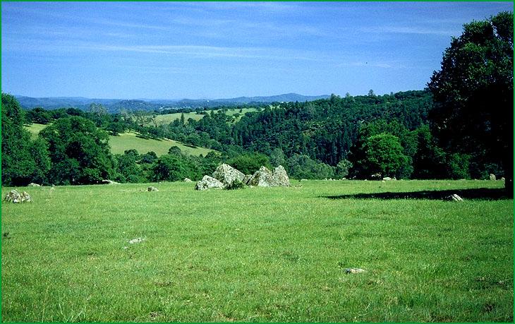
Subsection M261Fa, Buttes between Chico and Oroville Ś James R. Nelson |
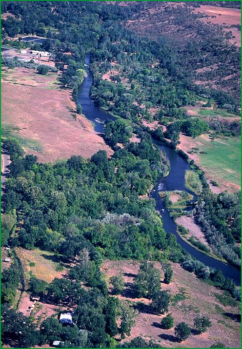
Subsection M261Fa, Battle Creek area Ś James R. Nelson |
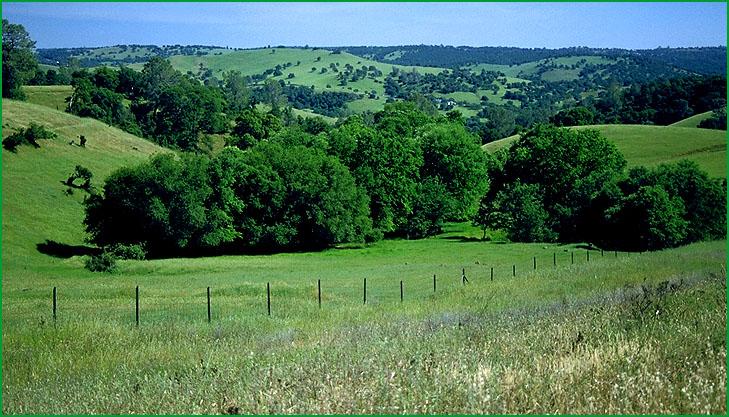
Lower Foothills Metamorphic Belt- Subsection M261Fb, west of Auburn Ś Robert Ettner |
Subsection M261Fb, west of Jackson...oak chaparral Ś USDA |
http://www.fs.fed.us/r5/projects/ecoregions/m261fa.htm
Subsection M261Fa
Tuscan Flows
This subsection is a relatively low elevation volcanic plateau at the northeast end of the Sacramento Valley. The southwesterly sloping plateau is at the extreme southwest end of the Cascade Ranges. It is included in the Sierra Nevada Foothills section because of ecosystem similarities. The climate is hot and subhumid. MLRA 18d.
Lithology and Stratigraphy. Late Pliocene and Quaternary basalt, andesite, and andesitic lahars dominate this subsection. Some of the basalt is Holocene. Small areas of Cretaceous marine and Eocene nonmarine sediments are exposed beneath the flows. There is some Quaternary alluvium in valleys.
Geomorphology. This subsection is on a very gently to gently sloping plateau with a few moderately steep to steep volcanic cones on it. There are several Holocene cinder cones. Where the plateau is dissected, canyon sideslopes are steep to very steep. Some of the larger canyons have floodplains and terraces in them. The subsection elevation range is about 200 to 2000 feet on the plateau surface and up to 3103 on Inskip Hill. Fluvial erosion is the main geomorphic processes.
Soils. The soils are mostly Lithic Ruptic - Xerorthentic Xerochrepts, Typic Rhodoxeralfs, and Pachic Argixerolls. Those on sedimentary rocks are mostly Lithic Xerochrepts and Entic Chromoxererts. Typic Xerofluvents, Typic Xerochrepts, Mollic Haploxeralfs, Typic Durixeralfs, and Typic Palexeralfs are common on floodplains and terraces. The soils are well drained. Bicarbonate weathering and leaching and accumulation of clay and silica in subsoils are the main pedogenic processes. Soil temperature regimes are thermic. Soil moisture regimes are xeric.
Vegetation. The predominant natural plant community is Blue oak series. Needlegrass grasslands predominate on the Vertisols and shallow soils. Northern basalt flow and Northern volcanic mudflow vernal pool habitats occur in this subsection.
Characteristic series by lifeform include:
Vernal pools: Northern basalt flow vernal pool. Grasslands: California annual grassland series.
Shrublands: Interior live oak shrub series, Scrub oak series, Wedgeleaf ceanothus series.
Forests and woodlands: Birchleaf mountain-mahogany series, Blue oak series, Foothill pine series, Interior live oak series, Knobcone pine series, McNab cypress series, Valley oak series.
Climate. The mean annual precipitation is about 20 to 40 inches. It is practically all rain. Mean annual temperature is about 56░ to 64░ F. The mean freeze-free period is about 250 to 300 days.
Surface Water. Streams in this subsection drain to the Sacramento River. All but the larger streams are generally dry during the summer. There are no natural lakes.
Subsection M261Fb
Lower Foothills Metamorphic Belt
This subsection is the lower elevation western edge of the Sierra Nevada from the northwest end of the Sierra Nevada southeastward to just beyond the Merced River. It has a hot and subhumid climate. MLRA 18d.
Lithology and Stratigraphy. Mainly Jurassic and Paleozoic marine sedimentary and metavolcanic rocks; some Mesozoic granitic rocks; and minor Eocene and Pliocene basalt and andesite occur in this subsection. Ultramafic rocks are common along faults. There is very little Tertiary sedimentary rock and Quaternary alluvium.
Geomorphology. This subsection is on moderately steep to steep mountains and hills at the western foot of the Sierra Nevada. All of the northern part and most of the southern part of the subsection is west of the Melones Fault Zone. West of this fault zone the western slope of the Sierra Nevada does not appear as a plateau, except on a few plutons, but as a series of northwest to north-northwest aligned ridges that decline in elevation from northeast to southwest. Major rivers cut across the ridges to form a trellis drainage pattern, although it is not a distinct pattern. Alluvial fans, floodplains, and terraces are not extensive. The subsection elevation range is about 300 to 3000 feet. Mass wasting and fluvial erosion are the main geomorphic processes.
Soils. The soils are mostly Lithic and Ruptic - Lithic Xerochrepts; Mollic and Ultic Haploxeralfs; and Lithic Xerorthents. Those on ultramafic rocks are mostly Mollic Haploxeralfs and Lithic Argixerolls. The soils are well drained. Bicarbonate weathering and leaching and accumulation of clay in subsoils are the main pedogenic processes. Soil temperature regimes are mostly thermic. Soil moisture regimes are xeric.
Vegetation. The predominant natural plant community is Blue oak series. Also, there are some Needlegrass grasslands, Chamise series on shallow and rocky soils, and Valley oak series in valleys.
Characteristic series by lifeform include:
Vernal pools: Northern claypan vernal pools.
Grasslands: California annual grassland series.
Shrublands: Chamise series, Chamise - wedgeleaf ceanothus series, Interior live oak shrub series, Scrub oak series, Wedgeleaf ceanothus series, White manzanita series.
Forests and woodlands: Birchleaf mountain-mahogany series, Black oak series, Blue oak series, Foothill pine series, Interior live oak series, Ione manzanita series, Mixed oak series, Valley oak series.
Climate. The mean annual precipitation is about 20 to 40 inches. It is practically all rain. Mean annual temperature is about 52░ to 62░ F. The mean freeze-free period is about 225 to 300 days.
Surface Water. The Feather, Yuba, American, Cosumnes, Mokelumne, Stanislaus, Tuolumne, and Merced Rivers cross this subsection. Runoff is rapid to these rivers and their tributaries. All but the larger streams are generally dry during the summer. There are no natural lakes, but many reservoirs.