 | Lower Granitic Foothills- Southern Granitic Foothills- San Emigdio Mountains |
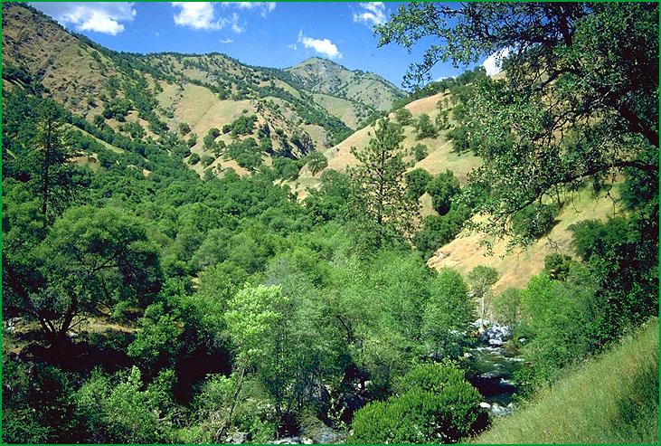
Lower Granitic Foothills-Subsection M261Fc, foothill riparian Ś USDA |
Subsection M261Fc, Deer Creek drainage Ś Robert Ettner |
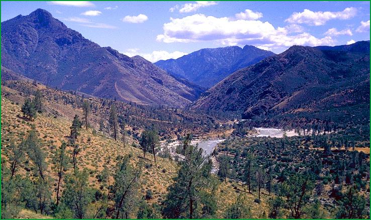
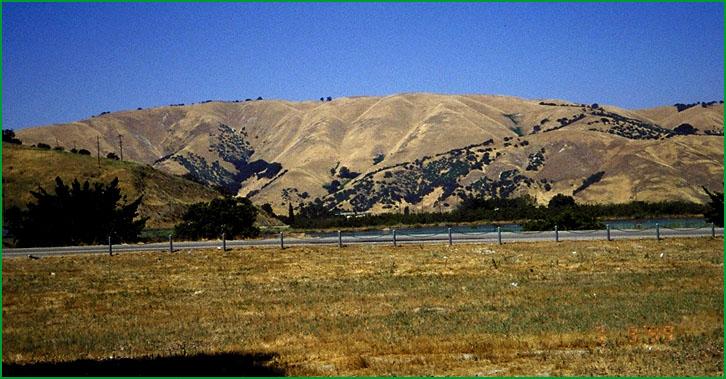
Southern Granitic Foothills-Subsection M261Fd, Kern Canyon near Gold Ledge Creek Ś Robert Ettner |
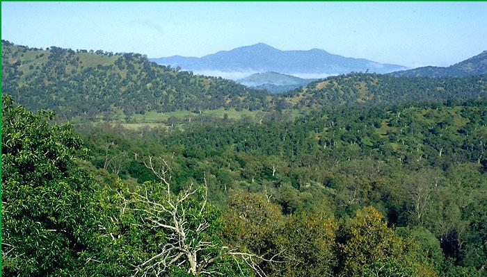
Subsection M261Fd, Poso Creek drainage Ś Robert Ettner |
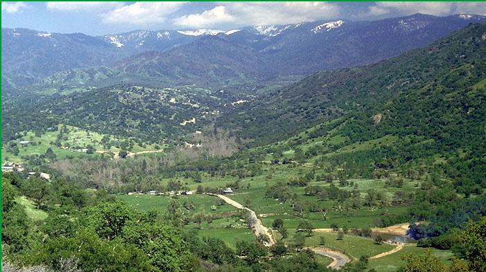
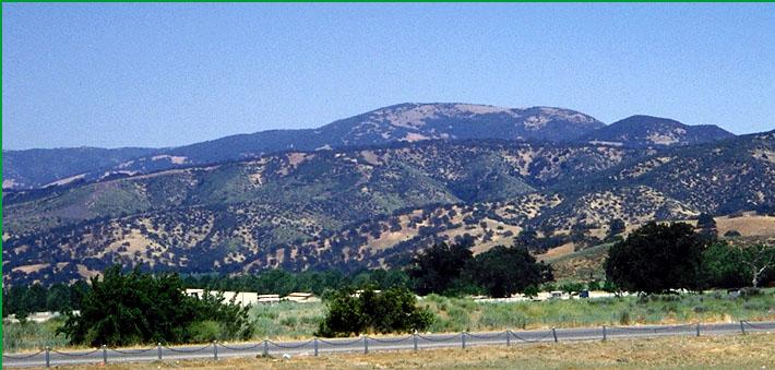
San Emigdio Mountains-Subsection M261Fe, Tejon Pass area Ś Patsy Miles |
Subsection M261Fe, Tejon Pass area Ś Scott Miles |
http://www.fs.fed.us/r5/projects/ecoregions/m261fc.htm
Subsection M261Fc
Lower Granitic Foothills
This subsection is the lower elevation western edge of the Sierra Nevada from Guadalupe Mountains southeastward to Blue Mountain, west of the Greenhorn Mountains. It has a hot and subhumid climate. MLRAs 18d and 18e.
Lithology and Stratigraphy. Mesozoic granitic rocks predominate in this subsection. Also, there are some Mesozoic mafic plutonic and Jurassic and older metavolcanic and metasedimentary rocks. A large body of ultramafic rock is exposed near the Kings River. There is very little Tertiary sedimentary rock and Quaternary alluvium.
Geomorphology. This subsection is on moderately steep to steep mountains and hills at the western, or southwestern, foot of the Sierra Nevada. There is little faulting, compared to the Lower Foothill Metamorphic Belt (M261Fb), and northwest to north-northwest aligned ridges are much less common and less distinct. Ridges are more commonly aligned toward the southwest, parallel to major rivers that flow off the western slope of the Sierra Nevada. Alluvial fans, floodplains, and terraces are not extensive. The subsection elevation range is about 400 to 4000 feet. Mass wasting and fluvial erosion are the main geomorphic processes.
Soils. The soils are mostly Mollic Haploxeralfs; Typic Xerochrepts; and shallow Typic Xerorthents. Those on ultramafic rocks are mostly Mollic Haploxeralfs. Typic Chromoxererts and Typic Rhodoxeralfs are common on mafic plutonic rocks, such as gabbro. The soils are well drained. Bicarbonate weathering and leaching and accumulation of clay in subsoils are the main pedogenic processes. Soil temperature regimes are mostly thermic. Soil moisture regimes are xeric.
Vegetation. The predominant natural plant community is Blue oak series. Also, there are some Needlegrass grasslands, Chamise series on shallow and rocky soils, and Valley oak series in valleys.
Characteristic series by lifeform include:
Grasslands: California annual grassland series.
Shrublands: Chamise series, Chamise - wedgeleaf ceanothus series, Interior live oak shrub series, Scrub oak series, Wedgeleaf ceanothus series, White manzanita series.
Forests and woodlands: Birchleaf mountain-mahogany series, Blue oak series, Brewer oak series, California buckeye series, Foothill pine series, Interior live oak series, Mixed oak series, Valley oak series.
Climate. The mean annual precipitation is about 18 to 30 inches. It is practically all rain. Mean annual temperature is about 52░ to 64░ F. The mean freeze-free period is about 225 to 300 days.
Surface Water. The San Joaquin, Kings, Kaweah, and Tule Rivers cross this subsection. Runoff is rapid to these rivers and their tributaries. All but the larger streams are generally dry during the summer. There are no natural lakes, but many reservoirs.
Subsection M261Fd
Southern Granitic Foothills
This subsection comprises the lower slopes around the southern end of the Greenhorn Mountains and on the western sides of Breckenridge Mountain and the Tehachapi Mountains. Hot Spring Valley along the Kern River and the lower part of South Fork Valley are included in this subsection. It has a hot and semi-arid to subhumid climate. MLRA 18e.
Lithology and Stratigraphy. Mesozoic granitic rocks predominate in this subsection. Also, there are some Mesozoic mafic plutonic and pre-batholith metamorphic rocks. There is Quaternary alluvium in Linns, Hot Spring, and South Fork Valleys and a few other small valleys.
Geomorphology. This subsection is mostly on moderately steep to steep mountains and hills. Major valleys are aligned east-west or toward the south-south west parallel to the Breckenridge Fault. Ridges at the northwestern end of the Tehachapi mountains curve from east-west around toward the west-northwest. Alluvial fans, floodplains, and basin floors are important, but not extensive, parts of the subsection. The subsection elevation range is about 1000 to 5000 feet. Mass wasting and fluvial erosion are the main geomorphic processes.
Soils. The soils are mostly Typic and Pachic Haploxerolls; shallow Typic Xerorthents; and Lithic and Typic Argixerolls. Xerochrepts are common on metamorphic rocks. Soil in the larger valleys are mostly Xeric Torripsamments and Xeralfic Haplargids. The soils are well drained. Bicarbonate weathering and leaching and accumulation of clay in subsoils are the main pedogenic processes. Calcium carbonates accumulate in some soils. Soil temperature regimes are mostly thermic. Soil moisture regimes are mostly xeric, but aridic in at least South Fork Valley and possibly in other valleys.
Vegetation. The predominant natural plant community is Blue oak series. Also, there are some Needlegrass grasslands, Chamise series on shallow and rocky soils, and Valley oak series in valleys.
Characteristic series by lifeform include:
Grasslands: California annual grassland series.
Shrublands: Allscale series, Bladderpod - California ephedra - narrowleaf goldenbush series, Chamise series, Chamise - wedgeleaf ceanothus series, Chaparral whitethorn series, Interior live oak shrub series, Scalebroom series, Scrub oak series, Wedgeleaf ceanothus series, White manzanita series.
Forests and woodlands: Birchleaf mountain-mahogany series, Blue oak series, California buckeye series, Foothill pine series, Interior live oak series, Mixed oak series, Valley oak series.
Climate. The mean annual precipitation is about 8 to 25 inches. It is practically all rain. Mean annual temperature is about 50░ to 64░ F. The mean freeze-free period is about 200 to 300 days.
Surface Water. Runoff is rapid from most of the subsection. It flows to closed basins in the southern end of the Great Valley. All but the larger streams are generally dry during summer. There are no natural lakes, but some reservoirs.
Subsection M261Fe
San Emigdio Mountains
This subsection comprises the San Emigdio Mountains and the southwest end of the Tehachapi Mountains at the southern end of the Great Valley. The San Andreas Fault is the southern boundary of this subsection. It has a hot and semi-arid to subhumid climate. MLRA 18e.
Lithology and Stratigraphy. Mesozoic granitic rocks predominate in this subsection. Also, there are some pre-batholith metamorphic rocks. Adjacent to the Great Valley there are Eocene, Oligocene, and Miocene sedimentary rocks. There is Quaternary alluvium in Castaic Valley and a few other small valleys.
Geomorphology. This subsection is mostly on moderately steep to steep mountains and hills. The east-northeast aligned Garlock Fault meets the west-northwest aligned San Andreas Fault on the southern margin of this subsection. Ridges adjacent to these faults are aligned parallel to them. Most other ridges point to the Great Valley, which is the direction that the larger streams flow. Alluvial fans, floodplains, and basin floors are not extensive. The subsection elevation range is from about 2000 feet up to 7495 feet on San Emigdio Mountain. Mass wasting and fluvial erosion are the main geomorphic processes.
Soils. The soils are mostly Typic and Dystric Xerochrepts; shallow Typic Xerorthents; Typic and Pachic Haploxerolls; Ultic Haploxerolls; and Pachic Argixerolls on granitic rocks. They are mostly Calcic Haploxerolls and Typic Argixerolls on Tertiary sedimentary rocks, which happen to be at lower elevations than most of the granitic rocks. The soils are well drained. Bicarbonate weathering and leaching and accumulation of clay in subsoils are the main pedogenic processes. Calcium carbonates accumulate in some soils on Tertiary sedimentary rocks. Soil temperature regimes are thermic and mesic. Soil moisture regimes are xeric.
Vegetation. The predominant natural plant community is Blue oak series, with Ponderosa pine series and Jeffrey pine series at higher elevations. Also, there are some Needlegrass grasslands, Canyon live oak series on steep canyon slopes, Chamise series and Mixed chaparral shrublands on shallow and rocky soils, and Valley oak series in valleys.
Characteristic series by lifeform include:
Grasslands: California annual grassland series.
Shrublands: Allscale series, Bladderpod - California ephedra - narrowleaf goldenbush series, Chamise series, Chamise - wedgeleaf ceanothus series, Chaparral whitethorn series, Interior live oak shrub series, Scalebroom series, Scrub oak series, Wedgeleaf ceanothus series, White manzanita series.
Forests and woodlands: Birchleaf mountain-mahogany series, Blue oak series, California buckeye series, Canyon live oak series, Foothill pine series, Interior live oak series, Jeffrey pine series, Mixed oak series, Ponderosa pine series, Valley oak series.
Climate. The mean annual precipitation is about 10 to 20 inches. It is practically all rain. Mean annual temperature is about 45░ to 60░ F. The mean freeze-free period is about 150 to 250 days.
Surface Water. Runoff is rapid from most of the subsection. It flows to closed basins in the southern end of the Great Valley. The streams are generally dry during the summer. There are no natural lakes.