 | Likely Tableland-Likely Mountain- Bald Mountain - Dixie Valley |
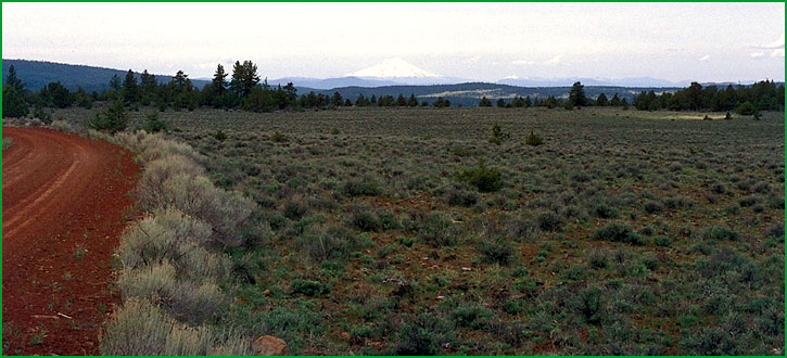
Bald Mountain - Dixie Valley - Subsection M261Gj, Dixie Valley area, looking toward Mt. Shasta Ś David Schultz |
http://www.fs.fed.us/r5/projects/ecoregions/m261gh.htm
Subsection M261Gh
Likely Tableland
This subsection is a very gently sloping footslope of the Warner Mountains. The climate is temperate and semi-arid to subhumid. MLRA 21e.
Lithology and Stratigraphy. The bedrock is predominantly Pliocene basalt. Tertiary pyroclastic rock is exposed in some ravines.
Geomorphology. The landform is an eroded and slightly dissected, very gently sloping lava flow. The surface form resembles a pediment, which may be a reflection of the landform that the flow was deposited on. The elevation range is about 4500 to 5500 feet. Faulting, fluvial erosion, and freeze-thaw are the main geomorphic processes.
Soils. Soils on uplands are mostly Lithic Argixerolls, Leptic Haploxererts, Xerertic Haplargids, and Argiduridic Durixerolls. The soils are well drained. Soil temperature regimes are mesic. Soil moisture regimes are aridic and xeric.
Vegetation. The predominant natural plant communities are Big sagebrush series, Bluebunch wheatgrass series, and Idaho fescue series. Low sagebrush series is common on shallow soils.
Characteristic series by lifeform include:
Grasslands: Ashy ryegrass series, Bluebunch wheatgrass series, California oatgrass series, Creeping ryegrass series, Idaho fescue series, Indian ricegrass series, Nebraska sedge series, Needle-and-thread series.
Shrublands: Big sagebrush series, Bitterbrush series, Black sagebrush series, Low sagebrush series, Parry rabbitbrush series, Rubber rabbitbrush series.
Forests and woodlands: Curlleaf mountain-mahogany series.
Climate. The mean annual precipitation is about 12 to 20 inches. Much of the precipitation is snow. Mean annual temperature is about 45░ to 48░ F. The mean freeze-free period is in the range from 75 to 100 days.
Surface Water. Runoff is rapid. Streams that flow from the Warner Mountains through the subsection to the Pit River are perennial, but those that head within the subsection are dry during summer.
Subsection M261Gi
Likely Mountain
This subsection is a faulted and eroded volcanic plateau with many volcanic hills and mountains. It is between the Warner Mountains and the Madeline Plains. The climate is temperate to cold and semi-arid to subhumid. MLRA21e.
Lithology and Stratigraphy. The bedrock is predominantly Miocene basalt and lesser amounts of Pleistocene basalt and Tertiary pyroclastic rocks. There are some alluvial and lacustrine deposits in small valleys. Most faults are aligned north-south east of the northwest-trending Likely Fault and toward the northwest west of the fault.
Geomorphology. The main landforms are a gently to moderately sloping volcanic plateau and moderately steep to steep shield volcanoes. The plateau has a moderately well integrated drainage system, with few small closed depressions. Basin-fill on basin floors in the small depressions is a small but important part of the subsection. A lake plain occurs in Jess Valley. The elevation range is from about 4500 feet up to 7376 feet on Likely Mountain and about 8000 feet on Red Rock Mountain at the southern edge of the Warner Mountains. Faulting, fluvial erosion and deposition, lacustrine deposition, and freeze-thaw are the main geomorphic processes.
Soils. Soils are mostly Dystric Xerorthents; Aridic and Pachic Haploxerolls; Typic, Lithic, Aridic, and Pachic Ultic Argixerolls; Xerollic, Xeralfic, and Xerertic Haplargids; Argiduridic and shallow Argiduridic Durixerolls; and Entic Chromoxererts. Also, there are Cumulic and Fluvaquentic Haploxerolls; Chromic Haploxererts; and Fluvaquentic Endoaquolls in alluvial and lacustrine deposits on basin floors. The soils are well drained on upland and well to poorly drained on basin floors. Soil temperature regimes are mostly mesic and frigid. Soil moisture regimes are mostly xeric and aridic, but some are aquic on basin floors.
Vegetation. The predominant natural plant communities are Western juniper series, Big sagebrush series, Jeffrey pine series, Ponderosa pine series, Mixed conifer series, and White fir series. Sedge meadow communities occur in basins.
Characteristic series by lifeform include:
Grasslands: Ashy ryegrass series, Bluebunch wheatgrass series, California oatgrass series, Creeping ryegrass series, Idaho fescue series, Indian ricegrass series, Nebraska sedge series, Needle-and-thread series.
Shrublands: Big sagebrush series, Bitterbrush series, Parry rabbitbrush series, Rubber rabbitbrush series.
Forests and woodlands: Aspen series, Curlleaf mountain-mahogany series, Jeffrey pine series, Jeffrey pine - Ponderosa pine series, Ponderosa pine series, Western juniper series, White fir series.
Climate. The mean annual precipitation is about 12 to 20 inches. Much of the precipitation is snow. Mean annual temperature is about 40░ to 48░ F. The mean freeze-free period is in the range from 50 to 100 days.
Surface Water. Runoff from uplands is rapid; much of it drains down through joints in the basalt to the ground water reservoir, limiting overland flow of water and development of stream channels. Some of the drainage is internal, to closed depressions in and around the subsection, and water ponds in many small depressions. There are few stream and most of those are dry during summer. Streams that flow from the subsection drain to either the Pit River or the Madeline Plains
Subsection M261Gj
Bald Mountain - Dixie Valley
This subsection is a faulted and eroded volcanic plateau with many volcanic hills and mountains. It is south of Big Valley and the Big Valley Mountains. The climate is temperate to cold and semi-arid to subhumid. MLRA 21e.
Lithology and Stratigraphy. The bedrock is predominantly Pliocene basalt and lesser amounts of Pleistocene basalt and Tertiary pyroclastic rocks. There are some alluvial and lacustrine deposits in small valleys. The alignments of most of the faults ranges from north-south to northwest.
Geomorphology. The main landforms are a gently to moderately sloping volcanic plateau and moderately steep to steep shield volcanoes. The plateau has a moderately well integrated drainage system, with few small closed depressions. Basin-fill on basin floors in the small depressions is a small but important part of the subsection. There are a few Pliocene cinder cones. The elevation range is from about 3500 feet up to 6067 feet on Dixie Peak on Bald Mountain. Faulting, fluvial erosion and deposition, lacustrine deposition, and freeze-thaw are the main geomorphic processes.
Soils. Soils are mostly Andic Xerumbrepts; Typic, Lithic, Lithic Ultic, Ultic, and Pachic Ultic Argixerolls; Lithic and Ultic Haploxeralfs; and shallow Argiduridic and shallow Abruptic Argiduridic Durixerolls. Also, there are Aquic Haploxerolls, Typic Melanaquands, and Typic Haplaquands in alluvial and lacustrine deposits on basin floors. The soils are well drained on upland and well to poorly drained on basin floors. Soil temperature regimes are mesic and frigid. Soil moisture regimes are mostly xeric, but some aridic in and around valleys and some are aquic on basin floors.
Vegetation. The predominant natural plant communities are Western juniper series, Big sagebrush series, and Jeffrey pine series, and Ponderosa pine series. Sedge meadow communities occur in many of the basins.
Characteristic series by lifeform include:
Grasslands: Ashy ryegrass series, Bluebunch wheatgrass series, California oatgrass series, Creeping ryegrass series, Idaho fescue series, Indian ricegrass series, Nebraska sedge series, Needle-and-thread series.
Shrublands: Big sagebrush series, Bitterbrush series, Parry rabbitbrush series, Rubber rabbitbrush series.
Forests and woodlands: Aspen series, Birchleaf mountain-mahogany series, Curlleaf mountain-mahogany series, Jeffrey pine series, Western juniper series, White fir series.
Climate. MLRA 21e. Mean annual precipitation is about 15 to 25 inches. Much of the precipitation is snow. Mean annual temperature is about 42░ to 52░ F. The mean freeze-free period is in the range from 75 to 150 days.
Surface Water. Runoff from uplands is rapid; much of it drains down through joints in the basalt to the ground water reservoir, limiting overland flow of water and development of stream channels. Some of the drainage is internal, to closed depressions in the subsection, and water ponds in many small depressions. There are few streams and most of those are dry during summer. Streams that flow from the subsection drain to the Pit River, which runs through the northwestern edge of the subsection.