 | Horsehead Mountain-Adin Mountains and Valleys-Eagle Lake - Observation Peak |
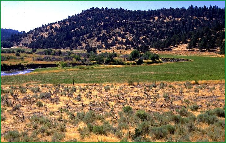
Adin Mountains and Valleys -Subsection M261Gl, Pit River area near Canby bridge Ś Robert Ettner |
http://www.fs.fed.us/r5/projects/ecoregions/m261gk.htm
Subsection M261Gk
Horsehead Mountain
This subsection consists of mountains west of the Adin Mountains. It includes Horsehead, Schaffer, and Knox Mountains. The climate is cold to very cold and subhumid. MLRA 22e.
Lithology and Stratigraphy. The bedrock is predominantly Miocene basalt and lesser amounts of Tertiary pyroclastic rocks. Most faults are aligned toward the west-northwest on Schaffer Mountain and toward the north-northwest in the rest of the subsection.
Geomorphology. The main landforms are two mountain blocks that are steep on one side and gently sloping to moderately steep on the other side. The Schaffer Mountain block is steep on the south-southwest side and the Horsehead Mountain block is steep on the west-southwest side. There is at least one steep, eroded shield volcano east of Horsehead Mountain. There are few cinder cones. The elevation range is from about 4500 feet up to 7036 feet on the Horsehead Mountain block. Faulting, fluvial erosion, and freeze-thaw are the main geomorphic processes.
Soils. Soils are mostly Pachic and Pachic Ultic Argixerolls; Andic Haploxeralfs; Xeric Haplocryands; and Dystric Xerorthents. The soils are well drained. Soil temperature regimes are frigid and cryic. Soil moisture regimes are xeric.
Vegetation. The predominant natural plant communities are Jeffrey pine series, Ponderosa pine series, Mixed conifer series, and White fir series.
Characteristic series by lifeform include:
Grasslands: California oatgrass series, Creeping ryegrass series, Idaho fescue series, Indian ricegrass series, Nebraska sedge series, Needle-and-thread series.
Shrublands: Big sagebrush series, Bitterbrush series, Parry rabbitbrush series, Rubber rabbitbrush series.
Forests and woodlands: Aspen series, Curlleaf mountain-mahogany series, Jeffrey pine series, Jeffrey pine - Ponderosa pine series, Ponderosa pine series, White fir.
Climate. The mean annual precipitation is about 20 to 25 inches. Much of the precipitation is snow. Mean annual temperature is about 35░ to 45░ F. The mean freeze-free period is in the range from 50 to 100 days.
Surface Water. Runoff is rapid; much of it drains down through joints in the basalt to the ground water reservoir, limiting overland flow of water and development of stream channels. There are few streams and most of those are dry during summer. Streams drain to the Pit River or its tributaries.
Subsection M261Gl
Adin Mountains and Valleys
This subsection consists of mountains east-northeast of Big Valley, including Round Valley and other small valleys in the mountains. The climate is temperate to cold and semi-arid to subhumid. MLRA 21e.
Lithology and Stratigraphy. The bedrock is predominantly Miocene basalt and other Tertiary basalt and pyroclastic rocks. There are some alluvial and lacustrine deposits in small valleys. Southeast of Round Valley most faults are aligned toward the northwest, and northwest of Round Valley most major faults are oriented toward the west-northwest.
Geomorphology. The main landforms are mostly steep mountains and a gently to moderately sloping volcanic plateau. The mountains are elongated parallel to the major faults. There are alluvial fans and basin-fill on valley floors. The elevation range is from about 4500 feet up to 6394 feet on Fox Mountain. Faulting, fluvial erosion and deposition, lacustrine deposition, and freeze-thaw are the main geomorphic processes.
Soils. Soils are mostly Typic, Lithic, Lithic Ultic, Pachic, Ultic, and Pachic Ultic Argixerolls; Pachic Haploxerolls; and shallow Abruptic Argiduridic Durixerolls. Also, there are Argiduridic and shallow Argiduridic Durixerolls; Typic Chromoxererts; and Xeric Endoaquerts on alluvial fans and basin floors. The soils are well drained on upland and well to poorly drained on basin floors. Soil temperature regimes are mesic and frigid. Soil moisture regimes are mostly xeric, but some are aridic in and around valleys and some are aquic on basin floors.
Vegetation. The predominant natural plant communities are Western juniper series, Big sagebrush series, Jeffrey pine series, and Ponderosa pine series. Low sagebrush series is common on shallow soils. Sedge meadow communities occur in many of the basins.
Characteristic series by lifeform include:
Grasslands: Ashy ryegrass series, Bluebunch wheatgrass series, California oatgrass series, Creeping ryegrass series, Idaho fescue series, Indian ricegrass series, Nebraska sedge series, Needle-and-thread series.
Shrublands: Big sagebrush series, Bitterbrush series, Black sagebrush series, Low sagebrush series, Parry rabbitbrush series, Rubber rabbitbrush series.
Forests and woodlands: Foothill pine series, Curlleaf mountain-mahogany series, Jeffrey pine series, Jeffrey pine - Ponderosa pine series, Ponderosa pine series, Western juniper series, White fir series.
Climate. The mean annual precipitation is about 20 to 25 inches. Much of the precipitation is snow. Mean annual temperature is about 42░ to 50░ F. The mean freeze-free period is in the range from 75 to 125 days.
Surface Water. Runoff from uplands is rapid; much of it drains down through joints in the basalt to the ground water reservoir, limiting overland flow of water and development of stream channels. There are few streams and most of those are dry during summer. Streams drain to the Pit River, which runs through the northern part of the subsection, or to tributaries of the Pit River.
Subsection M261Gm
Eagle Lake - Observation Peak
This subsection is a faulted and eroded volcanic plateau with many volcanic hills and mountains and basins. It is between the west end of the Honey Lake Valley and the Madeline Plains. The climate is temperate to very cold and semi-arid to subhumid. MLRA
Lithology and Stratigraphy. The bedrock is predominantly Pliocene basalt and lesser amounts of Pleistocene basalt and Miocene rhyolite and pyroclastic rocks. There are some alluvial and lacustrine deposits in valleys. The alignment of most of the faults ranges from north-south to northwest.
Geomorphology. The main landforms are a gently to moderately sloping volcanic plateau and moderately steep to steep, eroded shield domes and stratovolcanoes. There are few cinder cones. The drainage system is poorly integrated; there are many closed basins. Basin-fill on basin floors in small depressions is a small but important part of the subsection; it is most extensive around Horse Lake and Eagle Lake and in Willow Creek and Said Valleys. The elevation range is from about 4200 feet adjacent to Honey Lake Valley up to 7943 feet on Fredonyer Mountain and 7964 feet on Observation Peak. Faulting, fluvial erosion and deposition, lacustrine deposition, and freeze-thaw are the main geomorphic processes.
Soils. Soils are mostly Pachic Haploxerolls; Typic, Lithic, Aridic, Vitrandic, and Ultic Argixerolls; Xerollic, Xeralfic, and Xerertic Haplargids; Entic Chromoxererts; and Argic Cryoborolls. Also, there are Cumulic, Fluvaquentic, and Torripsammentic Haploxerolls; Xerollic Camborthids; and Aridic Argixerolls in alluvial and lacustrine deposits on basin floors. The soils are well drained on upland and well to somewhat poorly drained on basin floors. Soil temperature regimes are mostly mesic in basins and frigid on hills and mountains, and some are cryic at higher elevations. Soil moisture regimes are mostly xeric, but some are aridic at lower elevations.
Vegetation. The predominant natural plant communities are Western juniper series, Big sagebrush series, and Jeffrey pine series. Low sagebrush series and Black sagebrush series are common on shallow soils. Silver sagebrush series, Sedge meadow communities, and Emergent aquatic communities occur in many of the basins.
Characteristic series by lifeform include:
Grasslands: Ashy ryegrass series, California oatgrass series, Creeping ryegrass series, Idaho fescue series, Indian ricegrass series, Nebraska sedge series, Needle-and-thread series.
Shrublands: Big sagebrush series, Bitterbrush series, Black sagebrush series, Low sagebrush series, Parry rabbitbrush series, Rubber rabbitbrush series.
Forests and woodlands: Curlleaf mountain-mahogany series, Jeffrey pine series, Western juniper series.
Climate. The mean annual precipitation is about 15 to 30 inches. Much of the precipitation is snow. Mean annual temperature is about 38░ to 50░ F. The mean freeze-free period is in the range from 50 to 125 days.
Surface Water. Runoff from uplands is rapid; much of it drains down through joints in the basalt to the ground water reservoir, limiting overland flow of water and development of stream channels. Some of the drainage is internal, to closed depressions in the subsection, and water ponds in many small depressions. Most of the ponds and lakes are ephemeral, but Eagle Lake is permanent. There are few streams and most of those are dry during summer. Streams that flow from the subsection drain to either the Honey Lake Valley or the Madeline Plains.