 | Little San Bernardino - Bighorn Mountains- Fontana Plain - Calimesa Terraces-Perris Valley and Hills- San Jacinto Foothills - Cahuilla Mountains |
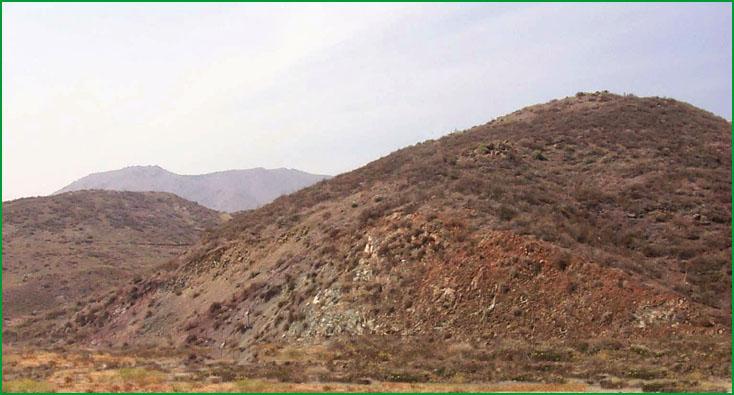
Perris Valley and Hills-Lake Elsinore area Ś Scott Miles |
Lake Elsinore area Ś Scott Miles |
Lake Elsinore area Ś Scott Miles |
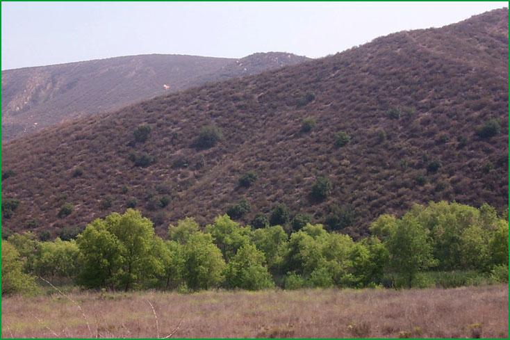
San Jacinto Foothills - Cahuilla Mountains-South Fork San Jacinto River area Ś Robert Ettner |

http://www.fs.fed.us/r5/projects/ecoregions/m262bi.htm
Subsection M262Bi
Little San Bernardino - Bighorn Mountains
This subsection includes the Bighorn Mountains, the northern edge of the San Bernardino Mountains and the Little San Bernardino Mountains. It is bounded by the Mojave Desert on the north and northeast and by the Coachella Valley on the southwest. This is the hot and dry eastern end of the Transverse Ranges. MLRAs 20e, 29f, and 30g.
Lithology and Stratigraphy. This subsection is mostly Mesozoic granitic rocks and Pre-Cambrian gneiss. Also, there is some Paleozoic marine sedimentary rock and Quaternary nonmarine sediments. There is Recent alluvium in Morongo Valley.
Geomorphology. The Bighorn Mountains are an appendage of the San Gorgonio Mountains, separated from it by the Pipes Canyon fault. Broad, dissected pediments slope east-northeast across the Bighorn Mountains. The general trends of these slopes are on the order of 4 to 12%, but the actually gradients to drainage ways are greater. The Little San Bernardino Mountains, which are separated from the Bighorn Mountains by the Morongo Valley fault, are steep and very steep mountains with narrow canyons. They trend northwest, parallel to the Mission Creek fault in the San Andreas Fault Zone. The subsection elevation range is from about 500 feet up to 5500 feet. Mass wasting and fluvial erosion and deposition are the main geomorphic processes.
Soils. The soils are mostly Typic Xerochrepts, Entic Ultic Haploxerolls, and Mollic Haploxeralfs. In the Little San Bernardino Mountains there are these plus Lithic Torriorthents and Lithic Camborthids. On Quaternary nonmarine sediments there are Typic Torripsamments, Typic Haplargids, and Haplic Durargids, and in Recent alluvium, Typic and Mollic Xerofluvents, Typic Xerorthents, and Typic Haploxeralfs. The soils are well drained. Soil temperature regimes are mostly thermic, and some soils on north-facing slopes at higher elevations are mesic. Soil moisture regimes are xeric (nearly aridic) and aridic. Most of the soils with aridic moisture regimes are in the Little San Bernardino Mountains.
Vegetation. The predominant natural plant communities are Singleleaf pinyon series, California juniper series, and Mixed chaparral shrublands. Creosote bush series, some Mojave yucca series, and Joshua tree series, occur in areas with aridic soil moisture regimes.
Characteristic series by lifeform include:
Grasslands: California annual grassland series.
Shrublands: Big sagebrush series, Black bush series, Catclaw acacia series, Chamise series, Chamise - cupleaf ceanothus series, Creosote bush series, Cupleaf ceanothus - fremontia - oak series, Fourwing saltbush series, Joshua tree series, Mixed saltbush series, Mojave yucca series, Mulefat series, Nolina series, Scalebroom series, Scrub oak series, Shadscale series.
Forests and woodlands: Birchleaf mountain-mahogany series, California juniper series, Curlleaf mountain-mahogany series, Singleleaf pinyon series.
Climate. The mean annual precipitation is about 6 to 20 inches. Most of it is rain. Mean annual temperature is about 55░ to 70░ F. The mean freeze-free period is about 200 to 275 days.
Surface Water. Runoff is rapid. All but the larger streams are dry through the summer, and water runs in them only after rain in the Little San Bernardino Mountains. Natural lakes are absent.
Subsection M262Bj
Fontana Plain - Calimesa Terraces
This subsection includes alluvial fans in San Gorgonio Pass; basin floor in the Redlands area, between the San Andreas and San Jacinto Faults; and a basin that is separated from the Los Angeles Basin by the Chino, Puente, and San Jose Hills on the west side of the subsection. It is just south of the San Gabriel and the San Bernardino Mountains. The climate is hot and subhumid; it is moderated by marine influence. MLRA 19d.
Lithology and Stratigraphy. This subsection contains mostly Quaternary nonmarine sediments and Recent alluvium. There are some Mesozoic granitic rocks and older sedimentary and metamorphic rocks in the Jurupa Mountains and other hills that are included in this subsection.
Geomorphology. This subsection is on very gently to gently sloping alluvial fans, mostly from the San Gabriel and San Bernardino Mountains, and some floodplain along the Santa Ana River and its larger tributaries. A few areas of hills are included in this subsection. The subsection elevation range is from about 600 feet up to 2400 feet. Fluvial erosion and deposition are the main geomorphic processes.
Soils. The soils are mostly Typic Xeropsamments, Typic Xerorthents, Fluventic Haploxerolls, and Typic Haploxeralfs. There are Haplic and Typic Durixeralfs on old alluvial fans. Carbonates have accumulated in some of the soils and silica has accumulated in the older soils. The soils are well drained. Soil temperature regimes are thermic. Soil moisture regimes are xeric.
Vegetation. The predominant natural plant communities are California sagebrush - California buckwheat series and Needlegrass grasslands.
Characteristic series by lifeform include:
Grasslands: California annual grassland series, Foothill needlegrass series, Nodding needlegrass series, Purple needlegrass series.
Shrublands: Brittlebush series, Bush seepweed series, California buckwheat series, California buckwheat - white sage series, California sagebrush series, California sagebrush - California buckwheat series, California sagebrush - black sage series, Chamise series, Chamise - California buckwheat - white sage series, Fourwing saltbush series, Mixed saltbush series, Scalebroom series, White sage series.
Forests and woodlands: California juniper series, California sycamore series.
Climate. The mean annual precipitation is about 12 to 20 inches; most of it is rain. Mean annual temperature is about 62░ to 64░ F. The mean freeze-free period is about 250 to 275 days.
Surface Water. Runoff is rapid, even from the alluvial fans. All but the larger streams are dry through the summer. Water runs in the Santa Ana River throughout the year. Natural lakes are absent
Subsection M262Bk
Perris Valley and Hills
This subsection consists of hills and valleys in a graben between the San Jacinto Fault on the northeast and the Elsinore Fault zone on the southwest. It stretches from the Santa Ana River southeast beyond Perris Valley. The climate is hot; it is modified somewhat by marine influence. MLRAs 19d and 20d.
Lithology and Stratigraphy. This subsection contains mostly Mesozoic granitic, gabbroic, marine (Jurassic) sedimentary, and metavolcanic rocks in the hills. The valleys are filled with Quaternary alluvium.
Geomorphology. This subsection is on moderately steep to steep hills, pediments, dissected Quaternary nonmarine sediments adjacent to the Elsinore Fault Zone and near the Santa Ana River, and Recent alluvium in Perris Valley and along the Elsinore Fault Zone. The subsection elevation range is from about 1400 feet to 2600 feet. Mass wasting and fluvial erosion and deposition are the main geomorphic processes.
Soils. The soils are mostly shallow Typic Xerorthents and Typic Haploxeralfs on hills and pediments in granitic terrain and Lithic Haploxerolls, Mollic Haploxeralfs, and Typic Natrixeralfs on other hills. On Recent alluvium, there are Typic Xerofluvents, Fluventic and Fluvaquentic Haploxerolls. There are Natric Haploxeralfs, Haplic and Typic Durixeralfs, and Typic Pelloxererts on dissected nonmarine Quaternary deposits and terraces. Carbonates have accumulated in some of the soils and silica has accumulated in the older soils. The soils are well drained, except for somewhat poorly drained Fluvaquentic Haploxerolls in Recent alluvium. Soil temperature regimes are thermic, and soil moisture regimes are xeric.
Vegetation. The predominant natural plant communities are California sagebrush - California buckwheat series and Needlegrass grasslands. There is some Black sage series and small areas of Coast live oak series and Chamise series.
Characteristic series by lifeform include:
Vernal pools: San Jacinto Valley vernal pools.
Grasslands: California annual grassland series, Foothill needlegrass series, Nodding needlegrass series, Saltgrass series.
Shrublands: Bush seepweed series, California buckwheat series, California buckwheat - white sage series, California sagebrush series, California sagebrush - California buckwheat series, Chamise - hoaryleaf ceanothus series, Chamise - white sage series, Fourwing saltbush series, Mixed saltbush series, Scalebroom series, Scrub oak series, White sage series.
Forests and woodlands: Birchleaf mountain-mahogany series, California juniper series, Coast live oak series.
Climate. The mean annual precipitation is about 10 to 16 inches. It is practically all rain. Mean annual temperature is about 58░ to 64░ F. The mean freeze-free period is about 225 to 250 days.
Surface Water. Runoff is rapid, except from floodplains and lake basins. All but the larger streams are dry through the summer. There are sag ponds along the Elsinore Fault Zone, Lake Elsinore being the largest. Also, there are several reservoirs in the subsection.
Subsection M262Bl
San Jacinto Foothills - Cahuilla Mountains
This subsection includes the lower southwestern slopes of the San Jacinto Mountains, hills along the northeast side of the San Jacinto Fault, and hills and valleys around the Cahuilla Mountains on the southwest side of the San Jacinto Fault. The climate is hot to temperate, and subhumid. MLRA 20d.
Lithology and Stratigraphy. This subsection contains mostly Mesozoic granitic rocks, with large areas of Pliocene and Pleistocene nonmarine sediments and Recent alluvium. Also, there are Pre-Cretaceous granitic, marine (Jurassic) sedimentary, and metamorphic rocks.
Geomorphology. This subsection is on lower mountain slopes, moderately steep to steep hills, and nearly level to gently sloping alluvial plains in Terwilliger Valley and other small valleys. There are alluvial fans, terraces, and floodplains on the alluvial plains. Pliocene and some Pleistocene nonmarine sediments along the San Jacinto Fault northwest of the Cahuilla Mountains have been eroded to badlands. The subsection elevation range is from about 1500 feet to 4000 feet. Mass wasting and fluvial erosion and deposition are the main geomorphic processes.
Soils. The soils on granitic rocks are mostly shallow Typic Xerorthents, Typic Xerochrepts, and Typic Haploxeralfs at lower elevations and shallow Entic Haploxerolls, Entic Ultic Haploxerolls, and Mollic Haploxeralfs at higher elevations. There are Lithic Haploxerolls and Typic Natrixeralfs on other kinds of rocks. Soils in badlands are Xerorthents. Haploxerolls predominate in Recent alluvium. Calcium carbonates have accumulated in some of the soils at lower elevations. The soils are well drained. Soil temperature regimes are mostly thermic; and soil moisture regimes are xeric.
Vegetation. The predominant natural plant communities are Coast Live oak series, California sagebrush - California buckwheat series, and Black sage series at lower elevations southwest of the San Jacinto Fault, and some Chamise series and Red shank - chamise series.
Characteristic series by lifeform include:
Grasslands: California annual grassland series, Foothill needlegrass series, Nodding needlegrass series, Purple needlegrass series.
Shrublands: Big sagebrush series, Bigberry manzanita series, Brittlebush series, California buckwheat series, California buckwheat - white sage series, California sagebrush series, California sagebrush - black sage series, California sagebrush - California buckwheat series, Chamise series, Chamise - bigberry manzanita series, Chamise - black sage series, Chamise - white sage series, Chamise - wedgeleaf ceanothus series, Chamise - mission-manzanita - woollyleaf ceanothus series, Red shank series, Red shank - chamise series, Red shank - birchleaf mountain-mahogany series.
Forests and woodlands: Bigcone Douglas-fir series, Bigcone Douglas-fir - canyon live oak series, Birchleaf mountain-mahogany series, California juniper series, Coulter pine series, Coulter pine - canyon live oak series, Coast live oak series, Parry pine series, Singleleaf pinyon series.
Climate. The mean annual precipitation is about 10 to 20 inches. It is practically all rain. Mean annual temperature is about 50░ to 60░ F. The mean freeze-free period is about 200 to 250 days.
Surface Water. Runoff is rapid, except from nearly level alluvial plains. All but the larger streams are dry through the summer. There are no natural lakes.