 | Western China |
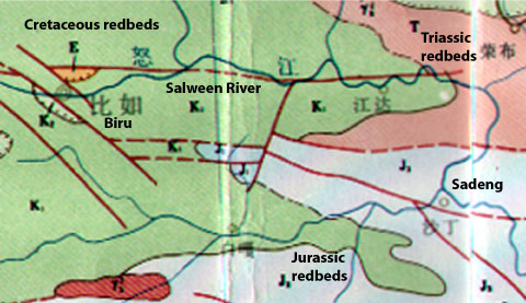
Geologic Map of the Salween from Biru to Sadeng. Map produced by the Chinese Ministry of Geology and Mineral Resources |
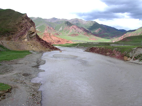
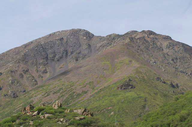
Mesozoic redbeds west of Biru. Photo by Cindy Appel |
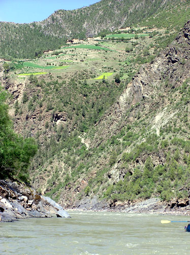
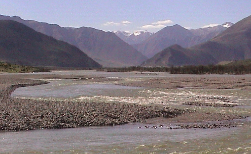
Paleozoic metamorphics form the canyon east of Biru. Photo by Cindy Appel |
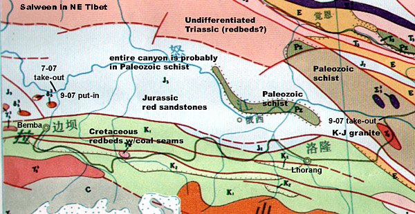
Geologic Map of the Salween from Sadeng to Marri/Lhorong area.Map produced by the Chinese Ministry of Geology and Mineral Resources |
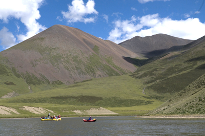
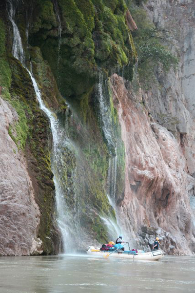
Mesozoic redbeds in fault contact with limestone south of Marri. Photo by Tony Griessbach |
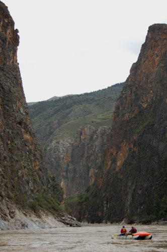
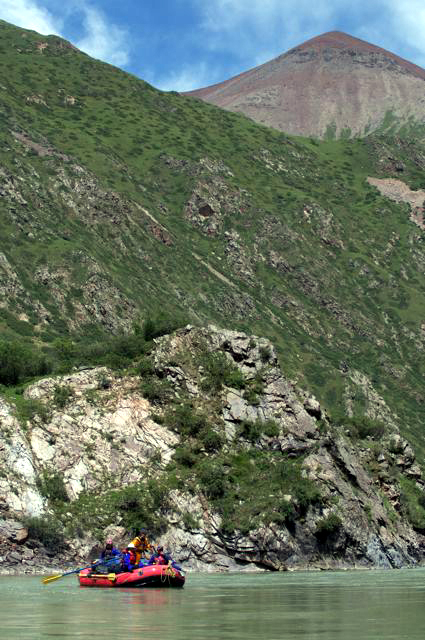
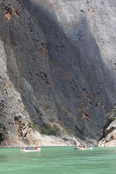
Paleozoic metamorphics form the canyon east of Sadeng. Salween inner gorge. Photo by Brock Disante |
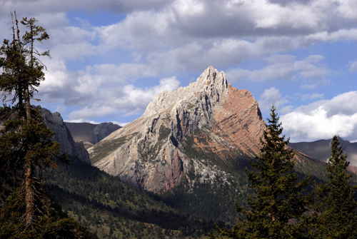
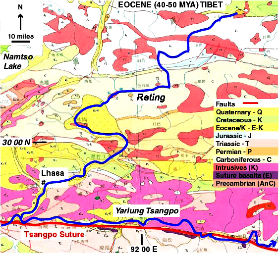
Geologic Map of the Reting and Lhasa Rivers Area. Map produced by the Chinese Ministry of Geology and Mineral Resources |
Marble cliffs. Photo by Wei Yi |
Black Slates. Photo by Wei Yi |
Red Volcanics. Photo by Wei Yi |
Granite. Photo by Wei Yi |
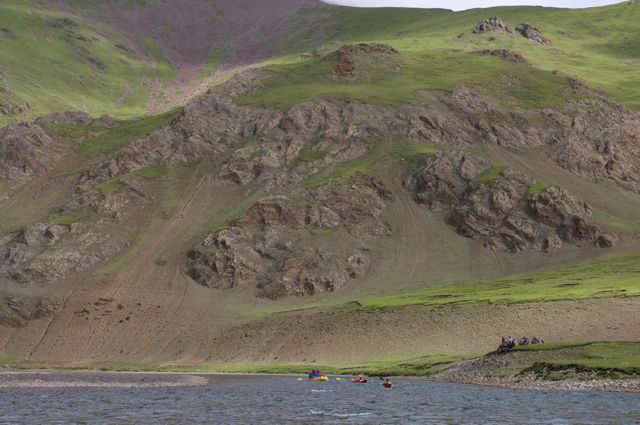
River Gravels in Kyi Qu. Photo by Steve Swann |
Bed Rock Rapid. Photo by Wei Yi |
Land Slide Rapid. Photo by Wei Yi |
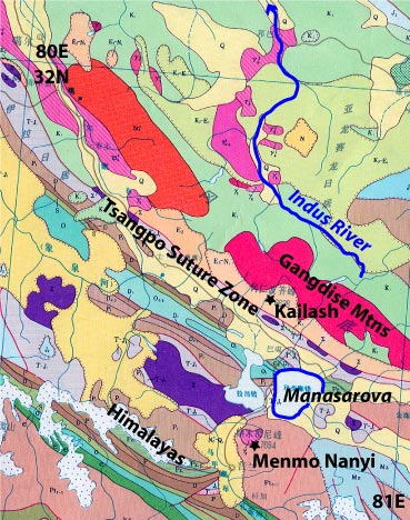
Geology and Geography of the Mt. Kailash area and Indus River headwaters in southwestern Tibet.Geologic Map of the Mt. Kailash area and Indus River headwaters in southwestern Tibet Headwaters Area Map produced by the Chinese Ministry of Geology and Mineral Resources Original scale 1:1,500,000 |
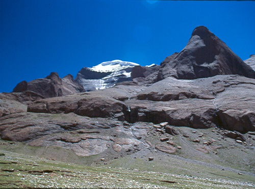
Mt. Kailash appears to be a metasedimentary roof pendent supported by massive granite.Photo by Travis Winn |
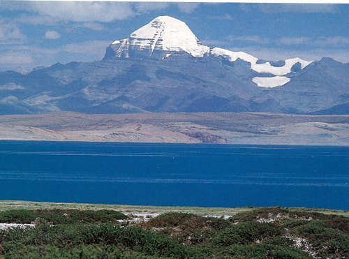
Looking north over Lake Manasarova at Mt. Kailash |
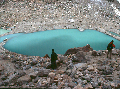
A small glacier feeding lakes bounded by moraines on the north side of Mt. Kailash is a remnant of the great ice sheets that covered northern Asia and Tibet during the Quaternary. The last ice sheet began retreating about 10,000 years ago. Photo by Travis Winn |
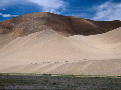
A herd of kiang (wild asses) cross Quaternary sand dunes which cover late Eocene volcanics interbedded with Cretaceous to Eocene sediments in the Indus River headwaters. The river valley is filled with glacial gravels and as a result has a constant gradient of about 16 feet per mile (3 m/km). Photo by Travis Winn |
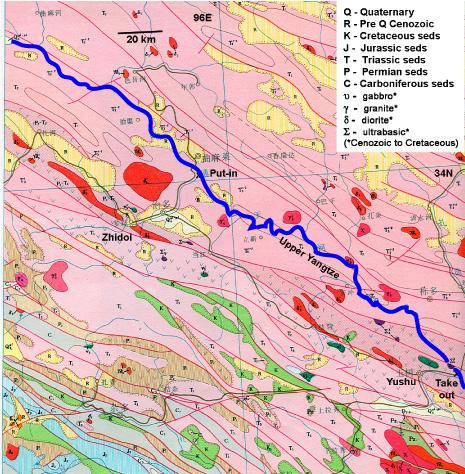
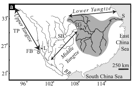
Geologic Map of the Yangtze Headwaters Area. Map produced by the Chinese Ministry of Geology and Mineral Resources Original scale :1,000,000 |
The size and shape of early Cenozioc rock exposures suggests the sediments were eroded from nearby older rocks and deposited in small basins created by early folding events as uplift of the Plateau progressed northeastward. Consequently, the upper Yangzte tributaries probably didn''t integrate to develop as a major river drainage until mid Cenozoic. Photo by Tony Griesbach |
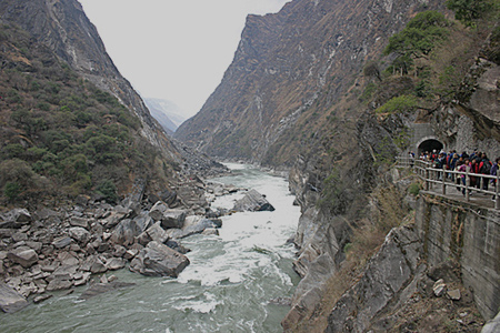
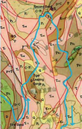
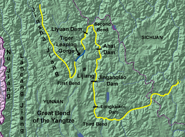
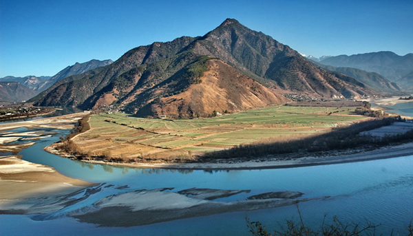
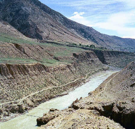
the Great Bend of the Yangtze Tiger Leaping Gorge |
Map produced by the Chinese Ministry of Geology and Mineral Resources Original scale :1,000,000 |
Three Great Bends of the Great Bends. Map by Rand McNally |
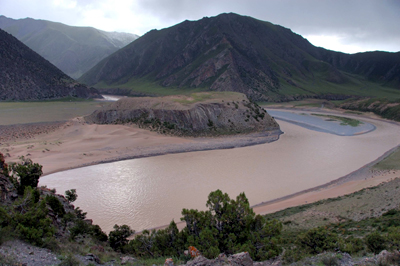
First Bend of the Jinsha (file photo) |
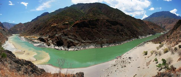
Second Bend of the Jinsha, Shuiluo confluence on left (photo by Li Hong |
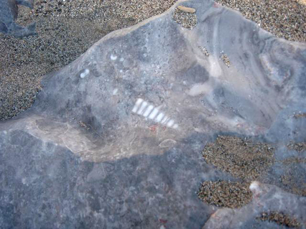
Fossil in Limestone (photo by Li Hong). |
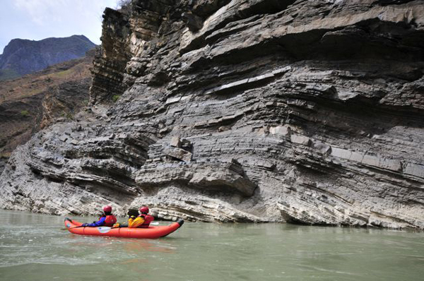
Limestone Beds, with oldest layers at bottom (photo by Li Hong). |
Massive Limestone Cliffs (photo by Li Hong). |
Large Spring in Limestone Canyon (photo by Li Hong). |
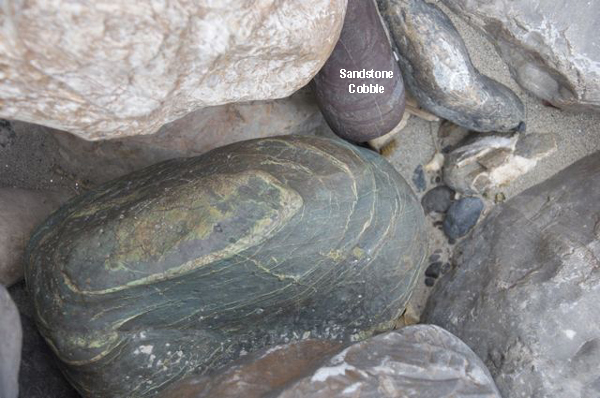
Sandstone cobble (photo by Li Hong). |
Sandstone Cliffs (photo by Li Hong). |
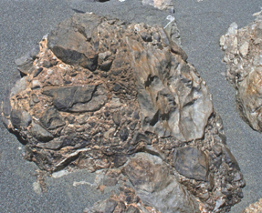
Rock shattered by fault zone activity (photo by Li Hong). |
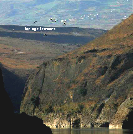
Ice Age Terraces perched several hundred feet above the river (photo by Li Hong). |
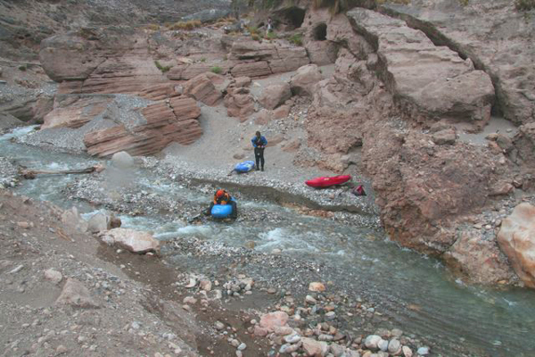
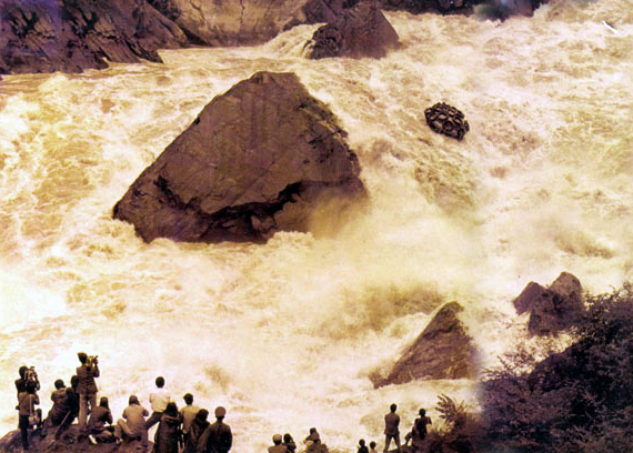
"Rafting" Hutaio Shoal in Tiger Leaping Gorge, 1986 |
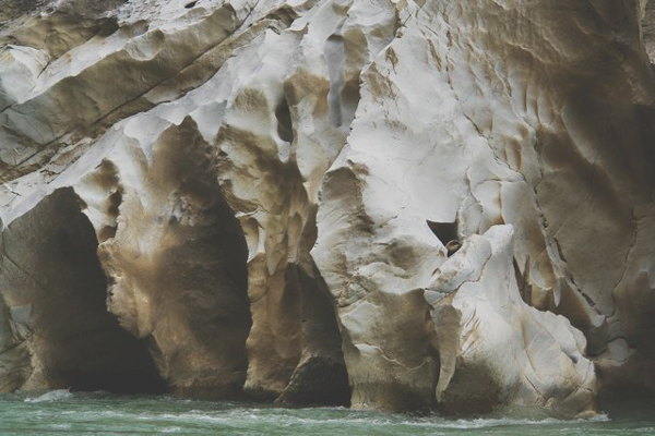
Fluted (water carved) limestone (photo by Li Hong). |
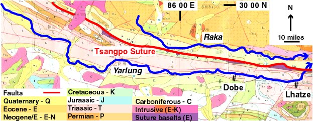
Map produced by the Chinese Ministry of Geology and Mineral Resources Original scale :1,000,000 |
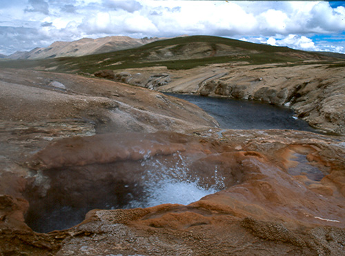
King Tiger Hotsprings north of Raka, indicating continued heat flow from India''s collision with Asia. An attempt to develop them failed. Photo by Travis Winn |
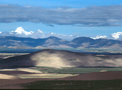
View of the Tsangpo where it ponds above Kanglai Gorge, with large sand dunes in the foreground and Anapurna (8091m or 26,538'') in the background. In the upper river valley, the river bed is filled with glacial gravels and with the exception of Kanglai Gorge upstream from Dobe, rapids are rare. Photo by Travis Winn |
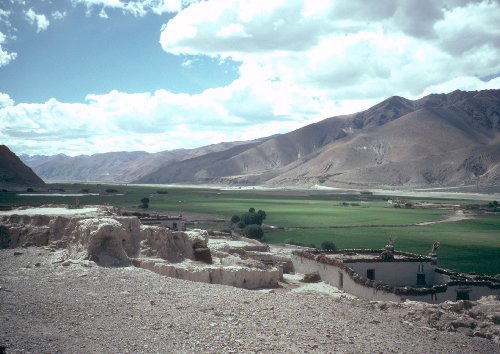
Just downsream from Dobe, the river enters Renqinding Gorge, which constricted the river at the end of the last ice age (10,000 years ago) and caused ponding and the deposition of lake sediments as illustrated in this photo. Underlying gravels form benches along the river which are sometimes three hundred feet thick and wide and flat enough for villages and fields, as seen in the photo below. Also note erosion of the colluvial fan above the village, due in part to overgrazing |
Yalung gravel. Photo by Steve Swann |
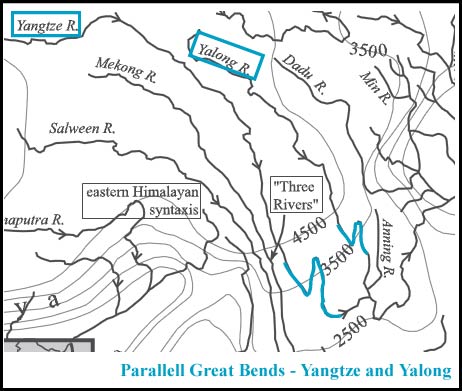
Pre-Himalayan Yangtze Drainage Pattern (by Burchfiel and others). |
Yangtze and Yalong - Parallel Great Bends (highlighted in blue) (by Burchfiel and others). |
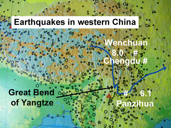
Major earthquakes in western China as of 2008 (US Geological Survey). |
Source: http://www.shangri-la-river-expeditions.com/wchinageo/wchinageo.html
Map produced by the Chinese Ministry of Geology and Mineral Resources Original scale 1:1,000,000