 | Phillippines Holocene Volcanoes |
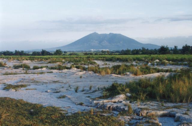
The forested Arayat volcano is one of the few topographic features that rise above the flat Central Plain of Luzon Island. Weak steaming occurs at the NW side of the 1026-m-high summit, which rises NE of the city of Angeles. A large breached crater on the WNW side is the apparent source of a major debris-avalanche deposit that forms hummocky terrain beyond the west and NW sides of the volcano. Post-collapse activity formed an andesitic dome known as White Rock in the collapse amphitheater. There are no reports of historical eruptions from Arayat. Although the volcano was listed as active during the past 2000 years (IAVCEI, 1973), perhaps referring to its thermal activity, the only dated rocks are 0.53 and 0.65 million-year-old basalts that predated collapse and formation of the lava dome. |
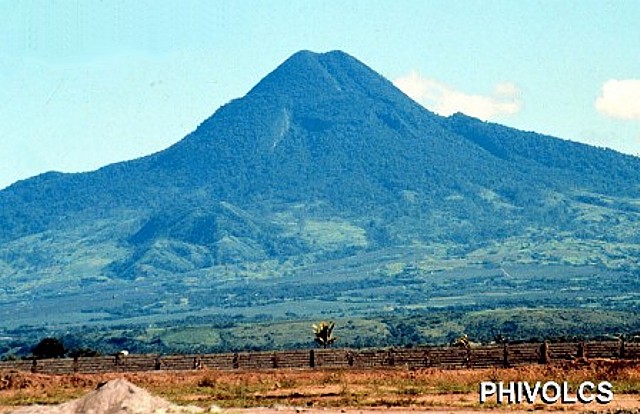
Conical Smith volcano in the foreground is one of five Pleistocene-to-Holocene volcanic centers occupying Babuyan de Claro Island north of Luzon. The symmetrical basaltic andesite cinder cone of Smith Volcano (also known as Mount Babuyan), rises to 688 m and is the youngest volcano on the island. Both the higher Babuyan Claro volcano and Smith volcano have apparently been active in historical time, although the identity of the erupting volcano is not always certain. |
Beautifully symmetrical Mayon volcano, which rises to 2462 m above the Albay Gulf, is the Philippines'' most active volcano. The structurally simple volcano has steep upper slopes averaging 35-40 degrees that are capped by a small summit crater. The historical eruptions of this basaltic-andesitic volcano date back to 1616 and range from strombolian to basaltic plinian, with cyclical activity beginning with basaltic eruptions, followed by longer term andesitic lava flows. Eruptions occur predominately from the central conduit and have also produced lava flows that travel far down the flanks. Pyroclastic flows and mudflows have commonly swept down many of the approximately 40 ravines that radiate from the summit and have often devastated populated lowland areas |
The symmetrical Matutum stratovolcano rises to 2286 m in southern Mindanao, NW of Sarangani Bay. The summit of the andesitic-to-dacitic volcano is truncated by a well-preserved 320-m-wide crater that is breached by three gorges and has a 120-m-deep, densely forested floor. Widespread silicic pyroclastic-flow deposits surround the volcano, which overlooks the major city of General Santos. The youngest pyroclastic deposits were dated at about 2000 yrs BP. A report stated that Matutum volcano was "smoking" on March 7, 1911 (Neumann van Padang, 1953). The Akmoan and Lianan thermal areas are located on the WSW flank of the volcano. |
Taal volcano is one of the most active volcanoes in the Philippines and has produced some of its most powerful historical eruptions. In contrast to Mayon volcano, Taal is not topographically prominent, but its prehistorical eruptions have greatly changed the topography of SW Luzon. The 15 x 20 km Talisay (Taal) caldera is largely filled by Lake Taal, whose 267 sq km surface lies only 3 m above sea level. The maximum depth of the lake is 160 m, and several eruptive centers lie submerged beneath the lake. The 5-km-wide Volcano Island in north-central Lake Taal is the location of all historical eruptions. The island is a complex volcano composed of coalescing small stratovolcanoes, tuff rings, and scoria cones that has grown about 25% in area during historical time. Powerful pyroclastic flows and surges from historical eruptions of Taal have caused many fatalities. |
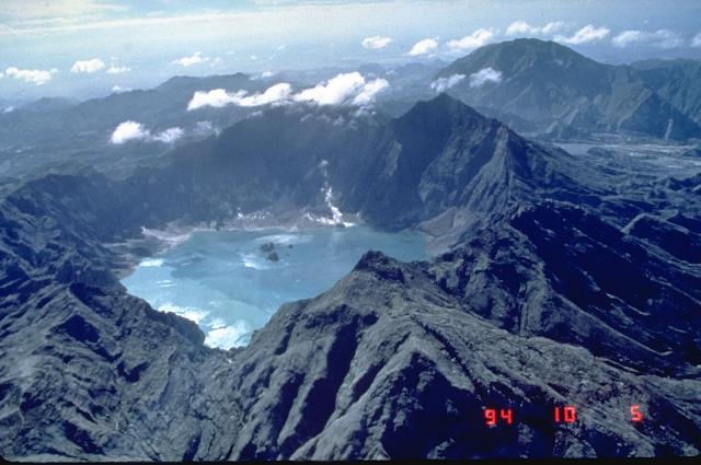
The 1991 eruption of Pinatubo volcano in the Philippines created a new caldera with an average diameter of 2.5 km. Caldera collapse, which lowered the height of the volcano about 300 m, occurred following the ejection of nearly 10 cu km of tephra in one of the world''s largest eruptions of the 20th century. This 1994 view from the NW shows a lake filling the caldera floor and two small islands from a partially submerged lava dome that was erupted in 1992. |
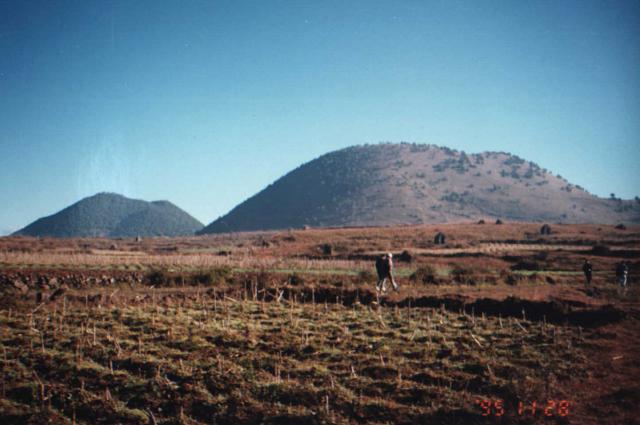
China. The Tengchong volcanic district, located in southern China near the border with Burma (Myanmar), was active during five periods ranging from the early Pliocene to the Holocene. Three main stages prroduced Pliocene to mid-Pleistocene basaltic rocks, mid- to late-Pleistocene silicic pyroclastic rocks, and Holocene basaltic andesites. The youngest volcanism in the 600 sq km volcanic field occurred in two stages during the early and late Holocene. Volcanic cones at the northern end of the field are sparsely vegetated and have clearly visible lava flows. Three basaltic-andesite centers, Dayinshshan, Maanshan, and possibly Heikongshan, are of Holocene age. An unconfirmed explosive eruption took place in 1609, and there are unconfirmed reports of eruptions in the Qing Dynasty (1644-1911). The Tengchong district is the site of active geothermal fields, the largest and highest temperature of which is the Rehai geothermal field. More than 20 hydrothermal eruptions have occurred at the Rehai geothermal field since 1993. |
The Global Volcanism Program database for Volcanoes of the Philippines and Southeast Asia currently contains 59 Holocene volcanoes and 3 Pleistocene volcanoes with thermal activity, sorted below in geographical (volcano number) order


