 | Havaiian maps (MBARI) |
http://www.mbari.org/data/mapping/hawaii/index.htm |
Map view Haleakala - http://www.mbari.org/data/mapping/hawaii/haleakala.htm |
Haleakala - http://www.mbari.org/data/mapping/hawaii/haleakala.htm |
Haleakala - http://www.mbari.org/data/mapping/hawaii/haleakala.htm |
Haleakala - http://www.mbari.org/data/mapping/hawaii/haleakala.htm |
Map view Hilo-http://www.mbari.org/data/mapping/hawaii/hilo.htm |
Hilo-http://www.mbari.org/data/mapping/hawaii/hilo.htm |
Map view Kohala - http://www.mbari.org/data/mapping/hawaii/kohala.htm |
Kohala - http://www.mbari.org/data/mapping/hawaii/kohala.htm |
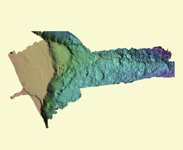
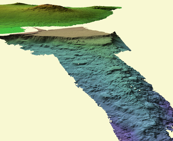
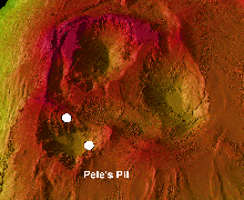
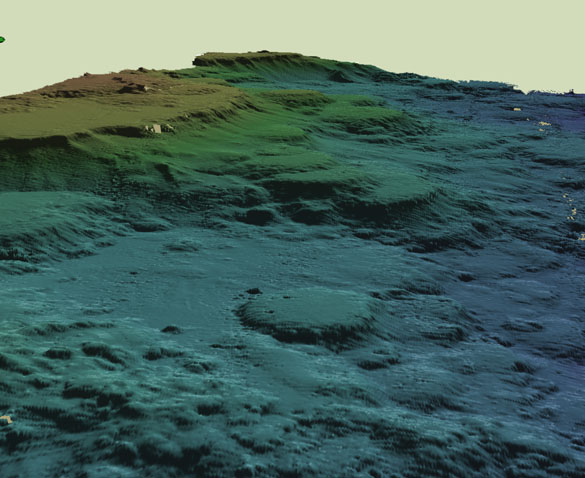
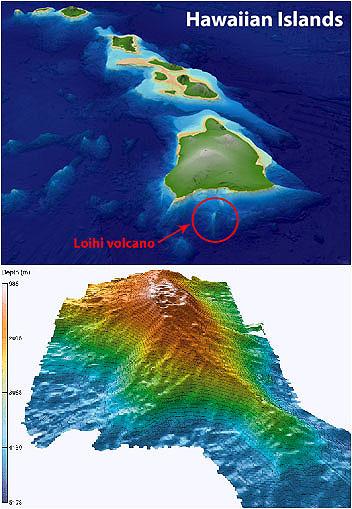
Map view Loihi- from http://www.mbari.org/data/mapping/hawaii/loihi.htm |
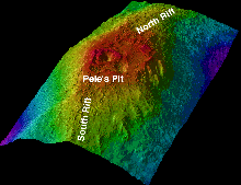
Bathymetric relief map of Loihi Seamount shows summit and rift zones. Bathymetric data courtesy of F. Duennebier |
Loihi- from http://www.mbari.org/data/mapping/hawaii/loihi.htm |
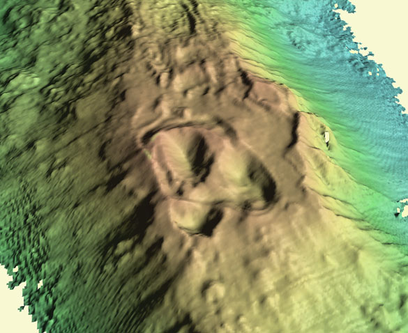
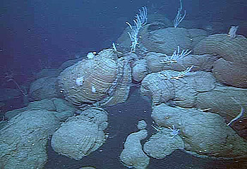
Close-up of summit of Loihi Seamount with newly formed pit crater. White dots mark location of hydrothermal vents |
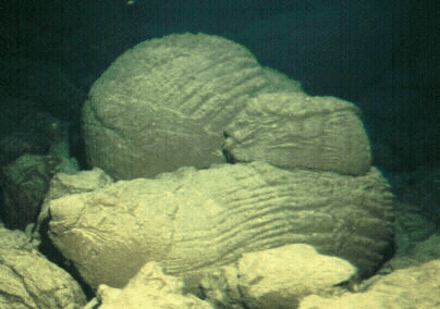
A bulbous pillow lava from Loihi''s summit area. Most of the rocks to be found on Loihi''s summit are coated by some amount of fine sediment and/or clay minerals that come from the interaction of sea water with the rock''s surface. Only the very youngest rocks typically are sediment-free in this environment -http://www.soest.hawaii.edu/GG/HCV/loihi.html |
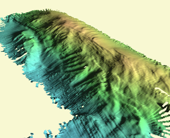
Map view Mahukona ¢ from http://www.mbari.org/data/mapping/hawaii/mahukona.htm |
Mahukona ¢ from http://www.mbari.org/data/mapping/hawaii/mahukona.htm |
A series of drowned coral reefs form terraces off Kawaihae on the island of Hawaii.Image ® 2004 MBARI |
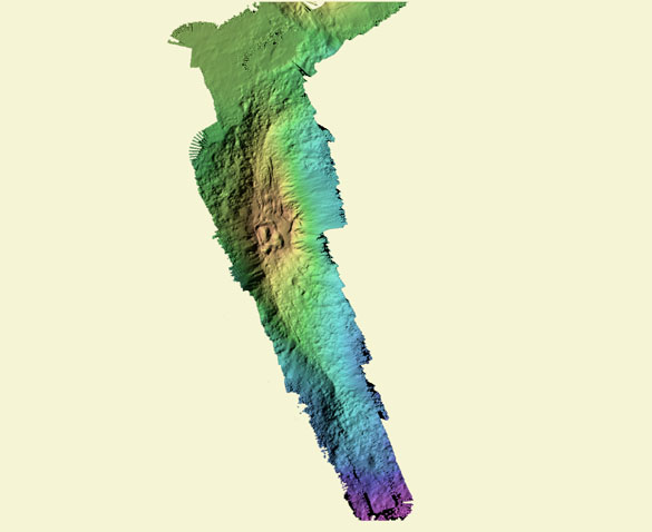
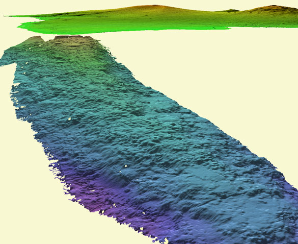
Oblique view Moloka`I ¢from http://www.mbari.org/data/mapping/hawaii/molokai.htm |
Map view Ni`ihau from http://www.mbari.org/data/mapping/hawaii/niihau.htm |
Oblique view Ni`ihau from http://www.mbari.org/data/mapping/hawaii/niihau.htm.Stair steps of flat-topped cones seen in the bathymetric data off the island of Ni''ihau (west of Kauai) |
Oblique view Ni`ihau from http://www.mbari.org/data/mapping/hawaii/niihau.htm |
http://www.mbari.org/data/mapping/hawaii/papau.htm |
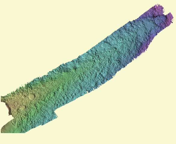
Map view on Puna Ridge - from http://www.mbari.org/data/mapping/hawaii/puna.htm |
Oblique viqw on Puna Ridge - from http://www.mbari.org/data/mapping/hawaii/puna.htm |
http://www.mbari.org/news/homepage/2011/clague-pyroclastics/clague-pyroclastics.html |
Black sand rubble amongst underwater lava formations off the coast of Hawaii. Image ® 2000 MBARI |
limu o Pele fragments |
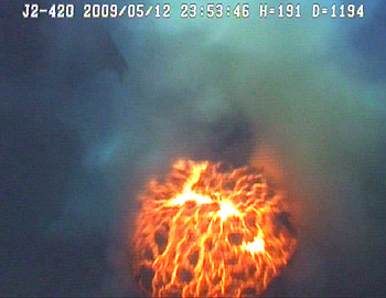
An underwater eruption in progress on West Mata volcano in the Lau Basin, southwest of American Samoa. MBARI geologist David Clague caught this volcano in the act, using the remotely operated vehicle JASON 2 in May 2009. Image courtesy of Joe Resing/NOAA/NSF |
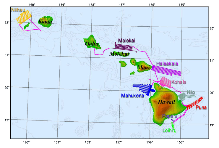
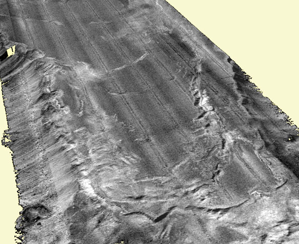
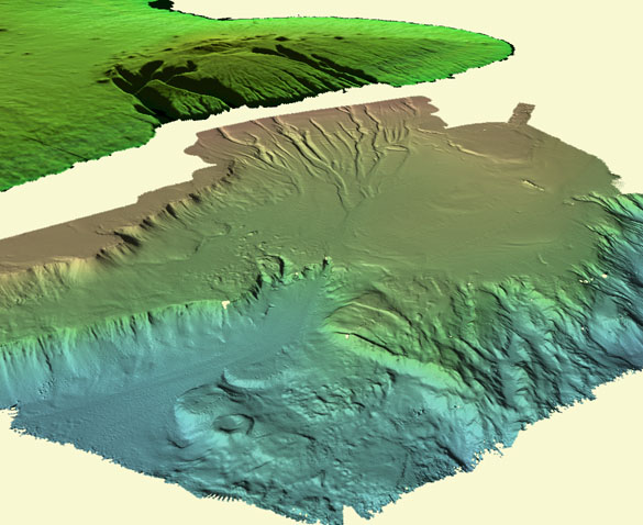
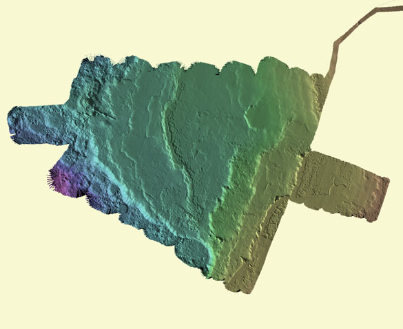
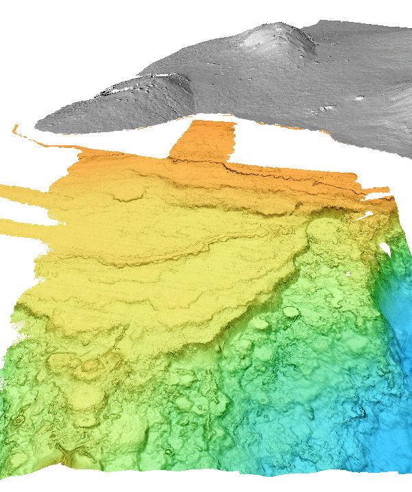
Haleakala -from http://www.mbari.org/data/mapping/hawaii/haleakala.htm
The Haleakala survey shows a 55-by-20-kilometer smooth section of the rift zone east of Maui that was once above sea-level. The region is marked by a series of shoreline features, including several prominent coral reefs (best seen in the third oblique view below) and as previously described by Moore et al. (1990) and Clague et al. (1998). These reefs and shorelines are tilted down to the south because of flexure related to the growth of Hawaii.
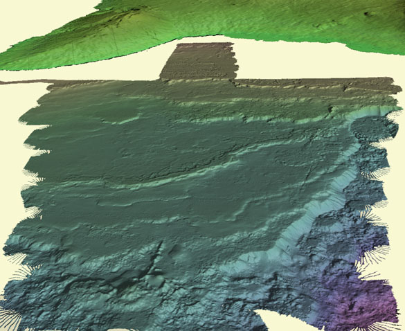
This gently-sloping platform is dotted with numerous pointed volcanic cones at the western end nearest the island (Clague et al., 1999, in press). These cones do not have summit craters like their subaerial counterparts and are inferred to have erupted below sea level. They are probably composed of alkalic basalt or hawaiite erupted at the same time as the post-shield Kula Volcanics on East Maui Volcano. One cone is surrounded by an area of high backscatter, as seen in the second oblique view, and may be younger, and have thinner sediment cover, than the other pointed cones. Previous sampling of this cone shows that it consists of fragmental hawaiite coated with thick hydrothermal manganese-oxides (Hein et al., 1996).
The rift zone below the break-in-slope, as seen in the first oblique view, is characterized by flat-topped volcanic cones (Clague et al., 1999, in press), most of which are very similar in form to those on the slopes of Ni`ihau, although a few have central summit craters. Two irregularly-shaped perched lava ponds with levees (Clague et al., 1999, in press) occur among the cones.
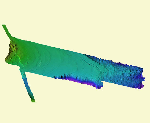
from-http://www.mbari.org/data/mapping/hawaii/hilo.htm
Hilo Survey
The Hilo survey was a joint effort between MBARI and the U.S. Geological Survey. The USGS data for the shallow part of the area (Dartnell and Gardner, 1999) were combined with our survey covering the Hilo Ridge rift zone to construct the composite images shown. There are several prominent reefs offshore Hilo, including a 150-meter-deep reef that is about 15,000 years old, a 400-meter-deep reef that is about 125,000 years old, and a 1,150-meter-deep one that is about 425,000 years old.
In addition, several more subtle reefs are present between the 400-meter and the 150-meter reefs. These reefs record smaller changes in Pleistocene sea level than the prominent reefs. Each of these reefs has grown on top of the Hilo Ridge, thereby demonstrating that Hilo Ridge is greater than 425,000 years old (Clague et al., 1998). This age makes it unlikely that the Hilo Ridge is a submarine rift zone from Mauna Kea Volcano as the Mauna Kea shield was still actively growing at that time. It seems most likely that the Hilo Ridge is a long submarine rift zone of Kohala Volcano, as proposed by Reiners et al. (1997). This rift would be comparable in length to the Puna Ridge of Kilauea Volcano and the magmatic processes operative within the rift zone are similar to those documented at Puna Ridge (Clague et al., 1995; Yang et al., 1999). The 1,150-meter terrace is dotted with numerous small volcanic cones. The rift zone below the 1,150-meter terrace is characterized by numerous flat-topped volcanic cones (Clague et al., 1999, in press), one of which has been modified by rift-parallel faulting
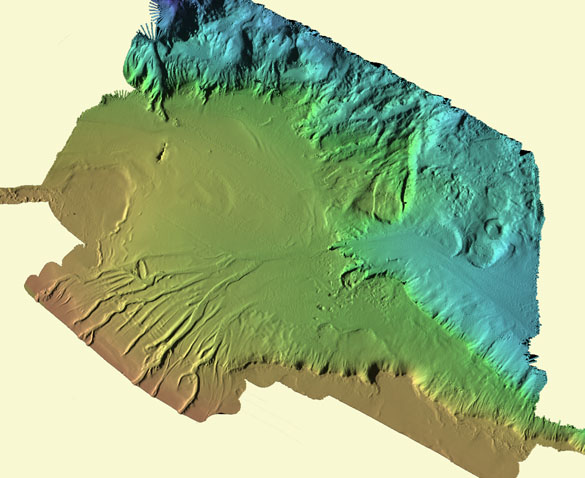
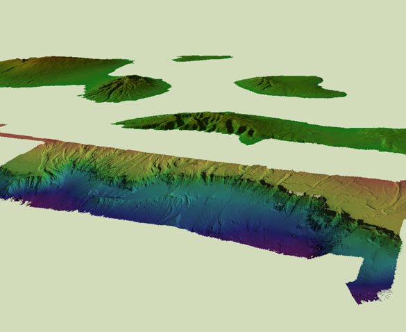
Kohala - http://www.mbari.org/data/mapping/hawaii/kohala.htm
The Kohala survey shows the headwall of the Polulu giant landslide (Moore et al., 1989, 1994) on the northeast side of Kohala Volcano on Hawaii. On land, the landslide is bounded to the south by the famous Waipio Valley and to the north by the Pololu Valley. Offshore, the landslide is not evident as it is buried beneath carbonate terrace deposits (Clague et al., 1998).
There are two prominent terraces present, with the shallower one about 400 meters deep and dating from about 125,000 years ago, and the deeper and older terrace about 1,150 meters deep and dating from about 425,000 years ago (Moore and Clague, 1992). These reefs are constructed on top of the slide debris, indicating that the slide dates from the active shield-building stage of activity of Kohala Volcano, which ended at about this time. In addition, the offshore data suggest that the slide did not move very far, as a cluster of volcanic cones occur in the path that the slide is thought to have traveled.
The Pololu slide appears to have been a slump, like the Hilina fault system on Kilauea, but one that never failed catastrophically. The shallowest part of the carbonate terrace is incised by submarine canyons. However, in contrast to the canyons north of Moloka`i, these canyons appear to have formed below sea level and to have eroded into the carbonate terraces. Many of the canyons begin mid-slope and become more subtle downslope. We think that these canyons formed from submarine fresh water flow that dissolved the canyons in the carbonate terraces
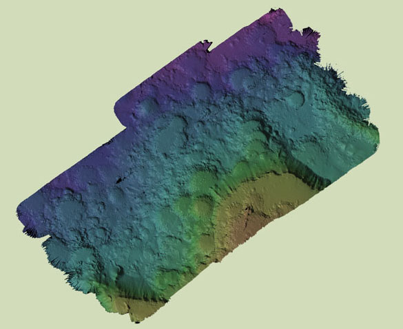
Loihi- from http://www.mbari.org/data/mapping/hawaii/loihi.htm
The Loihi Seamount survey covers the summit and rift zones, but not the steep flanks of the volcano. Lower resolution surveys of the entire seamount are presented by Fornari et al. (1988) and Moore and Chadwick (1995). The new data show that there are few cones, none of which are flat-topped, on LoihiÆs rift zones compared to the rifts of the other surveyed volcanoes.
The 1996 collapse pit in the southwestern part of the summit platform (1996 Loihi Science Team, 1997; Davis and Clague, 1998) is clearly seen, as are the two older collapse pits. The 1996 pit, with a volume of about 0.17 cubic kilometers, probably formed in response to magma withdrawal to feed an eruption down the south rift zone (Davis and Clague, 1998), although the eruption site has not yet been located
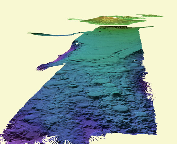
Mahukona ¢ from http://www.mbari.org/data/mapping/hawaii/mahukona.htm
The Mahukona survey is located west of the north Kona coast on Hawaii and shows a large area named the Kohala Terrace. We have called it the Mahukona survey for the submarine volcano that forms the western part of the survey area. This area is characterized by a stairstep series of drowned coral reefs that date from as recent as 15,000 years ago, for the shallowest reef at 150-meters depth, to as old as 465,000 years for a reef near the break-in-slope (Clague and Moore, 1991). The new bathymetry and sidescan allow us to determine the distribution of these reefs much more accurately than was previously possible (Clague et al., 1998).
The new data show that the series of reefs were progressively tipped toward the southeast as the island of Hawaii grew. The images also reveal several, previously unknown, submarine eruptive fissures and lava flows that drape the different reefs. These fissures are probably radial vents from Mauna Loa Volcano. The western rift zone of Mahukona Volcano is characterized by numerous flat-topped circular volcanic cones, similar in form to those on the flanks of Ni`ihau. In addition, several pointed cones, including one that is about 650 meters tall, occur along the rift zone. The large pointed cone is constructed of alkalic basalt (Garcia et al., 1990; Clague and Moore, 1991), and probably erupted during the post-shield stage.
http://www.mbari.org/data/mapping/hawaii/molokai.htm
The Moloka`i survey shows the headwall of the giant Wailau landslide (Moore et al., 1989, 1994). The break-in-slope is the headwall of the slide, which is seen to be quite irregular due to secondary slumping (Clague et al., 1998). The gently-sloping platform above the headwall is cut by numerous submarine canyons and, to the west, a meandering stream channel, all probably carved when this area was still above sea level.
Plunge pools are present at the distal end of many of the canyons below the break-in-slope. A single volcanic cone and flow are present in the central part of the gently-sloping platform above the break-in-slope. This cone and flow are apparently young (they have high backscatter in the sidescan data indicating thin sediment cover) and probably erupted during the rejuvenated stage that formed the Kalauapapa Peninsula between 370,000 and 540,000 years ago (Clague et al., 1982). Below the headwall a single rotational slump block has moved away from the headwall and diverted subsequent sediment flow around the block to the east. The oblique view below shows the area from the north with the islands of Moloka`i, Maui, Lana`i, and Kaho`olawe in the background.
The oblique views show the area from the north with the islands of Moloka`i, Maui, Lanai, and Kaho`olawe in the background. The second oblique is a close-up of some of the canyons and the offshore rotated slump block.
Ni`ihau from http://www.mbari.org/data/mapping/hawaii/niihau.htm
The Ni`ihau survey imaged a region of young lava flows and volcanic cones on the submarine northwest flank of Ni`ihau Island. More than half of Ni`ihau Island consists of rejuvenated-stage alkalic basalt flows and cones of the Kiekie Volcanics (Stearns and Macdonald, 1947; Clague, 1987) and the submarine volcanic cones and flows are almost certainly related to them. The Kiekie Volcanics have been dated by potassium-argon techniques at 0.3-3.5 million years old (Clague and Dalrymple, 1987), and the submarine lava flows and cones, although unsampled, probably formed during this same time period.
The volcanic cones have unusual shapes with steep flanks and nearly flat tops that probably formed as submarine lava ponds overflowed levees, creating the circular shape and the flat top (Clague et al., 1999, in press). Such flat-topped volcanic cones had not previously been identified from the flanks of any of the Hawaiian Islands. A few cones have pointed tops and may be related to post-shield stage eruptions of volatile-rich alkalic basalt.
The new data also show an old shoreline of the island, probably formed near the end of the voluminous tholeiitic shield stage, as a sharp break-in-slope around 1,000 meters depth. The depth of this shoreline feature indicates the amount of subsidence that Ni`ihau Island has undergone since the end of the shield-building stage. In addition, the break-in-slope is deeper to the northeast (1,090 meters) than to the southwest (960 meters), indicating that Ni`ihau subsided more on the end closest to the adjacent Kauai Island. Several irregular-shaped cones are present on the gently-sloping platform above the break-in-slope.
The images below are map views of the bathymetry and backscatter data and several oblique views. The first of the oblique views is from the north, the second is a close-up from the same direction, and the final view is from the west. The oblique images are sun-illuminated bathymetry with a color scale superposed and the backscatter draped on the sun-illuminated bathymetry.
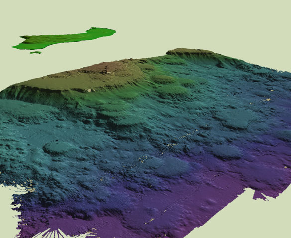
Papa`u seamouth from http://www.mbari.org/data/mapping/hawaii/papau.htm
A small survey was conducted on PapaÆu Seamount, a small hill located on the southwest edge of the Hilina landslide on Kilauea. In previous bathymetry (Moore and Chadwick, 1995), Papa`u Seamount was simply a rounded hill, leading to possible origins ranging from volcanic to tectonic. The new data show that this hill is along a shear zone on the southwest margin of the Hilina Slump (Clague et al., 1998; Morgan et al., submitted).
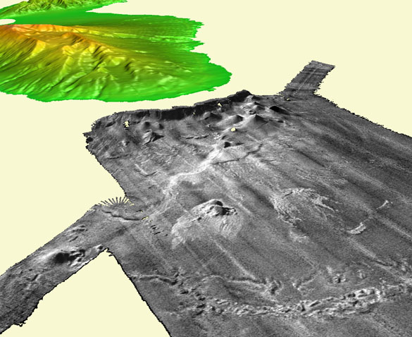
Puna Ridge - from http://www.mbari.org/data/mapping/hawaii/puna.htm
The Puna Ridge survey was conducted to obtain higher-resolution bathymetry than previously available from SeaBeam surveys (Clague et al., 1994, 1995). The new bathymetry shows details such as cones with craters at 3,000 meters depth. Several cones along the shallow part of the rift zone are flat-topped cones (Clague et al., 1999, in press), but most of the volcanic vents are small cones with craters or linear ridges parallel to the rift. Several low cones with large craters occur in shallow water and may have formed by hydromagmatic explosive eruptions. The evolution of Hawaiian rift zones, based on these Simrad surveys, is briefly discussed in Reynolds et al. (1998).
Mata Submarine Volcano (video)
Erupting Underwater Volcano
Erupting Underwater Volcano (video)
References