 | Havaii |
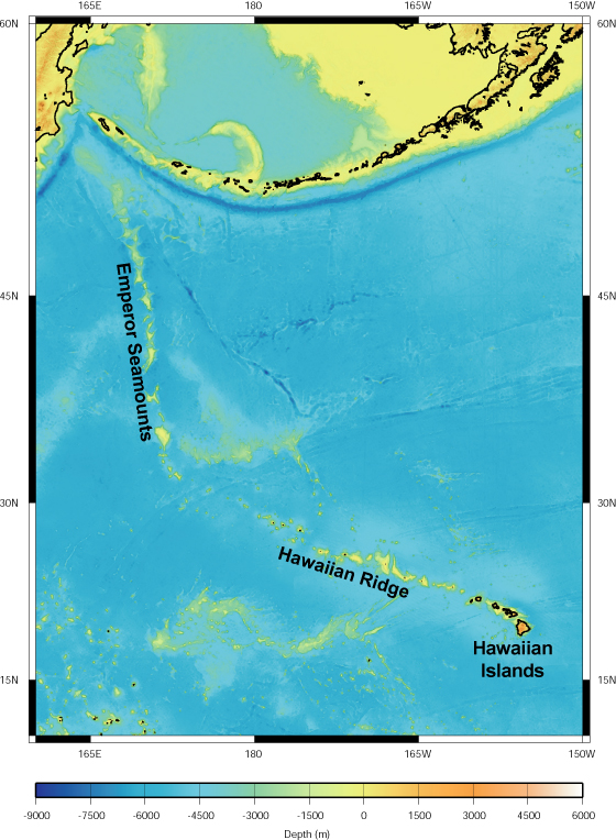
Map of Hawaiian-Emperor Seamount Chain. Map ® 2004 MBARI |
|
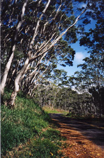
Native koa forest along the road to Kilauea.Photo ® 1999 J.B. Paduan -biogeography-http://www.mbari.org/volcanism/Hawaii/HR-Biogeography.htm |
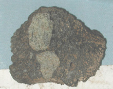
Lava (brown) containing olivine-rich xenoliths (greenish) collected offshore of Kauai.Photo ® MBARI 2001- http://www.mbari.org/volcanism/Hawaii/HR-MagmProc.htm |
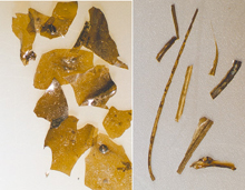
Fragments of limu o Pele and Pele''s hair, formed from lava bubbles during eruption http://www.mbari.org/volcanism/Hawaii/HR-ExplosiveErupt.htm -Photo ® 2001 MBARI - |
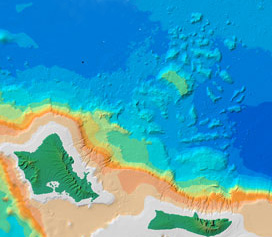
Debris from enormous landslides off Oahu and Molokai extends hundreds of kilometers.Map ® 2001 MBARI -http://www.mbari.org/volcanism/Hawaii/HR-Landslides.htm |
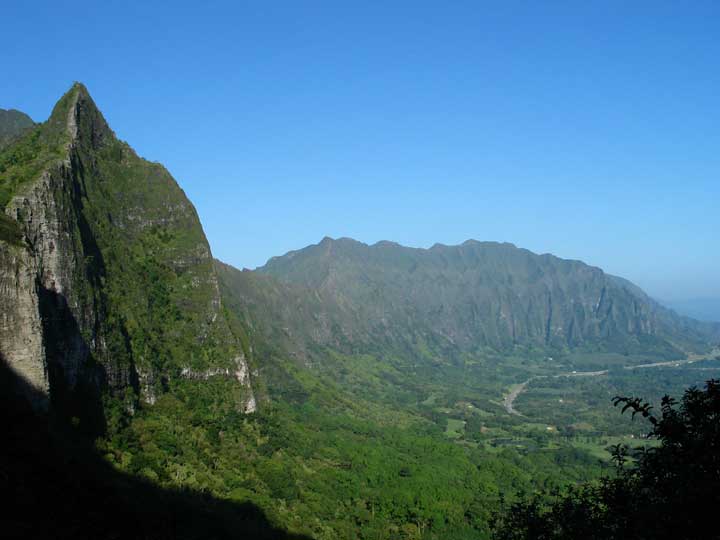
Pali above Kane''ohe Bay on Oahu: the slide-scarp of the Nuuanu landslide.Photo ® 2004 J.B. Paduan -http://www.mbari.org/volcanism/Hawaii/HR-Landslides.htm |
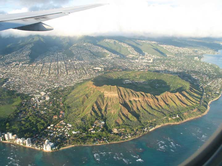
Waikiki''s landmark, Diamond Head crater, from the air. Photo ® 2004 J.B. Paduan -http://www.mbari.org/volcanism/Hawaii/HR-Hazards.htm |
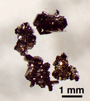
Sulfide minerals include pyrite, pyrrhotite -http://www.mbari.org/volcanism/Hawaii/HR-Hydrothermal.htm |
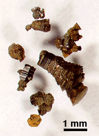
Sulfide minerals include wurzite and sphalerite (right), some with copper, lead, and cadmium-rich inclusions -http://www.mbari.org/volcanism/Hawaii/HR-Hydrothermal.htm |
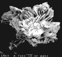
The sulfates consist of anhydrite and barite; the latter has a high strontium content. Chemical compositions are similar to those observed at mid-ocean ridge vent precipitates -http://www.mbari.org/volcanism/Hawaii/HR-Hydrothermal.htm |
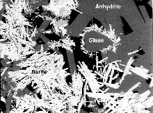
Backscattered electron images (BSE) of rounded glass shard completely surrounded by a shell of delicate sulfide and sulfate crystals -http://www.mbari.org/volcanism/Hawaii/HR-Hydrothermal.htm |
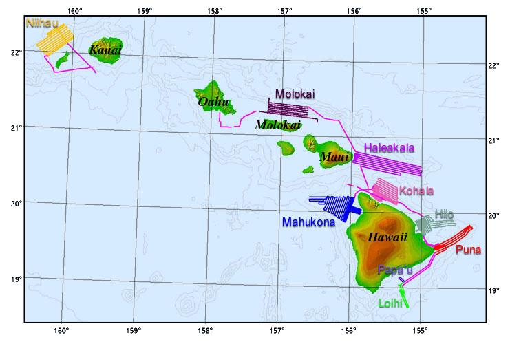
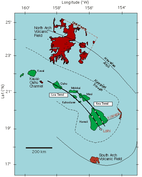
Map showing the North and South Arch lava fields, in red, in relation to the Hawaiian Islands. The axes of the trough and arch are encircling the islands.Map ® MBARI 2001 - http://www.mbari.org/volcanism/Hawaii/HR-FlexArch.htm |
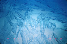
Photo from the Shinkai 6500 submarine of a sheet flow on the North Arch. Note the thin sediment cover, indicating the relatively young age of the flow.Photo ® 1999 JAMSTEC - http://www.mbari.org/volcanism/Hawaii/HR-FlexArch.htm |
|
Havaiian Volcano observatory
Havaiin island geology
Havaii Center for Volcanology