 | Hokkaido Volcanos |
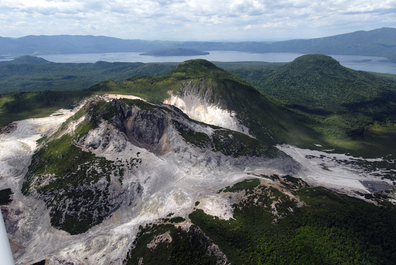
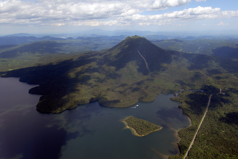
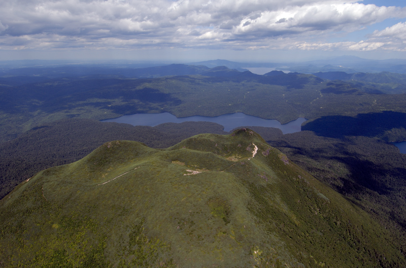
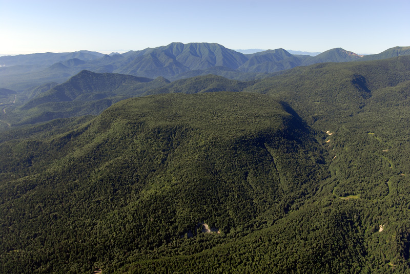
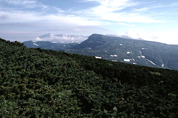
Aerial view of Lava domes of Atosanupuri Volcano as seen from the E. Atosanupuri, Makuwanchisappu and Sawanchisappu from left to right. Kussharoko Lake in the background. |
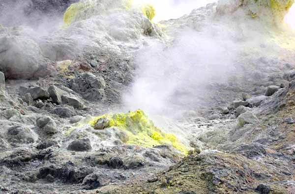
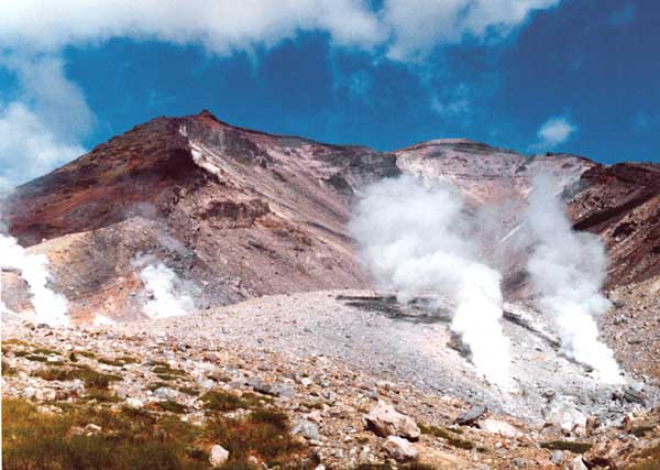
Fumaroles with sulfur at flank of Atosanupuri Lava Dome |
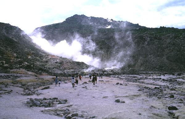
fumaroles of Atosanupuri Lava Dome from the NE. |
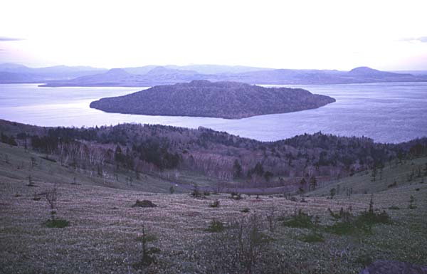
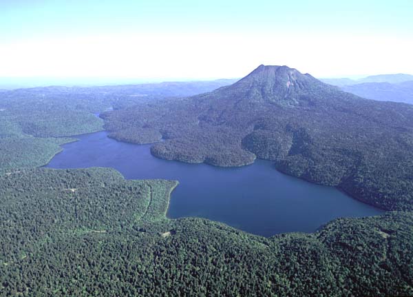
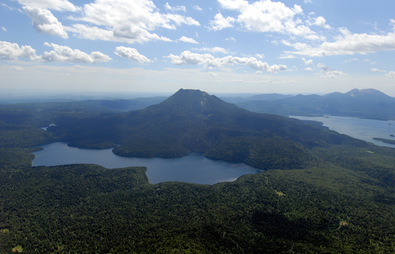
View of Nakajima Volcano from the E. Younger lava domes in the crater of tuff-ring; Kussharo Caldera wall in the background |
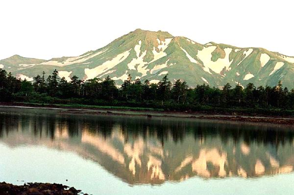
View of post-caldera Nakajima Volcano from the W (Bihoro Pass on the western caldera rim). Ring-shaped hydroclastic cone of Nakajima with lava domes in the crater and Atosanupuri Lava Dome on the opposite side of the lake |
View of Birao-yama from the ESE (town of Teshikaga). |
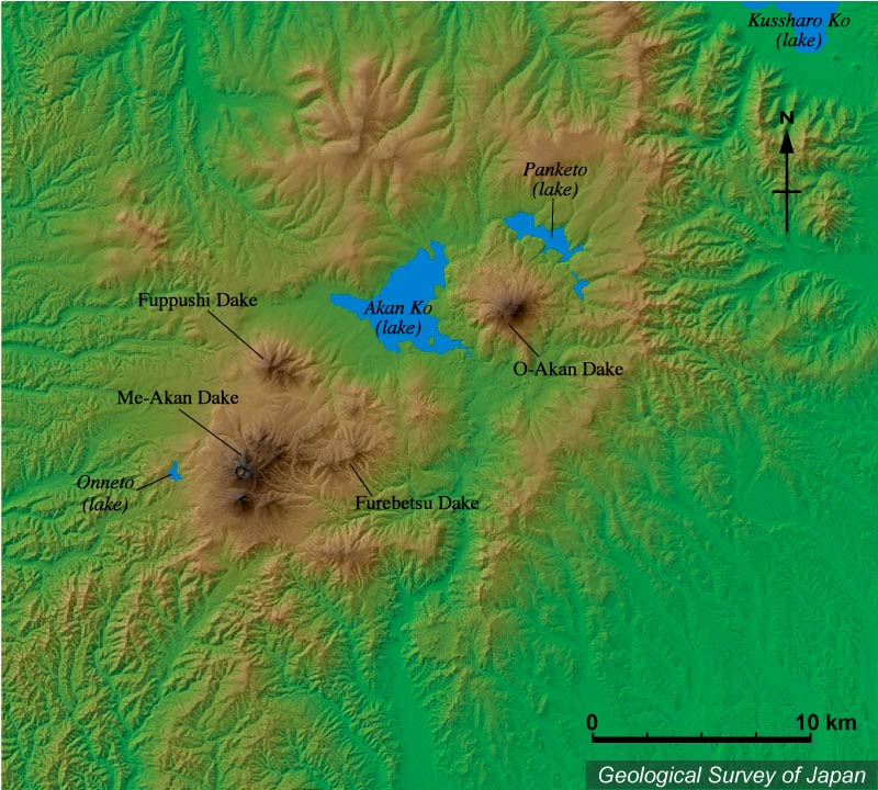
Colored topographic relief of Akan Caldera. Lake Akan is subdivided by post-caldera volcano "Oakan-dake". Fuppushi-dake, Furebetsu-dake and Meakan-dake are post-caldera volcanoes located on the southeastern caldera rim. Lake Kussharo located on the northwestern edge of the area |
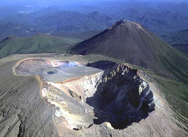
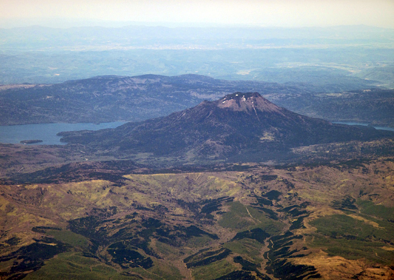
View of Akan Caldera rim from the E. Caldera rim in the middle (ca. 700-800 m a.s.l.). Post-caldera volcanoes Meakan-dake on the left and Oakan-dake on the right. Two fumarole areas on the summit of Meakan-dake |
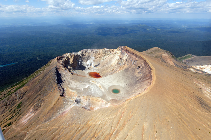
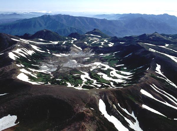
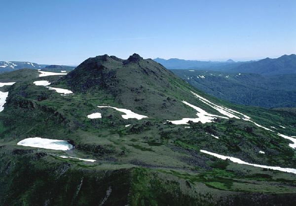
MEAKAN-DAKE Aerial view of Ponmachineshiri Crater as seen from the SE |
MEAKAN-DAKE Oblique aerial view of Akan-Fuji (foreground), Ponmachineshiri (middle), Fuppushi-dake (left side behind) and Oakan-dake (right background) as seen from the SW |
MEAKAN-DAKE Oblique aerial view of Ponmachineshiri Crater from the N. Younger Akanuma Crater in the foreground and older crater with small pond (Aonuma). Akan-Fuji in the middleground |
MEAKAN-DAKE Low aerial view of Nakamachineshiri Crater as seen from the NE |
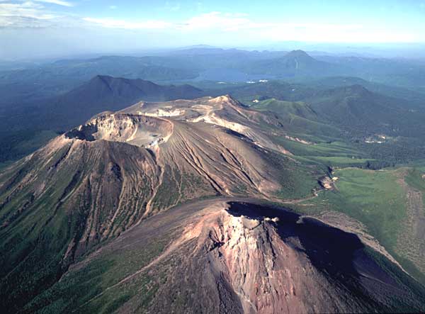
Oblique aerial view of Oakan Volcano from the N showing beautiful morphology of lava flows that entered Lake Panketo |
Aerial view of Oakandake as seen from the SE. |
Oblique aerial view of Oakan Volcano as seen from the N showing beautiful morphology of lava flows that entered Lake Panketo. |
Aerial view of the Oakan Volcano as seen from the WSW |
Aerial view of the summit of Oakan Volcano as viewed from the SSW |
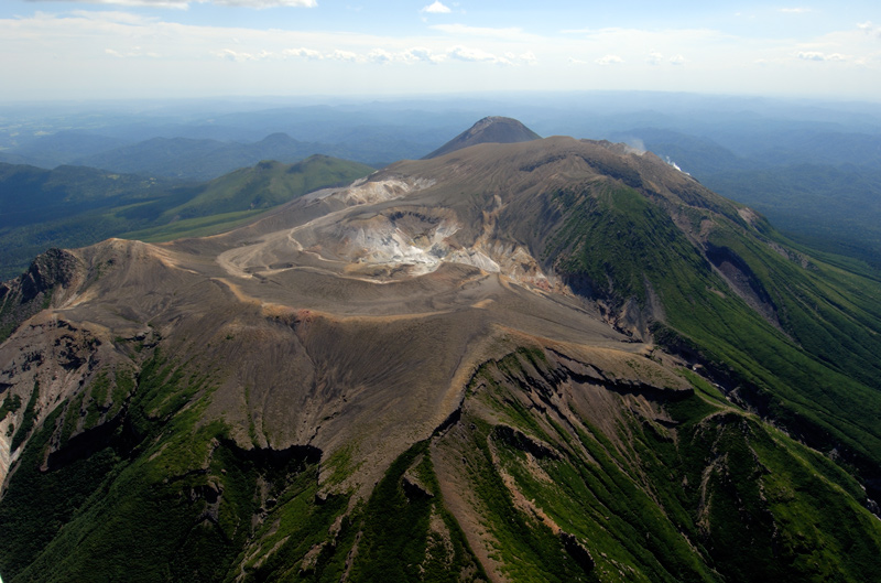
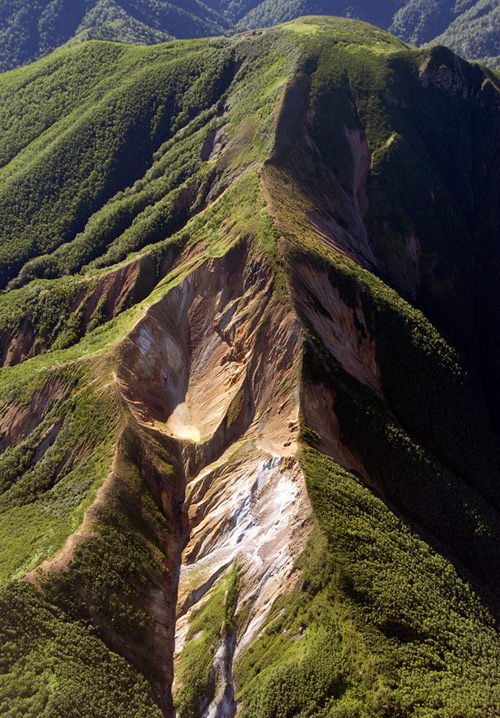
Aerial view of the altered zone and craters of Higashi-Taisetsu-Maruyama Volcano as seen from the NW. |
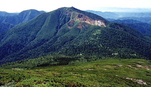
View of Maru-yama Volcano from the N. Row of explosion craters in the collapsed scar on the right. |
Low aerial view of Nipesotsu-yama (center) and Tengu-dake (right) as seen from the SE |
Aerial view of Gunkan-yama Lava Dome (flat plateau in the center) as seen from the NNE |
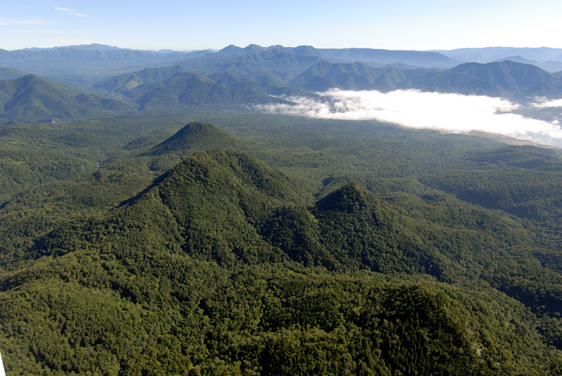
Aerial view of Eboshi Volcano Group as seen from the S. Eboshiyama, symmetric cone, in the backgroud |
Aerial view of Eboshiyama (center) as seen from the W. |
Aerial view of Kumaneshiridake (left) as seen from the NW. Nishi Kumaneshiridake in the right foreground |
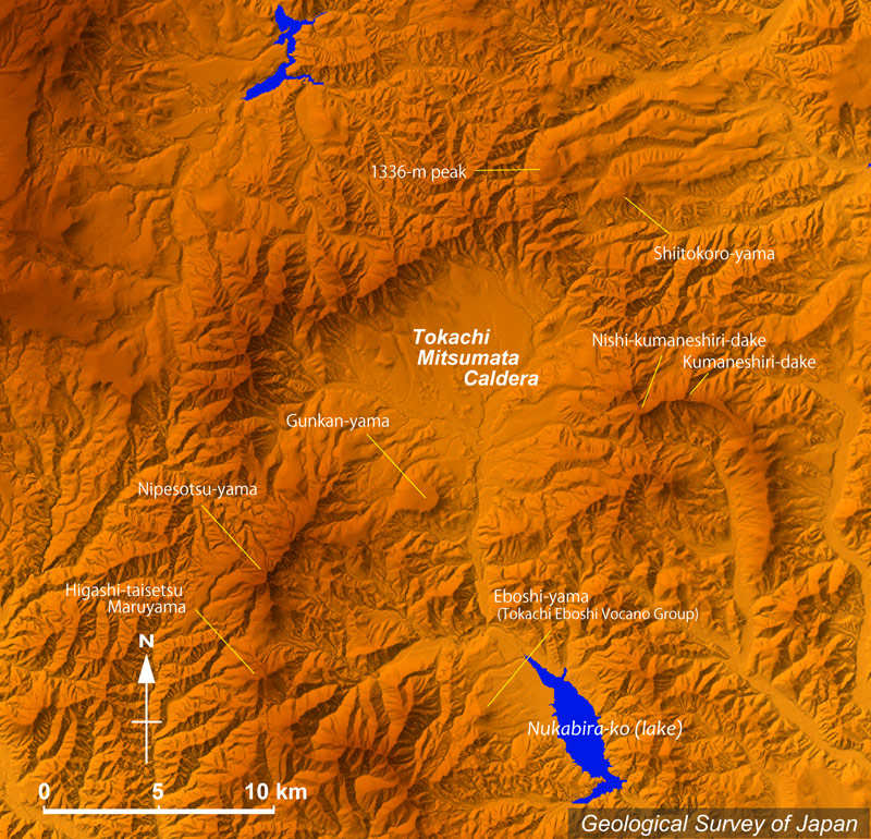
Topographic relief of Tokachi-Mitsumata caldera and Quaternary volcanoes in the vicinity. Shiitokoro Volcano (uper right) is comprised of Shitokoro-yama, 1336-m peak and so on |
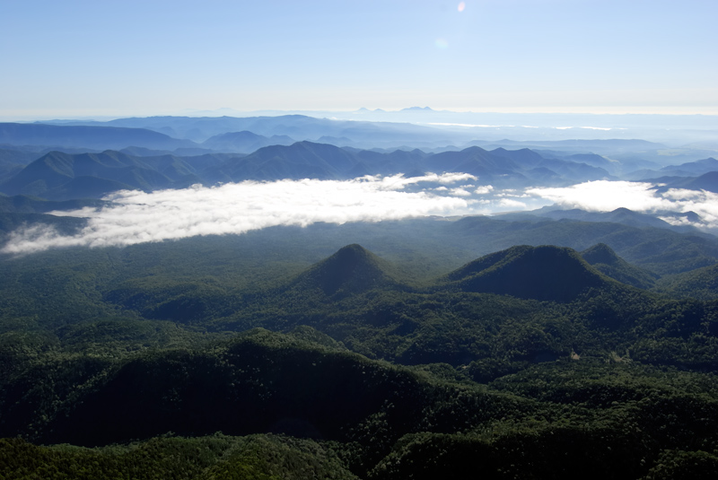
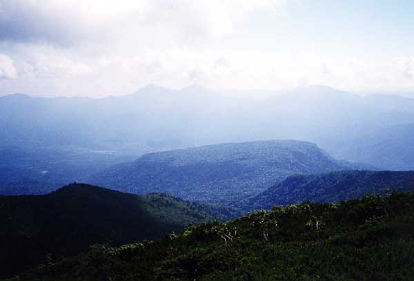
View of Tokachi-Mitsumata Caldera (flat basin behind Gunkan-yama in the middleground) - caldera rim in the background - as seen from the WSW |
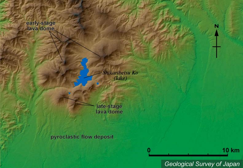
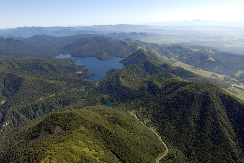
Colored topographic relief of Shikaribetsu Volcano Group. Several lava domes around Lake Shikaribetsu with some younger ones in the south and ignimbrite plateau extending towards the south |
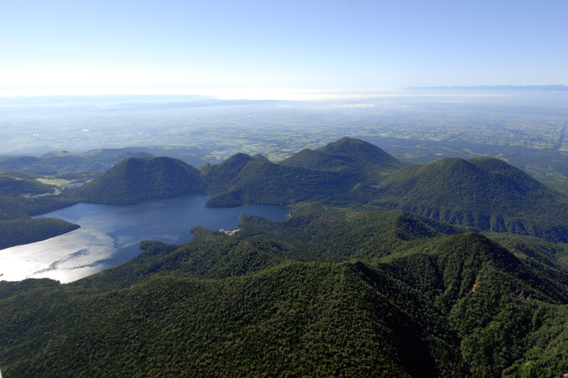
Aerial views of lava domes of Shikaribetu Volcano Group as seen from the NW. Nishi Nupukaushinupuri in the right |
View of Higashi-Nupukaushinupuri (right) and Nishi-Nupukaushinupuri lava domes (middle) as seen the SW (village of Shikaoi). |
Aerial views of lava domes of Shikaribetu Volcano Group as seen from the SW. Nishi Nupukaushinupuri (left) and Higashi Nupukaushinupuri (right) in the foreground. |
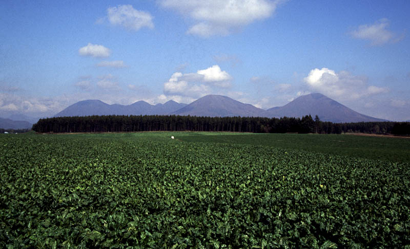
Aerial view of Hirayama with a gentle slope as seen from the NE. Taisetsu Volcano Group in the backgroud. |
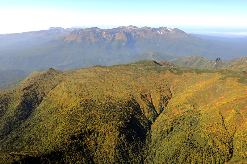
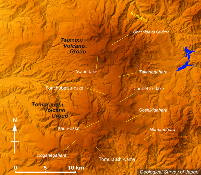
Topographic relief of Taisetsu Volcano Group (north) and Tomuraushi Volcano Group (south). Chubetsu Volcano at the middle. Asahidake is the highest peak among the volcano group. Kumagatake Crater between Asahidake and Ohachidaira Caldera. |
Active fumaroles in the crater area "Jigokudani" on the slope of Asahi-dake Volcano as seen from the W. |
View of Asahi-dake with fumaroles in the crater area "Jigoku-dani" in the background and explosion crater (Fufu-ike) in the foreground as seen from the W. |
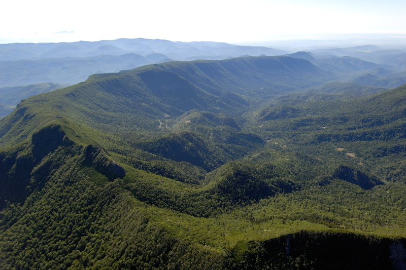
Oblique aerial view of Ohachidaira Caldera from the SW. Peaks of Ryoun-dake, Keigetsu-dake, Kuro-dake from left to right, Nisekaushuppe-yama in the background. |
View of Hokuchin-dake from the SW. Flat plateau named "Kumonotaira" at foot of Hokuchin-dake and northern Ohachidaira Caldera rim on the left |
View of Chubets-dake from the S (upper Goshikigahara). Ponchubetsu-dake (plateau on the left) and Taisetsu-zan Volcano Group in the background (Asahi-dake on the left). |
View of Tomuraushi-yama from the E. |
Oblique aerial view of Tomuraushi lava dome and Minaminuma pond (left) as seen from the SW |
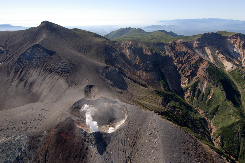
Aerial view of summit area of Tokachidake Volcano as seen from the N. Kitamuki Crater, Suribachi Crater, Ground Crater and the summit from this side to the back. 62-2 Crater with white gas to the right of Ground Crater. |
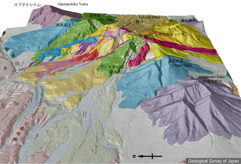
Topographic relief around Tokachidake Volcano combined with geological map (tilted by 25°from the W to the E). Volcanic products of the Younger Stage (0.06 Ma to present) are mainly distributed to the NW of the summit of Tokachidake. Bi and To are Biei Pyroclastic Flow (ca. 1.9 Ma) and Tokachi Pyroclastic Flow (ca. 1.1-1.2 Ma) Deposits, respectively. |
Oblique aerial view of 62-2 Crater with white gas as seen from the NW. |
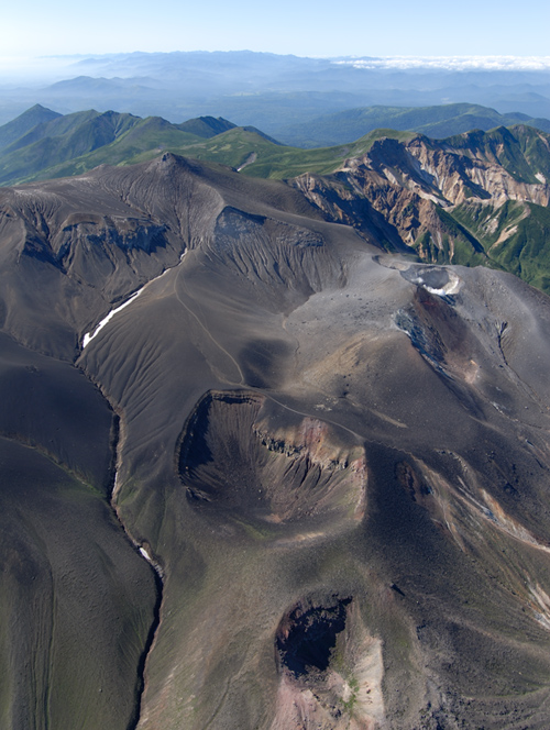
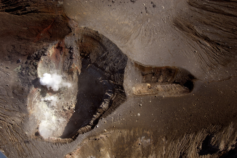
Aerial vertical view of 62-2 Crater (left) and 62-3 Crater (right). The top of the photo is the NE |
source - http://riodb02.ibase.aist.go.jp/strata/VOL_JP/EN/vol_lis2.htm
Кальдера AKAN, поверхность озера Akan - высота 420 м, 43 ° 27'' N 144 ° 07'' E, стратовулкан, пирокластическая кальдера, плато потока, дацит, риолит (базальт, андезит), предкальдерный стратовулкан старше 2.0 Ма, вулканы посткальдерной фазы –примерно 0.2 Ма возраста, кальдера Akan имеет диаметр 24 х 13 км. Вулканы Oakan, Meakan, Furebetsu и Fuppushi - вулканы посткальдерной фазы
MEAKAN-DAKE, высота 1499 м, 43 ° 23'' 03" N 144 ° 00'' 46" E, стратовулкан, андезит, дацит, моложе 50 (?) Ka. Akan-Fuji - возник примерно 2.5-1 Ka., 2 Ka – извержение Subplinian скории с потоками лавы.
2-1 Ka: стромболианское (?) извержение: Scoria fallout.Потоки лавы.
1-0.5 Ka: Subplinian извержение: скория fallout Потоки лавы.
Апрель 1954: облако пепла: Незначительное phreatic извержение? (кратер Nakamachineshiri-Obuki).
Ноябрь 1955-19 мая 1957: Несколько phreatic извержений (кратер Ponmachineshiri): выбросы пепла.
Август-сентябрь 1957: Незначительные phreatic извержения (кратер Nakamachineshiri-Obuki).
23 февраля 1958: Phreatic извержение (кратер Ponmachineshiri).
Май, июль 1959: Незначительные phreatic извержения (кратер Nakamachineshiri-Obuki).
Август, октябрь 1959: Phreatic извержения (кратер Ponmachineshiri): выбросы пепла.
Сентябрь 1960: Phreatic извержение (кратеры Ponmachineshiri и Nakamachineshiri-Obuki).
1962, 1964, 1965, 28 апреля 1966: Незначительные phreatic извержения (кратер Nakamachineshiri-Obuki).
1983, 1984: облако пепла (кратер Ponmachineshiri).
Январь, февраль 1988: Phreatic извержение (кратер Ponmachineshiri): выбросы пепла.
21 ноября 1996: Phreatic извержение (кратер Ponmachineshiri): выбросы пепла.
9 ноября 1998: Phreatic извержение (кратер Ponmachineshiri): выбросы пепла.
31 марта 2006: Phreatic извержение (кратеры Ponmachineshiri Akanuma Кратер и СЗ фланг): выбросы пепла. MEAKAN-DAKE - один из вулканов посткальдерной фазы кальдеры Akan, который включает три стратовулкана: Akan-Fuji, Ponmachineshiri и Nakamachineshiri.
OAKAN-DAKE, высота 1370 м, 43° 27'' 06" N 144° 10'' 07" E, стратовулкан, лавовый купол, андезит, дацит, моложе 14 Ka., Oakan-dake - один из вулканов посткальдерного этапа кальдеры Akan
HIGASHI-TAISETSU MARU-YAMA, высота 1692 м, 43 ° 24'' 54" N 143 ° 02'' 06" E, стратовулкан, лавовый купол, андезит, дацит, моложе 0.1 Ма. С 3 декабря 1898 в течение 3 дней наблюдались Phreatic извержения. Эти вулканы четвертичного периода были обнаружены только в 1989г. Группа вулканов Nipesotsu-Maruyama включает северный вулкан Nipesotsu.
NIPESOTSU-YAMA, высота 2013 м, 43 ° 27'' 12" N 143 ° 02'' 10" E, стратовулкан, андезит, дацит, период активности примерно 0.4-0.2 Маю Группа вулканов Nipesotsu включают стратовулканы Nipesotsu-yama, Tengu-dake и Kotengu-dake. Есть два более ранних образования - Gunkan-yama (1181 м) и "пик на высоте 1332 м".
GUNKAN-YAMA, высота 1181 м, 43 ° 28'' 47" N 143 ° 06'' 49" E, лавовый купол, риолит, период активности примерно 0.6 Ма. Gunkan-yama считается частью группы вулканов Nipesotsu-Maruyama. Андезитовые породы распространены вокруг "пика на высоте 1332 м" в 4 км к северу от Nipesotsu-yama и также показывают возраст, схожий с Gunkan-yama.
Группа вулканов TOKACHI EBOSHI, высота 1291 м (Byobu-yama) и 1057 м (Eboshi-yama), 43 ° 22'' 35" N (Byobu-yama), 143 ° 07'' 58" E, лавовый купол?, андезит, дацит, Onsen-dake (ЮЮЗ от Byoubu-yama) возраста примерно 1.8 Ма. Byoubu-yama: примерно 0.7 Маю Моногенетическая группа вулкана Tokachi Eboshi включает несколько лавовых куполов и вулканических некков.
KUMANESHIRI-DAKE, высота 1635 м (Nishi-kumaneshiri-dake) и 1586 м (Kumaneshiri-dake), 43 ° 31'' 00" N (Nishi-kumaneshiri-dake) 143 ° 14'' 13" E, стратовулкан, андезит, дацит, период активности примерно 1.3 Ма
SHIITOKORO-YAMA, высота 1336 м, 1232 м. (Shiretoko-yama), 43 ° 36'' 37" N (1336м пик) 143 ° 11'' 04" E, лавовый поток, лавовый купол, андезит, дацит, возраст активности примерно 1.4 Ма
Кальдера TOKACHI MITSUMATA, высота 650-700 м (центральная часть кальдеры), 43 ° 31'' N (центральная часть кальдеры) 143 ° 09'' E, пирокластический кальдерой поток, риолит, период активности примерно 0.6-0.3 Ма. Бассейн Tokachi-Mitsumata интерпретируется как круглая кальдера примерно 8 км в диаметре и является источником пирокластических потоков Muka и Meto
SHIKARIBETSU, высота 1401 м (Kita Petoutoru), 43 ° 18'' 44" N 143 ° 05'' 44" E, лавовый купол, андезит, дацит, моложе 0.3 Ма. Самая последняя активность моложе 20 Ka, Группа вулкана Shikaribetsu включает 10 лавовых куполов (Nishi-Nupukaushinupuri, Higashi-Nupukaushinupuri, Tenbo-Сан, Hakuun-zan и др.)
TENGU и HIRA-YAMA, высота 1796 м (Himara-yama) и 1635 м. (Ariake-yama), 43 ° 46'' 34" N (Himara-yama) 143 ° 00'' 59" E, стратовулкан, андезит, дацит, период активности примерно 1.3-1.0 Ма. Группа вулкана Tengu-Hirayama включает вулканы Tengu и Hira-yama. Самый высокий пик вулкана Tengu - Ariake-yama, а вулкана Hirayama - Himara-yama. Лканические породы Kitamitoge (возраста около 1.6-1.3 Ма) найдены в северной части области
NISEIKAUSHUPPE-YAMA, высота 1883 м, 43 ° 46'' 39" N 142 ° 59'' 21" E, стратовулкан, базальт, период активности примерно 1.1 Ма
TAISETSU-ZAN, высота 2290 м (Asahi-dake), 43 ° 39'' 40" N 142 ° 51'' 29" E, Пирокластическое плато потока, кальдера стратовулкана, стратовулкан, лавовый купол, лавовый поток и маленький щитовидный вулкан, андезит, дацит, моложе 1.4 Ма, скорее всего был активен 600-500 лет назад: Phreatic извержение, текущая паровая деятельность в Asahi-dake
CHUBETSU-DAKE, высота 1963 м, 43 ° 35'' 19" N 142 ° 53'' 54" E, стратовулкан, андезит, активен примерно 1.0-0.8 Ма
Группа Вулкана Tomuraushi, высота 2141 м, 43 ° 31'' 29" N 142 ° 51'' 09" E, лавовый купол, стратовулкан, андезит, дацит. Старший вулкан Tomuraushi (вулканы Koganegahara и Goshikigahara) активны 1.1-0.7 Ма. Вулкан Numanohara - 0.6-0.3 Ма. Сам вулкан Tomuraushi берет свое начало 0.3 Ма. Вулканы Futamata и Kaunnai - 0.1 Ма. Группа вулкана Tomuraushi включает вулканы Koganegahara, Goshikigahara, Numanohara, Tomuraushi, Futamata и Kaunnai
TOKACHI-DAKE, высота 2077 м, 43 ° 24'' 56" N 142 ° 41'' 25" E, пирокластическая кальдера плато потока, стратовулкан, пирокластический конус, лавовый поток и маленький щитовой вулкан, лавовый купол, андезит, базальт, дацит. Старшая и с группа вулканов Tokachi моложе 0.5 Ма. Более молодая группа Tokachi моложе 10 Ka. В 17-м столетии вулканическая деятельность проявилась в виде лавового потока.
1857: Вулканическая деятельность.
1887: Облако пепла: осадки пепла
23 декабря 1925: сформировался кратер на центральном конусе (кратер Obuki ).
Февраль-май 1926: Незначительное phreatic извержение: осадки из пепла.
24 мая 1926: Phreatic и Vulcanian извержения: оползень и lahar.
8 сентября 1926: Vulcanian извержение
1926-10 и 25 декабря 1928: новое извержение валканианского типа:незначительный lahar.
1936: Извержение серы molten sulfur.
Сентябрь 1954: Незначительное phreatic извержение (кратер Showa).
Июнь 1956: Незначительное phreatic извержение.
Август и ноябрь 1959: Незначительное phreatic извержение и малый lahar.
14 августа 1961: Незначительное phreatic извержение.
29 июня 1962: Phreatic извержение (вокруг Yunuma)
С 30 июня 1962 в течение 2 месяцев извержения типа Валканиан и Стромболиан, осадки пепла. Сформировался конус скория.
1968, 1969, 1974, 1984: Вулканическая деятельность.
19 июня 1985: Незначительное phreatic извержение.
Декабрь 1989 (с марта 1988): извержение типа Валканиана: осадки из пепла. Пирокластические потоки и lahar.
25 февраля и 19 апреля 2004: Незначительная phreatic деятельность.