 | Central Honshu |
|
|
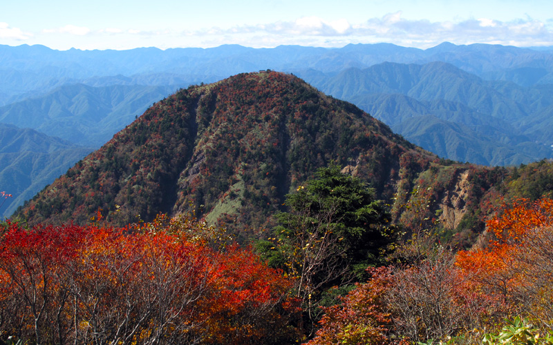
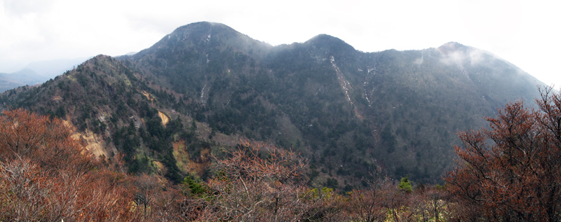
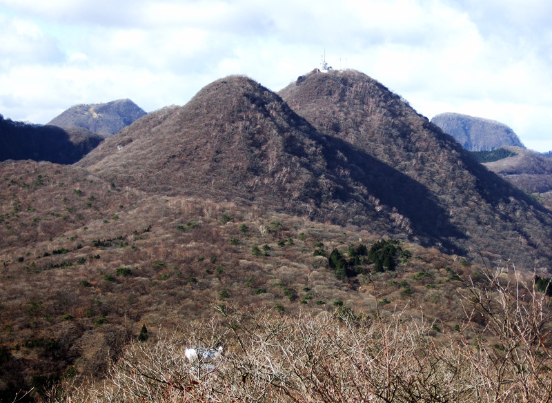
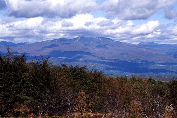
Keichosan viewed from the E (Shakagatake). |
Keicho-san viewed from the NE |
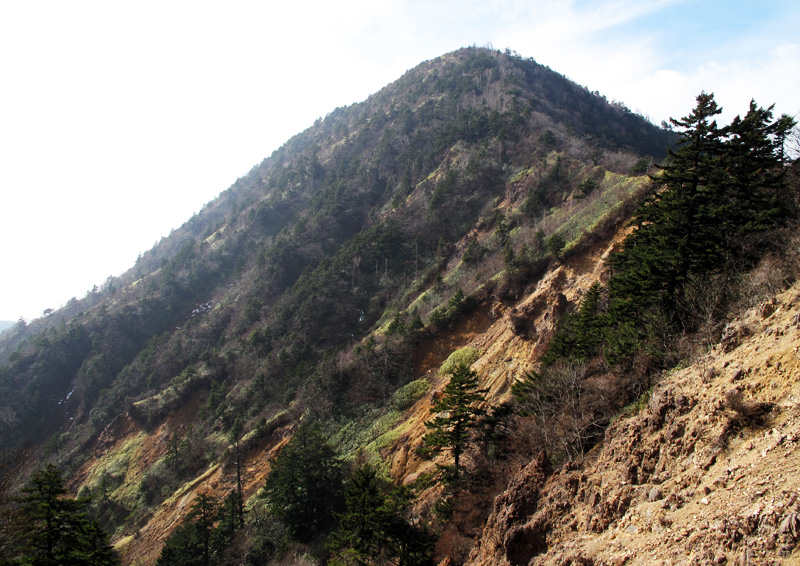
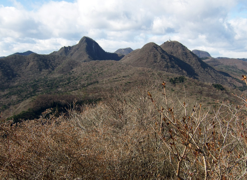
Shakagatake viewed from the W (Keicho-san). |
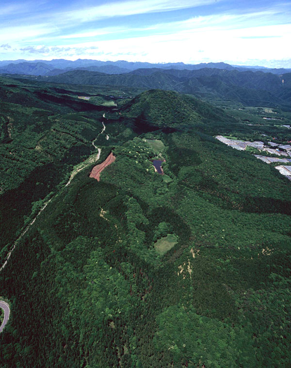
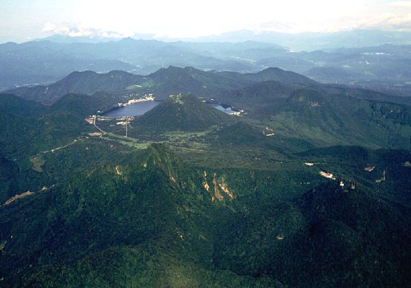
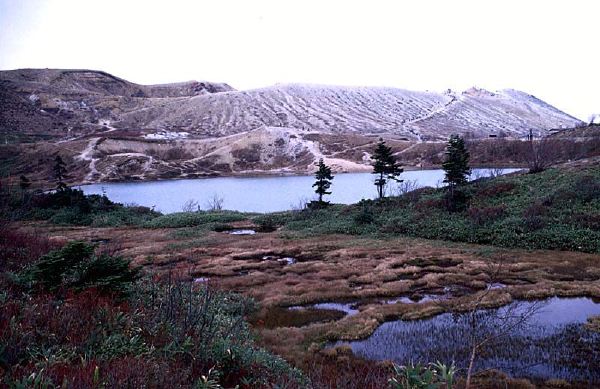
Oblique aerial view of Fuji-yama (middle upper) from the ESE. Onuma pond (middle) and Kareta-ike pond (foreground) are part of the continuous eruptive fissure on the WNW of Fuji-yama. There is one more eruptive fissure on the other side of the road (left). |
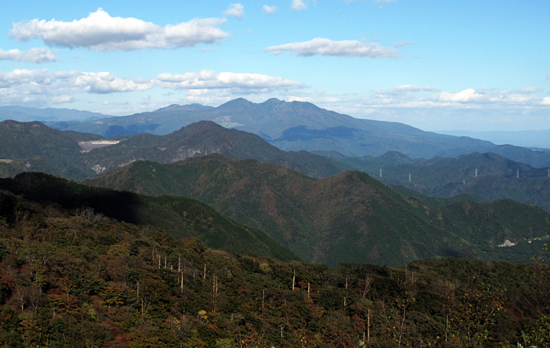
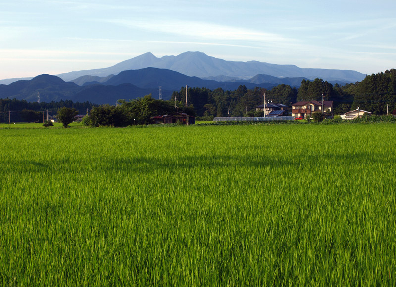
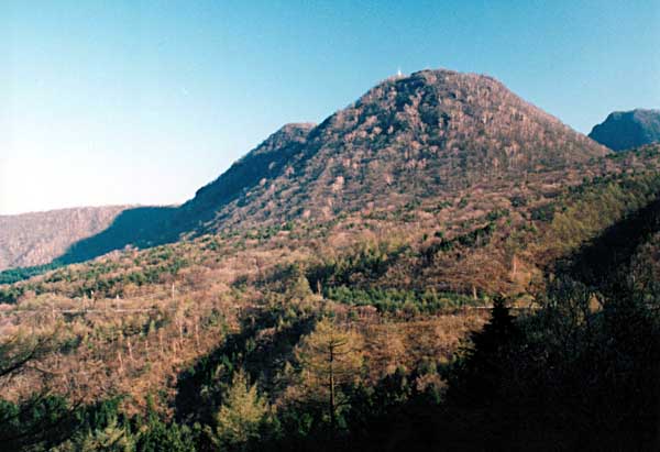
Takahara Volcano (background) viewed from the SW |
Keichosan (left) and Shakagatake, the highest peak (right) from the S. |
Takahara Volcano viewed from the SW. Peak of Shakaga-dake on the left |
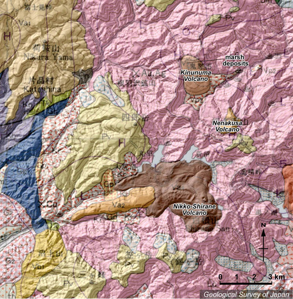
Topographic relief of Nikko Shirane (south) and Kinunuma (northeast) volcanoes combined with geological map. Thick lava flow morphology characterizes the Nikko Shirane Volcano |
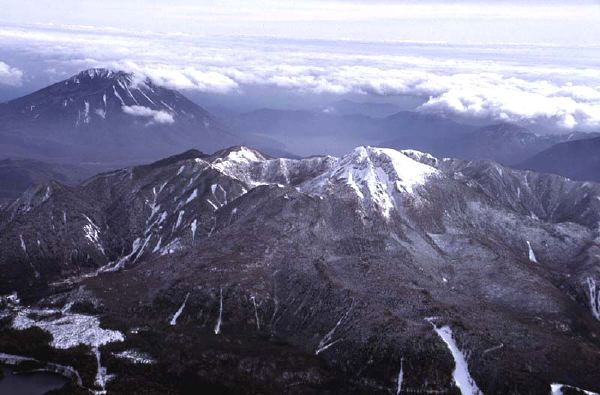
Oblique aerial view of Nikko Shirane-san (middle) and Nantai-san (left background) from the NW |
Nikko-shirane Lava Dome (background) viewed from the ESE, Nantaisan |
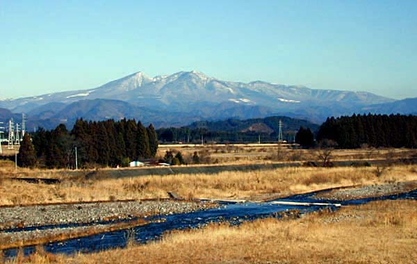
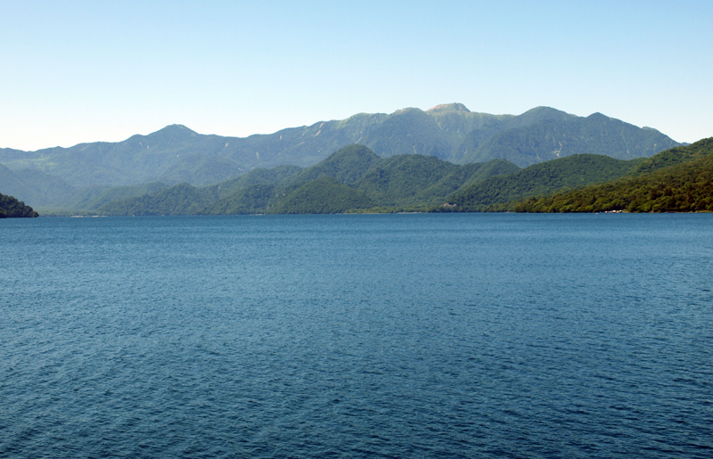
View of Nikko Shiranesan (right) and Suzugatake (left) from the ESE. Chuzenji-ko in the foreground |
Nikko Shirane Lava Dome viewed from the N (Lake Midaga-ike). |
Summit lava dome of Nikko Shirane-san viewed from the SE |
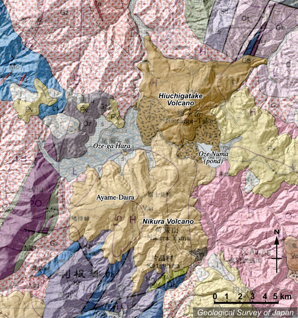
Topographic relief of Hiuchiga-take (north) and Nikura-Ayamedaira (south) volcanoes combined with geological map. Ozegahara (Oze upland bog) and lake of Ozenuma formed by damming up by volcaniclastics from Hiuchigatake Volcano. |
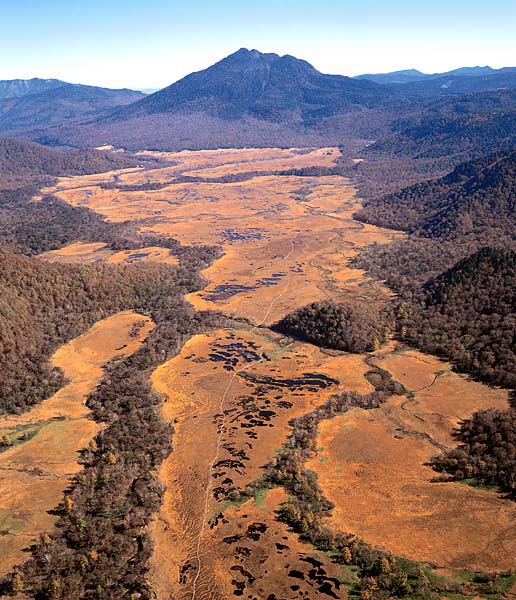
Oblique aerial view of Hiuchiga-take (middle background) and Ozegahara (Oze upland bog) as seen from the WSW. Ozegahara has formed due to damming up by pyroclastic deposits from Hiuchigatake Volcano. |
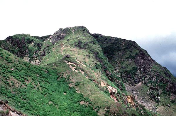
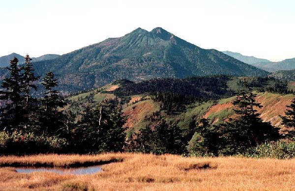
View of Hiuchiga-take from the NNE (Aizu Komagatake). |
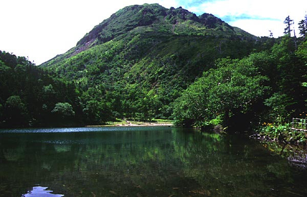
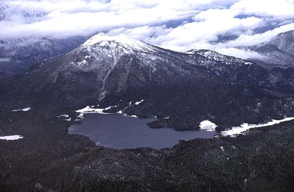
Oblique aerial view of Hiuchiga-take (middle) and Ozenuma (lake in the foreground) from the SE |
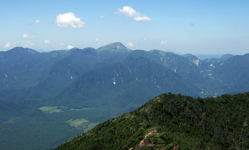
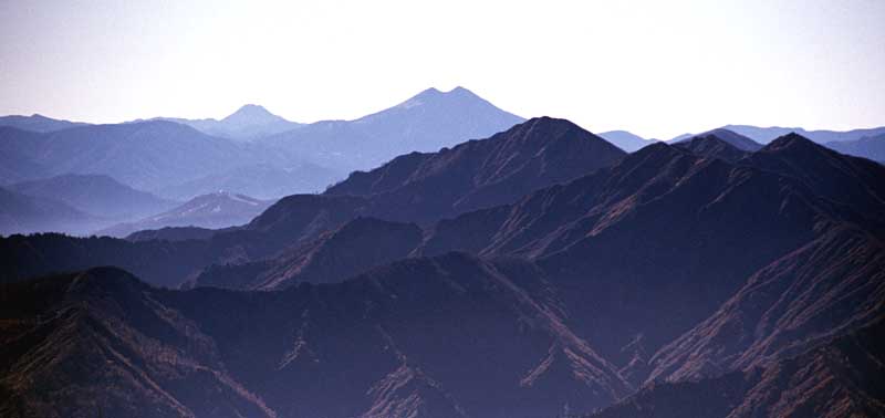
View of Hiuchiga-take Volcano as seen from the NNW (summit of Sumon-dake). Nikko Shirane-san in the left background and Kemou-yama in the foreground. |
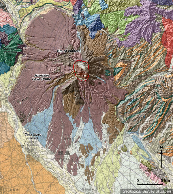
Topographic relief of Akagi Volcano combined with geological map. Caldera on the summit and several central cones and lava domes (e.g. Jizo-dake Lava dome). The volcano has remarkably broad volcanic aprons. Komochi Volcano locating in the WNW |
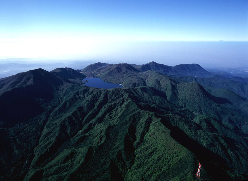
Oblique aerial view of summit of Akagi Volcano as seen from the NNW. The highest peak of caldera rim "Kurobi-yama" on the left. |
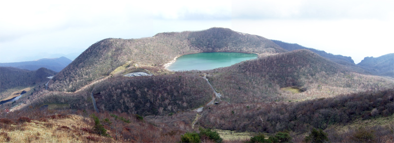
Post-caldera Kono (Konuma) Crater viewed from the NW (Jizo-dake). |
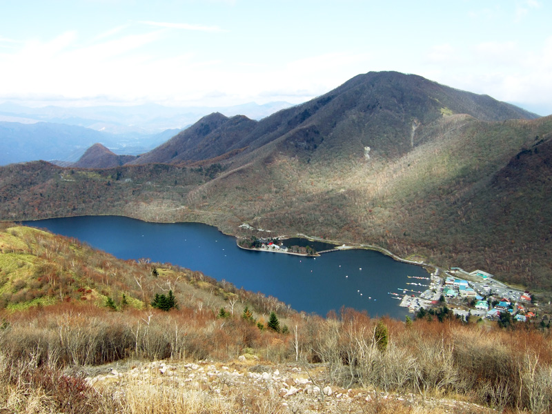
The highest peak of caldera rim "Kurobi-yama" and Ono (Onuma) pond on the caldera floor viewed from the SSW (Jizo-dake). |
Jizo-dake Lava Dome (central cone) as seen from the SE (Choshichiro-yama). Lake Ono on the right background and Lake Kono (crater lake) in the foreground. |
Jizodake Lava Dome (right) and Asakamine (left, a part of Kono Crater rim) viewed from the ESE. |
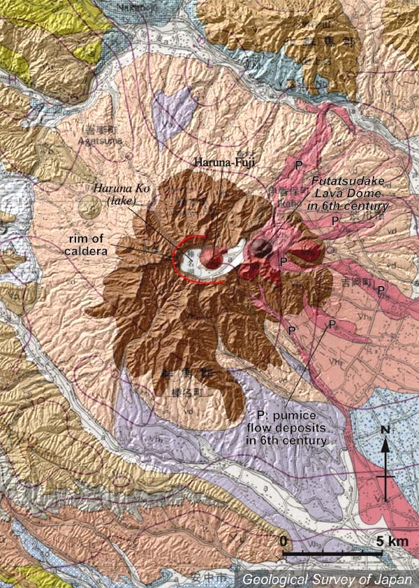
Topographic relief of Haruna Volcano combined with geological map. Lake Haruna and Haruna-Fuji in the center of the caldera. Futatsu-dake Lava Dome (brown) on the east of caldera. Pyroclastic flow extending from the NE to the SE flank |
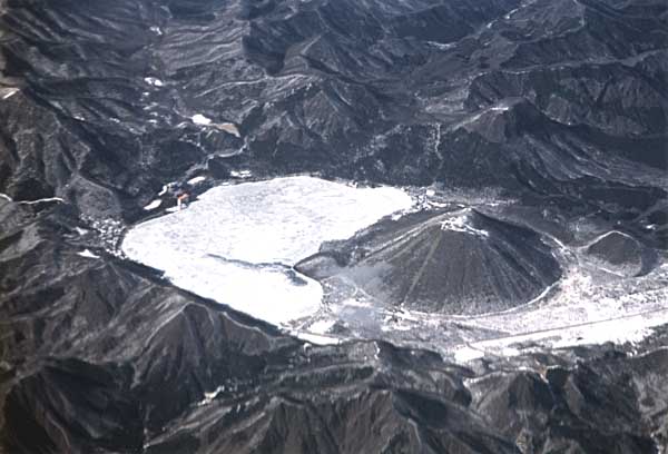
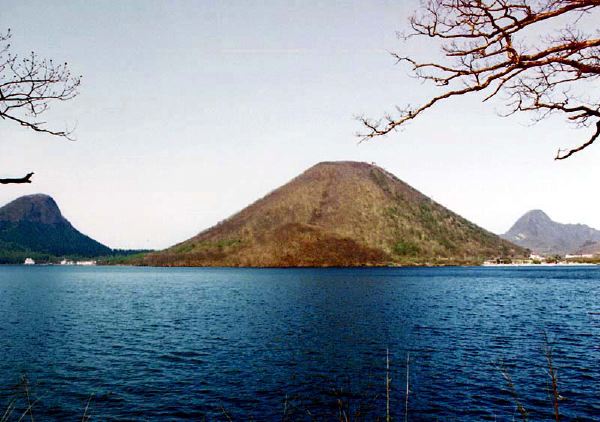
Oblique aerial view of Haruna-Fuji (middle) and Lake Haruna (left) as seen from the SE. Jaga-take Lava Dome at right of Haruna-Fuji. Kamonga-take, the highest peak on the caldera rim, on the left. |
Oblique aerial view of Haruna Volcano as seen from the E. Lake Haruna and Haruna-Fuji Lava Dome (middle) in the caldera. Soma-yama in the foreground. |
Futatsudake Lava Dome viewed from the E, Mizusawayama |
Futatsudake (right) and Somayama (left) viewed from the E, Mizusawayama |
Futatsu-dake Lava Dome from the NNW |
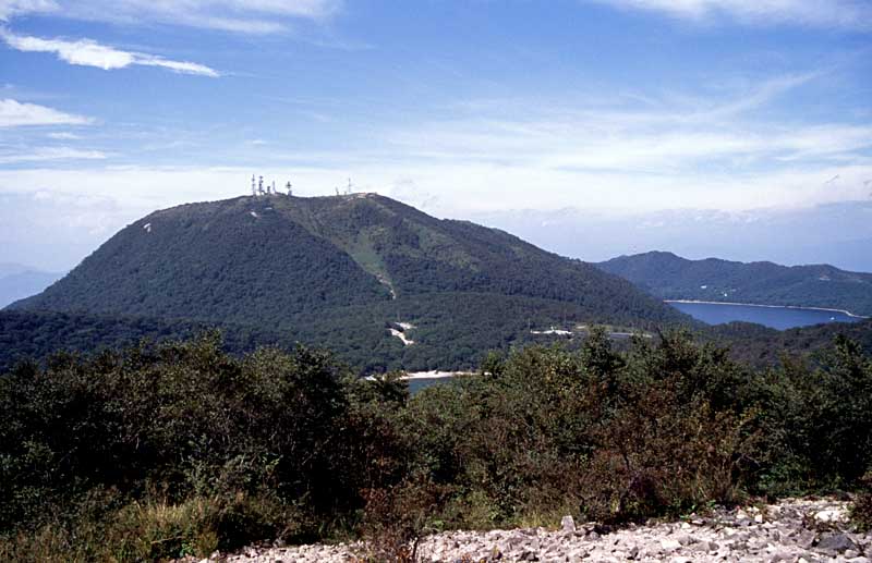
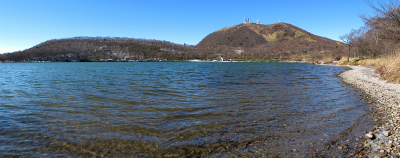
Haruna-Fuji (lava dome) on the caldera floor of Haruna Volcano as seen from the west of Lake Haruna. |
Haruna-fuji Lava Dome (left center) and Lake Harunako (foreground) viewed from the W (Suzuri-iwa). Caldera rim at the right of the lake |
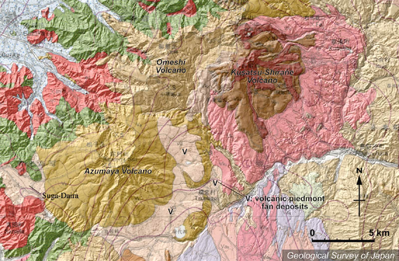
Topographic relief combined with geological map around Kusatsu Shirane Volcano. Oshi pyroclastic flow deposits (indicated by pink) are widely distributed around the volcano |
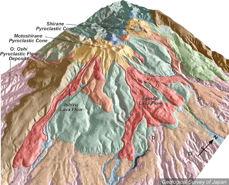
Topographic relief of Kusatsu Shirane Volcano combined with geological map (tilted by 45°from the SE to NW). Note the Sessho and Ishizu lava flows with conspicuous lava levees. |
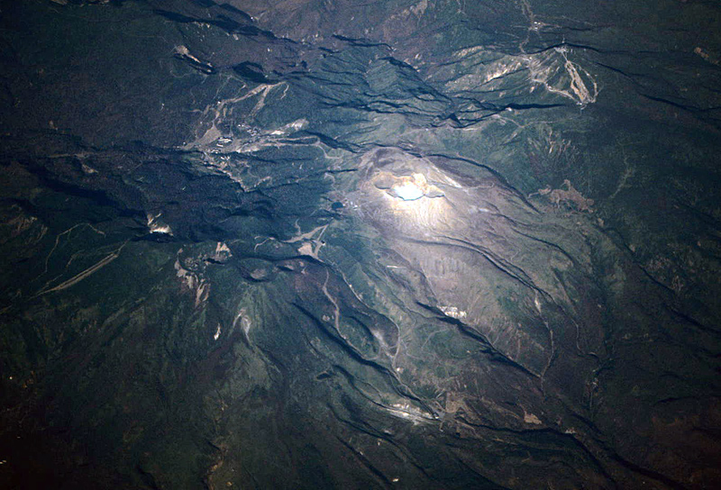
Oblique aerial view of Kusatsu Shirane Volcano as seen from the SE. Shirane Pyroclastic Cone with Yugama Crater at the center |
Motoshirane viewed from the S. |
Shirane Pyroclastic Cone and Yumiike pond (explosion crater) viewed from the SSW. |
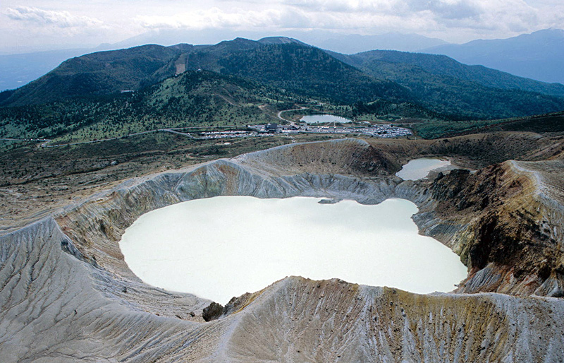
Oblique aerial view of Yugama (crater of Shirane Pyroclastic Cone) as seen from the SE. |
Aerial view of Yugama Crater of Shirane Pyroclastic Cone as seen from the N. |
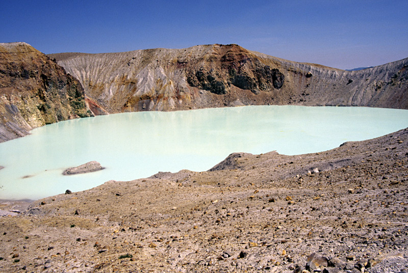
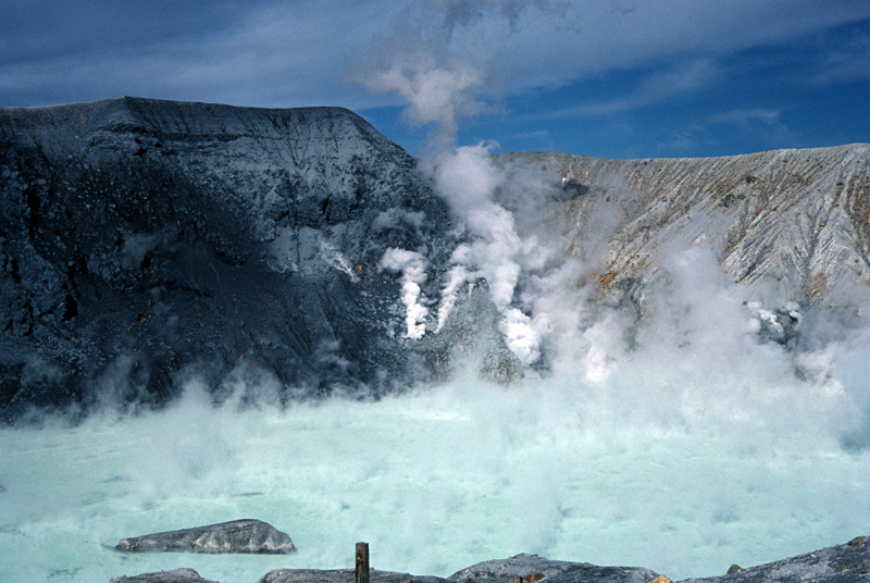
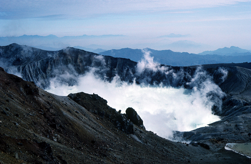
Yugama Crater viewed from the SW. |
Western wall of Yugama Crater viewed from the SE. Phreatic eruption occurred two days before |
Yugama Crater viewed from the W. Phreatic eruption occurred three days before at the western crater wall (left side). |
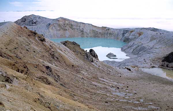
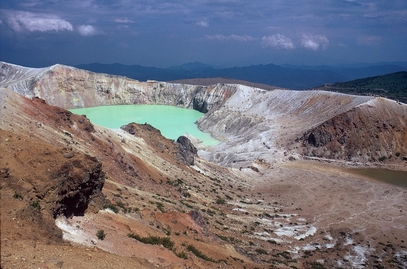
Yugama Crater and Karegama Crater (right front) viewed from the W. |
Yugama Crater and Karegama Crater (right) viewed from the W. |
Yugama Crater from the western rim. Note sightseers inside the crater |
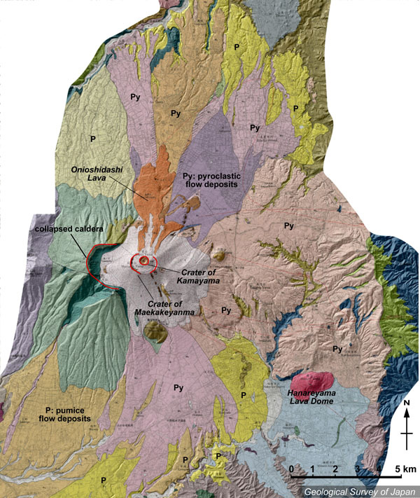
Topographic relief of Asama Volcano combined with geological map by Aramaki (1993). Onioshidashi lava flow which erupted from Kamayama crater in 1783 is distributed in the northern side of Kamayama. Pyroclastic flow deposits (Py) are distributed on the northern and southern slopes. |
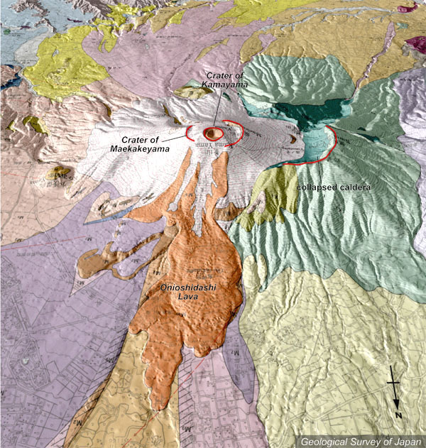
Topographic relief of Asama Volcano combined with geological map (tilted by 40 degrees from the N to S). Onioshdashi lava flow in the front of Kamayama. Pyroclastic flow deposits are widely distributed around the volcano. |
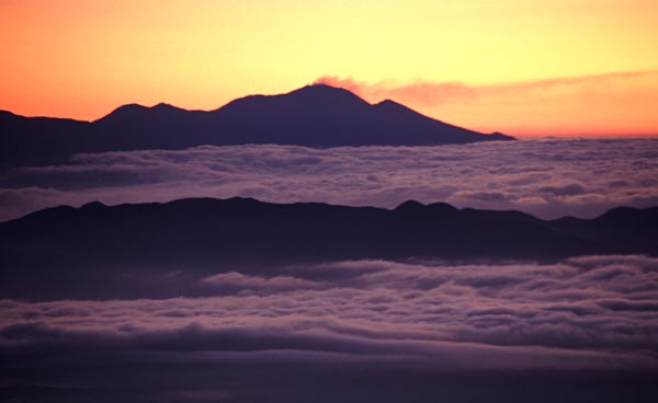
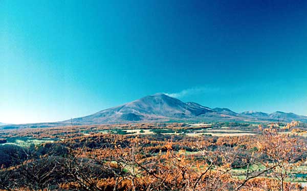
The distant view of Asama Volcano in the sunrise viewed from the WSW (Chogatake). |
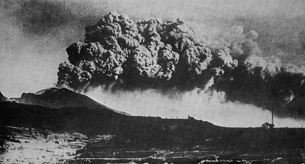
Ash cloud in December 14, 1912, viewed from the SW (Komoro city). |
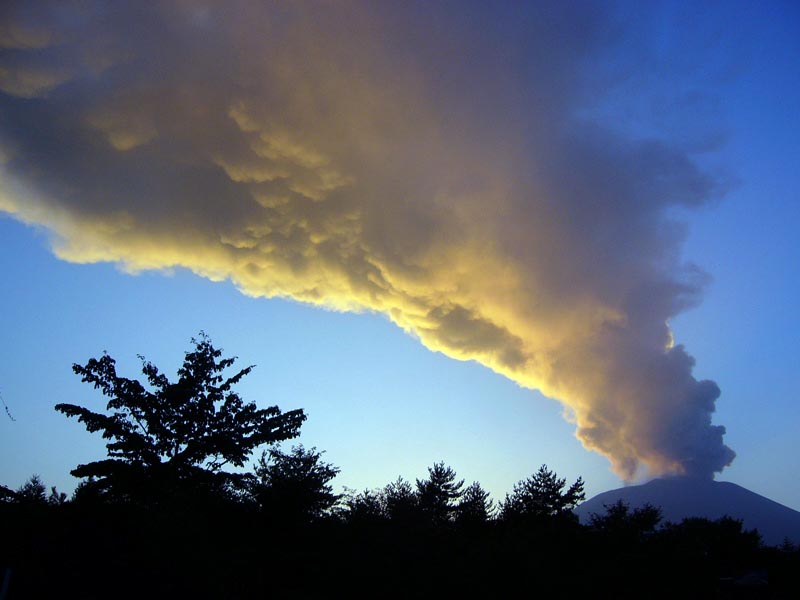
Gas plume viewed from the ESE colored by the evening sunlight, 2004 |
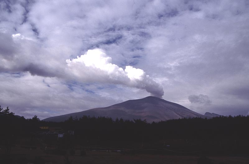
Continuous white vapor emission from the summit crater, as viewed from the NE. |
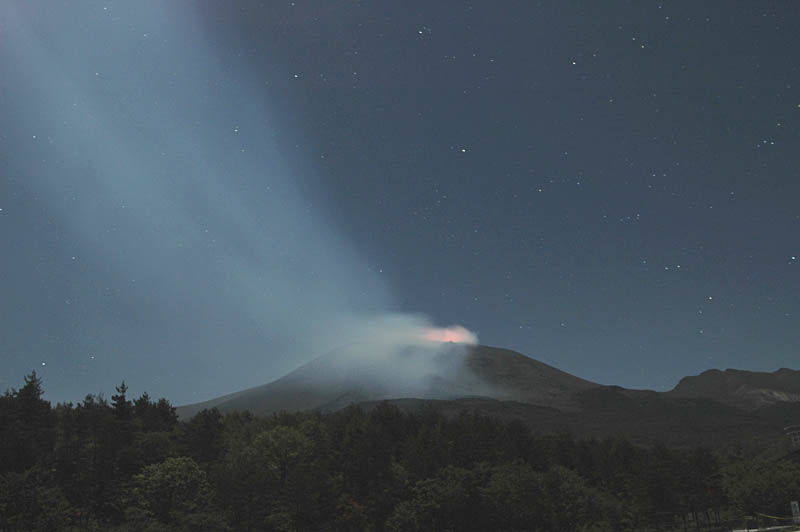
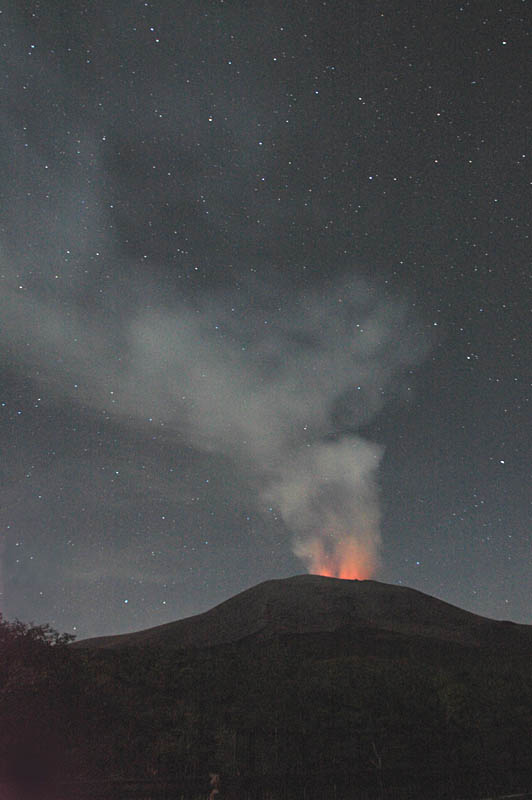
Night scene of volcanic glow and northeastward-flowing volcanic gas viewed from the NNE (Onioshidashien). |
Night scene of volcanic glow and rising volcanic gas viewed from the NNE (Onioshidashien). |
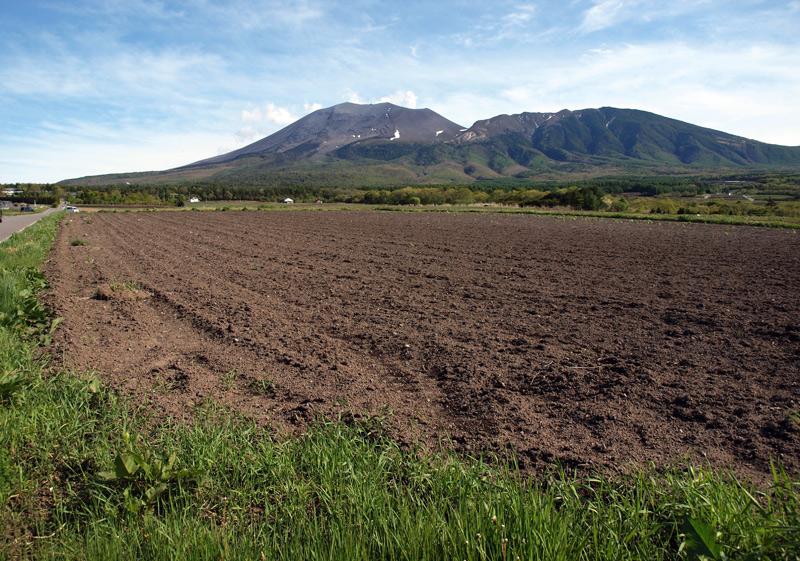
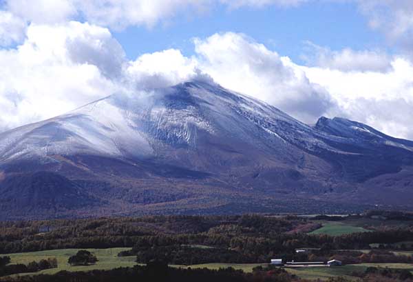
Asama Volcano viewed from the ENE, Nidoage-toge Pass |
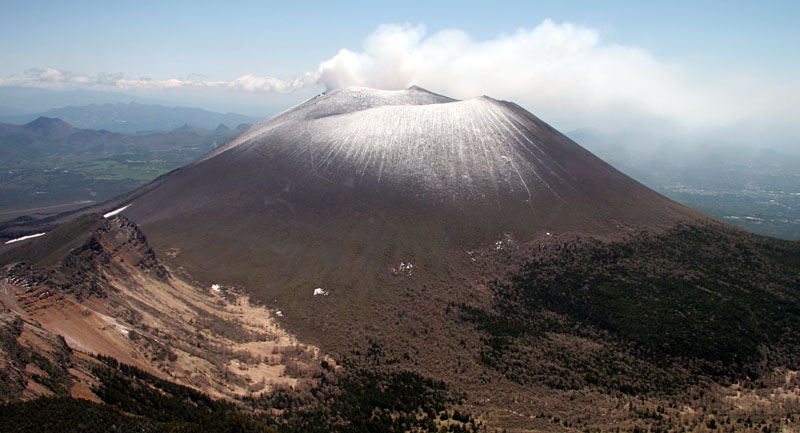
Asama Volcano viewed from the N. Kurofuyama Somma in the right |
Asama Vocano viewed from the E (Koasamayama) |
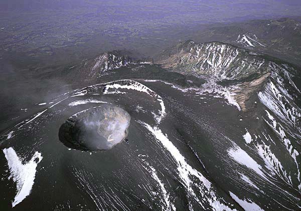
Aerial view of Kamayama Crater (on the upper side) and Onioshidashi Lava Flow (erupted in 1783) in the foreground, as seen from the N. |
Asama Volcano with gas emisson and the season''s first snow, viewed from the ENE. |
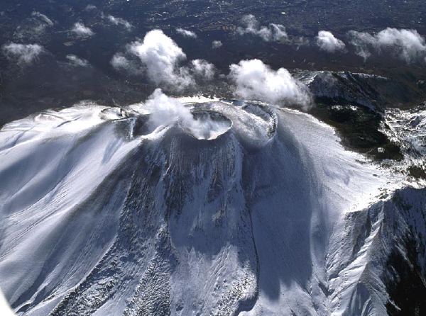
Aerial view of Maekakeyama Pyroclastic Cone surrounding Kamayama Crater as seen from the NE. Kuforuyama Somma in the right |
Aerial view of Kamayama crater and Onioshidashi Lava Flow (erupted in 1783) as seen from the N. |
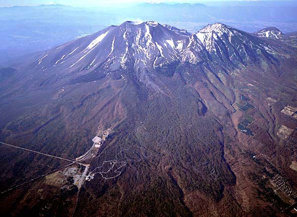
Aerial view of central cone of Asama Volcano as seen from the WNW. Kurofuyama Somma with stratified layers in the foreground. |
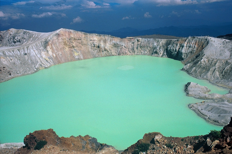
Kamayama Crater with a large amount of fumarolic gas |
Fumarolic activities inside of the Kamayama Crater |
NIKKO SHIRANE, высота 2578 м, 36 ° 47'' 44" N 139 ° 22'' 45" E, лавовый поток и маленький щитовой вулкан, лавовый купол, андезит, активный с 20 Ka. Извержения:
Февраль 1649: Главное phreatic извержение: осадки из пепла. Новый кратер сформировался.
14 мая 1872: Незначительное phreatic извержение: Новый кратер сформировался на юго-западном фланге.
12 марта 1873: Незначительное phreatic извержение: осадки из пепла.
4 декабря 1889: Незначительное phreatic извержение: осадки из пепла.
22 августа 1890: Незначительное phreatic извержение.
С июля 1952 в течение 2 месяцев: облако из пепла.
AKAGI- SAN, высота 1828 м (Kurobi-Сан), 36 ° 33'' 26" N 139 ° 11'' 47" E, стратовулкан-кальдера, лавовый купол, андезит, дацит, вулканическая деятельность началась до 0.3 Ма. Извержения:
18 мая 1251: Вулканическая деятельность?
26 сентября 1947: Lahar.
HARUNA- SAN, высота 1449 м (Kamon-ga-take), 36 ° 28'' 27" N 138 ° 51'' 14" E, стратовулкан-кальдера, лавовый купол, пирокластический конус, андезит, базальт, дацит, вулканическая деятельность началась до 0.3 Ма. Извержения:
5-е столетие: Вулканическая деятельность: осадки из пемзы.
6-е столетие: Phreatoplinian извержения: осадки из пепла и пирокластические потоки.
Середина 6-го столетия: Plinian извержения: осадки из пемзы и пирокластические потоки. Лавовый купол Futatsudake сформировался.
KUSATSU SHIRANE- SAN, высота 2171 м (Moto-shirane-san), 36 ° 37'' 11" N 138 ° 32'' 06" E, стратовулкан, андезит, активный с примерно 0.6 Ма. Извержения:
1805: Phreatic извержение?: осадки из пепла.
6 августа 1882: Phreatic извержение (Yugama и Karagama): осадки из пепла.
4 июля-августа 1897: Незначительные phreatic извержения (Yugama).
1 октября 1900: Незначительное phreatic извержение.
Июль-сентябрь 1902: Phreatic извержения (вокруг Yumi-иконоскопа): осадки из пепла.
Октябрь 1905: Незначительное phreatic извержение.
26 января 1925: Phreatic извержение: осадки из пепла.
31 декабря 1927: Незначительное phreatic извержение.
29 - 31 января 1928: Незначительные phreatic извержения.
1 октября 1932: Phreatic извержение: осадки из пепла; lahar. .
Ноябрь, декабрь 1937: Незначительные phreatic извержения: осадки из пепла.
Февраль-май 1939: Phreatic извержения: осадки из пепла.
Апрель, сентябрь 1940 и январь 1941: осадки из пепла.
2 февраля 1942: Незначительное phreatic извержение (извержение трещины).
Декабрь 1958: Незначительное phreatic извержение (Yugama).
2 марта 1976: Незначительное phreatic извержение (Mizugama).
3 августа 1976: в Shirane-sawa долине (газовая эмиссия).
26 октября 1982: Незначительное phreatic извержение (Yugama и Karagama): осадки из пепла.
29 декабря 1982: Phreatic извержение (Yugama): осадки из пепла.
26 июля 1983: Незначительное phreatic извержение (Yugama).
13 ноября 1983: Phreatic извержение (Yugama): осадки из пепла.
21 декабря 1983: Незначительное phreatic извержение (Yugama и Karagama): падение пепла.
ASAMA-YAMA, высота 2568 м (Кама-yama), 36 ° 24'' 12" N 138 ° 31'' 34" E, стратовулкан, лава течет и маленький вулкан щита, лавовый купол, андезит, дацит, активный начиная с 0.1 Ма. Извержения:
4-е столетие: Plinian извержения: осадки из пемзы, пирокластические потоки и потоки лавы.
1108: Plinian извержения: осадки из пемзы, пирокластические потоки (пирокластический поток Oiwake) и поток лавы Butai.
3 июля 1281: Вулканическая деятельность: осадки из пемзы.
Июль 1427: Вулканическая деятельность?
1527-1528: Вулканическая деятельность.
14 января 1532: Vulcanian извержение?: осадки из пепла.
1-5 мая 1596: Vulcanian извержения?: осадки из пепла.
1596, 1598, 1604, 1605, 1609: Вулканическая деятельность.
1644, 1645, 1647: Вулканическая деятельность.
Март 1648: Вулканическая деятельность: Lahar.
1649: Вулканическая деятельность.
1651: Вулканическая деятельность.
1652: Vulcanian извержение?
1655-1661: Спорадическая вулканическая деятельность.
1704, 1706, 1708, 1709, 1710, 1711, 1717, 1718, 1720: Вулканическая деятельность.
1721: Vulcanian извержение?
1722, 1723, 1728, 1729, 1731, 1732: Вулканическая деятельность.
1733: Vulcanian извержение?
1754: Несколько извержений: осадки из пепла.
1776-1777: Несколько извержений: осадки из пепла.
9 мая и 25 июня 1783: Вулканическая деятельность: осадки из пепла (начало извержения Tenmei).
17 июля 1783: Вулканическая деятельность: осадки из пемзы.
С 26 июля 1783 в течение 10 дней: Plinian извержение: осадки из пемзы.
4 августа 1783: пирокластический поток Agatsuma.
5 августа 1783: пирокластический пток Kambara закончился созданием lahar на входе в реку Tone. Поток лавы Onioshidashi.
4 июля, 7 и 20 ноября 1803: Вулканическая деятельность: осадки из пепла.
Февраль 1815: Вулканическая деятельность.
1869 (весна осень): Вулканическая деятельность.
Июнь 1875: Вулканическая деятельность.
Sep 1879: Вулканическая деятельность.
Декабрь 1889: Vulcanian извержение?
1890-1892: Спорадическая вулканическая деятельность.
Апрель-июнь 1894: Вулканическая деятельность: осадки из пепла.
1899-1902: Вулканическая деятельность: осадки из пепла.
1904, 1906-1908: Вулканическая деятельность: осадки из пепла.
1909, 1910: Vulcanian извержения: осадки из пепла.
1911-1914: Vulcanian извержение: осадки из пепла.
1916, 1917, 1919-1922, 1927-1932: Vulcanian извержения: осадки из пепла.
1934-1942: Спорадические Vulcanian извержения: осадки из пепла.
1944-1947: Спорадическое Vulcanian извержение: осадки из пепла.
1949-1955: Спорадическое Vulcanian извержение: осадки из пепла.
1958: Vulcanian извержение: осадки из пепла; пирокластический поток.
1959: Vulcanian извержение: осадки из пепла.
1961 (после 23 месяцев затишья): Vulcanian извержение: осадки из пепла.
Май 1965: небольшое извержение валканианианского типа.
1 февраля 24 мая 1973: извержение валканианского типа: осадки из пепла. Три незначительных пирокластических потока.
26 апреля 1982: извержение валканианского типа: осадки из пепла; небольшой пирокластический поток.
2 октября 1982: небольшое извержение валканианского типа.
8 апреля 1983: извержение валканианского типа, осадки из пепла.
20 июля 1990: небольшое извержение валканианского типа.
6 февраля, 30 марта, 7 апреля, 18 апреля 2003: Очень незначительная вулканическая деятельность: очень незначительные осадки из пепла.
1 сентября 2004: Средний масштаб извержения валканианского типа: осадки из пепла. Периодическая вулканическая деятельность по 14-18 сентября. Strombolian деятельность 16-17 сентября. Выделение лавы на окраине кратера 16 сентября. Средний масштаб извержения валканианского тапа 23, 29 сентября. Незначительная вулканическая деятельность по 1, 10, 16, 18, 19, 28 октября с осадками из пепла. Взрыв среднего масштаба 14 ноября. Незначительная взрывная деятельность 15-18 ноября и 9 декабря.
MYOKO- SAN (ECHIGO FUJI), высота 2454 м, 36 ° 53'' 18" N 138 ° 07'' 00" E, стратовулкан-кальдера, лавовый купол, андезит, дацит, моложе 0.3 Ма. Миоко - действующий вулкан, но нет никакого исторического свидетельства вулканической деятельности. Самое последнее phreatic извержение: примерно 3 Ka.
