 | Central Honshu |
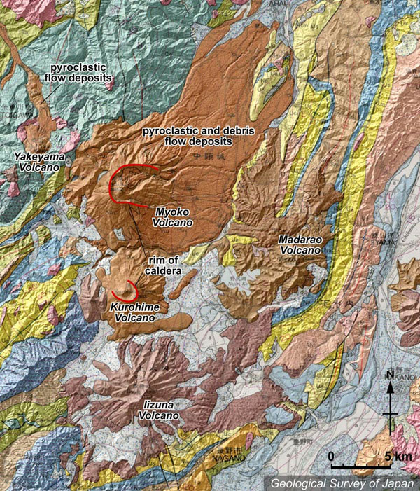
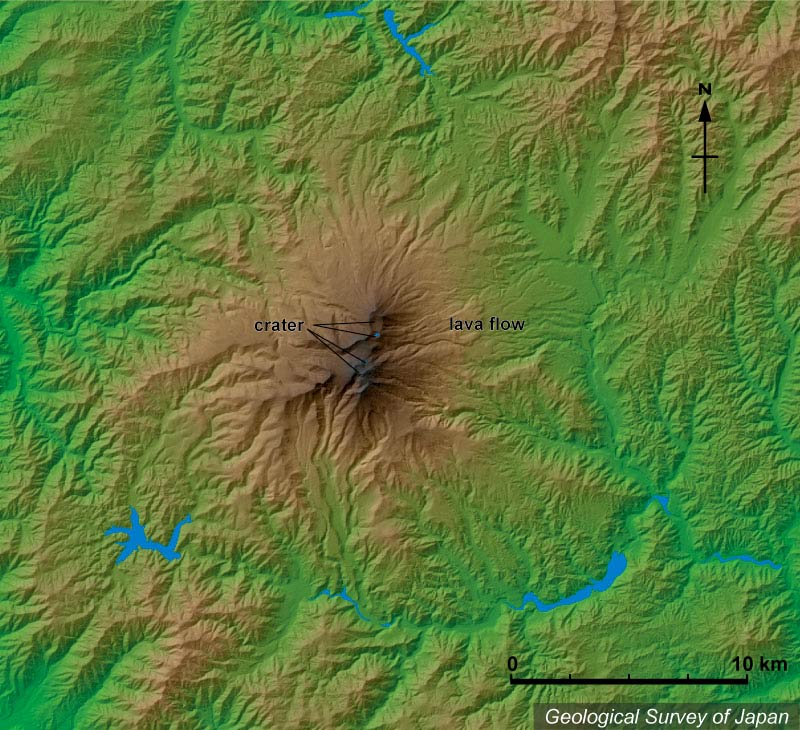
Topographic relief combined with geological map around Myoko volcano group. N-S trending volcanoes are Myoko, Kurohime and Iizuna Volcanoes from north to south. Eastward-open caldera (3 km in diameter) is located at the summit of Myoko Volcano. Volcanic fan deposits composed of pyroclastic flow and debris flow deposits are widely distributed in the east and northeastern foot of the volcano. |
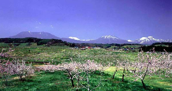
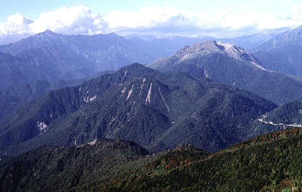
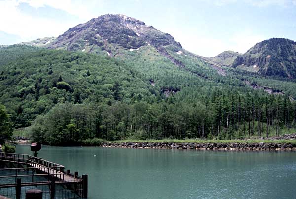
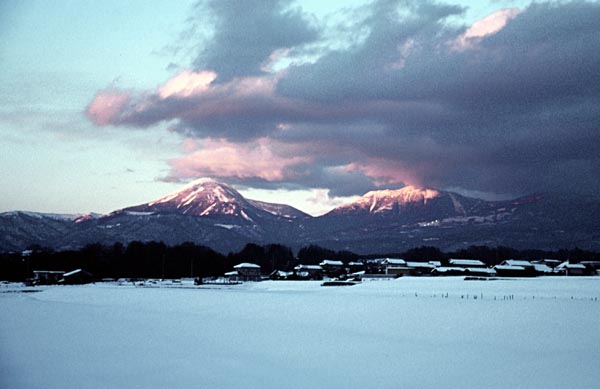
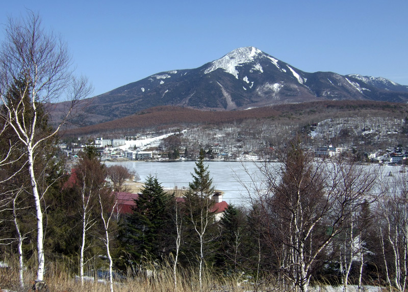
Panoramic view of Myoko volcano group from the E. Myoko, Kurohime and Iizuna volcanoes from right to left. |
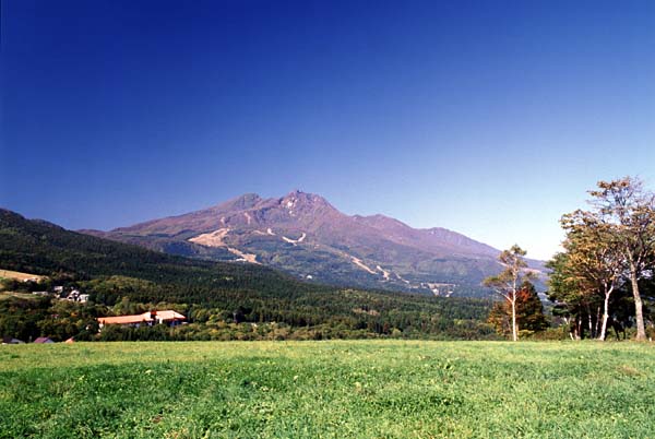
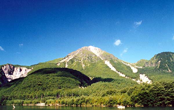
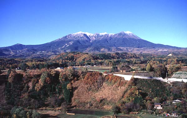
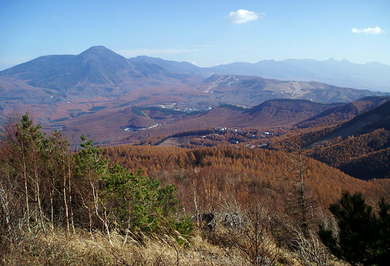
View of Myoko Volcano from the SE, Kurohime-kogen |
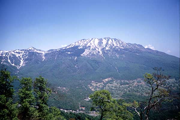
View of somma of Myoko Volcano from the SW. |
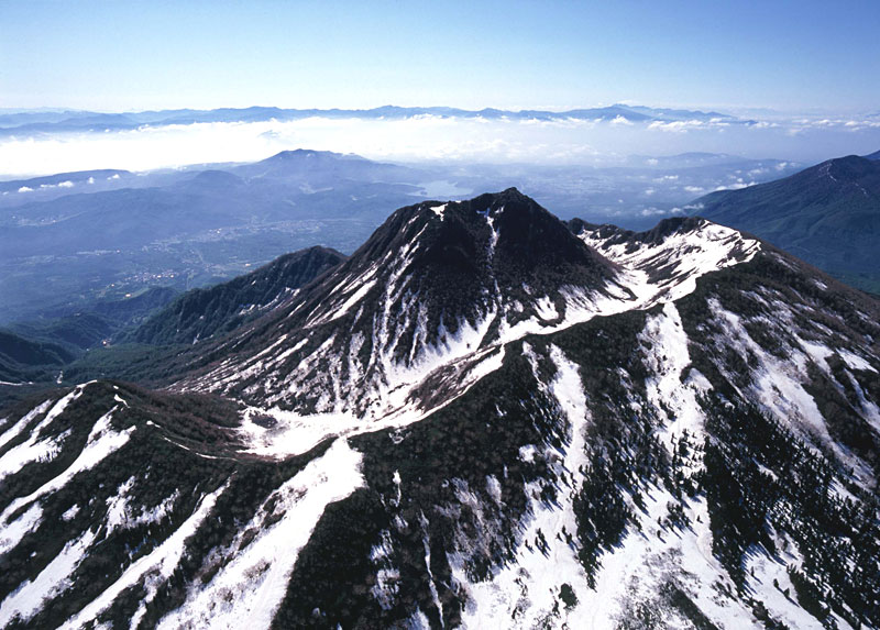
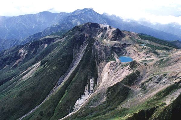
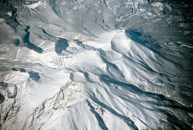
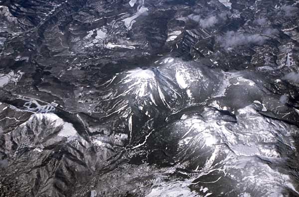
Aerial view of Myoko Volcano as seen from the NW. Note the central cone and horseshoe-shaped caldera opening to the E. |
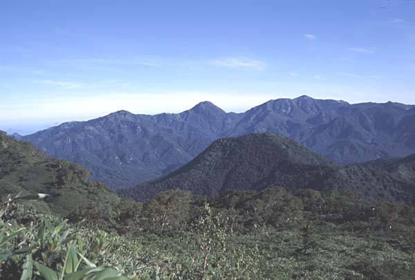
Panoramic view of Yakeyama (center) and Hiuchiyama (right) from Takazumayama |
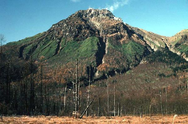
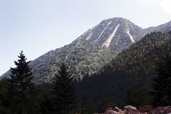
Yakeyama Lava Dome from the E, summit of Hiuchiyama |
Yakeyama Lava Dome viewed from the WNW. |
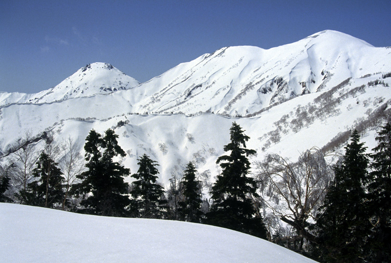
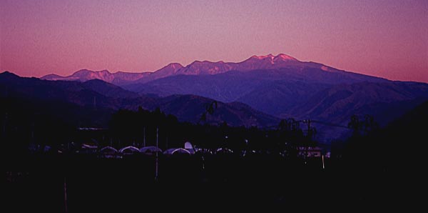
View of Niigata Yakeyama Volcano (left) and Hiuchi-yama (right) from the ESE (Kurosawa-yama). |
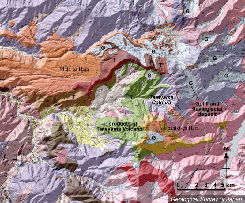
Topographic relief around Tateyama Volcano combined with geological map. Tateyama Caldera in the center, and flat plateau (such as Midagahara) in the northwestern side of Tateyama Caldera. The shape of caldera rim is clear in the northwestern side of caldera (composed of new lava flow indicated by brown of reddish brown), but it is entirely eroded in the southeastern side of caldera (except in Goshikigahara). Surface of the volcano is covered by till and fluvioglacial deposits in the east-northeastern side of the caldera. |
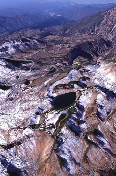
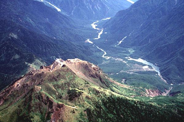
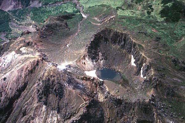
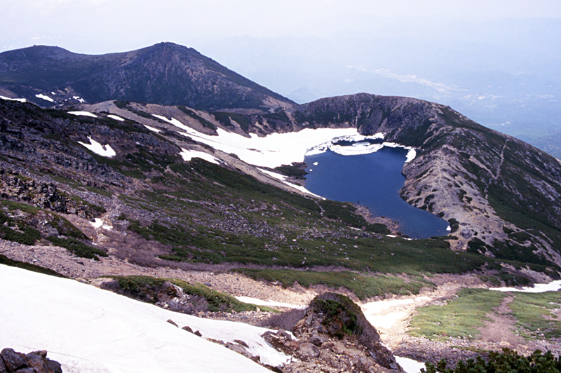
Aerial view of explosion craters in Murododaira and Jigoku-dani as seen from the E. Mikurigaike Crater in the center, and Jigokudani Valley (altered zone) in the right. Gentle slopes in Tengudaira to Midagahara are located on the left bank of Shomyogawa. |
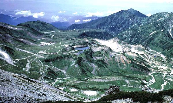
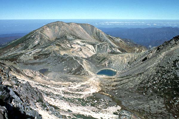
Murododaira Plateau viewed from the E. Mikurigaike and Midorigaike Ponds in the center and Jigokudani Valley (white colored), altered zone in the right. |
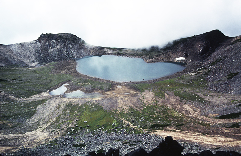
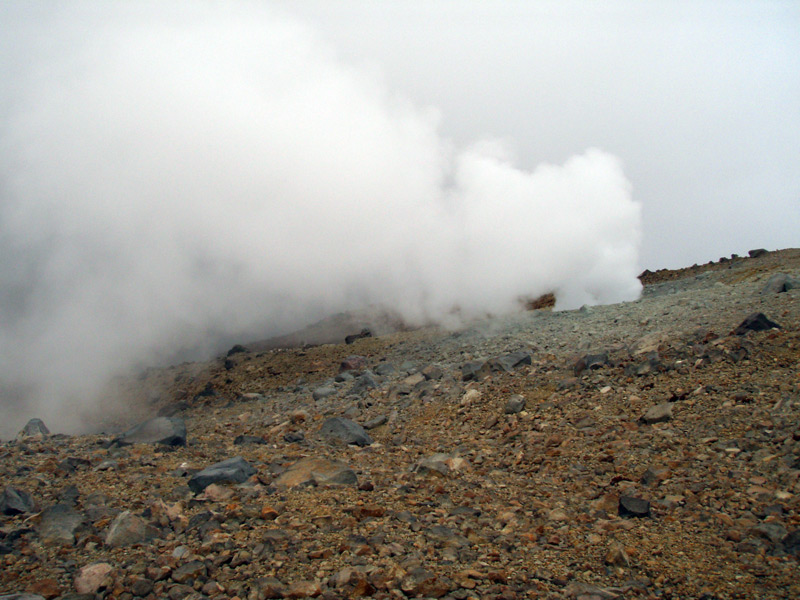
A big fumarole (Kajiyajigoku) in Jigokudani Valley. The fumarolic emissions stopped in 1992 and restarted in 2005 |
Yakedake Volcano |
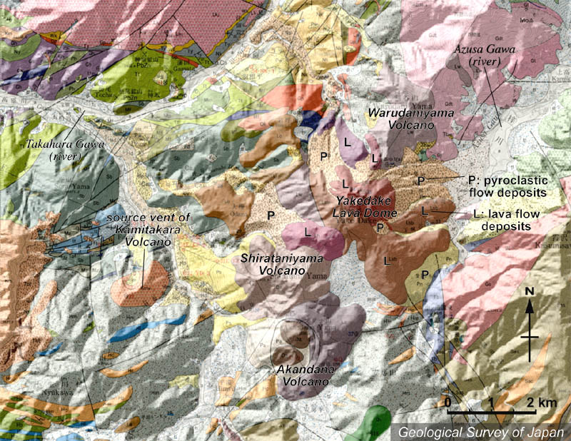
Topographic relief combined with geological map around Yakedake Volcano. Warudaniyama Volcano ,Yakedake Lava Dome, Shirataniyama Volcano and Akandana Volcano are arranging in the NE-SW direction. |
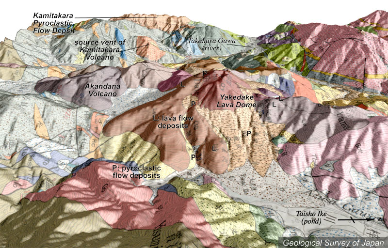
Topographic relief of combined with geological map around Yakedake Volcano (tilted by 10 degrees from the E to the W). Pyroclastic flow deposits and debris flow deposits in the foreground of Yakedake Lava Dome. Akandana Volcano is located in the left end of volcanoes. |
Akandana Volcano and and Yakedake Lava Dome (right background) viewed from the SW |
Yakedake Lava Dome viewed from the E, Taishoike Pond. |
Yakedake Lava Dome viewed from the E, Kamikochi. |
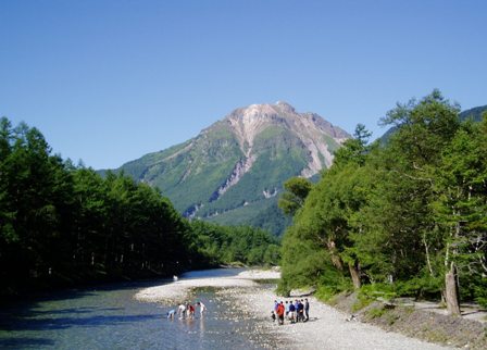
Aerial view of Kamikochi formed by damming by eruption of Yakedake Volcano, as viewed from the S. |
Yakedake Lava Dome viewed from the E, Taishoike Pond |
Akandanayama viewed from the SSE. |
Craters at the summit of Yakedake Lava Dome. The lower left of this figure is north. |
Summit crater (Shogaike crater) of Yake-dake Lava Dome viewed from the NE rim. Deep innkyoana crater in the right |
Shogaike crater from the S, summit of Yakedake |
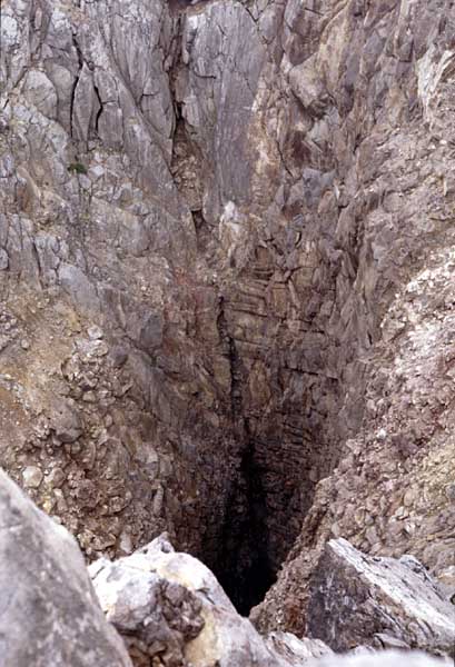
Downward view of Inkyoana crater from the E. The bottom of the crater is unvisible |
Inkyoana crater (on the right) and Shogaike crater (on the left) at the top of Yakedake Lava Dome, viewed from the E |
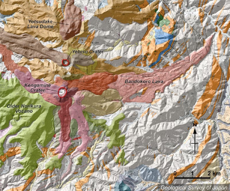
Topographic relief around Norikura Volcano combined with geological map. Yotsudake Lava Dome in the N, Yebisu Crater and Kengamine Lava Cone in the center. The valley in the E was filled with Bandokoro Lava. Older Norikura Volcano (green-colored) is located on the lower left |
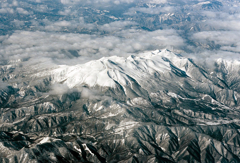
Aerial view of Norikura Volcano as seen from the SE. |
Panoramic view of Norikura Volcano from the W in the evening |
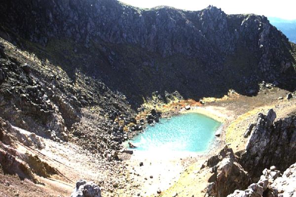
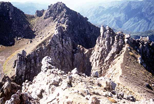
Gongen-ike Crater viewed from the E, Kengamine |
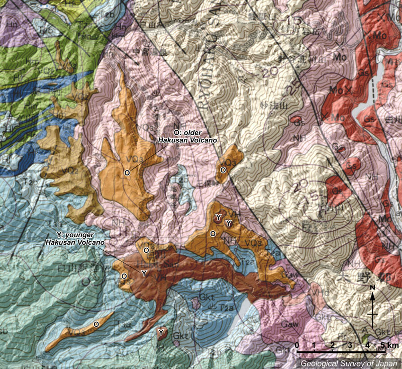
Topographic relief of Hakusan Volcano combined with geological map, showing the summit of Hakusan in the bottom of the figure |
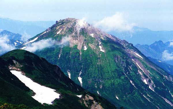
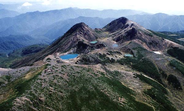
Aerial view of Hakusan as seen from the N. Gozengamine on the right and Kengamine on the left. Midorigaike Pond is located in the front of Kengamine. |
Aerial view of Hakusan Volcano as seen from the NE. Bessan in the background |
Onanjigamine viewed from the NW, summit of Gozengamine. Kon''yaike Pond in the center. |
Topographic relief map around Ontake Volcano. NNE-SSW trending craters on the mountaintop. |
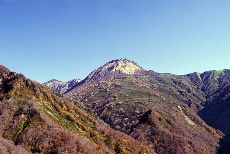
Ontake Volcano viewed from the E. Kengamine, the highest peak, is located in the left end, and Mamakodake in the right end. Small peak in the left slope, Mikasayama, is presumed to be caldera rim of Older Ontake |
Aerial view of Ontake Volcano as seen from the SSE. Craters are aligned in the N-S direction. |
Sannoike Crater viewed from the SW. Mamakodake in the left background. |
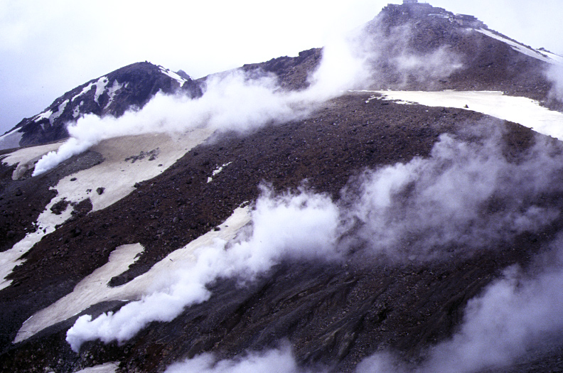
Fumaroles at the south of Kengamine, viewed from the SE. |
S-3 Crater at the Jigokudani Valley, south of Kengamine |
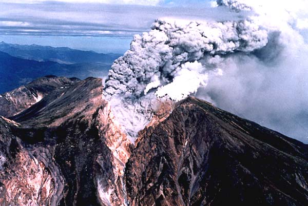
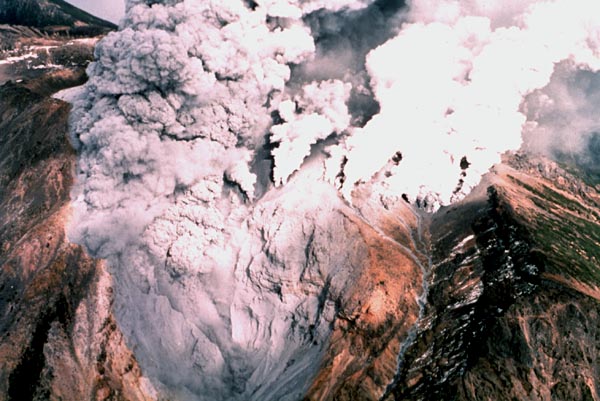
Aerial view of the eruptive activity at the upper part of Jigoku-dani (valley) in 1979, as seen from the S. Gray-colored smoke contains volcanic ash |
Aerial view of eruptive activity at the upper part of Jigoku-dani (valley) in 1979. Volcanic ash reached to Maehashi City, Gumma Prefecture. |
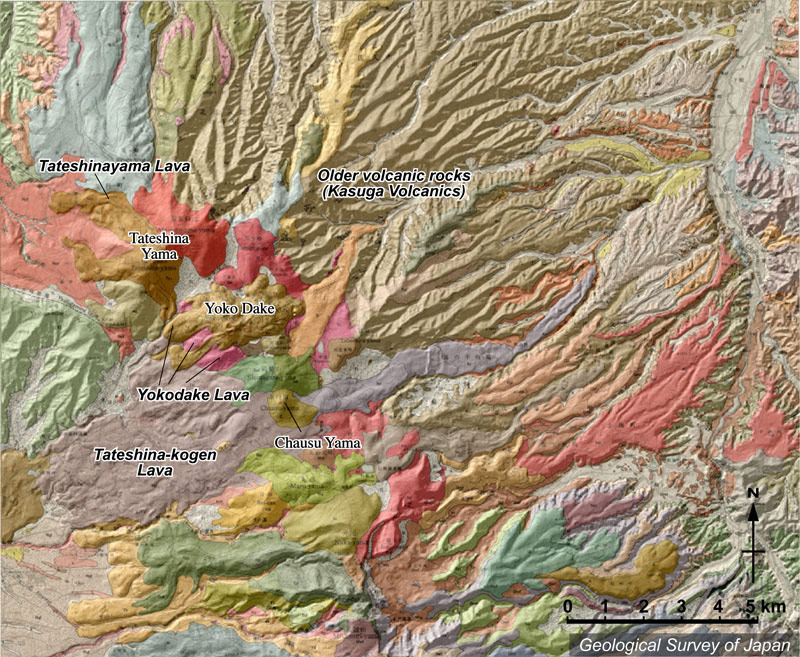
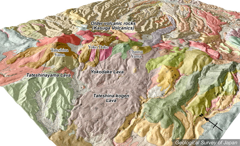
Topographic relief of Kita Yatsugatake Volcano combined with geological map, showing NW-SE to N-S trending volcanic row |
Topographic relief of Kita Yatsugatake Volcano combined with geological map (tilted by 30°from the SW to the NE). |
View of Tateshinayama (left) and Yokodake (right) in winter from the SW |
View of Tateshimayama (left) from the NW (Ozasayama, Kirigamine). |
Aerial view of Tateshinayama (center) and Yokodake (lower right) as seen from the S. |
Tateshinayama (center background) viewed from the NW (Utsukushigahara). |
Tateshinayama viewed from the W (Daimon-toge). |

MYOKO-SANhttp://riodb02.ibase.aist.go.jp/strata/VOL_JP/EN/active_v.htm#honshu
NIIGATA YAKE-YAMA (CHAUSUDAKE), высота 2400 м, 36 ° 55'' 04" N 138 ° 02'' 21" E, лавовый купол, стратовулкан, андезит, дацит, активный начиная с 3 Ka. Извержения:
11-12-е столетие: Вулканическая деятельность: осадки из пепла. Пирокластические потоки (расширен север на 20 км). Потоки лавы.
1361: Вулканическая деятельность: осадки из пепла. Пирокластический поток. Лавовый купол сформировался.
1773: извержения: осадки из пепла. Пирокластический поток.
1852-1854: Phreatic извержения.
5 и 8 февраля 1949: Phreatic извержения: осадки из пепла.
19 мая 1949: Phreatic извержения.
30 июля 1949: Lahar.
13 Sep 1949: Phreatic извержения.
14 марта 1962: Незначительные phreatic извержения.
28 июля 1974: Phreatic извержения: осадки из пепла. Lahar.
14 и 15 апреля 1983: Незначительные phreatic извержения.
TATE-YAMA (MIDAGAHARA), высота 2621 м (Kunimi-dake), и примерно 2630 м (Murodo-yama), 36 ° 34'' 05" N 137 ° 35'' 34" E, стратовулкан-кальдера, пирокластическое плато потока, поток лавы, андезит, дацит, моложе 0.22 Ма. Извержения:
704: Вулканическая деятельность?
9 июля 1836: Phreatic извержение (Jigoku-dani).
10 июня 1839: Phreatic извержение? (Jigoku-dani).
8 апреля 1858: Оползень после землетрясения Hietsu.
23 апреля 1858: грязевой поток debris flows.
7 июня 1858: грязевой поток. Кальдера Tateyama – эрозионная кальдера, а не кальдера коллапса.
NORIKURA-DAKE, высота 3026 м (Ken-ga-mine), 36 ° 06'' 12" N 137 ° 33'' 24" E, стратовулкан, лавовый купол, андезит, дацит, старший вулкан Norikura: примерно активен с 1.3-0.86 Ма, младший Norikura моложе 0.32 Ма. Norikura-dake - действующий вулкан, но нет никаких исторических летописей об его извержении.
HAKU- SAN, высота 2702 м (Gozen-ga-mine), 36 ° 09'' 07" N 136 ° 46'' 28" E, ранняя стадия вулкана (вулкан Kagamuro): активен примерно 0.4-0.3 Ма, старший вулкан Haku- SAN: примерно 0.2-0.1 Ма, младшие Haku- SAN и вулкан Uguisudaira моложе 20 Ka. Извержения:
706: Вулканическая деятельность?
853: Вулканическая деятельность?
859: Вулканическая деятельность?
884: Вулканическая деятельность?
1042: Phreatic извержение (кратер Senjaga-ike).
18 мая 1177: Вулканическая деятельность?
4 июля 1547: Вулканическая деятельность: осадки из пепла.
1548: Вулканическая деятельность.
1554-1556: извержение валканианского типа? (Кратер Midoriga- ike): Незначительные пирокластические потоки; осадки из пепла.
27 Sep 1579: Вулканическая деятельность: Lahar.
1582: Облако из пепла.
1640: Вулканическая деятельность: осадки из пепла.
1659: Вулканическая деятельность: осадки из пепла.
ONTAKE- SAN, высота 3067 м (Ken-ga-mine), 35 ° 53'' 23" N 137 ° 29'' 00" E, стратовулкан-кальдера, стратовулкан, базальт, андезит, дацит, риолит, старший вулкан Ontake активен 0.75-0.42 Ма, младший Ontake: 90-20 Ka. Кальдера сформировалась в течение ранней стадии более молодого Ontake. Умеренная деятельность начиная с 20 Ka. Извержения:
774: Вулканическая деятельность?
1892: Вулканическая деятельность с грохотом?
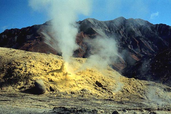
28 октября 1979: Phreatic извержение (Jigoku-dani): осадки из пепла .
14 сентябрь 1984: сель, вызванный разрушением фланга из-за землетрясения Nagano-ken Seibu ("Ontake-kuzure").
Май 1991: Маленькие phreatic извержения (Jigoku-dani): осадки из пепла только вокруг кратера.
Март 2007: Маленькие phreatic извержения (Jigoku-dani): осадки из пепла только вокруг кратера.
KITA YATSU-GA-TAKE (TATESHINA-YAMA), высота 2530 м (Tateshina-yama) и 2480 м (Yoko-dake), 36 ° 06'' 02" N 138 ° 17'' 53" E, стратовулкан, лавовый купол, андезит, дацит, базальт, старший вулкан Yatsugatake моложе 1 Ма, молодой вулкан Yatsuga-take моложе 0.2 Ма. Извержения:
Последняя деятельность Yoko-dake произошла примерно 800 лет назад. 20 июня 888: сель, вызванный разрушением фланга сформировал озеро Matsubara. Группа вулканов Kita-Yatsugatake включает Tateshina-yama, Yoko-dake, Shimagare-yama, Chausu-yama и Futago-mine. Вулкан Yoko-dake определен как действующий вулкан на основании "нового определения действующего вулкана" от января 2003.