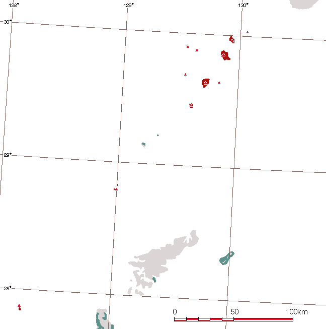
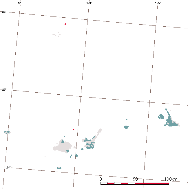
 | Kyushu and Okinawa |
|
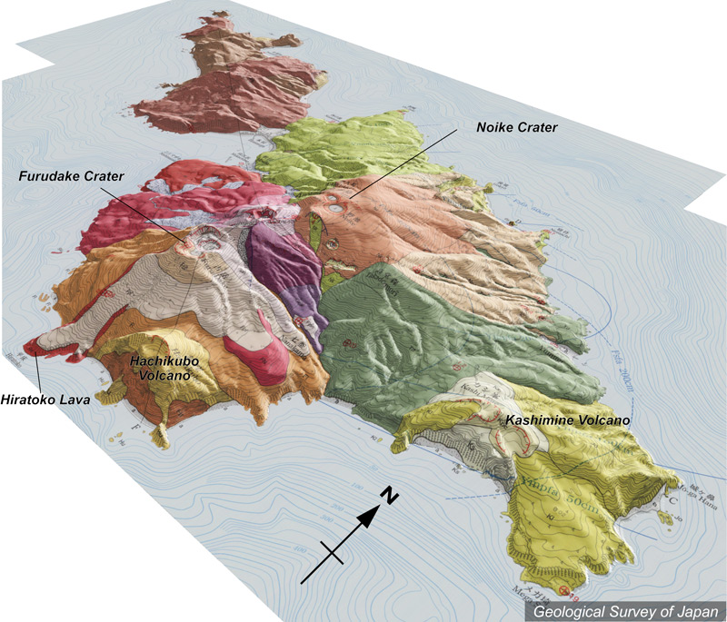
Topographic relief of Kuchinoerabujima Volcano combined with geological map (tilted by 35° from the SE to the NW). Younger volcanoes with summit craters are distributed in the southeast of the island |
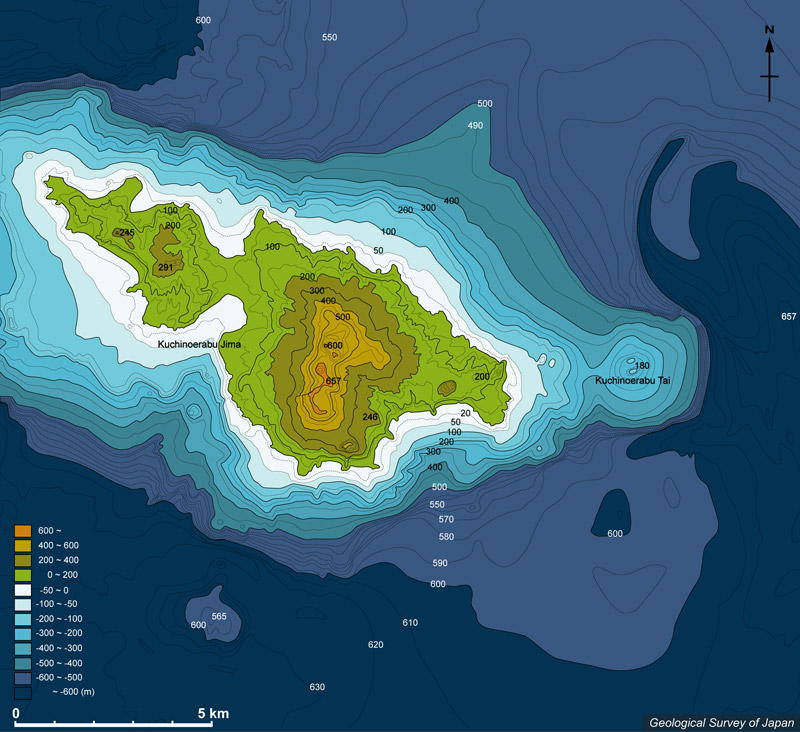
Bathymetric map around Kuchinoerabujima Island |
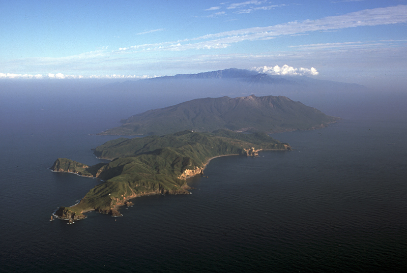
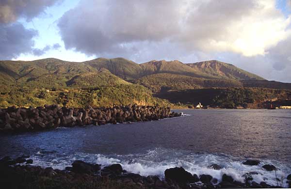
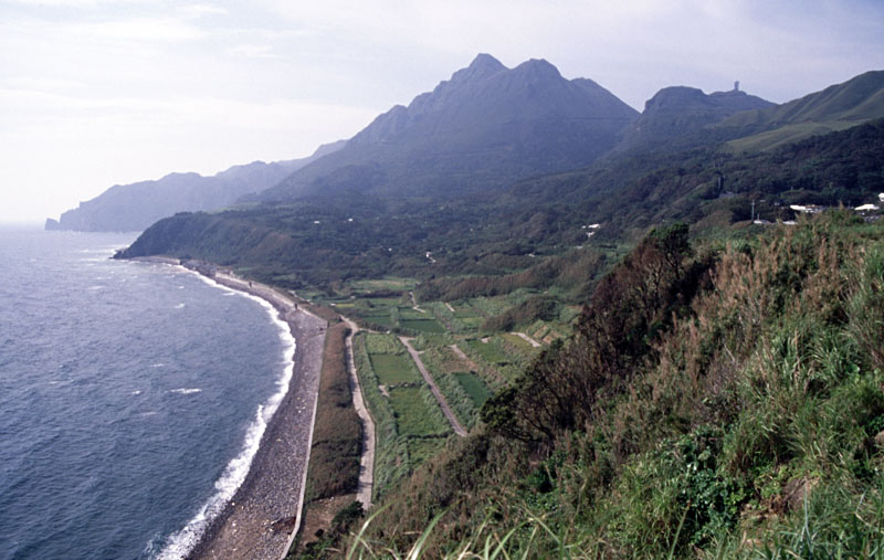
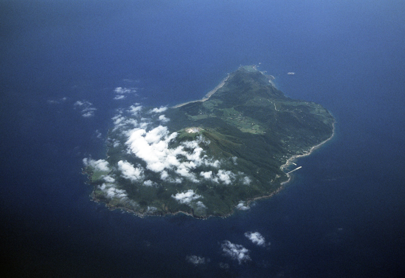
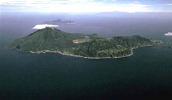
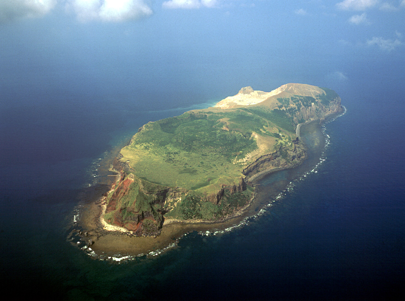
Aerial view of Kuchinoerabu Jima (Island) as seen from the WNW. Yakushima Island in the distance |
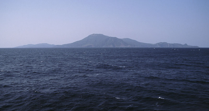
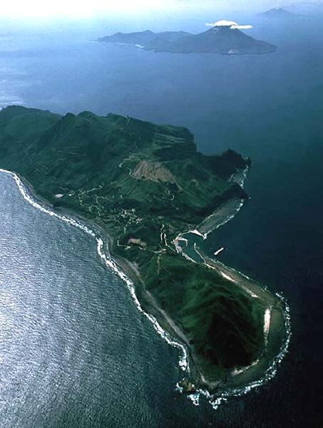
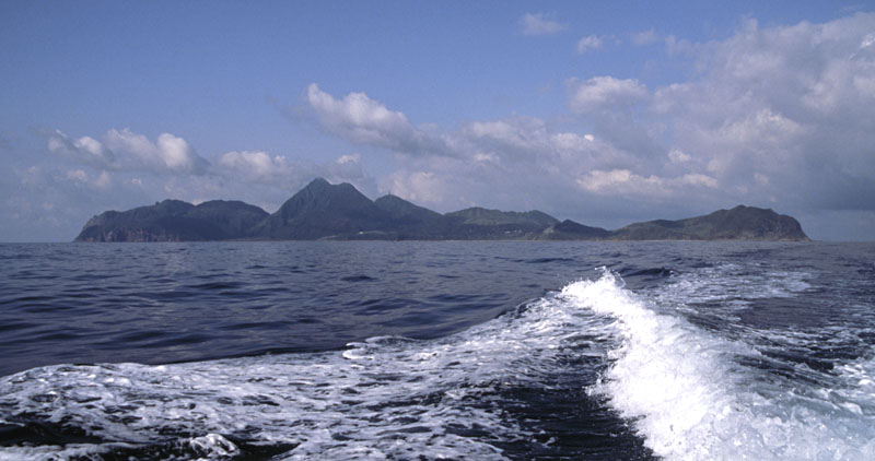
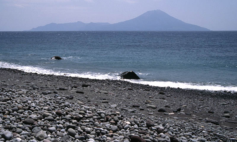
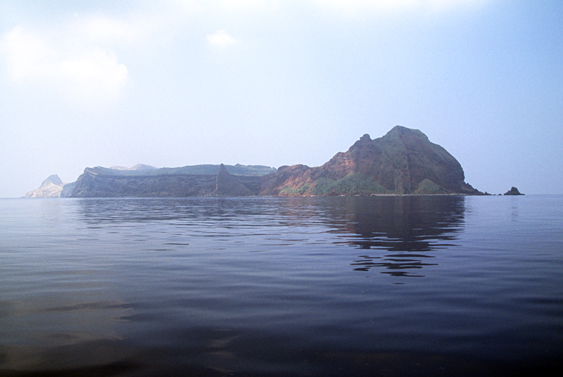
Kuchinoerabujima Island viewed from the SE |
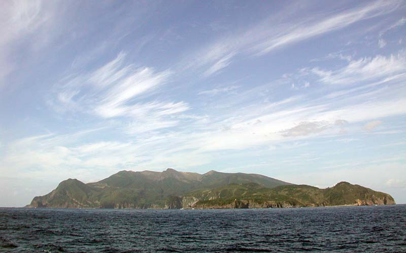
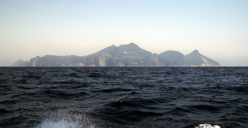
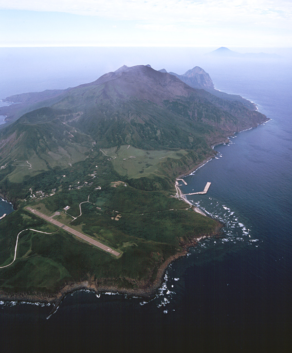
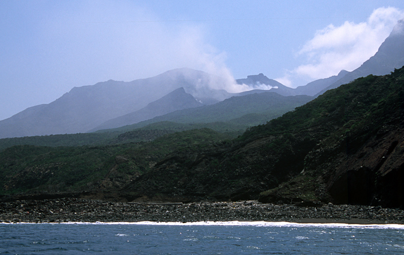
Kuchinoerabujima Island viewed from the E |
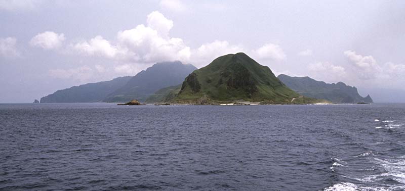
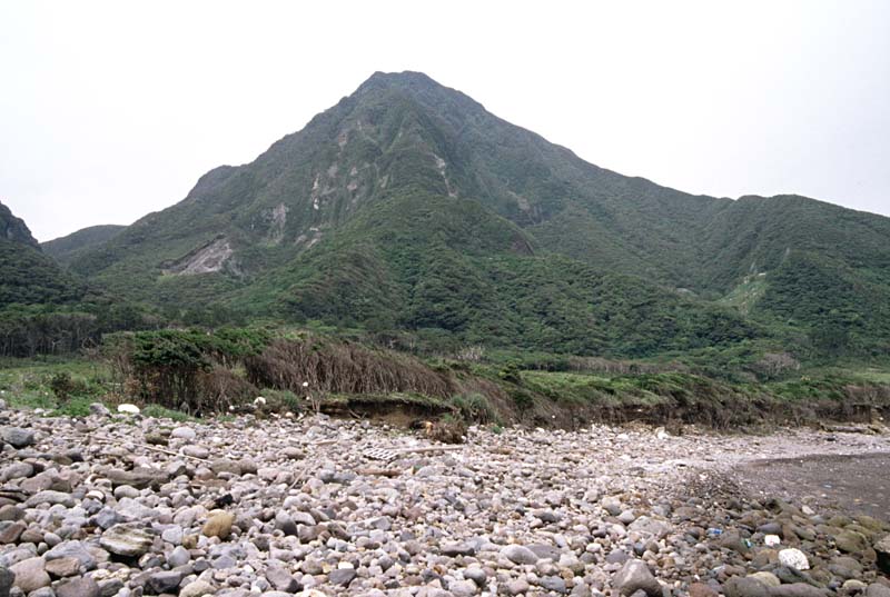
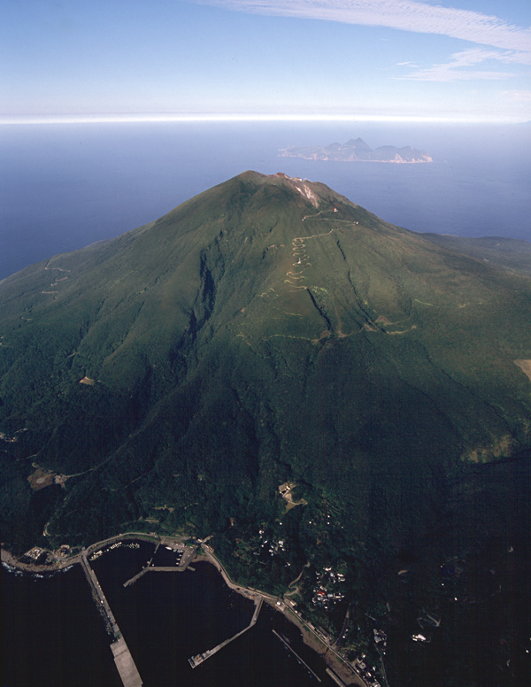
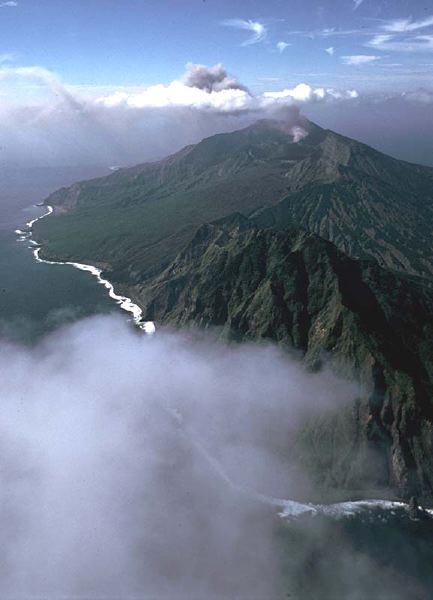
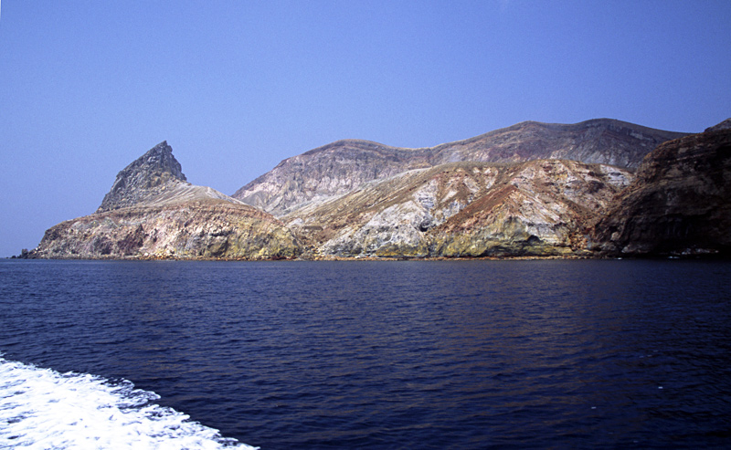
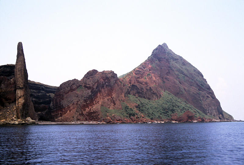
Furudake, Shindake and Sankakutenyama Volcanoes from right to left, viewed from the NW |
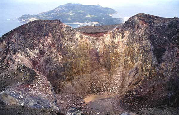
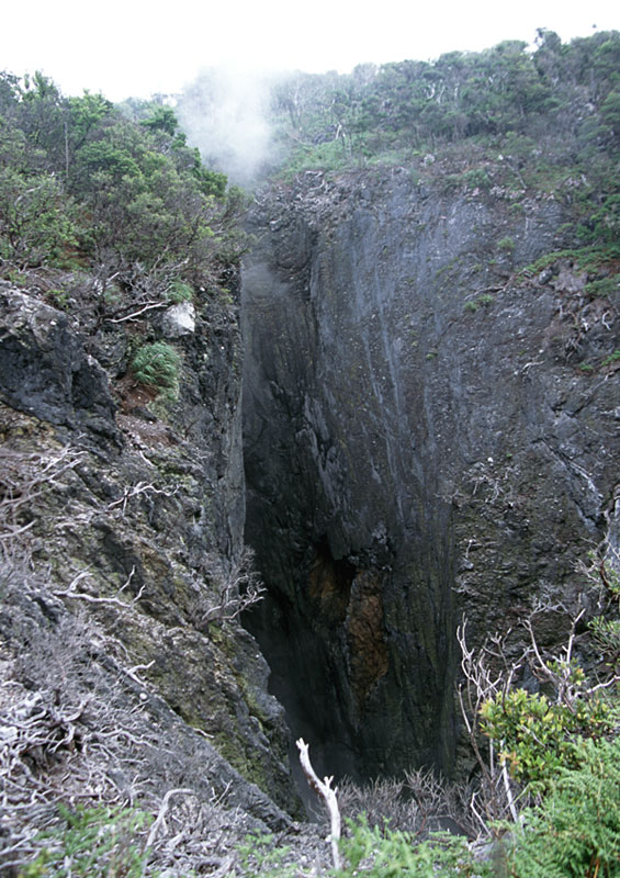
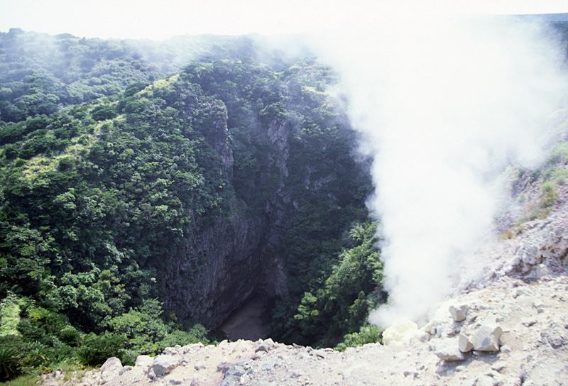
View of the crater of Shindake Volcano from the SE. |
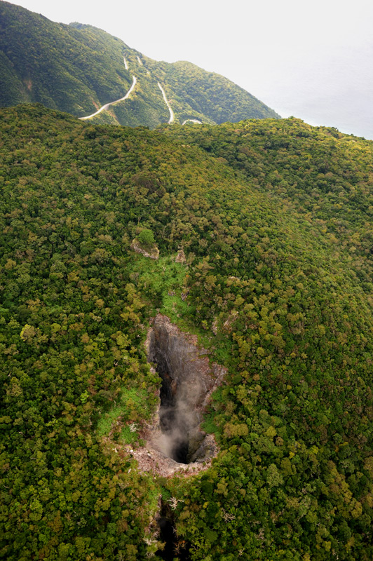
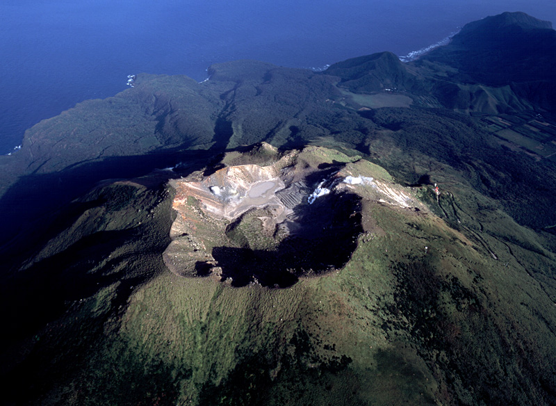
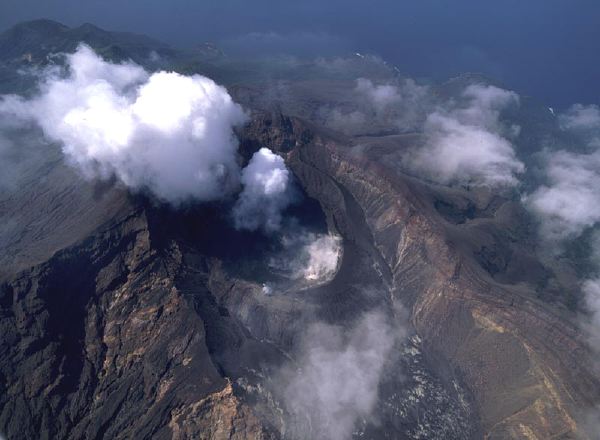
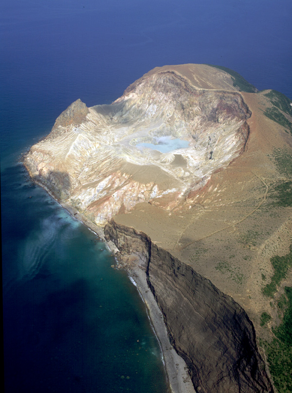
Aerial view of the summit crater of Shindake Volcano as viewed from the E. Note eruption fissures from center to right in this side |
Eastern crater of Sankakutenyama Volcano viewed from the S. |
Aerial view of Furudake Volcano (center) and Shindake Volcano (right) as seen from the E |
Aerial view of Kuchinoshima Island as seen from the NNE |
Panoramic view of Kuchinoshima Island from the NE. The highest point of the island is Maedake Lava Dome. |
Panoramic view of Kuchinoshima Island from the SW. The highest peak is Maedake Lava Dome. The second peak from the right is the youngest lava dome, Moedake |
Kuchinoshima Island viewed from the N. Furiidake Volcano in the front is the oldest |
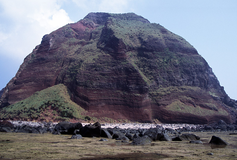
Maedake Lava Dome viewed from the N. |
Maedake Lava Dome viewed from the E (Toshiri-Kaigan). |
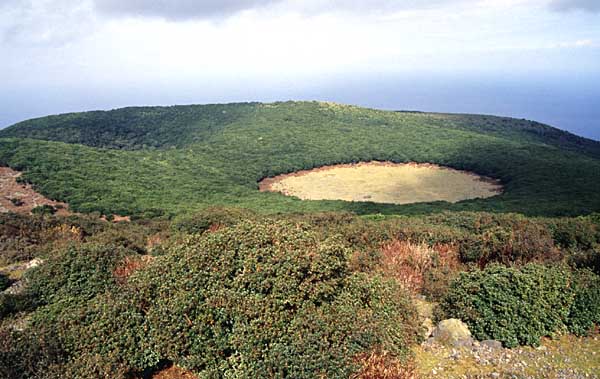
Explosion crater with fumarolic activity at the summit of Moedake Lava Dome |
Aerial view of explosion craters of Moedake as seen from the N |
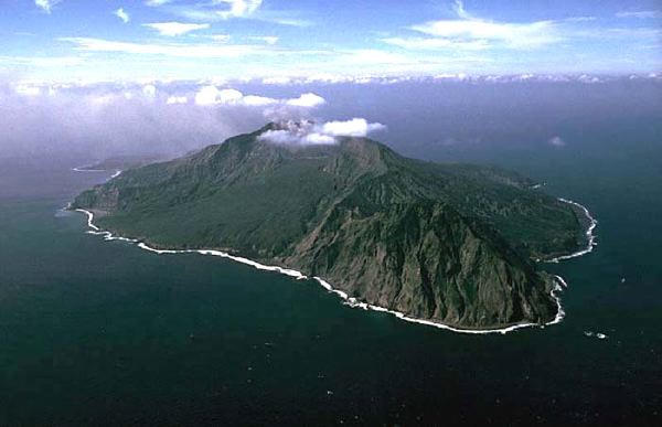
Aerial view of the Nakanoshima Island as seen from the NW. |
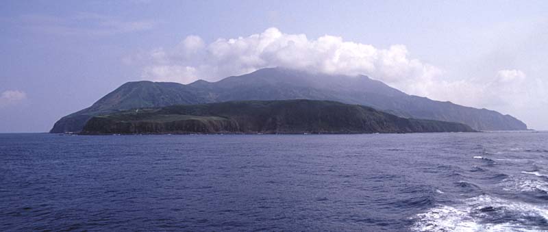
Aerial view of Nakanoshima Island as seen from the SSE. Peak of Otake is covered by cloud. Kuchinoshima Island is in the background |
View of Nakanoshima Island from the NNE (Seranma-Hama on Kuchinoshima Island) . |
Aerial view of Otake Volcano as seen from the SW. |
Aerial view of summit crater of Otake Volcano, as seen from the W |
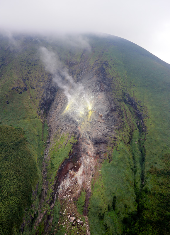
Aerial view of the fumarolic activity on the eatstern slope of Otake as seen from the E. |
Aerial view of Suwanose-Jima, as seen from the NE. Horseshoe-shaped Sakuchi Caldera is at the center of the island, opening to the east. Tondachidake Volcano is an older volcano located in the north of the island. |
Suwanosejima Island viewed from the S. Lava Plateau in this side is Makkou-Dai |
Aerial view of Suwanosejima Island as seen from the S. |
Aerial view of Suwanose-Jima as seen from the NE. Dark-colored ash cloud spouts from Otake Crater inside Sakuchi Caldera. Older Tondachidake Volcano in the front. |
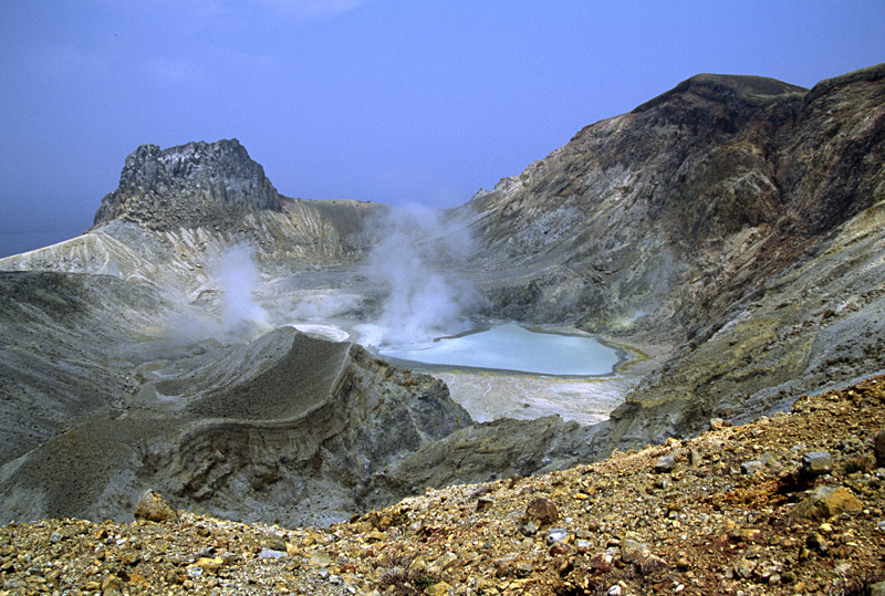
Active Otake Crater within the Sakuchi Caldera viewed from the NE. |
Aerial view of Sakuchi Caldera and Otake Crater with volcanic smoke, as seen from the ENE |
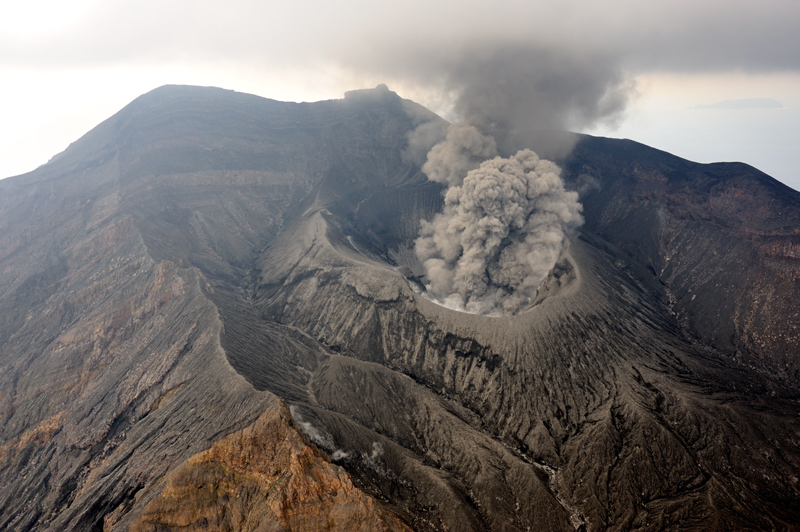
Eruption of Otake Crater viewed from the SW, on the caldera rim |
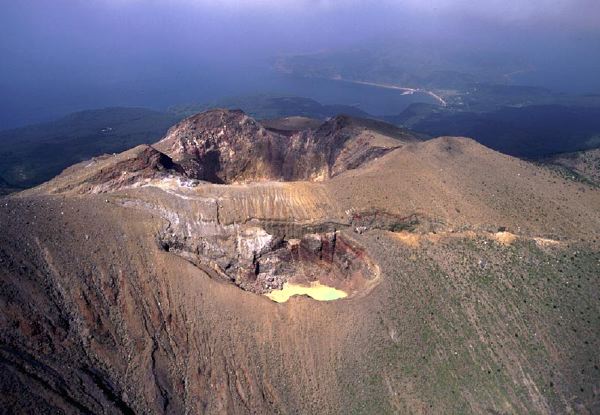
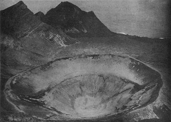
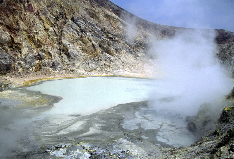
Otake Crater viewed from the SW. The crater is about 450 m across. |
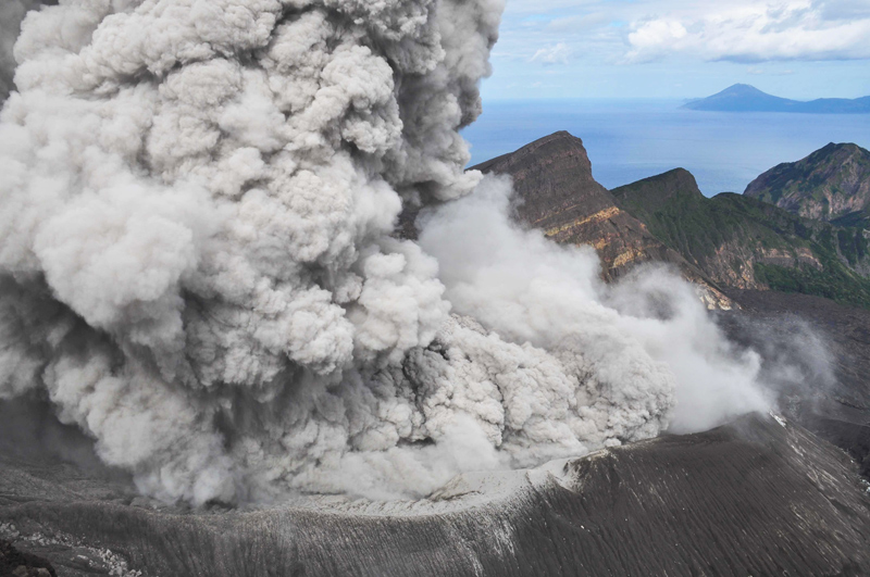
Aerial view of eruption of Otake Crater as seen from the from the NE |
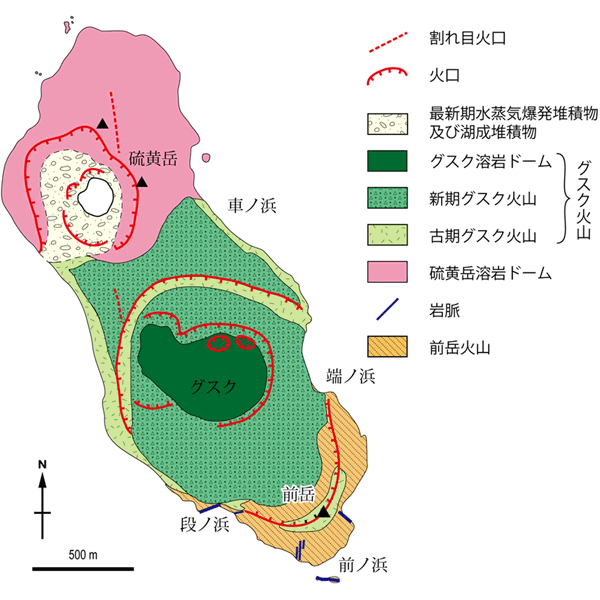
Geological map of Io-Torishima Island. The Island is comprised of three volcanoes |
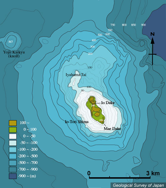
Bathymetric map around Io-Torishima, created from the Basic Maps of the Sea " Io-Tori Shima" at the scale of 1:50,000 (Japan Coast Guard, 1987). |
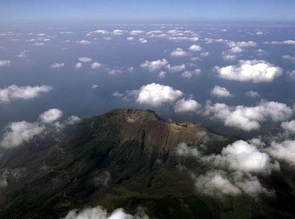
Aerial view of Io-Torishima Volcano as seen from the SE. |
Io-Torishima Island viewed from the SW |
Aerial view of Io-dake Crater, located at the northwestern part of Io-Torishima as seen from the S |
View of Io-dake Volcano from the SW. Hydrothermal alteration of rocks is remarkable |
Maedake Volcano from the SW. Left is a vertical dike |
Oldest Maedake Volcano viewed from the S. |
View of Io-dake Crater with fumarolic activity from the S. |
Io-dake Crater with fumarolic activity viewed from the N. |
Fumarole inside of Io-dake Crater |
A explosion crater of Gusuku Volcano, Fogijun, viewed from the E |
|
submarine volcano NNE of IRIOMOTE-JIMA Pumice fragments generated by submarine eruption in 1924 drifted ashore on coast all over Japan in a year. The red circle shows the submarine volcano. |
KUCHINOERABU-JIMA, высота 657 м (Furu-take , 30 ° 26'' 23" N 130 ° 13'' 10" E, стратовулкан, андезит, Извержения:
23 мая 1841: Вулканическая деятельность (Shin-take).
1 августа 1841: Вулканическая деятельность: осадки из пепла.
Апрель и май 1931: Вулканическая деятельность по западному флангу: осадки из пепла.
23 июля 1932: облако из пепла.
С 24 декабря 1933 до 11 января 1934: Вулканическая деятельность: осадки из пепла.
3 ноября 1945: Вулканическая деятельность по восточному флангу: осадки из пепла.
22 ноября 1966: Вулканическая деятельность: осадки из пепла.
Декабрь 1968 - март 1969: Вулканическая деятельность: осадки из пепла.
2 сентября 1972: Вулканическая деятельность.
KUCHINO-SHIMA, высота 628м (Mae-dake), 29 ° 57'' 52" N, 129 ° 55'' 39" E, стратовулкан, лавовый купол, андезит, последняя магматическая деятельность около 8-13-го столетия сформировала лавовый купол Moedake (Okuno и др., 2004).
NAKANO-SHIMA, высота 979 м (Otake), 29 ° 51'' 20" N 129 ° 51'' 33" E, стратовулкан, андезит, дацит, основа Nakano-shima имеет возраст околот 1.8-1.7 Ма. Более молодой вулкан Nakano-shima моложе 0.2 Ма. Извержения:
Январь 1914: Незначительные phreatic извержения.
Октябрь 1949: облако из пепла.
SUWANOSE-JIMA, высота 799 м (Otake), 29 ° 38'' 05" N 129 ° 42'' 58" E, стратовулкан, пирокластический конус, андезит, вулкан активен с 0.7 Ма. Извержения:
1813-1814: Subplinian извержения: скория. Поток лавы.
1877: Вулканическая деятельность.
1884-1885: Strombolian извержения: скория. Потоки лавы.
21 марта 1914: облако из пепла.
Июль, сентябрь 1915: облако из пепла.
8 и 9 декабря 1921: Вулканическая деятельность.
26 января 1922-1925: Вулканическая деятельность.
13 мая 1925: Strombolian извержение: скория. Потоки лавы.
11 марта 1938: Вулканическая деятельность.
29 ноября 1940: Вулканическая деятельность.
Октябрь 1949: Strombolian и Vulcanian извержения.
1950-1954: Спорадические Strombolian и Vulcanian извержения.
Ноябрь и декабрь 1956: Strombolian и Vulcanian извержения.
1957-1997: Частые Strombolian и Vulcanian извержения.
Январь 1999: облако и осадки из пепла.
Февраль 2000: облако и осадки из пепла.
Декабрь 2000: Незначительная вулканическая деятельность: облако и осадки из пепла.
Январь-май и июль 2001, октябрь 2001 по декабрь 2003: Strombolian извержения: осадки из пепла от кратера, возникшего в течение извержения декабря 2000 на северо-западном склоне кратера Otake.
Январь 2004 по август -октябрь 2007: Взрывные извержения: осадки из пепла (новый кратер наблюдался в феврале 2004). Кратер Otake в настоящее время активный как стратовулкан, лавовый купол и пирокластический конус, андезит. Извержения:
1664: Вулканическая деятельность.
1796: Вулканическая деятельность: осадки из пепла.
1 декабря 1829: Вулканическая деятельность.
1855: Вулканическая деятельность.
1868: Вулканическая деятельность: осадки из пепла.
Март-август 1903: Вулканическая деятельность: осадки из пепла.
С 8 июня 1959 в течение одного месяца: Вулканическая деятельность: осадки из пепла.
25 ноября 1967: Вулканическая деятельность.
18 июля 1968: Вулканическая деятельность.
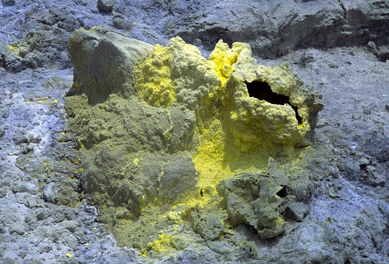
Месторождение серы.
Подводный вулкан северо-северо-восточнее IRIOMOTE-JIMA, глубина не известна, 24 ° 34'' N 123 ° 56'' E, местоположение серии подводных извержений, риолит. Извержения: 31 октября 1924: Подводные извержения: пемзовые лапилли раскиданы по японским островам. Вулкан вероятно принадлежит целой цепи подводных вулканов, находящихся на глубине примерно 1000-1500 м ( b.s.l.).