 | Axial Volcano on the Juan de Fuca Ridge |
|
|
http://www.pmel.noaa.gov/vents/geology/axial.html |
From the south |
From the southeast |
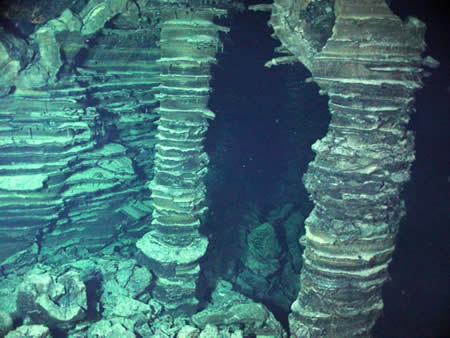
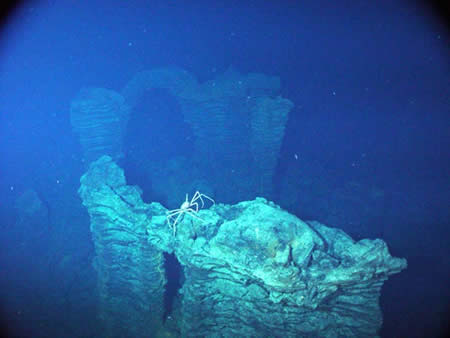
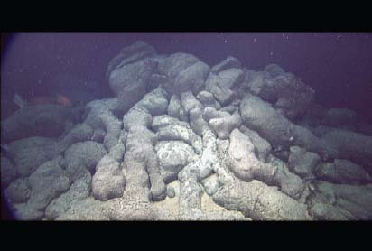
Lava pillars - http://www.pmel.noaa.gov/vents/nemo2006/ |
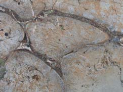
Lava Arche |
|
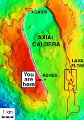
Ashes map -http://www.pmel.noaa.gov/vents/nemo/explorer/ashes.html |
Ashes map -http://www.pmel.noaa.gov/vents/nemo/explorer/ashes.html |
Submarine volcanism Enteropneust worm off Hawaii. The dome-shaped proboscis and lobed collar are about 2cm in length.-http://www.mbari.org/volcanism/Seamounts/Seam-Eclectic.htm |
Dike intrusions (vertical and slanted features) into the Koolau volcanic shield, Oahu, Hawai`i.Photo taken during road construction where the road cut is defined by three, near-horizontal ōstaircaseösteps. A person on the second terrace (circled) offers a scale - http://www.tos.org/oceanography/issues/issue_archive/issue_pdfs/23_1/23-1_staudigel2.pdf |
Dissected pillow formation from Archean |
Pillow lavas from submarine Vance seamount |
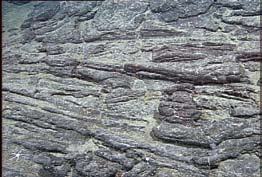
Surface of a submarine sheet flow resembling a subaerial pahoehoe |
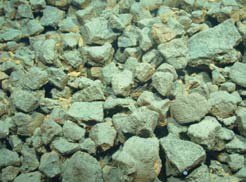
Pillow fragment breccia from L¶`ihi Seamount, |
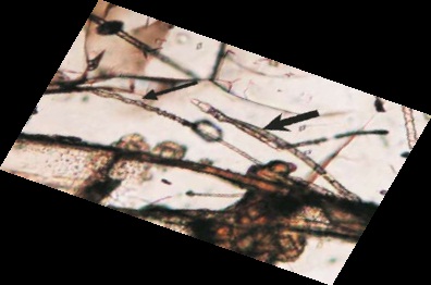
Tubular micro tunnels at a crack in a glassy pillow margin from Deep Sea Drilling - http://www.tos.org/oceanography/issues/issue_archive/issue_pdfs/23_1/23-1_staudigel2.pdf |
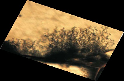
Segmented tubular alteration and tubules with coilebored from Troodos ophiolite. Tubular features in (E) and (F) are interpreted as trace fossils formed by microbial chemical drilling (Staudigel et al., 2008). |
Bamboo corals on Pioneer Seamount -http://www.mbari.org/expeditions/Seamounts07/ |
MBARI dives at Davidson Seamount. Map ® MBARI 1999 -http://www.mbari.org/volcanism/seamounts/Seam-ContlMarg.htm |
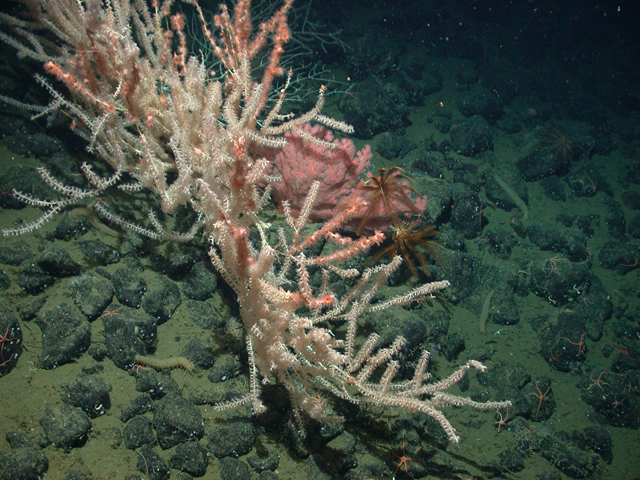
Diverse invertebrate community on Davidson Seamount. Image ® MBARI 2000-http://www.mbari.org/volcanism/seamounts/Seam-ContlMarg.htm |
Plate showing the variety of animals found at Davidson Seamount. (A) Paragorgia arbora. (B) Farrea occa sponge. (C) Staurocalyptus sp. sponge.(D) Asbestopluma sp., Farrea occa, Gorgonocephalus sp., Staurocalyptus sp. (E) Crinoids, antipatharians, and primnoids. (F) A baited fish trap that attracted abundant lithodid crabs but few fish -.http://www.tos.org/oceanography/issues/issue_archive/issue_pdfs/23_1/23-1_clague.pdf |
Davidson Seamount perspective view from the southeast - http://www.mbari.org/data/mapping/seamounts/davidson.htm |
Vance Seamount -http://www.mbari.org/data/mapping/seamounts/images/VanceA.jpg |
South-southeast -http://www.mbari.org/data/mapping/seamounts/vance.htm |
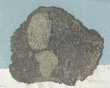
Lava (brown) containing olivine-rich xenoliths (greenish) collected offshore of Kauai.Photo ® MBARI 2001- http://www.mbari.org/volcanism/Hawaii/HR-MagmProc.htm |
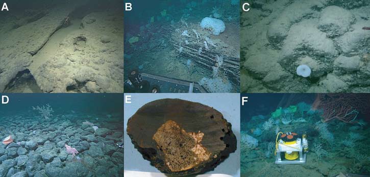
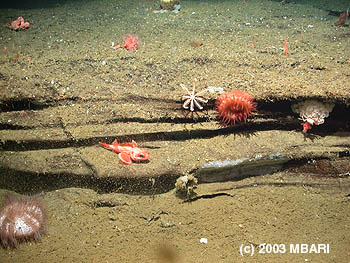
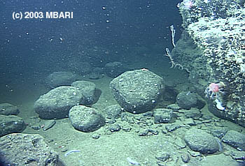
This photograph was taken by MBARI''s Remotely Operated Vehicle (ROV) Tiburon about 680 meters below the surface at Rodriguez Seamount. The layered rocks are hypothesized to be ancient beach sands from a time when this seamount was a volcanic island off the coast of Southern California. This photograph also shows a few of the deep-water marine animals that inhabit the slopes of these seamounts-http://www.mbari.org/news/news_releases/2004/agu2004.html |
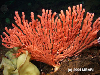
The large cold-water corals found on many seamounts grow very slowly and if undisturbed, may live for hundreds of years.Image credit: (c) 2004 MBARI- http://www.mbari.org/news/news_releases/2004/agu2004.html |
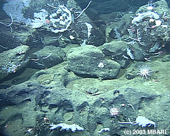
When MBARI researchers dove on Rodriguez Seamount they were surprised to see rocks such as these, which appear to have been sculpted by wave action, but are currently 635 meters below the sea surface (far below the reach of the largest storm waves).-http://www.mbari.org/news/news_releases/2004/agu-images.html |
These boulders at Rodriguez Seamount appear to have been rolled around the sea floor and rounded off by waves in shallow water when the seamount was an island. Image credit: (c) 2003 MBARI - http://www.mbari.org/news/news_releases/2004/agu-images.html |
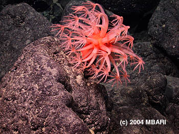
Like many organisms living on seamounts, this "mushroom coral" captures minute food particles that drift past on the ocean currents-http://www.mbari.org/news/news_releases/2004/agu-images.html |
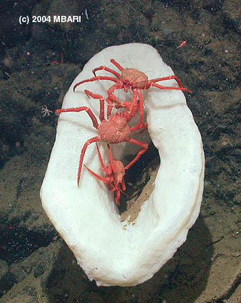
Large deep-water sponges often provide sanctuaries for many smaller animals such as these three crabs --http://www.mbari.org/news/news_releases/2004/agu-images.html |
http://www.mbari.org/news/publications/pubs.html |
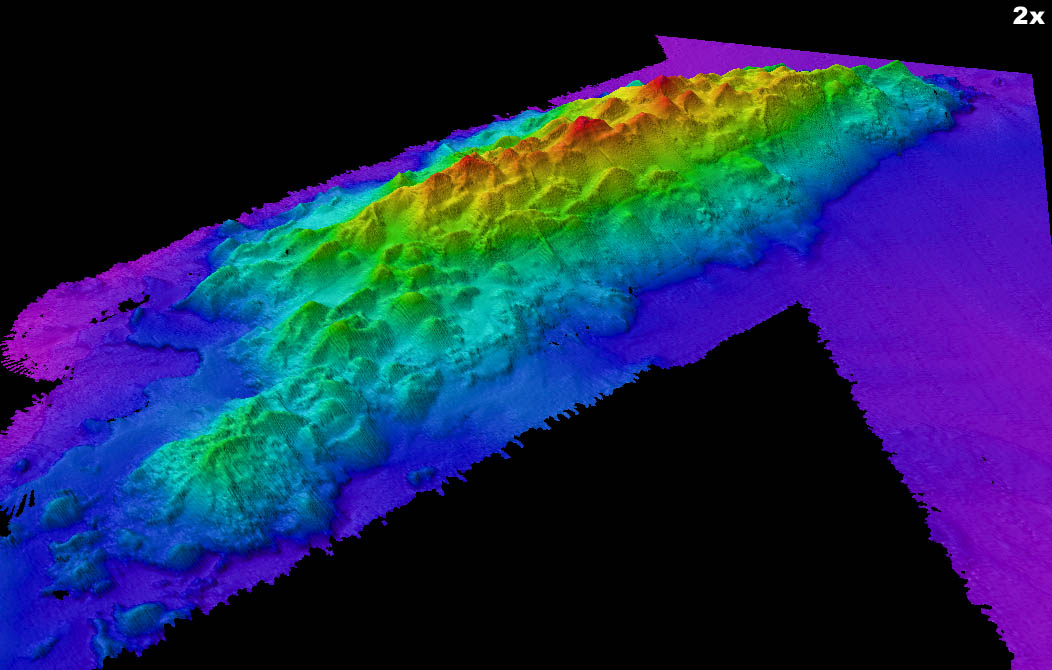
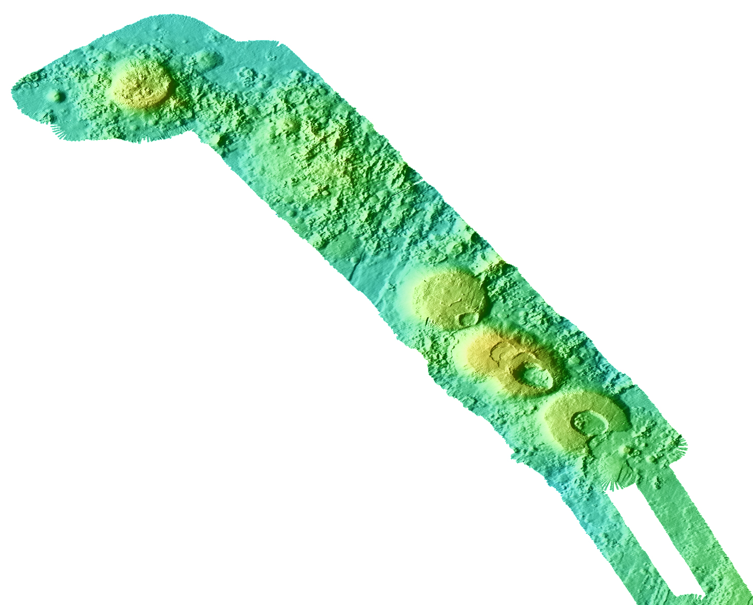
From MBARI -http://www.mbari.org/data/mapping/seamounts/axial.htm
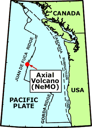
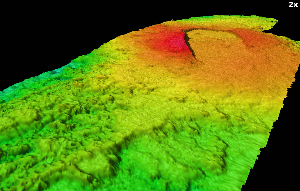
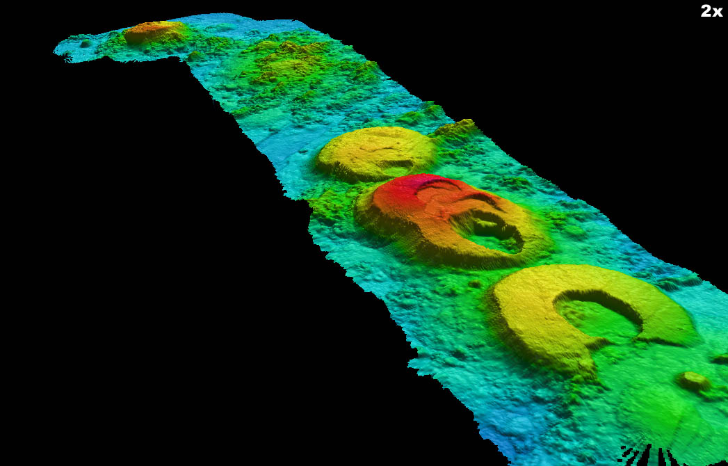
Axial Volcano is located on the Juan de Fuca Ridge at about 46єN, 130єW. The
Cobb-Eickelberg seamount chain intersects the Juan de Fuca Ridge axis
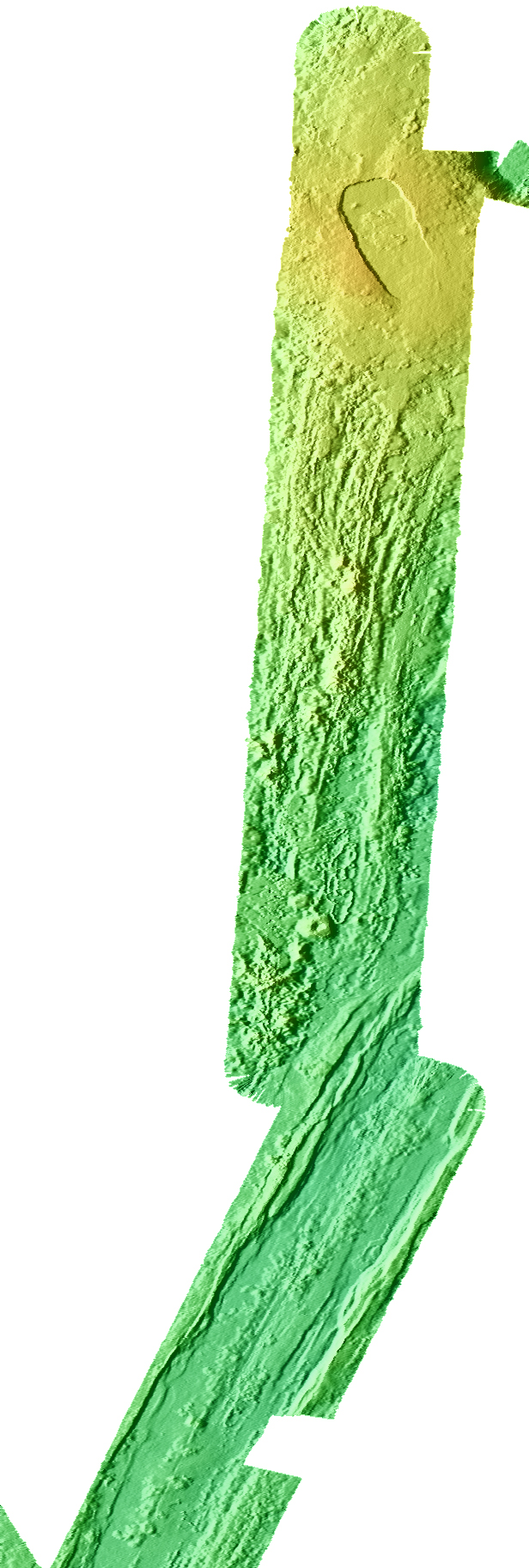
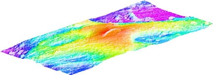
(Delaney et al., 1981). The volcano is elongate with a summit region between two rift zones that extend north and south. The summit is characterized by a horseshoe-shaped caldera (3 x 8 kilometers) that is open towards the southeast. Hydrothermal vents and deposits are common inside the caldera (e.g., Embley and Chadwick, 1994). An eruption took place on the southeastern edge of the caldera in 1998 (Embley et al., 1999). Numerous previous surveys of Axial Volcano (e.g., Embley et al., 1990; Applegate, 1990; Applegate and Embley, 1992) and continued monitoring efforts by the National Oceanic and Atmospheric Administration (NOAA) have provided great detail about the geology and activity of the volcano.
More information about NOAA monitoring is available at: http://www.pmel.noaa.gov/vents/nemo/index.html .
More background on Axial Volcano is available at: http://www.pmel.noaa.gov/vents/geology/axial.html .
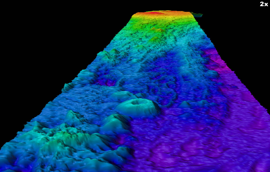
The survey presented here is the highest-resolution, best-navigated survey of this feature and provides a base for measuring future changes in the volcano. The survey was already used with previous surveys to define the location and size of the 1998 eruption on the upper part of the south rift (Embley et. al., 1999).
from http://www.pmel.noaa.gov/vents/geology/axial.html
In January 1998, Axial Volcano experienced a submarine volcanic eruption. Research cruises to Axial every summer since then have been documenting changes at the site caused by the eruption. More information about this work can be found at the NeMO website, where daily updates are posted when scientists are at sea. Also check out NeMO Explorer, which has virtual reality views of the seafloor at Axial.
--------------------------------------------------------------------------------
Axial Volcano rises 700 meters above the mean level of the ridge crest and is the most magmatically robust and seismically active site on the Juan de Fuca Ridge between the Blanco Fracture Zone and the Cobb offset. It represents the product of intense volcanic activity from the Cobb-Eikelberg hotspot juxtaposed on the extensional field of the spreading center. Axial Volcano was first studied in the late 1970s and then mapped in greater detail by NOAA/VENTS with SeaBeam in the early 1980s. Following the initial discovery of venting in the northern portion of the caldera in 1983, a concentrated mapping and sampling effort was made in the mid-late 1980s.The summit of Axial Volcano is marked by an unusual rectangular shaped caldera (3 x 8 km) that lies between the two rift zones. The caldera is defined on three sides by a boundary fault of up to 150 m relief. Hydrothermal vents colonized with biological communities are located near the caldera fault or along the rift zones. Two major high temperature vent areas include the ASHES vent field in the SW caldera and CASM in the north end. The caldera and the upper rift zones have been extensively surveyed by SeaMARC I sidescan sonar, towed camera systems, and submersible dives (see our Methods page for more informtion). The camera tows and submersible dives have revealed extensive areas of fresh lava and diffuse venting on the upper portions of the rift zones. T-phase monitoring of the Juan de Fuca Ridge since 1991 has shown that more than 90% of the on-axis events have originated from the summit of Axial Volcano, excluding the 1993 CoAxial intrusion. (What is a T-phase?). Seafloor instruments deployed in Axial caldera have recorded evidence for several possible intrusion events since 1988. All of these observations point to the fact that Axial is very active and dynamic, and is an excellent site to study the interaction between volcanic events and perturbations to its hydrothermal and biological systems.
--------------------------------------------------------------------------------
The following 12 scientific papers were published in a special section about the 1998 eruption at Axial Volcano the journal Geophysical Research Letters.
Baker, E. T., C. G. Fox, and J. P. Cowen, In situ observations of the onset of hydrothermal discharge during the 1998 submarine eruption of Axial Volcano, Juan de Fuca Ridge, Geophys. Res. Lett., 26, 3445-3448, 1999.
Chadwick, W. W., Jr., R. W. Embley, H. B. Milburn, C. Meinig, and M. Stapp, Evidence for deformation associated with the 1998 eruption of Axial Volcano, Juan de Fuca Ridge, from acoustic extensometer measurements, Geophys. Res. Lett., 26, 3441-3444, 1999.
Cowen, J. P., R. Shackelford, D. McGee, P. Lam, E. T. Baker, and E. Olson, Microbial biomass in the hydrothermal plumes associated with the 1998 Axial Volcano eruption, Geophys. Res. Lett., 26, 3637-3640, 1999.
Dziak, R. P., and C. G. Fox, The January 1998 earthquake swarm at Axial Volcano, Juan de Fuca Ridge: Hydroacoustic evidence of seafloor volcanic activity, Geophys. Res. Lett., 26, 3429-3432, 1999.
Dziak, R. P., and C. G. Fox, Long-term seismicity and ground deformation at Axial volcano, Juan de Fuca Ridge, Geophys. Res. Lett., 26, 3641-3644, 1999.
Embley, R. W., W. W. Chadwick, Jr., D. Clague, and D. Stakes, The 1998 Eruption of Axial Volcano: Multibeam anomalies and seafloor observations, Geophys. Res. Lett., 26, 3425-2428, 1999.
Feely, R. A., E. T. Baker, G. Lebon, J. F. Gendron, J. A. Resing, and J. P. Cowen, Evidence for iron and sulfur enrichments in hydrothermal particles at Axial Volcano following the January-February 1998 eruption, Geophys. Res. Lett., 26, 3649-3652, 1999.
Fox, C. G., In situ ground deformation measurements from the summit of Axial Volcano during the 1998 volcanic episode, Geophys. Res. Lett., 26, 3437-3440, 1999.
Lupton, J. E., E. T. Baker, R. W. Embley, R. Greene, and L. Evans, Anomalous helium and heat signatures associated with the 1998 Axial Volcano event, Juan de Fuca Ridge, Geophys. Res. Lett., 26, 3449-3452, 1999.
McLaughlin-West, E. A., E. J. Olsen, M. D. Lilley, J. A. Resing, J. E. Lupton, E. T. Baker, and J. P. Cowen, Variations in hydrothermal methane and hydrogen following the 1998 eruption at Axial Volcano, Geophys. Res. Lett., 26, 3453-3456, 1999.
Resing, J. A., R. Feely, G. Massoth, and E. T. Baker, The water-column chemical signature after the 1998 eruption of Axial Volcano, Geophys. Res. Lett., 26, 3645-3648, 1999.
Sohn, R. A., S. C. Webb, and W. C. Crawford, Local seismicity following the 1998 eruption of Axial Volcano, Geophys. Res. Lett., 26, 3433-3436, 1999
--------------------------------------------------------------------------------
Previous results from a broad range of studies at Axial Volcano were published in a special issue of the Journal of Geophysical Research (vol. 95, no. B8, August 10, 1990, p.12,689-12,966). The following are some selected scientific papers on the geology of Axial Volcano:
Appelgate, B., Volcanic and Structural Morphology of the Southern Flank of the Axial Volcano, Juan de Fuca Ridge: Results From a Sea MARC I Side Scan Sonar Survey, J. Geophys. Res., 95, 12,765-12,783, 1990.
Appelgate, B., and R. W. Embley, Submarine tumuli and inflated tube-fed lava flows on Axial Volcano, Juan de Fuca Ridge, Bull. Volcanol., 54, 447-458, 1992.
Chase, R.L., J.R. Delaney, J.L. Karsten, H.P. Johnson, S.K. Juniper, J.E. Lupton, S.D. Scott, V. Tunnicliffe, S.R. Hammond, and R.E. McDuff, Hydrothermal vents on an axis seamount of the Juan de Fuca ridge (Canadian American Seamount Expedition), Nature, 313, 212-214, 1985.
Embley, R. W., K. M. Murphy, and C. G. Fox, High resolution studies of the summit of Axial volcano, J. Geophys. Res., 95, 12785-12812, 1990.
Fox, C. G., Evidence of active ground deformation on the mid-ocean ridge: Axial Seamount, Juan de Fuca Ridge, April-June, 1988, J. Geophys. Res., 95, 12813-12822, 1990.
Fox, C. G., Five years of ground deformation monitoring on Axial Seamount using a bottom pressure recorder, Geophys. Res. Lett., 20, 1859-1862, 1993.
Hammond, S.R., Relationships between lava types, seafloor morphology, and the occurrence of hydrothermal venting in the ASHES vent field of Axial Volcano, Journal of Geophysical Research, 95, 12,875-12,893, 1990.
Jacobson, R.S., L.D. Bibee, R.W. Embley, and S.R. Hammond, A microseismicity survey of Axial Seamount, Juan de Fuca Ridge, Bulletin of the Seismological Society of America, 77(1), 160-172, 1987.
Johnson, H.P. and R.W. Embley, Axial Seamount: An active ridge axis volcano on the central Juan de Fuca Ridge, J. Geophys. Res., 95(B8), 12,689-12,696, 1990
From http://www.pmel.noaa.gov/vents/nemo2006/
NeMO studies the dynamic interactions between submarine volcanic activity and seafloor hotsprings at an observatory, Axial seamount. A volcanic eruption occured at Axial in January 1998, destroying some hydrothermal vent sites and creating new ones. Since then NeMO scientists have been assessing the impact of the eruption and documenting the on-going changes in Axial''s summit caldera.
During ROPOS dive R1010 a few days ago we repeated precise pressure measurements at an array of points on the seafloor in order to monitor inflation of Axial volcano. The last measurements we made were two years ago and this yearÆs data show that the center of the caldera has uplifted by 21 cm (~8 inches) since 2004. This continues a trend we have documented since the 1998 eruption, although the rate of uplift appears to be slowing. We estimate the caldera has now risen a total of 1.7 meters (~5.5 feet) since the 1998 eruption. The uplift is caused by magma accumulating in a reservoir located beneath the caldera. Eventually, this refilling will lead to AxialÆs next eruption and we hope these measurements may help forecast when that will occur. During dive R1010, ROPOS also recovered and replaced long-term temperature recorders at hydrothermal vents distributed throughout the caldera, another part of our long-term monitoring effort at Axial.
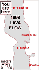
Today, ROPOS dive R1012 made several geologic traverses across the 1998 lava flow to document the distribution of lava pillars. These unusual-looking spires are hollow pipes that connect the upper and lower crusts of the lava flow when the interior of the flow is still molten. The pillars are visible at the edges of collapse areas that form when the molten interior drains and the upper crust caves in. ROPOS collected several samples of the pillars for chemical analysis. We also discovered for the first time that small hydrothermal clams have now colonized some vents on the 1998 lava flow. During our traverses, we also discovered some new vent areas, like Zen Garden, that we had not run across before.
At the end of dive R1012, ROPOS recovered a monitoring instrument that had been deployed right after the 1998 eruption (a ōrumbleometerö, like the one that got stuck in the 1998 lava flow). The batteries in the acoustic release were dead, so the only way to get it back was to physically haul it up to the surface, but since it still had its anchor attached it weighed 500 pounds in water and 1600 pounds in air! ThatÆs a heavy load - and before this year - too heavy for any ROV to manage. But ROPOSÆs new configuration allows it to lift loads up to 4000 pounds, so we decided to try out this new capability. ROPOS clipped a hook into the instrument and gently lifted it off the seafloor, suspended by a line below the vehicle. The whole operation went incredibly smoothly and was very impressive
The ASHES vent field is located in the SW part of Axial caldera, within about 100 m of the caldera wall. ASHES is a long-lived high-temperature hydrothermal vent site that was first discovered in 1984. Within a 100 x 100 m area there are 4 large sulfide chimneys (3-5 m high) and many smaller chimneys and areas of diffuse venting colonized by vent animals. One interesting aspect of ASHES is that the vent fluids there are hot enough to be "phase separated". This means that they actually boil beneath the seafloor, and a vapor phase becomes separated from a brine phase, each with very different chemistry. At this water depth (1540 m) the boiling temperature for seawater is 348░C.
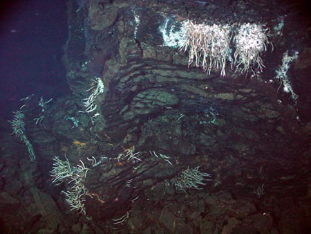
The CASM site is noteworthy because it was the first active hydrothermal vent site discovered in the NE Pacific. CASM was first discovered in 1983 by a group of Canadian and U.S. Scientists using the Canadian PISCES IV submersible. However, it had not been visited by a submersible or ROV for about a decade before 1998. CASM is an acronym for Canadian American Seamount (Expedition). The CASM site is located at the northern end of Axial caldera, where the caldera wall intersects Axial''s north rift zone. Hydrothermal venting at CASM is located in and around a large fissure, within about 100 m of the caldera wall. The site has both active and extinct sulfide chimneys and appears to have been rejuvenated by the 1998 eruption. Lush colonies of young tube worms and palm worms were observed after the eruption, with a distinct increase in populations after 1998.
Castle and Circ vents provide a contrast between focused and diffuse styles of hydrothermal venting, and between old and new lava surfaces. Castle vent is the only known active sulfide chimney in the 1998 lava flow area. It is located just east of the 1998 lava flow contact, on a mound of older pillow lavas. This vent consists of a pair of massive sulfide edifices that are 5 m high with multiple spires at the top. Each of these chimneys formed by mineral precipitation around a focused stream of high-temperature vent fluid. In its prime, Castle vent probably teemed with life. Today it appears to be in decline, with few tube worms in residence and little apparent smoke venting out the top.
Pit Vent is located on the 1998 lava flow in an area of mostly uncollapsed lobate lavas. Nevertheless, there are some small (1-m deep) collapse pits in the area, showing that some lava drain-out occurred here, and that many of the lava lobes are hollow beneath their solid upper crust. In hydrothermally active areas, these hollow cavities act as incubators and provide an ideal habitat for heat-loving microorganisms that live beneath the seafloor. This was dramatically illustrated when ROPOS accidentally broke a hole in the upper crust of a hollow lava lobe, which initiated an outpouring of hydrothermal fluid carrying white microbial floc (the bi-product of a microbial bloom). This "snowstorm" lasted for several hours.
Castle and Circ vents provide a contrast between focused and diffuse styles of hydrothermal venting, and between old and new lava surfaces. Castle vent is the only known active sulfide chimney in the 1998 lava flow area. It is located just east of the 1998 lava flow contact, on a mound of older pillow lavas. This ven
NeMo Explorer: Animal gallery
Nemo 2007 cruise report
References