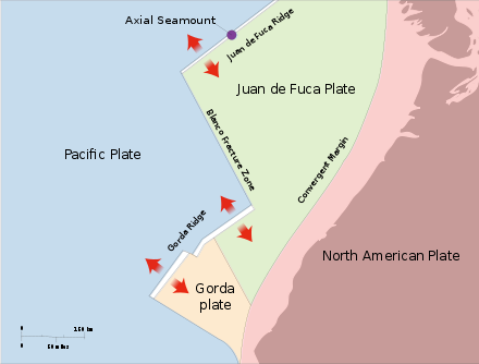
 | Juan de Fuca |
http://en.wikipedia.org/wiki/Juan_de_Fuca_Ridge |
|
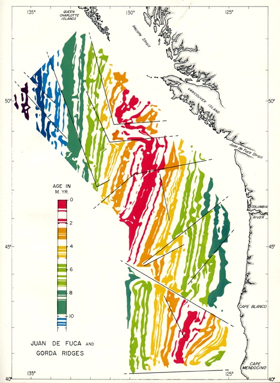
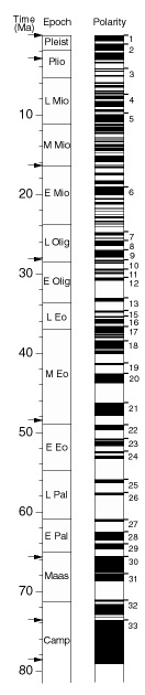
JDF Stripes image source, Paleomag. image source -http://geophysics.eas.gatech.edu/classes/Geophysics/misc/Intro_Plate_tectonics.html |
|
http://geophysics.eas.gatech.edu/classes/Geophysics/misc/Intro_Plate_tectonics.html |
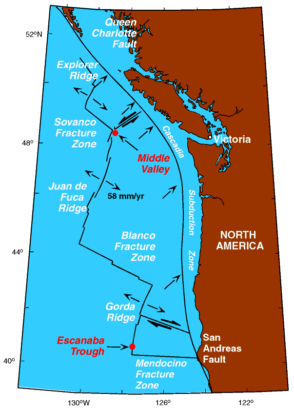
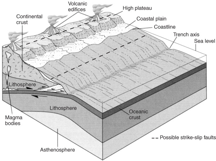
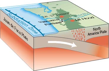
Cascadia subduction zone |
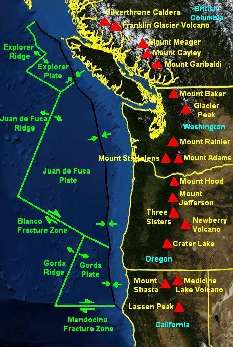
Cascade volcanic arc http://en.wikipedia.org/wiki/Mendocino_Fracture_Zone |
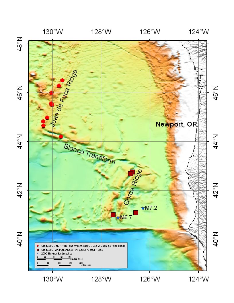
MBARI exploration in 2005The first component is to survey, map, and sample several historic lava flows on the Juan de Fuca Ridge to determine if pyroclastic particles were produced during their eruption and to ascertain if benthic communities that have colonized the flows since their eruption can be used to estimate flow ages. This component will be joint dives for Dave Clague and Jim Barry, MBARI. The second is to explore, map, and sample an unusually large and deep lava pond complex on the south rift zone of Axial Seamount for Dave Clague. The third is three NURP-funded dives to recover and service sensors deployed at South Cleft and Axial Seamount for Bill Chadwick, Oregon State University. The fourth is a single dive to search for active hydrothermal vents in the Blanco Transform Fault and to collect vent biota for Bob Vrijenhoek, MBARI.Gorda Leg: The leg has two components. The first is a single dive at the Seacliff hydrothermal site to collect vent biota for Bob Vrijenhoek, MBARI. The remainder is all geologic with the primary objective to quantitatively determine the distribution of volcanic particles produced during two eruptions. The 1996 eruption on the Northern Gorda Ridge will be sampled along the trajectory of the event plume. The NESCA site in Northern Escanaba Trough will be thoroughly sampled in a grid to determine the size and volume distribution of pyroclastic particles produced during a prehistoric eruption (about 300 year-old) in the mud-filled axial valley. The final dive will take place near the epicenter of the June 2005 magnitude 7.2 earthquake on the southeastern Gorda plate with the hope of locating surficial expression of the earthquake. The dive will also sample basalts along fault scarps produced parallel to the Escanaba Trough about 4-5 million years ago . |
Ridge (NeMo 2007) |
Axial seamonuth. Contact between the new flow (glossy black) and the Magnesia flow, which is maybe 100 years old -http://www.mbari.org/expeditions/Northern11/L2/logbook/day10.htm, lava flow |
Axial seamonuth Near the eruptive fissure, there is still a lot of diffuse hydrothermal flow, which has coated the rocks with a thick soupy ōspoogeö of bacterial mat |
Axial seamonuth -the spooge with the thrusters or manipulator, and then it was like being in the midst of a feather pillow fight |
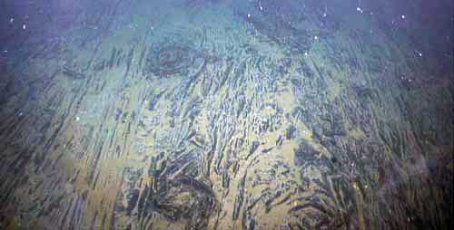
Axial seamonuth- Flow channel in the older Magnesia flow was a lava superhighway. The lineated sheet flow with beautiful lava whorls is dusted with sediment |
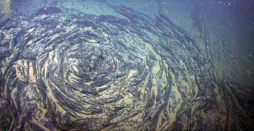
Axial seamonuth -Lovely lava whorl in the new flow is several meters wide |
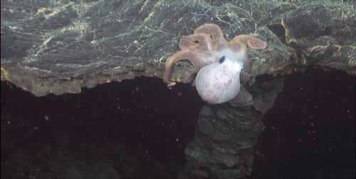
Axial seamonuth -Graneledone octopus hangs onto edge of collapsed lobate flow above a lava channel in the new flow |
Axial seamonuth-The lava pillows in the center have been populated with about a zillion limpets (small dots, each about a centimeter long), which have cleaned the rocks of bacterial mat |
Axial seamonuth-ōSnowblowerö vent named ōBocaö is spewing mineral-rich water that is laden with bacteria. The orifice of the larger hole is about a meter across. The ōlidö of the smaller one lies just in front of it, where it blew out. |
Axial seamonuth-An even larger, and as yet unnamed, ōsnowblowerö vent, is a collapsed and drained lobate pillow through which water is venting. The mineral-rich water supports a thick white bacterial mat |
Axial seamonuth-Lava pillars in the new flow are emanating shimmering water, (it has a slightly different density and refractive index than sea water), which hosts white bacterial mat. This supports the hypothesis that the hollow pillars formed as hot water conduits from beneath the flow |
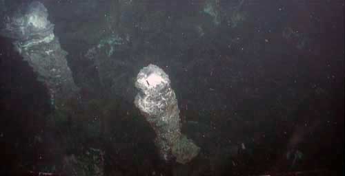
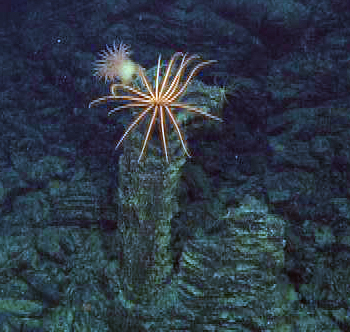
Location: North Cleft of the Juan de Fuca Ridge,A lava pillar, some two meters tall, provides a perch for a sponge and huge brisingid sea star. The pillar was left behind after a molten lava channel drained - http://www.mbari.org/expeditions/Northern11/L1/logbook/day9.htm |
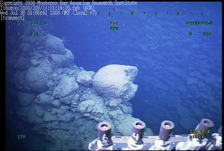
North Cleft of the Juan de Fuca Ridge, A tectonic fracture has pulled apart this older pillow flow |
North Cleft of the Juan de Fuca Ridge, This lineated sheet flow is like a lava ōsuper highwayö in the middle of a flow channel |
North Cleft of the Juan de Fuca Ridge, Contact between two lava flows. Both flows are sedimented and have lost their glossy black surface they had when fresh, but on closer inspection, the pillow flow is overlying, and therefore younger than, the flatter lobate flow |
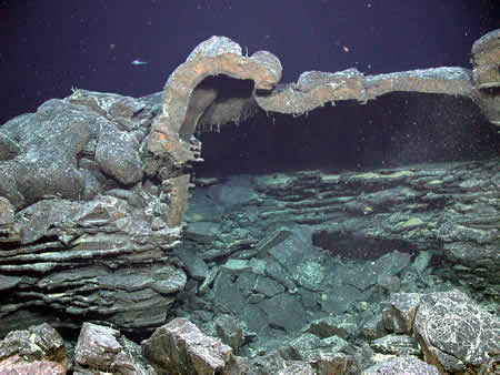
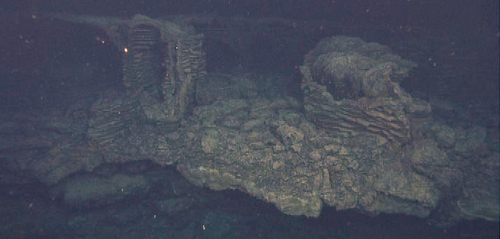
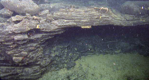
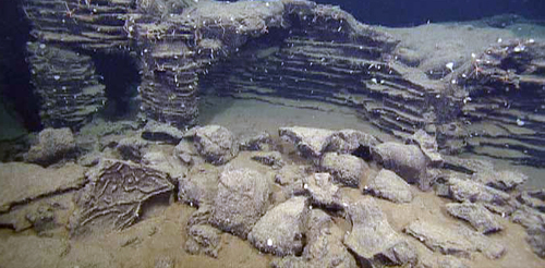
North Cleft of the Juan de Fuca Ridge, two-story edifice made entirely of lava. Along the bottom of the photo is the wall of the eruptive fissure, rugged, spattery, and approximately five meters deep, seven meters across, and several hundred meters long (about 15 meters of it is in view). Above that is the floor of a drained lava lake (lower center), from which lava pillars rise and support the collapsed lakeÆs solidified surface, like a roof (in the distance |
North Cleft of the Juan de Fuca Ridge, Contact! An older jumbled sheet flow has been overtopped by a younger pillow lava -http://www.mbari.org/expeditions/Northern11/L1/logbook/day10.htm |
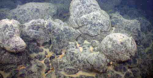
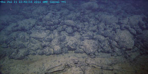
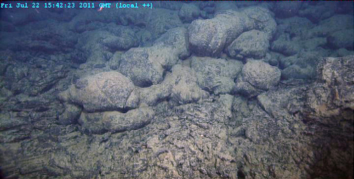
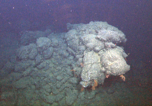
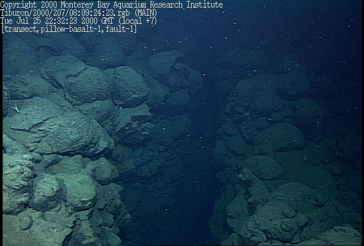
An ideal sample location for pillow lava (broken, background) and sediment (foreground and collected in pushcore) in the same location. |
The crest of a lava pillar that stands several meters tall within sheet flows (not visible) in a collapsed lava lake in the northern Cleft segment of Juan de Fuca Ridge |
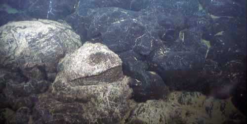
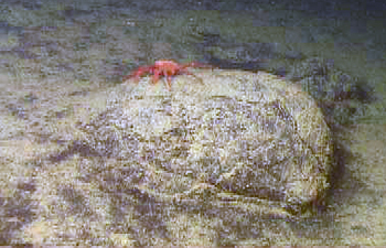
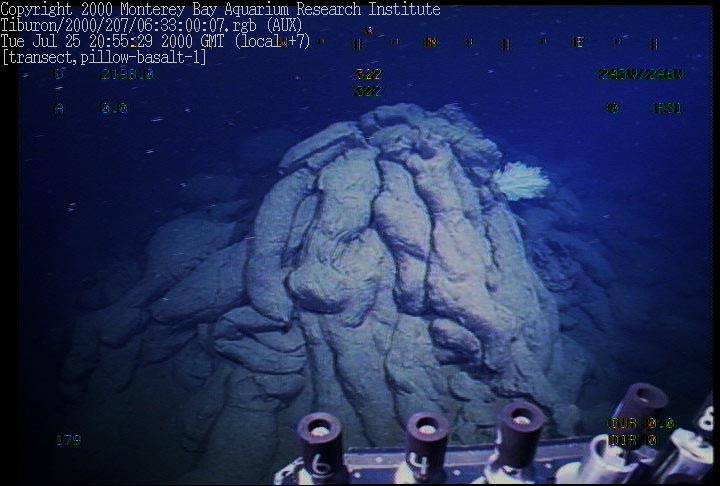
Caldera at Axial Seamount, Bulbous lava pillow provides a perch for a large crab. The flow is largely obscured by a vast plain of sediment, which suggests this is an old flow -http://www.mbari.org/expeditions/Northern11/L1/logbook/day8.htm |
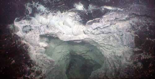
Caldera at Axial Seamount, Interior wall of a skylight in a drained collapsed lava channel or lava pond. The upper surface of the flow had formed a roof (top), which collapsed, and as the flow drained away, the newly cooling lava surfaces left a horizontally layered veneer on the wall (center), much like bathtub rings |
Axial Volcano NE flank, Sheet flow has been fractured, perhaps tectonically. A rattail fish, marketed as "Grenadier" (Coryphaenoides), glides into view -http://www.mbari.org/expeditions/Northern11/L2/logbook/day2.htm |
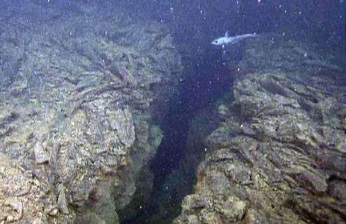
CoAxial Segment, A wide, deep fracture has cracked apart a flow of lava pillows. The far side of the gap can be seen in the distance -http://www.mbari.org/expeditions/Northern11/L2/logbook/day3.htm |
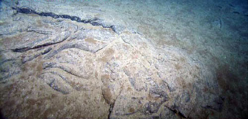
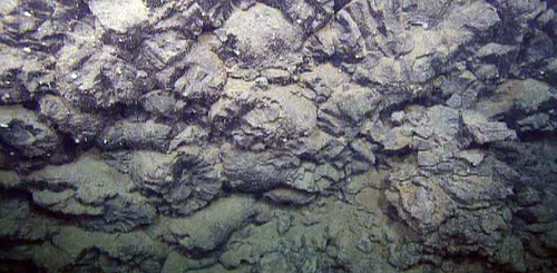
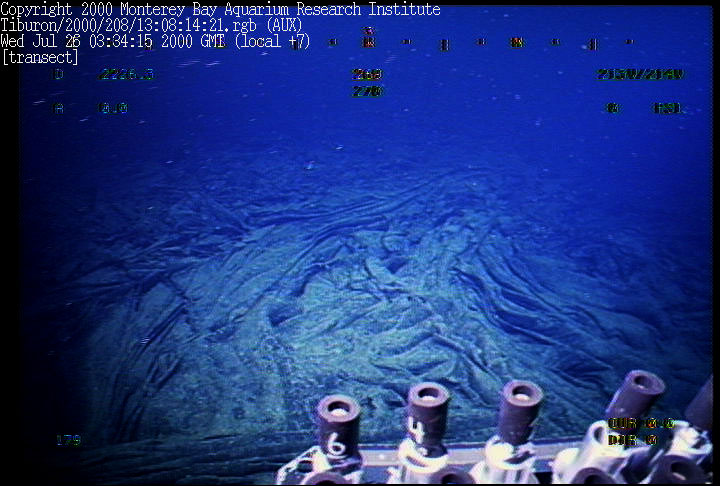
CoAxial Segment, Subtle, ropy texture of a sheet flow lies underneath slowly accumulating sediment. This kind of flow is actually very difficult to sample. The folded sheets of lava are almost all glass and shatter in the manipulator, and the amount of sediment here is too little to stay up in the core tube even though there is enough to almost bury the flow |
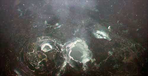
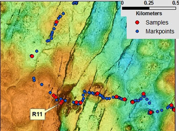
Map showing about a one-mile-wide view of our AUV map at CoAxial. Our dive track is annotated as ōmarkpointsö (blue dots) selected from the incoming navigation feed of the ROV, which is displayed in real-time in our GIS in the ROV control room. Sample sites are shown as red dots. Depth range is 2,485 meters (blue) to 2,367 meters (orange), and the map is centered at 46░ 31.7Æ N. 129░ 35.4Æ W. |
CoAxial Segment, knife-like ridge on a fault block of an extremely fractured, and presumably older, small cone. It is visible in the map; rock sample R11 (see map) was collected from this ridge |
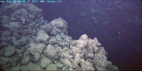
CoAxial Segment, very top of the same ridge provides a popular perch for crinoids, which were rare elsewhere on the dive |
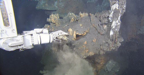
Endeavour Ridge, Sampling of sulfide from an active black smoker. The sample was pyrite and other sparkly sulfide minerals-http://www.mbari.org/expeditions/Northern11/L2/logbook/day4.htm |
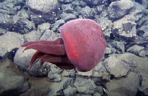
ōBig Redö jelly (Tiburonia granrojo). |
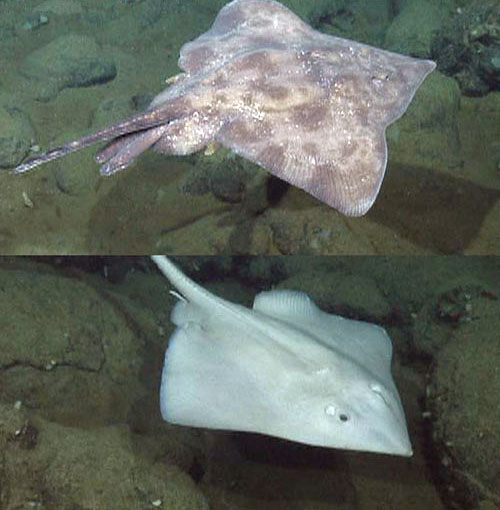
Deep-sea skates Bathyraja spinosissimia and Amblyraja badia |
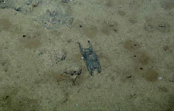
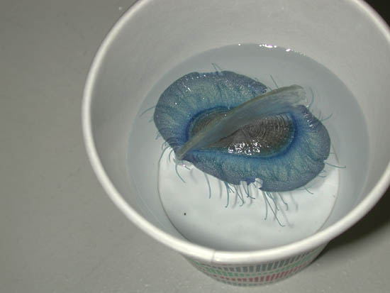
"Mermaid purse" (skate eggcase). |
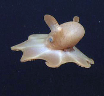
This octopus uses its fins to swim through the water. |
Endeavour Ridge, Classic example of a pit and pillar feature from Endeavour -http://www.mbari.org/expeditions/Northern11/L2/logbook/day5.htm |
Endeavour Ridge, vertical outcrop showing layers of truncated pillows and lobate flows. |
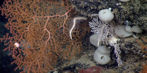
Endeavour Ridge, the seastar (Evoplosoma claguei) munches on a tasty bamboo coral overhanging a large fissure |
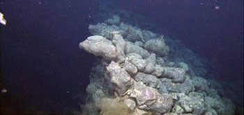
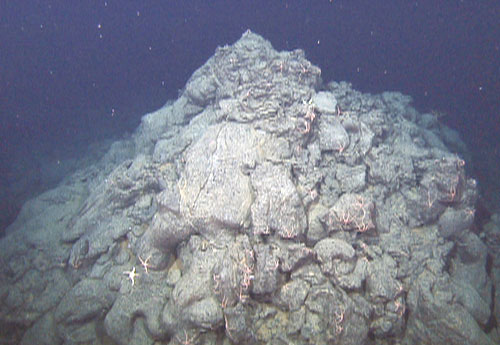
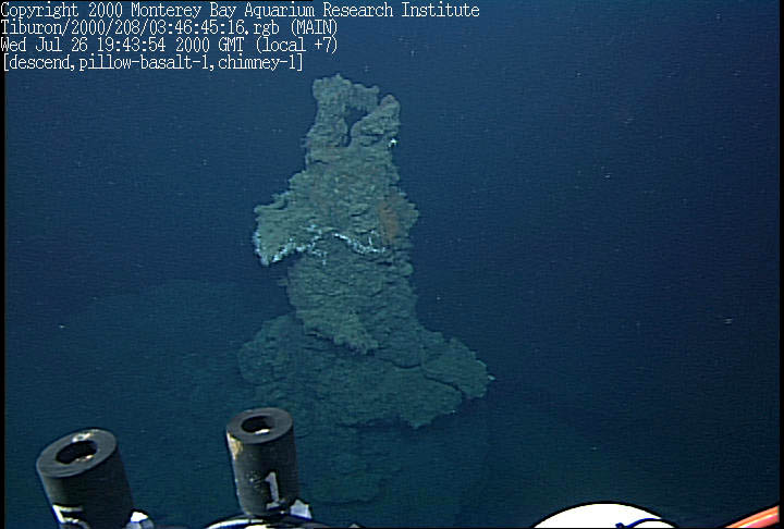
Endeavour Ridge, approaching the top of a chimney on an enormous (30-meter-high!), now inactive, hydrothermal mound -http://www.mbari.org/expeditions/Northern11/L2/logbook/day6.htm |
Endeavour Ridge, multiple species of deep-sea corals and sponges host hundreds of smaller animals like nudibranchs (sea slugs), crustaceans, worms, and snailsŚas beautiful as any coral reef |
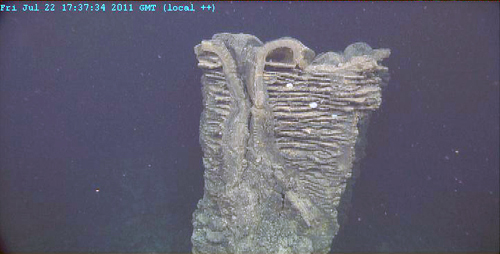
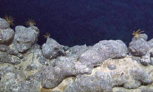
Endeavour Ridge, a hornito is a cone-shaped formation that occurs when lava erupts through an opening in the cooled surface of a flow. This forty-meter-high hornito of elongate pillow lava has spatter at the top. This demonstrates that mildly explosive (Strombolian) eruptions can produce pillows. Brittle stars are about 10 cm for scale |
Endeavour Ridge, pillow lava drapes over the vertical wall of a fault scarp. Did the pillow flow erupt after the fault formed, or are these pillows older than the faulting events, and they somehow survived the forces pulling the flow apart |
|
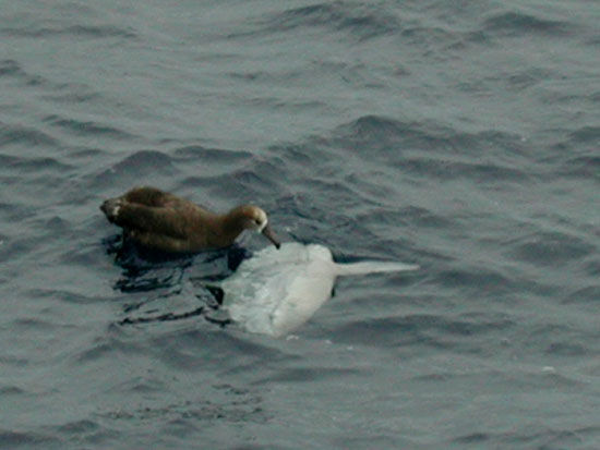
The Mola mola came to the surface and started "chasing" the Albatross |
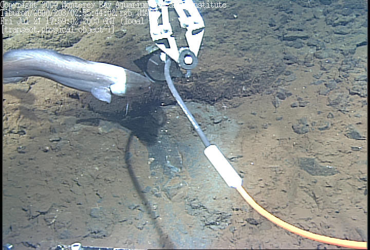
A frame grab that captured the magnetometer being deployed (as a fish cruised by for a closer look). |
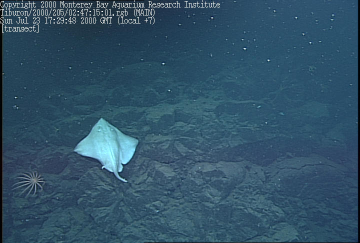
a deep-sea ray |
unusual looking sea star |
|
Biologist Robbie Young inspects a deep-sea coral |
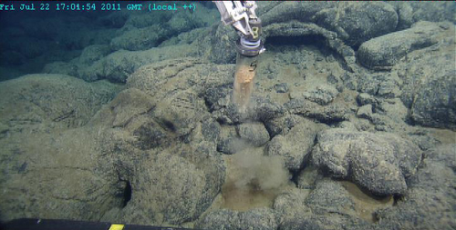
Frame grab of a knob of fresh pillow basalt - most of the glassy margin fell off during collection, but enough remained for analysis. You can see the shiny black surface which is made up of glass formed from rapidly cooling lava |
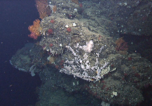
Low temperature vent. Frame grab of a mound which was venting clear fluid. Note some of the organisms living on and around this site |
many deep fissures running parallel to the axis of the ridge, here is one of those fissures. |
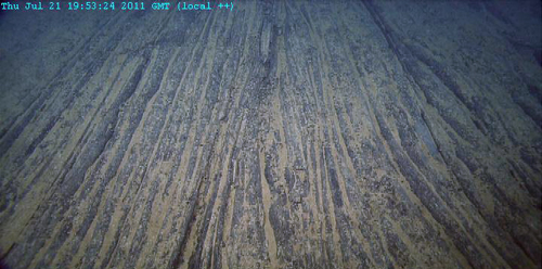
A flat, sheeted, ropy flow called "po hoe hoe" (in Hawaiian), found in the very flat region just west of the ridge axis |
A "hornito" structure, created by a localized volcanic eruption |
A truncated pillow basalt on top of a steep razorback. A razorback is surrounded on both sides by fissures |
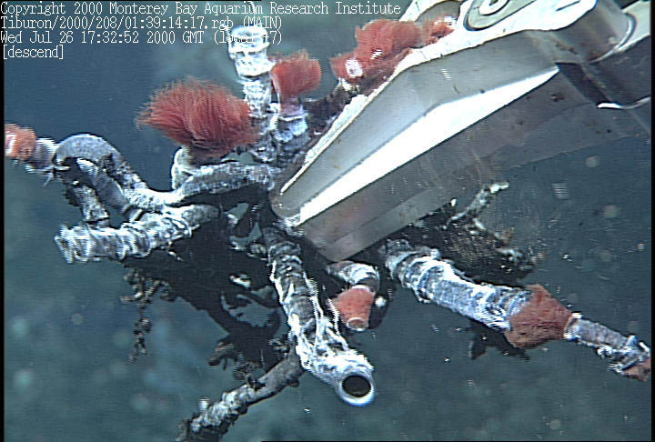
Over 650 km off the Washington-Oregon Coast, the "Flyer Vent Site", Tube worms from "Vent 1". The reddish colored tips are their plumes, or gills, which exchange hydrogen sulfide as well as carbon dioxide and oxygen |
"Vent 1" chimney, a black smoker. A metal stake can be seen which is a Hobo Thermometer left by a NOAA research cruise. |
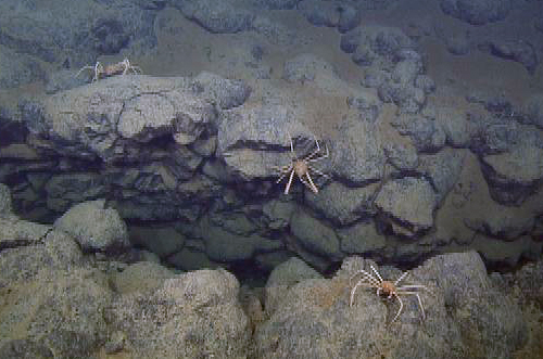
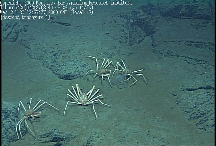
Four spider crabs enjoying a jelly meal |
Lava columns. A drain back structure within the Axial trough formed during the last major eruption 10-20 years ago.More drain back structures. These form as the surface lava cools and the lava underneath drains out, leaving pits and columns. |
An inactive sulfide spire that was not venting hydrothermal fluids, even after we broke off a sample from the tip |
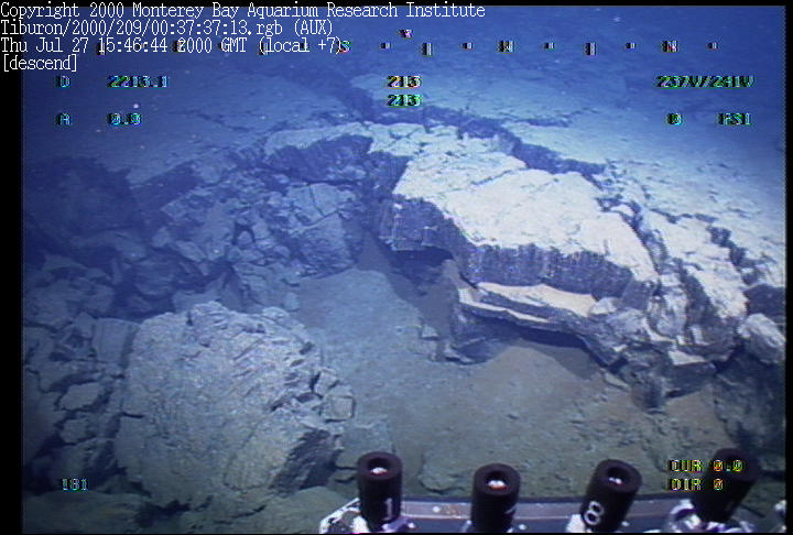
Foundered edge of a massive sheet flow. This is where we were able to determine the age relationship between two flows. |
From MBARI http://www.mbari.org/expeditions/ridges2005/
The monitoring instruments that will be recovered at South Cleft and Axial Seamount are two types of acoustic extensometers, that are designed to measure seafloor spreading events. The tectonic plates are gradually moving apart, but right at the plate boundary they only move during volcanic or tectonic events. We are trying to learn more about these kind of events. The instruments are deployed in a linear array across the ridge axis and measure the distance to their neighbors very precisely by acoustic ranging. The instruments at south Cleft were deployed in 2000 and the ones at Axial were put down in 2003, and have all been recording ever since. However, they need to be recovered periodically in order to download the data and service them. We will also be recovering and replacing some temperature recorders at high-temperature black smoker vents at South Cleft, and deploying a bottom pressure recorder at Axial Seamount. These are all ways of monitoring what is going within the volcanic systems at these active spreading ridge segments.
Mid-ocean ridge eruptions occur infrequently and in remote, deep-sea locations, so are difficult to sample directly. The styles of eruption and their chemical and thermal inputs are poorly understood. We have now found limu o Pele, distinctive curved and folded volcanic glass shards, at mid-ocean ridges with slow (Gorda), medium (Northern East Pacific Rise) and fast (Southern East Pacific Rise) spreading rates. They indicate that mildly explosive eruptions are common on mid-ocean ridges. In each of these locations, the eruption depths were greater than the depth at which water can flash to steam. This raises the intriguing hypothesis that the glass particles are not derived from contact of the lava flows with seawater or wet sediment as previously envisioned, and suggests that gases other than steam are driving the explosive activity. If this is the case, the particles should not be confined to the zone of sediment/lava interaction, but should be entrained into the water column by fire-fountains and the turbulence of the rising, hot eruption plume, and dispersed away from the eruptive vents by near-bottom currents, eventually settling out of the plume. Because their trajectories are dependent on event plume dynamics, they will give another method to evaluate chemical and thermal inputs to the deep ocean from mid-ocean ridge eruptions.
We plan to sieve the glass particles from sediment samples taken during transects radiating from several known eruption sites to measure the particle distributions. We will combine the results with laboratory measurements of particle settling rates to distinguish between two different models of dispersal. The site at NESCA is unique in that the eruption is young, unique in composition, and we have sampled glass shards there previously, so we know that the eruption had an explosive component. We also know that the particles were distributed over a large area, presumably by an event plume, and that we can readily quantify the size and quantity of particles deposited by using push-cores to sample the surrounding sediment-covered region. No other known flow anywhere on the global mid-ocean ridge system will allow a complete quantitative sampling since elsewhere the particles settle on lava flow surfaces where we can qualitatively determine their presence, but cannot quantify their abundance and size distribution.
A large, deep lava pond complex on the Juan de Fuca Ridge is where we can estimate the volume of lava extruded quite accurately and determine where the lava went that drained from the pond. We can estimate the pond lifespan from the thickness of collapsed roof fragments that should be jumbled in the bottom of the drained pond. This site is completely unexplored and is known only from the high-resolution bathymetry MBARI collected in 1998
See http://www.pmel.noaa.gov/vents/nemo/NeMO2007-cruise-report.pdf
Location: North Cleft of the Juan de Fuca Ridge
Latitude: 44░55.4052Æ N
Longitude: 130░14.0483Æ W
Location: Caldera at Axial Seamount
Latitude: 45.933░ N
Longitude: 130.014░ W
Location: Axial Volcano NE flank
Latitude: 45║ 57.73'' N
Longitude: 129║ 59.46'' W
Location: CoAxial Segment
Latitude: 46.186; 31.53Æ N
Longitude: 129.186; 34.69Æ W
Location: Endeavour Ridge
Latitude: 47.97618º N
Longitude: 129.08103º W
Axial Volcano
Cascadia subduction zone
President Jackson Seamounts
Juan de Fuca photos from MBARI
Vance seamount