 | Monument Valley- Kayenta area, AZ-UT |
AZ |
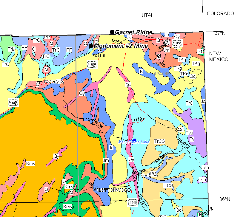
Geological map |
Anasazi pictograph-Arizona |
Monument Valley-Kayenta |
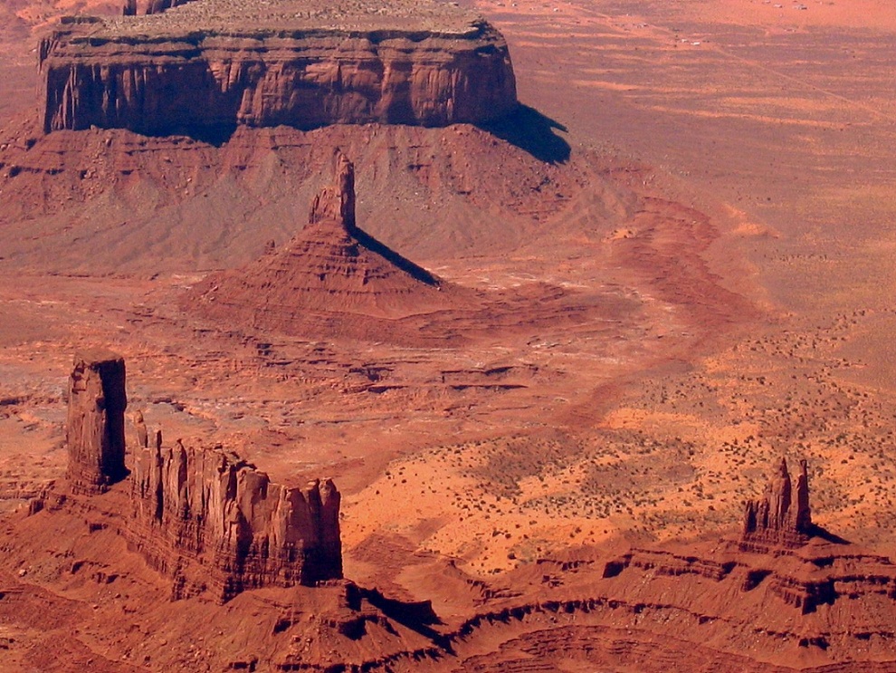
Monument Valley |
Monument Valley |
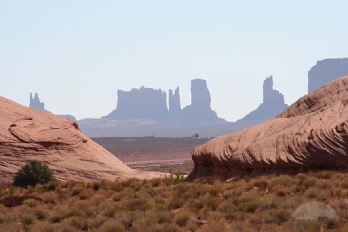
Monument Valley.AZ |
Monument Valley Yei bi Chei and Totem Pole Buttes |
The view across Mystery Valley past the Saucer Rocks and Petrified Dunes |
the scene to the west of Saucer Rocks of the Petrified Dunes and Mystery Valley. |
Monument Valley Cly Butte Artist''s Point |
Monument Valley-Kayenta |
Monument Valley-Kayenta |
Monument Valley-Kayenta sand storm |
Monument Valley |
Monument Valley |
Monument Valley |
Monument Valley |
Monument Valley-Kayenta |
Monument Valley-Kayenta. Merrick Butte |
Monument Valley. Ut |
Monument Valley-Kayenta |
Monument Valley |
Monument Valley |
Monument Valley |
Monument Valley |
Monument Valley |
Monument Valley |
Monument Valley |
|
Monument Valley The Thumb |
Monument Valley Landscape Spearhead Mesa |
Monument valley- Kayenta area AZ , Navajo keet seel. 0ne of the large alcoves form near the base of the Navajo sandstone cave - The Navajo is predominantly a quartz sandstone with small amounts of microcline, plagioclase feldspar, chalcedony, magnetite, zircon, tourmaline, and garnet. The Navajo is weakly to firmly cemented by calcite, silica, and iron oxide. The cementation, however, is poor in most places and the Navajo is, in general, an extremely friable rock. A thin film of brown iron oxide coats each grain. |
|
|
|
Monument Valley, Ut, Mexican Hat |
White Mesa Arch |
Monument Valley: Mystery Valley Honeymoon Arch |
Kayenta, Navajo Tribal Park |
Coral dune, Kayenta area , Monument Valley, AZ |
Monument Valley Navajo Tribal Park |
Monument Valley- Kayenta area, AZ, Bonito Park |
Tyuyamunite, Monument No. 2 Mine, Monument No. 2 channel, Monument Valley, Navajo Indian Reservation, Apache Co., Arizona, USA - http://www.mindat.org/loc-3294.html |
Jacob''s chair SE Utah |
A geologic map of southeastern Utah displaying the geographic locations of Monument Upwarp, Raplee Ridge and Comb Ridge. Modified from map by Bump and Davis, 2003. A white dashed line traces the length of Comb Ridge. Raplee Ridge is outlined with a rectangular box -http://www.sciencedirect.com/science/article/pii/S0191814109001333 |
Major Uplifts |
Map showing the geographic features in the Four-Corners region of Colorado, Utah, New Mexico, and Arizona. Shaded area is the Monument Upwarp -http://www.nature.nps.gov/geology/parks/nabr/geol_history.cfm |
Raplee Anticline, Monument Upwarp, near Mexican Hat, Utah |
Low altitude aeral view of Comb Ridge on the eastern limb of the Monument Uplift, Navajo Reservation. Mexican Hat and the Abajo Mountains are seen in the background -http://www.airphotona.com/image.asp?imageid=159 |
En echelon folds in Raplee Ridge, part of the Monument Upwarp. of Raplee Ridge anticlinal in Utah |
Raplee Anticline, Monument Upwarp, near Mexican Hat, Utah (37 09 15.44N, 109 49 20.24W) - http://serc.carleton.edu/NAGTWorkshops/structure/Google_Earth/locations.html |
Monument Upwarp |
Monument Upwarp |
Aeral view of Aerial photo of Monument Upwarp, San Juan County, Utah, UT -http://www.airphotona.com/image.asp?imageid=3625&catnum=0&keyword=&country=&state=&pagenum=4 |
Aerial photo of Monument Upwarp, San Juan County, Utah |
Close aeral view of snow dusted hogback ridges of Comb Ridge, on the eastern limb of the Monument Uplift. Winter, Navajo Rez. Southern Utah -http://www.airphotona.com/image.asp?imageid=158 |
Riplee Ridge aeral |
Monument Upwarp. Near Mexican Hat, Utah |
Raplee Ridge is in the Monument Upwarp in southeastern Utah. Mexican Hat |
Raplee Ridge (Middle Summit) . Mexican Hat, |
|
Gooseneck State Park near Mexican Hat, Utah. |
Goose neck in the Monument Upwarp |
Goosenecks of the San Juan |
Riplee Ridge |
large scale: en echelon folds of Raplee Ridge anticlinal Monument -http://bio-geo-terms.blogspot.com/2007/06/en-echelon.html |
Evidence of right-lateral slip along Set I fractures in the Unnamed limestone. a) Offset of Set II fractures caused by slip along Set I. Bleaching highlights fracture. View of pavement surface. b) Calcite slickenfibers on a Set I fracture surface. Cross sectional view. c) View of pavement surface with echelon veins. We infer that a Set I fracture is just beneath and perpendicular to this surface with a strike that follows the midpoints of the echelon veins - http://www.sciencedirect.com/science/article/pii/S0191814109001333 |
Valley of the Gods and Raplee Ridge Valley of the Gods and the San Juan |
Valley of the Gods and Raplee Ridge Valley of the Gods and the San Juan |
The stratigraphic column of units exposed at Raplee Ridge. Fractures were measured and mapped in the Goodrich, Shafer, Mendenhall and Unnamed members of the Rico Formation. The exact location of the PennsylvanianPermian boundary is unknown and may lie within the Rico Formation. Modified from Ziony, 1Shafer, Mendenhall and Unnamed members of the Rico Formation. The exact location of the PennsylvanianPermian boundary is unknown and may lie within the Rico Formation. Modified from Ziony, 1966 -http://www.sciencedirect.com/science/article/pii/S0191814109001333 |
C http://www.utahgeology.com/stratcolumns.php?URLVariable=strat_101
Cņšąņčćšąōč’
CAMB: Tapeast Sandstone 180+m, Bridht Angel Slate 290m,Muav Limestone 630m; DEV: Elbert formation 310m,Oural Limestone 110m; MISS ( Redwall Ls): Whitmore wash 90m, Thunder spr 140m, Mooney falls 220m, Hoorseshoe mesa 110m; PENN: Molas FM 150m; Hermosa Fm: Pirkenton Trail Fm 600-400m,Paradox Fm 400-200m, Honaker Trail Fm. 500-1000m; PERMIAN Citler Croup: Halgaiti Fm 400-700m, Cedar Mesa Fm 500-700m, Organ Rock Shale 300-700m, DeChelly sandstone 0-400m TRIASSIC: Hoskinnini Sandstone 40-120m, Moenkopi Fm 100-350m, Chinle Fm (Shinarump Cg Mbr 0-200m, undivided n, arizona members 770-1020m); JURASSIC: Glen Canyon Group (Wingate Ss 310-360m, Kayenta Fm 200-230m, Navajo Ss 600+m), TERT: Lamptophyric dike near Oljeto, intrusive , QUART Alluviun, dune sand 0-100m
Navajo Volcanic Field (AZ, UT, NM, Colorado)
Monument Valley stratigraphy
Geology,Uranium and vanadium deposits Apache and Navajo counties AZ
Fracture initiation, development, and reactivation in folded sedimentary rocks at Raplee Ridge, UT
Navajo Tribal Park


