 | Pacific Plate |
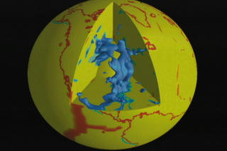
Farallon Plate today |
|
|
|
|
|
|
|
|
|
|
|
|
|
|
|
|
|
|
|
|
gravity |
|
|
|
|
|
|
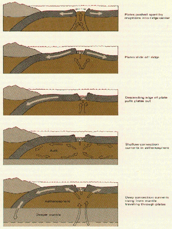
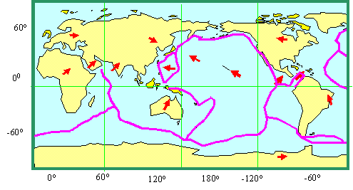
Various hypotheses have been proposed to explain the forces that drive the plate tectonic mechanism.ДX North Atlantic -1-2cm/yr,ДX East Pacific -3-8cm/yr, West Pacific -18cm/yr |
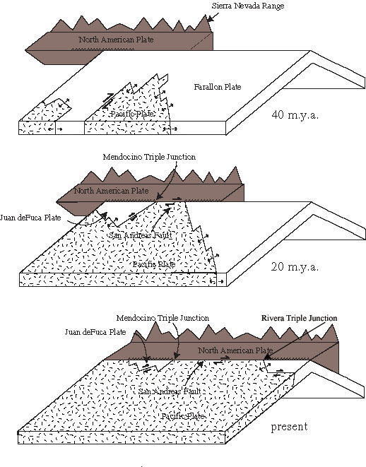
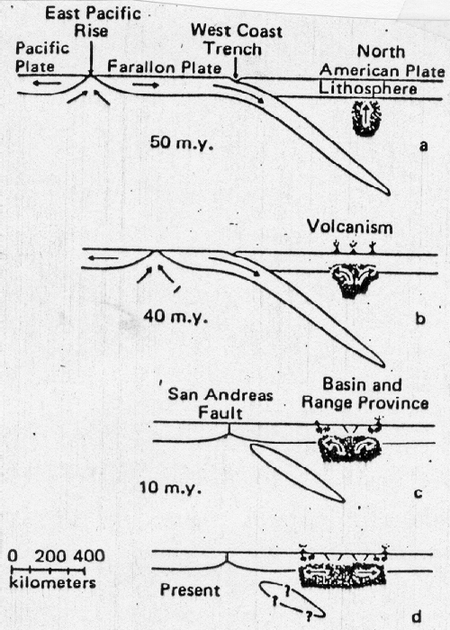
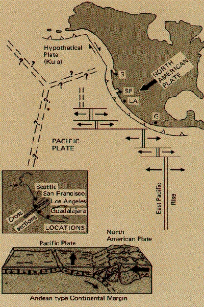
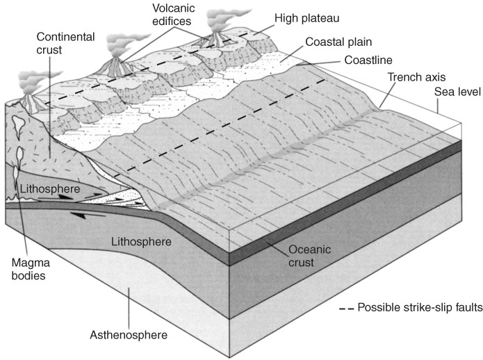
Mesozoic plate relations along the Cordilleran margin. Prior to the development of the San Andreas fault, plates of the Pacific Ocean were probably descending beneath the North American plate and creating a subduction zone like the present one along the west coast of South America |
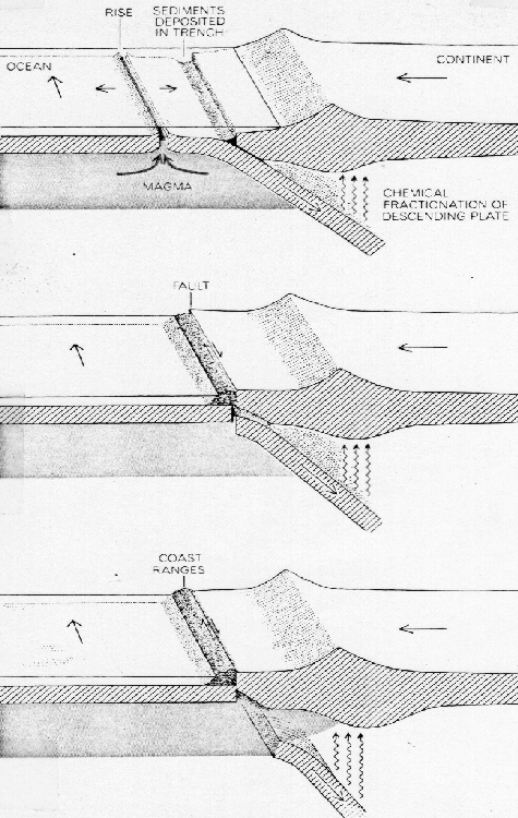
Interaction between rise and trench leads to mutual annihiliation and the formation of the San Andreas Fault Zone and Coast Ranges, etc |
Schematic cross section of the Cordilleran belt at about 40∞N latitude showing possible diapir development of the Basin and Range Province |
|
|
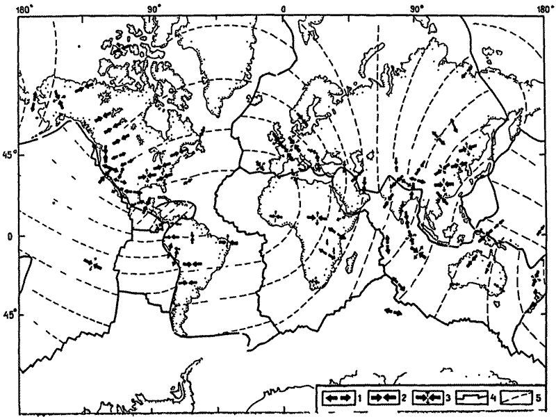
√енерализованна¤ карта напр¤жений |
|
|
|
|
|
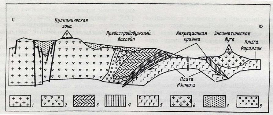
√еодинамический профиль “айгоносского сегмента. 1 Ч континентальна¤ кора; 2Ч3 Ч аккретированные террейны: 2 Ч √анычаланский, 3 Ч”пупкинский; 4 Ч океаническа¤ плита; 5Ч9 Ч комплексы ”дско-ћургальской островодужной системы: 5 Ч вулканическа¤ дуга, 6 Ч туфо-терригенные осадки; 7 Чтурбидиты склона и подножи¤; 8 Ч аккреционна¤ призма; 9 Ч серпентинитовые диапиры - http://atlantic.ginras.ru/education/russia/lecture_18.pdf |
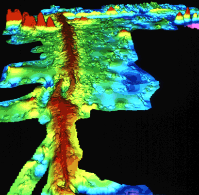
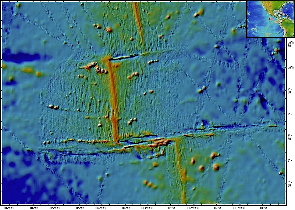
“рехмерное изображение перекрывающихс¤ центров спрединга на ¬осточно-“ихоокеанском подн¤тии, по: http://pubs.usgs.gov/publications/text/topomap.html - Computer-generated detailed topographic map of a segment of the Mid-Oceanic Ridge. "Warm" colors (yellow to red) indicate the ridge rising above the seafloor, and the "cool" colors (green to blue) represent lower elevations. This image (at latitude 9∞ north) is of a small part of the East Pacific Rise. (Imagery courtesy of Stacey Tighe, University of Rhode Island.) |
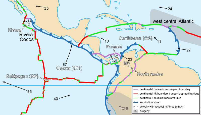
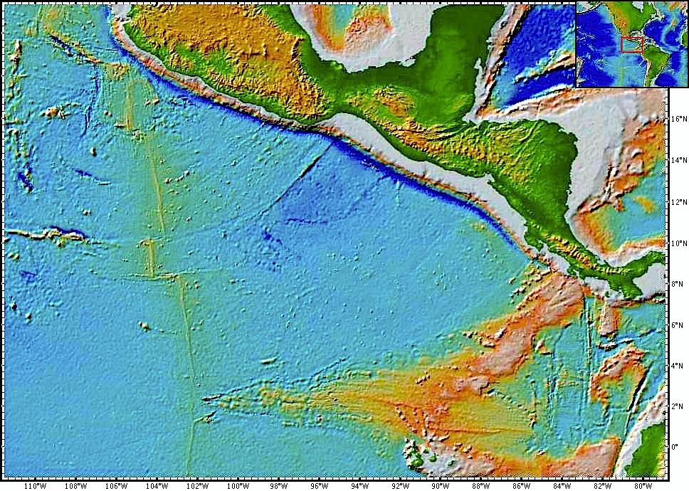
Tthe relative plate motions are obvious, and because the absolute pole of Cocos plate rotation is near, the transform faults and ocean ridges for clear small and great circles identifying the pole -http://geophysics.eas.gatech.edu/classes/Geophysics/misc/Intro_Plate_tectonics.html |
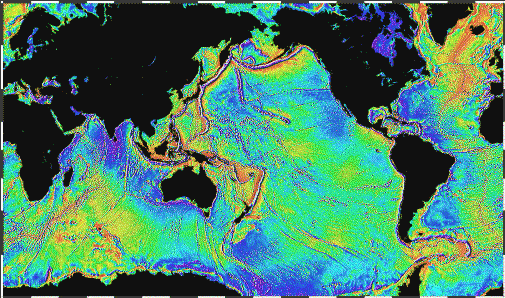
Image from (http://www.ngdc.noaa.gov/mgg) |
ХEast Pacific Rise Transforms new 9∞ North -http://geophysics.eas.gatech.edu/classes/Geophysics/misc/Intro_Plate_tectonics.html |
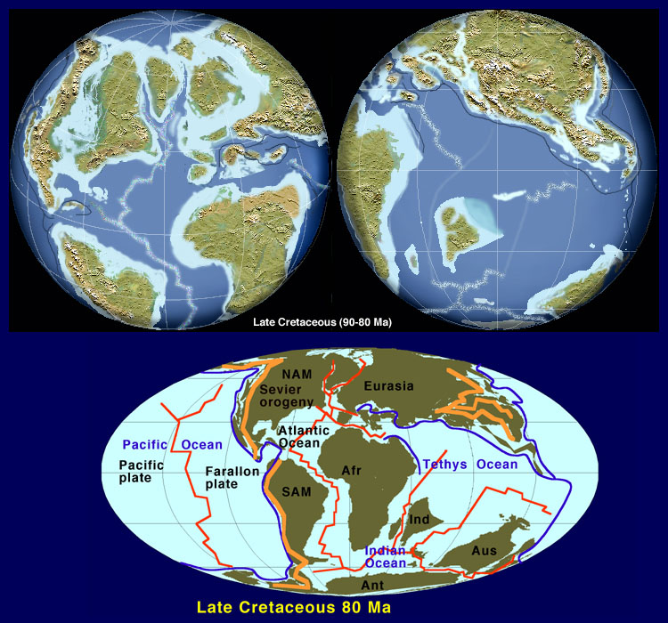
http://www.emc.maricopa.edu/faculty/farabee/biobk/anauLate_Cret.jpg |
Schematic Subduction Zone - http://geophysics.eas.gatech.edu/classes/Geophysics/misc/Intro_Plate_tectonics.html |
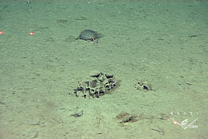
Haploops lodo sediment tubes on the seafloor 3600 m |
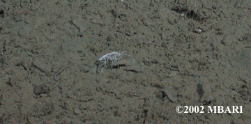
Ischnomesid |
Xenophyophore (Psamminidae) |
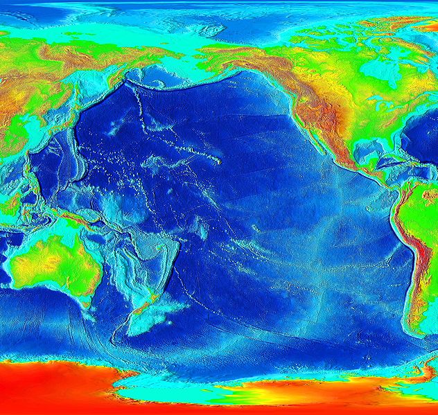
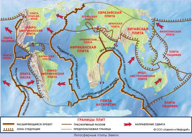
The Pacific Plate is an oceanic tectonic plate beneath the Pacific Ocean, and at 103 million square kilometres, the largest of all tectonic plates [1].
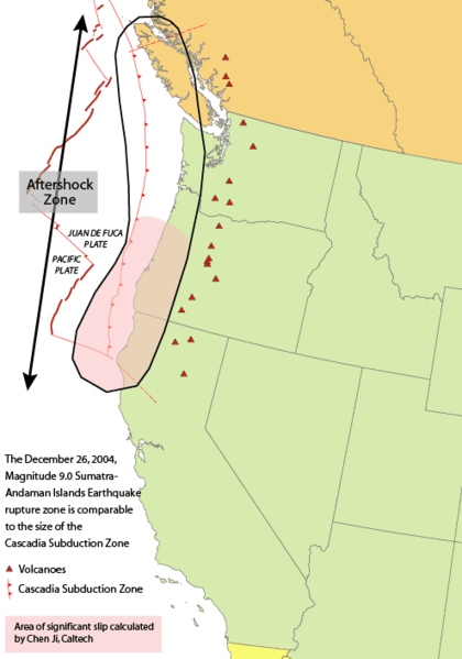
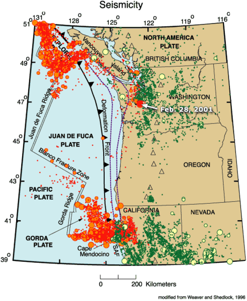
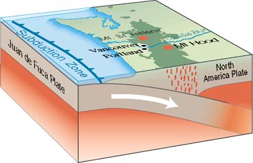
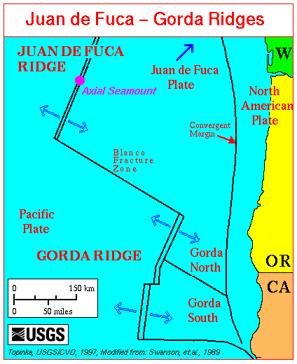
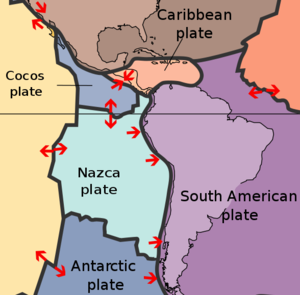
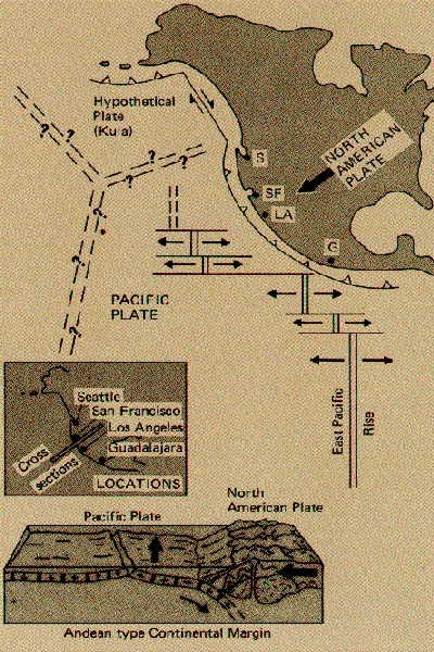
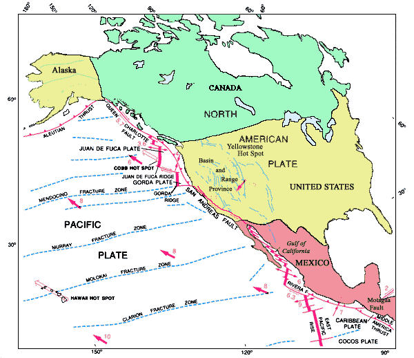
The north-eastern side is a divergent boundary with the Explorer Plate, the Juan de Fuca Plate and the Gorda Plate forming respectively the Explorer Ridge, the Juan de Fuca Ridge and the Gorda Ridge. In the middle of the eastern side is a transform boundary with the North American Plate along the San Andreas Fault, and a boundary with the Cocos Plate. The south-eastern side is a divergent boundary with the Nazca Plate forming the East Pacific Rise.
The southern side is a divergent boundary with the Antarctic Plate forming the Pacific-Antarctic Ridge.
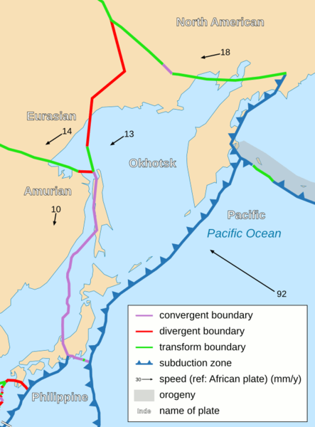
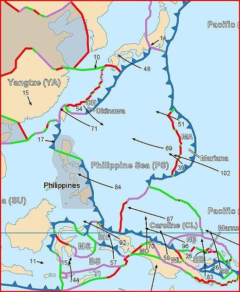
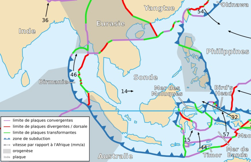
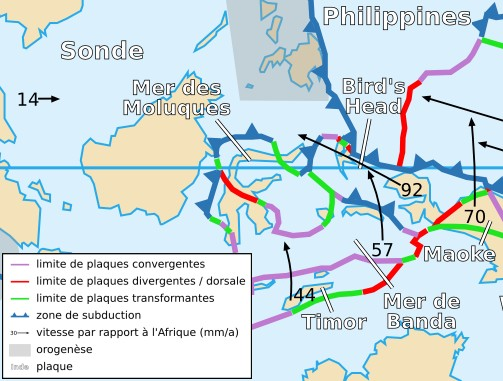
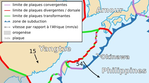
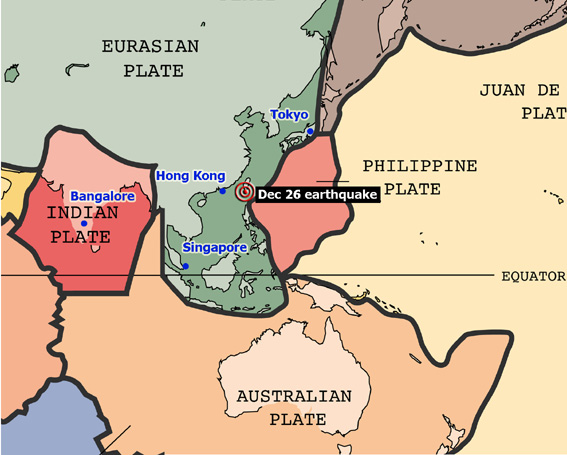
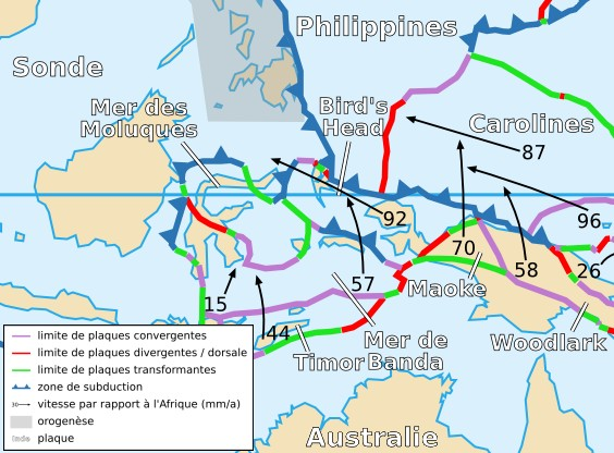
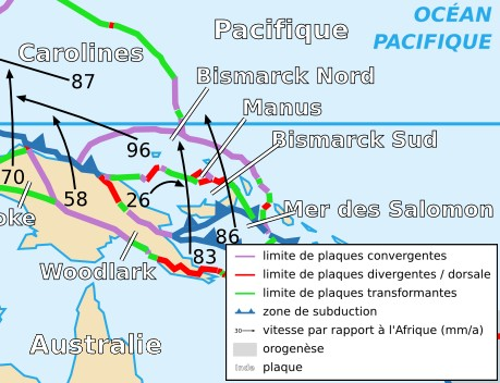
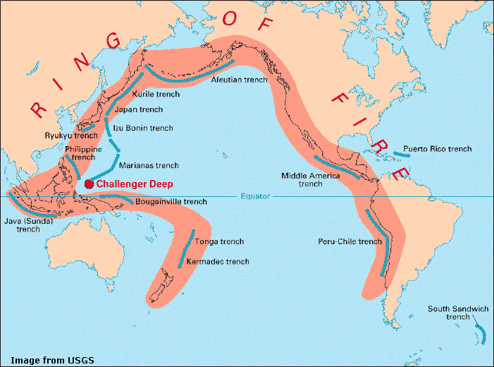
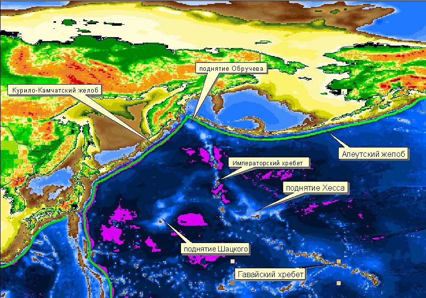
The western side, the plate is bounded by the Okhotsk Plate at the Kuril-Kamchatka Trench and the Japan Trench, forms a convergent boundary by subducting under the Philippine Sea Plate creating the Mariana Trench, has a transform boundary with the Caroline Plate, and has a collision boundary with the North Bismarck Plate.
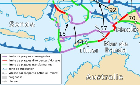
In the south-west, the Pacific Plate has a complex but generally convergent boundary with the Indo-Australian Plate, subducting under it north of New Zealand forming the Tonga Trench and the Kermadec Trench. The Alpine Fault marks a transform boundary between the two plates, and further south the Indo-Australian Plate subducts under the Pacific Plate forming the Puysegur Trench. The southern part of Zealandia, which is to the east of this boundary, is the plate''s largest block of continental crust.
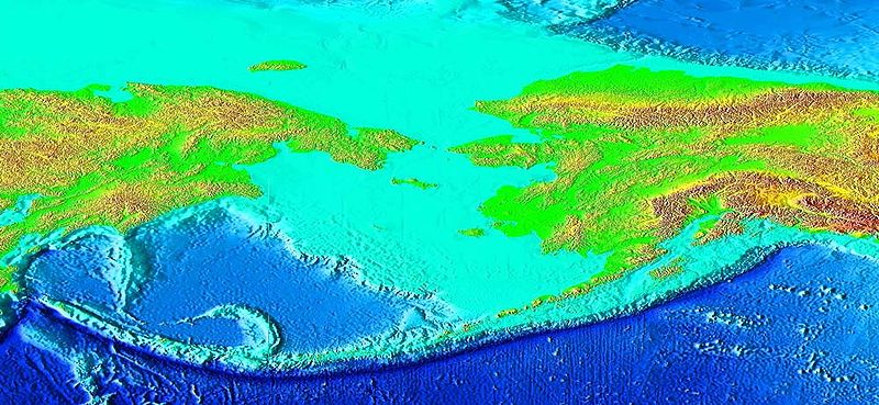
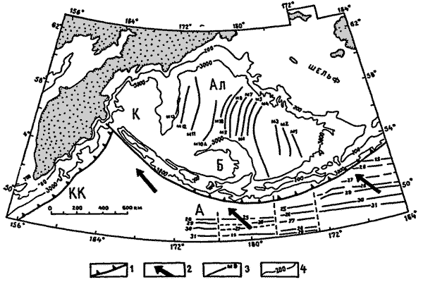
The northern side is a convergent boundary subducting under the North American Plate forming the Aleutian Trench and the corresponding Aleutian Islands.
The Pacific Plate contains an interior hot spot forming the Hawaiian Islands.
Hillis and Mьller are reported to consider the Bird''s Head Plate to be moving in unison with the Pacific Plate.[1] Bird considers them to be unconnected.[2]
[edit] Paleo-geology of the Pacific Plate
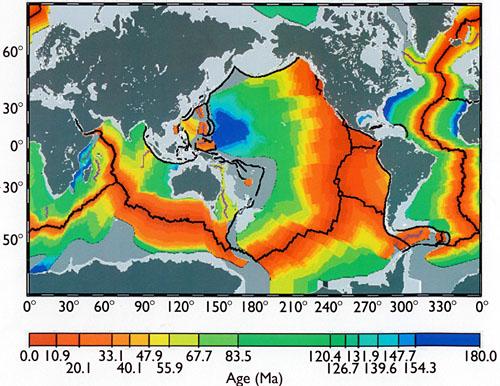
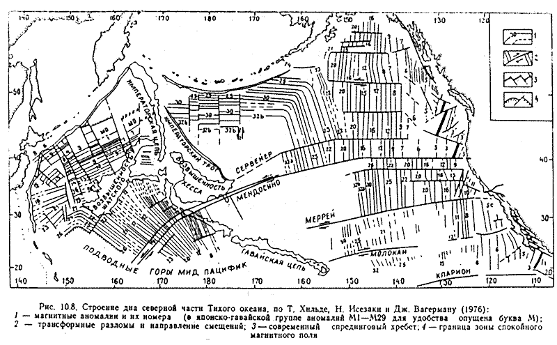
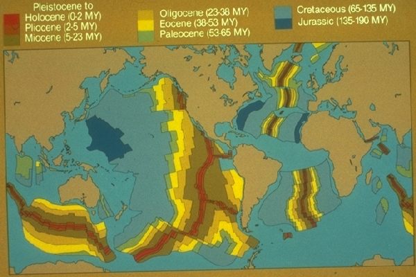
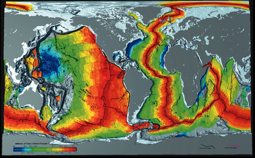
The Pacific Plate has the distinction of showing one of the largest areal sections of the oldest members of seabed geology being entrenched into eastern Asian oceanic trenches. A geologic map of the Pacific Ocean seabed shows not only the geologic sequences, and associated Ring of Fire zones on the ocean''s perimeters, but the various ages of the seafloor in a stair-step fashion, youngest to oldest, the oldest being consumed into the Asian oceanic trenches. The oldest member disappearing by way of the Plate Tectonics cycle is early-Cretaceous (145 to 137 my BP).]
