 | Gumdrop, Pioneer, and Guide Seamounts |
|
Guide Seamount |
http://www.mbari.org/data/mapping/seamounts/pioneer_smt.htm |
From the west-southwest |
PMEL data, downloaded from www.pmel.noaa.gov -FROM http://www.physics.sfsu.edu/~seamount/research/overview/overview.html http://www.physics.sfsu.edu/~seamount/research.html |
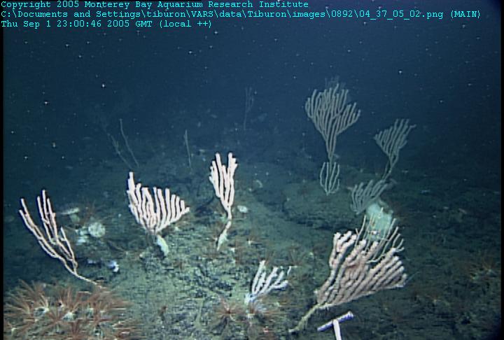
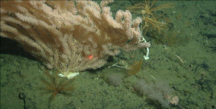
On one part of Pioneer Seamount, we found large numbers of delicate bamboo corals, which are rare elsewhere. Right image: Although the volcaniclastic rocks on Pioneer Seamount looked soft and unconsolidated, they were actually very hard and it was difficult to collect samples that were attached to outcrops. In many places the outcrops were dotted with a variety of colorful corals and sponges. On one part of Pioneer Seamount, we found large numbers of delicate bamboo corals, which are rare elsewhere. Right image: Although the volcaniclastic rocks on Pioneer Seamount looked soft and unconsolidated, they were actually very hard and it was difficult to collect samples that were attached to outcrops. In many places the outcrops were dotted with a variety of colorful corals and sponges. |
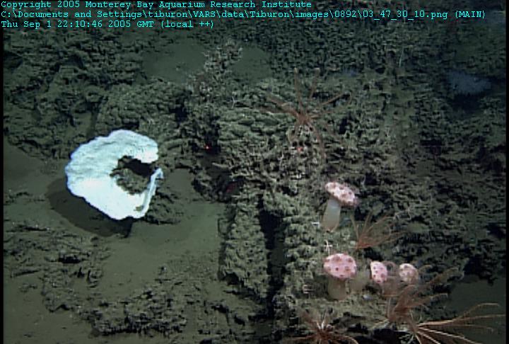
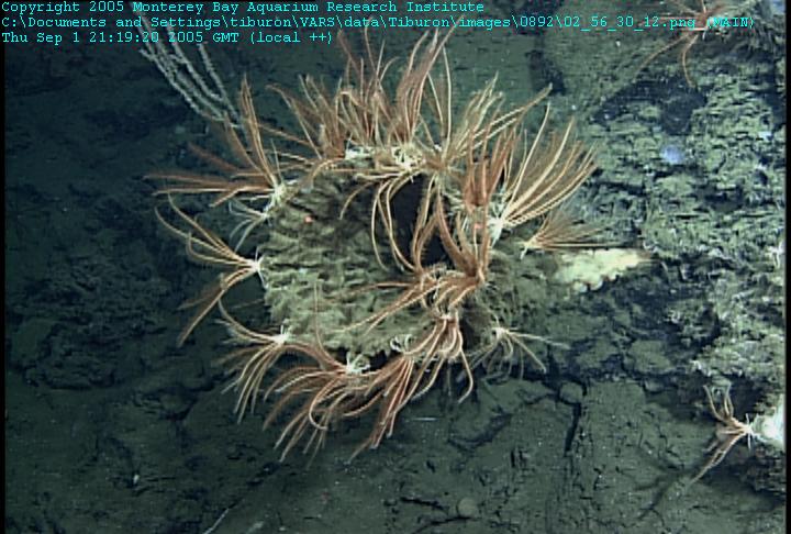
On some parts of Pioneer Seamount, we had a hard time collecting rock samples because the sea floor was covered with the remains of dead sponges, which apparently collected over long time periods. The pink mushroom-like organisms are a type of soft coral, which are growing on top of the dead-sponge "reef" along with some crinoids and a white sponge that is still alive. Right image: Near the tops of the volcanic cones, we saw "gardens" of large sponges, many of which were over a meter across. On one ridge top, the sponges were covered with crinoids (the orange fringed creatures in this picture). On other ridges, we saw no crinoids, but lots of small crabs living in and on the sponges-http://www.mbari.org/expeditions/ridges2005/september_1.htm, On some parts of Pioneer Seamount, we had a hard time collecting rock samples because the sea floor was covered with the remains of dead sponges, which apparently collected over long time periods. The pink mushroom-like organisms are a type of soft coral, which are growing on top of the dead-sponge "reef" along with some crinoids and a white sponge that is still alive. Right image: Near the tops of the volcanic cones, we saw "gardens" of large sponges, many of which were over a meter across. On one ridge top, the sponges were covered with crinoids (the orange fringed creatures in this picture). On other ridges, we saw no crinoids, but lots of small crabs living in and on the sponges |
crinoids |
at 1078 meters |
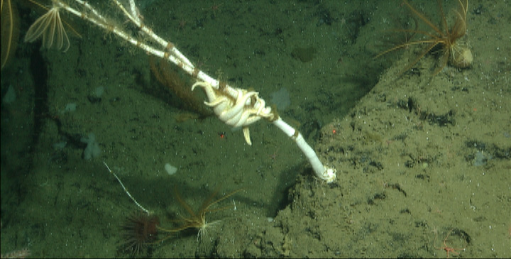
Sea star eating its way up a bamboo coral skeleton, an old volcano,dense with hard and soft corals, brittle stars, and sponges. One specimen of the soft coral Keratoisis measured well over 2 meters in height, the trunk at its thickest-a full 5-6cm. We also collected 3 individuals of an undescribed species of nudibranch. Also collected on Pioneer were 3 gastropods of the genus Neptunea, a gastropod typical of the Monterey Canyon complex but previously unknown from seamounts in the region. Overall a productive day and one filled with exciting and important discoveries. This evening we are taking a gravity cores, a 300+ kilogram beast of a device that is dropped to the bottom to take 3-meter long sediment cores |
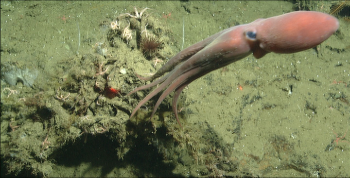
Benthoctopus |
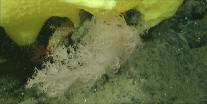
Neptheidae coral at the base of a large yellow sponge. |
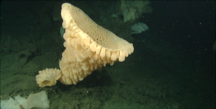
Our transect began at a depth of 1032 m and ran northwestward to shallows at 850 m. The peak of Pioneer Seamount is located in the oxygen minimum zone of the Pacific, and hosts a colorful variety of species of marine life. the ecology of the corals. In contrast to yesterday, where corals dominated the deeper regions of Pioneer, the shallower depths visited today contained dense aggregations of sponges, such as this enormous goiter sponge (approximately one meter across) at 900m. |
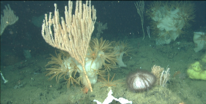
Isidella coral at 1100m depth with a large urchin and sponges covered with crinoids (feather stars).Of the corals seen, the bamboo coral species Keratoisis was less dominant than the species Isidella. The highlight of the day occurred when one of our biologists discovered in the shipÆs lab that Isidella and Keratoisis bioluminesce! We collected two sets of pushcores to analyze the upper sediment layers for assessment of environmental conditions. The cores originated from two sediment ponds between cones on the seamount. During one core''s collection, we captured a small gastropod of the genus Neptunea at the top of the core. Rock samples were also collected throughout the dive to provide insight on the type of volcanism occurring at Pioneer Seamount. The highlights of the rock samples collected included vesicular basalt that we thought during collection was volcanic sandstone, and a basalt with geochronological potential |
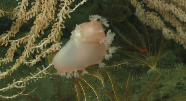
A large, pink nudibranch is perched and feasting on the fine branches of a coral. Crinoids wait below for crumbs.Overall, these dives were a great success. We have now finished our objectives at this site: exploring the volcanic cones on the shallowest part of the seamount and collecting coral samples from a range of depths to anchor the northernmost climate signal we have from the California Current. We observed deep-sea corals at depths ranging from 1490 m to 830 m. We also observed sponge meadows and fields of corals. The materials collected and animals observed here will provide the scientists on board the Western Flyer with a plethora of new information with which to study the deep sea |
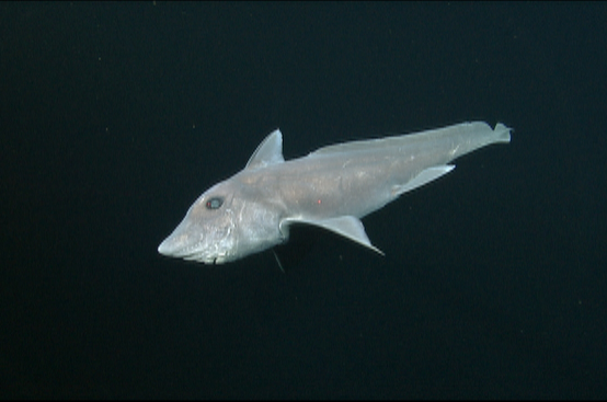
The highlight of the dive today was an elusive ratfish (a.k.a. chimera, a primitive relative of sharks) that danced in front of our ROV cameras during a midwater traverse. |
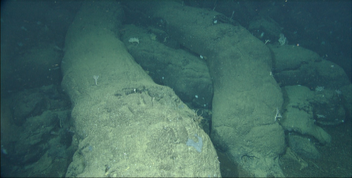
Elongated pillow lava drapes the outer rim of the young lava flow. We collected two sediment cores in the interior of a collapse pit in a young lava flow we explored today, and just beyond the edge of the flow. We are hoping the collected sediment contains many foraminifera for environmental analysis. We also collected a number of water samples. unusual volcanic feature we had discovered during a high-resolution bathymetric survey conducted last fall using the new MBARI Mapping AUV D. Allan B. The map showed a fluid lava pond between several of the steep-sided cones that are the normal expression of volcanic activity on Davidson. Our dive today showed that this flow is indeed a fluid flow formed by rapid eruption of fluid lava and that the lava drained out of the pond, perhaps back down the eruptive vents.The mapping data hinted that the pond was younger than all the cones around it, but the samples and dive observations provide evidence that the flow may be much younger than other Davidson eruptions, which range from 9.8-14.8 million years old. We observed only a thin cover of sediment on the pond, thin Mn-oxide crusts on the rocks (about 2 mm from visual observation), and the presence of volcanic glass beneath the Mn-crusts. We collected 6 samples on the flow for chemical analysis and age dating so hope to be able to rigorously test our ideas about the youthfulness of this eruption. Another seamount located offshore Pt. Conception named San Juan Seamount, on which we will also be diving this voyage, had a very prolonged eruptive history with lavas dated from 18.7 to 2.7 million years. We think Davidson may turn out to have had a similarly long history. |
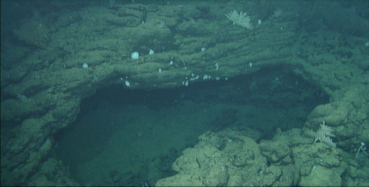
Collapsed skylight through the crust of the young lava flow has drain back "bathtub rings" and spatter around the edge. Much of the rest of the dive returned to volcanic cones we have collected volcanic rocks from previously and we did not add to those collections. At the end of the dive, we located the cone from which an unusual lava type named trachyte erupted 14.8 million years ago. The dated sample and one other both came from dives that had experienced some navigation problems and the location of these important samples was uncertain. After today''s dive was completed we returned to a sedimented area observed at the start of the dive and attempted to collect a 3-meter gravity core, but the core apparently bounced on the gravel surface andno core was recovered. Determining the thickness of and recovering the foraminifera ooze beneath the gravel will have to await a return trip, perhaps with different sampling gear. We wanted to recover thissediment because the foraminifera, which live in the surface water, record the climatic conditions during their lifetimes in their shells and so might record the history of climate offshore California for the last several hundreds of thousands to perhaps millions of years |
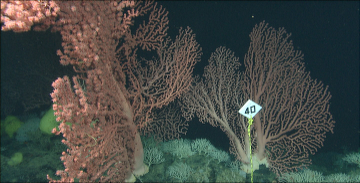
Stately Paragorgia (pink "bubblegum" coral) and primnoids (short, white coral) are marked for future study. For reference, the site marker is 15 cm (6 inches) on a side. |
FROM - http://en.wikipedia.org/wiki/Pioneer_Seamount
Pioneer Seamount is an undersea mountain, or seamount, in the Pacific Ocean off the coast of central California
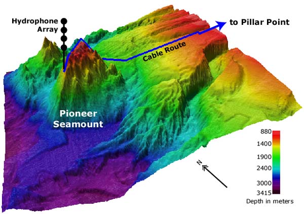
Pioneer Seamount is located at 37░ 21.1'' North Latitude, 123░ 26.1'' West Longitude, at the base of the continental slope of North America about 95 kilometers (51 nautical miles) off the coast just north of San Francisco, California.
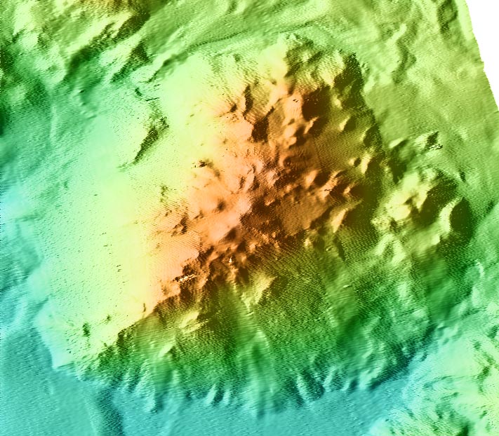
The seamount is a volcano between 10.9 and 11.1 million years old. It is about 12.8 kilometers (6.9 nautical miles) long as well as about 12.8 kilometers (6.9 nautical miles) wide, and has a volume of about 135 cubic kilometers (32.4 cubic miles). It rises about 1,930 meters (6,332 feet) above the surrounding ocean floor, and its peak is a minimum of 820 meters (2,696 feet) below the ocean''s surface. Samples from the seamount consist of highly vesicular alkalic basalt, hawaiite, and mugearite.
Biological environment
A wide variety of sealife lives on the seamount. Corals dominate in deeper areas and sponges in its shallower parts.
Pioneer Seamount was named for Pioneer, the first of three survey ships of the United States Coast and Geodetic Survey to bear the name. Pioneer operated along the United States West Coast and in the then-Territory of Alaska during her Coast and Geodetic Survey career, which lasted from 1922 to 1941.
FROM -http://www.mbari.org/data/mapping/seamounts/pioneer_smt.htm
Pioneer Seamount is 11.0▒0.1 million years old (Davis et al., in press) and is nearly equidimensional with width and length of about 12.8 kilometers. It rises about 1930 meters above the surrounding seafloor to a minimum water depth of 820 meters. It has a volume of about 135 km3. Samples recovered from Pioneer are alkalic basalt, hawaiite, and mugearite. Like samples from Davidson Seamount, all samples are highly vesicular
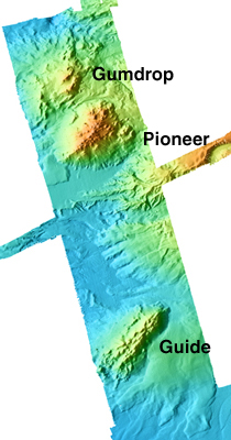
from Gumdrop, Pioneer, and Guide Seamounts
http://www.mbari.org/data/mapping/seamounts/guide2gumdrop.htm
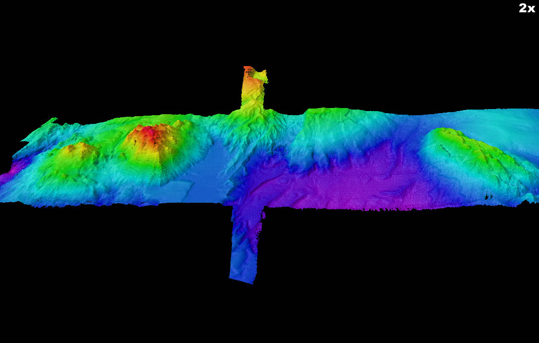
Gumdrop, Pioneer, and Guide Seamounts are located about 120 kilometers off the California margin, north of Monterey Bay. They and other seamounts along the California and Baja California margin, including Davidson Seamount and Rodriguez Seamount (MBARI Mapping Team, 2000), have a similar structure and origin. Magnetic anomalies near Guide and Pioneer Seamounts are not symmetrical but correspond to Chron 6B and 6C, respectively, indicating ocean crust of about 22 to 24 million years old. Formation of these complex, northeast-trending seamounts offshore central California, including Davidson Seamount to the south, is incompatible with a hot spot model or formation as near-mid-ocean ridge seamounts. All may have been formed by eruption through structurally weak zones at abandoned spreading centers, with volcanism occurring as much as 8 million years after the ridge stopped spreading. Lavas apparently originated and partly crystallized in the shallow mantle (Davis et al., in press). Trace element ratios and isotopic compositions suggest origin by small degrees of melting from a mildly but variably-enriched mid-ocean ridge source.
Gumdrop, the northernmost of the three seamounts, has a series of aligned cones separated by sediment-filled troughs, but these structures are poorly defined. The shallowest cone rises to 1207 meters below sea level. The volume is difficult to estimate because the base of the seamount is poorly defined. However, we estimate its volume at about 100 km3. Samples recovered from Gumdrop are highly vesicular, alkalic basalt, hawaiite, and mugearite, but their age is not determined.
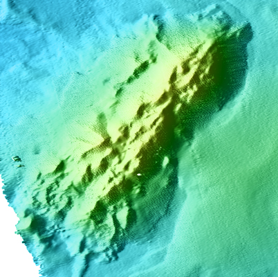
Guide Seamount is about 16.6▒0.5 million years old (Davis et al., in press). The seamount consists of four, nearly parallel volcanic ridges, separated by sediment-filled troughs, aligned parallel to magnetic anomalies in the underlying ocean crust and therefore parallel to the abandoned mid-ocean ridge that formed the crust. Guide Seamount looks virtually identical to Davidson Seamount, except it is smaller (approximately 16.5 kilometers by 5 kilometers). It rises about 1440 meters above the surrounding seafloor and reaches a minimum water depth of 1682 meters. The volume above the surrounding seafloor is about 130 km3. The lavas from Guide are alkalic basalt, hawaiite and mugearite composition with some pyroclastic deposits near the summit (Davis et al., in press)
Pioneer Seamount. The dive was a continuation of one we began two years ago, but had to abort due to bad weather. It seemed fitting that we could complete it after having been unable to dive at the epicenter of the June Eureka M7.2 earthquake due to poor weather.
Pioneer Seamount is one of a group of seamounts (underwater volcanos) off the central California coast that consist of a cluster of parallel volcanic ridges or cones. These ridges are aligned parallel to oceanic spreading centers that became inactive when the San Andreas fault system formed, some 20-24 million years ago. We have been working on these seamounts for the past 5 years, so the opportunity to add another dive on Pioneer was welcome.
In previous years, we were not able to dive near the summit of Pioneer Seamount because a submarine cable is draped over the seamount, and we were concerned about entangling the ROV or its tether with the cable. However, over the last few years, MBARI performed ROV dives along the cable to map its route, and we discovered that we can, in fact, dive safely in this area.
After the spectacular lava forms we saw on the Juan de Fuca and Gorda Ridges, the rocks on the seamount were relatively dull and quite uniform. Most of the dive showed a sea bottom made up of volcaniclastic flows of breccia and sandstone, with some fragmental lava flow surfaces. Some sediment was draped over the rock surfaces, but currents have prevented sediment from accumulating very thickly during the roughly 12 million years since the volcano was active
we moved on from Pioneer Seamount, approximately parallel with San Francisco, to Davidson Seamount further south, approximately parallel with the Big Sur coast. Davidson Seamount will likely soon be added to the Monterey Bay Marine Sanctuary and has received an increased amount of attention both by scientists and the public. This is my second time to visit Davidson and I was no less in awe this time around. Previously, my work focused on the southern-most region of Davidson. Today we dropped down on the northern end, a potentially younger volcanic region. Lava pillows, tubes, and domes dominated the flanks. We eventually transversed the flank and explored around an extinct lava pond. Most of the pond and flanks were either void of life or possessed very low densities of organisms. Although speculative, its is likely that these regions experience little current and thus settling larvae rarely make it to this area. Alternatively, low current speeds may prevent many organisms that survive on filtering the water for food to flourish here.
