| Structural Images |
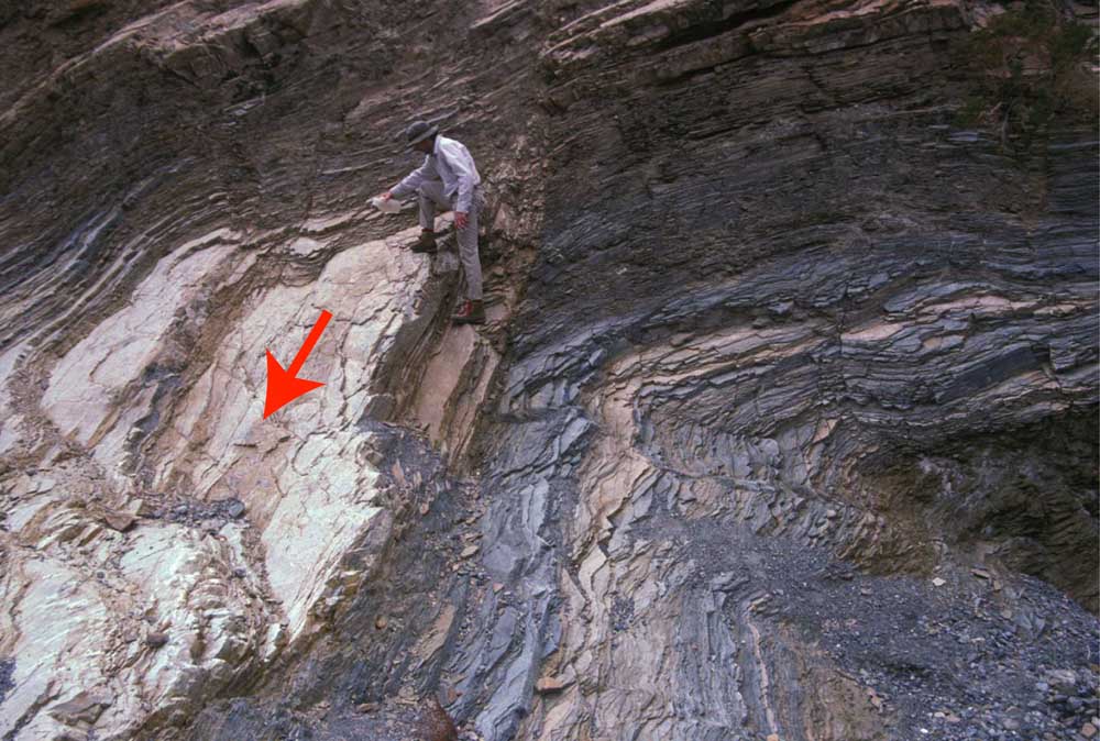
Cross-bedded building stone. The contact immediately below A appears to dip gently to the right, but at B, the contact appears to dip to the left. But it''s not a syncline! Both of those views are oblique, rather than perpendicular, to strike, so they only give the apparent dip. Because strike is roughly parallel to the plane of the photograph, the true dip of the bed comes directly out of the screenAs true dip is the steepest path down a planar surface, water will flow directly down true dip--marked here by the red arrow (you can also see where the water is because it''s darkened the light-colored dolomite). Notice that these foliation surfaces appear to dip gently to the left in the upper right corner of the photo and appear to take a sudden turn just below the geologist''s left leg, as if they were folded. But the surfaces are not folded; they are planar. The sudden turn is just the way they appear when viewed from different angles. Incidentally, the geologist who sacrificed his water to illustrate this phenomenon survived the ordeal. |
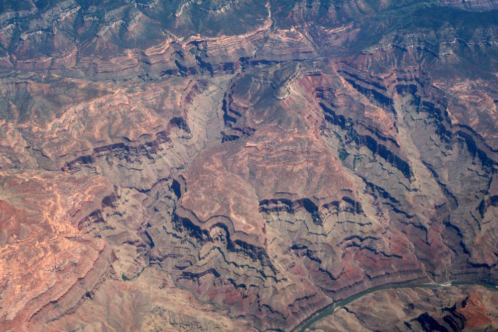
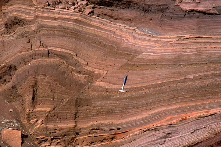
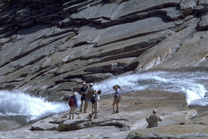
Flat laing beds in Grand Canyon.Geologic maps show where various rock units and structures lie at the earth''s surface. Because many of these structures are planar, or approximately planar features, they interact with topography in predictable waysWhere beds are horizontal, or nearly horizontal, their contacts must also be horizontal--so, on maps, contacts run about parallel to contour lines. Geologic maps which portray flat-lying rocks are very distinctive: the various colors used to distinguish rock units are confined by contour lines and so accentuate the topographyLook below. The photograph on the left shows a bird''s eye view of some sub-horizontal rocks near the Grand Canyon. The map on the right shows part of the Grand Canyon itself. Even though they are of different places, you should be able to see that in both, the relationship of bedding to topography is the same. Note that the contacts in the geologic map are parallel to the contour lines. Consequently, the different colors enhance the "topographic look" to the map. To see just how parallel the contacts are to the contour lines, click here to see the map enlarged. |
|
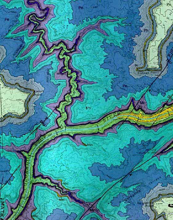
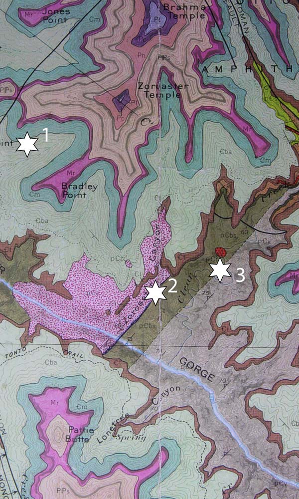
The Inner Gorge. The map above shows a part of the western Grand Canyon where the Colorado River has cut only as far ast the Cambrian Muav Limestone (shown in light green--near the river). Farther upstream, the river has cut below the Great Unconformity into the underlying Precambrian rocks. This area is called the "Inner Gorge". Click here to see a more detailed map of the geology of part of the Inner Gorge. From a geometrical standpoint, this map is instructive because it shows steeply dipping contacts beneath sub-horizontal ones.Map patterns of Low-Angle faults--they also follow topography. Location 1. Here, the Cambrian Muav Limestone overlies the Cambrian Bright Angel Shale. Like all the contacts on this map between the different Paleozoic rock units (light greens to pinks to purples), the contacts follow the contour lines, indicating that they are nearly horizontal.Location2. This contact, between Precambrian biotite schist (olive green) and the Precambrian Zoroaster Granite, runs straight across the Colorado River with no deflection to indicate it is vertical.Location3. Another vertical contact (it goes right across the river with no deflection). This one''s between the Biotite Schist (olive green) and the Vishnu Schist (gray). |
Mesozoic Rocks along the San Juan River, SE Utah.One of the most important generalities is the "Rule of Vs", which states that where dipping surfaces are incised by stream valleys or canyons, their map view will make a "V" in the direction of dip. If the surfaces dip vertically, then they do not make a "V"; if they are horizontal, then they will follow the contours: the "V" will point uphill. The only exception to this rule comes when the dip of the surface is less than the gradient of the valley. Then, similar to horizontal surfaces, the surface will make a "V" that points upstream. Take a look at the photo below. Note that the beds dip to the left and towards the viewer. Wherever they are cut by gullies, the outcrop pattern is such that the beds "V" in the direction they dip |
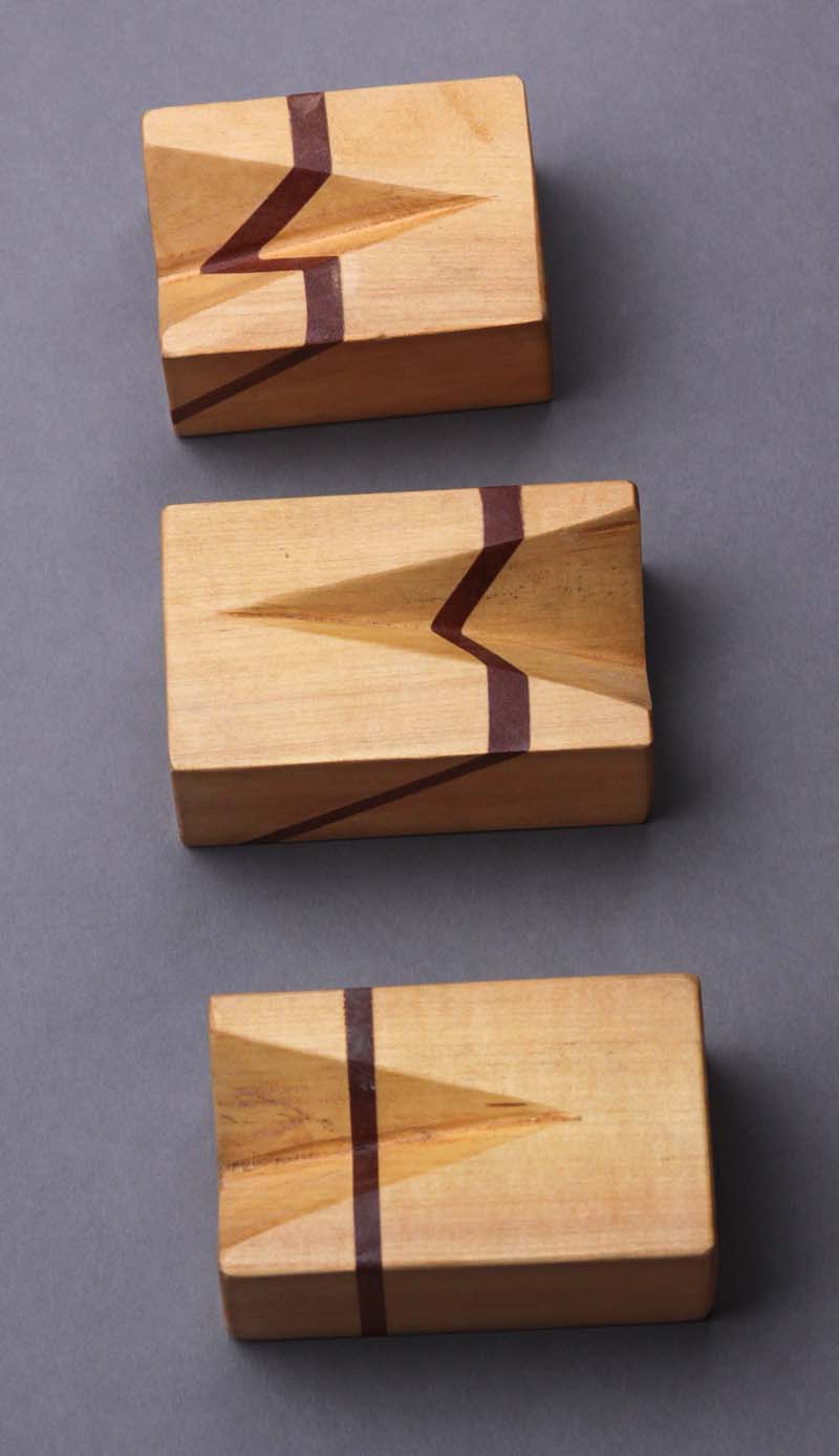
The rule of Vs in some wooden blocks...Each block model has a dark-colored layer, shown dipping gently to the left in the top block, steeply to the left in the middle block, and vertical in the bottom block. Note that the map pattern of the layer shows it making a "V" in the direction of dip where the block is cut by the notch. Note also that the steeper the dip of the layer, the less pronounced the "V" becomes; where the layer is vertical, there is no "V" at all. Note also, that it does not matter which direction the gradient of the notch runs--the "V" points in the direction of the dip of the bed. |
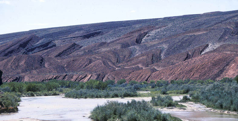
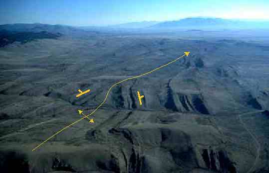
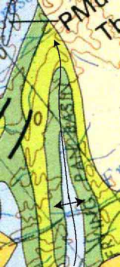
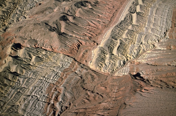
Aerial view of the "Frying Pan" area in SW Montana. Plunging Folds.Map patterns of plunging folds make zig-zag patterns that change direction at the fold hinges. Anticlines plunge in the direction that folds close; synclines plunge in the direction that they open. Compare the photo and map below. They are both from the same area in southwestern Montana. |
|
at the small-scale a gneiss that is folded into a synformal shape, plunging in the direction of the penny... note how the "nose" of the fold is opposite that of the plunge direction |
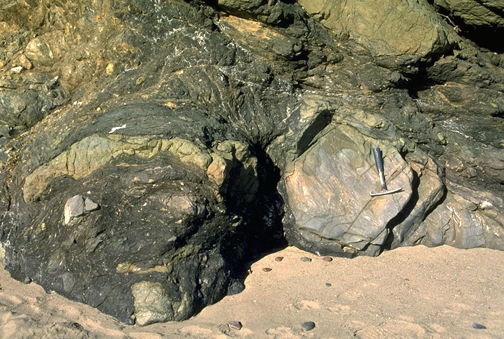
Brittle features -. Conjugate normal faults, Black Mountains frontal fault zone, Death Valley, California. Note that the rock these faults cut is itself brecciated, to suggest a complicated history of deformation |
Small thrust fault and fold in sandstone, southern Oregon |
Aerial view of right-lateral strike-slip fault, southern Nevada |
Left-lateral strike-slip faults in siltstone, southern British Columbia, Canada |
Brittle features: Quartz-filled extension fractures in sandstone. Note that the quartz fibers are perpendicular to the fracture walls, to indicate the fractures lack a shear component |
Space clevage |
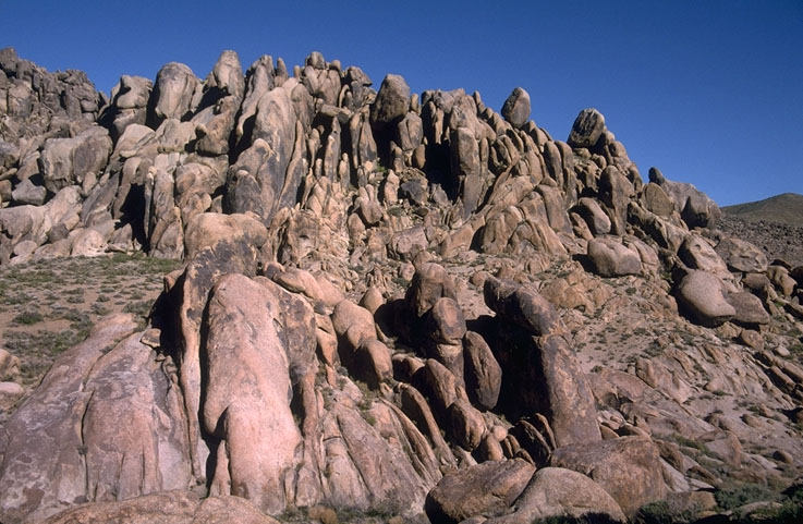
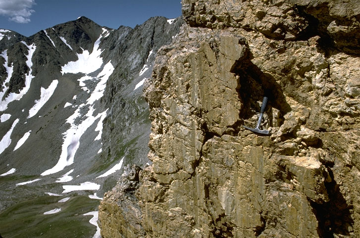
brittle features: Vertical joints in granitic rock, Alabama Hills, southeastern California |
Brittle features: Sheeting (exfoliation or unloading) joints in granitic rock, Yosemite National Park, California. Note how the joint surfaces dip towards the creek from either side |
Brittle features: Slickenlines on fault surface, northern Colorado. Slickenlines form parallel to fault motion;these ones are nearly parallel to the dip of the fault to indicate dip slip motion |
Brittle features: Fault breccia in limestone |
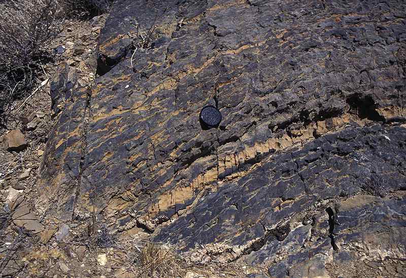
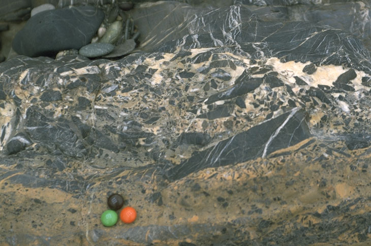
Brittle features: Melange. San Simeon, California. Melanges consist of a mixture of various rock types thrown into a matrix of finer grained material. This photo shows blocks of sandstone and schist in a matrix of shale |
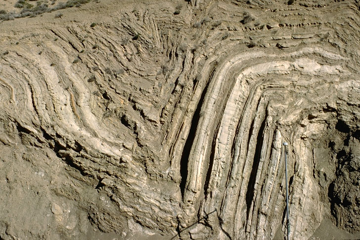
Ductile features: Syncline and anticline in Tertiary rock near Palmdale, California. This roadcut is adjacent to the San Andreas fault |
Ductile features: Chevron folds in ribbon chert, Marin Headlands, California |
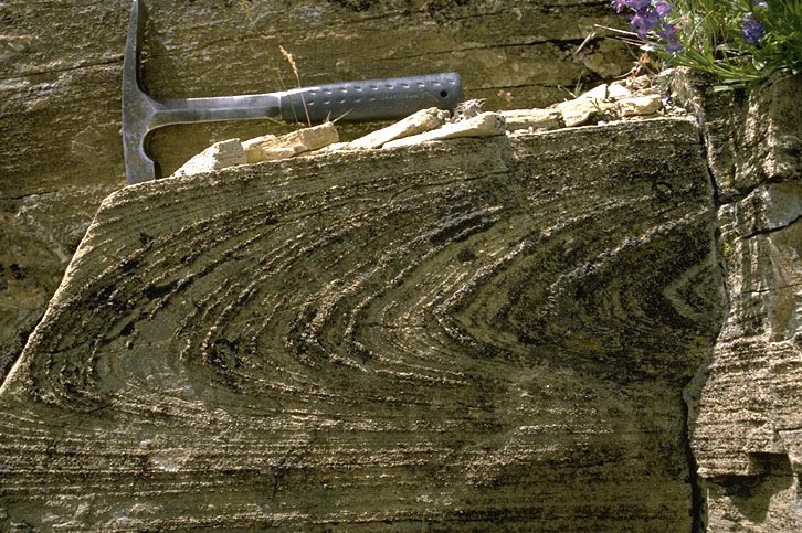
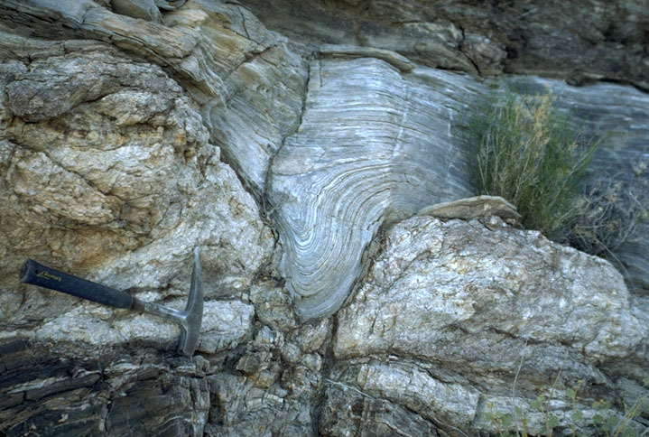
Ductile features: Recumbent isoclinal fold in marble.This fold is described as recumbent because its axial surface is nearly horizontal, and isoclinals because its limbs are nearly parallel |
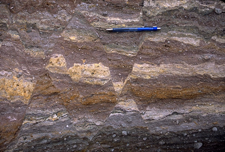
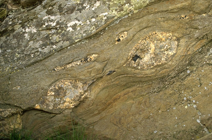
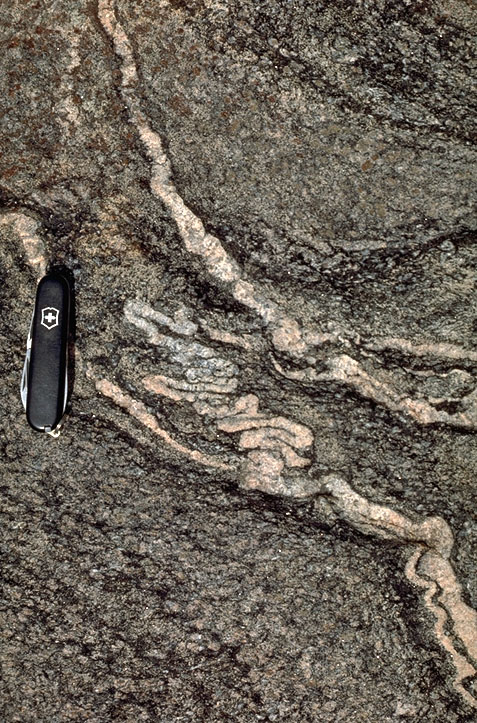
Ductile features: Boudins of pegmatite in schist.Boudins form when a body of rock is extended, the more competent parts of the rock then pull apartand separate to form the boudins, while the less compentent parts flow around the boudins |
Ductile features: Deformed conglomerate |
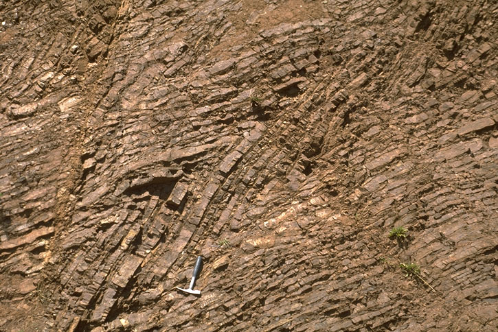
Ductile features: Axial planar cleavage in sandstone. Note the syncline (left) and anticline (right) exposed in the cliff in the background. Note also how the cleavage, exposed in the foreground, is parallel to the axial surfaces of the folds. Devonian Old Red Sandstone, SW Wales, UK. |
Slaty cleavage and bedding in limestone. In this outcrop, the bedding dips gently to the right, whereas the cleavage is nearly vertical |
Contrasting behaviors: brittle and ductile. Here, the low competency marble flowed, where as thehigher competency pegmatite broke into pieces |
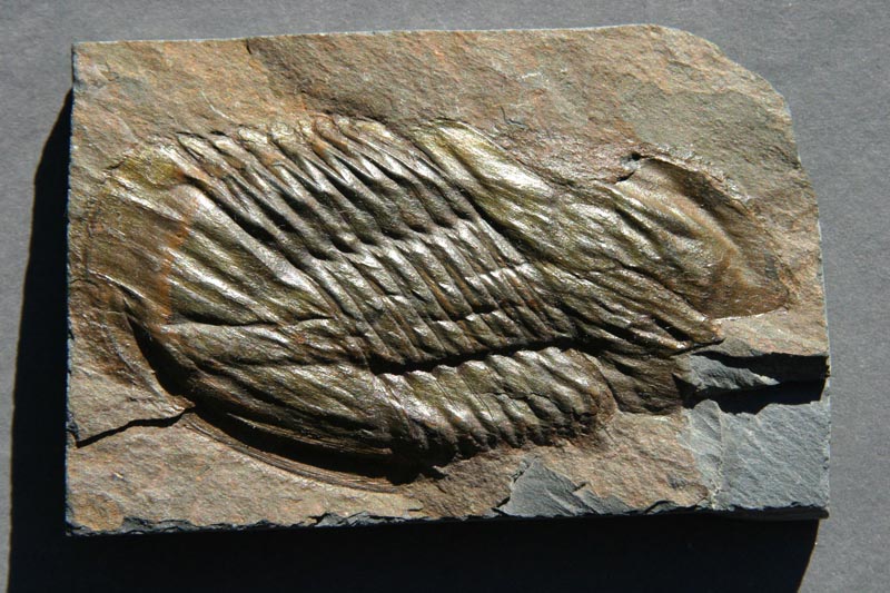
Ductile deformation: Deformed Ordovian trilobite. Deformed samples such as this provide valuable strain markers. Since we know the shape of an undeformed trilobite of this species, we can compare that to this |
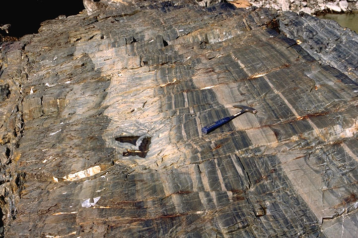
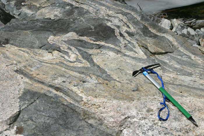
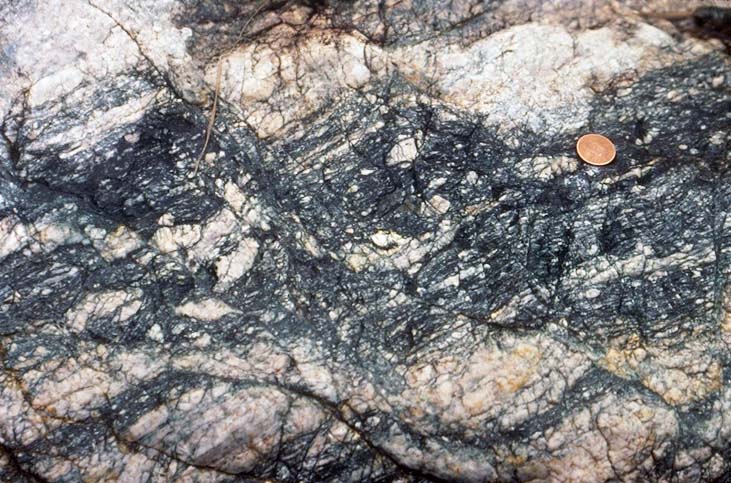
Ductile shear zone in gneiss. Note that the individual layers are deflected across a narrow zone, but do not lose cohesion. Note also that this zone is cut by an undeformed pegmatite. |
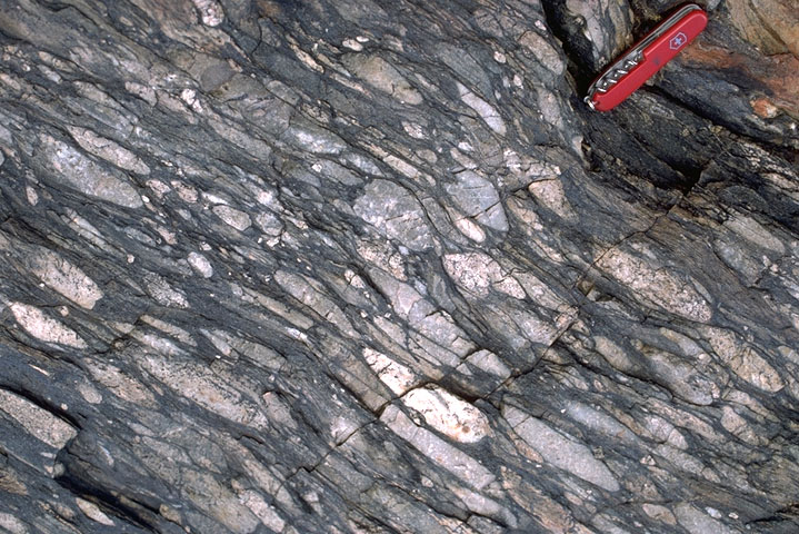
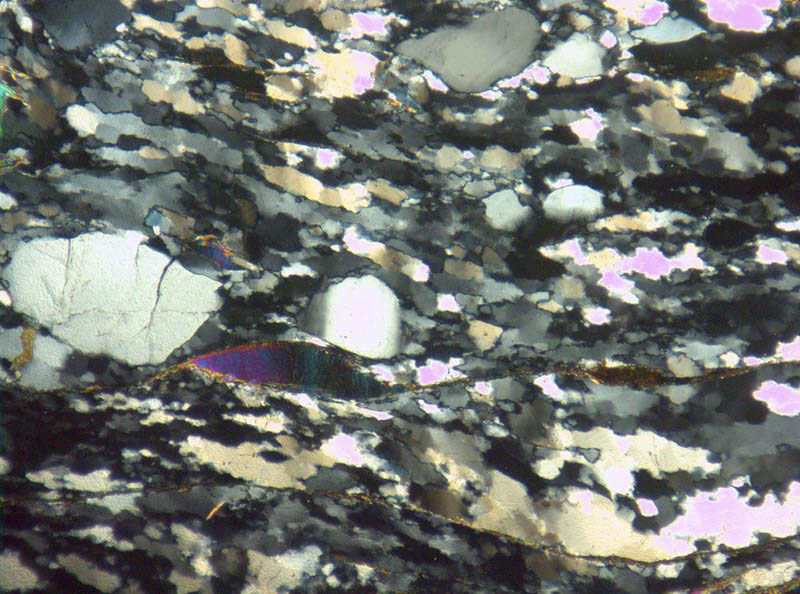
Ductile features: Mylonitic gneiss and asymmetric porphyroclasts. This sample, from the Badwater Turtleback in Death Valley, California, shows top-to-the-right (northwest) shear strain, as determined fromthe shape of the felsic porphyroclasts |
Ductile features: Chevron folds in ribbon chert, southern Oregon coast |
Ductile features: Upright syncline in limestone |
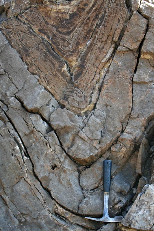
Ductile features: Ptygmatic folds of pegmatite in gneiss.Ptygmatic folds are those with a high amplitude to wavelength ratio. They typically form when there is a high competency contrast between the different components of a rock, but an overall low competency of the bulk rock. |
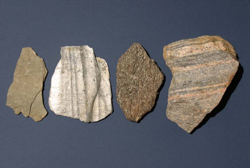
Metamorphic Rocks. From left to right: slate, phyllite, schist, gneiss. |
Metamorphism: Phyllite, with small-scale, folded veins and crenulations |
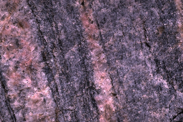
Metamorphism: Close-up view of gneiss, showing how gneissic foliation is defined by bands of different minerals. Photo is approximately 5 cm across |
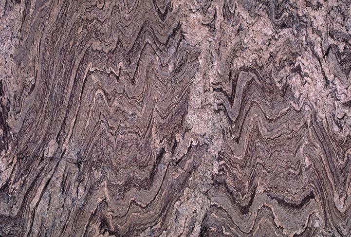
Folded gneiss. Teton Range, Wyoming |
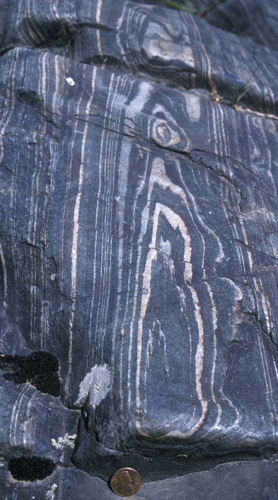
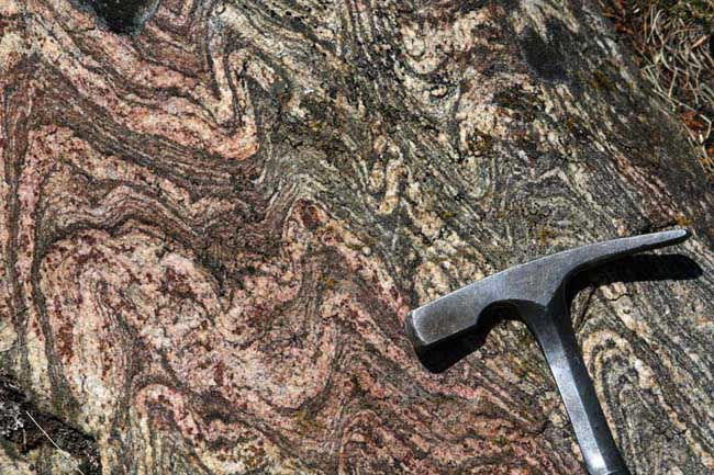
Migmatite gneiss, SW Montana |
Metamorphism: Intruded, folded gneiss. Rocky Mountain National Park, Colorado |
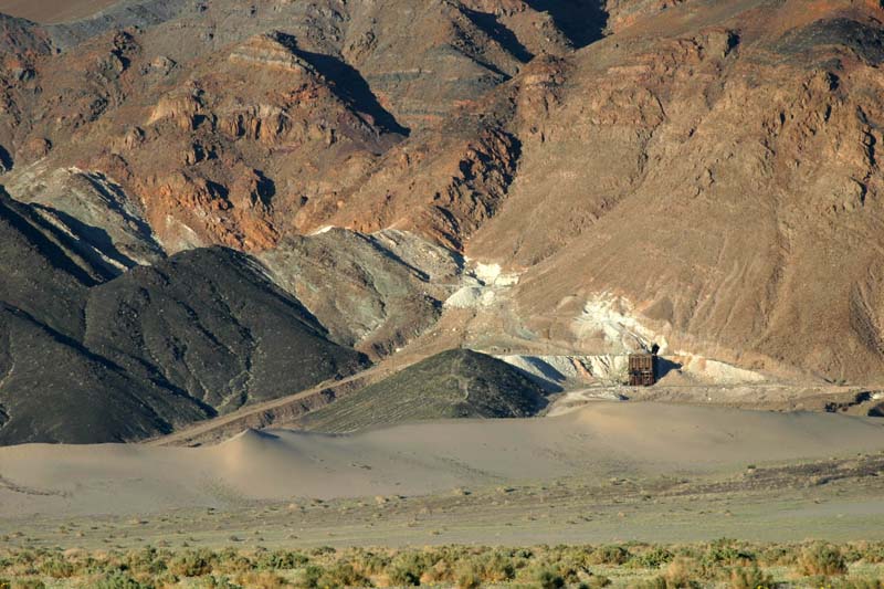
Contact Metamorphism. The white band is a talc deposit in southern Death Valley, California. Thed ark green rocks below the talc is diabase; the brown rocks above the talc is dolomite. The talc formed by contact metamorphism of the dolomite by the intruding diabase. Note the mine workings along the deposit |
Metamorphism: Retrograde metamorphism: chloritic gneiss. Note the small normal faults |
Metamorphism: SC fabric in quartz-feldspar gneiss. Displays top-to-right sense of shear |
Metamorphism: Photomicrograph (crossed polars) of folded schist. The platy, rightly colored minerals are muscovite; the gray stubbier crystals are quartz. Field of view is approx 1 cm across |
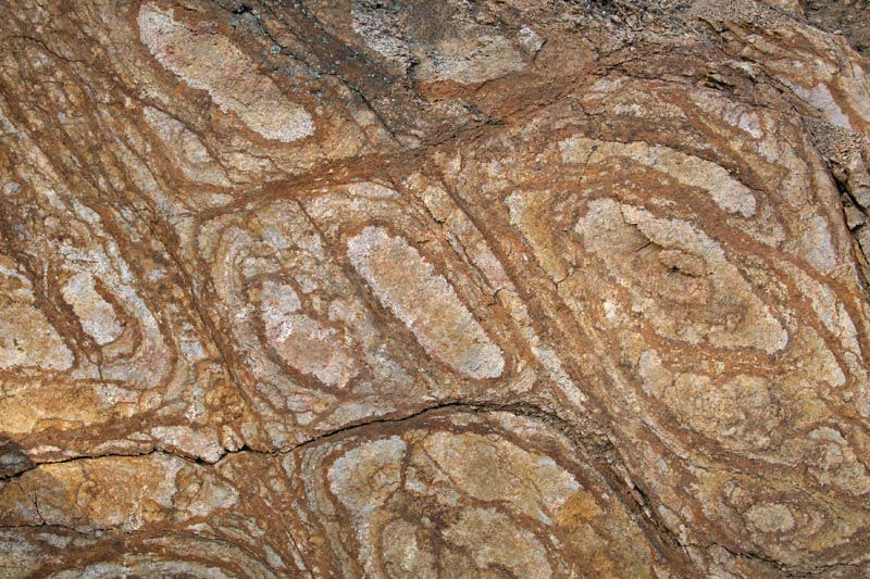
Liesegang banding from groundwater flow in granite. Note the concentration of iron oxide discoloration tends to be along fractures, sites of increased groundwater flow. This image is approximately 1 meter across. |
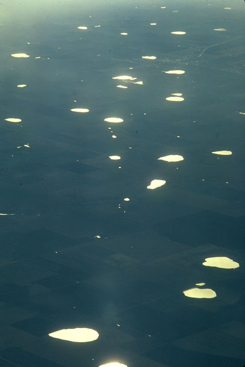
Sinkholes, W. Texas |