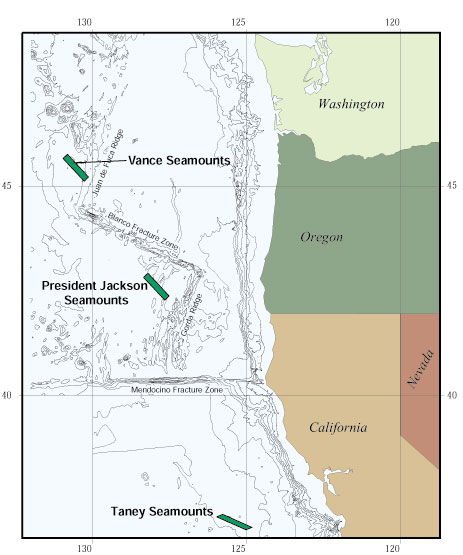
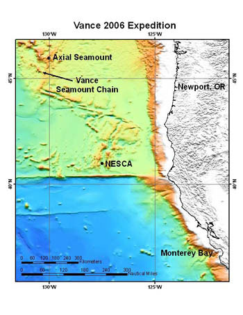
 | Vance Seamounts |
|
|
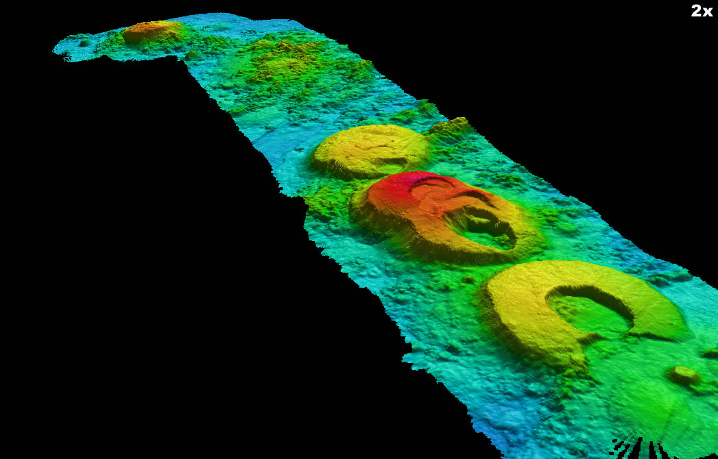
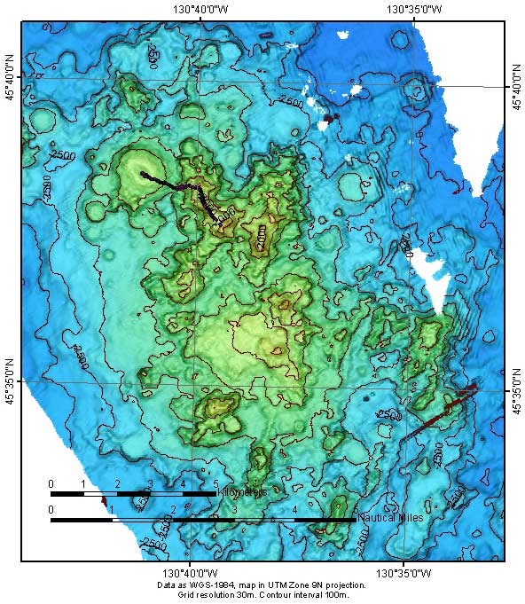
Perspective view of the Vance Seamounts, showing nested flat-topped calderas. Image © MBARI 1999 |
|
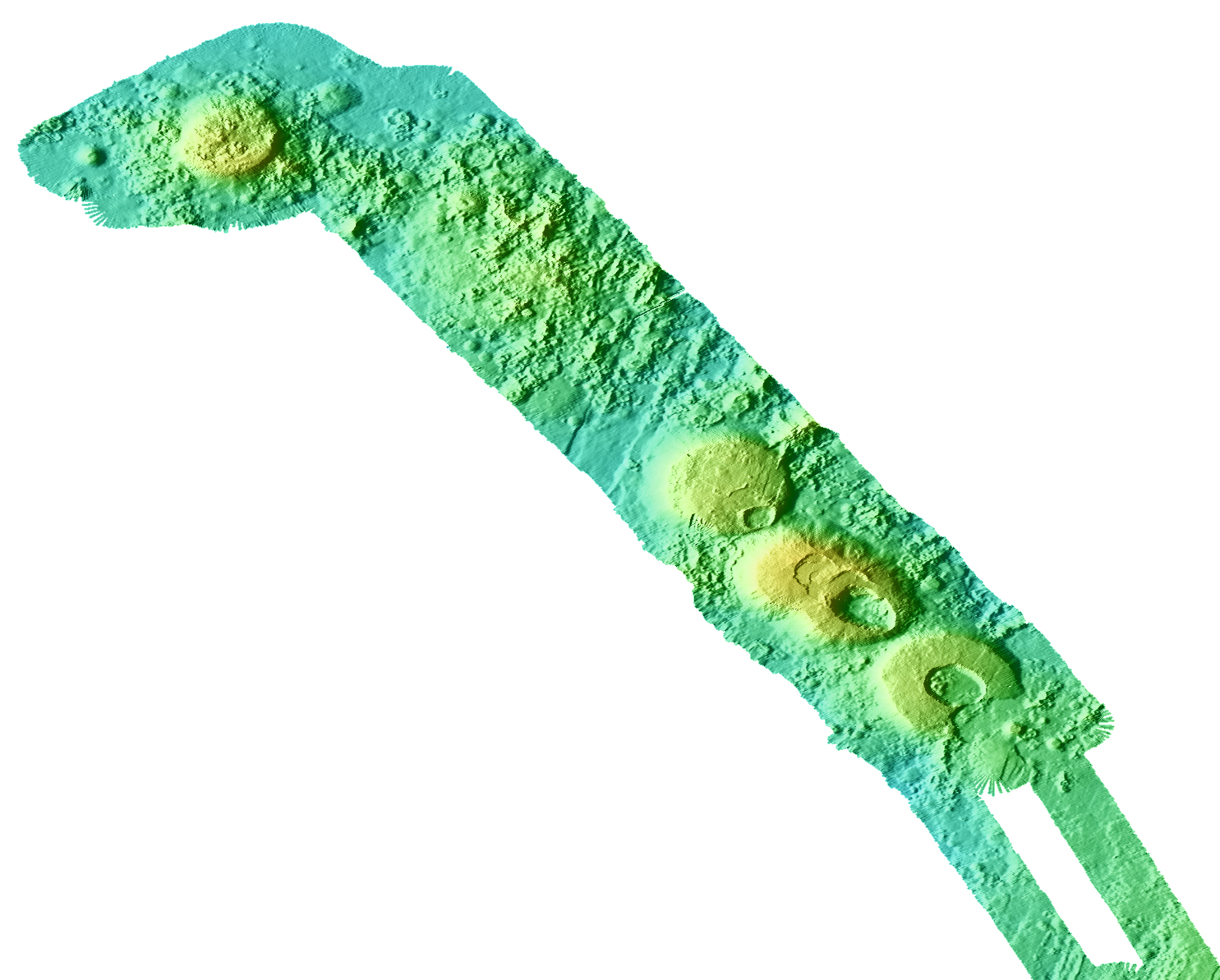
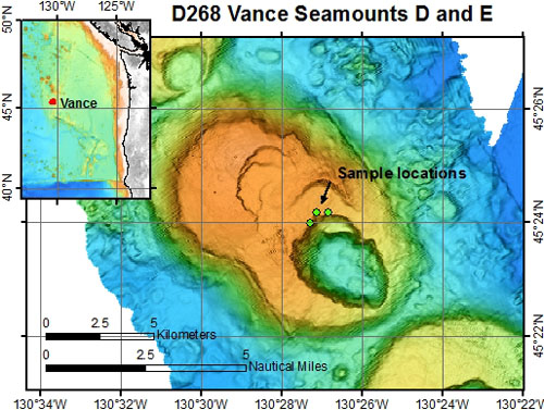
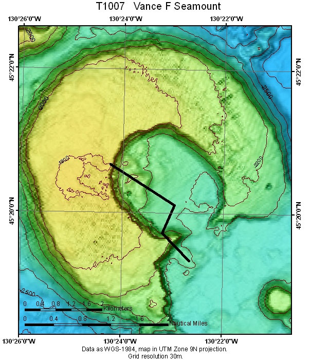
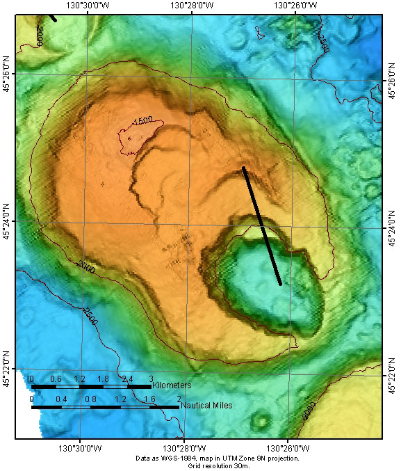
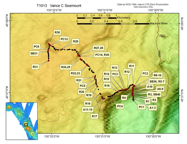
Map of the Vance seamounts D and E showing locations where samples were collected on ROV dive D268 at the caldera rim of Seamount E. The chain of seamounts formed near the Juan de Fuca mid-ocean ridge approximately a million years ago. These two coalesced, and have nested calderas from multiple eruptions. Depth range is 3,350 to 1,450 meters -http://www.mbari.org/expeditions/Northern11/L2/logbook/day8.htm |
|
|
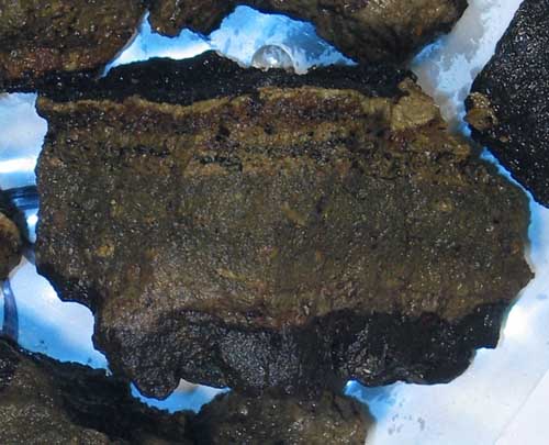
Lava flows -A volcaniclastic rock collected at Vance (7cm wide). The upper cm has several layers of glassy fragments and volcanic sand from explosive eruptions, and a manganese oxide crust that formed slowly over time |
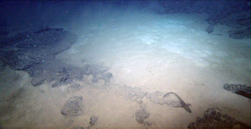
Flat top of seamount is rippled and burrowed modern sediment |
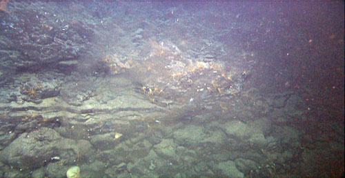
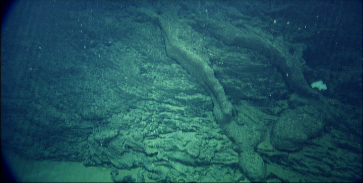
Basalt breccia over sheet flow over pillows below the caldera rim. The haziness is some condensation that has unfortunately formed inside the camera housing. |
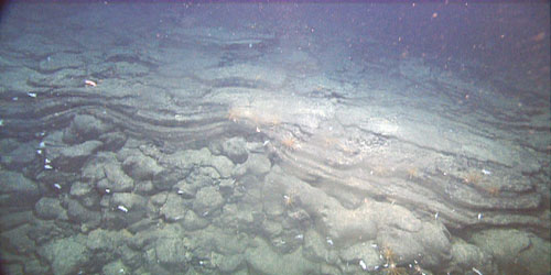
Volcaniclastic (ash and volcanic debris) sandstone and mudstone draping pillow basalt just below caldera rim |
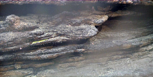
Wavy, thick laminations in volcanic sandstone and mudstone |
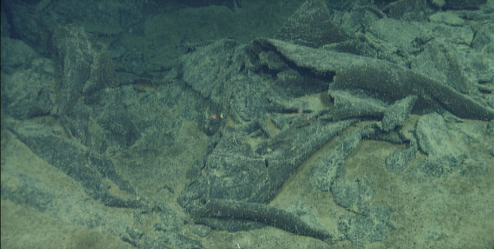
Horizontal borings in sandy mudstone are visible in broken pieces of rock |
The dive began in the flank caldera floor, where we landed on lava flows erupted within the caldera after it formed. These flows drape several small faults that parallel the nearby Juan de Fuca Ridge axis, showing that the flows postdated all movement on these faults. We then drove northwest to the base of caldera wall, which was a large talus-covered slope for about half its height. The upper portion was a series of truncated pillow flows and massive lava flows, all capped by a thin layer of fine-grained volcaniclastite (a sedimentary rock composed of silt and sand sized volcanic particles). We crossed over a narrow septum between the two calderas and then dropped down into the second, and centrally located, caldera. Once again, the caldera wall consisted of a series of truncated pillow and massive flows under a thin cap of volcaniclastite, with the lower half of the slope buried in talus. At the base of the talus slope, the nearly flat caldera floor was buried beneath rippled sediment. As we crossed the caldera floor, outcrops of harder rock were spotted on the sonar and we found exposures of fine-grained volcaniclastite that formed the flat floor of the caldera. We proceeded north towards a hummocky deposit on the caldera floor that could have been either landslide debris or constructional volcanics. It turned out to be the latter, showing that effusive eruptions occurred on the caldera floors of both calderas after they formed. We ended this dive with one more traverse up the caldera wall, encountering the same sequence of units seen previously, with more abundant massive flows and less abundant pillow lava, and capped with volcaniclastite |
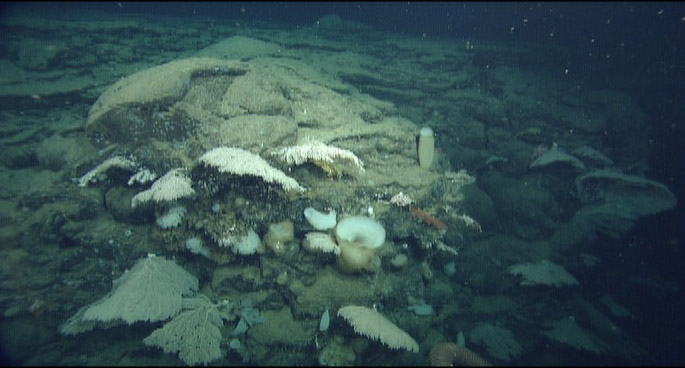
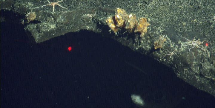
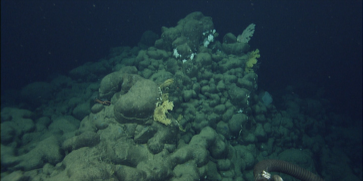
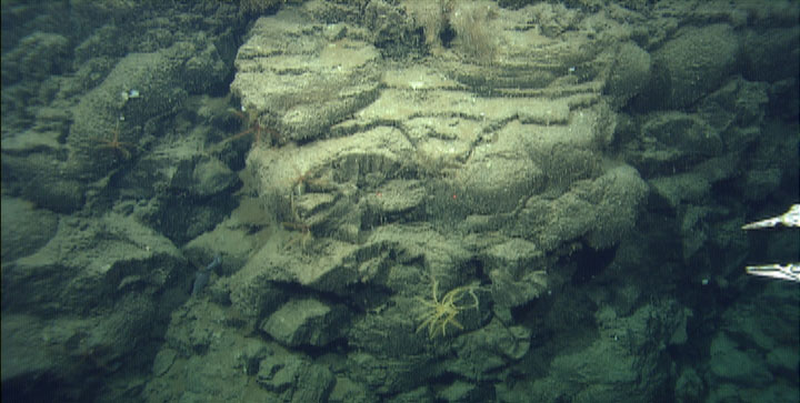
At the top of the caldera walls, we found thin beds of volcaniclastic (= broken up volcanic) material overlying the more massive flow units. Here at the very edge, a multitude of gorgonians and sponges are attached to the flow units, their fronds growing out, rather than the usual up, to take advantage of currents focused up the wall that carry particles of food. Note that nothing appears to be growing on the clastic material |
Pillow lavas overlain by a massive flow interior unit on the caldera wall. Stacks of these units were truncated and became a vertical cliff hundreds of meters tall when the caldera collapsed.This single dive has documented that the volcano formed by accumulation of numerous pillowed and massive flows, followed by formation of the two calderas and explosive eruption of a thin layer of volcaniclastite, perhaps in direct response to collapse of the first, central, caldera. Small effusive eruptions on the caldera floors appear to be the final volcanic activity on this volcano. This remarkably clear sequence defines the major volcanic events in the history of this seamount. Samples collected from each phase of this activity will be used to determine how the magma compositions changed as the volcano grew and changed. In addition, sediments collected on top of each unit will be dated to place this evolution in a timeframe, to find out when this all took place and how long it took to occur.During the dive we also collected a number of animals to characterize the biota living on this young volcano. In general, the talus slopes and sediment hosted sparse communities whereas lush complex communities occurred on the upper caldera walls. At one location on the caldera wall we collected 8 different gorgonian species as we waited for the ship to catch up to us so we could traverse down the inner caldera wall |
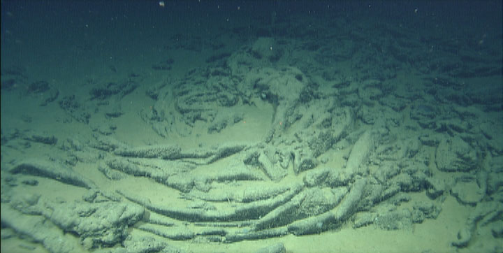
Outcrop of jumbled sheet flow draped with very fluid, elongate pillow lava. The story that we can decipher about the history of this seamount is quite different from the rather simple story yesterday, although some themes are consistent for the two volcanoes. The main thing that is similar is that both have at least thin deposits of volcaniclastic rocks draping the summits and that both had some eruptions that occurred after the formation of the clastic deposits. The outer slopes of the old volcano are mostly talus rather than lava flows draping the slopes. Todays dive also observed numerous fault scarps that offset portions of the summit, but these are too small to be seen in the existing bathymetry. The sediment trapped in the deep calderas observed yesterday was almost entirely pelagic microfossils that had accumulated over time whereas the sediment observed today on the summit of the old volcano had been winnowed and redistributed by strong currents and included a significant component of lava fragments in sand and gravel sizes. We have sampled these gravelly sediments with the hope of determining the full range of lava compositions erupted near the end of volcanic activity. We also collected similar samples on the outer slopes that may provide a glimpse at the range of compositions of lavas during construction of the bulk of the volcano |
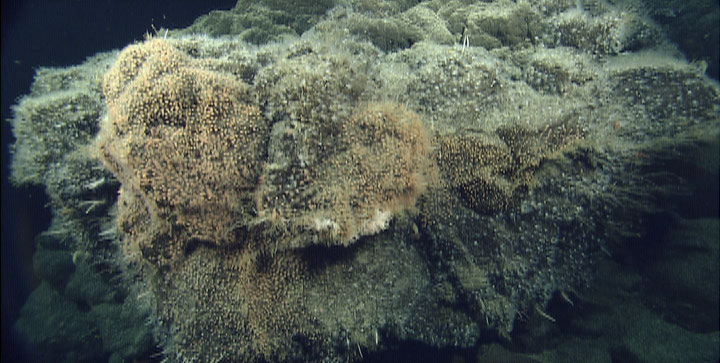
This one outcrop, overhanging the top of a sheer cliff on the outer flank of the volcano, was the most desirable real estate, by far. Dense colonies of pink and white cup corals, gorgonians, stars, crabs and shrimp crowded on this one spot, and were rare elsewhere. During the transit across the summit, we encountered a small, unusual orange-colored outcrop that consisted of highly altered hydrothermal sulfide. This is probably the oldest such deposit yet found on the seafloor since it certainly formed when the volcano was active, perhaps 2 million years ago. One surprise was that the animal communities were not as prolific as we expected, but again consisted dominantly of gorgonians, sponges, and tunicates. Two new additions were anthomastus (mushroom corals) that reached sizes up to about 40 cm in diameter with their polyps extended, and several species of bamboo corals. We added to our collections of gorgonians, including several very tiny ones (about 2-5 cm tall). The suction sampler was also used to collect an array of small animals including baby crabs; polychaete, scale, and annelid worms; cup corals, brittle stars; a sea pen; and brachiopods |
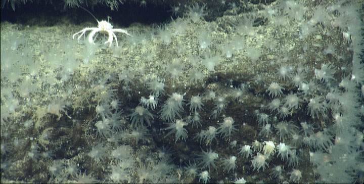
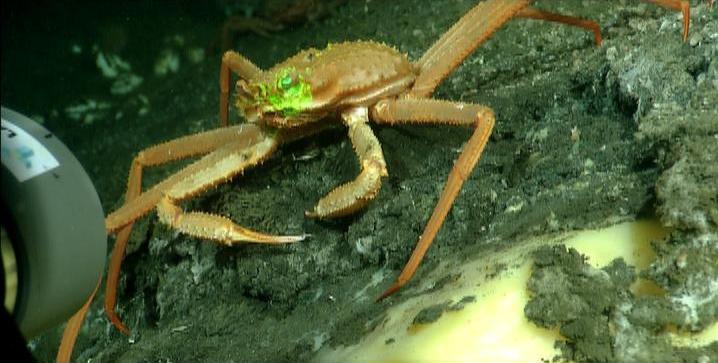
Cup corals and a crab on the densely-covered cliff edge. The abundance of these few animals, in distinct areas from each other, was an amazing sight. This projecting piece of rock was the only part that supported a dense population of animals, so the difference was striking. Why that one chunk and not any of the surrounding ones? We concluded that a strong current passed by and under the ledge, whereas the surrounding areas are most likely relatively still. With this exception, there were not as many animals on today''s dive, although we did see black corals, polychaetes, and a number of enormous soft corals, called Anthomastus. The flows were very old and logically should have had more life, but had a thick manganese crust that is toxic to sessile animals. |
Barnacles attached to the edge of a collapsed sheet of lava. |
the second-youngest cone of the Vance Seamount chain.This structure is very complex as it consists of two large volcanoes that have coalesced. The eastern (younger) half, where we dove, has 3 apparent nested calderas, two of which (the oldest and youngest) truncated lava shields on the summit platform when they collapsed. The western half also has three nested calderas and another shield. The dive began on the floor of the deepest, and most south-easterly, of the three calderas. There we encountered some lava flows that postdate formation of the caldera. Most of the floor was covered in pelagic sediment, but pillow lava projected through the sediment here and there. The wall of the caldera has a long slope with scattered blocks of talus on and embedded in pelagic sediment. Moving upslope, the talus abruptly gives way to a near vertical wall of interlayered thick massive flows and pillowed flow units. One of these thick flows was more than 30 meters thick and had beautiful columnar joints. Others were thinner, but several more also displayed columnar joints. At the very top of the wall, a layered 2-meter section of fine-grained volcaniclastite outcropped and formed the surface on the floor of the next older, middle, caldera. Most of that caldera floor was buried by pelagic sediment. The wall of this middle caldera was a repeat of the wall of the south-eastern one, with interbedded massive, columnar-jointed flows and pillow lavas, again topped by a roughly 2-meter section of volcaniclastite. The similarity of the rocks in these caldera walls suggests that the middle one may not actually be a separate caldera, but a section of the floor of the south-eastern caldera that simply did not subside completely. We continued across the floor of the north-western caldera where we found low outcrops of pillow lava surrounded by and partly covered by the fine-grained, layered volcaniclastite seen at the rim of the caldera to the south-east. These pillow lavas therefore predate the eruption of the clastic unit and the formation of the caldera. The pillows appeared to be unbroken, suggesting that the caldera floor may have subsided as a cylinder, leaving the uppermost flows intact. We finally reached the base of the final, oldest caldera wall and found that it was heavily encrusted in manganese oxide crusts that obscured the underlying rocks. It was very difficult to tell what was talus and what was flows until we reached quite high on the wall. Thick, jointed units were common but it was unclear whether they were ponded lava flows or dikes, and only the upper section appears to be pillow flows. A short distance over the very top of the caldera rim was a coarse-grained volcaniclastite we thought was a sheet-flow, We have been seeing a pattern in which volcaniclastite formed during caldera formation, and that sometimes some subsequent lava flows erupted onto the caldera floors. The final part of todays dive was somewhat different in that there was no thick volcaniclastic section at the top of the caldera wall but a thinner deposit of volcaniclastite that was coarser grained than what we have collected previously. In each case so far, the surface that was disrupted by caldera collapse is covered in volcaniclastite and is the only location we have found such deposits. |
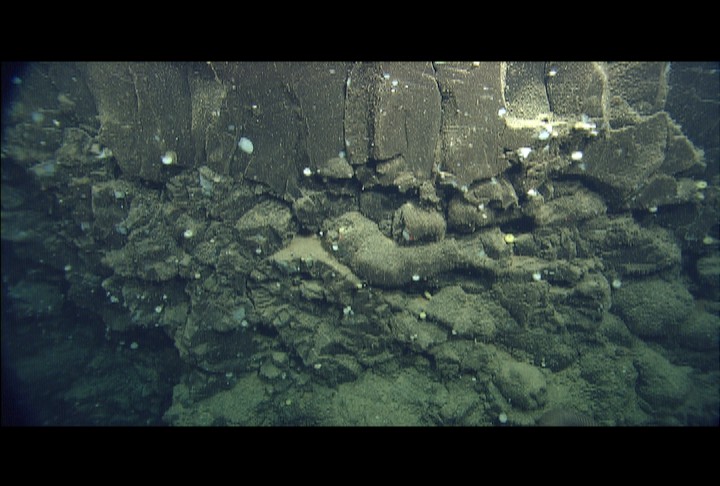
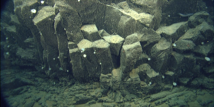
Columnar jointed, massive lava flow or lava lake, on top of ropy sheet flows. These types of units repeated many times as we ascended the cliffs of the caldera walls. |
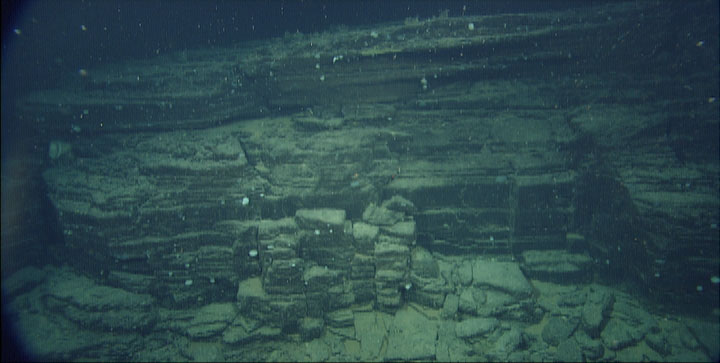
Thick sections of thinly bedded volcaniclastic rock formed the top unit of the south-eastern and middle caldera walls |
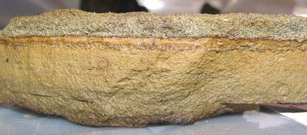
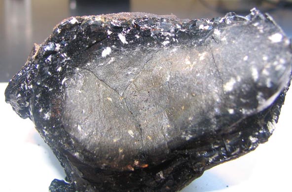
Cross section of a piece of volcaniclastite (sedimentary rock of volcanic origin, collected from a section like in the accompanying photo) in the lab. Layers of pulverized rock are interspersed with layers of volcanic glass (dark layers). The rock is about 2cm thick |
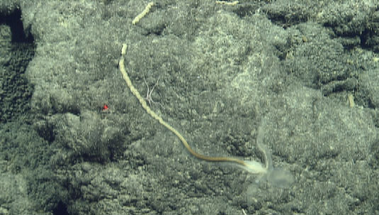
An enteropneust worm crawling on a manganese-encrusted talus block. The body of the worm is nearly transparent (the head and upper body are in the lower right of this photo), and the most visible part is the trail of feces it leaves behind.a set of sediment cores that would help unravel the history of Axial Volcano. Our first few attempts yesterday to core sediments close to the summit were hugely successful, but as we moved downslope we suddenly found relatively young lava flows with virtually no sediment cover on them at all. So we spent most of the latter half of the dive looking at the lavas. So what do the lavas tell you? On the seafloor, we pay attention to the types of flows. Bulbous pillow lavas form where the rate of extrusion of the lavas is pretty low, and the lava advances as a tube (maybe 1 metre across). Flat sheet flows form when the rate of extrusion is high and the lavas pour out as thin sheets over the seafloor. There are gradations in-between these two types, but these are the kinds of things that we can observe that tell us about the rate at which lavas were erupted. So how do we identify the products of a single eruption or multiple eruptions? In this case you cant just look at the type of flow, since different eruptions will very often have the same eruption rate and hence flow type. So we need to then look close-up at the individual lava samples once we have them in the lab on the Western Flyer. We carefully describe and photograph each sample, and look for similarities and differences in the detailed rock textures. At Axial we noted a key aspect in trying to decide if we are looking at one or many different flows from different events. We noted that the older lavas that we were able to sample from beneath sediments near the volcano summit lacked any mineral crystals, but several of the younger-looking lavas from downslope had a few crystals of a mineral called feldspar. So now we can go back to our dive track and note where we sampled mineral-free vs. feldspar-bearing lava, and map out the distribution of the eruption that produced the feldspar-bearing lava flows. |
This rock has abundant plagioclase feldspar crystals (white specks) and a substantial glassy rind |
Very glassy rock without plagioclase feldspar crystals |
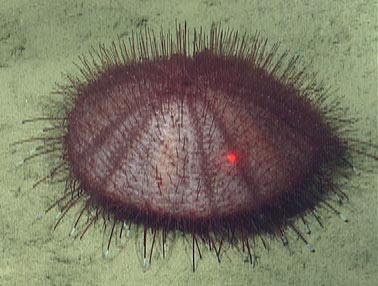
Very large urchin, which has what look like white spats on its tube feet. The red dots of the lasers are 29cm apart for scale. Several highlights include finding (and collecting) Acesta moreii, a deepsea bivalve related to fileshells, this far north. This animal has been the object of a genetic study at MBARI for several years in an effort to understand their larval dispersal. We collected a large purple urchin we have seen many times, but not collected (due to its 9 inch diameter!) We also collected an unusual 5-armed crinoid, many ophiuroids (brittle stars), several polychaetes, some isopods, another gorgonian, a bamboo coral, and an enteropneust worm. The enteropneust is a hemichordate (thought to be ancient ancestors of chordates, like us) that has only rarely been collected and whose genetic relations to other hemichordates is unresolved |
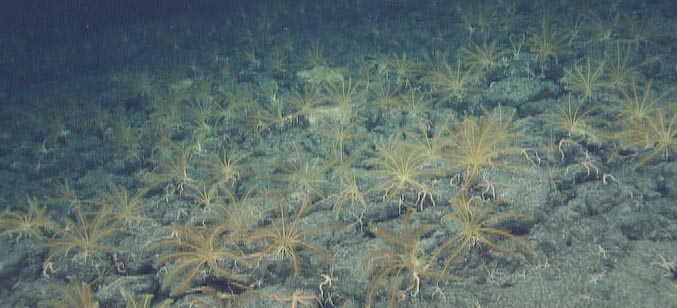
Lush "garden" of crinoids (feather stars, gold) and ophiuroids (brittle stars, pink) on the plateau above the western-most caldera wall.really giant (about 60cm long) octopus just lounging around on the ocean floor. We collected a really big sea urchin, the biggest I''ve ever seen. Its diameter was probably as big as a basketball. Of course we had our usual brittle stars everywhere, but they were still nice to look at. At the end of the dive we came upon a "garden" of Crinoids. They were so pretty, and they seemed to go on forever! In the lab tonight, Gill and I got to disect some clams. |
Map of Vance B "seamount. This region is located between the oldest seamount (seamount A, our second dive on the Vance Seamounts) and the seamount we will dive on tomorrow (seamount C). Despite the rather non-descript bathymetry of "seamount" B (no circular flat-topped seamount with calderas) the volume of excess lava erupted on the seafloor is similar to that of two of the large volcanoes, suggesting that the rate of magma production along the chain did not vary widely. The primary dive objective was to determine if the lavas differ significantly from those that form the larger volcanoes in the chain. On most of the Vance Seamounts, magmas passed through chambers beneath the calderas. Evacuation of magma from these chambers created the space that became the caldera after collapse of the surface. Some processes that modify magmas, such as cooling and crystallization, magma mixing, and incorporation of surrounding rocks are more efficient if the magmas pass through and reside in such chambers prior to eruption. The area we studied today, unlike all the other areas studied during this cruise, should be lacking magma chambers, so these processes should be minimized or eliminated, allowing direct assessment of the composition of the magmas produced in the Earths mantle. When we get all the samples back to our laboratories, we will analyze them chemically to determine if we our ideas about magma chambers are viable. We think that the lavas collected today will have higher magnesium contents and therefore higher eruption temperatures, compared with those from the large circular seamounts. |
Summit of a mound of pillows, which looks like many we saw today. Typically, each mound was more than 30 meters (~100ft) high, and the mounds were often built on top of each other so we would dip into a sedimented gully next to one and then climb the sheer cliff of the next. These steep-sided, relatively small cones are probably individual eruptive vents. |
On the steep flank of a pillow mound, this lava pillow had cracked open and drained during the eruption. The rind at the top of the broken pillow makes a convenient grip for the manipulator to collect a sample; most of the rest of the lava is well-cemented to the earth, We passed by some beautiful volcanic outcrops on one of the Vance seamounts showing huge pillow basalts, strange-looking lobate basalts, massive sheet flow sections or layers of volcanic sediments, evidence of the wild explosive life parts of the volcano |
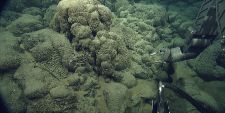
Small outcrop of elongate pillows. The manipulator arm is poised to begin searching for a sample that it can break free from the outcrop and from the tenacious cement of the manganese crust on these old rocks. The sample it will succeed with is in the lower center of the photo, a twisted tube that budded from the pile. |
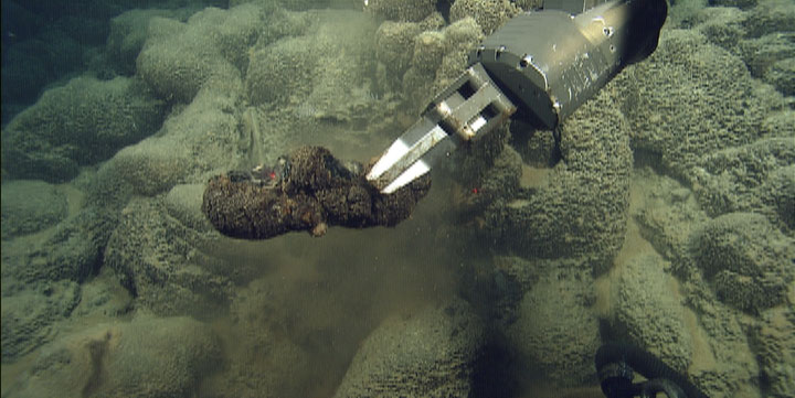
Sample of the elongate pillow bud in the manipulator''s grasp. We photograph each sample as it is collected to assist us with figuring out which black rock is which in the ROV''s hydraulic drawer after the dive |
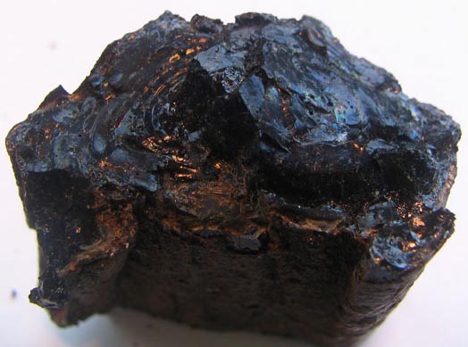
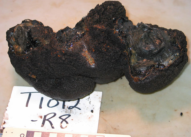
Lava sample collected in the accompanying photos, as pictured in the lab. The glassy, black surfaces along the top are the freshly broken places where it was attached to the outcrop. The brown, duller texture of the rest of the rock is manganese crust. |
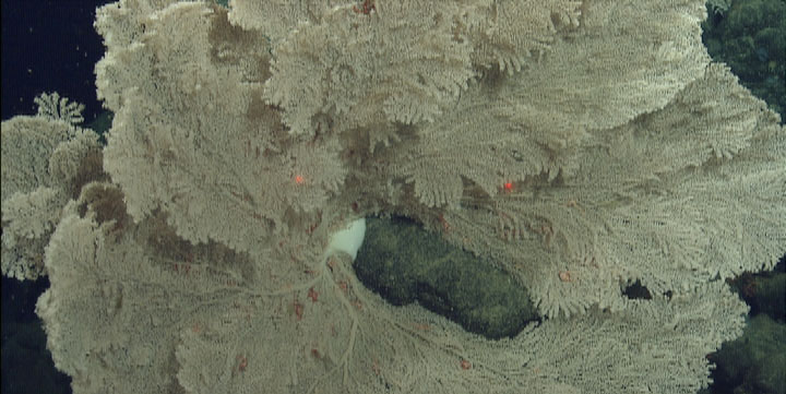
Closeup of a large gorgonian (sea fan) with a white sponge visible at its base on the rocks. The red laser dots are 29cm apart for scale |
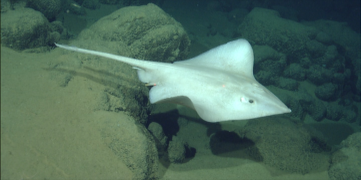
A ray swimming past pillow lavas draped with sediment |
the samples were collected along track. Everything on the bottom, including talus, lava flows, and volcaniclastic rocks, were covered by at least an inch thick layer of hydrothermal manganese crust. This covering made it very difficult to tell talus from pillow lava or sheet flows from layered volcaniclastic rocks. It also made sampling much more challenging as the manganese crusts are surprisingly strong, making it hard to break off even brittle glassy sheet flows. For much of the day, we were unsure if we had seen or sampled volcaniclastite, and thought that our conclusion that volcaniclastite erupted at about the same time as caldera collapses was not going to hold up. However, when the rocks were unloaded from the vehicle, we found that quite a few samples were actually volcaniclastite coated in manganese crusts. |
Rim of the caldera wall. Fragmental volcanic rock (volcaniclastite) blankets the rim of the first caldera wall we explored today. Manganese crust coated the rocks so thoroughly, and made them so difficult to break off from the outcrop, that we mistook this for a lava sheet flow until we saw the sample in the lab: the rock was 80% volcanic glass fragments, with pieces up to 7mm (1/4") in size. |
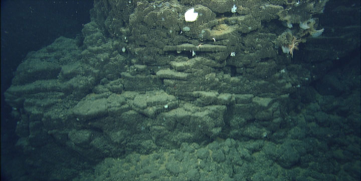
Base of the caldera wall. At the bottom of the image is the top of a talus-covered scree slope, which laps onto a massive lava flow. Above that are layers of thin sheet flows, and above that are truncated, hollow pillows of a lobate flow, to which some white sponges and crinoids are attached. |
Whorl in a ropy sheet flow on the caldera floor, dusted with sediment |
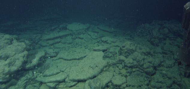
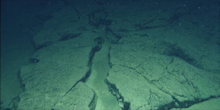
Sheet flow, slightly domed and fractured, on the floor of the second caldera we explored today. This was probably the surface of a lava lake |
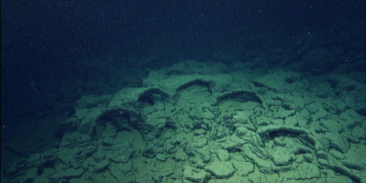
Collapse structure: five lobate pillows collapsed as the lava drained elsewhere. We think these look like a giant paw print in the lava |
Tiburon dive T1014, Vance G Seamount. Truncated pillow lavas part way up a fault scarp are draped with thin layers of very fine-grained fragmental volcanic deposits (volcaniclastite) |
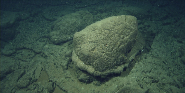
Bulbous lava pillow that was engulfed with fine volcaniclastic sediment. We aren''t sure how the sediment came to be stuck to the pillow like a skirt, but it probably represents the initial depth of the deposit, which may have compacted or eroded later |
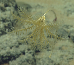
yellow stalked crinoid |
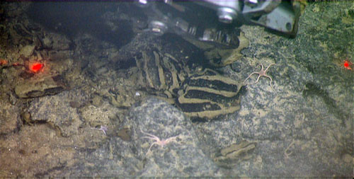
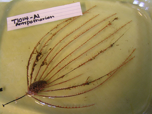
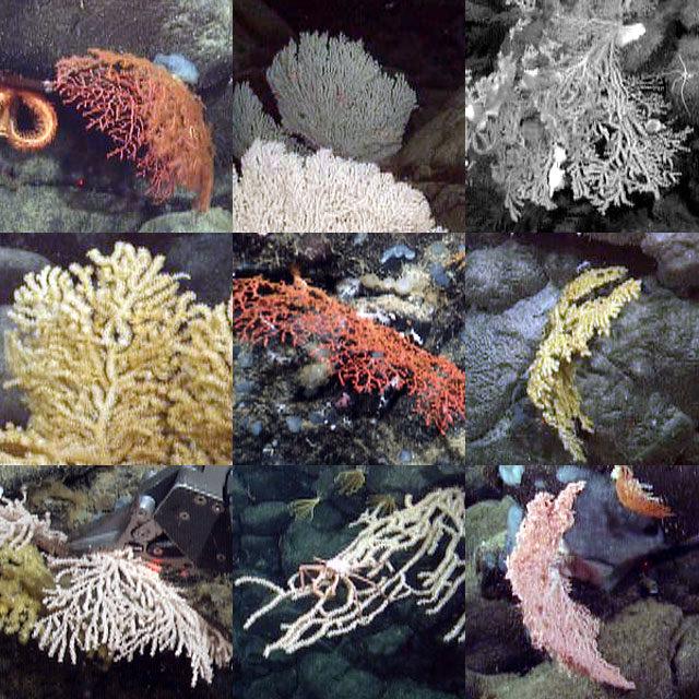
Animal we found attached to a manganese crust fragment on our last dive. It is probably a black coral (antipatharian), but has an unusual, rigid mass at the base of its branches. We are guessing this might be an anti-predatory device, if it has nematocysts inside. Many of the animal samples that we collected are undoubtedly new species. How many new species did we find? The answer to that will be answered in the coming months. Some are common, being found on seamounts in other parts of the Pacific Ocean; how do larvae of these species make the journey between these isolated seamount islands? MBARI researchers and collaborators are eagerly awaiting samples to begin their analyses. Collaborators at NOAA will extract DNA to determine species identity and relationships among the plethora of coral samples that we collected (see collage). Other researchers will be estatic that we collected five-armed crinoids (most crinoids have 10 arms), undoubtedly something unique. Yet others will be excited that we collected tissue samples from three species of enteropneust for DNA analysis. It is rare to even see these unusual animals much less have the ability to collect these delicate creatures from the bottom of the sea. These samples will address the question of how this curious group of hemichordates is related to other invertebrates. Personally, I''m most excited about samples of clams and squat lobsters that we collected from the Vance Seamounts. When I get back to the lab on Thursday, I will compare the DNA of these animals to those from other seamounts and ridges where weve collected samples to answer questions about how the populations are related. If they are different species, I will send the specimens to my colleague who will analyze the morphology. While all of this seems like a lot of work (and it is!), it is only a scratch into the amount of work that remains to be done in the oceans. |
Coral collection. The diversity that saw on the various seamounts was astonishing. We saw nearly the entire spectrum of invertebrates including porifera (sponges), cnidarians (jellyfish, corals, and allies), annelids (segmented worms), arthropods (crabs and shrimp), molluscs (clams, scallops, etc), echinoderms (sea stars and crinoids), and hemichordates (acorn worms). An entire textbook of species in one small area of the the worlds oceans! There is undoubtedly a lot of diversity in the deep sea and this is just a small subset of what is out there. Many new species and unsual environements exist that we have yet to discover. |
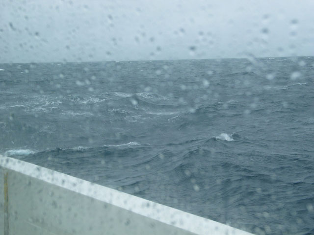
Rough Seas at Barkley Canyon |
|
|
|
|
from MBARI - http://www.mbari.org/volcanism/Seamounts/Seam-NearRidge.htm
Purpose
Understand the formation of calderas on submarine volcanoes
Among the questions we have: How and when do calderas form? Do they form from one large, final event or are there repeated events? How big and how violent are the eruptions; how far is material ejected and how large are the particles? How deep in the volcano does the material come from? Are the explosions driven by magmatic gas or water vapor; is hydrothermal activity in any way associated?
Seamounts erupted near mid-ocean ridges
There are many linear chains of seamounts that originate near mid-ocean ridges and are somehow due to excess magmatic activity intermittently but profusely over extended periods at that same point of the ridge. They are especially common near fast spreading ridge segments, and seem to be preferentially located near bends or offsets in the ridge crest. The chains are often asymmetric, with many more seamounts located on one side of a ridge than on the other. The cones are often flat-topped with pronounced calderas
Tiburon dive T1014, Vance G Seamount: the easternmost volcano in the Vance chain. This volcano is a broad shield only 180 meters tall and 3.7 kilometers (NW-SE) by 2.4 kilometers (NE-SW). The entire volcano, including a broad, elevated, underlying plateau, has a volume of only about 15 cubic kilometers compared to volumes of the larger volcanoes with calderas of 23 to 34 cubic kilometers. The volume of the shield above the plateau is very small - no more than a few cubic kilometers. The shield is offset by two normal (vertical) faults that drop the southeastern side downwards. In addition, the southeast flank of the shield has two linear ridges that may represent fissure eruptions that occurred along faults parallel to the nearby Juan de Fuca Ridge axis. These are the only structural features evident in the bathymetry.
As I explained yesterday, the dive today was much shorter than normal so that we could begin our transit back to port in Newport, Oregon to arrive by 5 pm Sunday. To compensate a little, we began the dive a half hour earlier than usual, while ending the dive at 2 pm instead of the normal 7 to 8 pm. Thus we had slightly more than half the time on the bottom as a normal dive day. We planned the dive to cut across the two fissure zones and the three faults to maximize our sampling opportunities.
The dive began as expected with a low ridge of young, nearly unsedimented sheet flows followed by another of pillow lava. As we continued towards the northwest, however, the terrain shifted to old, sediment covered, volcaniclastite with pillows projecting up through the clastic layers. The sediment we collected was deeper than the 30 cm length of the pushcores and ended in very light-colored foraminiferal ooze that must be at least Pleistocene in age, as today planktonic foraminifers dissolve before they sink to the bottom at the depth of this dive. We spent much of the dive traversing regions with this sediment cover and small outcrops of volcaniclastite draped over older pillow or sheet flow lavas. The gentle slopes we expected based on the bathymetry turned out to almost always consist of fault scarps up to 30 meters tall, exposing sections of talus below interbedded stacks of pillow and sheet flows. The larger faults evident on the bathymetry were simply the largest of these faults, but numerous others cut the region, with all oriented roughly parallel to the nearby Juan de Fuca Ridge axis.
We expected this entire shield volcano to consist of young lavas like we found in the beginning of the dive, and the older age of most of it came as a surprise. In addition, the thickness of both volcaniclastite and hydrothermal manganese crusts was unexpected since we expected much younger lava flows. We speculate that the collapse of the caldera at nearby Vance F (our very first dive site at the Vance Seamounts) may have produced volcaniclastic material that draped not only the summit and caldera floor of Vance F, but also the adjacent areas, including Vance G. The breach in the caldera on Vance F to the southeast would enable transport of the fine volcanic particles towards, and probably beyond, Vance G. We can test this hypothesis by seeing if the glass particles at both sites have the same compositions.
