 | Stikine Volcanic Belt.Canada |
Stikine Volcanic Belt.This large area of volcanism stretches from just north of Prince Rupert, into the Yukon Territory and the Alaska border. It is the most active volcanic region in Canada, containing more than 100 volcanoes, 3 of which erupted in the last few hundred years (2 witnessed by people). These volcanoes formed due to extensional cracking of the crust in response to the Pacific Ocean plate dragging northward along the edge of the North American plate, on its way to the Aleution subduction zone. This belt includes the volcanoes Volcano Mountain, Mount Edziza, Level Mountain, and the extremely youthful Tseax Cone (240 years), Lava Fork (360 years), and Ruby Mountain (103 years).The Northern Cordilleran Volcanic Province (NCVP), formerly known as the Stikine Volcanic Belt, is a geologic province defined by the occurrence of Miocene to Holocene volcanoes in the Pacific Northwest of North America. This belt of volcanoes extends roughly north-northwest from northwestern British Columbia and the Alaska Panhandle through Yukon to the Southeast Fairbanks Census Area of far eastern Alaska, in a corridor hundreds of kilometres wide. It is the most recently defined volcanic province in the Western Cordillera. It has formed due to extensional cracking of the North American continentŚsimilar to other on-land extensional volcanic zones, including the Basin and Range Province and the East African Rift. Although taking its name from the Western Cordillera, this term is a geologic grouping rather than a geographic one. The southmost part of the NCVP has more, and larger, volcanoes than does the rest of the NCVP; further north it is less clearly delineated, describing a large arch that sways westward through central Yukon.At least four large volcanoes are grouped with the Northern Cordilleran Volcanic Province, including Hoodoo Mountain in the Boundary Ranges, the Mount Edziza volcanic complex on the Tahltan Highland, and the Level Mountain Range and Heart Peaks on the Nahlin Plateau. These four volcanoes have volumes of more than 15 km3 the largest and oldest which is the Level Mountain Range with an area of 1,800 km2 and a volume of more than 860 km3. Apart from the large volcanoes, several smaller volcanoes exist throughout the Northern Cordilleran Volcanic Province, including cinder cones which are widespread throughout the volcanic zone. Most of these small cones have been sites of only one volcanic eruption; this is in contrast to the larger volcanoes throughout the volcanic zone, which have had more than one volcanic eruption throughout their history. However, the Northern Cordilleran Volcanic Province is commonly interpreted to be part of a gap in the Pacific Ring of Fire between the Cascade Volcanic Arc further south and the Aleutian Arc further north. But the Northern Cordilleran Volcanic Province is recognized to include over 100 independent volcanoes that have been active in the past 1.8 MYs. At least three of them have erupted in the past 360 years, making it the most active volcanic area in Canada. Nevertheless the dispersed population within the volcanic zone has witnessed few eruptions due to remoteness and the infrequent volcanic activity - http://en.wikipedia.org/wiki/Northern_Cordilleran_Volcanic_Province. |
Minor and major volcanoes of the Northern Cordilleran Volcanic Province, including the Queen Charlotte, Denali and Tintina fault zones. The existence of a fault next to the western flank of the Mount Edziza volcanic complex is normally considered to be the prime structural evidence for continental rifting in the Northern Cordilleran Volcanic Province. However, more recent mapping and seismic studies in the Coast Mountains have documented the presence of brittle rift-related faults southwest of the small community of Stewart in northwestern British Columbia. But these faults were in a matter of dispute in 1997 by geologists, stating these faults were last active between 20 and five MA. In 1999, a sequence of north-trending faults were mapped that seem to represent young rifting events parallel with the southwestern boundary of the Northern Cordilleran Volcanic Province. These rift-related faults might have been active as recently as five million years ago and they might have connections with adjacent Miocene and younger volcanic activity in the southern part of the Northern Cordilleran Volcanic Province. In addition, brittle faults with similar north-trending directions might enlarge as far north as the fault next to the western flank of the Mount Edziza volcanic complex. These tectonic events might have helped form the structure the Northern Cordilleran Volcanic Province.Subduction beside the northern portion of the Western Cordillera deceased between 43 and 40 MA. This finally caused the formation of a slab window under the northern portion of the Western Cordillera 10 MA, supporting an entrance to relatively undepleted upper mantle. A switch in relative plate motions at the Queen Charlotte Fault 10 million years ago produced consequent strain throughout the northern portion of the Western Cordillera, resulting in crustal thinning and decompression melting of oceanic island basalt-like mantle to create alkaline volcanism. Several plate motion models indicate a rebound to net compression throughout the Queen Charlotte Fault sometime after four million years ago. Although extensive rifting has not yet been recognized in the Northern Cordilleran Volcanic Province, volcanism throughout the past 1.6 million years is possibly due to repetitive upper mantle upwelling and adjacent transtension throughout the Queen Charlotte Fault, accommodated partly by numerous east-west trending fault zones that extend all through the Northern Cordilleran Volcanic Province. The volcanics comprising the Northern Cordilleran Volcanic Province are conistent with the rifting environment. Alkaline basalt, lesser hawaiite and basanite magmas from effusive eruptions create the massive shield volcanoes and small cinder cones throughout the volcanic province, several of which comprise lherzolite magma. Felsic magmas from more viscous eruptions create the massive central volcanoes and largely consist of trachyte, pantellerite and comendite lavas. These felsic volcanics are understood to have been created by fractionation of mainly alkali basalt magma in crustal reservoirs. An area of continental rifting, such as the Northern Cordilleran Volcanic Province, would aid the formation of high-level reservoirs of capable size and thermal activity to maintain long-lived fractionation. The variety of different temperature ranges from xenoliths throughout the Northern Cordilleran Volcanic Province indicate that a narrow lithosphere lies under the northern portion of the volcanic province and a more dense lithosphere lies under the southern portion of the volcanic province. This indication is further provided if the geothermal gradient inside the lithosphere under the northern portion of the Northern Cordilleran Volcanic Province is greater than that in the southern portion of the province. A greater geothermal gradient would indicate that a xenolith recording a temperature of 900 ░C was collected from a shallower depth than one from a zone with a reduced geothermal gradient that also records a temperature of 900 ░C http://en.wikipedia.org/wiki/Northern_Cordilleran_Volcanic_Province. |
Stikine Volcanic Belt NCVP -http://www.enotes.com/topic/Northern_Cordilleran_Volcanic_ProvinceFurther evidence that indicate lithospheric thickening beneath the middle portion of Stikinia include the increased profusion of cognate inclusion and plagioclase megacrysts in volcanic rocks from the southern portion of the volcanic province, which might be evidence of magma ponding and magma crystallization in the lithosphere before a volcanic eruption, and the restricted existence of petrologically evolved rock types in the southern half of the Northern Cordilleran Volcanic Province. If the developed magmas originated from fractionation of mafic magmas, fractionation associated with lithospheric contamination, or entirely from melting of the associated lithosphere, their existence suggests more dense lithosphere lies under the southern portion of the Northern Cordilleran Volcanic Province.In the Llangorse section of the Atlin Volcanic Field in northwestern British Columbia, a suite of xenoliths confines the thickness of the Northern Cordilleran Volcanic Province mantle lithosphere to as thin as 18 km (11 mi) and a thickness no more than 39 km (24 mi).[7] Analysis of recent data related to earthquakes in the southwestern portion of the volcanic province indicates that the crust under Stikinia, which comprises the bedrock underlying a large number of volcanoes in the southern portion of the Northern Cordilleran Volcanic Province, is also more dense than the crust under the nearby Coast Plutonic Complex, which consists of a broad belt of granitic and dioritic intrusive rocks that collectively represent more than 140 million years of nearly continuous subduction-related magmatism. Hot springs are present throughout the Northern Cordilleran Volcanic Province, indicating magmatic heat is present under the Northern Cordilleran Volcanic Province. They are formed if water percolates deeply through the crust and heats up from the primal magmatic heat under the surface. After the groundwater is heated, the heated groundwater rises to the surface as a hot spring. In some cases, the heated groundwater may rise along extensional faults related to rifting in the Northern Cordilleran Volcanic Province. The Lakelse Hot Springs near Lakelse Lake Provincial Park in northern British Columbia is interpreted to be one such example. With a temperature of 89 ░C , the springs are the hottest in Canada. It is also possible the magma associated with the Nass Valley eruption 250 years ago to the north rose along the same north trending fault lines fueling the Lakelse Hot Springs. Hot springs are also present in Iskut River Hot Springs Provincial Park and Choquette Hot Springs Provincial Park in northwestern British Columbia.Xenoliths, rock fragments that become enveloped in a larger igneous rock, are widespread in the Northern Cordilleran Volcanic Province. Xenoliths that originated in the Earth''s crust include rich metamorphic rocks and felsic intrusive rocks. Granulite xenoliths exist mainly at the Fort Selkirk Volcanic Field in central Yukon, Prindle Volcano in easternmost Alaska and at Castle Rock and the Iskut River in northern British Columbia. Felsic intrusive xenoliths are a lot more common and usually originate from adjacent granitic intrusions, including those that form the Coast Mountains. More than 14 volcanic zones throughout the Northern Cordilleran Volcanic Province comprise xenoliths that originated from the Earth''s mantle and are located mainly at the Yukon-Tanana Terrane, the Cache Creek Terrane and at volcanoes occupying the Paleozoic and Mesozoic Stikinia terrane. They consist of lherzolite, harzburgite, wehrlite, dunite, websterite and garnet composed pyroxenite. The highest and lowest temperatures recorded by mantle xenoliths increase to the south and decrease to the north. Mantle xenoliths at Prindle Volcano in easternmost Alaska record the minimum temperature of 860 ░C and mantle xenoliths from the Fort Selkirk Volcanic Field in central Yukon record the minimum temperature range from 960 to 1,050 ░C. At Castle Rock in northern British Columbia, mantle xenoliths record the maximum temperature of 1,260 ░C , as well as the maximum temperature range from 1,000 to 1,260 ░C . The minimum xenolith temperatures indicate that the boundary between the Earth''s crust and mantle is shallowest beneath the northern portion of the Northern Cordilleran Volcanic Province. Therefore, the temperature ranges for the northernmost xenolith series is about one-half the temperature range found in xenoliths at the southern portion of the volcanic province http://en.wikipedia.org/wiki/Northern_Cordilleran_Volcanic_Province. |
Northern Cordilleran Volcanic Province -http://www.enotes.com/topic/Northern_Cordilleran_Volcanic_Province. The Northern Cordilleran Volcanic Province has been a zone of active volcanism since it began to form 20 MA. Unlike other parts of the Pacific Ring of Fire, the Northern Cordilleran Volcanic Province has its origins in continental riftingŚan area where the Earth''s crust and lithosphere is being pulled apart. This differs from other portions of the Pacific Ring of Fire as it consists largely of volcanic arcs formed by subducting oceanic crust at oceanic trenches along continental margins circling the Pacific Ocean. The continental crust at the Northern Cordilleran Volcanic Province is being stretched at a rate of about 2 cm (1 in) per year. This incipient rifting formed as a result of the Pacific Plate sliding northward along the Queen Charlotte Fault, on its way to the Aleutian Trench, which extends along the southern coastline of Alaska and the adjacent waters off the southern coast of the Kamchatka Peninsula. As a result, volcanism in the Northern Cordilleran Volcanic Province is also not related to back-arc basin volcanism. When the stored energy is suddenly released by slippage across the fault at irregular intervals, it can create very large earthquakes, such as the magnitude 8.1 Queen Charlotte Islands earthquake of 1949. As these far-field forces stretch the North American crust, the near surface rocks fracture along steeply dipping faults parallel to the rift zone. Hot magma rises between these fractures to create passive or effusive eruptions. Volcanoes within the Northern Cordilleran Volcanic Province are located along short northerly trending segments which in the northern part of the volcanic province are unmistakenably involved with north-trending rift structures, including synvolcanic grabens and grabens with one major fault line along only one of the boundaries (half-grabens). Grabens are indicative of tensional forces and crustal stretching.Two major north-trending faults hundreds of kilometres long extend along the Northern Cordilleran Volcanic Province. These two rock fractures, known as the Tintina and Denali fault systems, have been tectonically active since the Cretaceous period as strike-slip faults. The Denali fault to the west and the Tintina fault to the east are nearly 2,000 km long, extending from northern British Columbia to central Alaska.[1] Other mechanisms suggested for triggering volcanism in the Northern Cordilleran Volcanic Province include mantle plumes, deglaciation and slab windows, although continental rifting is the most accurrate mechanism for activating volcanism in the volcanic zone. Further evidence for continental rifting in the Northern Cordilleran Volcanic Province is magmas are mainly alkaline, it includes highly alkaline and peralkaline rock types, the main spatial-temporal pattern of volcanism is in the middle of the volcanic province followed by movement to the south, north and possibly northeast, heat flow in the Northern Cordilleran Volcanic Province is high, seismic activity is largely absent in the volcanic province and the largest period of volcanism correlates with an interval of net extension between the Pacific and North American range of more heavily alkaline rock types not commonly found in the Western Cordillera are regionally widespread in the Northern Cordilleran Volcanic Province. These include nephelinite, basanite and peralkaline phonolite, trachyte, and comendite lavas.[1] The most magnesium oxide-rich nephelinites, basanites and alkaline basalts all through the Northern Cordilleran Volcanic Province display trace element abundances and isotopic compositions that are logical with an asthenospheric source like those for average oceanic island basalt and for alkaline basalts younger than five million years in the rift-related Basin and Range Province of southwestern United States and northwestern Mexico. One hypothesized explanation for oceanic island basalt in the Earth''s upper mantle under the Northern Cordilleran Volcanic Province is the existence of a slab window.[1] However, not much of a noticeable evidence linking the production of magma in the upper mantle to a possible tectonic system has been stated http://en.wikipedia.org/wiki/Northern_Cordilleran_Volcanic_Province |
Lava fountains like those associated with KŅlauea in Hawaii are a common eruption style in the Northern Cordilleran Volcanic Province - http://en.wikipedia.org/wiki/Volcanic_history_of_the_Northern_Cordilleran_Volcanic_Province.At least five volcanoes have had seismic activity since 1985, including the Mount Edziza volcanic complex (eight events), Castle Rock (two events), Hoodoo Mountain (eight events), Crow Lagoon (four events) and The Volcano (five events). Seismic data suggests that these volcanoes still contain contain living magma chambers, indicating possible future eruptive activity. Although the available data does not allow a clear conclusion, these observations are further indications that some Northern Cordilleran volcanoes are potentially active and that their associated hazards may be significant.The seismic activity correlates both with some of Canada''''s most youthful volcanoes and with long-lived volcanoes with a history of significant explosive activity, such as Hoodoo Mountain and the Mount Edziza volcanic complex. To date, Edziza and Hoodoo pose the greatest threats in the Northern Cordilleran Volcanic Province. A large pumice deposit scattered throughout the Edziza complex highlights one of the significant volcanic hazards associated with the complex, including the possibility of a large explosive eruption. This large pumice deposit indicates that the Mount Edziza volcanic complex has a history of producing not only fluid and passive basaltic lava flows, but also more silica-rich trachytic and rhyolitic lava flows and explosive eruptions. The silica-rich compositions are similar to those associated with the most catastrophic eruptions on Earth. A large explosive eruption at the Edziza complex could produce an eruption column that would affect parts of the Pacific Northwest. Similarly, high eruption columns from Hoodoo Mountain would disrupt air traffic between Canada, Alaska and Asia. The flat summit of Hoodoo Mountain is also covered by an ice cap more than 100 m thick. An eruption from Hoodoo''''s summit would cause considerable melting of the ice cap to create large floods and lahars, which would have significant effects on adjacent river valleys. This includes the Iskut River just on the southern flank of Hoodoo Mountain, which is the host for a large amount of salmon, logging operations and a large mining and mineral exploration camp.Edziza and Hoodoo Mountain are two of the three most hazardous volcanoes in Western Canada that have been active in the past 10 KY , the other being Mount Meager in the Garibaldi Volcanic Belt of southwestern British Columbia which produced a large-scale eruption 2,350 years ago that sent ash as far as central Alberta.Lava flows in the Northern Cordilleran Volcanic Province are among the least hazardous, even though they can be enormously destructive to property in their path. This is because lava generally moves slowly enough for people to get out of their way, though this is dependent on the viscosity of the lava. Lava flows typically have secondary hazards, including the destruction of buildings and ejection of volcanic gases.[69] Forest fires started by lava flows are also a possibility in this part of Canada. The typical lava fountains in the Northern Cordilleran Volcanic Province are commonly associated with lava flows, but these do not normally reach heights more than a few hundred metres. Therefore the dangers caused by lava fountains are only adjacent to the erupting volcano.Currently, no volcanoes in the Northern Cordilleran Volcanic Province are monitored closely enough by the Geological Survey of Canada to ascertain how active there magma chambers are. An existing network of seismographs has been established to monitor tectonic earthquakes and is too far away to provide a good indication of what is happening beneath them. It may sense an increase in activity if a volcano becomes very restless, but this may only provide a warning for a large eruption. It might detect activity only once a volcano has started erupting. The Interagency Volcanic Event Notification Plan, Canada''''s volcanic emergency notification program, was established to outline the notification procedure of some of the main agencies that would be involved in response to a volcanic eruption in Canada, an eruption close to Canada''''s borders, or an eruption significant enough to have an effect on Canada and its people. It focuses primarily on aviation safety because jet aircraft can quickly enter areas of volcanic ash.[10] The program notifies all impacted agencies that have to deal with volcanic events.Aircraft are rerouted away from hazardous ash and people on the ground are notified of potential ash fall http://en.wikipedia.org/wiki/Volcanic_history_of_the_Northern_Cordilleran_Volcanic_Province |
Hoodoo Mountain in the Boundary Ranges of the Coast Mountains, whose flat-topped summit likely originated from frequent interactions between volcanic activity and ice of the Cordilleran Ice Sheet. Because volcanic activity in western Canada was contemporaneous with the ebb and flow of Cordilleran glaciations, many of the volcanoes display ice contact features. Mount Garibaldi itself is a supraglacial volcano which erupted onto a regional ice sheet. Others, such as Hoodoo Mountain, were contained within basins thawed in the ice and assumed the flat-topped form of tuyas. Still others, such as the subglacial mounds of the Clearwater Field, were erupted under glacial ice to form piles of pillow lava and hyaloclastite. Hoodoo Mountain lies west of the main axis of the Stikine Volcanic Belt. It consists of a symmetrical lava dome, 6 km in diameter, surrounded on three sides by alpine glaciers. Only its southern slope, which extends down to the floodplain of Iskut River is ice free. Hoodoo''s steep sides and nearly flat 900-meter summit suggest it formed as a subglacial tuya when regional ice sheets covered all but the highest peaks of the northern Coast Mountains. Subaerial lava flows which rest on glacial till along Iskut River indicate that volcanic activity continued after retreat of the ice. Radiometric dates of 0.11 and 0.09 MY are consistent with the age of other ice-contact features in the Stikine Volcanic Belt. Because volcanic activity in western Canada was contemporaneous with the ebb and flow of Cordilleran glaciations, many of the volcanoes display ice contact features. Mount Garibaldi itself is a supraglacial volcano which erupted onto a regional ice sheet. Others, such as Hoodoo Mountain, were contained within basins thawed in the ice and assumed the flat-topped form of tuyas. Still others, such as the subglacial mounds of the Clearwater Field, were erupted under glacial ice to form piles of pillow lava and hyaloclastite - http://plate-tectonic.narod.ru/volcanoam2photoalbum.html. http://en.wikipedia.org/wiki/Hoodoo_Mountain In the early Holocene epoch, volcanism at Hoodoo Mountain produced lava flows with well-preserved lava channels on its northwestern and southwestern flanks and are largely unglaciated, suggesting the last eruptive activity at Hoodoo Mountain occurred in an ice-free environment. These lava flows originated from the mountain''''s flat-topped summit and volcanic vents on its flanks. Geologists do not always agree on the dates of these more recent eruptions, some dating them to nice thousand years ago, others to as recently as seven thousand years ago |
Lava flows exposed on the flanks of Hoodoo Mountain.In the Boundary Ranges of northwestern British Columbia, Hoodoo Mountain began its formation at least 100,000 years ago mostly under glacial ice of the Cordilleran Ice Sheet. More than 90% of Hoodoo Mountain was formed during this eruptive period and interlayed peralkaline phonolitic and trachytic lava flows and hyaloclastites are the main volcanics comprising the volcano. On the northern flank of Hoodoo Mountain lies the smaller Little Bear Mountain, a tuya which also formed in the Pleistocene epoch |
Mount Edziza, British Columbia, a stratovolcano in the province |
Lava flows erupted from the flanks of Mount Edziza |
The Tseax Cone, Northern Cordilleran Volcanic Province, cinder cone, last eruption 18th century (15th deadliest eruption of all time). Also called the Tseax River Cone or alternately the Aiyansh Volcano, is a young cinder cone and adjacent lava flows associated with the Nass Ranges and the Northern Cordilleran Volcanic Province. It is located east of Crater Creek at outlet of Melita Lake, southeast of Gitlakdamix and 60 kilometres (37 mi) north of Terrace, British Columbia, Canada.The volcano is situated in a valley above and east of the Tseax River, about 20 km south of the river''s junction with the larger Nass River. The Tseax Cone is one of the most accessible volcanic centres in British Columbia.It has been active at least twice in the past few hundred years and other remnants of lava flows exist in the area. It is 290 m in diameter at its base and rests on the remnants of an earlier and somewhat larger, dissected, 460 m diameter cone. The volcano is made of volcanic bombs and cinders with a crater at its summit where a churning lava lake ponded and overflowed its rim during the 18th century.Volcanism at the Tseax Cone is caused by the rifting of the Earth''s crust where two parts of the North American Plate are breaking apart. The cause of this rifting is the result of the Pacific Plate sliding northward along the Queen Charlotte Fault, on its way to the Aleutian Trench.The lava emitted in eruptions at the Tseax Cone is fluid. Its lavas are made of basalt, a common grey to black or dark brown extrusive volcanic rock low in silica content (the lava is mafic) that is usually fine-grained due to rapid cooling of lava on the Earth''s surface. Pahoehoe is found at the volcano, which have a smooth, billowy, undulating, or ropy surface. A pвhoehoe flow typically advances as a series of small lodes and toes that continually break out from a cooled crust. It also forms lava tubes where the minimal heat loss maintains low viscosity. However, there is also basaltic lava at the volcano characterized by a rough or rubby surface composed of clinker called ōa aö. The clinkery surface actually covers a massive dense core, which is the most active part of the flow. As pasty lava in the core travels downslope, the clinkers are carried along at the surface. - http://en.wikipedia.org/wiki/Tseax_Cone, http://volcano.oregonstate.edu/vwdocs/volc_images/north_america/canada/Final-Tseax.html |
The Tseax Cone was the source for a major lava flow eruption around the years 1750 or 1775 that travelled into the Tseax River, damming it and forming Lava Lake. The flow subsequently travelled 11 km (7 mi) north to the Nass River, where it filled the flat valley floor for an additional 10 km (6 mi), making the entire lava flow approximately 22.5 km long.The Nass River valley contains abundant tree casts and lava tubes. The tree casts were formed when the hot lava flow burned out tree trunks leaving holes in the lava. Lava tubes formed when the low-viscosity hot alkali basaltic lava travelled beneath the surface which eventually flowed out leaving the crust as the roof and walls of the tubes.Native legends of the Nisga''a people tell of a prolonged period of disruption by the volcano, including the destruction of two Nisga''a villages. Several Nisga''a people dug pits for shelter but approximately 2,000 Nisga''a people died due to volcanic gases and poisonous smoke (most likely carbon dioxide). The Nisga''a story of the destruction is Canada''s worst known geophysical disaster.The lava beds, which reach 12 m (39 ft) above the road in some places, are the burial ground of these people. It is the only eruption in Canada for which legends of First Nations people have been verified. The lava flow can also be found near modern Nisga''a villages, such as Gitlakdamix. This eruption is just one of hundreds that have modified the landscape of western Canada over the past million years.It has recently been suggested that the Tseax eruption was triggered by the Cascadia earthquake of 26 January 1700. This was the most powerful earthquake during the last 1000 years in the Pacific Northwest. If this theory is substantially correct, then another hazard must be added to those risks associated with major megathrust earthquakeshttp://en.wikipedia.org/wiki/Tseax_Cone. |
Volcanic rock erupted from the Tseax Cone -http://en.wikipedia.org/wiki/Tseax_Cone. The Tseax Cone, which last erupted in the 18th century, is the southernmost historically active volcano in the province, while Prindle Volcano in easternmost-central Alaska, which erupted during the Pleistocene period, is generally considered the northernmost Prindle Volcano is an isolated basaltic cinder cone located in eastern Alaska, United States, in the headwaters of the East Fork of the Fortymile River. The cone is fresh-looking and has a base approximately 900 meters wide. It is the northwesternmost expression of the Northern Cordilleran Volcanic Province. The cinder cone, and an approximately 11 km-long lava flow which breached the margin of the cone, erupted in the Pleistocene approximately 176,000 years ago.[1] Rocks forming the Prindle Volcano occur within, and penetrated through, the Yukon-Tanana upland which is a large region of mostly Paleozoic-Mesozoic metamorphosed and deformed sedimentary, volcanic, and intrusive rocks that are intruded by younger Cretaceous and Tertiary granitic rocks.[2] Xenoliths contained in the volcano''s ejecta provide a sample of lower crust material http://en.wikipedia.org/wiki/Prindle_Volcano.The two most recent were lava flow eruptions at Tseax Cone in the 18th century and at The Volcano in 1904. Reports of an eruption 80 km south of Gladys Lake in northern British Columbia were made by placer miners at the end of the 19th century, but no evidence for this eruption has been found, leading researchers to speculate the eruption as uncertain |
Nass valley lava beds .At the southernmost end of the Northern Cordilleran Volcanic Province, Tseax Cone lies in a valley above and east of the Tseax River. It is a young Holocene age cinder cone that was the source for a major basalt lava flow eruption around the years 1750 and 1775 that travelled into the Tseax River, damming it and forming Lava Lake. The lava flow subsequently travelled 11 km north to the Nass River, where it filled the flat valley floor for an additional 10 km , making the entire lava flow 22.5 km long. 2,000 Nisga''''a people were killed due to volcanic gases and poisonous smoke (most likely carbon dioxide). As of 1993, the Tseax Cone quietly rests in Nisga''''a Memorial Lava Beds Provincial Park -http://en.wikipedia.org/wiki/Tseax_Cone. As of 1993, the volcano quietly rests in the 17,683-hectare Nisga''a Memorial Lava Beds Provincial Park. But the Tseax Cone could reawaken at any time. Before the tragic 18th century eruption, the volcano erupted in 1325. The gases emitted by the volcano are evidence that the volcano is still active and potentially dangerous. Signs of unrest will almost certainly precede any future eruptive activity from the Tseax Cone, and its past activity is an extremely important factor for hazard assessment.If the Tseax Cone erupts again, there may be a repeat of the poisonous gas disaster (as happened to the Nisga''a people). It could cause forest fires and could potentially dam local rivers (as happened to the Tseax and Nass River) if the volume of the lava flows are large enough.[3] If the lava flows again reach the Nass River, it could have disastrous short-term consequences for the important salmon fisheries on the Nass River system.People living in the region still have limited knowledge of the dangers of the Tseax Cone should it become active or erupt. The relative lack of knowledge on the previous eruptions would require modern monitoring and include studies of the gases emitted by the volcano. Warning systems for people living downslope from the volcano would need to be created http://en.wikipedia.org/wiki/Tseax_Cone |
The landscape of a basaltic lava field in Nisga''a Memorial Lava Beds Provincial Park. Tseax Cone lava bed covered with moss and lichen -http://en.wikipedia.org/wiki/Tseax_Cone |
Lava Lake is a lava dammed lake located in northwestern British Columbia, Canada. The lake lies within the Nisga''a Memorial Lava Beds Provincial Park, which includes fishing, hiking and other features.Lava Lake formed when lava flowed into the Tseax River in the 18th century, damming it to form Lava Lake. The flow subsequently traveled 11 km (7 mi) north to the Nass River, where it filled the flat valley floor for an additional 10 km, making the entire lava flow approximately 22.5 km long. This is one of Canada''s youngest lava flows. The source for this lava was the Tseax Cone - http://en.wikipedia.org/wiki/Lava_Lake |
Armadillo Peak eruptive period (Mount Edziza Volcanic Complex) The first phase of activity resulted in the creation of Armadillo Peak seven million years ago, today represented by an eroded remnant of a small caldera flanked by steep-sided light-coloured secondary lava domes, including Cartoona Peak, Tadeda Peak, IGC Centre, and Sezill Volcano and a thick pile of interlayered light-coloured lava flows, pyroclastic flows, air-fall pumice, and epiclastic deposits. It is the most central of the four central volcanoes and its 2,210 m summit is capped by 180 m of fine-grained silica-rich trachyte lava flows which were ponded inside the caldera to produce a lava lake six million years ago during its final stage of activity- http://en.wikipedia.org/wiki/Mount_Edziza_volcanic_complex When the Mount Edziza volcanic complex began to form 7.5 MA, volcanism rates in the Northern Cordilleran Volcanic Province increased again. Early volcanic activity of the Mount Edziza volcanic complex seven MA constructed Armadillo Peak, the oldest and most central of the four central volcanoes comprising the complex. Armadillo Peak is a caldera, located about 3 km north of Bourgeaux Creek and northeast of Raspberry Pass, British Columbia, Canada. It is south of Mount Edziza and is overlapped by the Ice Peak central volcano, which was formed during the early Pleistocene. Its caldera is largely destroyed by glaciers. It is part of the Mount Edziza volcanic complex, which is made of basaltic lava flows Its 2,194 m summit is capped by 180 m thick fine-grained silica-rich trachyte lava flows that ponded inside the caldera to produce a lava lake six MA during its final stage of activity. http://en.wikipedia.org/wiki/Volcanic_history_of_the_Northern_Cordilleran_Volcanic_Province |
At the southern end of the Mount Edziza volcanic complex, volcanism constructed the Spectrum Range three to 2.5 MA. Named for its extensive colouration, this nearly circular lava dome is up to 650 m thick and more than 10 km wide with a basaltic shield volcano forming its broad base. Since its formation, the Spectrum Range lava dome has been deeply cut by erosion, forming an extensive valley system. This valley system exposes large comendite and trachyte lava flows of the dome, including faults of a hidden 4.5 km wide caldera. The Spectrum Range, formerly called the Spectrum Mountains and the Rainbow Mountains, is a subrange of the Tahltan Highland in the Stikine Country of northwestern British Columbia, south of Mount Edziza and north of the Arctic Lake Plateau. The Spectrum Range falls within Mount Edziza Provincial Park. The range is lightly glaciated, as compared to the other ranges to the west. Like the Rainbow and Itcha-Ilgachuz Ranges at the western end of the Chilcotin Plateau farther south, the range''s name derives from the brilliant colours that are symptomatic from heavy mineralization comprising the material forming the range.The Spectrum Range, 2430 m shield pliocene-to-holocene volcano is one of four large stratovolcanoes that make the Mount Edziza volcanic complex. A predominantly lava dome overlies a basal shield volcano. The range is Pliocene in age and on its southwestern flank contains Pleistocene subglacial and subaerial cones and its northwest and southwest sides contain Holocene pyroclastic cones and lava flows. The youngest feature in the volcanic complex could be The Ash Pit.- http://en.wikipedia.org/wiki/Spectrum_Range |
Spectrum Range eruptive period (Mount Edziza Volcanic Complex) The second phase of activity began 3 MA, emplacing rhyolitic magma 150 m thick and 13 m long during a single event of activity. A broad circular lava dome was eventually created called the Spectrum Range. This is the southernmost of the four central volcanoes and is over 10 km wide and up to 650 m thick on the southwestern flank of Armadillo Peak and north of the Arctic Lake Plateau. Named for its extensive colourful alteration, it overlies a basal shield volcano and contains deeply carved circular valleys displaying portions of massive silica-rich comendite and trachyte lava flows which comprise the lava dome. The deeply carved circular valleys also display the bounding faults of a buried, cogenetic caldera approximately 4.5 km across. More than 100 km3 of rhyolite and trachyte was erupted during the Spectrum Range dome eruptive period, with its activity ending 2,5MA.The Arctic Lake Plateau is a lava plateau -http://en.wikipedia.org/wiki/Mount_Edziza_volcanic_complex |
Ice Peak eruptive period (Mount Edziza Volcanic Complex) Ice Peak, 2,500 m high, which overlaps the northern flank of Armadillo Peak, began to form during Edziza''s third phase of activity, starting 1,6 MA when the regional Cordilleran Ice Sheet began retreating. It is a stratovolcano that was constructed when large areas of the Edziza lava plateau were free from glacial ice and now enclosed by glacial deposits. However, additional parts of the Mount Edziza volcanic complex were likely still covered by glacial ice. The volcanic activity from Ice Peak during this period produced both basic and intermediate to light-coloured lava flows and pyroclastic rocks which mixed with meltwater to produce debris flows. As Ice Peak began to form, basic lava spread to the flanks of the cone where it formed meltwater lakes and combines with and forms part of the adjacent shield volcano. As lava continued to flow into these meltwater lakes, pillow lava and solidified rubble was created. Many of the lava flows with compositions of trachyte and basalt were however erupted just below the surface of the soil. Continuous volcanic activity eventually made Ice Peak reach an elevation of 2,400 m when three viscous, intermediate, and light-coloured lava flows built up around secondary lava domes parallel with its western side during its final stage of activity 1,5MA and develops nearly all of the steep, higher flanks of the volcano. These viscous light-coloured lava flows are displayed at two cliffs with broad faces, known as Ornostay Bluff and Koosick Bluff and contain basic rock made of solidified rubble overlain by large fractured lava with massive, poorly established pillars.Two cinder cones on Ice Peak''s southern flank called Camp Hill and Cache Hill and possibly first erupted when glacial ice was still existing on the Edziza lava plateau. As lava flowed into the glacial ice above a vent, pools of meltwater were created. Continuous lava eruptions that flowed into the meltwater pools were cooled and fractured. This fragmental material was interrupted by explosions of steam, water, ash, rock, and volcanic bombs called phreatic eruptions. Camp Hill was eventually developed and over time it grew above water level inside the meltwater lake. Later eruptions produced a pyroclastic cone on top of the original fragmental cone.[10] Cache Hill erupted when nearly all the glacial ice had retreated. The first lava flows from Cache Hill flowed through and dammed a river valley, which eventually ponded to produce a small lake. Subsequent lava flows traveled into the lake to produce pillow lava and solidified rubble. During the long period of Ice Peak activity, high-altitude glaciers developed and melted cutting valleys into the volcano. The current 2,500 m high summit of Ice Peak is a remnant of the western rim of a small summit caldera, which has been nearly destroyed by erosion from high-altitude glaciation. Near the end of Ice Peak activity 1,5 MA, this high-altitude glacial ice combined with the regional ice forming part of the Cordilleran Ice Sheet. It is likely that only the tallest mountains might have been visible over the Cordilleran Ice Sheet which was at least 2,285 m thick. A small volume of intermediate lava was erupted from Ice Peak compared to the other central volcanoes - http://en.wikipedia.org/wiki/Mount_Edziza_volcanic_complex.Ice Peak, which overlaps the northern flank of Armadillo Peak, began to form when the regional Cordilleran Ice Sheet began retreating from the Mount Edziza volcanic complex 1,600,000 years ago. It is a stratovolcano that was constructed when large areas of the Edziza lava plateau were free from glacial ice, but additional parts of the Mount Edziza volcanic complex were likely still covered by glacial ice. Volcanic activity at Ice Peak during this period produced lava flows and pyroclastic rocks, which mixed with meltwater to produce debris flows. As Ice Peak began to form, basic lava spread to the flanks of Ice Peak where it formed meltwater lakes and combines with and forms part of the adjacent shield volcano. Mount Edziza, a steep-sided stratovolcano overlapping the northern flank of Ice Peak and the most northerly of the four central volcanoes comprising the Mount Edziza volcanic complex, began to form a million years ago when the Cordilleran Ice Sheet retreated from the upper flanks of the Edziza lava plateau. Its smooth northern and western flanks are only slightly channeled by erosion and they curve up to a circular 2,700 m summit ridge which surrounds a central ice-filled caldera 2 km in diameter. Active cirques on Edziza''s eastern flank have breached the caldera rim, exposing the remnants of several lava lakes that ponded in the caldera 900,000 years ago. As well, subglacial eruptions around the flanks of Mount Edziza and Ice Peak constructed piles of pillow lava and hyaloclastite. |
Mount Edziza eruptive period (Mount Edziza Volcanic Complex) The fourth phase of activity began one million years ago when the Cordilleran Ice Sheet retreated from the upper flanks of the adjacent lava plateau, creating Mount Edziza proper which is the most northerly of the four central volcanoes. It is a steep-sided stratovolcano and the largest and highest of the peaks that form the volcanic complex with an elevation of 2,787 m, overlapping the northern flank of Ice Peak. The stratovolcano is made up of a fine-grained volcanic rock called trachyte and is associated with several lava domes which were formed by trachyte lava flows and explosive eruptions. Its smooth northern and western flanks, only slightly channeled by erosion, curve up to a circular 2,700-m summit ridge which surrounds a central, ice-filled caldera 2 km in diameter. Many glaciers cover Mount Edziza proper, including the Tencho Glacier on its southern flank. Active cirques on the eastern flank have breached the caldera rim, exposing the remnants of numerous lava lakes which ponded in the caldera 900 KA and rest on hydrothermally altered breccia of the main conduit. Piles of pillow lava and hyaloclastite, formed by subglacial eruptions, are found on the flanks of Mount Edziza and nearby Ice Peak, as well as on the surface of the surrounding shield volcano. Pillow Ridge on Edziza''s northwest flank was formed when basaltic lava erupted beneath the regional Cordilleran Ice Sheet when it was close to its greatest thickness Northwestern flank of Mount Edziza proper http://en.wikipedia.org/wiki/Mount_Edziza_volcanic_complex |
Mount Edziza eruptive period (Mount Edziza Volcanic Complex) Central volcano flank eruptive period. The fifth and final phase of eruptive activity occurred from secondary volcanic vents along the flanks of the four central volcanoes starting 10KA. This phase of activity began at a time when remnants of glacial ice were still present and continued after the glacial period. The initial flank eruptions, quenched by glacial meltwater, formed hyaloclastite tuff rings, whereas later activity created 30 small cinder cones, primarily of basaltic composition, including Mess Lake Cone, Kana Cone, Cinder Cliff, Icefall Cone, Ridge Cone, Williams Cone, Walkout Creek Cone, Moraine Cone, Sidas Cone, Sleet Cone, Storm Cone, Triplex Cone, Twin Cone, Cache Hill, Camp Hill, Cocoa Crater, Coffee Crater, Nahta Cone, Tennena Cone, The Saucer and the well-preserved Eve Cone. These cinder cones were formed no more than the year 700 based on the age of burnt plant stems still rooted in former soil under 2 mof loose basaltic fragments. These cinder cones were built on the basaltic fragments and blocky lava fields surrounding the cones. The Snowshoe lava field, on the southern end of the Big Raven Plateau, is one of the areas of young lava flows in the region while the Desolation lava field, on the northern end of the Big Raven Plateau, is the largest area of young lava flows, covering an area of 150 km2 The ongest lava flow is 12 km. This volcanic activity was followed by at least two younger, but still undated eruptions, including an undated air-fall pumice deposit. The undated air-fall pumice deposit exists across the southwestern part of the Big Raven Plateau called Sheep Track Pumice or Sheep Track member. Pumice is a light volcanic rock full of air spaces and commonly pale in colour, ranging from white, cream, blue or grey, but can be green or black. The Sheep Track Pumice is mysterious because the vent of its origin is unknown, even though it is estimated from its state of preservation to be younger than 500 years old. This pumice deposit emphasizes one of the significant volcanic hazards linked to the Mount Edziza volcanic complex - the likelihood of a violent explosive eruption. The volcano that produced the pumice might be covered by glacial ice.[9] Collaborators at the University of British Columbia have started work on samples collected from deposits of Sheep Track Pumice - A large Edziza lava flow and the Eve and Sidas conehttp://en.wikipedia.org/wiki/Mount_Edziza_volcanic_complex |
Cinder cones and Sheep Track Pumice - http://en.wikipedia.org/wiki/Mount_Edziza_volcanic_complex |
Lava fields of the Mount Edziza volcanic complex. The Mount Edziza volcanic complex is one of the eleven Canadian volcanoes associated with recent seismic activity. Seismic data suggests that these volcanoes still contain live magma plumbing systems, indicating possible future eruptive activity. Although the available data does not allow a clear conclusion, these observations are further indications that some of Canada''s volcanoes are potentially active, and that their associated hazards may be significant. The seismic activity correlates both with some of Canada''s most youthful volcanoes, and with long-lived volcanic centres with a history of significant explosive behavior, such as the Mount Edziza volcanic complexThe most recent volcanic activity at the Mount Edziza volcanic complex have been hot springs, several of which are found on the volcano''s western flank, including Elwyn springs (36░C), Taweh springs (46░C ), and inactive springs near Mess Lake. The springs are near the youngest lava fields of the Mount Edziza volcanic complex and are most likely associated with the most recent eruptive activity. These hot springs were highly important to the adjacent Tahltan people. Hot springs are closely associated with fumaroles, which are vents in an active volcanic area releasing steam and hot gases, such as sulfur dioxide. In general, the water is rotating groundwater that comes into contact with rocks heated by magma and finds openings to the surface. The formation of the springs depends both on the rocks the water has passed through and the profusion of volcanic discharges mixed with the groundwater. Iron oxide, iron sulfides and other substances usually colour pools of boiling mud brilliant yellow, red, brown or green. Hot springs comprising significantly softened silica may deposit it to form siliceous sinter, whereas those comprising softened calcium carbonate deposit spongy-looking calcareous rock called tufa. Overflow of the springs can build masses, spires or stepped terraces of sinter or tufa - http://en.wikipedia.org/wiki/Mount_Edziza_volcanic_complex |
Eve Cone - the youngest cone |
More than 20 eruptions have occurred at the Mount Edziza volcanic complex in the past 10 KA, including Mess Lake Cone, Kana Cone, Cinder Cliff, Icefall Cone, Ridge Cone, Williams Cone, Walkout Creek Cone, Moraine Cone, Sidas Cone, Sleet Cone, Storm Cone,Triplex Cone,Twin Cone, Cache Hill, Camp Hill, Cocoa Crater, Coffee Crater, Nahta Cone, Tennena Cone, The Saucer and the well-preserved Eve Cone. These cinder cones were formed no more than the year 700 based on the age of burnt plant stems still rooted in former soil under 2 m of loose basaltic fragments. The cones were built on the basaltic fragments and blocky lava fields surrounding the cones. The Snowshoe Lava Field on the southern end of the Big Raven Plateau is one of the areas of young lava flows in the region while the Desolation Lava Field on the northern end of the Big Raven Plateau is the largest area of young lava flows, covering an area of 150 km2 . The longest lava flow is 12 km . This volcanic activity was followed by at least two younger, but still undated eruptions.- http://en.wikipedia.org/wiki/Volcanic_history_of_the_Northern_Cordilleran_Volcanic_Province |
Mount Edziza, Coffee Crater and Tencho Glacier -http://en.wikipedia.org/wiki/Mount_Edziza_volcanic_complex |
South side of Cocoa Craterhttp://en.wikipedia.org/wiki/Mount_Edziza_volcanic_complex |
Mount Edziza, one of the main volcanoes of the Mount Edziza volcanic shield, 1,750 m,Tahltan Highland, Shield volcano, 7.5 Ma, last eruption younger than 700.The Mount Edziza volcanic shield is a large and potentially active north-south trending shield volcano in Stikine Country, northwestern British Columbia, Canada. It occupies the southeastern portion of the Tahltan Highland, an upland area of plateau and lower mountain ranges, lying east of the Boundary Ranges and south of the Inklin River, which is the east fork of the Taku River. As a volcanic shield, it consists of many types of volcanoes, including shield volcanoes, calderas, lava domes, stratovolcanoes, and cinder cones.Most of the Mount Edziza volcanic shield is encompassed within a large provincial park called Mount Edziza Provincial Park. Named after Mount Edziza, this 2,660.95 km2 park was established in 1972 to preserve the volcanic and cultural treasures unique to the northern British Columbia area. The Mount Edziza volcanic complex is remote, and, without roads, accessible only along trails. The Mount Edziza volcanic shield began forming about 7.5 MA and has grown steadily since then. Like other volcanoes in northwestern British Columbia, the Mount Edziza volcanic complex has its origins in continental riftingŚa long divergent plate boundary where the lithosphere is being pulled apart. Here, the continental crust of the North American Plate is being stretched at a rate of about 2 cm per year. This incipient rifting has formed as a result of the Pacific Plate sliding northward along the Queen Charlotte Fault, on its way to the Aleutian Trench, which extends along the southern coastline of Alaska and the adjacent waters of northeastern Siberia off the coast of Kamchatka Peninsula. As the continental crust stretches, the near-surface rocks fracture along steeply dipping cracks parallel to the rift known as faults. Hot basaltic magma rises along these fractures to create passive lava eruptions, known as effusive eruptions.The rift zone has existed for at least 20 million years, and has created a line of volcanoes called the Northern Cordilleran Volcanic Province, also called the Stikine Volcanic Belt, stretching from the Alaska-Yukon border to near Prince Rupert, British Columbia - http://en.wikipedia.org/wiki/Mount_Edziza_volcanic_complex. |
The Mount Edziza volcanic shield is Canada''s second largest volcano of young volcanic activity, with an area of 1,000 km2, exceeded only by the Level Mountain Range north of Edziza, which has an area of 1,800 km2. Four central volcanoes, known as Armadillo Peak, Spectrum Range, Ice Peak, and Mount Edziza, lie along the northerly trending axis of an oval, composite shield volcano. The composite shield volcano consists of overlapping shields, two of which are clearly noticeable on maps. The composite shield volcano forms a broad lava plateau, 65 km long and 20 km wide, mainly made of basaltic lava flows; it is dotted with cinder cones and surrounded by steep ridges called escarpments, which expose layers of black columnar basaltic lava flows with distal rock fragments and pyroclastic deposits. More light-coloured magmas of mainly trachyte and comendite with very little aluminum are mainly confined to the four central volcanoes and associated lava dome. The lava plateau is flanked by Klastline River to the north, Mess Creek and larger Stikine River to the west and the Iskut River to the east.Elevations of the lava plateau are 1,500 to 1,800 m with volcanic mountains rising 2,590 m above sea level.Three sections of the lava plateau have official names; these are the Arctic Lake, Big Raven, and Kitsu plateaus. The history of the Mount Edziza volcanic complex includes at least two periods of regional glaciation, when deep ice sheets covered the land, and several lesser advances of mountain glaciers.] Stratovolcano composition - the steep-sided, symmetrical stratovolcanoes in the region were built by repeated eruptions of thick, slow-moving lava that have commonly flowed only a few kilometres from the vent. Explosive eruptions are often associated with these volcanoes, depositing alternating layers of volcanic ash, cinders, blocks, and globes of molten rock called volcanic bombs or lava bombs, which are added to its slopes to create the stratovolcano.Edziza''s stratovolcanoes contain a fine-grained silica-rich volcanic rock called trachyte; they have not erupted for thousands of years, allowing erosion to destroy the original cone, creating craggy ridges and rock outcrops of more resistant materials.Caldera composition - circular calderas in the Mount Edziza volcanic shield were formed as a result of emptying the magma chamber beneath a volcano. If enough magma is erupted, the emptied chamber will not be able to support the weight of the volcanic edifice above it. A roughly circular fractureŚ a "ring fault"Ś develops around the edge of the chamber. These ring fractures serve as feeders for fault intrusions that are also known as ring dikes. Secondary volcanic vents form above the ring fracture. As the magma chamber empties, the centre of the volcano within the ring fracture begins to collapse. The collapse may occur as the result of a single cataclysmic eruption, or it may occur in stages as the result of a series of eruptions. These caldera collapses are relatively small compared to most other caldera collapses. The largest caldera at the Mount Edziza volcanic shield is about 6 kilometres (4 mi) in diameter while most calderas are at least 25 kilometres (16 mi) in diameter.[12] Volcanic eruptions accompanying these collapses produced trachyte and a white, sodic rhyolite called comendite. Lava dome composition - Edziza''s rounded, steep-sided lava domes were built by eruptions of very thick light-coloured magma, including trachyte. Such magmas are typically too thick to move far from the vent it extrudes from, causing it to solidify quickly and build on previous volcanic extrusions, creating a characteristic dome-like shape.[13] The thickness of the magma is attributed to high levels of silica, a naturally occurring silicon dioxide found in various crystalline and amorphous forms. Edziza''s domes reach heights of several hundred metres, and grew slowly and steadily for months to years. The sides of these structures are composed of unstable rock debris. Due to the possibility of the building of gas pressure, the dome can experience more explosive eruptions over time. When part of a lava dome collapses while it still contains molten rock and gases, it can produce a pyroclastic flow, a super-heated mix of gas, ash, and pumice. .Characteristics of lava dome eruptions include shallow, long-period and hybrid seismic activity, which is attributed to excess fluid pressures in the contributing vent chamber. Other characteristics of lava domes include their spherical dome shape, cycles of dome growth over long periods, and sudden onsets of violent explosive activity. The average rate of dome growth may be used as a rough indicator of magma supply, but it shows no systematic relationship to the timing or characteristic of lava dome explosions. Cinder cone c omposition - the steep conical cinder cones of Edziza were formed by lava fountain eruptions, emitting particles and blobs of congealed lava from a single vent. As the gas-charged lava is blown violently into the air, it breaks into small fragments that solidify and fall as cinder around the vent to form a circular or oval cone Edziza''s cinder cones have bowl-shaped craters at their summits and rise more than a hundred metres above their surroundings. Cinder cones are widespread in British Columbia as well as throughout other volcanic terrains of the world. Eve Cone, a black cinder cone of the Mount Edziza volcanic shield, is one the most famous symmetrical and best preserved cinder cones in Canada, reaching a height of 1,740 m and a topographic prominence of 150 m. Shield volcano composition- Edziza''s volcanic shield are built almost entirely of fluid lava flows. They formed as a result of lava flowing out in all directions from central summit vents and from groups of vents, building a broad, gently sloping cone of flat, domical shape. They are built up slowly by the accretion of thousands of lava flows of highly fluid basaltic lava, which spread widely over great distances, and then cool as thin, gently dipping sheets. In some shield volcano eruptions, basaltic lava has poured out quietly from fissure vents instead of central vents, flooding the surrounding countryside with lava flow upon lava flow, forming Edziza''s broad lava plateau. Lava plateaus similar to Edziza''s can be found elsewhere in North America, including the Snake River Plain in Idaho, and the Columbia River Basalt Group in southeastern Washington, and eastern Oregon, United States; they can also be found in Iceland.. Subglacial mound composition- Subglacial mounds (SUGM) of the Mount Edziza volcanic shield are an unusual type of subglacial volcano formed when subglacial eruptions began melting overlying glacial ice at a time when this region was covered by glacial ice during the Pleistocene and early Holocene periods. These subglacial eruptions were not hot enough to melt a vertical pipe right through the overlying glacial ice, instead forming mounds of hydrated volcanic rock made up of volcanic fragments called hyaloclastite and lava that solidified into pillow-shaped masses called pillow lava deep beneath the glacial ice field.[19] Once the glaciers had retreated, the subglacial volcanoes would be revealed, with a unique shape as a result of their confinement within glacial ice. The lava domes, calderas, stratovolcanoes, subglacial mounds and cinder cones forming the volcanic shield were constructed in five phases, each of which began with the effusion of dark olivine basalt which formed the flat-lying shield volcanoes and concluded with the eruption of light-coloured magma. This cyclical behavior is attributed to the episodic rise of basic, mantle-derived alkali basalt both to the surface and partly into crustal reservoirs where the light-coloured magmas with very little aluminum were created by prolonged crystal fractionation. The silica-rich trachyte and comendite lavas are similar to those associated with the most violent eruptions on Earth - http://en.wikipedia.org/wiki/Mount_Edziza_volcanic_complex |
Pyramid Mountain, a subglacial mound in British Columbia. A subglacial mound (SUGM) is a type of subglacial volcano. This type of volcano forms when lava erupts beneath a thick glacier or ice sheet. The magma forming these volcanoes was not hot enough to melt a vertical pipe right through the overlying glacial ice, instead forming hyaloclastite and pillow lava deep beneath the glacial ice field. Once the glaciers had retreated, the subglacial volcano would be revealed, with a unique shape as a result of their confinement within glacial ice.[1] They are somewhat rare worldwide, being confined to regions which were formerly covered by continental ice sheets and also had active volcanism during the same period. They are found throughout Iceland, Antarctica and the Canadian province of British Columbia.Subglacial mounds can be mistaken for cinder cones because they may have a similar shape. An example of this confusion is Pyramid Mountain in the Wells Gray-Clearwater volcanic field of east-central British Columbia, Canada - http://en.wikipedia.org/wiki/Subglacial_mound |
Granulite facies xenoliths from Prindle . Prindle Volcano, the northernmost volcano of the Northern Cordilleran Volcanic Province and one of the most isolated volcanoes in Alaska, was formed on the Yukon-Tanana upland during the Pleistocene epoch. It is a small cinder cone made of basanite with a 90 m deep breached volcanic crater at its summit. Extending from Prindle''s breached volcanic crater is a 11.2 km long basanite lava flow that flowed southeast of the cone then flowed southwest into a river valley. |
Location of the Chilcotin Plateau- http://en.wikipedia.org/wiki/Chilcotin_Plateau |
NCVP . Volcanic Cone and the Headwaters of Maitland Creek, Sacred Headwaters -http://landscapephotographyblogger.com/category/activist-photography/ |
Gladys Lake. A Yukon newspaper reported in 1898 that an eruption was occurring near Atlin about 80 km south of Gladys Lake. Nor were Cracker Creek or Volcanic Creek cones.One possible explanation for the story is that placer miners found gold bearing gravels beneath an ancient lava flow at the base of Ruby Mountain, and were actively tunneling under the old lava flow to mine the gravels. As its name suggests, Ruby Mountain is ruby-colored due to the scoriaceous tephra that covers much of its summit. There have been no evidence of the eruption found in the region, however, the volcanic activity in the region is young enough to have been the site of an historical eruption, although the 19th century report of the eruption is considered uncertain. During the Miocene period, a basaltic lava flow engulfed the southern end of Anderson Bay. Remnants of this lava flow are present as columnar-jointed lava flows. More Miocene age volcanics of 27.5 ▒ 4.3 and 16.2 ▒ 2 MY are present at the Anderson and Moose bays of Atlin Lake in northern British Columbia that represent remnants of columnar-jointed basalt lava flows. This indicates these volcanics are older than the Edziza and Level Mountain Range shields and they might represent the oldest volcanic events in the Northern Cordilleran Volcanic Province. However, their distinctive chemical characteristics and apparent large age differences compared to other volcanics in the Atlin area could also indicate that these columnar-jointed basalt lava flows are not part of the Northern Cordilleran Volcanic Province assemblage. In northern Yukon, similar aged volcanics can be found, including 19.9 ▒ 0.5 MY volcanics at Forty Mile and 17.2 ▒ 0.3 My volcanics at Sixty Mile (At Sixty Mile, Miocene age volcanics are present. However, the type of volcanic landform these volcanics represent is unknown). http://en.wikipedia.org/wiki/Atlin_Volcanic_Field |
The Level Mountain Range, the largest volcano of the Northern Cordilleran Volcanic Province. The large brown area in the middle is a dissected stratovolcano and the surrounding light brown is the broad shield volcano comprising a lava plateau -http://en.wikipedia.org/wiki/Volcanic_history_of_the_Northern_Cordilleran_Volcanic_Province.The first volcanic activity in the Northern Cordilleran Volcanic Province 20 MA was infrequent, creating small amounts of volcanic material. This infrequent volcanic activity was interrupted when considerable volcanism began to form the large Level Mountain Range shield volcano 15 MA. The 1,800 km2 shield volcano forms a broad cliff-bounded lava plateau 70 km long and 45 km wide, with an average thickness of 750 m. Ropy pahoehoe lava flows predominate over blocky lava flows, breccias and tuffs, attesting to a fluid and effusive character for the volcanism -http://en.wikipedia.org/wiki/Volcanic_history_of_the_Northern_Cordilleran_Volcanic_Province. A massive stratovolcano was also formed on top of the Level Mountain Range shield volcano 7.1 to 5.3 MA during this increased period of volcanism when viscous peralkaline trachyte and comendite lavas were erupted. The stratovolcano has a volume of 860 km3 and comprises several volcanic vents, some of which were formally more than 2,500 m in elevation. Glacial ice and streams have since dissected the stratovolcano into a series of valleys with intervening ridges that constitute the Level Mountain Range proper- http://en.wikipedia.org/wiki/Volcanic_history_of_the_Northern_Cordilleran_Volcanic_Province.Volcanism 1.6 million to 10,000 years ago http://en.wikipedia.org/wiki/Volcanic_history_of_the_Northern_Cordilleran_Volcanic_Province. The third type of volcano-ice interaction is geographically restricted to three volcanoes, including the Level Mountain Range, the Mount Edziza volcanic complex and Hoodoo Mountain. All three volcanoes are broad enough to hold ice caps that likely altered regional ice flow while still being altered by the Cordilleran Ice Sheet at individual periods. The Mount Edziza and Level Mountain Range complexes have shelves of older lava with elevations more than 1 km and have been zones of volcanic activity long enough that their geothermal activities might have had effects on movements of the Cordilleran Ice Sheet much like the Grimsvotn caldera in Iceland, which has been a significant heat source beneath the vast Vatnajokull icecap. At the Edziza complex, most of the subglacial products were formed on top of the main lava plateau, which now rises at least 1,000 m in elevation above adjacent stream valleys.[ The Edziza complex consists of a collection of mafic subglacial products, but more unusually, including Hoodoo Mountain and Level Mountain, comprises some of the largest deposits of peralkaline felsic subglacial volcanics known. At the Edziza and Level Mountain Range complexes, glacier hydrology of the Cordilleran Ice Sheet was possibly dominated by a complicated interaction between drainage on the flat plateaus under relatively thinner ice and drainage within nearby steep valleys filled with much thicker ice. |
The Level Mountain Range with extensive elevated plateau in the foreground -http://en.wikipedia.org/wiki/Volcanic_history_of_the_Northern_Cordilleran_Volcanic_Province A series of lava domes were constructed in the Level Mountain Range alpine valley system 4.5 to 2.5 MA. These domes intrude the glacially eroded core of the 860 km3stratovolcano and headward erosion has further modified the Level Mountain Range shield by incising youthful V-shaped stream canyons into the lava plateau margin |
Heart Peaks in the upper-left corner and the central and largest, is the treeless plateau of the Level Mountain shield volcano whose stratovolcano and domes are etched out by a light snowfall. Intermontane lowland lakes are shown as irregular dark blue patches -http://en.wikipedia.org/wiki/Volcanic_history_of_the_Northern_Cordilleran_Volcanic_Province Just northwest of the Level Mountain Range, the Heart Peaks shield volcano rises with a topographic prominence of 1,025 m above the Nahlin Plateau with rhyolitic lava domes capping its summit. Heart Peaks is made of flat-lying basaltic and trachybasaltic lava flows and pyroclastic rocks. The most recent eruption at the shield is of dominantly Pleistocene age and late-stage Holocene activity is uncertain. On the divide between the head of the Omineca and Bear rivers, The Thumb rises with a topographic prominence of 180 m above gently sloping benchland near the crest of the Connelly Range. It is the largest among a cluster of seven steep-sided volcanic plugs associated with dikes, lava flows and remnants of cinder cones |
The Alligator Lake volcanic complex. The two small reddish brown areas in the middle are cinder cones - http://en.wikipedia.org/wiki/Volcanic_history_of_the_Northern_Cordilleran_Volcanic_Province |
In northern British Columbia, remnants of a shield volcano are found throughout the western Cassiar Mountains. This pliocene prehistoric shield volcano, known as Maitland Volcano, was erupted from five to four million years ago on a mature eroded surface as thin hawaiite and basaltic lava flows engulfed the surrounding landscape. Remnants of this prehistoric shield volcano include a cluster of 14 volcanic plugs and scattered cliff-bounded basaltic lava flows.In the western Cassiar Mountains lie the remnants of a prehistoric shield volcano called the Maitland Volcano which formed between 5 and 4 million years ago during the Pliocene period. Maitland Volcano was a Pliocene age shield volcano in the western Cassiar Mountains of northwestern British Columbia, Canada. In the course of one million years, Maitland Volcano was formed on a mature, eroded Tertiary surface by rifting of the North American continent as thin alkali olivine basalt and hawaiite lava flows covered the surrounding area. In the four million years since the volcano was active, erosion has been extensive, exposing a cluster of 14 steep-sided volcanic plugs and scattered, cliff-bounded basalt lava flows that were originally part of the >900 km2 shield volcano. All volcanic plugs are about 30 m wide and are the only known vents for the basaltic and hawaiite lavas. The cliff-bounded basalt lavas cover the higher mountains of the Cassiar Mountains and individual lavas covering the mountains are up to 230 m thick and contain from 1 m to 20 m lava flows of columnar basalt separated by beds of scoriaceous flow-topped breccia and tephra. Intervening valleys, deeply incised into the underlying Jurassic shale and sandstone, are as much as 600 m below the base of the former Maitland shield volcano. These volcanics form part of the rift-related Northern Cordilleran Volcanic Province. http://en.wikipedia.org/wiki/Maitland_Volcano |
Crow Lagoon. Crow Lagoon, 335 m, Pacific Coast Ranges, Holocene Pyroclastic cone is a little-known volcanic center located north of Prince Rupert, British Columbia, Canada. There are beds of thick, basaltic tephra that are of Holocene age.Crow Lagoon is one of the top 10 volcanoes in Canada with recent seismic activity.On the south side of the Khutzeymateen Inlet north of Prince Rupert, thick basaltic Plinian eruption tephra deposits are recognized at Crow Lagoon.These volcanics originated from a volcanic vent that remains unidentified. However, existence of volcanic bombs at the Plinian tephra deposits indicates the volcanic vent of its origin is located nearby. The age of these volcanics is unknown but they were deposited throughout the Holocene epoch - http://maps.google.com/maps?tbnh=116&tbnw=158&um=1&hl=en&sig=111738466124716681455&biw=1024&bih=587&q=Crow+Lagoon+british+columbia&ie=UTF-8&hq=&hnear=0x540cc6d525b76097:0xaccc0b959da6ae4a,Crow+Lagoon&gl=us&t=p&ei=fHW0T9-nH4eriAKH68jOAg&sa=X&oi=geocode_result&ct=image&resnum=1&ved=0CBUQ8gEwAA Old Crow tephra (140 ▒ 10 ka) is closely associated with deposits from the penultimate Reid glaciation along the Pelly River in central Yukon Territory. The elevation of the tephra above present base level and association with deglacial sediments suggests a close minimum age estimate, confirming a MIS 6 age for the Reid glaciation. This is in contrast to a MIS 4 age for the penultimate Gladstone glaciation in southwest Yukon. This study demonstrates that the assumed synchrony of the penultimate advance of the Cordilleran Ice Sheet has little support, and regional controls on the mass balance of source regions of the ice sheet are more important than previously considered-http://www.sciencedirect.com/science/article/pii/S0277379108001698 |
Tuya Butte, the flat-topped mountain in the center right of the photograph, is one of six subglacial volcanoes cluster close to Tuya Lake (center of picture), in northcentral British Columbia. The base of the volcano comprises pillow lavas and hyaloclastite, indicating that the volcano formed either beneath ice or with a large lake. The flat top comprises subaerially-erupted lava flows. Some of the other volcanoes in the area include South Tuya, Ash Mountain, and Mathew''s Tuya. The volcanoes in the Tuya region of northwestern British Columbia form part of the northern Cordilleran volcanic province of northwestern Canada (Edwards & Russell 2000). - http://volcano.oregonstate.edu/vwdocs/volc_images/north_america/canada/Final-TuyaButte.html Throughout the Pleistocene epoch 1.6 million to 10,000 years ago, volcanism in the Northern Cordilleran Volcanic Province was broadly associated with glacial ice and ice sheets during glacial periods, including the large Cordilleran Ice Sheet. This volcano-ice association can be recognized in three different physiographic settings, each displaying unique relationships between topography, volcanism and glacial ice. The first volcano-ice interaction is displayed as tuyas, including Tuya Butte, on the Tanzilla Plateau in the Northern Interior of British Columbia. This sub-section of the Stikine Plateau consists of large flatlands with hills of low relief, and might have been one of the areas of ice accumulation for the Cordilleran Ice Sheet. Tanzilla Plateau volcanism throughout the Pleistocene epoch was basaltic subglacial eruptions. The most generally known subglacial volcanoes are distinctive tuyas, which commonly reach more than 100 m in elevation. Other volcanic forms also exist, some of which are basic and others that are probably the products of weathering. The subdued relief on the Tanzilla Plateau strongly influenced edifice morphologies, favoring broad-based tuyas. The hydrological conditions in these areas likely were controlled by relatively uniform ice thickness and gentle topography.http://en.wikipedia.org/wiki/Volcanic_history_of_the_Northern_Cordilleran_Volcanic_Province |
Tuya Butte |
The Cassiar Mountains and Tanzilla Plateau in northern British Columbia are dominated by tuyas of the broad Tuya Volcanic Field. These flat-topped, steep-sided subglacial volcanoes were formed when magma intruded into and melted a vertical pipe in the overlying Cordilleran Ice Sheet. At least six volcanoes formed beneath glacial ice close to Tuya Lake, including Ash Mountain, South Tuya, Tuya Butte, Mathews Tuya.[22] Ash Mountain at the head of Parallel Creek consists of pillow lava and hyaloclastite, South Tuya consists of loose volcanic debris with basaltic dikes intruding into the volcano and Tuya Butte and Mathews Tuya consist of pillow lava and hyaloclastite on its lower flanks with subaerially erupted lava flows at their flat-topped summits. http://en.wikipedia.org/wiki/Tuya_volcanic_field. In the Pleistocene Tuya Volcanic Field, small subaerial shield volcanoes and postglacial cinder cones and lava flows can be recognized. At least one of these volcanoes is of Holocene age. Gabrielse Cone near the headwaters of Iverson Creek in the Stikine Ranges rises with an elevation of 1,600 m and a diameter of 400 m . It is mostly made of loose basaltic scoria with a volcanic crater 30 m deep at its summit. The northeastern flank of Gabrielse Cone is ruptured where remnants of a basaltic lava flow exists. This basalt lava flow extends more than 400 m from the volcano and there is no proof Gabrielse Cone was formed during or before the Cordilleran Ice Sheet. As a result, Gabrielse Cone is unmistakably younger than 11 KY and it was formed in the Holocene epoch - http://en.wikipedia.org/wiki/Volcanic_history_of_the_Northern_Cordilleran_Volcanic_Province Volcano Vent Grizzly Butte, 1412 m Holocene small shield volcano located in northwestern British Columbia, Canada. It is Holocene in age and stands in relief above the surrounding area north of the Nazcha Creek and comprises the West Tuya lava field with West Vent and Volcano Vent. It is one of the three small shield volcanoes in the Tuya Volcanic Field which in turn form part of the Northern Cordilleran Volcanic Province.- http://en.wikipedia.org/wiki/Grizzly_Butte http://en.wikipedia.org/wiki/Tuya_volcanic_field West Vent , 1452m, is one of the three small shield volcanoes located in the Tuya Volcanic Field. It is Holocene in age and stands in relief above the surrounding area north of the Nazcha Creek and comprise the West Tuya lava field. |
South Tuya, shown above in a view looking to the south, is one of six subglacial volcanoes cluster close to Tuya Lake, in northcentral British Columbia. Some of the other volcanoes in the area include Tuya Butte, Ash Mountain, and Mathew''s Tuya. The cone seen above comprises loose volcanic debris as well as dikes of basaltic rock intruded into the volcanic pile. The base of the volcano comprises pillow lavas and hyaloclastite, indicating that the volcano formed either beneath ice or with a large lake. The volcanoes in the Tuya region of northwestern British Columbia form part of the northern Cordilleran volcanic province of northwestern Canada (Edwards & Russell 2000)- http://volcano.oregonstate.edu/vwdocs/volc_images/north_america/canada/Final-STuya.html |
Location map of the Skeena Mountains - http://en.wikipedia.org/wiki/Skeena_Mountains. Volcanism 1.6 million to 10,000 years ago http://en.wikipedia.org/wiki/Volcanic_history_of_the_Northern_Cordilleran_Volcanic_Province. The seconed type of volcano-ice interaction is located only to the east, south and southwest of the Tanzilla Plateau, in the Cassiar Mountains, Skeena Mountains and in the Boundary Ranges. Volcanic activity in these locations is also largely mafic in composition, but the extensive elevations of these areas had a much more impressive influence on glaciation and subglacial volcanism. High altitude glaciation took over when the Cordilleran Ice Sheet was not present and even when buried by the Cordilleran Ice Sheet, basal ice movement was strongly influenced by the deep, pre-glacial drainages.Accordingly, the erosional remnants of subglacial volcanoes are minor and intermittent. In the Skeena Mountains, separated outcrops of pillow lava and volcanic breccia are generally found side by side on the summits of sharp rugged mountain ridges, with presumably temporally-associated pyroclastic rocks having collected downslope |
Old Crow tephra site on penultimate glacial deposits; S, Snag; G, site of TCN MIS 4 ages for penultimate Gladstone glaciation; FS, Fort Selkirk; AB, Ash Bend; OM, Olgive Mountains. Modified after Duk-Rodkin http://www.sciencedirect.com/science/article/pii/S0277379108001698 Fort Selkirk volcanic field, Yukon, Valley-filling basalts of the Selkirk Volcanics north and west of the Pelly River-Yukon River confluence, range in age from early Pleistocene to Holocene. Soils formed on the older surfaces have complex parent materials reflecting early Pleistocene glaciation and significant loess accumulation. Lava flows originating on the south side of the Volcano Mountain cinder cone display vegetation ranging from discontinuous lichen and moss cover to white spruce-aspen forest. |
Yukon River above the junction with the Pelly River. Ne Ch''e Ddhawa, an extinct volcano in the Fort Selkirk Volcanic Field of central Yukon, reaches a height of 300 m near the junction of the Pelly and Yukon rivers. It was erupted subglacially under the Cordilleran Ice Sheet between 0.8 and one million years ago, depositing hyaloclastite tuffs, breccias and pillow breccias that now form the volcano. Numerous eruptions have occurred since the beginning of the Holocene epoch 10 KA when the vast Cordilleran Ice Sheet retreated rapidly at the end of the last glacial period. The majority of volcanic eruptions throughout the Holocene have occurred in British Columbia while fewer Holocene eruptions have occurred in Yukon |
Tagish Highland (http://en.wikipedia.org/wiki/Tagish_Highland), |
An eruption was reported in the Atlin Volcanic Field by placer miners on November 8, 1898. Miners working in the area reportedly were able to work during the dark nights due to the glow of the eruption. A news report published on December 1, 1898 by the American newspaper publisher The New York Times stated: ō Dr. W. D. Kinslee and T. P. James, Denver mining men who with Col. Hughes of Rossland have just returned from Alaska, report that a volcano is in active eruption about fifty miles from Atlin City. No name has yet been given to the volcano, but the officials of Atlin are preparing for a trip of inspection and will christen it. It is said to be the second in a string of four mountains lying fifty miles due south of Lake Gladys, all of which are more than 500 m high.In 1898 the Atlin area was in dispute with the Alaska-British Columbia boundary, leading American news broadcasters stating the Atlin area was in Alaska rather than in northwestern British Columbia. This Alaska-British Columbia boundary dispute was eventually resolved by arbitration in 1903 and no evidence for the 1898 eruption has been found, leading researchers to speculate the eruption and report as uncertain.[15] However, given the location of the placer operations from which the eruption was supposedly visible (Pine, Birch, Discovery, and McKee creeks) and the reported location of the volcano 80 km south of Gladys Lake, the vent might possibly be in the very rugged and inaccessible Coast Mountains south or southwest of Atlin Lake. |
Details: Approximately 30 375 line kilometres of high-resolution aeromagnetic data were acquired in the Atlin map area (NTS 104N), northwestern British Columbia, between September 2000 and March 2001. The survey, flown by SIAL Geosciences Inc. under contract to the Geological Survey of Canada, was funded by the federal government''s Targeted Geoscience Initiative. Much of the surveyed area is underlain by oceanic sedimentary, volcanic, and volcaniclastic rocks interleaved with structural panels of ultramafic and other ophiolitic rocks that make up the Cache Creek Terrane. Significant contrasts in magnetic properties among many of these rock types result in a data set that is rich in magnetic anomalies and trends and, as such, a valuable aid to bedrock mapping and mineral exploration currently underway in the region -http://www.empr.gov.bc.ca/Mining/Geoscience/MapPlace/thematicmaps/pages/AtlinGeophysics.aspx |
Atlin Lake and Atlin VF. One of the glacial rivers feeding a large lake straddling the Yukon-British Columbia border has dried up |
Atlin Lake and Atlin VF. |
The Atlin Volcanic Field, NCVP, Holocene cinder cone, latest possible eruption eruptions in 1898, Teslin Plateau (southern Yukon Plateau -http://en.wikipedia.org/wiki/Yukon_Plateau )also called the Llangorse Volcanic Field and the Surprise Lake Volcanic Field, is a group of late-Pleistocene to Holocene cinder cones that lies on the Teslin Plateau east of Atlin Lake, Canada. The largest volcanic feature is the 1880-m-high Ruby Mountain which has been partially dissected by Pleistocene and post-Wisconsin glaciation. Two basaltic cinder cones at the heads of Cracker Creek and Volcanic Creek lie within glacially dissected U-shaped valleys and may be of postglacial age A Yukon newspaper reported in 1898 that an eruption was occurring near Atlin about 80 km south of Gladys Lake, near the end of the 19th century. Miners working in the area reportedly were able to work during the dark nights, due to the glow of the eruption. The article also reported that a group of people were going down from the Yukon to investigate the eruption, but no further reports were apparently made. Several recent studies, including a summary by Edwards et al. (2003) published by the Geological Survey of Canada, have determined that Ruby Mountain was definitely not the site of a historic eruption. Nor were Cracker Creek or Volcanic Creek cones.One possible explanation for the story is that placer miners found gold bearing gravels beneath an ancient lava flow at the base of Ruby Mountain, and were actively tunneling under the old lava flow to mine the gravels. As its name suggests, Ruby Mountain is ruby-colored due to the scoriaceous tephra that covers much of its summit. So, with miners working by the light of the summer sun shining off of the ruby-red flanks of the volcano, it''s easy to see how such a rumor would have started. There have been no evidence of the eruption found in the region, however, the volcanic activity in the region is young enough to have been the site of an historical eruption, although the 19th century report of the eruption is considered uncertain http://en.wikipedia.org/wiki/Atlin_Volcanic_Field |
Malayaite - Ash Mountain, Tuya Range, Atlin Mining Division,Dark brown Malayaite on matrix |
Cracker Creek Cone, Teslin Plateau (southern Yukon Plateau), 1,895 m, NCVP, is a small Holocene cinder cone in northwestern British Columbia. A large lava flow that partly filled Ruby Creek may have originated from this cone. The lower west side of the cone appears to be partly covered by glacial till suggesting that the cone is older than the most recent glacial advances down Ruby Creek. Cracker Creek Cone is in the Northern Cordilleran Volcanic Province and is one of the three young volcanic cones in the Atlin Volcanic Fieldhttp://en.wikipedia.org/wiki/Cracker_Creek_Cone Cracker Creek cone, the hill in the center of the above photograph taken looking to the east, is a small cinder cone at the head of Cracker Creek, immediately east of Ruby Mountain volcano. A large lava flow that partly filled Ruby Creek may have originated from this cone. The lower west side of the cone appears to be partly covered by glacial till, suggesting that the cone is older than the most recent glacial advances down Ruby Creek. Cracker Creek cone, part of the northern Cordilleran volcanic province (Edwards & Russell 2000), is one of three young volcanoes in the Atlin area. The other two are Ruby Mountain volcano and Volcanic Creek cone. http://volcano.oregonstate.edu/vwdocs/volc_images/north_america/canada/Final-Cracker.html |
Volcanic Creek Cone, Tagish Highland, 1,520 m, Pleistocene cinder cone, last eruption ¢ Holocene, is a small cinder cone 20 km northeast of Atlin in northwestern British Columbia. There are two cinder cones and a lava flow at least 3 kilometers long which is present below parts of the tree covered area. The subdued form of Volcanic Creek cone is visible directly below the largest snow patch. The cone has probably suffered through at least one glacial episode. Volcanic Creek cone is part of the Northern Cordilleran Volcanic Province - http://en.wikipedia.org/wiki/Volcanic_Creek_ConeLooking up Volcanic Creek valley to the southeast, Volcanic Creek cone can be seen on the flank of the much larger Mt. Barham (center). Volcanic Creek is a small volcanic center located 20 km northeast of Atlin, in northwestern British Columbia, and 900 km east of Anchorage, Alaska. At this location there are two small cinder cones and a lava flow at least 3 kilometers long, which is present below parts of the tree-covered area in the lower right hand quarter of the above photograph. The subdued form of Volcanic Creek cone is visible directly below the largest snow patch. The cone has probably suffered through at least one glacial episode, although its location high on the mountainside probably protected it from direct glacial erosion. Two cinder cones are actually present, with one nested inside the other. Volcanic Creek cone, part of the northern Cordilleran volcanic province (Edwards & Russell 2000), is one of three young volcanoes in the Atlin area http://volcano.oregonstate.edu/vwdocs/volc_images/north_america/canada/Final-vc.html |
Volcanic Creek Cone. The lava flow, shown above, is covered by glacial till and eskers; this is evidence that the lava is older than the most recent glacial advances. The lava flow covers older gold-bearing gravels which were protected by glacial erosion by the resistant lava flow; a boon to modern-day gold miners, who operate in the valley -http://volcano.oregonstate.edu/vwdocs/volc_images/north_america/canada/Final-vc.html |
Ruby Mountain, viewed from the east in the photograph above, is located 25 km east of the town of Atlin, in northwestern British Columbia, and 900 km east of Anchorage, Alaska. Ruby Mountain volcano is a small stratovolcano comprising a series of lava flows, airfall deposits, and volcanic breccia. It probably formed in the last 1 million years, with the most recent volcanic activity predating the last glaciation in the area (Edwards et. al., 1996). The volcano is part of the northern Cordilleran volcanic province (Edwards & Russell 2000). Ruby Mountain, 1,895 m, NCVP, Teslin Plateau (southern Yukon Plateau) is a Holocene cinder cone in Stikine Region, British Columbia, Canada, located 23 km northeast of Atlin and 6 km south of Mount Barham. A recent collapse on the volcanoes eastern side created a large landslide which dissects this side of Ruby Mountain. The volcano is the largest feature within the Atlin Volcanic Field.Reports were received of eruptions in the Ruby Mountain area, about 80 km south of Gladys Lake, near the end of the 19th century. Miners working in the area were able to work during the dark nights under the glow of the eruption. However, there has been no evidence found, such as lava flows, that is young enough to have been the site of an historical eruption - http://en.wikipedia.org/wiki/Ruby_Mountain |
The summit of Ruby Mountain is a partially preserved crater made up of volcanic bombs and scoria. The northern slopes of the volcano show evidence for hosting glaciers in the past. Even today, a small rock glacier resides on the northwest face of the mountain. A recent collapse of the east side of Ruby Mountain resulted in a large landslide, dissecting this portion of the volcano. The resulting scarp displays a cross-section of the interior structure of the volcano. Blocks of volcanic material (scoria) embedded in grey landslide material - http://volcano.oregonstate.edu/vwdocs/volc_images/north_america/canada/Final-Ruby.html |
Fort Selkirk |
The Fort Selkirk volcanic field, 1239m, is a monogenetic volcanic field i It is the northernmost Holocene age volcanic field in Canada, located close to the connection of the Yukon and Pelly rivers. The youngest eruptions within the field are unknown. However, the youngest volcano Volcano Mountain produced lava flows that appear to be only a few hundred years old. - http://en.wikipedia.org/wiki/Fort_Selkirk_Volcanic_Field http://www.mountain-forecast.com/peaks/Fort-Selkirk-Volcanic-Field |
Volcano Mountain, 1,239 m, Yukon Ranges, is an active Holocene cinder cone in central Yukon Territory, Canada, located a short distance north of Fort Selkirk, near the confluence of the Pelly and Yukon Rivers. Volcano Mountain is the youngest volcano in the Fort Selkirk Volcanic Field and one of the youngest in the northern section of the Northern Cordilleran Volcanic Province. The lava at Volcano Mountain is called olivine nephelinite, which is a very uncommon type of lava. This type of lava is believed to have come from much deeper inside the Earth than the basaltic lava. The last eruption from Volcano Mountain produced young nephelinitic lava flows that remain unvegetated and appear to be only a few hundred years old. However, dating of sediments in lake impounded by the lava flows indicated that the youngest flows could not be younger than mid-Holocene and could be early Holocene or older. Future eruptions from Volcano Mountain would probably be lava flows, since there is a lack of pyroclastic material. The main hazards from Volcano Mountain are forest fires started by the lava flows. Older volcanic deposits south of Volcano Mountain indicate that lava flows may have once partly blocked or at least altered the course of the Yukon and Pelly Rivers. Any future activity in this area could disrupt the course of both of these major rivers and could have a serious impact on people living or working downstream - http://en.wikipedia.org/wiki/Volcano_Mountain |
Volcano Mountain.located near Pelly Crossing, Yukon, Canada. This is the last volcano to erupt in the Yukon after the last glaciation.Immediately north of the junction of the Pelly and Yukon rivers, Volcano Mountain in central Yukon consists of a cinder cone and a series of lava flows. It is the youngest volcano in the Fort Selkirk Volcanic Field and lava flows originated from fractures in the volcano''''''''s flank. These lava flows extend northeast and southwest of the volcano. The northeastern lava flow extends 5.5 km from Volcano Mountain whereas the southwestern lava flow extends 3 km from the volcano. These lava flows are composed of olivine nephelinite, a type of lava not commonly found on Earth. Nephelinite lavas are usually interpreted to have originated much deeper in the Earth''''''''s mantle unlike the typical basaltic lava found throughout the Northern Cordilleran Volcanic Province. The nephelinite lava flows at Volcano Mountain remain clear from vegetation and seem to be only a few hundred years old. However, dating of sediments in a lake dammed by the nephelinite lavas suggest the lava flows could not be younger than mid-Holocene and could be early Holocene or older. Therefore, the exact age for the most recent eruptions at Volcano Mountain are unknown. The volcano comprises a cinder cone and a series of lava flows. The lavas flowed through breaks in the cone wall to the northeast and the southwest, as well as from a small satellite vent on the volcano''s south side. The northeastern lava flow traveled about 8 km and the southwestern flows only about 3 km. Airfall deposits of lapilli-sized fragments formed coincidently with the lava flows. The lavas contain small, angular to rounded peridotite nodules. Sediments from two ponds apparently formed by lava dams give ages of 7350 and 3210 years BP. Lack of lapilli in the pond sediments suggests that the lapilli-forming eruption is older than 7350 years BP. Volcano Mountain is the youngest volcano in the Fort Selkirk volcanic complex and one of the youngest in the northern Cordilleran volcanic province - http://davidskelhon.photoshelter.com/image/I0000YjIhgpjZtbc |
Alligator Lake in southern Yukon, Canada, is a group of basaltic cones and lava flows (the Miles Canyon basalts). It is located at the northern extremity of the Stikine volcanic belt.The field contains 2 cinder cones on top of a small basaltic shield volcano which is eroded by glacial cover. The cones probably post-date the ice age and seem to be a few thousands years old. Lava flows from both cones traveled to the north and were erupted simultaneously. The longest lava flow extends 6 km N and reaches a width of 10 km. http://www.volcanodiscovery.com/alligator_lake.html. Two well-preserved reddish brown basaltic cinder cones cap a small shield volcano of the Alligator Lake volcanic complex in southcentral Yukon.These cinder cones are likely younger than the adjacent Holocene glaciation and both cones were erupting at the same time. These cinder cones produced alkaline olivine basalt to basanitic lava flows that extend to the north. Lava flows from the northeast cone are the largest, extending 6 km from the cone and expanding to a width of 10 km at the end. Sections of the lava flows comprise spinel lherzolite, xenoliths composed of granite and megacrysts of olivine, pyroxene and spinel - http://en.wikipedia.org/wiki/Volcanic_history_of_the_Northern_Cordilleran_Volcanic_Province |
Aerial view of west-facing portion or the summit or Mount Prindle - http://www.fs.fed.us/pnw/pubs/pnw_gtr224.pdf |
Bedrock geology. ¢¢The Mount Prindle region is part of the Yukon-Tanana Terrane (pessel and others 1987). The Yukon-Tanana Terrane includes at least two sequences of metamorphic rocks that are Paleozoic to Late Precambrian in age.The Mount Prindle RNA contains portions of two plutons (injected magma) of theHope granite suite (Burns and Newberry 1987). The Hope suite is part of a belt of http://www.fs.fed.us/pnw/pubs/pnw_gtr224.pdf |
Two debris torrent channels, west-facing slope of Mount Prindle, in the southwest corner of Mount Prindle Research Natural Area, on September 24, 1982 |
Mount Prindle, a dormant volcano reaching more than1700 m,sits alone in Alaska''s Fortymile country. Alaska has both a Mount Prindle and a Prindle Volcano, both named for Louis Prindle. This article refers to the volcanic mountain situated near the East Fork River, close to the Canadian border. Mount Prindle is located northeast of Fairbanks, in the White Mountains (Photo by Ned Rozell) While most of Alaska''s volcanoes make up the curve of the Aleutian Islands, with bunches of others on the Alaska Peninsula, in Cook Inlet, and in the Wrangell Mountains, Prindle stands alone in the Fortymile River country close to the Canada border, about 80 km northeast of Tok. Mount Prindle has a sharp-edged crater about 70 m feet deep and an open spout on one wall of the crater where lava flowed down to the valley floor of the East Fork River. Spruce trees grow inside the crater and tundra covers the outside wall of the volcano. It still looks like a young volcano, though. One that the boreal forest has not yet overtaken, and other geological forces have not yet bulldozed.Helen Foster of the USGS was part of a team that traveled to the volcano in the 1960s. In an attempt to discover the date of Prindle''s last eruption, she noted a coating of volcanic ash that blanketed the crater. The ash, known as White River Ash, is from another volcano that erupted in the area about 1,900 years ago. From the ash coating and the dating of other rocks she collected at Mount Prindle, she estimated that the volcano was possibly several million years old, but might have last erupted around the birth of Christ.In 1995, another group of scientists chartered a helicopter from Tok to study Mount Prindle. Ben Edwards of Dickinson College in Pennsylvania was then a graduate student interested in the volcano. Shortly after he and his party landed on the rim of the volcano, Edwards picked up some green and white rocks that make the volcano unique. The rocks, called xenoliths, are from deep within Earth''s mantle and crust, possibly more than 12 miles down. When molten rock raced to the surface during Prindle''s eruption, it picked up xenoliths along the way and shot them out as lava bombs that still rest on the surface around the volcano.Russell and Edwards think Prindle and other volcanoes in the group formed differently than Alaska''s active volcanoes, which sit above the subduction zone where the massive Pacific Plate is grinding beneath the North American Plate. Though Prindle is far from where the plates meet, the volcano is located in an area where Earth''s crust is stretched by the action of the plates, Edwards said. This stretching creates fractures that allow heat and molten rock to escape the inner Earth, erupt at the surface, and sometimes leave behind solitary cinder cones, such as Mount Prindle - http://www.sitnews.us/0309news/032209/032209_ak_science.html. |
Mt. Prindle via Nome Creek - http://www.titaniumvertical.com/2009/07/mt-prindle-via-nome-creek.html. Prindle Volcano erupted more than 10 KA, is generally considered the northernmost. Prindle Volcano is an isolated basaltic cinder cone located in eastern Alaska, United States, in the headwaters of the East Fork of the Fortymile River. The cone is fresh-looking and has a base approximately 900 m wide. It is the northwesternmost expression of the NCVP. The cinder cone, and an approximately 11 km-long lava flow which breached the margin of the cone, erupted in the Pleistocene approximately 176,000 years ago. Rocks forming the Prindle Volcano occur within, and penetrated through, the Yukon-Tanana upland which is a large region of mostly Paleozoic-Mesozoic metamorphosed and deformed sedimentary, volcanic, and intrusive rocks that are intruded by younger Cretaceous and Tertiary granitic rocks. Xenoliths contained in the volcano''s ejecta provide a sample of lower crust material. |
Mt. Prindle via Nome Creek - http://www.titaniumvertical.com/2009/07/mt-prindle-via-nome-creek.html |
Mount Prindle -http://www.supertopo.com/climbing/thread.php?topic_id=1674807 |
Mount Prindle -http://www.supertopo.com/climbing/thread.php?topic_id=1674807 |
Mount Prindle -http://www.supertopo.com/climbing/thread.php?topic_id=1674807 |
Mount Prindle -http://www.supertopo.com/climbing/thread.php?topic_id=1674807 |
Mount Prindle -http://www.supertopo.com/climbing/thread.php?topic_id=1674807 |
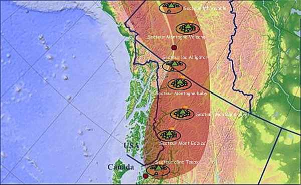


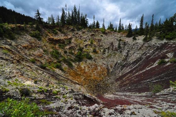


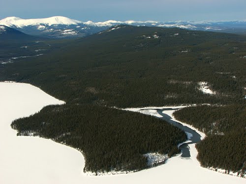


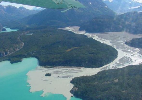


Megacrysts, crystals or grains that are considerably larger than the encircling matrix, are commonly found in lava flows throughout the Northern Cordilleran Volcanic Province. They consist of three different groups, including kaersutitic amphibole megacrysts, clinopyroxene megacrysts and plagioclase megacrysts. Megacrysts made of kaersutite are known to be found mainly at Llangorse Mountain in northern British Columbia. Black glassy clinopyroxene megacrysts are widespread throughout the Northern Cordilleran Volcanic Province, suggesting their creation is independent of lithosphere structure. In contrast, clear glassy plagioclase megacrysts are found largely at the southern end of the Northern Cordilleran Volcanic Province and largely within the boundaries of the Stikinia terrane. This suggests the plagioclase megacrysts have a source that is sensitive to the Earth''s lithosphere, including contamination or magma ponding. Megacrysts made of plagioclase and clinopyroxene regionally show significant evidence of reaction with the associated magma, including sieve-textured cores and random, resorbed and embayed outer margins wherever they are located. Lava tubes are widespread in the Northern Cordilleran Volcanic Province, and are typically basaltic in composition. At the Level Mountain Range, lava tubes reach diameters of 1 m to 2 m. These owed their origin to highly fluid lavas with temperatures of at least 1,200 ░C. In Nisga''a Memorial Lava Beds Provincial Park of northwestern British Columbia, lava tubes are present that were formed during one of Canada''s most recent volcanic eruptions in the 18th century. Lava Fork at the British Columbia-Alaska border is influenced by lava flows from a recent volcanic eruption that later collapsed into underlying lava tubes after the lava solidified. Sections of these collapsed lava tubes now form volcanic pits.Extensive areas of nearly flat-lying lava flows throughout the Northern Cordilleran Volcanic Province can cover areas of at least 100 km2 and are generally composed of highly-fluid basaltic lava. However, lava plains that pre-date the last glacial period have been eroded and overridden by glacial ice, affording a less distinctive form to these older landforms. For example, lava beds at least a million years old in central Yukon contain unconsolidated glacial deposits that were deposited when glacial ice rode on top of the lava flows comprising the lava beds.Subvolcanic intrusions in the Northern Cordilleran Volcanic Province are exposed in areas of high relief. This includes volcanic plugs found at the Mount Edziza volcanic complex, the Level Mountain Range, Hoodoo Mountain and in the Atlin and Maitland areas. Volcanic plugs in the Atlin and Maitland areas consist of olivine nephelinite and basanite magmas. Minor plugs made of gabbroic and granitic magma are associated with volcanic stratigraphy at the Mount Edziza volcanic complex and Level Mountain Range.
The bedrock of the Northern Cordilleran Volcanic Province consists of four large terranes, known as Stikinia, Cache Creek, Yukon-Tanana and Cassiar. Stikinia is a sequence of late Paleozoic and Mesozoic aged volcanic, plutonic and sedimentary rocks interpreted to have been created in an island arc environment that were later placed along a pre-existing continental margin. The Cache Creek Terrane is believed to have formed widely in a pre-existing oceanic basin. It comprises late Paleozoic to Mesozoic aged oceanic melange and abyssal peridotites intruded by younger granitic intrusions.[1] The Yukon-Tanana and Cassiar terranes consist of shifted sedimentary and metamorphic rocks that were derived from the North American continent.
The southern boundary of the Northern Cordilleran Volcanic Province is parallel with southwestern Stikinia and is characterized by separate volcanic vents and erosional remains of lavas south of the small community of Stewart. The southern boundary of the Northern Cordilleran Volcanic Province also parallels with a gap in modern volcanism and the supposed northern boundary of the Cascadia subduction zone, defined by the eastward extension of the northern edge of the subducting Juan de Fuca Plate.[1] These two zones divide the Northern Cordilleran Volcanic Province from modern volcanic zones further south, including the broad Chilcotin Plateau, the east-west trending Anahim Volcanic Belt and the monogenetic Wells Gray-Clearwater volcanic field in the British Columbia Interior. The eastern boundary of the Northern Cordilleran Volcanic Province is bounded by the Cassiar Terrane and is adjoined by a cluster of volcanic plugs in central British Columbia. The northern and western boundaries are adjoined by the Yukon-Tanana and Cache Creek terranes where there lies volcanics in eastern Alaska and weathered remains of lava flows just north and west of Dawson City in west-central Yukon.
The Tintina and Denali faults are the largest fault zones associated with the Northern Cordilleran Volcanic Province rift zone, with all volcanism occurring west of the Tintina Fault and east of the Denali Fault. Physiographically, the Tintina Fault forms the Northern Rocky Mountain Trench and the Tintina Trench, which is the northern extension of the Northern Rocky Mountain Trench. The fastest rates of strike-slip movement along the Tintina Fault likely occurred during two pulses in the Mid-Cretaceous and early Cenozoic periods, respectively, with the latter probably occurring during the Eocene epoch. Since the Cretaceous, the Tintina Fault has offset 450 km of the surface, although some evidence suggest as much as 1,200 km of offset. The end result is that the Northern Cordilleran Volcanic Province and the terrains of which the volcanic province occupies have moved northwards. In the context of plate tectonics, strip-slip movement of the Tintina Fault is also related to strike-slip movement along the San Andreas Fault and other extensional or strike-slip fault systems of western North America.
To the west, the Denali Fault is the source of minor earthquakes that extend along the length of the fault. In contrast to the Tintina Fault, strike-slip movement along the Denali Fault has offset at least 370 km (230 mi) of the surface. The fault separates mountains of the Insular Belt from mountains east of the fault. Tectonic events in the Insular Belt are also related to movement along the Denali Fault. http://en.wikipedia.org/wiki/Northern_Cordilleran_Volcanic_Province
The volcanic history of the Northern Cordilleran Volcanic Province presents a record of volcanic activity in northwestern British Columbia, central Yukon and the U.S. state of easternmost Alaska. The volcanic activity lies in the northern part of the Western Cordillera of the Pacific Northwest region of North America. Extensional cracking of the North American Plate in this part of North America has existed for millions of years. Continuation of this continental rifting has fed scores of volcanoes throughout the Northern Cordilleran Volcanic Province over at least the past 20 MY (see Geology of the Pacific Northwest-http://en.wikipedia.org/wiki/Geology_of_the_Pacific_Northwest) and occasionally continued into geologically recent times.
Eruptive activity in the Northern Cordilleran Volcanic Province throughout its 20 MY history has been mainly the production of alkaline lavas, including alkaline basalts. A range of alkaline rock types not commonly found in the Western Cordillera are regionally widespread in the Northern Cordilleran Volcanic Province. These include nephelinite, basanite and peralkaline phonolite, trachyte and comendite lavas. The trachyte and comendite lavas are understood to have been created by fractionation of mainly alkali basalt magma in crustal reservoirs. An area of continental rifting, such as the Northern Cordilleran Volcanic Province, would aid the formation of high-level reservoirs of capable size and thermal activity to maintain long-lived fractionation.
In the past 15 MY, at least four large volcanoes have formed their way through dense igneous and metamorphic composed bedrock of this part of North America (Hoodoo Mountain, the Mount Edziza volcanic complex, the Level Mountain Range and Heart Peaks). Most notable of these is the 7.5 MY Mount Edziza volcanic complex, which has had more than 20 eruptions in the past 10 KA. The only activity present in the Northern Cordilleran Volcanic Province has been occasional earthquakes and constant boiling of hot springs. However, a high potential exists for renewed eruptive activity that could threaten life and property in the volcanic zone
More than 100 eruptions have occurred in the past 20 MY with a broad range of eruptive styles. These volcanic processes have created a range of different volcanic landforms, including stratovolcanoes, shield volcanoes, lava domes and cinder cones, along with a few isolated examples of rarer volcanic forms such as tuyas. Large persistent volcanoes of the Northern Cordilleran Volcanic Province can remain dormant for hundreds or thousands of years between eruptions and therefore the greatest risk caused by volcanic activity is not always readily apparent. Volcanics older than 14 MY are mainly found in the northern portion of the volcanic province while volcanics ranging from nine to four million years old exist only in the middle of the volcanic province. At least three types of volcanic zones are present in the Northern Cordilleran Volcanic Province, including large persistent lava plateaus like those found at the Mount Edziza volcanic complex, polygenetic volcanoes such as Hoodoo Mountain and monogenetic volcanoes like the basaltic cinder cones found throughout the volcanic province. When Northern Cordilleran volcanoes do erupt, pyroclastic flows, lava flows and landslides can devastate areas 10 km away and mudflows of volcanic ash and debris can inundate valleys 10 km downstream. Falling ash from explosive eruptions can disrupt human activities hundreds of kilometres downwind, and drifting clouds of fine volcanic ash can cause severe damage to jet aircraft even hundreds of kilometres away. Volcanic deposits in the Northern Cordilleran Volcanic Province include lava flows, welded and unwelded pyroclastic deposits, hydroclastic deposits and other ice-contact volcanic deposits. The variety of different volcanic deposits is partly due to changes in eruption characteristics from mainly subaerial eruptions to broadly subglacial eruptions throughout the history of the Northern Cordilleran Volcanic Province
There is evidence of a decline in volcanic activity over the past few million years. This decline in volcanic activity can be grouped into two phases. From eight to four million years ago, volcanism rates were higher than they are at present. Magma production during this volcanic phase was most active from seven to five million years ago and was related to a period of rifting along the Pacific and North American Plate boundary. Between four and three million years ago in the Pliocene epoch, a pause in volcanic activity began to happen. The most recent magmatic phase ranging from two million years ago to present resulted from nearby areas of rifting during a period of compression between the Pacific and North American plates. Volcanism rates during this volcanic phase was most active from two to one million years ago with the construction of 25 volcanic zones then decreased one million years ago with the construction of 11 volcanic zones. To date, the most recent volcanic phase has produced 100 km3 of volcanic material whereas the first phase produced 250 km3 of volcanic material. Even though the rate in volcanism throughout the Northern Cordilleran Volcanic Province has changed considerably, there is no correlation between the rate in magma production and the number of active volcanoes during any interval of time. However, geologists are aware the temporal volcanic patterns known for the Northern Cordilleran Volcanic Province should be looked at carefully because volcanics that pre-date the last glacial period have been eroded by glacial ice and many of the volcanics have not been directly dated or have not been dated in significant detail to identify more individual temporal patterns. Lava fountains can occur in the Northern Cordilleran Volcanic Province roughly every 100 years.
Large basaltic shield volcanoes throughout the central Northern Cordilleran Volcanic Province form large lava plateaus and are the largest volcanoes of the volcanic zone. These extensive volcanoes are generally larger and more long-lived than volcanoes of adjacent volcanic zones, including the stratovolcanoes of the Cascade and Aleutian arcs. Mount Shasta, the largest stratovolcano in the Cascade Arc and Mount Veniaminof, one of the largest and most active volcanoes in the Aleutian Arc, have volumes of at least 350 km3, less than half of that of the Level Mountain and Edziza shield complexes. The massive Level Mountain Range shield, occupying an area of 1,800 km2 and a volume of more than 860 km3, is the most voluminous and most long-lived volcano of the Northern Cordilleran Volcanic Province. Further south, the Mount Edziza volcanic complex resides as the seconed most voluminous volcano with an area of 1,000 km2 and a volume of 670 km3. Just west of the Level Mountain Range lies Heart Peaks, the third most voluminous volcano of the Northern Cordilleran Volcanic Province with an area of 275 km2. However, remains of a shield volcano that once covered an area of more than 900 km2 are present in the western Cassiar Mountains as Maitland Volcano.- http://en.wikipedia.org/wiki/Volcanic_history_of_the_Northern_Cordilleran_Volcanic_Province
The two most recent were lava flow eruptions at Tseax Cone in the 18th century and at The Volcano in 1904. Reports of an eruption 80 km (50 mi) south of Gladys Lake in northern British Columbia were made by placer miners at the end of the 19th century, but no evidence for this eruption has been found, leading researchers to speculate the eruption as uncertain.
More Miocene age volcanics of 27.5 ▒ 4.3 and 16.2 ▒ 2 MY are present at the Anderson and Moose bays of Atlin Lake in northern British Columbia that represent remnants of columnar-jointed basalt lava flows. This indicates these volcanics are older than the Edziza and Level Mountain Range shields and they might represent the oldest volcanic events in the Northern Cordilleran Volcanic Province. However, their distinctive chemical characteristics and apparent large age differences compared to other volcanics in the Atlin area could also indicate that these columnar-jointed basalt lava flows are not part of the Northern Cordilleran Volcanic Province assemblage.
On the south side of the Khutzeymateen Inlet north of Prince Rupert, thick basaltic Plinian eruption tephra deposits are recognized at Crow Lagoon.These volcanics originated from a volcanic vent that remains unidenti
next
Volcanoes of Canada (21 volcanoes)
Volcanic history of the Northern Cordilleran Volcanic Province
Northern_Cordilleran Volcanic Province
Stikine Volcanic Belt