 | Wells Gray-Clearwater volcanic field and Watts Point volcanic centre |
|
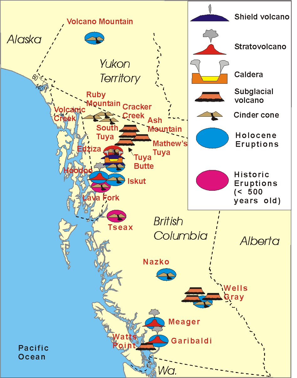
The Watts Point volcanic centre, Britannia Range (North Shore Mountains), 90-130 KA, is a small outcrop of Pleistocene age volcanic rock at Watts Point. It is the southernmost volcanic zone in the Squamish volcanic field and of the Garibaldi segment of the Cascade Volcanic Arc. The latest research indicates that it is most likely a subglacial mound. It comprises a continuous mass of sparsely porphyritic highly jointed dacitic lava overlying the mid-Cretaceous Coast Plutonic Complex and overlain locally by clay and of glacial till. The volcanic outcrop at Watts Point extends from below the present sea level up the side of a steep slope over 240 metres The outcrop is less than 1 km long, with an area of about 0.4 km2 and an eruptive volume of roughly 0.02 km3. The Squamish volcanic field (lava flows, dikes, subglacial volcanoes), 510 m, is a small north-south trending volcanic field. It extends for only about 3 km from the eastern side of Howe Sound northeast of Britannia Beach to the heavily forested slope on the western side of the Squamish River mouth. It forms the southernmost end of the Garibaldi Volcanic Belt, the Canadian portion of the Cascade Volcanic Arc. Its volcanoes are relatively minor to the more voluminous stratovolcanoes found throughout the Garibaldi Belt and are composed of dacite and lesser basaltic andesite. Volcanism in the Squamish field has constructed at least two volcanic zones known as the Watts Point volcanic centre and Monmouth Creek complex. The most recent eruptive activity at these volcanoes is likely Pleistocene in age and are both likely products of glaciovolcanism during the last glacial period.http://en.wikipedia.org/wiki/Watts_Point_volcanic_centre http://en.wikipedia.org/wiki/Squamish_volcanic_field |
http://volcano.oregonstate.edu/vwdocs/volc_images/north_america/canada/Final-WP.html |
|
Pacific Cordillera, Columbia Mountains-http://en.wikipedia.org/wiki/Columbia_Mountains |
Cariboo Mountains -http://en.wikipedia.org/wiki/Cariboo_Mountains |
Quesnel Highland-http://en.wikipedia.org/wiki/Quesnel_Highland |
Shuswap Highland-http://en.wikipedia.org/wiki/Shuswap_Highland |
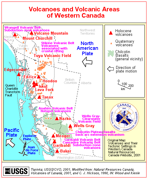
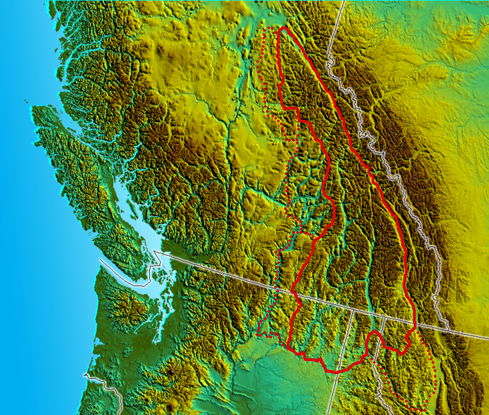
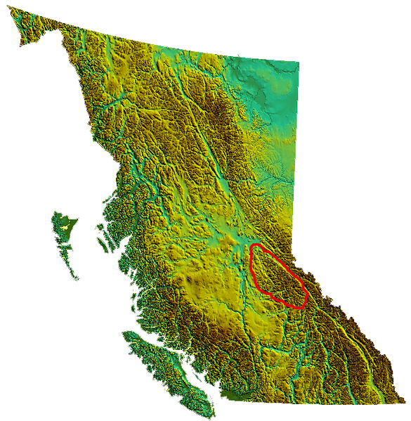
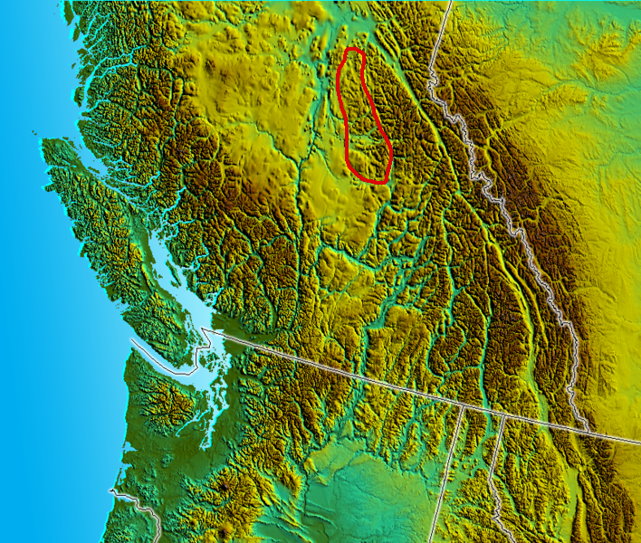
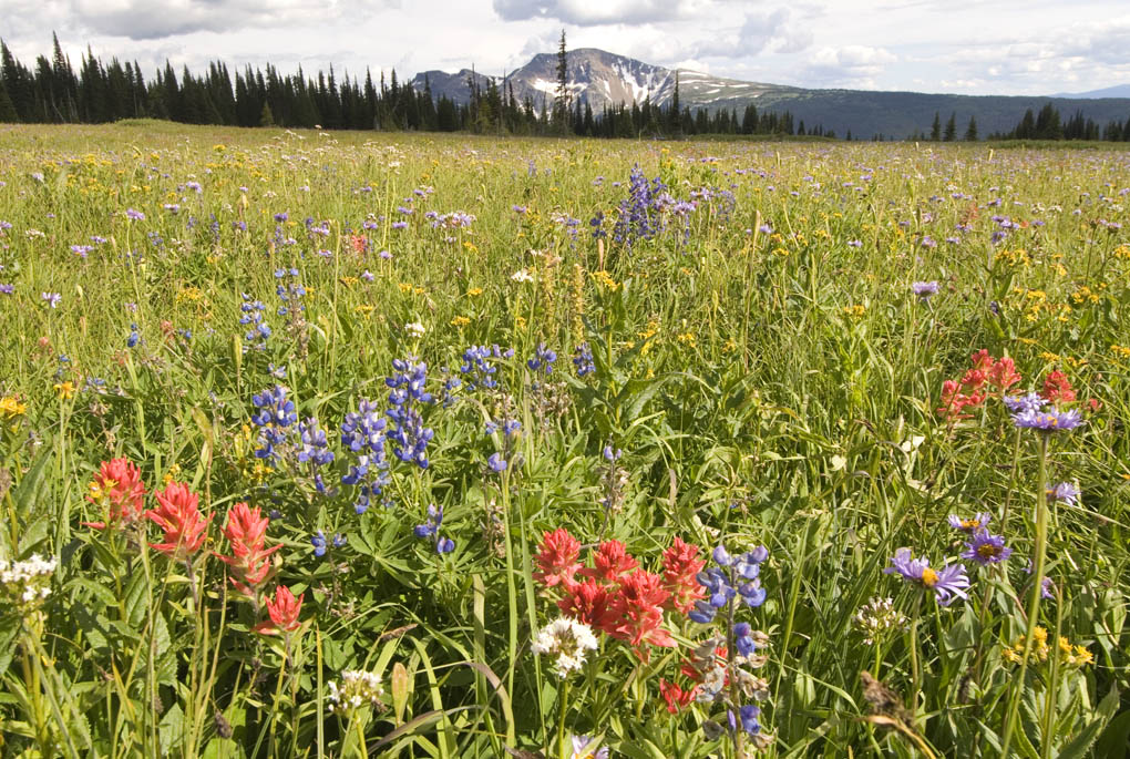
The Wells Gray - Clearwater Volcanic Field is a tight cluster of basaltic volcanoes, and includes the Quesnel Cone Group. The origin of this volcanism is not yet clear, but appears to be a result of local crustal thinning. Many of these eruptions occurred during periods of glaciation, so the eruptions interacted with the ice sheets in complex ways, forming distinctive volcanic forms. A number of these eruptions have occurred in the last 10,000 years. The volcanoes included in this field are Pyramid Mountain and Kostal Cone.The Wells Gray volcanic field, in east-central British Columbia, is made up of numerous small basaltic volcanoes and cinder cones such as Kostal (pictured above), Spanish, Fourmill cones. Individual volcanoes have been active for at least the last 3 million years during which time the region was covered by thick glacial ice at least three times. In addition to subaerial lava flows and cinder cones, several different types of subglacial lava deposits occur in the Wells Gray area. Many of the volcanoes in the Wells Gray area are now protected as part of a provincial park. Notable vents : Quesnel Lake 1,292, cinder conePleistocene, Kostal Cone 1,440Cinder cone Holocene, Pillow Creek 1,829 subglacial volcano, Pleistocene, Gage Hill1,090 tuya Pleistocene, Dragon Cone1,850Cinder coneHolocene, Flourmill Cone1,495Cinder coneHolocene, Pointed Stick Cone1,820Cinder coneHolocene, Spanish Lake Centre 1770Cinder coneHolocene, Spanish Bonk 1,770 m Volcanic neck Pleistocene, Ray Mountain 2,050 m Subglacial mound Pleistocene, Spanish Mump 1,800 m Subglacial mound Pleistocene, Jack''''s Jump 1,895m Subglacial volcano Pleistocene, Hyalo Ridge 2,012 m Tuya Pleistocene, McLeod Hill 1,250 m Tuya Pleistocene, Mosquito Mound 1,065m Tuya Pleistocene, Buck Hill 1,585m Cinder cone Pleistocene, Ida Ridge 1,981m Cinder cone Pleistocene, Fiftytwo Ridge 2,015 m Subglacial volcano Pleistocene, Flatiron 730 m Volcanic outcrop Pleistocene, White Horse Bluff 775m Subaqueous volcano Pleistocene, Pyramid Mountain 1,095 m Subglacial volcano Pleistocene -http://en.wikipedia.org/wiki/Wells_Gray-Clearwater_volcanic_field. |
Wells Gray Clearwater volcanic field - http://www.mountain-forecast.com/peaks/Wells-Gray-Clearwater-volcanic-field. The Wells Gray-Clearwater volcanic field, 2100m, Pliocene-to-Holocene, last eruption 1550?, also called the Clearwater Cone Group, is a potentially active monogenetic volcanic field., a volcanic field of small, scattered volcanic vents, containing numerous monogenetic volcanoes, are noted for having only one short eruptive event at each volcano. Monogenetic fields occur only where the magma supply to the volcano is low or where vents are not close enough or large enough to develop plumbing systems for continuous feeding of magma. Monogenetic volcanic fields can provide snapshots of the underlying region beneath the surface, and may be useful in studying the generation of magma and the composition of the mantle since the single eruption produced would match that of the chamber from which it erupted. It is situated in the Cariboo Mountains of the Columbia Mountains and on the Quesnel and Shuswap Highlands. As a monogenetic volcanic field, it is a place with numerous small basaltic volcanoes and extensive lava flows. Most of the Wells Gray-Clearwater volcanic field is encompassed within a large wilderness park called Wells Gray Provincial Park. This park was established in 1939 to protect Helmcken Falls and the unique features of the Clearwater River drainage basin, including this volcanic field. Five roads enter the park and provide views of some of the field''s volcanic features.Short hikes lead to several other volcanic features, but some areas are accessible only by aircraft - http://en.wikipedia.org/wiki/Wells_Gray-Clearwater_volcanic_field. The Wells Gray-Clearwater cinder cones are early Pleistocene-to-Holocene age. Pleistocene deposits include plateau-capping lava flows, subglacial mounds and tuyas, and hyaloclastites. Buck Hill Cone was erupted during the latest Pleistocene during the waning stages of the Fraser glaciation. Holocene eruptions took place in the Spanish Creek, Ray Lake and Kostal Lake areas, forming cinder cones and producing lava flows that traveled up to 14 km. A lava flow from Dragon cone is radiocarbon dated at about 7600 years ago, and flows from Flourmill, Kostal, and Spanish Lake Cones rest on glaciated bedrock without an intervening paleosol, suggesting an early Holocene age. Typical eruption style: Explosive.Wells Gray-Clearwater volcano eruptions: 1150 (Kostal Cone), 5650 BC (Dragon Cone) |
We had an exciting day at economic development today as we toured the new owners of Lava Works around Quesnel. Lava Works will be utilizing the lava rock in the Nazko Cone to sell locally, provincially and internationally. |
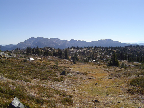
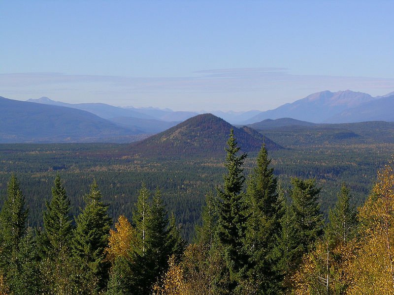
Wavy Range, Wells Gray Provincial Park |
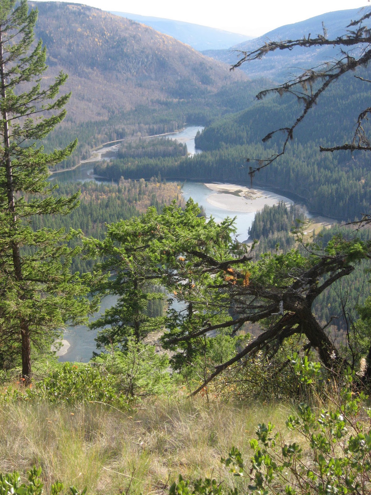
View of McDougall Lake from Kostal cone (looking NE) |
Clearwater Valley -http://en.wikipedia.org/wiki/Wells_Gray-Clearwater_volcanic_field |
Clearwater River |
Wells Gray Provincial Park |
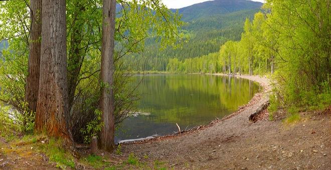
Clearwater Lake, a lava dammed lake in the Wells Gray-Clearwater volcanic field - http://en.wikipedia.org/wiki/Clearwater_Lake_(British_Columbia) |
Mahood lake - http://en.wikipedia.org/wiki/Mahood_Lake |
Wells Gray Provincial Park |
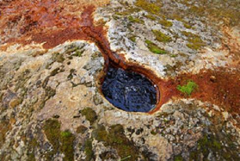
Ray Mineral Spring Helmcken Falls Lodge. McLeod Hill, 1284m is a tuya, located 41 km north of Clearwater in the Wells Gray-Clearwater volcanic field in Wells Gray Provincial Park.McLeod Hill last erupted about 12 KA when the Murtle Plateau was still covered by ice. However, it may also be the oldest volcano in the Clearwater Valley, dating to about 200 KA when it was the source of the vast quantity of lava that comprises the Murtle Plateau. Viewed from Green Mountain, it looks like a low rounded dome, quite different from nearby Pyramid Mountain. http://en.wikipedia.org/wiki/McLeod_Hill |
Canim Falls and lava flows, cut into a lava plateau associated with the Wells Gray-Clearwater volcanic field which forms the canyon walls of the Canim River.-http://en.wikipedia.org/wiki/Canim_Falls |
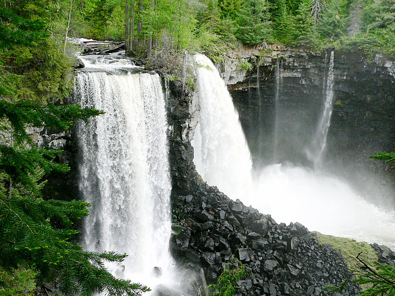
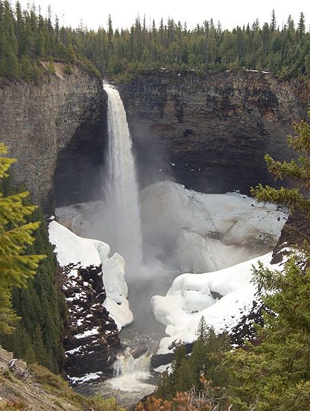
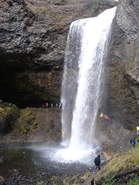
Helmcken Falls and the deposits of volcanic rock - http://en.wikipedia.org/wiki/Helmcken_Falls |
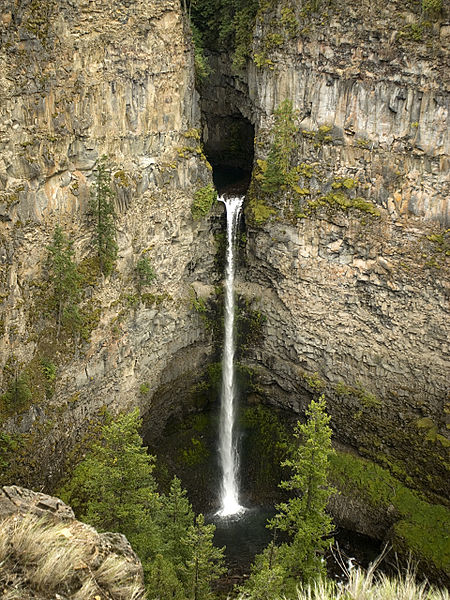
Moul Falls - http://en.wikipedia.org/wiki/Moul_Falls |
Spahats Falls and deposits of volcanic rock. Like the larger Helmcken Falls, Spahats Falls owes its formation to deposits of volcanic rock in the Wells Gray-Clearwater volcanic field. Starting about 300 KA, numerous eruptions from Trophy Mountain poured into the Clearwater River Valley and filled it layer upon layer to a depth of over 300 m. Eruptions in various parts of this valley continued sporadically for 200KY, producing some 25 km3 of lava and creating Wells Gray Park features such as Murtle Plateau. After the eruptions, the Clearwater River re-established its course and began cutting into the lava. During the Pleistocene, gigantic icefields scraped away at the lava. When all this ice melted, the floods completed the carving of Granite Canyon on the Clearwater River and the side canyon where Spahats Falls occurs - http://en.wikipedia.org/wiki/Spahats_Falls |
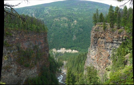
Spahats Creek Canyon - http://gigapan.com/gigapans?tags=wells_gray |
Dragon Cone 1830m, Cariboo Mountains, holocene, last eruption 7560 BP, is a monogenetic cinder cone located in Wells Gray Provincial Park. It is the source of a 15 km long lava flow, called Dragon''s Tongue. This lava covered the floor of narrow Falls Creek Valley and terminated at the Clearwater River, damming it to a height of 3 m and raising the level of existing Clearwater Lake upstream. Geologists have recovered some peat buried by the lava and radiocarbon dating produced an age of 7560 years plus or minus 100 years. Flows from nearby Flourmill Cone, Kostal Cone and Spanish Lake Cones rest on glaciated bedrock without an intervening paleosol, suggesting an early Holocene age - http://en.wikipedia.org/wiki/Dragon_Cone. |
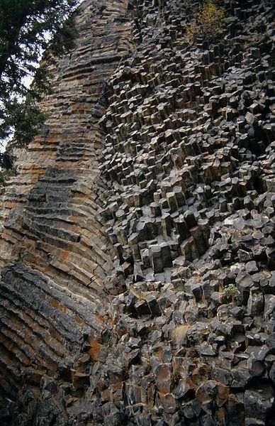
Columnar basalt of the Dragon''s Tongue lava flow |
The Flourmill Volcanoes, Quesnel Highland, 1770m, Holocene, also known as The Flourmills, are a small volcano range near the west boundary of Wells Gray Provincial Park. Located north of Mahood Lake and west of the Clearwater River, they form part of the Wells Gray-Clearwater volcanic field. Two cinder cones form the range, namely Flourmill Cone and Spanish Lake Centre. During volcanic activity 3000 years ago, the craters of both cones were breached, so lava flowed out the south side into the pass between Spanish Creek and Flourmill Creek. The lava then dammed Spanish Creek, creating Spanish Lake, and engulfed about 10 km of the Spanish valley to the southwest. This lava flow averages 10 m thick. http://en.wikipedia.org/wiki/Flourmill_Cone |
Kostal Cone, 1440 m, Cariboo Mountains, also called Kostal Volcano, is a young Holocene cinder cone in Wells Gray Provincial Park , last eruption 1550 years ago. It rises from the northeast shore of Kostal Lake in the Cariboo Mountains. Kostal Cone is one of the lowest volcanoes in the Wells Gray-Clearwater volcanic field. There has been activity at this site as recently as 7,600 years ago, though more likely less than 1,000 years ago. Kostal Cone is too young for the commonly used potassium-argon dating technique (usable on specimens over 100,000 years old), and no charred organic material for radiocarbon dating has been found. However, the uneroded structure of the cone with the existence of trees on its flanks and summit have it an area for dendrochronology studies, which reveals the growth of tree-ring patterns. Tree-growth data has revealed an age of 400 years for Kostal Cone, making it the youngest volcano in the Wells Gray-Clearwater volcanic field and one of the youngest volcanoes in Canada.Kostal Cone is made of fragmented and solidified lava called cinder and its summit contains a bowl-shaped crater. Kostal''s cinders were ejected by lava fountain eruptions and accumulated around the volcano''s vent in the shape of a cone when they fell back around its surroundings. Lava flows from Kostal''s 400 BP eruption are basaltic in composition and forms a lava bed. It is an example of volcanic activity that has occurred in the Wells Gray-Clearwater volcanic field since the last glacial period; others include the Dragon''s Tongue lava flow from Dragon Cone just north of Kostal Cone and the Flourmill Volcanoes north of Mahood Lake. http://en.wikipedia.org/wiki/Kostal_Cone |
The Rock Roses, White Horse Bluff, are a unique collection of small columns. Unlike most formations of columnar basalt which are vertical like organ pipes, these are horizontal and the ends of the columns point out, rather like the tiles on a shower wall. About 50 m (164 ft) further west, the columns suddenly change direction and resemble the wall of a log house. The Rock Roses were formed by the molten lava in the dyke contacting the cooler and older adjoining rocks - http://en.wikipedia.org/wiki/White_Horse_Bluff |
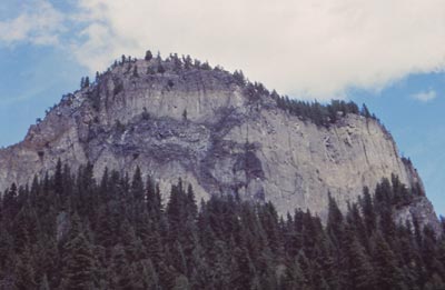
White Horse Bluff, 775 m, Shuswap Highland , Pleistocene, last eruption 500 KA, is a subaqueous volcano in Wells Gray Provincial Park. subaqueous volcano is a volcano formed beneath water (similar to submarine volcanoes) and never builds above lake level. They are commonly in the form of gently sloping tuff cones, although they can sometimes have an unvolcano-like form. About half a million years ago, the Clearwater Valley was filled by a lake backed up by a lava dam near Hemp Creek. White Horse Bluff is a complex volcanic formation that erupted underneath this lake. The outer lava cooled rapidly as it encountered the lake, then water percolated into the still-molten interior of the lava, initiating violent explosions. As the pile of debris grew, dykes fed more lava to the bluff. Subsequent erosion by glaciers and meltwater has exposed these dykes which give the impression that a giant hand has plastered gobs of lava onto the face -. http://en.wikipedia.org/wiki/White_Horse_Bluff |
White Horse Bluff |
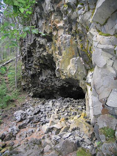
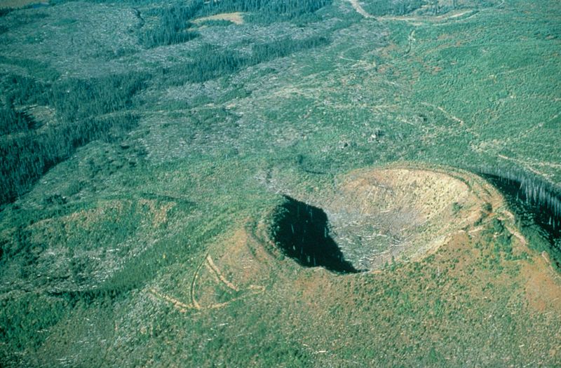
Pyramid Mountain, a subglacial mound.A subglacial mound (SUGM) is a type of subglacial volcano. This type of volcano forms when lava erupts beneath a thick glacier or ice sheet. The magma forming these volcanoes was not hot enough to melt a vertical pipe right through the overlying glacial ice, instead forming hyaloclastite and pillow lava deep beneath the glacial ice field. Once the glaciers had retreated, the subglacial volcano would be revealed, with a unique shape as a result of their confinement within glacial ice. They are somewhat rare worldwide, being confined to regions which were formerly covered by continental ice sheets and also had active volcanism during the same period.Subglacial mounds can be mistaken for cinder cones because they may have a similar shape. An example of this confusion is Pyramid Mountain, 1,094 m, Pleistocene, last eruption 11Ka. It was once mistaken for a cinder cone and is now known to have erupted underneath about 1,600 m of glacial ice. The volcano erupted vigorously and cooled rapidly when the hot lava contacted the surrounding ice and melted it, creating an envelope of water around the rising volcano. The result was a cement-like surface with smoothed cobbles of granite, schist, phyllite and other non-volcanic pebbles which were carried by the ice from many kilometers distant. As a result of this type of eruption, Pyramid Mountain has no crater and no lava flows stretching away from its base. The secondary cone to the east (best seen from Clearwater Valley Road near Hemp Creek) was not formed by a separate eruption, but was simply a slump when the ice melted away from Pyramid, releasing the pressure against its slopes - http://en.wikipedia.org/wiki/Pyramid_Mountain_(volcano) |
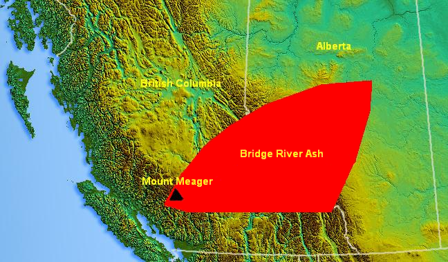
NCVP. Bridge River Cones. NASA / NASA |
The Bridge River Cones Belt Ash is a large geologically recent volcanic ash deposit that spans from southwestern British Columbia to central Alberta, Canada. The ash consists of dust-sized shards ellipsoidal fragments of pumice. It overlaps the Mount St. Helens Yn Ash and the Mazama Ash which were erupted from Mount St. Helens and Mount Mazama about 3,400 and 6,800 years ago.Even though the name Bridge River Ash is consistent with the Bridge River Cones, the ash did not originate from these volcanoes. The Bridge River Ash was created when Mount Meager erupted about 2,350 years ago as prevailing winds carried the ash east during eruption. This is the most recent major eruption in Canada - http://en.wikipedia.org/wiki/Bridge_River_Ash |


The Wells Gray-Clearwater volcanic field, Shuswap Highland/Cariboo Mountains, Quesnel Highland/Shuswap Highland, also called the Clearwater Cone Group, age of rock Pliocene to Holocene, last eruption 1550, a potentially active monogenetic volcanic field in east-central British Columbia. It is situated in the Cariboo Mountains of the Columbia Mountains and on the Quesnel and Shuswap Highlands. I is a place with numerous small basaltic volcanoes and extensive lava flows. Wells Gray Provincial Park established in 1939 to protect Helmcken Falls and the unique features of the Clearwater River drainage basin, including this volcanic field.
Pleistocene epoch
Clearwater Lake, a lava dammed lake in the Wells Gray-Clearwater volcanic field
Based on radiocarbon and potassium-argon dating, volcanic activity in the Wells Gray-Clearwater volcanic field began in the early Pleistocene epoch, creating valley-filling and plateau-capping lava flows that have a total volume of approximately 25 km3. The emplacement of these lava flows spanned at least three periods of glaciation, evidence for which is preserved in the form of tuyas, ice-ponded valley deposits, and subglacial mounds.[The few tuyas in the region, such as Gage Hill, Hyalo Ridge, McLeod Hill and Mosquito Mound, were formed when magma intruded into and melted a vertical pipe in the overlying glacial ice. The partially molten mass cooled as a large block, with gravity flattening its upper surface. The glacial erosion of the tuyas suggests they erupted during the early Pleistocene epoch.[
At least one explosive subaqueous volcano formed during the Pleistocene epoch. This subaqueous volcano, known as White Horse Bluff, is thought to have formed in three phases. Its first phase of activity was involved with water, possibly dammed by glacial ice which filled the Clearwater River valley. The volcano heated glacial water then flooded down the volcano''s vent, creating violent steam explosions and broken lava fragments. Once the steam explosions had subsided, the broken lava fragments settled back into the glacial water, creating the unvolcano-like form of White Horse Bluff which is mostly made of fragmental volcanic glass called hyaloclastite. The volcano ceased erupting soon after breeching the surface of the glacial water.
Other volcanic events elsewhere interacted with groundwater and magma creating numerous pit craters. Many of these pit craters have been filled with water creating several crater lakes. In some places glacial till and fluval sands and gravels are maintained under the several lava flows that form the volcanic field. Paleosols are found, but are rare. Glaciation has left a thick blanket of till over nearly all of the volcanic deposits and therefore outcrop is largely limited to cliffforming exposures in several valleys.
Holocene epoch
At the end of the last ice age approximately 10 KA, massive floods from the melting glacial ice carved deep canyons into the underlying plateau-capping lava flows. Most of these canyons contain rivers such as the Murtle and Clearwater, and waterfalls such as Canim Falls, Moul Falls, Spahats Falls and the 141 m high Helmcken Falls. The faces of the basaltic lava flows and waterfalls remain vertical due to the nature of the basaltic lava flows. Basaltic lava shrinks as it cools and forms vertical columns of rock called columnar basalt. More recently, the southern end of the volcanic field has experienced continuous volcanic activity since the end of the last ice age. This volcanic activity occurred in three areas; Spanish Creek, Ray Lake and Kostal Lake which were followed by lava fountain eruptions creating cinder cones and lava flows.
Volcanism in the Spanish Creek and Ray Lake areas were synglacial but continued after the glacial ice had melted away. Two cinder cones, known as Flourmill Cone and Pointed Stick Cone, were created in the Spanish Creek area. Lava flows from the two cinder cones lie on glaciated bedrock without an intervening paleosol, indicating an early Holocene age.
Eruptions near Ray Lake built a cinder cone known as Dragon Cone and concluded with an approximately 16 km long ʻaa� lava flow that has been radiocarbon dated at about 7,600 years old. This lava flow, known as "Dragon''s Tongue", is at least 15 m thick at the proximal end, but thins to 3 m at the distal end, damming the southern end of Clearwater Lake. Tree molds are maintained within the lava flow at the lower end.
The latest volcanic eruption created a small tree-covered basaltic cinder cone at the east end of Kostal Lake called Kostal Cone perhaps as recently as 400 years ago, making it one of the youngest volcanoes in Canada based on tree-growth data.
The Wells Gray-Clearwater volcanic field began forming approximately 3,5MA and has grown steadily since then. The tectonic causes of the volcanism that have produced the Wells Gray-Clearwater volcanic field are not yet clear and are therefore a matter of ongoing research. It is approximately 250 km inland from the north-south trending Garibaldi Volcanic Belt and is along-strike from the Nootka Fault on the British Columbia Coast, which has been subducting under the North American Plate at the Cascadia subduction zone. The Wells Gray volcanics are mostly alkali olivine basalt, with some lava flows comprising mantle xenoliths. Basalts of the Wells Gray-Clearwater volcanic field have been considered to be the easternmost expression of the Anahim Volcanic Belt. However, its relationship is unknown because the age-location trend does not reach into the Wells Gray-Clearwater area, and the Wells Gray-Clearwater volcanic field is not along trend with the Anahim Volcanic Belt. The Wells Gray volcanics were thought to have formed by crustal thinning and the existence of crustal penetrating structures.
More recent studies by volcanologists associated with the Geological Survey of Canada have indicated that the subducted extension of the Nookta Fault may be the primary cause of the alkalic structure of the Wells Gray-Clearwater volcanic field. The volcanism might have been mostly generated by asthenospheric upwelling possibly by displacement along the transform fault. If the transform fault had a section of vertical tearing to contain potentially different dip angles between the Explorer and Juan de Fuca Plates, the subducted plate asthenosphere may possibly flow upward into the mantle wedge. Similarly, if the displacement had a section of extension, a horizontal slab window-like gap would have developed, again allowing a pathway for upwelling magma. In either case, the unsettled asthenosphere might have experienced low degrees of decompressional melting and interacted with North American lithosphere to yield within plate compositions.
The composition of some lava flows in the Wells Gray-Clearwater volcanic field is unusual because they include small, angular to rounded fragments of rock called nodules and crystals that come from the mantle. These green nodules are known as peridotites because they are mostly made of a magnesium iron silicate mineral called olivine. These lava flows also comprise large crystals of olivine, plagioclase, and pyroxene that crystallized deep within the Earth''s crust and mantle. The lavas and nodules they contain are similar to those erupted at Volcano Mountain in the Yukon. The nodules help volcanologists and other geoscientists to verify what the mantle beneath the volcanic field is like.
Holocene lava flows are more alkalic than the Pleistocene lava flows and comprise several xenoliths of chromium-spinel lherzolite, spinel clinopyroxenite, and rare ferroan websterite and spinel wehrlite. Xenoliths do not exist in the older lava flows. However, chemical evidence indicates that every lava flow was produced in a similar way by low degrees of piecemeal melting. The melts originally came from the upper mantle which, over time, was progressively depleted by every following melting event.
Current activity
The Wells Gray-Clearwater volcanic field is one of the 10 volcanic areas in Canada associated with recent seismic activity; the others are Castle Rock, Mount Edziza, Mount Cayley, Hoodoo Mountain, The Volcano, Crow Lagoon, Mount Meager, Mount Garibaldi and Nazko Cone. Seismic data suggests that these volcanoes still contain living magma plumbing systems, indicating possible future eruptive activity. Although the available data does not allow a clear conclusion, these observations are further indications that some of Canada''s volcanoes are potentially active, and that their associated hazards may be significant. Beneath areas of monogenetic cinder cone activity, such as the Wells Gray-Clearwater volcanic field, the seismicity appears to be more dispersed. In a few cases earthquakes are clustered in time and space, suggestive of volcanic earthquake swarms.
Lava eruptions
Because the Wells Gray-Clearwater volcanic field is in a remote location, danger from lava eruptions would be low to moderate. Magma with low levels of silica (as in basalt) commonly extend tens of kilometers from the volcano''s vent. The leading edges of basalt flows can travel as fast as 10 km per hour on steep slopes but they typically advance less than 1 km per hour on gentle slopes. But when basalt lava flows are confined within a channel or lava tube on a steep slope, the main body of the flow can reach velocities more than 30 km per hour. Based on past volcanic activity, the Wells Gray-Clearwater volcanic field has a long history of producing quiet lava fountaining-style eruptions. Such eruptions consist of ejection of incandescent cinder, lapilli and lava bombs to altitudes of tens to hundreds of metres. They are small to medium in volume, with sporadic violence. Since the region is mostly forested and lava flows are likely to travel long distances, it is possible lava eruptions could start large forest fires and some river valleys might be dammed.
Explosive eruptions
More violent eruptions are possible only in unique circumstances, such as an eruption into a lake. Any future eruption is most likely to affect only a limited area downslope from the volcano. Poisonous substances, such as volcanic gas, includes a variety of substances. These include gases trapped in cavities (vesicles) in volcanic rocks, dissolved or dissoclated gases in magma and lava, or gases emanating directly from lava or indirectly through ground water heated by volcanic action. The volcanic gases that pose the greatest potential hazard to people, animals, agriculture, and property are sulfur dioxide, carbon dioxide and hydrogen fluoride. Locally, sulfur dioxide gas can lead to acid rain and air pollution downwind from the volcano.
Knowledge at the Wells Gray-Clearwater volcanic field and other volcanic areas in British Columbia is not as established, but certain contributions are being done at least Mount Cayley.
The existing network of seismographs to monitor tectonic earthquakes has existed since 1975, although it remained small in population until 1985.[3] Apart from a few short-term seismic monitoring experiments by the Geological Survey of Canada, no volcano monitoring has been accomplished at the Wells Gray-Clearwater volcanic field or at other volcanoes in Canada at a level approaching that in other established countries with historically active volcanoes. Active or restless volcanoes are usually monitored using at least three seismographs all within approximately 15 km, and frequently within 5 km, for better sensitivity of detection and reduced location errors, particularly for earthquake depth. Such monitoring detects the risk of an eruption, offering a forecasting capability which is important to mitigating volcanic risk. Currently the Wells Gray-Clearwater volcanic field does not have a seismograph closer than 59 kim With increasing distance and declining numbers of seismographs used to indicate seismic activity, the prediction capability is reduced because earthquake location accuracy and depth decreases, and the network becomes not as accurate. However, at least one possible volcanic earthquake swarm has been noticed east of the Wells Gray-Clearwater volcanic field. The inaccurate earthquake locations in the Wells Gray-Clearwater volcanic field are a few kilometers, and in more isolated northern regions they are up to 10 km. The location magnitude level in the Wells Gray-Clearwater volcanic field is about magnitude 1 to 1.5, and elsewhere it is magnitude 1.5 to 2. At carefully monitored volcanoes both the located and noticed events are recorded and surveyed immediately to improve the understanding of a future eruption. Undetected events are not recorded or surveyed in British Columbia immediately, nor in an easy-to-access process.
In countries like Canada it is possible that small precursor earthquake swarms might go undetected, particularly if no events were observed; more significant events in larger swarms would be detected but only a minor subdivision of the swarm events would be complex to clarify them with confidence as volcanic in nature, or even associate them with an individual volcanic edifice.
http://en.wikipedia.org/wiki/Wells_Gray-Clearwater_volcanic_field
http://en.wikipedia.org/wiki/Tuya - canada
http://en.wikipedia.org/wiki/Coast_Plutonic_Complex