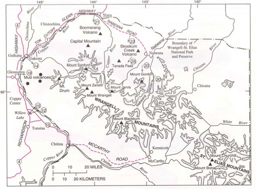
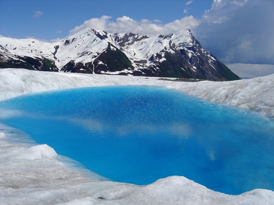
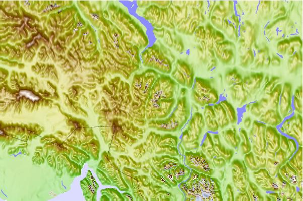
 | Wrangell Volcanic Field. Alaska Volcanoes |
An ultra prominent peak, or Ultra for short, is a mountain with a topographic prominence of 1,500 metres |
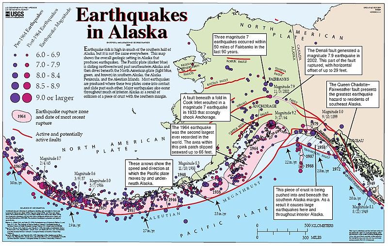
http://en.wikipedia.org/wiki/Fairweather_Fault |
|
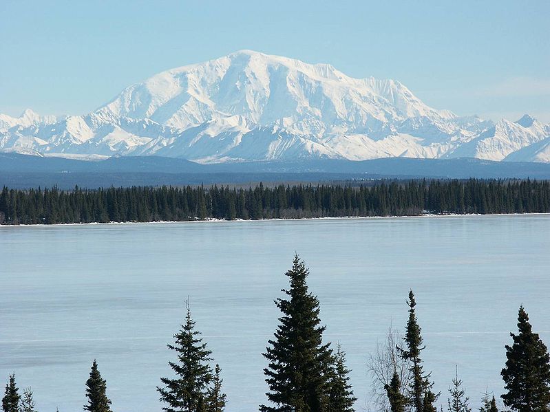
Mount Blackburn |
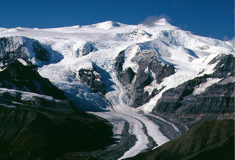
Mt. Blackburn-Willow Lake. 4,996 m.Wrangell Volcanic Belt. Mount Blackburn is the highest peak in the Wrangell Mountains of Alaska. The mountain is an old, eroded shield volcano, the second highest volcano in the United States behind Mount Bona and the fifth highest in North America. It is located in the heart of Wrangell ¢ St. Elias National Park, the largest national park in the country. Mount Blackburn is a large, dramatic peak, with great local relief and independence from higher peaks. Its west face drops over 3,350 m to the Kuskulana Glacier in less than 6 km. Its other faces drop 2,440¢3,050 m. The toe of the Kuskulana Glacier, less than 12 miles from the summit, lies at an elevation of 730 m, giving a rise of 4,270 m. While these figures speak to the peak''s relief, one measure of its independence is that it is the 50th most topographically prominent peak in the world. |
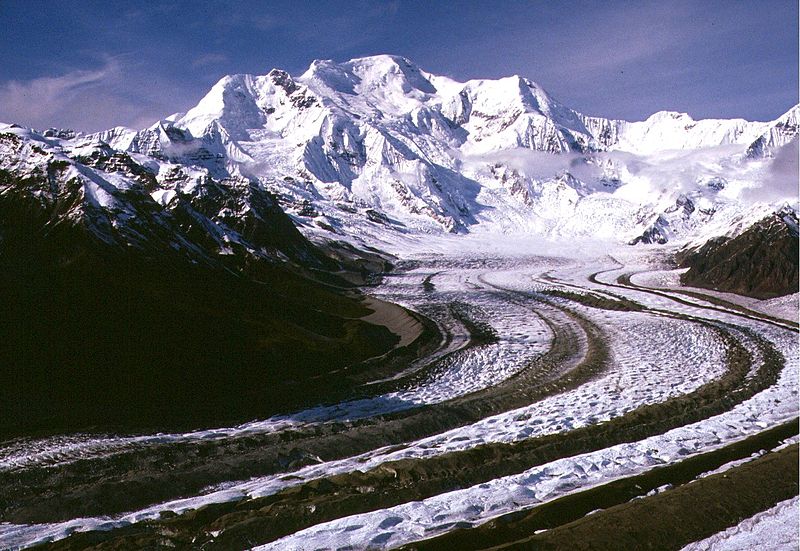
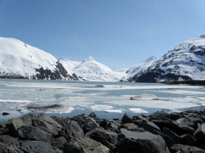
The Nabesna Glacier, with Mount Blackburn at right; Atna Peaks is the twin summit left of center and Parka Peak is the icy summit at left. Mt. Blackburn. Kennicott Glacier.nearby Kennecott Copper Mines, and forged a route up the heavily crevassed East Face to the East Peak, but did not traverse over to the West Peak. Keen went on to write a famous article for the Saturday Evening Post titled, ōFirst up Mount Blackburn.ö - http://en.wikipedia.org/wiki/Mount_Blackburn http://en.wikipedia.org/wiki/Kennecott,_Alaska |
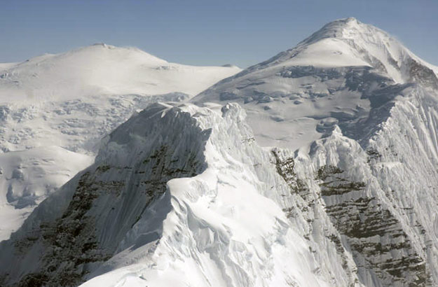
Parka Peak. Atna Peaks, 4,225 m, Eroded stratovolcano or shield volcano, is an eroded stratovolcano or shield volcano in the Wrangell Mountains of eastern Alaska. It is located in Wrangell-Saint Elias National Park about 10 km east of Mount Blackburn, the second highest volcano in the United States, and just south of the massive Nabesna Glacier. Because the mountain is almost entirely covered in glaciers, no geological studies have been done, but published references state and the geological map shows that the mountain is an old eroded volcanic edifice.The mountain''s main summit is 4,225 m, making it in Alaska. The second summit is located about 1 km to the east, reaching over 4,150 m, and another named summit, 4,048 m Parka Peak, is about 3 km further east across a glacier-covered saddle. The steep rocky south faces of these three peaks form part of the cirque of the Kennicott Glacier, which flows southeast over 32 km to just above the town of McCarthy - http://en.wikipedia.org/wiki/Atna_Peaks |
Mount Jarvis Mount, 4,091 m. Jarvis is an eroded shield volcano in the Wrangell Mountains of eastern Alaska, 1.7 ¢ 1.0 million years, last eruption dacite flow 10 MA. It is located in Wrangell-Saint Elias National Park about 16 km east of the summit of Mount Wrangell. The mountain sits at the northeastern edge of the massive ice-covered shield of Wrangell, rising nearly 1,500 m above it in a spectacular series of cliffs and icefalls.When seen from above, Mount Jarvis is distinctly dumbbell-shaped, with two prominent peaks connected by a narrower ridge. The mountain''s main summit is 4,091 m, making it one of numerous thirteeners in Alaska. The second summit is located about 5 km to the north-northwest, reaching 3,970 m with over 221 m of prominence above the connecting saddle, thus qualifying it as an independent peak on the list of thirteeners as well. The entire summit area including both peaks and the ridge is covered in glacial ice. The steep, rocky eastern and western faces of Mount Jarvis form headwalls above the cirques of the Jacksina Glacier and Copper Glacier, which flow northward out of the Wrangell Mountains. http://en.wikipedia.org/wiki/Mount_Jarvis |
Wrangell-St. Elias National Park and Preserve in southeast Alaska |
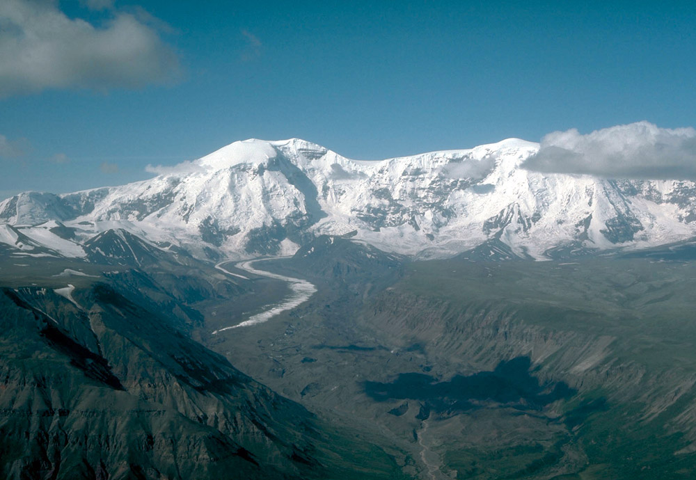
Mount Drum, 3,661 m, from the northwest.Mount Drum is a stratovolcano in the Wrangell Mountains of east-central Alaska in the United States. It is located at the extreme western end of the Wrangells, 18 miles (29 km) west-southwest of Mount Sanford and the same distance west-northwest of Mount Wrangell. It lies just inside the western boundary of Wrangell-Saint Elias National Park and Preserve, and is 25 miles (40 km) east of the Copper RiverStanding near the low valley of the Copper River, Mount Drum is notable for its large local relief. For example, its south face rises 6,000 feet (1,830 m) over the head of the Nadina Glacier in only 1.6 miles (2.6 km). Its west slopes rise 9,000 feet (2,743 m) over the tundra in only 10 miles (16 km), and 11,000 feet (3,353 m) over the Copper River in only 25 miles (40 km).[3] These numbers are comparable to better-known stratovolcanoes like Mount Rainier and Mount Shasta. However Mount Drum is somewhat overshadowed by its much higher neighbor Mount SanfordMount Drum was active between 650,000 and 240,000 years ago. Late in that period, various separate dacitic domes were formed in a rough circle around the current summit at a radius about 4 miles (6 km); one such dome is the current Snider Peak (8,250 ft/2,515 m) to the south of the main peak. After the constructive phaseparoxysmal explosive activity, probably from the central vent area, destroyed the south half of the stratovolcano and deposited ~7 km3 of hot and cold avalanche debris over an area >200 kmThe effects of this explosive phase can still be seen in the particularly steep south face of Mount Drum above the Nadina Glacier.Mount Drum is flanked on the west by a few small cones (less than 400 ft/122 m high), including Shrub and Klawasi. In historic times, the only volcanic activity in the vicinity of Drum has been mud and gas emitted from Shrub.[5] http://en.wikipedia.org/wiki/Mount_Drum |
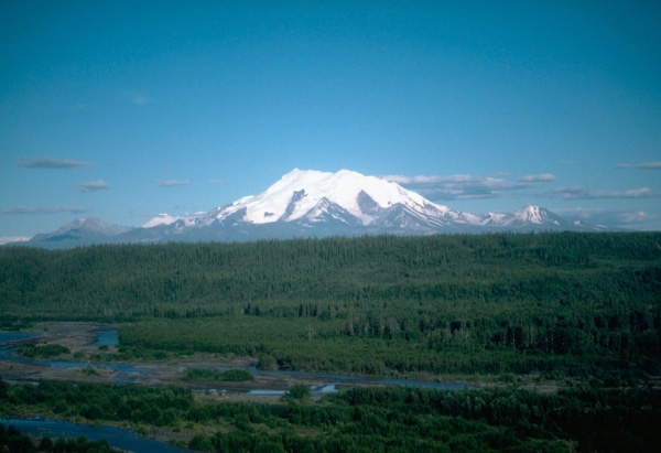
Mount Sanford is a shield volcano in the Wrangell Volcanic Field near the Copper River. It is the third highest volcano in the United States behind Mount Bona and Mount Blackburn. The south face of the volcano, at the head of the Sanford Glacier, rises 2,400 m in 1,600 m resulting in one of the steepest gradients in North America Mount Sanford is mainly composed of andesite, and is an ancient peak, being mostly Pleistocene, although some of the upper parts of the mountain may be Holocene. The mountain first began developing 900 KA, when it began growing on top of three smaller shield volcanoes that had coalesced. Two notable events in the mountain''s history include a large lava flow which traveled some 18 km to the north east of the peak, and another flow which erupted from a rift zone on the flank of the volcano some 320 KA. The second flow was basaltic in nature and marks the most recent activity of the volcano http://en.wikipedia.org/wiki/Mount_Sanford_(Alaska) |
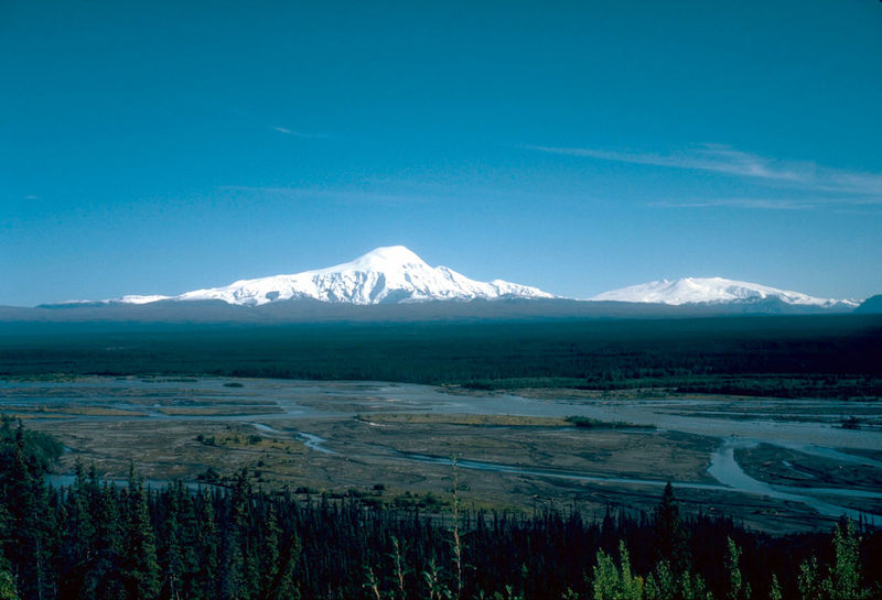
Mount Sanford (left), 4,949 m, and Mount Wrangell |
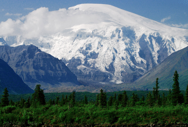
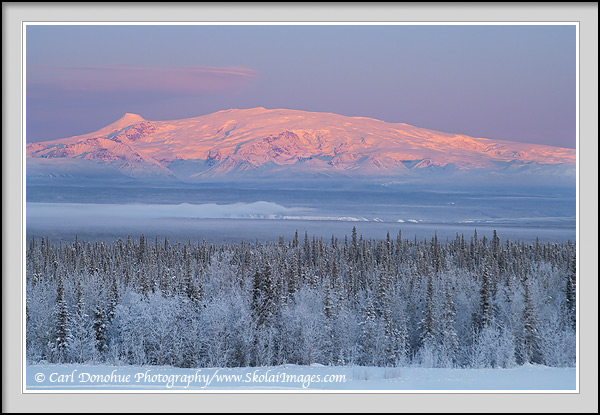
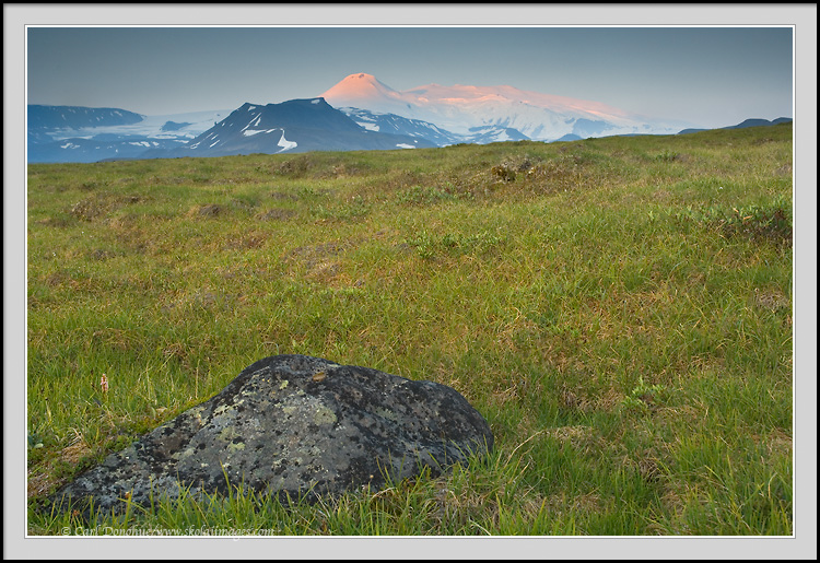
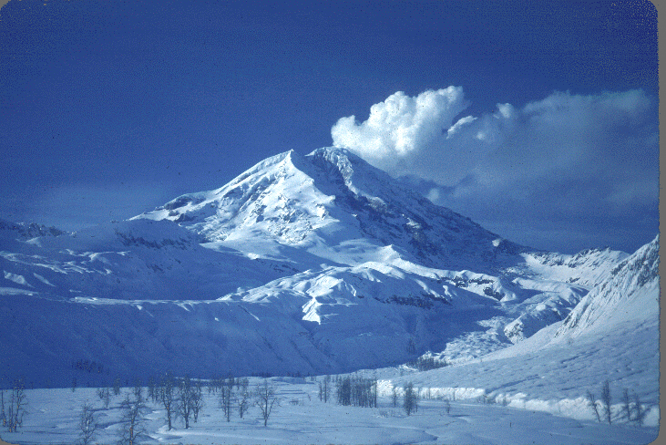
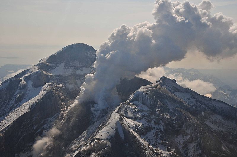
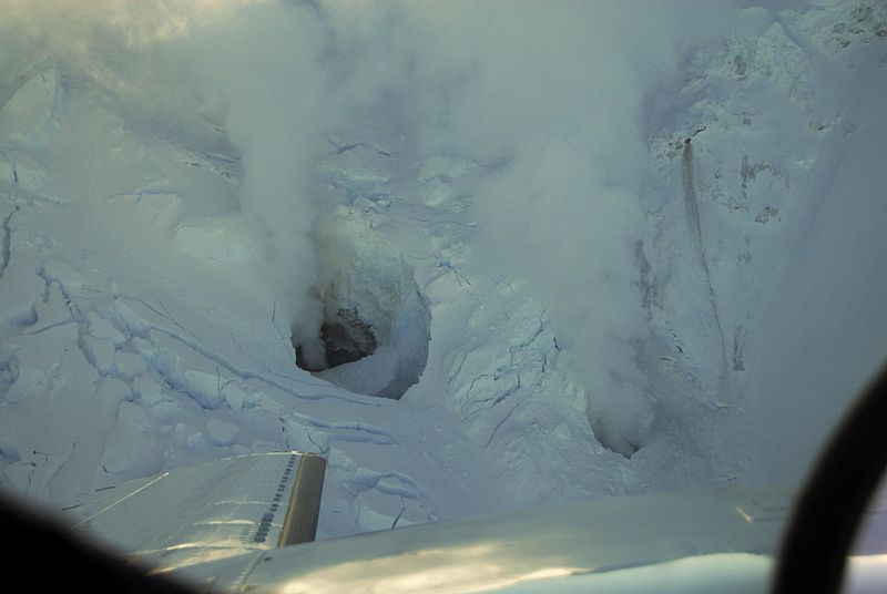
Mount Wrangell. 4,317 m. Mount Wrangell is a massive shield volcano located in Wrangell-St. Elias National Park and Preserve The shield rises over 3,700 m above the Copper River to its southwest. Its volume is over 920 km3, making it more than twice as massive as Mount Shasta in California, the largest stratovolcano by volume in the Cascades. It is part of the Wrangell volcanic field, which extends for more than 250 km across Southcentral Alaska into the Yukon Territory, and has an eruptive history spanning the time from Pleistocene to Holocene.Modern Mount Wrangell, built upon the remnants of a mid-Pleistocene volcano, has an eruptive history spanning from 750 KA to minor phreatic eruptions in 1884. An ice-filled caldera (4 by 6 km) in diameter lies at the top of Wrangell''s broad shield. The caldera was apparently formed by subsidence rather than large explosive eruptions. The caldera is in turn rimmed by three small craters, which often display fumarolic activity with steam plumes that can sometimes be seen from a distance. The main summit is on the north side of the caldera, while the west summit rises to 4,271 m. The summit region above 4,000 m in elevation is over 3 by 8 km in size. A very large cinder cone, (3,965 m) Wrangell is unusual in that despite being a shield volcano, it is made mainly of andesite rather than basalt, which forms most shield volcanoes in other parts of the world. A few other volcanoes in the Wrangell Volcanic Field also share this feature. Andesite is a volcanic rock found mainly in stratovolcanoes and tends to form short, stubby flows. How Wrangell grew into a shield volcano is poorly understood, but its lava flows appear to have been voluminous and were also probably generated by high eruption rates.Wrangell is the only volcano in the Wrangell Volcanic Field to have had historically recorded eruptions, generally in the form of small steam and ash explosions. The amount of geothermal heat being emitted by Wrangell has been increasing since the 1950s, raising the possibility of a future eruption. Also, the heat flux has been high enough to melt ice around the craters and create ice caves. Last eruption 2002 http://en.wikipedia.org/wiki/Mount_Wrangell |
View to Mount Wrangell, 4,317 m, and Mount Zanetti Mount Zanetti, a 3965-m high cone. Mount Zanetti, rises nearly 300 m above the northwest flank of Wrangell and is the source of some lava flows. |
Mt. Zanetty (pink) |
The Saint Elias Mountains are a subgroup of the Pacific Coast Ranges.Although most of the range is non-volcanic, portions at the western end near the Wrangell Mountains are volcanic. This region includes two major stratovolcanoes, Mount Churchill and Mount Bona, the latter being the highest volcano in the United States. West of the Saint Elias Mountains is the still-active Fairweather Fault, which is the northward extension of the Queen Charlotte Fault. The St. Elias range is a result of 10 million years of the North American tectonic plate pushing material up as it overrides the Pacific plate, then the material being worn down by glaciers-http://en.wikipedia.org/wiki/Saint_Elias_Mountains http://en.wikipedia.org/wiki/Wrangell-St._Elias_National_Park_and_Preserve |
Regal Mtn-Regal Glacier.4,220 m. Regal Mountain, 4220 m is an eroded stratovolcano or shield volcano in the Wrangell Mountains. It is located in Wrangell-Saint Elias National Park about 31 km east of Mount Blackburn, the second highest volcano in the United States, and southeast of the massive Nabesna Glacier. Regal Mountain is the third highest thirteener in Alaska, ranking just behind its neighbor, Atna Peaks. Because the mountain is almost entirely covered in glaciers, no geological studies have been done, but published references state and the geological map shows that the mountain is an old eroded volcanic edifice.Several major glaciers flow from the steep and heavily eroded flanks of Regal Mountain. The Rohn Glacier and Regal Glacier head east and southeast to join the Nizina Glacier, while the Root Glacier flows south 124 km to join the Kennicott Glacier just above the town of McCarthy. Each of those large glaciers exceeds 1.6 km in width, but largest of all on Regal Mountain is a massive unnamed glacier, over 3 miles (5 km) across, which flows northwest just over 16 km to join the mighty Nabesna. http://en.wikipedia.org/wiki/Regal_Mountain |
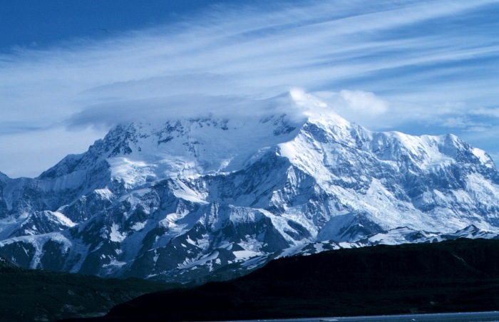
Mt. Bona, 5,005 m, is a dormant composite volcano. Mount Bona, 5,005 m, Wrangell volcanic field, Saint Elias Mountainsd is the fifth highest independent peak in the United States. Mount Bona and its adjacent neighbor Mount Churchill are both large ice-covered stratovolcanoes. Bona has the distinction of being the highest volcano in the United States and the fourth highest in North America, outranked only by the three highest Mexican volcanoes, Pico de Orizaba, Popocatķpetl, and Iztaccihuatl. The mountain''s massif is covered almost entirely by icefields and glaciers, and it is the principal source of ice for the Klutlan Glacier, which flows east for over 64 km into the Yukon Territory of Canada. http://en.wikipedia.org/wiki/Mount_Bona |
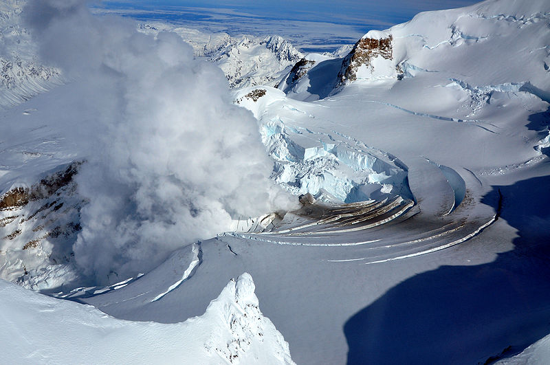
U.S. Geological Survey climbing party reaching the east rim of the summit caldera on Mount Churchill. Blocky debris in the photo consists of pumice and lithic fragments ejected 1,250 years ago, during the eruption which formed the eastern lobe of the White River Ash.Mount Churchill, 4,766 m, is a volcano in the Saint Elias Mountains and the Wrangell Volcanic Field. Churchill and its higher neighbor Mount Bona about 3 km to the southwest are both large ice-covered stratovolcanoes, with Churchill being the fourth highest volcano in the United States and the seventh highest in North America. Mount Churchill is most noteworthy as the source of the White River Ash, deposited during two of the largest volcanic eruptions in North America during the past two millennia. This twin-lobed tephra deposit covers more than 340,000 km2 of eastern Alaska and northwestern Canada, with the northern lobe deposited 1900 years ago and extending over 400 km and the larger eastern lobe about 1250 years ago and stretching over 800 km. The total volume of the ash exceeds 50 km3, or roughly 50 times the volume of the 1980 eruption of Mount St. Helens, and ash layers up to 60 cm thick can be seen just below the surface in many roadcuts along the Alaska Highway. - http://en.wikipedia.org/wiki/Mount_Churchill |
U.S. Geological Survey climbing party ascending the Klutlan Glacier en route to Mount Churchill.4,766 m. Mount Churchill, Saint Elias Mountains, Wrangell Volcanic Field, last eruption 700 +/- 200 AD. The extensive ash deposits in the lowlands near the White and Yukon Rivers were first recognized in 1883, but their source remained a mystery for the next century. Geologists in the 1960s traced the two lobes of the ash back into the Saint Elias Mountains, and postulated that the ash may have come from a vent now buried under the Klutlan Glacier, which flows east for over 64 km from the Bona-Churchill massif into the Yukon Territory of Canada. More detailed studies in the 1990s by the U.S. Geological Survey finally produced the definitive answer. Aerial photos showed a 4.2 x 2.7 km elliptical, gently sloping, ice-filled depression at 4400 m just east of the present summit of Mount Churchill. This was identified as a caldera, which had formed by the collapse of the volcano''s previous summit during the cataclysmic eruptions. The geological field work revealed thick young pumice deposits along the rim of the caldera which are mineralogically and chemically identical to the White River Ash.In terms of elevation, it is a major North American peak, in terms of topographic prominence or isolation, it is less significant, with less than a 400 m drop from its summit to the saddle with Bona. Churchill also lies on the northern, gentler side of the Bona massif, making it a less visually spectacular peak than some of the lower outliers of Bona such as University Peak or Aello Peak. The current standard climbing route is the South Ridge, usually as part of a climb of Mount Bona from the east starting from a ski-equipped bush plane landing at around 3,000 m on the Klutlan Glacier http://en.wikipedia.org/wiki/Mount_Churchill |
Rabbit Mountain,2,090 m/ 245 m, Wrangell Volcanic Field, Nutzotin Mountains, is an eroded volcanic outcrop in the Wrangell Volcanic Field, Yukon Territory, Canada, located 30 km southwest of Koidern and 4 km northwest of Canyon Mountain. It is east of the Yukon-Alaska boundary and can be accessed by old mining roads that reach Rabbit Creek. Rabbit Mountain formed as a result of melting of the crust, due to subduction of the Pacific Plate beneath the North American Plate and last erupted during the Pliocene. Like most volcanoes in the Yukon, Rabbit Mountain is part of the Pacific Ring of Fire, that includes over 160 active volcanoes -http://en.wikipedia.org/wiki/Rabbit_Mountain |
Nutzotin Mountains from Wrangel State Park |
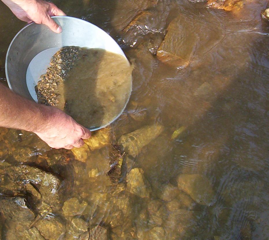
Gold panning at Bonanza Creek -http://en.wikipedia.org/wiki/Rabbit_Creek |
Coast Mountains, Felsite peak http://www.mountain-forecast.com/peaks/Felsite-Peak |
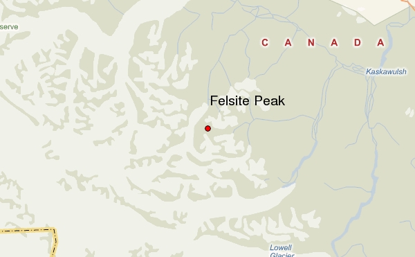
Felsite Peak, 2,530 m/670 m is an eroded volcanic outcrop in the Wrangell Volcanic Field, Yukon Territory, Canada, located 54 km south of Silver City, 8 km southwest of Snowshoe Peak and 30 km east of Pinnacle Peak. Felsite Peak was named after Felsite Creek and has a triple summit on the east side of the Disappointment Glacier and at the head of Felsite Creek. It formed as a result of melting of the crust[, due to subduction of the Pacific Plate beneath the North American Plate and last erupted during the Pliocene. Like most] volcanoes in the Yukon, it is part of the Pacific Ring of Fire, that includes over 160 active volcanoes - http://en.wikipedia.org/wiki/Felsite_Peak http://www.mountain-forecast.com/peaks/Felsite-Peak |
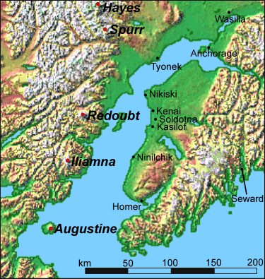
http://en.wikipedia.org/wiki/Mount_Redoubt |
|
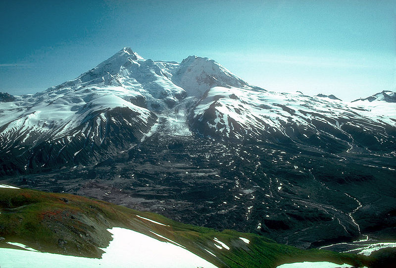
North face in 1980 |
View south of Redoubt volcano, Alaska on 7 April 1990. Hot pyroclastic flows during eruptions between December 1989 and June 1990 melted most of upper Drift glacier. Resulting floods threatened an oil storage-and-loading facility at the valley mouth. Debris of the pyroclastic flows thickly mantled the piedmont lobe of the Drift glacier (in foreground) - http://vulcan.wr.usgs.gov/Projects/H2O+Volcanoes/Frozen/Geology/Redoubt/Redoubt.images.html |
Fumarole on March 21, 2009, the day before the eruption -http://en.wikipedia.org/wiki/Mount_Redoubt |
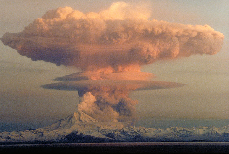
Steaming at the active summit lava dome on May 8 2009. Mount Redoubt, or Redoubt Volcano, 3,108 m, is an active stratovolcano in the largely volcanic Aleutian Range of the U.S. state of Alaska. Volcanic arch belt, Aleutian Islands. Ages of rocks ¢ 890 KY, last eruption March 22, 2009. March 22, 2009Located in the Chigmit Mountains (a subrange of the Aleutians), the mountain is just west of Cook Inlet, in the Kenai Peninsula Borough about 180 km (110 mi) southwest of Anchorage. Mount Redoubt towers 2,700 m above the surrounding valleys to the north, south, and southeast in little over 8 km; it is also the third highest within the range, with nearby Mount Torbert, being the highest and Mount Spurr being the second highest.Active for millennia, Mount Redoubt has erupted five times since 1900: in 1902, 1922, 1966, 1989 and 2009. The eruption in 1989 spewed volcanic ash to a height of 14,000 m. The ash blanketed an area of about 20,000 km2. The 1989 eruption is also notable for being the first ever volcanic eruption to be successfully predicted by the method of long-period seismic events developed by Swiss/American volcanologist Bernard Chouet. The volcano is about 6.0 km in diameter at its base with a rough volume of 30¢35 km3. The sides of the upper cone are relatively steep (in comparison to volcanoes in general). Made up of pyroclastic flow deposits and lava flows, and resting on Mesozoic era rocks of the Aleutian Mountain Range batholith, the mountain has been somewhat weathered by movement of several glaciers that reside on it. The current main vent is on the north side of the crater by the head of the Drift glacier. Also present on the mountain are Holocene lahar deposits that extend as far as the Cook Inlet. This mountain has produced andesite, basalt and dacite, with relatively silicic andesite dominant in recent eruptions. In 1819, smoke was observed at the mountain. However, this is often not recorded as an eruption as the information was insufficient to identify it as such. Similarly, in 2003, a blowing cloud of snow was mistaken by an employee of the ConocoPhillips Building in Anchorage for an ash plume. Possible steam-vapor let off was observed in 1933 at the mountain There was apparently an eruption described as "to the eastward, Redoubt Volcano, 3,370 m high, is constantly smoking, with periods of exaggerated activity. Fire has been seen issuing from its summit far out at sea. A great eruption took place in 1881, when a party of native hunters half-way up its slopes were overwhelmed by a lava-flow and only two escaped." However, this eruption is not well documented by other sources. |
This is a photo of a past eruption of Mt. Redoubt in Alaska. It is about to erupt again. This volcano has had many spectacular eruptions in the past. It is an extremely dangerous volcano so of course, oil companies built oil storage facilities near the foot of this active, active volcano. This volcano is less than 200km from Anchorage, Alaska. Captain James Cook saw Mt. Redoubt during the summer of 1778, describing it as "emitting a white smoke but no fire" which made some think it was no more than a white thick cloud such as we have frequently seen on the Coast, for the most part appearing on the sides of hills and often extends along a whole range and at different times falls or rises, expands or contracts itself and has a resemblance to Clouds of white smoke. But this besides being too small for one of those clouds, remained as it were fixed in the same spot for the whole time the Mountain was clear which was above 48 hours." However, several sources call this a "discredited eruption". There are several other of these activities that are not called eruptions.In 1819, smoke was observed at the mountain. However, this is often not recorded as an eruption as the information was insufficient to identify it as such. Similarly, in 2003, a blowing cloud of snow was mistaken by an employee of the ConocoPhillips Building in Anchorage for an ash plume. Possible steam-vapor let off was observed in 1933 at the mountain.There was apparently an eruption described as "to the eastward, Redoubt Volcano, 3,370 m high, is constantly smoking, with periods of exaggerated activity. Fire has been seen issuing from its summit far out at sea. A great eruption took place in 1881, when a party of native hunters half-way up its slopes were overwhelmed by a lava-flow and only two escaped." However, this eruption is not well documented by other sourcesThe volcano erupted rather abruptly in 1902, spewing out ash from January 18 to June 21 in the year. A local newspaper stated, "Word has just been received that Redoubt, one of the volcanoes at Cook''s Inlet had an eruption on January 18, and the country for 240 km around was covered with ashes and lava. The news comes from Sunrise, but nothing definite has been ascertained as to whether any damage was done, for no boats have as yet been in the neighborhood of the volcano." There were many other news reports on the eruption, one describing the eruption as "a terrific earthquake which burst the mountain asunder leaving a large gap," which could possibly suggest the crack formation in the volcano''s crater, however, it is unlikely. Supposedly, the volcano was ejecting "flames" from its caldera, and the eruption terrified natives in the area. Newspapers seemed to suggest that the ash had traveled for more than 150 miles (240 km), reaching the opposite side of the Cook Inlet. The volcano erupted on December 14, 1989, and continued to erupt for over six months. Sudden melting of snow and ice at the summit caused by pyroclastic flows and dome collapses caused lahars, or mudflows, which flowed down the north flank of the mountain. A majority of the mudflows coursed to Cook Inlet, about 22 miles (35 km) from the volcano. The lahars entered a nearby river, worrying officials that they might destroy an oil storage facility positioned along it.Since the lahars were produced repetitively, scientists realized that they could use these to analyze a trial period for a newly developed device proposed to measure the movement of rocks against each other. This device, now known as an Acoustic Flow Monitor, alerts nearby stations to possible lahars. By January 31, 2009 volcanic earthquakes increased to several per hour, and a large hole in the glacier on the side of the mountain was spotted.[21] Scientists began to monitor seismic data from the mountain twenty-four hours a day in an effort to warn people in nearby communities. A flyover conducted by the AVO detected "significant steaming from a new melt depression at the mouth of the summit crater near the vent area of the 1989-90 eruption."March 15. Seismic activity at Redoubt increased beginning about 13:00 ATZ. An AVO observation flight reported that a steam and ash plume rose as high as 4,600 m above sea level and produced minor ash fall on the upper south flank of Redoubt. Later reports were that the plume was then mainly steam.On the basis of this change in activity, AVO increased the level of concern and alert level to ORANGE/WATCH. Emissions. The material ejected from the volcano mainly consisted of water vapor, along with smaller amounts of carbon dioxide and sulfur dioxide. Further study by airborne monitors suggests that the materials were not oxidized much, and little of the concentration contained sulfates, less than 20%. Large scale eruptions beginMount Redoubt erupted explosively late in the evening of March 22, 2009. AVO has recorded numerous volcanic eruptions and/or explosions at Redoubt volcano. http://en.wikipedia.org/wiki/Mount_Redoubt |
Fumaroles observed on the side of Mount Redoubt on January 31, 2009-http://en.wikipedia.org/wiki/Mount_Redoubt |
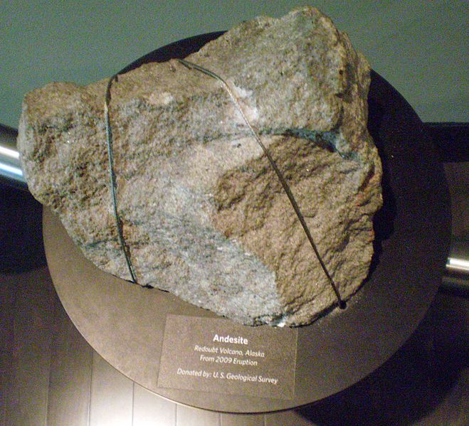
A chunk of andesite thrown from the volcano in 2009 is seen on display at the Anchorage Museum - http://en.wikipedia.org/wiki/Mount_Redoubt |
http://infoaboutalaska.com/communities/wrangell-island/ indians |
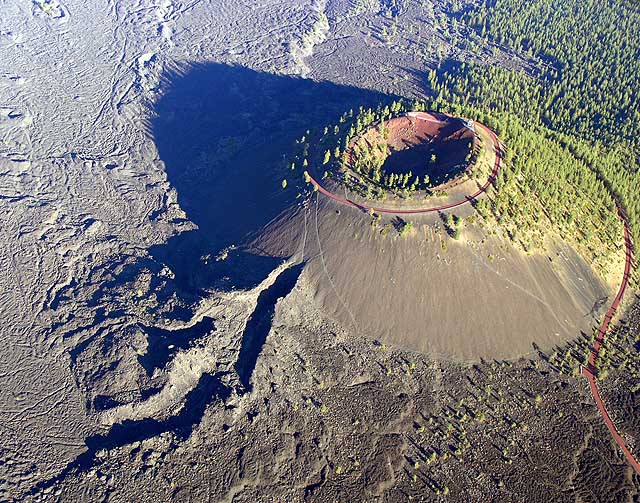
http://www.mountain-forecast.com/peaks/Cinder-Cone-and-the-Fantastic-Lava-Beds lassen see |
|
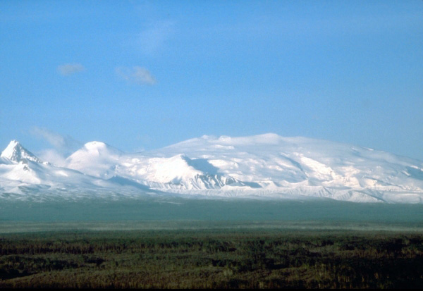
Wrangell Volcanic Belt lies mostly in Alaska but extends across the border into southwestern Yukon Territory. It formed as a result of melting of the crust due to subduction of the Pacific Ocean plate beneath the North American plate at the Aleutian Arc. It includes the volcanoes Mount Wrangell, which has been active historically, and Mount Churchill, which has had 2 large-magnitude explosive eruptions in the last 2,000 years that covered most of the Yukon with ash
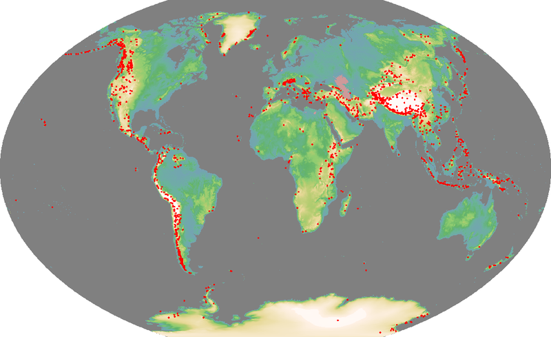
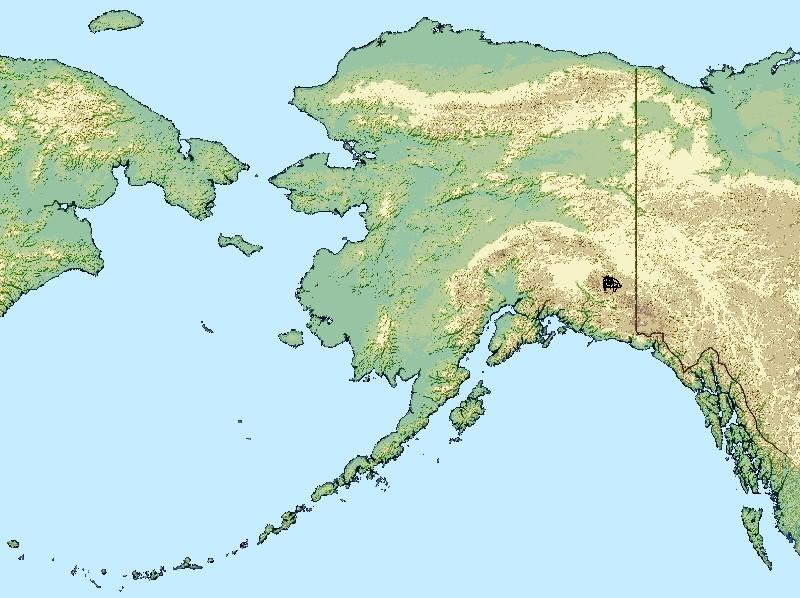
The Wrangell Volcanic Field is a volcanic field stretching from eastern Alaska in the United States to the southwestern Yukon Territory in Canada. The field includes the four highest volcanoes in the United States, Mount Bona, Mount Blackburn, Mount Sanford, and Mount Churchill, all of which exceed 4,600 m in elevation. It formed as a result of subduction of the Pacific Plate beneath the North American Plate at the easternmost end of the Aleutian Trench.
The bulk of the Wrangell Volcanic Field lies within the Wrangell Mountains of Alaska, but the field also extends eastwards into the neighboring Saint Elias Mountains.
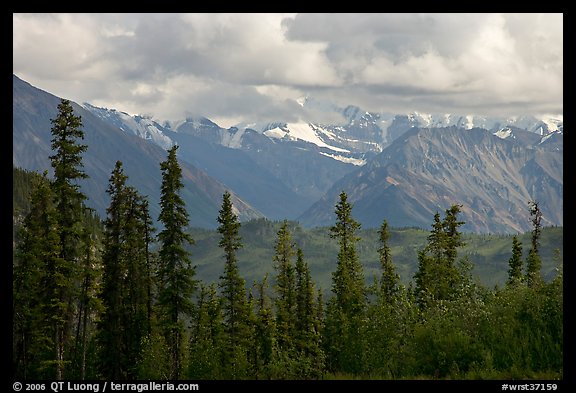
The east-west length of the field is over 320 km, while the width reaches up to 130 km in the central Wrangell Mountains. The field includes numerous shield volcanoes, stratovolcanoes, caldera complexes, cinder cones, and extensive lava flows, which have erupted throughout the past 26 MY. All of the higher peaks are less than 5 MY, since the rate of glacial erosion is very high in this region of extreme snowfall and cold temperatures. Higher elevations of the field above 1,500 m are almost entirely covered in glaciers and icefields, especially on the windward southern side of the ranges.
The field is named for Mount Wrangell, a massive shield volcano which has been active historically. The stratovolcano of Mount Churchill has had the largest recent eruptions, with two large-magnitude explosive eruptions in the last 2,000 years that blanketed most of the Yukon with volcanic ash (the White River Ash).
The volcanoes of the western Wrangell Mountains are less than 5 MY with the youngest lava flows are probably as young as 50 KA. The Canadian portion of the field is dominated by scattered remnants of upper Tertiary subaerial lavas and pyroclastic rocks. Over large areas extrusive rocks lie in flat undisturbed piles on a Tertiary surface of moderate relief. Locally, however, strata of the same age have been affected by a late pulse of tectonism, during which they were faulted, contorted into tight symmetrical folds, or overridden by pre-Tertiary baserocks along southwesterly dipping thrust faults. Considerable recent uplift, accompanied by rapid erosion, has reduced once vast areas of upper Tertiary volcanic rocks to small isolated remnants. Although no centers younger than late Miocene are known in Canada, the eruption of rhyolite pumice, White River Ash, from Mount Churchill near the head of Klutlan Glacier blanketed large areas of northwestern Canada with tephra some 2,000 years ago.
Most of volcanoes of the Western Wrangell Mountains are not like the other volcanoes located around the Pacific Rim. Rather than erupting explosive lavas forming stratovolcanoes, they have been built by the buildup of hundreds of comparatively fluid lava flows to form shield volcanoes. Only the young Mount Wrangell still shows its shield-like form; the other, commonly older volcanoes have had much of their original form removed by glacial and other erosional processes, such as Rabbit Mountain and Felsite Peak, which are now eroded to form an outcrop.
http://en.wikipedia.org/wiki/Wrangell_Volcanic_Field
http://en.wikipedia.org/wiki/Pacific_Coast_Ranges
http://en.wikipedia.org/wiki/Cascade_Range
http://en.wikipedia.org/wiki/Volcanism_of_Canada
http://en.wikipedia.org/wiki/Volcanism_of_Northern_Canada
http://en.wikipedia.org/wiki/Volcanism_of_Western_Canada
http://en.wikipedia.org/wiki/Pacific_Ring_of_Fire mexico
http://en.wikipedia.org/wiki/Trans-Mexican_Volcanic_Belt
http://en.wikipedia.org/wiki/Northern_Cordilleran_Volcanic_Province
http://en.wikipedia.org/wiki/Anahim_Volcanic_Belt
http://en.wikipedia.org/wiki/Anahim_hotspot
http://en.wikipedia.org/wiki/Dike_swarm
http://en.wikipedia.org/wiki/Volcanic_belt canada
http://en.wikipedia.org/wiki/Volcanic_field
http://en.wikipedia.org/wiki/Volcanic_arc
http://en.wikipedia.org/wiki/Subglacial_volcano
http://en.wikipedia.org/wiki/Volcanic_plug
http://en.wikipedia.org/wiki/Caldera
http://en.wikipedia.org/wiki/Cinder_cone
http://en.wikipedia.org/wiki/Lava_dome
http://en.wikipedia.org/wiki/Pel%C3%A9an_eruption
http://en.wikipedia.org/wiki/Plinian_eruption
http://en.wikipedia.org/wiki/Pacific_Cordillera
http://en.wikipedia.org/wiki/Western_Cordillera_(North_America)
http://en.wikipedia.org/wiki/Mount_Skukum_Volcanic_Complex
http://en.wikipedia.org/wiki/Montana_Mountain
http://en.wikipedia.org/wiki/Mount_Nansen_(Yukon)
http://en.wikipedia.org/wiki/Bennett_Lake_Volcanic_Complex
http://en.wikipedia.org/wiki/Sifton_Range_volcanic_complex
http://en.wikipedia.org/wiki/Powder_Mountain_Icefield
http://en.wikipedia.org/wiki/Rhyolite
http://en.wikipedia.org/wiki/Dacite
http://en.wikipedia.org/wiki/Lahar
http://en.wikipedia.org/wiki/Landslide
http://en.wikipedia.org/wiki/Flood
http://en.wikipedia.org/wiki/Hot_spring
http://en.wikipedia.org/wiki/List_of_volcanoes_in_Canada
http://en.wikipedia.org/wiki/Volcanism_of_Canada
http://en.wikipedia.org/wiki/Volcanism_of_Western_Canada
http://en.wikipedia.org/wiki/Queen_Charlotte_Fault
http://en.wikipedia.org/wiki/Aleutian_Trench
http://en.wikipedia.org/wiki/Volcanic_rock
http://en.wikipedia.org/wiki/Lava_tube
http://en.wikipedia.org/wiki/Extrusive
http://en.wikipedia.org/wiki/Cinder
http://en.wikipedia.org/wiki/Lava_lake
http://en.wikipedia.org/wiki/Mafic
http://en.wikipedia.org/wiki/Basalt
http://en.wikipedia.org/wiki/Volcanic_gas
http://en.wikipedia.org/wiki/Geology_of_the_Pacific_Northwest
http://en.wikipedia.org/wiki/Alkaline
http://en.wikipedia.org/wiki/Nephelinite
http://en.wikipedia.org/wiki/Basanite
http://en.wikipedia.org/wiki/Peralkaline
http://en.wikipedia.org/wiki/Phonolite
http://en.wikipedia.org/wiki/Trachyte
http://en.wikipedia.org/wiki/Comendite
http://en.wikipedia.org/wiki/Ring_dike
http://en.wikipedia.org/wiki/Rhyolite
http://en.wikipedia.org/wiki/Hyaloclastite
http://en.wikipedia.org/wiki/Subglacial_eruption
http://en.wikipedia.org/wiki/Pyroclastic_rock
http://en.wikipedia.org/wiki/Trachyte
http://en.wikipedia.org/wiki/Meltwater
http://en.wikipedia.org/wiki/Phreatic_eruption
http://en.wikipedia.org/wiki/Explosive_eruption
http://en.wikipedia.org/wiki/Tuya
http://en.wikipedia.org/wiki/Volcanic_Explosivity_Index
http://en.wikipedia.org/wiki/Eruption_column
http://en.wikipedia.org/wiki/Magma
http://en.wikipedia.org/wiki/Lava
http://en.wikipedia.org/wiki/Volcanic_ash
http://en.wikipedia.org/wiki/Pyroclastic_flow
http://en.wikipedia.org/wiki/Pyroclastic_dam
http://en.wikipedia.org/wiki/Pyroclastic_fall
http://en.wikipedia.org/wiki/Tephra
http://en.wikipedia.org/wiki/Pumice
http://en.wikipedia.org/wiki/Ignimbrite
http://en.wikipedia.org/wiki/Spherulite
http://en.wikipedia.org/wiki/Lithophysae
http://en.wikipedia.org/wiki/Scoria
http://en.wikipedia.org/wiki/Volcanic_bomb
http://en.wikipedia.org/wiki/Pillow_lava
http://en.wikipedia.org/wiki/Quartz_monzonite
http://en.wikipedia.org/wiki/Andesite
http://en.wikipedia.org/wiki/Basalt
http://en.wikipedia.org/wiki/Dacite
http://en.wikipedia.org/wiki/Augite
http://en.wikipedia.org/wiki/Olivine
http://en.wikipedia.org/wiki/Trachybasalt
http://en.wikipedia.org/wiki/Volcanic_gas
http://en.wikipedia.org/wiki/Matrix_(geology)
http://en.wikipedia.org/wiki/Outburst_flood
http://en.wikipedia.org/wiki/Debris_flow
http://en.wikipedia.org/wiki/Scree
http://en.wikipedia.org/wiki/Carbonated_water
http://en.wikipedia.org/wiki/Headward_erosion
http://en.wikipedia.org/wiki/Volcanic_block
http://en.wikipedia.org/wiki/Columnar_joint
http://en.wikipedia.org/wiki/List_of_volcanoes_in_Canada
http://en.wikipedia.org/wiki/Soufri%C3%A8re_Hills
http://en.wikipedia.org/wiki/Volcanic_ash alaska
http://en.wikipedia.org/wiki/Spherulite arizona
http://en.wikipedia.org/wiki/Mount_Mazama oregon
The Mazama Ash http://en.wikipedia.org/wiki/Mazama_Ash
Mount Garibaldi is one of the eleven Canadian volcanoes most strongly associated with recent seismic activity; the others are Castle Rock,[6] Mount Edziza,[6] Mount Cayley,[6] Hoodoo Mountain,[6] The Volcano,[6] Crow Lagoon,[6] Silverthrone Caldera,[6] Mount Meager,[6] Wells Gray-Clearwater Volcanic Field[6] and Nazko Cone.[43] http://en.wikipedia.org/wiki/Mount_Garibaldi
http://en.wikipedia.org/wiki/Garibaldi_Volcanic_Belt
http://en.wikipedia.org/wiki/Trachyte
http://en.wikipedia.org/wiki/Comendite
http://en.wikipedia.org/wiki/Wells_Gray-Clearwater_volcanic_field
http://volcano.oregonstate.edu/vwdocs/volc_images/north_america/canada/Canada.html
Notable vents : Quesnel Lake 1,292, cinder conePleistocene, Kostal Cone 1,440Cinder cone Holocene, Pillow Creek 1,829 subglacial volcano, Pleistocene, Gage Hill1,090 tuya Pleistocene, Dragon Cone1,850Cinder coneHolocene, Flourmill Cone1,495Cinder coneHolocene, Pointed Stick Cone1,820Cinder coneHolocene, Spanish Lake Centre 1770Cinder coneHolocene,
Name Height Coordinates Type Age of last eruption
metres feet
Spanish Bonk[4]
1,770 5,810[2]
52Ѓŗ08ЃЊN 120Ѓŗ22ЃЊW52.13ЃŗN 120.37ЃŗW[24]
Volcanic neck[24]
Pleistocene[24]
Ray Mountain[4]
2,050 6,730[2]
52Ѓŗ14ЃЊN 120Ѓŗ07ЃЊW52.24ЃŗN 120.11ЃŗW[25]
Subglacial mound[25]
Pleistocene[25]
Spanish Mump[4]
1,800 5,900[2]
52Ѓŗ10ЃЊN 120Ѓŗ20ЃЊW52.16ЃŗN 120.33ЃŗW[26]
Subglacial mound[26]
Pleistocene[26]
Jack''s Jump[4]
1,895 6,217[2]
52Ѓŗ07ЃЊN 120Ѓŗ03ЃЊW52.12ЃŗN 120.05ЃŗW[27]
Subglacial volcano[27]
Pleistocene[27]
Hyalo Ridge[4]
2,012 6,601[2]
52Ѓŗ07ЃЊN 120Ѓŗ22ЃЊW52.11ЃŗN 120.36ЃŗW[28]
Tuya[28]
Pleistocene[28]
McLeod Hill[4]
1,250 4,100[2]
52Ѓŗ01ЃЊN 120Ѓŗ01ЃЊW52.02ЃŗN 120.01ЃŗW[29]
Tuya[29]
Pleistocene[29]
Mosquito Mound[4]
1,065 3,494[2]
52Ѓŗ01ЃЊN 120Ѓŗ11ЃЊW52.02ЃŗN 120.18ЃŗW[30]
Tuya[30]
Pleistocene[30]
Buck Hill[4]
1,585 5,200[2]
51Ѓŗ05ЃЊN 119Ѓŗ59ЃЊW51.08ЃŗN 119.98ЃŗW[31]
Cinder cone[31]
Pleistocene[31]
Ida Ridge[4]
1,981 6,499[2]
51Ѓŗ05ЃЊN 119Ѓŗ56ЃЊW51.08ЃŗN 119.94ЃŗW[32]
Cinder cone[32]
Pleistocene[32]
Fiftytwo Ridge[4]
2,015 6,611[2]
51Ѓŗ56ЃЊN 119Ѓŗ53ЃЊW51.93ЃŗN 119.89ЃŗW[33]
Subglacial volcano[33]
Pleistocene[33]
Flatiron[4]
730 2,400[2]
51Ѓŗ53ЃЊN 120Ѓŗ03ЃЊW51.88ЃŗN 120.05ЃŗW[34]
Volcanic outcrop[34]
Pleistocene[34]
White Horse Bluff[4]
775 2,543[2]
51Ѓŗ05ЃЊN 120Ѓŗ07ЃЊW51.09ЃŗN 120.11ЃŗW[35]
Subaqueous volcano[35]
Pleistocene[35]
Pyramid Mountain[4]
1,095 3,593[2]
51Ѓŗ59ЃЊN 120Ѓŗ01ЃЊW51.99ЃŗN 120.01ЃŗW[36]
Subglacial volcano[36]
Pleistocene
http://en.wikipedia.org/wiki/Wells_Gray-Clearwater_volcanic_field
http://en.wikipedia.org/wiki/Volcanic_glass
http://en.wikipedia.org/wiki/Hyaloclastite
http://volcano.oregonstate.edu/vwdocs/volc_images/north_america/canada/Canada.html
http://www.volcano.si.edu/world/region.cfm?rnum=1200
http://vulcan.wr.usgs.gov/Volcanoes/California/
http://vulcan.wr.usgs.gov/Volcanoes/Oregon/
http://vulcan.wr.usgs.gov/Volcanoes/Washington/
http://vulcan.wr.usgs.gov/Volcanoes/Canada/
http://vulcan.wr.usgs.gov/Volcanoes/WesternUSA/framework.html
http://en.wikipedia.org/wiki/Wrangell_Volcanic_Field
Aleutian Range
http://www.lampholderpub.com/Volcano,YellowstoneWatch_new_page_65.htm
http://vulcan.wr.usgs.gov/Volcanoes/Canada/description_canadian_volcanics.html
http://vulcan.wr.usgs.gov/Volcanoes/Canada/framework.html