 | Salvador-Honduras volcanoes |
|
|
Cerro Cinotepeque, Holocene, 665m, is the largest and most prominent of a group of four pyroclastic cones of Holocene age mapped by Weber and Weismann (1978) in low-lying areas on either side of the Rio Lempa, about 40 km north of San Salvador. Cerro Cinotepeque (also spelled Cinotepec) lies south of the river; two other cones, Cerro Santiago and Cerro Mosquito, lie immediately north of the river. A fourth cone is located along the Rio Gualchayo about 10 km farther north. A large group of small Pleistocene stratovolcanoes and pyroclastic cones constructed along NW-SE-trending faults is located west and south of Cerro Cinotepeque and west of Guazapa volcano - http://www.volcano.si.edu/world/volcano.cfm?vnum=1403-051 |
Flat-topped Cerro las Tunas, Holocene, is seen here from the NE, just south of the town of Aguilares. Las Tunas is a Pleistocene stratovolcano that is part of the Cerro Cinotepeque volcanic field, an area of small stratovolcanoes and pyroclastic cones of Pleistocene-to-Holocene age on either side of the Rнo Lempa west of Guazapa volcano.Photo by Giuseppina Kysar, 1999 (Smithsonian Institution). http://www.volcano.si.edu/world/volcano.cfm?vnum=1403-051&volpage=photos |
Cerro Rodondo, Holocene, (also known as Tutultepeque) on the left and Picudo on the right are seen from the east across fields between the towns of Guazapa and Aguilares. These Pleistocene cones are part of the Pleistocene-to-Holocene Cerro Cinotepec volcanic field.Photo by Giuseppina Kysar, 1999 (Smithsonian Institution) http://www.volcano.si.edu/world/volcano.cfm?vnum=1403-051&volpage=photos |
Cerro Singuil, Holocene, 957m, is a morphologically youthful cone that is nevertheless old enough for a series of radially oriented erosional gullies to have formed on its flanks. The 957-m-high cone. Cerro Singuil (also known as El Cerron) is a large youthful-looking scoria cone with a well-preserved crater that lies at the eastern end of a large volcanic field in the interior valley of El Salvador near the Guatemalan border, SE of Volcan Chingo. Cerro Singuil is seen here from the SE along the Pan-American highway, which skirts the eastern flank of the cone. Photo by Giuseppina Kysar, 1999 (Smithsonian Institution). http://www.volcano.si.edu/world/volcano.cfm?vnum=1403-002 |
Bedded scoria deposits forming the flanks of a basaltic cinder cone are exposed in a quarry at Cerro Singuil. This cone is the largest of a small cluster of cones in El Salvador''s interior valley SE of Volcan Chingo. These cones are part of a broad area of monogenetic basaltic volcanism near the Guatemalan border on the opposite side of the main volcanic front from the Middle-American trench.Photo by Carlos Pullinger, 1996 (Servicio Nacional de Estudios Territoriales, El Salvador).http://www.volcano.si.edu/world/volcano.cfm?vnum=1403-002 |
The flat-topped summit of Cerro las Tablas is cut by one of a chain of three N-S-trending explosion craters located west of Cerro Singuil in the interior valley of El Salvador. Cerro las Tablas at 1035 m is the highest peak of the Cerro Singuil volcanic field and is seen here from the west.Photo by Giuseppina Kysar, 1999 (Smithsonian Institution). http://www.volcano.si.edu/world/volcano.cfm?vnum=1403-002 |
A panoramic view from the NE shows from left to right Volcan de San Diego, Cerro Masatepeque, and the two peaks of Loma Iguana and Cerro las Iguanas. Laguna de Metapбn is at the right. San Diego is the largest cone of a volcanic field surrounding Lake Guija near the El Salvador/Guatemala border. Basaltic flows from smaller vents of the San Diego volcanic field were responsible for blocking drainages and forming Laguna de Metapan. The larger Lago de Guija was formed as a result of flows from Volcan de San Diego itself.An extensive volcanic field of fresh-looking basaltic cinder cones and barren lava flows near Lake Guija, which straddles the border between El Salvador and Guatemala, is named after its largest feature, 781-m-high Volcan de San Diego. A large basaltic lava flow from the San Diego cinder cone dammed the drainage and was responsible for the formation of Lake Guija. Volcanism is concentrated in two areas near Lake Guija--an area of volcanic cones including San Diego east of the lake, and an area of small cones north of the lake near the Guatemalan border, north of the Rio Ostua. None of the eruptions in the San Diego volcanic field have been dated, but Williams and McBirney (1955) estimated that the latest eruption occurred within the past few thousand years. Quaternary volcanic rocks are also located across Lake Guija in Guatemala http://www.volcano.si.edu/world/volcano.cfm?vnum=1403-001&volpage=photos |
Cerro Quemado cinder cone near of the outlet of Lake Gьija has been extensively quarried, and only a remnant of the cone remains. The San Diego volcanic field straddles the El Salvador/Guatemala border and contains numerous basaltic cinder cones and associated lava flows on both sides of Lake Guija.Photo by Giuseppina Kysar, 1999 (Smithsonian Institution) http://www.volcano.si.edu/world/volcano.cfm?vnum=1403-001&volpage=photos |
The Lake Yojoa, Holocene volcanic field forms the entire northern shore of the 10 x 12 km long lake, in this Space Shuttle image with north to the upper left. Cretaceous limestones lie west of the lake, and Tertiary volcanic rocks to the east. Vents of the volcanic field, which extends to the top of the image, are concentrated along two NW- and NE-trending lines. The Lake Yojoa volcanic field has produced both tholeiitic and alkaline basaltic rocks.NASA Space Shuttle image ISS001-350-18, 2001 (http://eol.jsc.nasa.gov/).Lake Yojoa, coordinates 14o52�N 87o59� W, elevation 700m, is the largest lava dammed lake in Honduras with a surface area of 285 km3 and an average depth of 15 m. It lies in a depression formed by volcanoes. The Lake Yojoa volcanic field consists of Pleistocene to Holocene scoria cones, craters, and lava flows.The west side of the lake is bordered by steep mountains and Santa Barbara National Park while the east side is adjacent to Cerro Azul Meambar National Park. Lake Yojoa is a popular fishing destination and the surrounding area has a rich biodiversity--almost 400 species of birds and 800 plant species have been identified in the region. However, it also is threatened by deforestation, cattle ranching, and development. Unknown eruptions http://en.wikipedia.org/wiki/Lake_Yojoa |
The Lake Yojoa volcanic field consists a group of Pleistocene-to-Holocene scoria cones and collapse pits at the northern end of the scenic north-central Honduras lake (Williams and McBirney, 1969). The volcanic field has produced rocks ranging from tholeiitic basalts to trachybasalts, trachyandesites, and trachytes. The principal NE-trending chain of cones cuts through Cerro Babilonia, the 1090 m high point of the volcanic field, along the same fault pattern that bounds the limestone mountains bordering arcuate Lake Yojoa. Most of the pyroclastic cones, consisting of basaltic scoria and agglutinate, are 100-200 m in height and several contain well-preserved craters. Lava flows radiate in all directions from the cones. The longest flow traveled northward to the village of Rнo Lindo, where a waterfall cascades down the terminus of the flow. A few Quaternary lava flows occur in the Sulu graben along the Carretara del Norte north of Lake Yojoa. Times New Roman - http://www.volcano.si.edu/world/volcano.cfm?vnum=1403-15-&volpage=photos |
A large low-rimmed crater lies immediately WNW of Cerro el Hoyo. The floor of the crater has been planted with sugar cane, and other crops line the walls of the crater. The scale of the 1-km-wide crater is deceiving--note the barely visible truck and sugar cane workers on the crater floor at the left center.Photo by Rick Wunderman, 1999 (Smithsonian Institution). http://www.volcano.si.edu/world/volcano.cfm?vnum=1403-15-&volpage=photos |
El Volcan is the oldest and most dissected of a group of pyroclastic cones north of Lake Yojoa. El Volcan lies at the SE end of the cluster of cones near the lake. The cone, now mantled by scoria from younger cones, fed a series of basaltic lava flows that underlie a flat valley to the SE (to the right of this photo).Photo by Rick Wunderman, 1999 (Smithsonian Institution).http://www.volcano.si.edu/world/volcano.cfm?vnum=1403-15-&volpage=photos |
Cerro el Hoyo lies at the SE end of a subsidiary NW-SE-trending chain of pyroclastic cones of the Lake Yojoa volcanic field about 2 km NE of the lakeshore. The cones are surrounded by lava fields that are partially tholeiitic in composition, but mostly consist of trachytes, trachybasalts, and trachyandesites with large phenocrysts of sanadine and anorthoclase.Photo by Rick Wunderman, 1999 (Smithsonian Institution).http://www.volcano.si.edu/world/volcano.cfm?vnum=1403-15-&volpage=photos |
Utila Island, Honduras, coordinate 16o06�N 86o54�W, elevation 74m, Holocene volcato |
The low peak in the distance is Pumpkin Hill, a pyroclastic cone at the NE end of Utila Island. The small 74-m-high cone was erupted onto a coral-capped erosional surface forming the cliffs in the foreground and marks the high point on the island. Basaltic lavas and tuffs blanket terraces on the NE side of Utila. The island lies in the Caribbean Sea off the northern coast of Honduras and is the easternmost and lowest of the Bay Islands at the southern edge of the submarine Bartlett Trough. Photo by Rick Wunderman, 1999 (Smithsonian Institution). http://www.volcano.si.edu/world/volcano.cfm?vnum=1403-16-&volpage=photos |
Pumpkin Hill, a small pyroclastic cone at the NE end of Utila Island, is seen here across a forest from Stuert Hill, the other pyroclastic cone on the eastern side of the island. The two cones lie about 2 km apart and were constructed over flat-lying terraces that cover much of the elongated, 3 x 11 km wide island. Alkaline olivine-basaltic lava flows erupted from the cones cover much of the eastern side of the island and underlie the forest in this photo. The Caribbean Sea lies in the background to the NE. Pumpkin Hill, a low pyroclastic cone reaching only 74 m above sea level, is the high point of Utila Island. The cone occupies the NE tip of the island and consists of stratified basaltic lapilli and tuffs containing abundant blocks and small fragments of coral. The vent of the cone appears to lie on this side near its northern base, but only the southern half of the cone remains.Photo by Rick Wunderman, 1999 (Smithsonian Institution).http://www.volcano.si.edu/world/volcano.cfm?vnum=1403-16-&volpage=photos |
The low pyroclastic cone Stuert Hill (also spelled Stuart Hill) rises beyond Utila, the largest village on the island of the same name. A ferry connects the village of Utila, formerly known as East Harbor, to the mainland of Honduras. Most of the island consists of flat-lying uplifted coral reefs; volcanic rocks are found only at the eastern end of the island.Photo by Rick Wunderman, 1999 (Smithsonian Institution).http://www.volcano.si.edu/world/volcano.cfm?vnum=1403-16-&volpage=photos |
Santa Maria and el Salvador |
Santa Maria, 3772m, Sierra Madre Range, stratovolcano |
Santiago and Santa Maria |
Santa Maria Volcano is a large active volcano in the Western Highlands of Guatemala. Its eruption in 1902 (VEI 6) was one of the four largest eruptions of the 20th century, after the 1912 Novarupta and 1991 Pinatubo eruptions. It is also one of the five biggest eruptions of the past 200 (and probably 300) years. Santa Mar�a is part of the Sierra Madre range of volcanoes, which extends along the western edge of Guatemala, separated from the Pacific Ocean by a broad plain. The volcanoes are formed by the subduction of the Cocos Plate under the Caribbean Plate, which led to the formation of the Central America Volcanic Arc.Eruptions at Santa Maria are estimated to have begun about 30 KA. For several thousand years, eruptions seem to have been small and frequent, building up the large cone of the volcano, reaching about 1,400 m above the plain on which the nearby city of Quetzaltenango sits. Following the cone-building eruptions, activity seems to have changed to a pattern of long periods of repose followed by the emission of small lava flows from vents on the flanks. The cone built by the eruptions had a volume of about 10 cubic kilometres (2.4 cu mi), and consisted of a mixture of basalt and andesite lavas. The first eruption of Santa Mar�a in the recorded history occurred in October 1902. Before 1902 the volcano had been dormant for at least 500 years and possibly several thousand years, but its awakening was clearly indicated by a seismic swarm in the region starting in January 1902, which included a major earthquake in April 1902. The eruption began on 24 October, and the largest explosions occurred over the following two days, ejecting an estimated 5.5 cubic km of magma. The eruption was one of the largest of the 20th century, only slightly less in magnitude to that of Mount Pinatubo in 1991. The eruption had a VEI of 6, thus being ''Colossal''. The pumice formed in the climactic eruption fell over an area of about 273,000 square km and volcanic ash was detected as far away as San Francisco, 4,000 km away. The eruption tore away much of the south-western flank of the volcano, leaving a crater about 1 km in diameter and about 300 m deep, stretching from just below the summit to an elevation of about 2,300 m.Because of the lack of previous Holocene activity at Santa Maria, local people did not recognise the preceding seismicity as warning signs of an eruption. http://en.wikipedia.org/wiki/Santa_Mar%C3%ADa_(volcano), see also http://www.volcano.si.edu/world/volcano.cfm?vnum=1402-03= http://www.volcano.si.edu/world/volcano.cfm?vnum=1402-03=&volpage=photos |
Santiago, 2550m, eruption 2003. The 1902 eruption was followed by 20 years of dormancy. In 1922, new eruptions began, with the extrusion of a lava dome in the crater left by the 1902 eruption. The lava dome was dacitic in composition. These dome growth types are described by volcanologists as exogenous and endogenous respectively. Activity has been concentrated at several different vents, and Santiaguito now has the appearance of several overlapping domes. The currently active vent is El Caliente. There are three other domes - El Brujo, El Mitad and El Monje. Although most of Santiaguito''s eruptive activity has been relatively gentle, occasional larger explosions have occurred. In 1929, part of the dome collapsed, generating pyroclastic flows. Occasional rockfalls have generated smaller pyroclastic flows, and vertical eruptions of ash to heights of a few k. above the dome are common. http://en.wikipedia.org/wiki/Santa_Mar%C3%ADa_(volcano) |
A hot lahar rushes down a river valley near El Palmar in 1989 - http://en.wikipedia.org/wiki/Santa_Mar%C3%ADa_(volcano) |
Santa Ana |
Four volcanoes in western El Salvador are visible in this Space Shuttle image. The forested ridge at the left-center is the Apaneca Range, a complex of calderas and small stratovolcanoes. The summit crater of Santa Ana volcano lies below the small cloud bank, and the brownish area below it is Izalco volcano. A circular lake partially fills Coatepeque caldera. The Acajutla Peninsula at the bottom, named after the port city of Acajutla, was formed by a massive debris avalanche produced by the late-Pleistocene collapse of Santa Ana volcano.NASA Space Shuttle image STS61C-31-45, 1986 (http://eol.jsc.nasa.gov/). |
Izalco volcano was once known as the "Lighthouse of the Pacific" for its persistent incandescent nighttime displays. It was constructed on the southern flank of Santa Ana volcano, whose flat-topped summit is visible to the left of Izalco. At the right is Cerro Verde, a basaltic-to-andesitic pyroclastic cone on the SE flank of Santa Ana. Frequent strombolian eruptions have left the flanks of Izalco unvegetated; dark-colored lava flows at its base issued from both summit and flank vents and extend up to 7 km from the volcano.The unvegetated slopes of Izalco volcano contrast with the forests mantling Cerro Verde ("Green Hill") in the foreground. Izalco rises about 300 m above a saddle separating it from Cerro Verde. Exceptionally clear weather provides a view beyond Izalco to the Pacific Ocean, 40 km to the south; much of this area is underlain by deposits associated with a late-Pleistocene debris avalanche produced by collapse of Santa Ana volcano |
Santa Ana, Cerro Verde and Izalco volcanoes |
Izalco, Range Cordillera de Apaneca, last eruption 1966, stratovolcano. The 1950-m-high stratovolcano was constructed during frequent eruptions over a two-century period beginning in 1770. Strombolian eruptions from the summit crater were sometimes accompanied by lava flows that traveled down the slopes to the south, extending as far as 7 km from the summit. |
Izalco volcano grew to its present height of about 1950 m during a 200-year period following its birth in 1770 at an elevation of about 1300 m on the flank of Santa Ana volcano. Although Larde (1923) mentioned Izalco eruptions beginning in 1722, other sources consider the first Izalco eruption to have occurred in 1770. Intermittent strombolian eruptions and the effusion of dominantly basaltic-andesite lava flows built up the volcano to a height of 1825 m by the year 1866, 1885 m by 1892, 1900 m by 1951, 1935 m by 1953, and 1965 m by 1956. http://www.volcano.si.edu/world/volcano.cfm?vnum=1403-03=&volpage=photos |
View of Izalco volcano from the summit of Santa Ana volcano, view is towards the south. In the background is the Pacific Ocean and the Acajutla peninsula, formed by a debris avalanche from the Santa Ana volcano. Photo by Carlos Pullinger, 1996.http://www.geo.mtu.edu/volcanoes/central_america/el_salvador/izalco/images/.Sublimates at fumaroles: According to Stoiber and Rose (1973, p. 514), "incrustations at volcanic gas vents offer a convenient approach to studying the gases themselves. Changes in the minerals found at a fumarole reflect changes in the gases. Though a large number of mineral phases have been described at fumaroles, only nine minerals can be considered as ''very common'' and perhaps eight additional ones as ''common.'' The orderly arrangement of the fumarolic minerals in zones attests to a common causative process. The study of many high-temperature fumarolic vents and their associated incrustations has led to the conclusion that in spite of the large number of incrusation minerals found, all can be fairly well explained by a fumarolic gas consisting essentially of H2O, SO2, HCl, HF and possibly CO2 gases, and much smaller concentrations of volatile (and aerosol?) cations (i.e. Na, K, Zn, Cu, V, Mo) passing through an environment of rapidly changing temperature and pO2 and in contact with volcano wallrock." Dr. John Hughes and others have done considerable work on the fumarolic sublimates found at Izalco Volcano. An interesting fact to notice is the abundance of Vanadium found in these sublimates. It has not, as of yet, been determined why Vanadium is so common. Below is a listing and brief description of the sublimates. ZIESITE: Cu2V2O7, a new copper vanadate maineral, occurs as anhedral black crystals in the oxide zone of a fumarole. The mineral is associated with stoiberite and other unnamed copper vanadates. It is monoclinic, has a metallic luster and a red-brown streak. The phase relations between ziesite and other copper vanadates indicate a tempurature of formation 760-770 C. HOWARDEVANSITE: NaCuFe2(VO4)3 occurs with lyonsite and thenardite, formed as a sublimate from the volcanic gases. Howardevansite occurs as euhedral, black tabular crystals up to 80 microns in greatest dimension. The crystals are triclinic. The structure consisting of FeO6 octahedra, CuO5 trigonal bipyramids, and VO4 tetrahedra. Howardevansite is opaque and has a red-brown streak and metallic luster. BLOSSITE: Cu2V2O7 . The mineral is the natural analogue of the previously described synthetic phase, and is the low-tempurature polymorph of ziesite, Cu2V2O7, which was discovered at the same site. On the basis of previously determined atomic arrangements, the blossite-ziesite phase transition is of the non-nearest-neighbor reconstructive type. Blossite occurs as an equant, black anhedral crystal up to 150 microns in greatest dimension. The mineral has a metallic luster and a red-brown streak. The calculated density (Z=8) is 4.051 g/cm3. Blossite is opaque, and white in blue -filtered white light in air, with weak to moderate bireflectance in shades of creamy-white, and a moderate anisotropy, from gray to creamy brown-gray. LYONSITE: Cu3Fe4(VO4)6, a new iron-copper vanadate mineral, has been discovered in the summit crater fumaroles of Izalco volcano. The mineral, which occurs with thenardite and a Na-Cu-Fe vanadate, formed as a sublimate product from the volcanic gases. Lyonsite occurs as euhedral, black lathlike crystals up to 230 microns in greatest dimension. Lyonsite is orthorhombic. The structure is based on a pseudohexagonal close-packed oxygen array. The fundamental building block consists of six isolated VO4 tetrahedra that are linked, through corner sharing, to a central octahedron that is half-occupied by Cu +2 atoms. These "pinwheel" building blocks are connected on four sides by FeO6 octahedra and on the remaining two sides by square-planar CuO4 groups. The fundamental building block is isostructural with the silicate pinwheels in dumortierite. Lyonsite is opaque and has a dark gray streak and metallic luster, 4.215 g/cm3, a good cleavage. The mineral is creamy white in reflected light in air. MCBIRNEYITE: Cu3(VO4)2, a new copper vanadate mineral, summit crater fumaroles of Izalco volcano. The mineral formed as a sublimate from the volcanic gases and is associated with stoiberite, fingerite, ziesite, euchlorine and thenardite. Mcbirneyite is the naturally occurring analog of synthetic Cu3V2O8. Ttriclinic, the independent structure solution demonstrates that mcbirneyite is isostructural with stranskiite, CuZn2(AsO4)2, and a synthetic Cu phosphate, Cu3(PO4)2. The structure is constructed of layers of Cu atoms in square-planar and square-based pyramidal coordination with oxygen; adjacent layers are linked by isolated VO4 tetrahedra. Mcbirneyite is black with a metallic luster, is 4.50 g cm-3. The mineral is opaque to transmitted light; in reflected light in aur the mineral is medium-dark gray and nonpleochroic. FINGERITE: Cu11O2(VO4)6, a new copper vanadate mineral. The mineral, which occurs with thenardite and euchlorine, forms as a sublimate product from the volcanic gases. Fingerite occurs as euhedral, subhedral and anhedral crystals up to 150 microns in greatest dimension, triclinic, black with a metallic luster and opaque, 4.776 g/cc. SHCHERBINAITE: V2O5 has been discovered in the high-tempurature fumaroles of Izalco volcano,and Bezymyanny volcano, Kamchatka. The Izalco mineral occurs as euhedral golden-yellow needles and laths up to 1 cm in length. The crystals, which formed as sublimates from volcanic gases, are found coating basaltic breccia fragments in the summit crater fumaroles. The mineral is associated with bannermanite." BANNERMANITE: NaxV6O15 is a natural vanadium oxide bronze compound, occurs as black subhedral to euhedral crystals in the oxide zone of a fumarole at Izalco. The mineral is associated with shcherbinaite, stoibrite, and ziesite, monoclinic. The structure consists of a clinolattice of VO5 square-based pyramids and VO6 octahedra. This array of V-O polyhedra froms rectangular tunnels in which Na and K ions occur. The vanadium ions are in two charge states, V +4, and V +5, with the number of vanadium ions in the reduced state equal to the number of alkali ions in the tunnel sites; thus, charge balance is maintained. The mineral has two cleavages and a dark gray-black streak. STOIBERITE: Cu5V2O10, a new coppervanadate mineral, occurs as black platy crystals in the oxide zone of a fumarolein Izalco. It is monoclinic, with a medium reflectivity less than that of galena, density is 4.96 g/cc. http://www.geo.mtu.edu/volcanoes/central_america/el_salvador/izalco/fumar.html# |
Lava flow of the 1966 flank eruption over the much older lava flow. This image looks towards the south from the slope of Izalco. Eruption History. According to Stoiber, Rose, Lange, and Birnie (1975, p. B-2), volcano Izalco was "so continously active during the period from its birth in 1770 until 1958, that it assumed the title of ''lighthouse of the Pacific'', Izalco has been nearly completely in repose since the latter date. Only a brief, very small flank eruption in 1966 has interrupted dormancy. The extrusion of a small (900,000 m3) lava flow from a vent 550 m below the summit had remarkable little effect on the summit area, and Strombolian activity, in the past a hallmark of Izalco, was completely absent. Details of this eruption are contained in a pervious article (Rose and Stoiber, 1969). Since 1964 temperatures of the fumaroles in the summit crater of Izalco have been measured periodically, and a variety of other observations have been made irregularly - http://www.geo.mtu.edu/volcanoes/central_america/el_salvador/izalco/eruption.html The lava historically erupted from Izalco consists of vesicular vitrophyric olivine basalts. Izalcos formation was preceded by Fumorolic activity in 1658, before Izalco was born in 1770. Today, Izalco experiences only fumarolic activity in the form of rainwater seeping into the volcano and contacting hot rocks, rather than steam emissions from underground gases. The fumarole deposits of the volcano are noted as sources for several rare minerals. It is the type locality for the copper vanadium minerals: bannermanite, blossite, fingerite, howardevansite, lyonsite, mcbirneyite, stoiberite and ziesite http://en.wikipedia.org/wiki/Izalco_(volcano)The lava historically erupted from Izalco consists of vesicular vitrophyric olivine basalts. Izalcos formation was preceded by Fumorolic activity in 1658, before Izalco was born in 1770. Today, Izalco experiences only fumarolic activity in the form of rainwater seeping into the volcano and contacting hot rocks, rather than steam emissions from underground gases. The fumarole deposits of the volcano are noted as sources for several rare minerals. It is the type locality for the copper vanadium minerals: bannermanite, blossite, fingerite, howardevansite, lyonsite, mcbirneyite, stoiberite and ziesite http://en.wikipedia.org/wiki/Izalco_(volcano).Izalco products range from andesitic to basaltic, and are dominantly basaltic andesite. Despite its proximity to Santa Ana, Izalco lavas are distinctly higher in alumina, calcium, and strontium. The most recent eruptions of Izalco are more similar to Santa Ana than earlier ones.. |
A large unvegetated lava field on the SW flank of Izalco is seen here from its summit. Levees of individual lobes define distinct flows of the lava field, which extends up to about 7 km from the summit. Most of the flows seen here were emplaced prior to 1954. Wisps of steam rise from fumaroles near the summit, still active more than three decades after eruptive activity ceased in 1966.Photo by Lee Siebert, 1999 (Smithsonian Institution).http://www.volcano.si.edu/world/volcano.cfm?vnum=1403-03=&volpage=photos |
The dark-colored lava flows with prominent levees in the center of the photo were extruded from a vent on the NE flank of Izalco beginning in 1955. This lava extrusion took place during an almost continuous period of strombolian activity from November 1948 until the end of 1957. Periods of lava effusion took place July 1950, September-November 1952, October 1954, intermittently in 1955, November 1956, and January 1957. The eruption tapered off in late 1957 and was over by the end of the year.Photo by Lee Siebert, 1999 (Smithsonian Institution).http://www.volcano.si.edu/world/volcano.cfm?vnum=1403-03=&volpage=photos |
A network of lava flows, mostly erupted from flank vents, circles the base of Izalco volcano. The flows were deflected by the slopes of Santa Ana volcano and extend as far as about 7 km from the summit of Izalco. Forested Cerro Verde cinder cone, one of many vents erupted along a fissure SE of Santa Ana volcano, forms the right horizon. An atmospheric cloud between the two cones obscures the summit of Santa Ana volcano.Photo by Lee Siebert, 2002 (Smithsonian Institution).http://www.volcano.si.edu/world/volcano.cfm?vnum=1403-03=&volpage=photos |
View (due west) from left to right of Izalco, Cerro Verde and Santa Ana (partly covered by clouds) volcanoes. On the far right the southern part of the Coatepeque caldera rim can be observed. The foreground is composed of corn and sugar cane plantations that lie on Coatepeque pyroclastic flows.Izalco has been El Salvador''s most active volcano during historical time. More than 50 eruptions, many of several years to about a decade duration, took place since 1770, when the volcano was born. During its 200 year history prior to 1966, when activity ceased, the volcano was rarely quiet for more than a few years. Eruptions took place both from the summit craters and from flank vents. Unvegetated lava flows are seen here on the SE flank below Cerro Verde volcano (center) and the twin cones of El Conejal and El Astillero (right).Photo by Paul Kimberly, 1999 (Smithsonian Institution).The flat-topped summit of massive Santa Ana volcano appears at the right, with conical Izalco volcano at the left in this NW-looking view from the Zapotitan basin. The pyroclastic cone on the center skyline is Cerro Verde, and the brownish scoria cone below it is Cerro Marcelino. Historical eruptions have occurred from the summit crater of Santa Ana and satellitic cones such as Cerro Marcelino on its SE flank. Izalco volcano was born in 1770, and the saddle between Izalco and Cerro Verde increased 100 m in height in the century after 1866.http://www.volcano.si.edu/world/volcano.cfm?vnum=1403-03=&volpage=photos |
Santa Ana volcano (background, far right) with Izalco to the far left, Cerro Verde center and San marcelino vents in the foreground |
The broad light-colored hill in the center of the photo is the Cerro la Olla-Cerro Marcelino cone complex, a flank vent of Santa Ana volcano, whose cloud-topped summit is seen at the right. Cerro Marcelino at the right side of the cone complex was formed during the 1722 eruption, when the Teixcal lava flow traveled 13 km to the east and overran the town of San Juan Tecpan. The rounded forest-covered peak at the left is Cerro Verde, a large pyroclastic cone on the SSE flank of Santa Ana.Photo by Lee Siebert, 1999 (Smithsonian Institution).http://www.volcano.si.edu/world/volcano.cfm?vnum=1403-02=&volpage=photos |
The blocky basaltic-andesite lava flow in the foreground was erupted in 1722 from San Marcelino, the light-colored cinder cone on the right horizon. The 13-km-long Teixcal lava flow traveled to the east and destroyed the small village of San Juan Tecpan. The flow originated from two vents on opposite sides of San Marcelino. The peak on the center horizon is Cerro Chino, the central of three cinder cones along a line extending SW from San Marcelino to La Olla.Photo by Lee Siebert, 1999 (Smithsonian Institution). http://www.volcano.si.edu/world/volcano.cfm?vnum=1403-02=&volpage=photos |
Grass-covered San Marcelino cinder cone is seen from Cerro Chino on the SE flank of Santa Ana volcano. San Marcelino was formed during an eruption in 1722 and produced a lava flow that traveled 13 km to the east. The forested southern rim of Coatepeque caldera can be seen to the NE beyond and to the left of San Marcelino, and a small sliver of the surface of Lake Coatepeque is visible inside the caldera. Photo by Lee Siebert, 2002 (Smithsonian Institution).http://www.volcano.si.edu/world/volcano.cfm?vnum=1403-02=&volpage=photos |
San Marcelino cinder cone (center) on the NE flank of Santa Ana volcano was the source of a basaltic-andesite lava flow that traveled 13 km to the east (left). Larde (1923) considered the 1722 lava flow to have originated from Izalco volcano, but most other sources place the birth of Izalco in 1770 and assign the 1722 eruption to San Marcelino. The 1722 lava flow originated from two vents at the eastern and western sides of San Marcelino.Photo by Lee Siebert, 2002 (Smithsonian Institution).http://www.volcano.si.edu/world/volcano.cfm?vnum=1403-02=&volpage=photos |
The brownish area extending across the center of the photo is the Teixcal lava flow. Originating during an eruption in 1722 from the base of San Marcelino cinder cone (out of view to the right) on the SE flank of Santa Ana volcano, the flow traveled 13 km to the east to the edge of the Zapotitбn basin and destroyed the village of San Juan Tecpбn, burying about 15 sq km of prime agricultural land. Numerous elongated trenches on the surface of the blocky basaltic lava flow may mark the collapsed roofs of lava tubes.Photo by Lee Siebert, 2002 (Smithsonian Institution).http://www.volcano.si.edu/world/volcano.cfm?vnum=1403-02=&volpage=photos |
The brownish area extending diagonally from the lower left towards San Salvador volcano on the right horizon is the Teixcal lava flow. It originated during an eruption in 1722 from the base of San Marcelino cinder cone, from where this photo was taken. The basaltic-andesite flow is noted for its disequilibrium textures, where large ortho-pyroxene crystals are surrounded by reaction rims of olivine. The half-forested, half-grassy cone at the left center is Cerro Alto, a flank cinder cone of Coatepeque caldera, out of view to the left.Photo by Lee Siebert, 2002 (Smithsonian Institution).http://www.volcano.si.edu/world/volcano.cfm?vnum=1403-02=&volpage=photos |
A 20-km-long NW-SE-trending chain of satellitic vents cuts across Santa Ana volcano. This view looks to the NW from Cerro Chino cinder cone at the SE end of the chain. The small forested cone at the middle left is Cerro el Astillero, and the larger cone on the left horizon is Cerro Verde. The broad summit of Santa Ana forms the right horizon.Photo by Lee Siebert, 2002 (Smithsonian Institution).http://www.volcano.si.edu/world/volcano.cfm?vnum=1403-02=&volpage=photos |
Cerro Verde, a 2030-m-high satellitic cone of Santa Ana volcano, is seen here from the NW above Hacienda San Blas. Cerro Verde is near the SE end of a 20-km-long eruptive fissure that cuts across Santa Ana from its lower NNE flank. Three N-S-trending craters are located at the summit of Cerro Verde, and a fourth is located on the SE flank of the cone. Photo by Kristal Dorion, 1994 (U.S. Geological Survey).http://www.volcano.si.edu/world/volcano.cfm?vnum=1403-02=&volpage=photos |
Bedded scoria layers are exposed in a quarry on the NE flank of Cerro Verde volcano along the road to its summit. Cerro Verde is the largest of a chain of cinder cones on the SE flank of Santa Ana volcano. Cerro Verde has produced basaltic-to-andesitic products.Photo by Paul Kimberly, 1999 (Smithsonian Institution).http://www.volcano.si.edu/world/volcano.cfm?vnum=1403-02=&volpage=photos |
The escarpment cutting diagonally downward across the middle of the photo in front of conical Cerro los Naranjos volcano is the NW wall of a large late-Pleistocene caldera formed by edifice collapse of Santa Ana volcano. The exposed portion of the collapse scarp is up to about 200 m high along a roughly 5 km segment of the arcuate avalanche caldera. Pyroclastic ejecta and lava flows from modern Santa Ana volcano have filled in much of the scarp in the foreground and have buried it completely on the northern and eastern sides. Photo by Paul Kimberly, 2002 (Smithsonian Institution). http://www.volcano.si.edu/world/volcano.cfm?vnum=1403-02=&volpage=photos |
Santa Ana volcano rises beyond the summit crater of Izalco volcano, which formed beginning in 1770 on the northern flank of Santa Ana. Fumarolic activity producing the faint steam plume in the right foreground continues at Izalco, but has diminished considerably since the cessation of its 200-year-long eruptive period in 1966. A complex of four nested craters gives the summit of Santa Ana a flat profile. The slopes of Cerro Verde, a satellitic cone of Santa Ana, are seen at the right.Photo by Lee Siebert, 1999 (Smithsonian Institution). http://www.volcano.si.edu/world/volcano.cfm?vnum=1403-02=&volpage=photos The Santa Ana Volcano is a large stratovolcano , at 2,381 m above sea level, it is the highest volcano in El Salvador. It is located immediately west of Coatepeque Caldera.The summit of Santa Ana features four nested calderas and volcanic craters, with the innermost containing a small crater lake. Collapse of the summit during the late Pleistocene (inferring from underlying soil samples, the upper age limit is no more than 57 KA) produced a massive debris avalanche that reached the Pacific Ocean, forming the Acajutla Peninsula. Subsequent eruptions have largely rebuilt the edifice. There have been numerous historical eruptions since the 16th century, both at the summit and from cinder cones on the lower flanks, and also the flank vents of San Marcelino located east of Santa Ana. The San Marcelino vents erupted in 1722 and flowed eastwards for 11 km. http://en.wikipedia.org/wiki/Santa_Ana_Volcano |
An eruption plume from Santa Ana volcano towers above Coatepeque caldera lake. The brief, one-hour-long explosive eruption the morning of October 1, 2005 produced gas-and-ash plumes that rose 10 km or more. Ash fell in towns west of the volcano and extended into Guatemala; ashfall caused damage to coffee plantations. Volcanic blocks up to a meter in diameter fell as far as 2 km south of the summit. Lahars descended valleys on the flanks of the volcano. Photo by Jose Roberto Lopez, 2005 (Coatepeque Watershed Authority).http://www.volcano.si.edu/world/volcano.cfm?vnum=1403-02=&volpage=photos |
Santa Ana, volcano crater, inmediately the small volcano of Izalco is appreciated, at the left small hill Cerro verde.http://www.murrasaca.com/Elsalvadorpictures.htm Santa Ana, El Salvador''s highest volcano, is a massive, 2381-m-high, dominantly andesitic-to-trachyandesitic stratovolcano that rises immediately west of Coatepeque caldera. Collapse of Santa Ana (also known as Ilamatepec) during the late Pleistocene produced a voluminous debris avalanche that swept into the Pacific Ocean, forming the Acajutla Peninsula. Reconstruction of the volcano subsequently filled most of the collapse scarp. The broad summit of the volcano is cut by several crescentic craters, and a series of parasitic vents and cones have formed along a 20-km-long fissure system that extends from near the town of Chalchuapa NNW of the volcano to the San Marcelino and Cerro la Olla cinder cones on the SE flank. Historical activity, largely consisting of small-to-moderate explosive eruptions from both summit and flank vents, has been documented since the 16th century. The San Marcelino cinder cone on the SE flank produced a lava flow in 1722 that traveled 13 km to the east.Historical, last eruption 2005, elevation 2381 m http://www.volcano.si.edu/world/volcano.cfm?vnum=1403-02= |
Close up aerial view of the nested summit calderas and craters, along with the crater lake.The broad flat-topped summit of Santa Ana volcano is truncated by a 1.5-km-wide crater seen here from the south. A series of bedded phreatomagmatic tephra layers exposed in the crater wall mantle the summit region and overlie lava flows exposed lower in the crater walls |
Thermal activity at the surface of a volcano is evidence of volcanic heat below. The fumarolic activity seen here produces vigorous steam plumes along the sulfur-encrusted wall of the summit crater at El Salvador''s Santa Ana volcano. Thermal activity is common during non-eruptive periods at many volcanoes and may persist for many thousands of years. In addition to the fumarolic activity in this photo, the interaction of high-temperature volcanic fluids and gases with groundwater in hydrothermal fields can produce geysers, hot-spring pools, and mudpots.The steep-walled inner crater of Santa Ana volcano is half a kilometer wide and is partially filled by a 250-m-wide greenish crater lake. Fumaroles are located on the crater wall and in the lake, and abundant sulfur deposits are located on the SW wall (upper left). The acidic crater lake has a pH of about 1, and recent bathymetric surveys revealed that the lake was shallow, with a maximum depth of 27 m. Lake temperature in May 2000 increased to 30 degrees Centigrade.Photo by Kristal Dorion, 1994 (U.S. Geological Survey). http://www.volcano.si.edu/world/volcano.cfm?vnum=1403-02=&volpage=photos |
Fumarolic plumes are visible on the hydrothermally altered western wall of Santa Ana''s inner summit crater, which contains an acidic lake. A steep descent down the NE crater wall at the far right allows access to the lake for geochemical sampling; recent surveys measured pH values of around 1. Sequences of bedded phreatomagmatic tephra layers more than 100 m thick are exposed in the background in the walls of the outer summit craters of Santa Ana volcano. Geologists on the southern rim of Santa Ana''s summit crater observe the fumarolically altered walls of the more than 100-m-deep inner crater. A near-vertical fault left of center cuts the far northern wall of the larger crater beyond the broad bench in the center of the photo above the inner crater. The fault separates bedded phreatomagmatic tephra deposits on the left from a thick sequence of lava flows on the right. The lava flows are capped by a roughly 10-m-thick light-brown sequence of phreatomagmatic tephra layersPhoto by Paul Kimberly, 2002 (Smithsonian Institution).http://www.volcano.si.edu/world/volcano.cfm?vnum=1403-02=&volpage=photos |
Several nested craters are found at the summit of Santa Ana volcano. Steam rises from fumaroles on the steep-sided NE wall of an inner crater, which cuts the flat-bottomed floor of a roughly 900-m-wide crater. The 80-m-high walls of this crater expose bedded tephra layers from phreatomagmatic eruptions. The walls of the two outer craters, which are breached to the SW, appear at the upper right. Photo by Lee Siebert, 2002 (Smithsonian Institution) http://www.volcano.si.edu/world/volcano.cfm?vnum=1403-02=&volpage=photos |
The active crater of Santa Ana volcano lies at the SE end of series of four nested summit craters and contains a small lake not visible in this photo. The northern crater wall in the background exposes a series of lava flows and inter-bedded fragmental deposits. Several faults, such as the one at the upper left, are visible in the crater walls. The eastern side of Santa Ana''s crater was breached and then refilled. Later tectonic movements produced a graben in the central part of the crater with displacements of 50-70 m.Photo by Bill Rose, 1966 (Michigan Technological University).Ana''s active crater, partially filled by an acidic crater lake, lies at the SE end of a series of four nested craters. This photo is taken from the northern rim of the next-to-youngest crater and shows a broad bench whose surface is dotted by several small phreatomagmatic vents formed during historical eruptions.Photo by Carlos Pullinger, 1996 (Servicio Nacional de Estudios Territoriales, El Salvador).http://www.volcano.si.edu/world/volcano.cfm?vnum=1403-02=&volpage=photos |
Thick sequences of bedded phreatomagmatic tephra layers more than 100 m thick are exposed in the southern and western crater walls of Santa Ana volcano. The hydrothermally altered area at the lower right is the inner crater, which contains an acidic lake not visible in this photo. Four crater walls can be seen in this photo; the two outer walls appear on and below the center horizon, beyond the flat line that marks the rim of the 2nd crater.Photo by Lee Siebert, 2002 (Smithsonian Institution). |
The rugged eastern crater rim of Santa Ana volcano rises more than 100 m above the crater floor. The eastern wall is composed of breccias, scoria layers, thin lava flows, and dikes. Thick sequences of lava flows are exposed in the northern and southern crater walls and are overlain by bedded phreatomagmatic tephra layers up to 100 m thick on the southern side.Photo by Lee Siebert, 2002 (Smithsonian Institution). http://www.volcano.si.edu/world/volcano.cfm?vnum=1403-02=&volpage=photos |
Scoria from the 1904 eruption of Santa Ana volcano form the darker deposits blanketing the rim of the summit crater. The first of two 20th-century eruptions from Santa Ana began on January 12 and lasted for about two weeks, during which phreatomagmatic explosions ejected these scoriae.Photo by Carlos Pullinger, 1996 (Servicio Nacional de Estudios Territoriales, El Salvador).http://www.volcano.si.edu/world/volcano.cfm?vnum=1403-02=&volpage=photos |
These bedded scoria layers from Santa Ana were transported intact with only slight disruption about 30 km from the volcano in the Acajutla debris avalanche. A more than 20-m-thick sequence of inter-bedded tephra layers and thin lava flows is exposed in this quarry in an avalanche hummock near Highway 2. The red-and-yellow bars on the scale mark 10-cm increments.Photo by Paul Kimberly, 1999 (Smithsonian Institution).http://www.volcano.si.edu/world/volcano.cfm?vnum=1403-02=&volpage=photos |
Multi-colored individual units of the Acajutla debris-avalanche deposit are offset along normal faults in this view of a quarry wall 6 km SE of the city of Sonsonate. Many blocks are unfractured, but intensely shattered blocks with jigsaw textures are also present. About 8 m of the quarry wall is exposed at the right-hand side. The voluminous Acajutla avalanche deposit was produced by late-Pleistocene edifice failure of Santa Ana; this quarry lies about 18 km from the volcano.Photo by Lee Siebert, 2002 (Smithsonian Institution) http://www.volcano.si.edu/world/volcano.cfm?vnum=1403-02=&volpage=photos |
Multi-colored remnants of Santa Ana volcano are exposed in a quarry wall in a hummock of the Acajutla debris-avalanche deposit. This quarry in Cerro el Jicaro, 6 km SE of the city of Sonsonate, displays characteristic textures of debris-avalanche deposits. Individual segments are faulted and slightly deformed, but retain their integrity despite being transported about 18 km from the volcano. The geologist at the lower right provides scale.Photo by Paul Kimberly, 1999 (Smithsonian Institution).http://www.volcano.si.edu/world/volcano.cfm?vnum=1403-02=&volpage=photos |
Large angular clasts in an oxidized scoria matrix of the Acajutla debris-avalanche deposit are exposed at the Pacific Ocean coastline more than 40 km from Santa Ana volcano. Clasts with a jigsaw fracture pattern can be seen at the top of the photo. Large clasts to 6 m in exposed dimension occur nearby. Note the rock hammer in the center for scale.Photo by Lee Siebert, 1999 (Smithsonian Institution).http://www.volcano.si.edu/world/volcano.cfm?vnum=1403-02=&volpage=photos |
Santa Ana volcano, seen in the distance more than 30 km to the north, underwent catastrophic edifice collapse during the late Pleistocene. This produced a massive, highly mobile debris avalanche that deposited the boulders in the foreground and formed the small hills in the middle distance. The larger hill at the left is a kipuka formed by rocks of the older Balsamo formation, which were surrounded by the avalanche. This avalanche was one of the largest known in Central America and traveled nearly 50 km from the volcano.Photo by Lee Siebert, 1999 (Smithsonian Institution).http://www.volcano.si.edu/world/volcano.cfm?vnum=1403-02=&volpage=photos |
El Playon cinder cone on the lower NW flank of Santa Ana volcano was formed during an eruption in 1658. An explosive and effusive eruption began immediately following a major earthquake on November 3, 1658. Ash fell in Comayagua, and a lava flow (left horizon) traveled to the NE. The dark-colored lava flow in the foreground originated in a 1917 eruption from a vent on the upper northern flank of San Salvador.Photo by Lee Siebert, 2002 (Smithsonian Institution).http://www.volcano.si.edu/world/volcano.cfm?vnum=1403-05=&volpage=photos |
The Acajutla Peninsula is the largest topographic irregularity along a 900-km-long stretch of the Pacific coast between the Gulf of Tehuantepec off Oaxaca, Mexico and the Gulf of Fonseca at the SE tip of El Salvador. The 20-km-wide peninsula was created by a debris avalanche that traveled nearly 50 km following the late-Pleistocene collapse of Santa Ana volcano, located beneath the cloud bank to the right of Coatepeque lake. Part of the shallow submarine component of the deposit is visible in this Space Shuttle image with north to the lower left.NASA Space Shuttle image ISS004-701-34, 2002 (http://eol.jsc.nasa.gov/). |
This false color NASA aerial oblique ASTER image shows Santa Ana volcano (middle left), Izalco volcano (center), and lake-filled Coatepeque caldera from the SW. The summit of Santa Ana is truncated by a series of nested craters, and a NW-SE-trending fissure cuts across the massif. Fresh lava flows drape Izalco volcano, active from 1770 to 1966, and descend its southern flanks. The grayish area at the far upper left is the city of Santa Ana, El Salvador''s second largest city.NASA ASTER image, 2001 http://earthobservatory.nasa.gov/Newsroom/New Images/). |
Light-colored rhyolitic airfall pumice deposits from Coatepeque caldera are exposed in a quarry 20 km east of the caldera. These pumice-fall deposits blanket much of SW El Salvador, and along with associated pyroclastic-flow deposits have a volume of about 56 cu km. The earlier biotite-bearing Arce deposits originated during the largest eruption from Coatepeque about 72,000 years ago and are a half-meter thick at the Guatemalan border. The overlying Congo deposits originated during the second largest eruption of Coatepeque.Photo by Carlos Pullinger, 1996 (Servicio Nacional de Estudios Territoriales, El Salvador).http://www.volcano.si.edu/world/volcano.cfm?vnum=1403-041&volpage=photos |
The thick light-colored unit the volcanologist is pointing to is the Arce fall deposit, overlying a paleosol and mafic ash- and scoria-fall deposits. The biotite-rich rhyolitic Arce pumice-fall deposit was erupted from Coatepeque caldera about 72,000 years ago and was associated with formation of the SW part of the caldera. This outcrop is about 15 km NW of the caldera rim. Deposits of the 84,000-year-old Los Chocoyos Ash from Atitlan caldera in Guatemala lie about 3 m below the base of the Arce deposit, but are not visible in this photo.Photo courtesy of Carlos Pullinger, 1996 (Servicio Nacional de Estudios Territoriales, El Salvador).http://www.volcano.si.edu/world/volcano.cfm?vnum=1403-041 |
Rhyolitic pumice-fall and pyroclastic-flow deposits from the two caldera-forming eruptions (Arce and Congo) at Coatepeque are exposed in a quarry wall. The lower Arce biotite-bearing pumice-fall and overlying pyroclastic-flow deposit have a total volume about 40 cu km and were emplaced during the 72,000-year-old eruption that formed the NE part of the caldera. The upper deposits (above the brown paleosol in the center of the photo) are from the 16-cu-km Congo eruption prior to about 57,000 years ago and were erupted through a caldera lake. Photo by Carlos Pullinger, 1996 (Servicio Nacional de Estudios Territoriales, El Salvador).http://www.volcano.si.edu/world/volcano.cfm?vnum=1403-041 |
volcanologist investigates an exposure of the Arce pyroclastic deposits on the eastern flank of Chilamatal caldera, about 10 km ENE of the rim of Coatepeque caldera. The Arce eruption about 72,000 years ago produced about 40 cu km of tephra and was associated with the first caldera-forming event at Coatepeque. The Arce deposits consist of two thick biotite-rich pumice-fall deposits, separated by thin ash-, pumice-, and lithic-fall deposits. Arce fall deposits are distributed over much of western El Salvador.Photo by Carlos Pullinger, 1996 (Servicio Nacional de Estudios Territoriales, El Salvador). http://www.volcano.si.edu/world/volcano.cfm?vnum=1403-041 |
A quarry exposes reddish oxidized scoria deposits with inter-bedded light-colored lava flows at Cerro la Leona cinder cone on the northern rim of Coatepeque caldera. The adjacent cones of Cerro la Leona and Cerro Canitas on the NE caldera rim were bisected by the caldera ring faults. At least ten other basaltic scoria cones on the eastern and southern caldera rims form small hills that overlap the ring faults.Photo by Lee Siebert, 2002 (Smithsonian Institution).http://www.volcano.si.edu/world/volcano.cfm?vnum=1403-041 |
The northern wall of Coatepeque caldera rises about 250 m above the surface of Lago de Coatepeque, whose shores are lined with residences and small hotels. The conical peak on the left horizon is Volcan Chingo, which straddles the El Salvador/Guatemala border. The flat-topped peak on the far right horizon is Volcan Suchitan, one of the largest volcanoes in SE Guatemala.Photo by Lee Siebert, 2002 (Smithsonian Institution) http://www.volcano.si.edu/world/volcano.cfm?vnum=1403-041&volpage=photos |
Santa Ana volcano is seen here from the east on the rim of Coatepeque caldera. The eastern rim of Santa Ana''s summit crater was breached and produced the gently sloping deposits extending towards the caldera lake at the lower right. The NW wall of the caldera in the background cuts into the flanks of Santa Ana volcano to a level about 800 m above the lake surface (lower right). This SW part of Coatepeque caldera was formed about 57KA during the eruption of about 16 cu km of rhyolitic pumice-fall and pyroclastic-flow deposits. Photo by Lee Siebert, 1999 (Smithsonian Institution). http://www.volcano.si.edu/world/volcano.cfm?vnum=1403-02=&volpage=photos |
The western side of Coatepeque caldera at the top of the photo is seen from Cerro Chino cinder cone on the SE flank of Santa Ana volcano, which lies out of view to the left. The sloping rim of the caldera partially truncates the eastern side of Santa Ana. The western side of Coatepeque caldera is considered to have formed during the second stage of caldera formation associated with the eruption of the Congo Formation tephras and pyroclastic flows through a lake partially filling the earlier caldera.Photo by Lee Siebert, 2002 (Smithsonian Institution). http://www.volcano.si.edu/world/volcano.cfm?vnum=1403-041&volpage=photos |
The deep blue waters of Lago de Coatepeque fill the eastern side of Coatepeque caldera. Post-caldera lava domes, including the rounded island of Cerro Grande (Isla de Cabra) on the left at the far side of the lake and flat-topped Cerro Pacho (the low lighter colored area to its right below the caldera rim), were erupted along a E-W-trending line. The rounded hill on the right horizon is Cerro Verde. Photo by Lee Siebert, 2002 (Smithsonian Institution). The northern wall of Coatepeque caldera rises about 250 m above the surface of Lago de Coatepeque, whose shores are lined with residences and small hotels. The conical peak on the left horizon is Volcбn Chingo, which straddles the El Salvador/Guatemala border. The flat-topped peak on the far right horizon is Volcбn Suchitбn, one of the largest volcanoes in SE Guatemala http://www.volcano.si.edu/world/volcano.cfm?vnum=1403-041 |
Coatepeque caldera is seen here from its northern rim, with massive Santa Ana volcano in the background. Light-colored areas at the left and center are part of the caldera walls, which rise from 250 m to about one kilometer above the lake. The rounded summit behind the caldera rim at the left is Cerro Verde, which was erupted along a NW-SE-trending fissure cutting through Santa Ana.Photo by Lee Siebert, 2002 (Smithsonian Institution). http://www.volcano.si.edu/world/volcano.cfm?vnum=1403-041 |
Coatepeque Caldera, 746 m, Holocene, is a volcanic caldera, was formed during a series of major rhyolitic explosive eruptions between about 72 and 57 KA. Since then, basaltic cinder cones and lava flows formed near the west edge of the caldera, and six rhyodacitic lava domes have formed. The youngest dome, Cerro Pacho, formed after 8000 BC. The 7 x 10 km Coatepeque caldera, its eastern side filled by a caldera lake, was formed by collapse of a group of stratovolcanoes immediately east of Santa Ana volcano. The height of the caldera rim increases to 800 m on the west, where it partially truncates Santa Ana volcano. The caldera was formed during a series of major rhyolitic explosive eruptions between about 72,000 and 51,000 years ago. Post-caldera eruptions included the formation of basaltic cinder cones and lava flows near the western margin of the caldera and the extrusion of a half dozen rhyodacitic lava domes along a NE-SW line near the caldera lake margins. The highest of the domes forms the wooded island of Isla de Cabra, or Cerro Grande. The age of the domes is not known precisely, but the youngest dome, Cerro Pacho, was estimated to have formed less than 10,000 years ago. Hot springs occur near the lake margins, but no verified historical eruptions have occurred from Coatepeque. http://en.wikipedia.org/wiki/Coatepeque_Caldera http://www.volcano.si.edu/world/volcano.cfm?vnum=1403-041 Cerro la Isla lava dome forming the island at the left center. On the ridge behind the caldera wall are (from left to right) the San Marcelino-La Olla and El Conejal-El Astillero pyroclastic-cone complexes, the tip of Izalco volcano, rounded Cerro Verde scoria cone, and (in the clouds) the summit of Santa Ana volcano. The Pacific Ocean is visible in the distance.Cerro la Isla is the largest of a series of post-caldera lava domes extruded along a NE-SW-trending line within Coatepeque caldera. The summit of this 916-m-high dome, also known as Cerro Grande or Isla de Cabra (Goat Island), contains a shallow depression. The rhyodacitic dome, seen here from the southern caldera rim, rises about 90 m above the lake surface and about 180 m above the lake floor. |
The twin Anteojos lava domes form small peninsulas on the eastern shore of Lake Coatepeque. Four other domes were constructed on the opposite side of the caldera along a line that passes through Izalco volcano to the SW. The Anteojos domes, which rise only about 20-25 m above the lake surface, are mostly submerged. The southern (near) dome is andesitic, whereas the northern dome has a rhyodacitic composition. A chain of scoria cones was erupted along caldera ring faults; two of these are seen above the two domes.Photo by Lee Siebert, 2002 (Smithsonian Institution).Lago de Coatepeque fills much of the eastern part of Coatepeque caldera. The NE part of the caldera (seen here from the southern caldera rim) was formed following the eruption of 40 cu km of rhyolitic pumice-fall and pyroclastic-flow deposits about 72,000 years ago. The northern caldera rim in the distance rises about 250 m above the lake, which has a maximum depth of about 120 m. Hot springs are located at several points along the shore of the lake near a group of post-caldera lava domes. The forested Anteojos ("The Eyeglasses") lava domes form peninsulas on the eastern shore of Lake Coatepeque. Four other domes were constructed on the opposite side of the caldera along a line that passes through Izalco volcano to the SW. Most of the Anteojos domes lie beneath the lake surface and were once islands now connected by low spits to the caldera wall. The southern (near) dome is andesitic, whereas the northern dome has a rhyodacitic composition. Two scoria cones on the horizon erupted along caldera ring faults. http://www.volcano.si.edu/world/volcano.cfm?vnum=1403-041&volpage=photos |
The forested island at the right is Cerro Grande (Isla la Cabra), a post-caldera lava dome on the SW side of Coatepeque caldera. The partially submerged 916-m-high rhyodacitic dome has a basal diameter of about 2.5 km and a volume of about 0.5 cu km. Small San Pedro Island (left center) is exposed during low lake levels. A fissure here reportedly erupted cinders in 1902. However, warm springs issue from the adjacent lake shore, and this event was considered by Sapper (1917) to more likely represent expulsion of water and suspended sulfur. Photo by Lee Siebert, 2002 (Smithsonian Institution). The SW part of Coatepeque caldera was formed about 57,000 years ago following the eruption of the roughly 16 cu km Congo biotite-bearing rhyolitic pumice-fall and pyroclastic-flow deposits. Plinian and phreatoplinian eruptions took place through a lake that formed in the NE part of the caldera, which had formed during the larger Arce eruption about 72,000 years ago. Post-caldera lava domes in the SW part of the caldera are seen in the middle ground. http://www.volcano.si.edu/world/volcano.cfm?vnum=1403-041&volpage=photos |
Flat-topped Cerro Alto (right center), a 953-m-high cinder cone on the SE flank of Coatepeque caldera, is seen here from the southern rim of the caldera. Basaltic lava flows were erupted from the eastern side of the cinder cone. Cerro Alto predates formation of Coatepeque caldera and is blanketed by deposits from the caldera-forming eruptions. San Salvador volcano to the east forms the left horizon.Photo by Lee Siebert, 2002 (Smithsonian Institution). http://www.volcano.si.edu/world/volcano.cfm?vnum=1403-041&volpage=photos |
Lake-filled Coatepeque caldera is prominent in this Space Shuttle image with north to the lower left. A post-caldera lava dome forms an island at the SW side of the lake. The nested summit craters of Santa Ana volcano are visible below and to the right of Coatepeque, and the unvegetated cone of Izalco volcano is to the right of Santa Ana. Small stratovolcanoes of the Sierra de Apaneca form the forested ridge at the bottom right. The light-colored area at the left-center is the city of Santa Ana, the second largest in El Salvador.Coatepeque caldera is seen here from the SSW at the summit of Cerro Verde, a flank cone of Santa Ana volcano. Lago de Coatepeque fills the NE part of the 7 x 10 km caldera. The younger SW side of the caldera partially truncates Santa Ana volcano and extends to the sudden break in slope seen in the lower part of the photo. The caldera floor is higher on this side as a result of the accumulation of volcaniclastic debris from Santa Ana volcano and the eruption of a series of post-caldera lava domes, one of which forms the island at the right-center. NASA Space Shuttle image ISS004-E-9398, 2002 (http://eol.jsc.nasa.gov/). |
The summit of Izalco volcano provides a perspective of the adjacent Apaneca Range volcanic complex to the west. On the left horizon is flat-topped Cerro de Apaneca (also known as Chichicastepec). The city of Juayua can be seen in the center of the photo. Above it is the small peak of El Cerrito, and to its right is Cerro la Cumbre and the Cerro las Ninfas-Laguna Verde complex. Photo by Lee Siebert, 1999 (Smithsonian Institution).http://www.volcano.si.edu/world/volcano.cfm?vnum=1403-01=&volpage=photos |
The Apaneca Range (also known as the Cuyanausul Range), last eruption unknown, Holocene consists of an elongated group of roughly E-W-trending basaltic-to-andesitic Pleistocene and Holocene stratovolcanoes in western El Salvador between the Santa Ana complex and the Guatemala border. The 5 x 3.5 km wide Pleistocene dacitic-rhyolitic Concepciуn de Ataco caldera lies at the western end of the complex, along with post-caldera late-Pleistocene to Holocene andesitic-dacitic lava domes. The post-caldera cones of Cerro el Aguila (at 2036 m the highest peak of the complex) and Cerro los Naranjos volcano at the eastern end of the chain were mapped as Holocene by Weber and Weisemann (1978). Young craters on basaltic Laguna Verde stratovolcano may also have been active during the Holocene. Numerous fumarole fields are located on the northern flank of the range, and the Ahuachapбn geothermal field has been producing since 1975. Several small hydrothermal explosions have occurred in historical time, including one in October 1990 at the Agua Shuca thermal area in which 26 persons were killed. The northern side of the broad Apaneca (Cuyanausul) Range is seen here from El Rodeo. From left to right are Cuyanausul, Laguna Verde (the sharper-topped peak at the center), Las Ninfas, and the Cerro La Cumbre/Empalizada complex. Cuyanausul and Empalizada mark the eastern and western margins, respectively, of the 6-km-wide Concepciуn de Ataco caldera. The E-W-trending chain of overlapping Pleistocene and Holocene stratovolcanoes of the Apaneca Range forms a major topographic barrier in western El Salvador.Photo by Carlos Pullinger, 1996 (Servicio Nacional de Estudios Territoriales, El Salvador). http://www.volcano.si.edu/world/volcano.cfm?vnum=1403-01=&volpage=photos |
The broad E-W-trending Apaneca Range is seen here from the south with flat-topped Cerro de Apaneca on the left. The Las Ninfas-Laguna Verde complex is in the center, and to its right are Cuyanausul, Cerro de la Rana, Cerro Aguila, and Cerro los Naranjos. The 5-km-wide Concepcion de Ataco caldera lies beyond the center horizon, its rim obscured by post-caldera cones. The photo is taken from the top of a hummock on the surface of the massive Acajutla debris-avalanche deposit, which originated from Santa Ana volcano, out of view to the right.Photo by Lee Siebert, 1999 (Smithsonian Institution) http://www.volcano.si.edu/world/volcano.cfm?vnum=1403-01=&volpage=photos |
Flat-topped Cerro de Apaneca (also known as Chichicastepec) rises to 1831 m on the left horizon above the city of Juayua. To its right is Cerro la Cumbre and the Cerro las Ninfas-Laguna Verde complex. Construction of the latter post-dated major Pleistocene explosive eruptions that resulted in formation of the Pleistocene dacitic-rhyolitic Concepciуn de Ataco caldera, which lies beyond the center horizon.Photo by Lee Siebert, 2002 (Smithsonian Institution).http://www.volcano.si.edu/world/volcano.cfm?vnum=1403-01=&volpage=photos |
The Laguna Las Ninfas-Laguna Verde volcanic complex is seen here from the NW with steam plumes of the Ahuachapбn geothermal field in the middle ground. The 5-km-wide Concepciуn de Ataco caldera was formed during the late Pleistocene following the eruption of about 70 cu km of pyroclastic flows and airfall tephra. Flat-topped Laguna Verde at the center of the photo and Las Ninfas at the right are post-caldera volcanoes. Cuyanausul stratovolcano (left horizon) was constructed prior to caldera formation and lies to the east of the caldera.Photo by Pat Dobson, 1999 (Lawrence Berkeley National Laboratory).http://www.volcano.si.edu/world/volcano.cfm?vnum=1403-01=&volpage=photos |
The Ahuachapan thermal area on the NW flank of Laguna Verde has been producing geothermal power since 1975. It is one of the most recent manifestations of activity in a group of roughly E-W-trending Pleistocene and Holocene stratovolcanoes comprising the Cuyanausul Range. The Cerro El Aguila and Cerro Los Naranjos volcanoes at the eastern end of the chain are Holocene in age. No historical eruptions are known although a steam explosion from the Ahuachapбn thermal area in 1990 caused fatalities.Copyrighted photo by Dick Stoiber, 1962 (Dartmouth College) http://www.volcano.si.edu/world/volcano.cfm?vnum=1403-01=&volpage=photos |
This view from the Apaneca Range shows the CH-A well and drill rig of the Ahuachapбn geothermal field in the foreground. The conical peak on the left horizon to the north across the lowlands of El Salvador''s interior valley is Volcбn Chingo, along the El Salvador/Guatemala border. The flat-topped peak in the far right distance is Volcбn Suchitan in Guatemala.Photo by Comision Ejecutiva Hidroelectricia del Rio Lempa (CEL), 1992.http://www.volcano.si.edu/world/volcano.cfm?vnum=1403-01=&volpage=photos |
Two dramatic volcanoes rise above the town of Juayua (right-center) in western El Salvador. The conical peak at the left is 1961-m-high Cerro los Naranjos, one of the youngest peaks of the Apaneca Range volcanic complex. The broader peak at the right is 2365-m-high Santa Ana, El Salvador''s highest volcano. Los Naranjos has not erupted in historical time, but Santa Ana has had eruptions from both summit and flank vents since the beginning of the Spanish era.Photo by Carlos Pullinger, 1996 (Servicio Nacional de Estudios Territoriales, El Salvador).http://www.volcano.si.edu/world/volcano.cfm?vnum=1403-01=&volpage=photos |
The escarpment cutting diagonally downward across the middle of the photo, its face highlighted by vertical rows of trees in coffee plantations, is the NW wall of a large caldera formed by edifice collapse of Santa Ana volcano during the late Pleistocene. About 5 km of the avalanche caldera rim is exposed; the remainder is buried beneath ejecta and lava flows from modern Santa Ana volcano. Conical Cerro los Naranjos volcano rises beyond the scarp, and other peaks of the Apaneca range form the horizon on either side.Photo by Lee Siebert, 2002 (Smithsonian Institution) Conical Cerro los Naranjos volcano (also known as El Pilon) rises to 1961 m at the SE end of the Sierra de Apaneca. Los Naranjos is the youngest cone of the Apaneca range and at least in part postdates the late-Pleistocene collapse of ancestral Santa Ana volcano. Cerro el Aguila ("Eagle Peak") lies on the left horizon to the NW of Los Naranjos http://www.volcano.si.edu/world/volcano.cfm?vnum=1403-01=&volpage=photos |
Laguna Verde is a 500-m-wide lake that partially fills the 1-km-wide summit crater of Cerro Laguna Verde in the Apaneca Range. Laguna Verde is a 1829-m-high post-caldera stratovolcano of the Pleistocene-age Concepciуn de Ataco caldera. Satellitic craters on Laguna Verde volcano are among the youngest volcanic centers of the Apaneca (Cuyanausul) Range.Photo by iuseppina Kysar, 1999 (Smithsonian Institution).http://www.volcano.si.edu/world/volcano.cfm?vnum=1403-01=&volpage=photos |
La Labor fumarole field on the flank of Laguna Verde volcano is one of the most prominent in the Ahuachapбn geothermal field. The fumarole field is named for the immediately adjacent Hacienda La Labor plantation. The fumaroles typically attain temperatures of about 100 degrees centigrade. In addition to those at La Labor, fumaroles are also located at El Playon, Agua Shuca, El Sauce, and higher up at Laguna Verde and Cuyanausul, and numerous hot springs are found in the Ahuachapбn geothermal area.Photo by Giuseppina Kysar, 1999 (Smithsonian Institution).http://www.volcano.si.edu/world/volcano.cfm?vnum=1403-01=&volpage=photos |
La Labor fumaroles and hot pools form one of the largest thermal areas in the Ahuachapбn geothermal field. The thermal area is located near the SW base of the andesitic lava dome Cerro San Lazaro about 5 km north of Laguna Verde volcano. Thermal areas of the Ahuachapбn geothermal field, containing fumaroles, mud volcanoes, or hot springs, are sprinkled throughout a roughly 80 sq km area on the northern flank of the Apaneca Range.Photo by Giuseppina Kysar, 1999 (Smithsonian Institution) http://www.volcano.si.edu/world/volcano.cfm?vnum=1403-01=&volpage=photos |
Bubbling mudpots at La Labor fumaroles on the northern flank of Laguna Verde volcano distribute reddish oxidized mud on the surrounding boulders. This is one of several prominent fumarolic areas in the Apaneca Range. Hot springs are also found north of the Apaneca Range, particularly along the Agua Caliente and Escalante rivers.Photo by Rick Wunderman, 1999 (Smithsonian Institution) http://www.volcano.si.edu/world/volcano.cfm?vnum=1403-01=&volpage=photos |
Steam clouds rise above a hot pool at Agua Shuca, one of many thermal areas of the Ahuachapan geothermal field. A sudden hydrothermal explosion at Agua Shuca in October 1990 ejected clouds of steam and debris over an area of 200 m radius. The Agua Shuca ("Dirty Water") thermal area ESE of Laguna Verde volcano had historically been one of the most frequently visited areas at Ahuachapan. A previous explosion apparently took place in 1868.Photo by Pat Dobson, 1999 (Lawrence Berkeley National Laboratory).http://www.volcano.si.edu/world/volcano.cfm?vnum=1403-01=&volpage=photos |
Primero, el Cerro/Volcan de Nejapa, justo atras el Cerro/Volcan de Guazapa |
Volcan de Guazapa (right center) rises beyond Cerron Grande reservoir (lower right) in this view from the NE. The low peak to the left of Guazapa is Cerro Tecomatepe. A solitary cloud lies below the summit of San Salvador volcano (upper left). The Santa Ana complex forms the broad massif at the upper right; sharp-topped Izalco volcano is visible at the left side of the massif, and peaks of the Sierra Apaneca near the Guatemalan border form the irregular ridge to the right of Santa Ana. Photo by Lee Siebert, 2002 (Smithsonian Institution).http://www.volcano.si.edu/world/volcano.cfm?vnum=1403-052&volpage=photos The dominant natural features of the surrounding landscape are Cerro Tecomatepe, a small remnant volcanic cone to the southwest, and the extinct Guazapa Volcano to the west. The natural vegetation is tropical deciduous forest of the seasonal formation series. Some characteristic tree species of this formation are the ceiba (Ceiba pentandra), amate (Ficus spp.), and conacaste (Enterolobium cyclocarpum).The massive Pleistocene Guazapa stratovolcano is seen here in an aerial view from the SW with the Rio Lempa behind it. The youngest flank vent of Guazapa is Cerro Macanze, which lies on the SE flank of the volcano, behind the two small volcanoes in the right-center part of the photo. http://www.volcano.si.edu/world/volcano.cfm?vnum=1403-05=&volpage=photos |
Cascada En Bosque Cinquera, Cerro Tecomatepe |
Guazapa, el Salvador, coordinate 13o54�N 89o07W, elevation 1,438 m, Holocene stratovolcano, eruptions unknown |
Guazapa is a massive, eroded Pleistocene stratovolcano that rises 1000 m above the surrounding countryside NE of the capital city of San Salvador. The 1438-m-high basaltic volcano has no trace of its original summit crater, and deep canyons cut its flanks. Several young Holocene pyroclastic cones and lava flows of similar composition are found at the base of the volcano (Williams and Meyer-Abich, 1955). The Macanze scoria cone at the SE base of the volcano was considered to have probably been active only a few thousand years ago, however Weber and Wiesemann (1978) did not map Holocene vents in this area.Deep canyons dissect the volcano, but relatively young pyroclastic cones and lava flows are found around its base. http://www.volcano.si.edu/world/volcano.cfm?vnum=1403-052&volpage=photos |
The San Salvador Volcano (also known as Quetzaltepec) is a stratovolcano. The crater has been nearly filled with a relatively newer edifice, the Boqueron volcano. El Picacho, the prominent peak is the highest elevation (1,960 m). The San Salvador edifice formed more than 70KA, creating an edifice about 10 to 14 km in diameter and 3000m above sea level. Later, an explosive eruptive episode called ''G-1'' (about 40-50 KA) formed a crater that was 4.5 km by 6 km in size. The Picacho and Jabali peaks are the remnants of this crater. The G-1 episode erupted a dacitic pumice effusion, likely in a plinian style eruption.http://en.wikipedia.org/wiki/San_Salvador_(volcano) |
The Boqueron edifice formed between 40,000 and 1580 years ago, filling up the G-1 eruption crater. the lavas of the Boqueron edifice contain more alkali element and iron oxide than the lavas of the san salvador edifice, allowing for a clear chemical distinction. Around 800 years ago, the present day crater was formed in a violent explosion. The crater, which gives it the present name (Boqueron means "big mouth" in Spanish) is 1.5 km in diameter and 500m deep. Within the crater around the upper walls, crops are cultivated by the locals who live on the volcano.The magma chamber which the volcano sits upon contains a number of fissures which protrude along the flanks and sides of the volcano. The northwest (N40W) fissure has been the most active recently, with such significant eruptive events, such as the Loma Caldera The most recent eruption in 1917 caused a flank eruption on the volcano along the N40W fissure. During this eruption, the crater lake inside the Boqueron evaporated and a cinder cone appeared, christened ''Boqueroncito''.This small andesitic cinder cone formed on the floor of the summit crater of the Boquerуn cone at San Salvador volcano in 1917. The eruption began on June 6 from NW-trending fissures on the upper north flank of Boquerуn. A chain of cinder cones formed, and a lava flow traveled to the northwest, cutting the railroad between Quezaltepeque and Sitio del Niсo. The Boquerуn summit crater lake began to boil by June 10 and disappeared by June 28, after which this small cone (Boqueroncito) formed on the crater floor. http://en.wikipedia.org/wiki/San_Salvador_(volcano) big photo - http://upload.wikimedia.org/wikipedia/commons/3/36/Boquer%C3%B3n_crater.jpg |
The 1.5-km-wide Boqueron crater (left) was formed during a major eruption about 1200 AD that truncated the summit of the post-caldera Boqueron stratovolcano. The 0.3-0.5 cu km San Andrйs Talpetate Tuff produced during this eruption extended primarily to the west and was accompanied by pyroclastic flows. The eruption was named for the San Andres archaeological site, where it was first identified. The outskirts of the city of San Salvador encroach on the volcano at the right. Boqueron volcano, its summit cut by a steep-walled, 500-m-deep crater, was constructed within a 6-km-wide caldera whose largely obscured rims are visible in this aerial photo from the WSW. The caldera cut an older San Salvador edifice, remnants of which are visible at El Picacho peak (in the shadow behind Boqueron) and El Jabali (the low peak at the lower left). The buried caldera rim in the foreground is defined by the change in degree of dissection of the volcano''s flanks. Guazapa volcano can be seen in the distance at the top of the photo.Photo by Carlos Pullinger, 1996 (Servicio Nacional de Estudios Territoriales, El Salvador).http://www.volcano.si.edu/world/volcano.cfm?vnum=1403-05=&volpage=photos |
The false-color NASA ASTER image (with north to the top) looks down on the 1.5-km-wide summit crater of San Salvador volcano. The prominent dark-colored lava flow on the north side of the volcano was erupted from a flank vent in 1917. The tiny circular cone in the center of the summit crater was also erupted in 1917. The NW distal margin of the flow is cut by a highway. Lake-filled Laguna de Chanmico maar lies on the lower NW flank of the volcano at the left-center. The capital city of San Salvador is at the lower right.NASA ASTER image, 2001 (http://earthobservatory.nasa.gov/Newsroom/New Images/). |
The barren lava flow in the foreground was formed during a 1917 eruption from vents on the flank of Boquerуn stratovolcano, the rounded peak at the left. The lava flow cut the railway SW of Quezaltepeque. The 1917 eruption also produced a small cinder cone in the summit crater of Boquerуn. Boquerуn has grown within a 6-km-wide caldera whose western rim forms El Jabalн peak (right). Three fracture zones that extend beyond the base of the volcano have been the locus for numerous flank eruptions of Santa Ana volcano. Photo by Kristal Dorion, 1994 (U.S. Geological Survey). http://www.volcano.si.edu/world/volcano.cfm?vnum=1403-05=&volpage=photos |
The southern rim of Coatepeque caldera provides a dramatic view of the western side of San Salvador volcano. Flat-topped Boqueron volcano has grown within a large caldera cutting an older stratovolcano, of which rounded Picacho volcano to the left is a remnant. One of several cinder cones on the lower NW flank of San Salvador volcano is visible at the left-center margin. The flat, dark-brown colored area at the right center is the 1722 lava flow from San Marcelino cinder cone on the lower flank of Santa Ana volcano The western slopes of San Salvador volcano rise above the Zapotitan basin south of Coatepeque caldera. The western flanks of the volcano and the rounded El Picacho peak left of the summit are part of the ancestral San Salvador volcano, which collapsed around 40-50 KA to form a 6-km-wide caldera. Flat-topped Boqueron stratovolcano subsequently overtopped much of the caldera rim, and lava flows traveled down the northern and southern flanks of the ancestral volcano, smoothing its profile.Photo by Lee Siebert, 2002 (Smithsonian Institution).http://www.volcano.si.edu/world/volcano.cfm?vnum=1403-05=&volpage=photos |
Oxidized reddish scoria deposits are exposed in a quarry on Cerro el Cerrito, a pyroclastic cone on the lower northern flank of San Salvador volcano. This cone (also known as Quezaltepeque, El Realenco, or El Cerrito Balestrera) is located immediately SE of the town of Quezaltepeque and is the NE-most of a chain of NE-SW-trending cones erupted along a fissure cutting across the northern flank of San Salvador volcano. Photo by Carlos Pullinger, 1996 (Servicio Nacional de Estudios Territoriales, El Salvador).http://www.volcano.si.edu/world/volcano.cfm?vnum=1403-05=&volpage=photos |
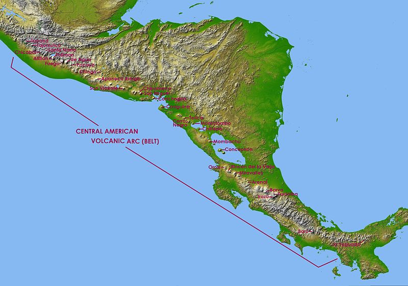
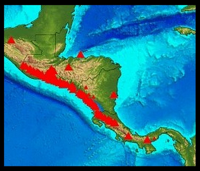


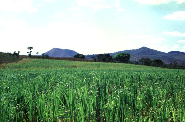
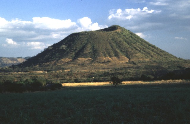
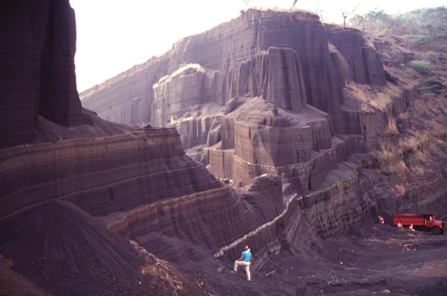
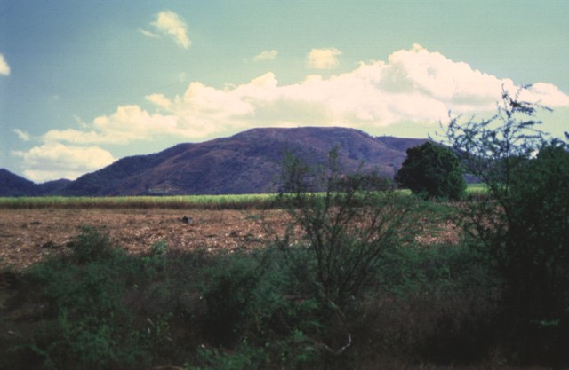
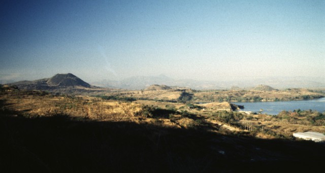
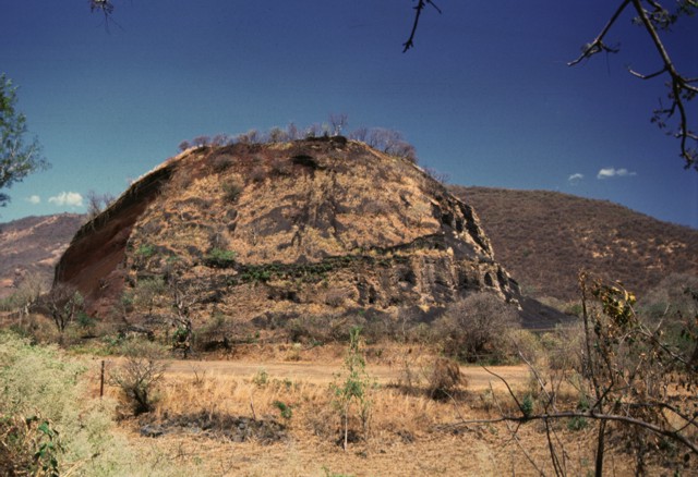
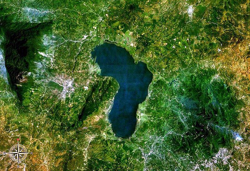

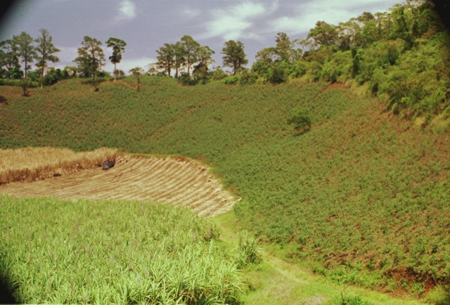
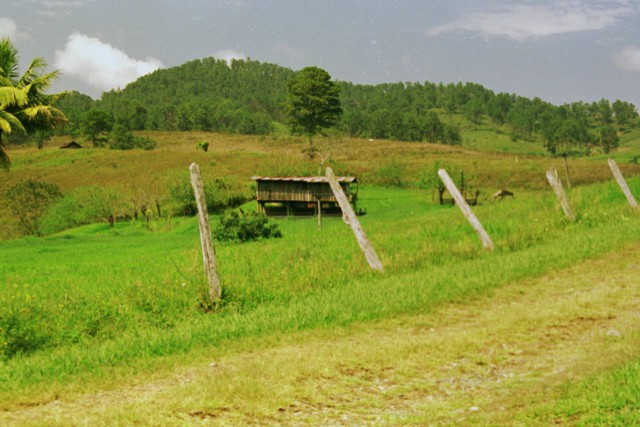
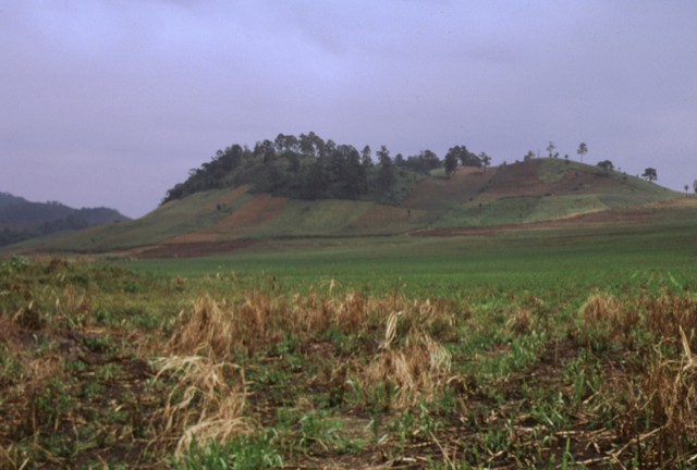


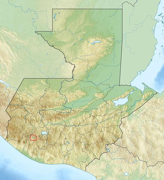
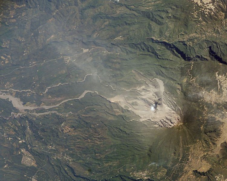

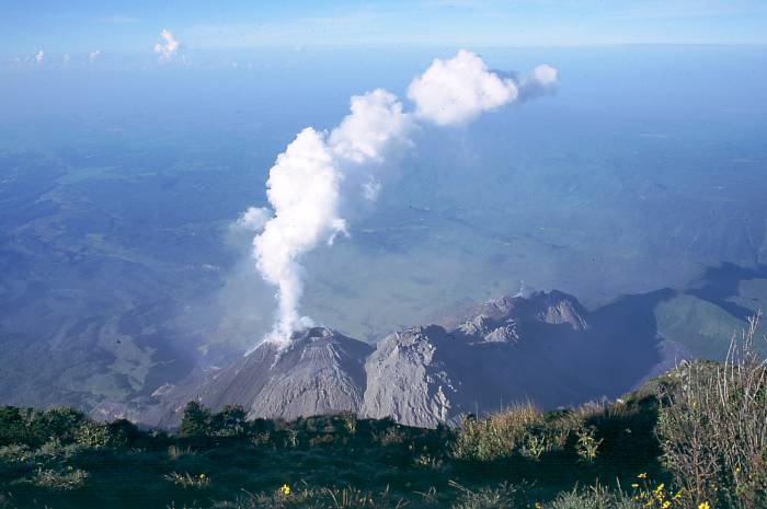
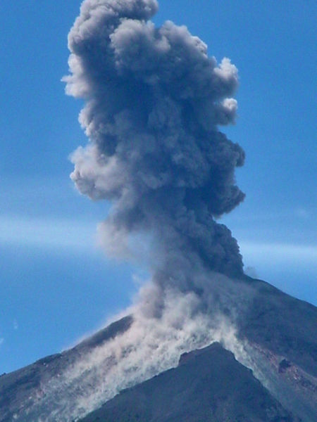

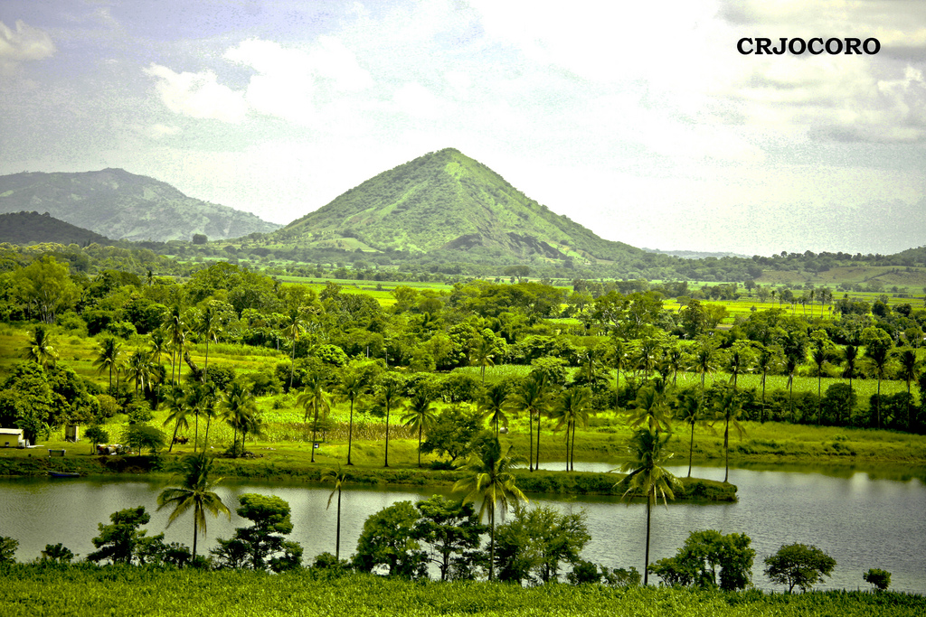


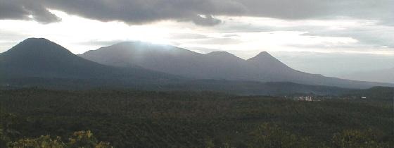
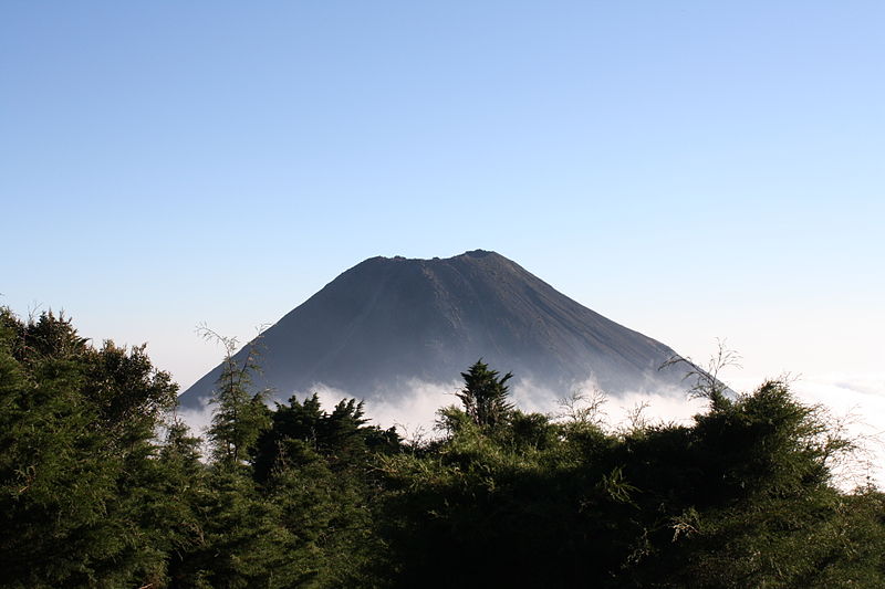
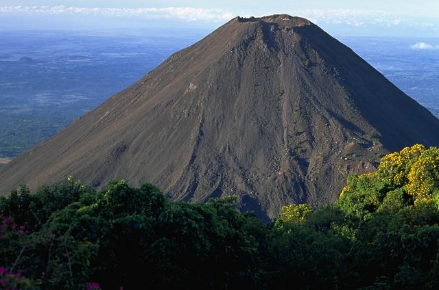

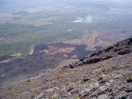
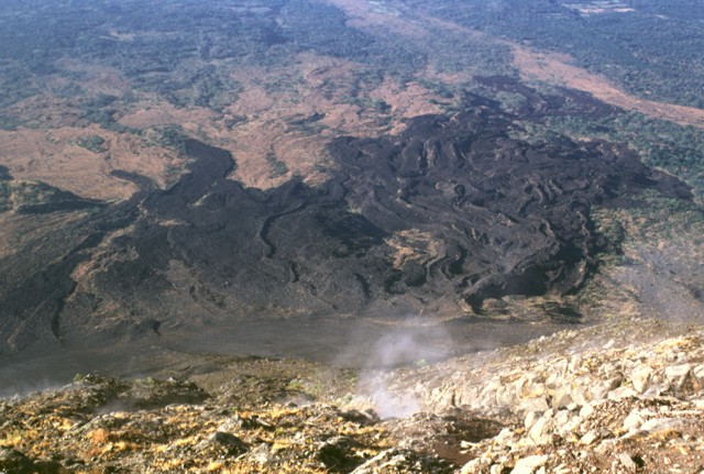
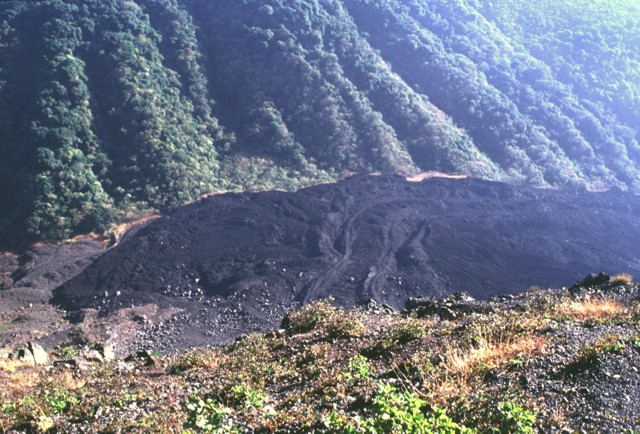
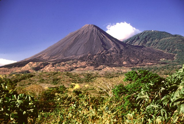

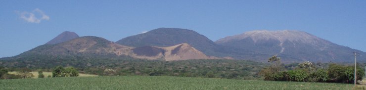
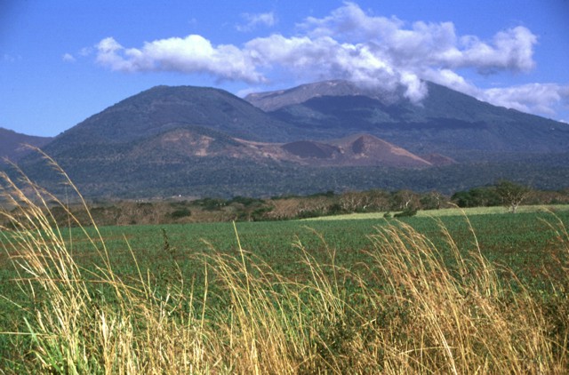
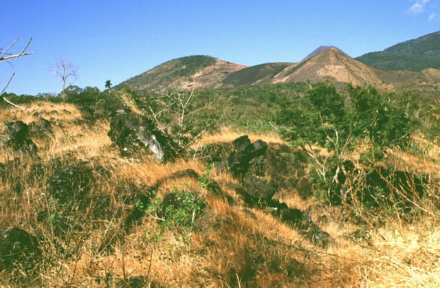
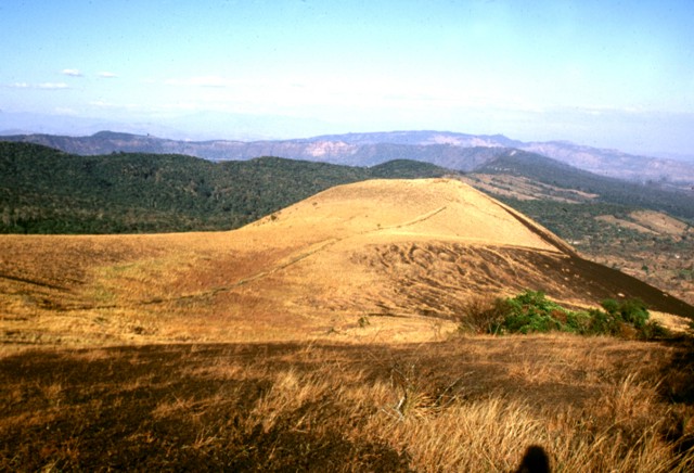
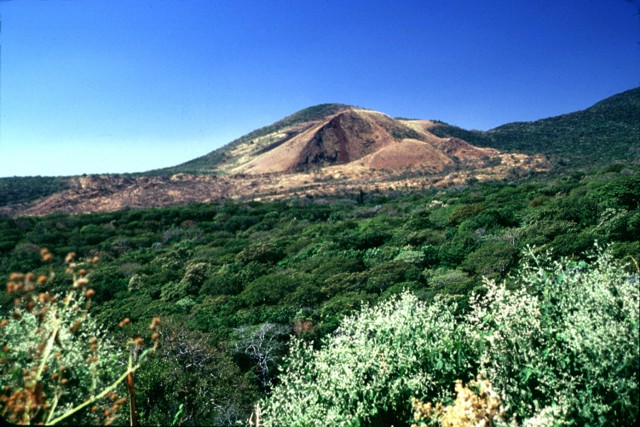
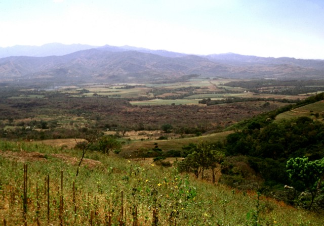
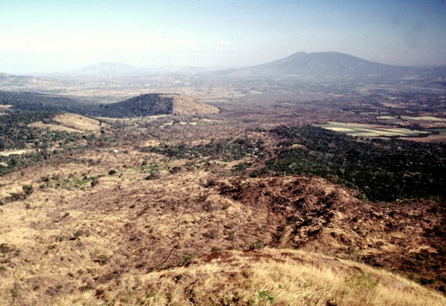
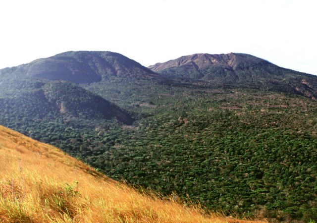
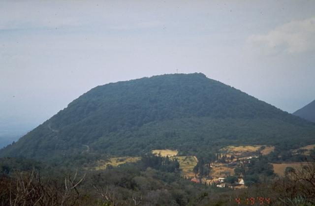
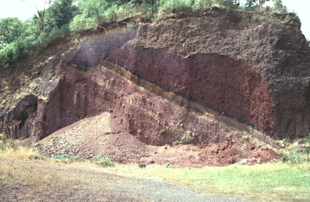
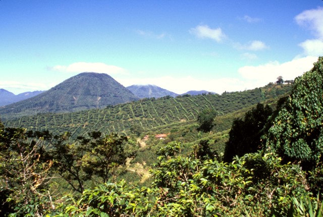


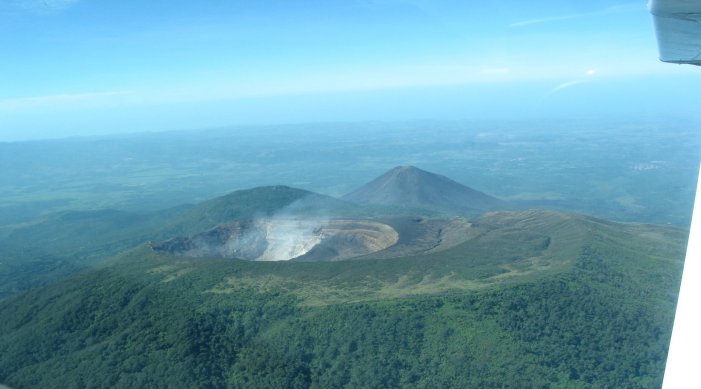


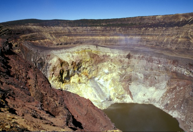
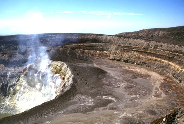
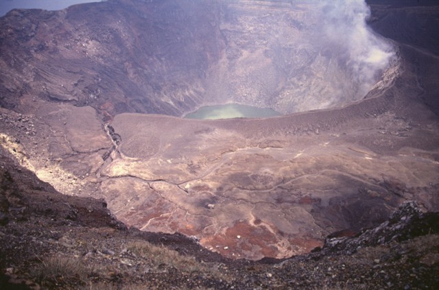
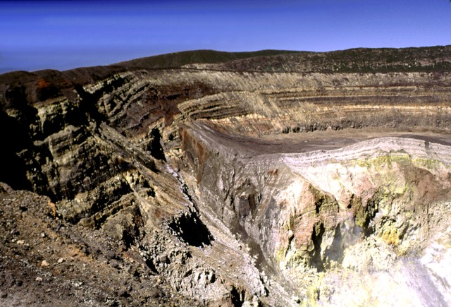
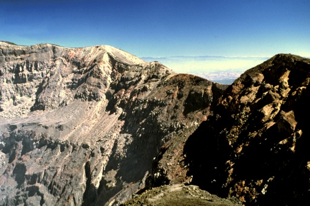
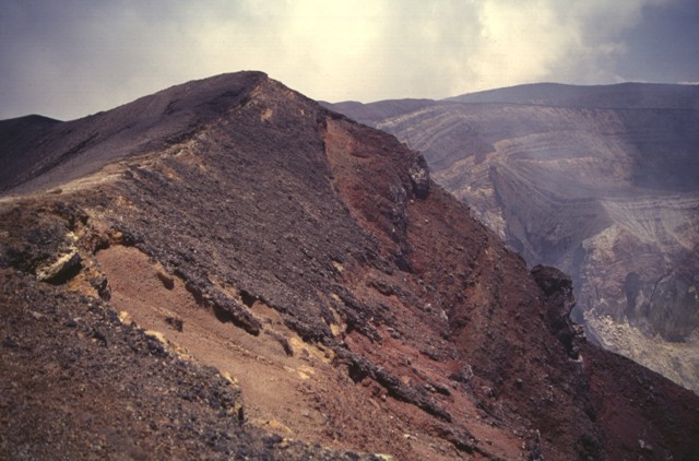
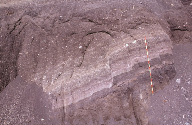
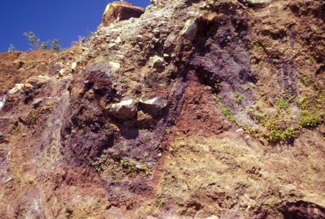
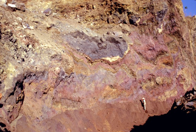
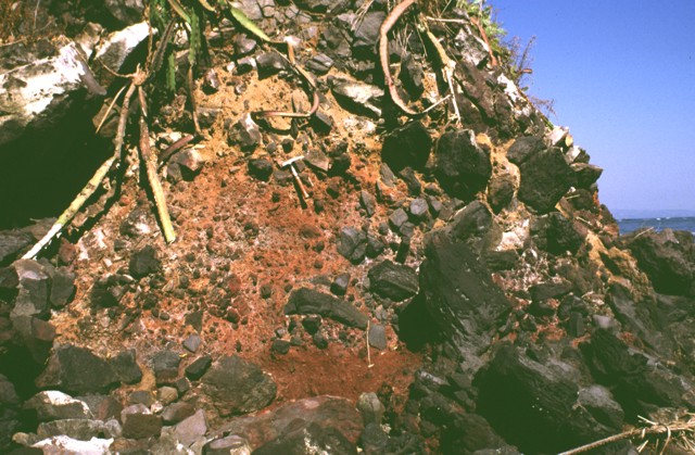

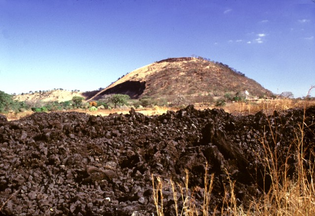
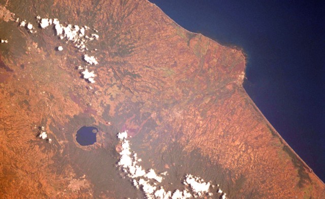
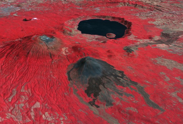
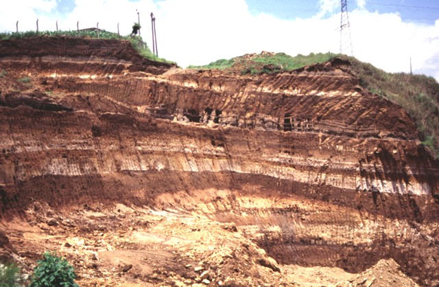
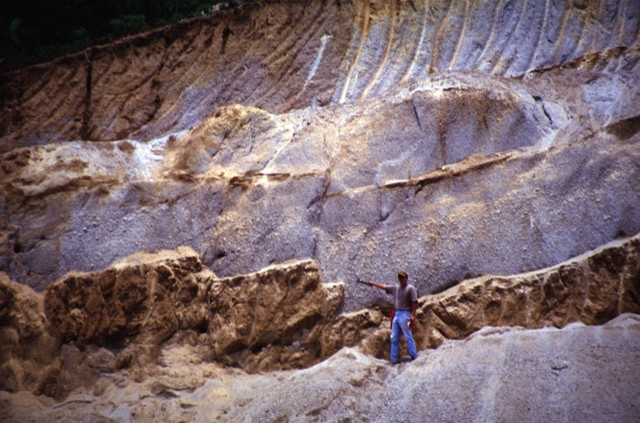
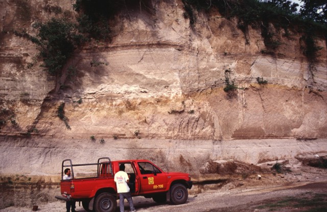
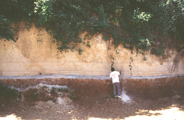
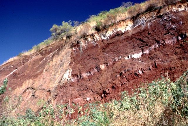
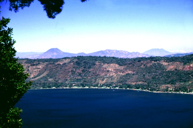
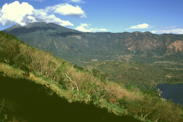
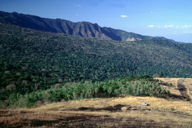
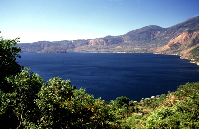
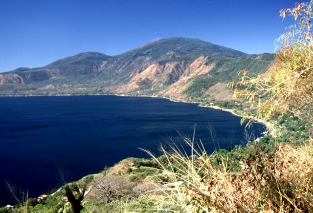
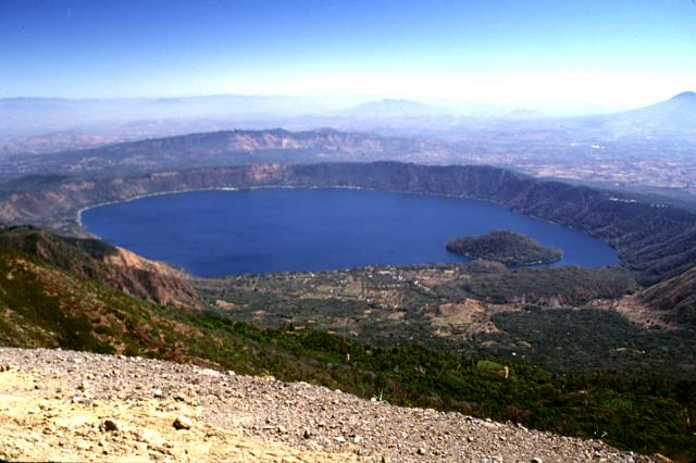
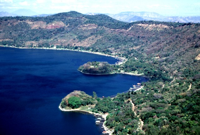
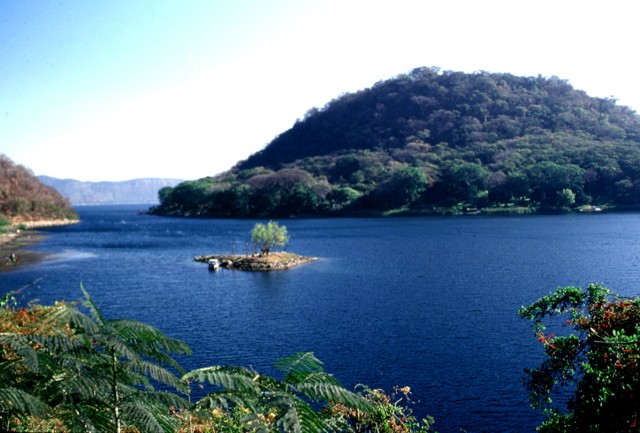
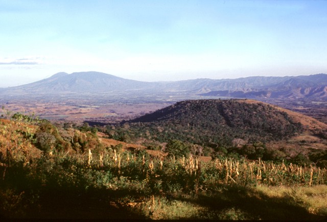
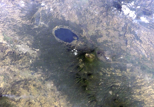
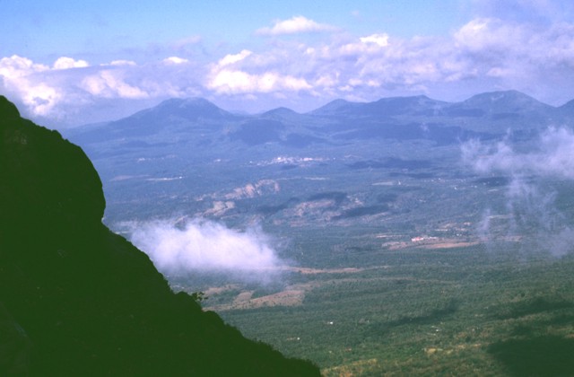
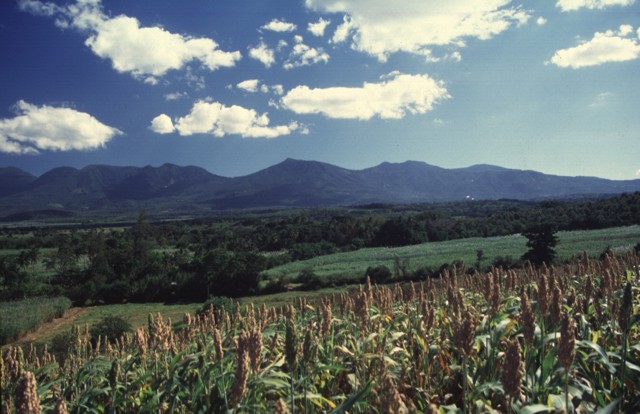
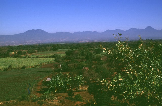
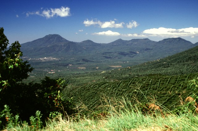
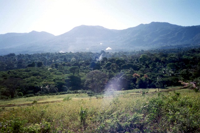
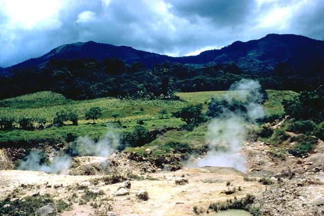
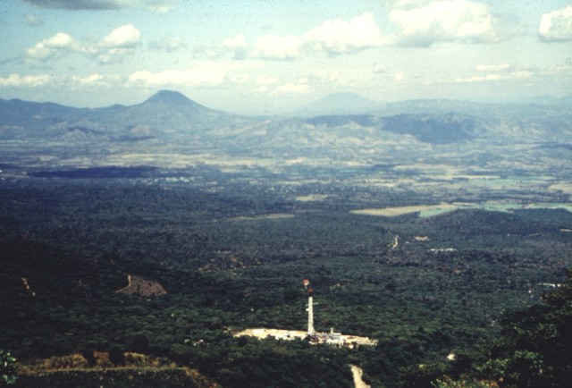
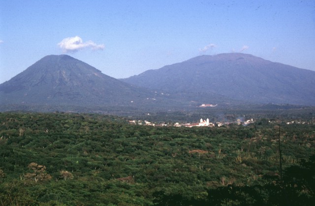

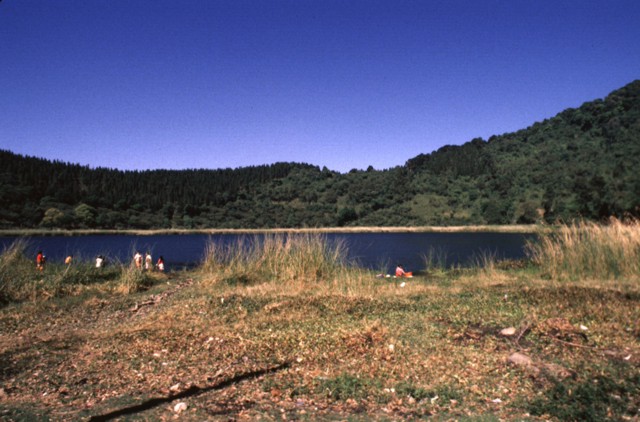
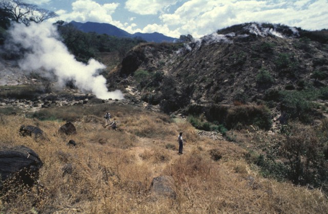
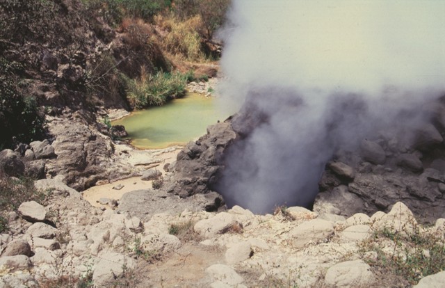
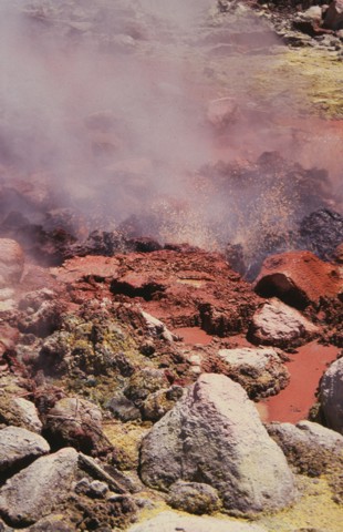
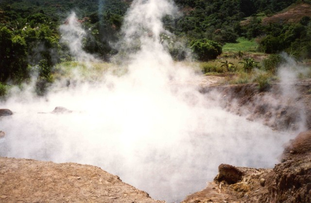
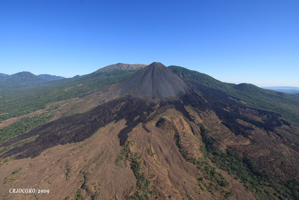
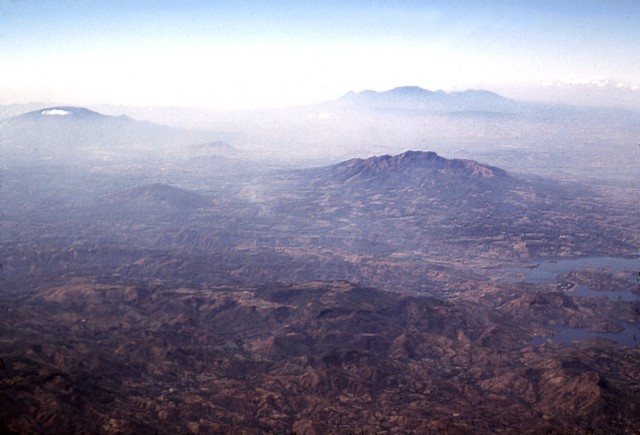

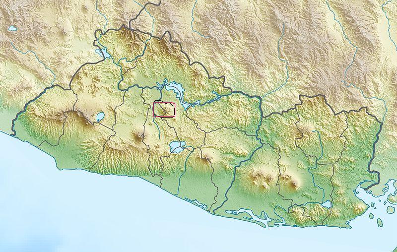
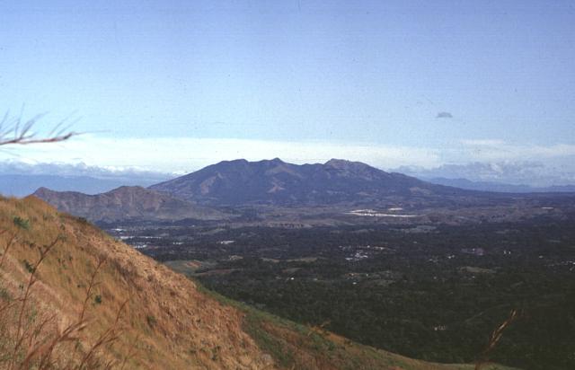

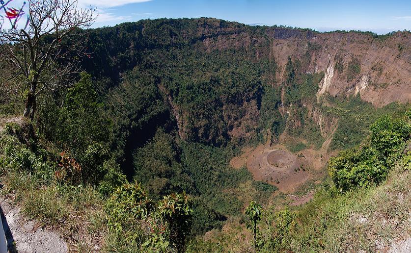
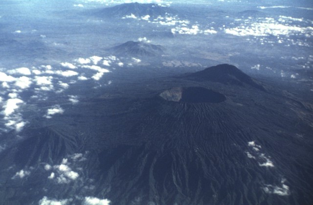
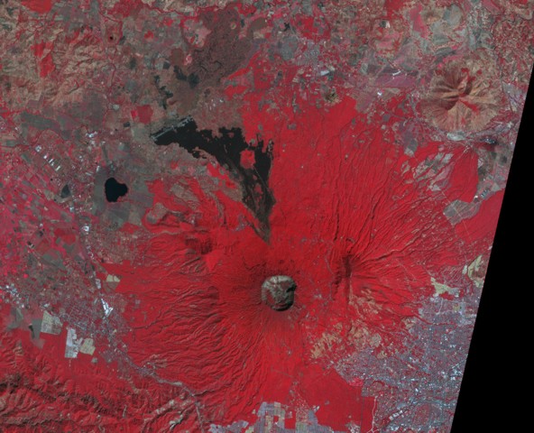
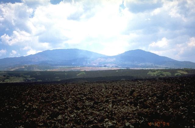
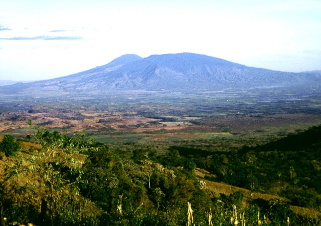
http://en.wikipedia.org/wiki/List_of_volcanoes_in_El_Salvador
http://en.wikipedia.org/wiki/List_of_volcanoes_in_Honduras
http://en.wikipedia.org/wiki/List_of_volcanoes_in_Nicaragua
http://en.wikipedia.org/wiki/List_of_volcanoes_in_Panama
http://en.wikipedia.org/wiki/List_of_volcanoes_in_Costa_Rica
http://www.eoearth.org/article/Guatemala
A solitary cloud lies below the summit of San Salvador volcano (upper left). and peaks of the Sierra Apaneca near the Guatemalan border form the irregular ridge to the right of Santa Ana.
A circular lake partially fills Coatepeque caldera. The Acajutla Peninsula at the bottom, named after the port city of Acajutla, was formed by a massive debris avalanche produced by the late-Pleistocene collapse of Santa Ana volcano. Cerro Alto Cerro el Astillero Cerro Chino