 | Panama Volcanoes and additional photos |
|
|
|
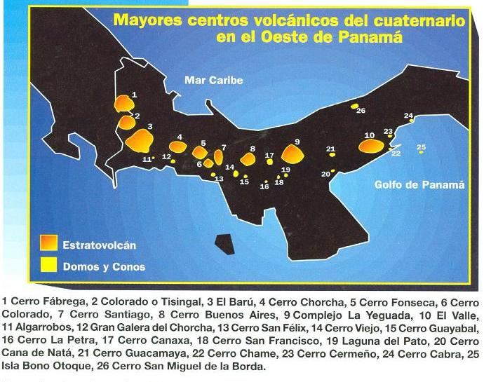
Cerro Guayabal Domo y Cono http://desastres.usac.edu.gt/documentos/pdf/spa/doc16425/doc16425-2e.pdf Cerro santiago, elevation 2121m - http://www.peakbagger.com/peak.aspx?pid=8201 map Isla Otoque and Isla Bono |
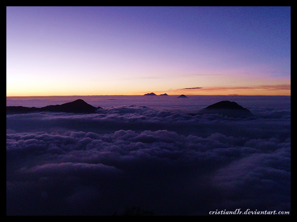
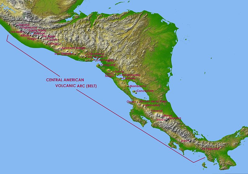
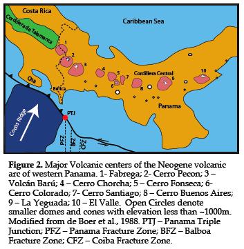
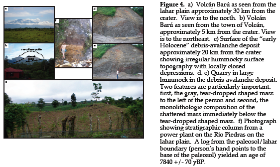
of us do not associate Panama with impressively large, active volcanoes, perhaps because no historic eruptions have occurred in Panama. Thus, there are no newsworthy images of Panamanian eruptions as are common from other volcanoes within the "Pacific Ring of Fire". Despite this fact, it appears that Panama may have played host to one of the largest edifice and sector collapses in Central America during the Holocene. It has been hypothesized that Volcбn Barъ experienced an early Holocene or Late Pleistocene eruption with estimates of ejected material ranging from ~25 km3 to ~100 km3. Debris-avalanche deposits and lahars extend as much as 90 km away from the collapsed edifice, reaching the Pacific Ocean. Our recent preliminary mapping and dating of these deposits tightly constrains the age of this eruption to between ~8.7 ka and ~9.2 ka. However, our recent mapping also indicates that there have probably been multiple Quaternary eruptive events that confound volume estimates for the early Holocene eruption. Volcбn Barъ lies along a complex plate boundary inboard of the Panama Triple Junction (PTJ) located in southern Central America, near the border with Panama and Costa Rica (Fig. 2). The evolution of the PTJ has controlled, to a large degree, the eruptive history of Volcбn Barъ throughout the last ~3 Ma. The active volcanic arc of Central America continues unbroken from Guatemala to central Costa Rica. However, the last active volcano in Costa Rica is Volcбn Turrialba. Southeast of Volcбn Turrialba and inboard of the Cocos Ridge, the arc is extinct and ~8-10 Ma granitic plutons that formed the core of the old volcanic arc [de Boer et al., 1995;] are exposed in the highest range on the Central American isthmus, the Cordillera de Talamanca (Fig. 2). Southeast of the PFZ and the PTJ, active volcanism resumes at Volcбn Barъ (Fig. 2) which has not erupted in historic times, but it is an "active" volcano. There have been 4 eruptive episodes within the last 1300 years (Sherrod et al., 2007) consisting of small lapilli and ash eruptions with accompanying pyroclastic surges. Compositionally these eruptions are andesite to basaltic andesite with minor dacite. The most recent eruptive episode occurred between 420 and 540 cal yr BP. There was an earthquake swarm under the volcano several years ago. http://keckgeology.org/panama2010 |
|
|
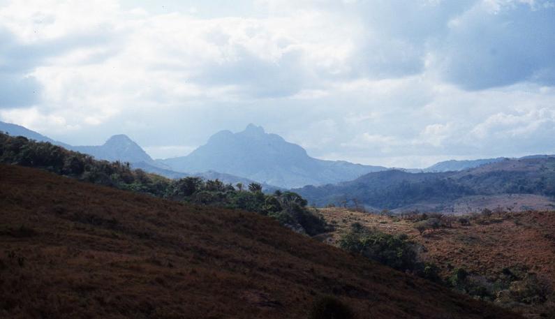
Volcan Cirripo, Cordillera de Talamanca, ultra, volcanic from Costa Rica to Panama:Cirripo CR-3820, Cerro Kamuk,CR-3554m, Cerro Buena Vista CR-3491m, Volcan Baru P-3475, Cerra de la Muerte CR-3451m, Cerro Fabrega P-3335m, Cerro Itamut P -3293m, Cerro Durica CR 3280m, Cerro Echandi P -3163m http://vi.wikipedia.org/wiki/Cordillera_de_Talamanca |
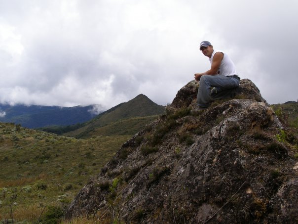
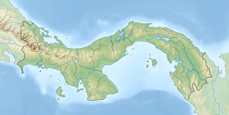
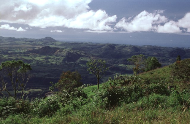
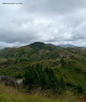
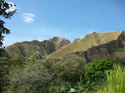
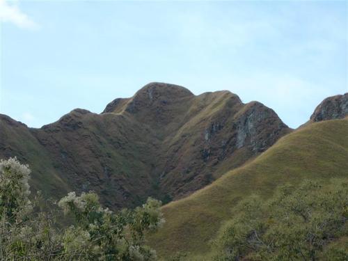
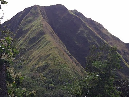
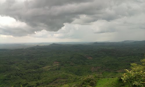
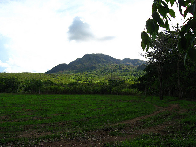
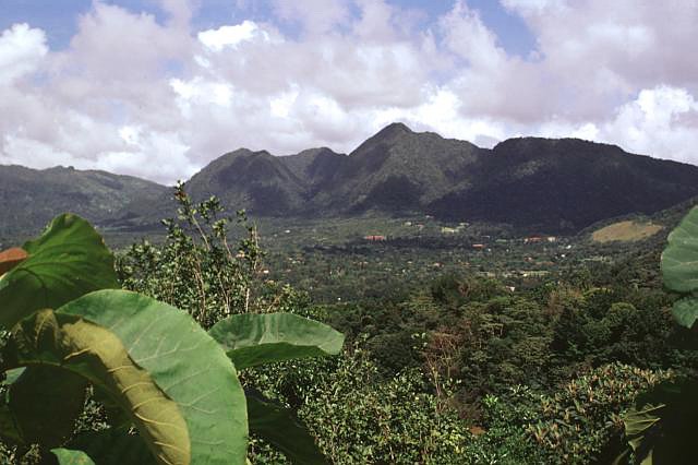
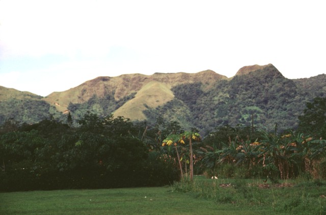
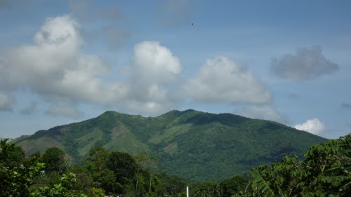
Cerro Punta is a volcano in the western highlands of Panama, elevation more than 2000m |
Almost 2000m above sea level in a bowl-shaped valley surrounded by densely forested mountains, CERRO PUNTA |
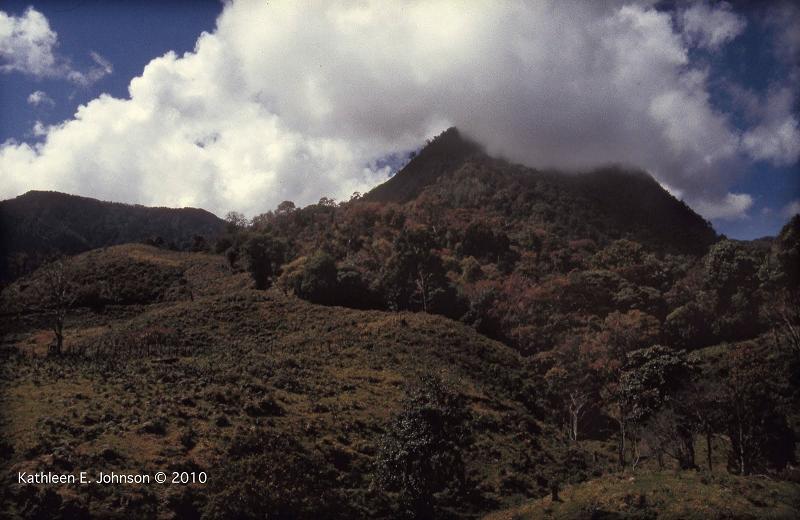
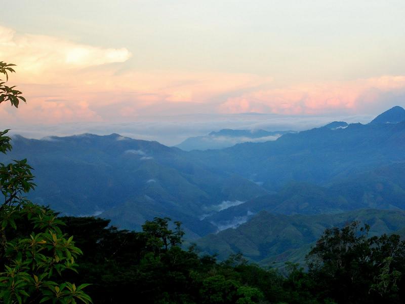
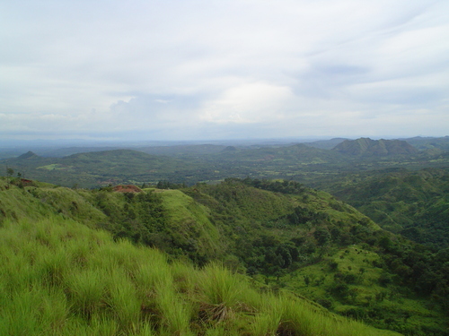
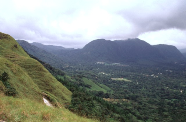
View of one of the Cerros Tararias and out across to the Rio Jet valley |
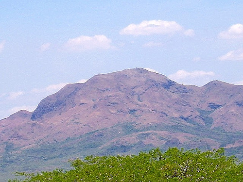
Cerro Fabrega (3,335 m) http://www.birdlife.org/datazone/sitefactsheet.php?id=19263, http://es.wikipedia.org/wiki/Cerro_F%C3%A1brega |
CERRO FABREGA -http://www.nhm.ac.uk/natureplus/blogs/tropicalbotanyresearcher?fromGateway=true |
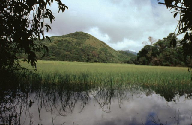
Cerro Totuma is a lava dome within Tisingal Volcano |
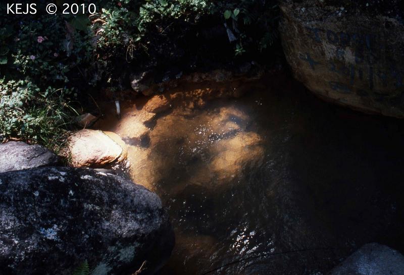
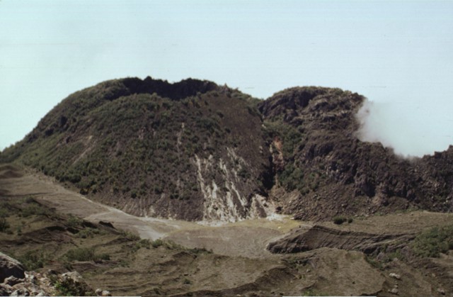
Los Pozos are a series of hot springs inside Tisingal Caldera |
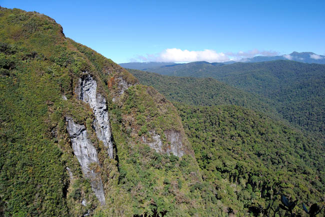
Baru |
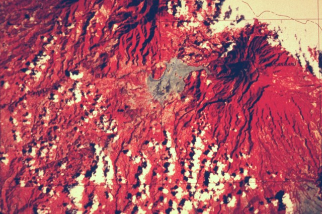
This false-color Landsat image shows two large Quaternary volcanoes of Panama.Baru volcano is at the upper right below the cloud cover, and Volcan Colorado lies at the top center. Virtually the entire lower left quadrant of the image is underlain by debris-avalanche deposits produced by collapse of these two volcanoes, which left large calderas breached widely to the west and SW, respectively. The light-colored area west of Barъ consists of pyroclastic-flow and lahar deposits related to growth of lava domes inside the caldera of Baru.National Aeronautical and Space Administration (NASA), courtesy of Kathleen Johnson (University of New Orleans).http://www.volcano.si.edu/world/volcano.cfm?vnum=1406-01-&volpage=photos |
Baru, sammit 3474m, stratovolcano, last eruption 1550. The Volcan Baru. It is surrounded by a fertile area of cool highlands drained by the Chiriqui and Caldera rivers. The towns of Volcan and Cerro Punta can be found on its western side, while Boquete is on the eastern flank.The occasional fall of hail or ice pellets has been reported on the summit, where the minimal temperature can be below 0¯C (32¯F) and the formation of frost is frequent during the dry season.The last major eruption of the volcano was about 500 AD. There are reports and some evidence of a minor eruption around 1550 AD. However, in 2006, an earthquake swarm occurred underneath the mountain, raising fears that it could erupt sometime in the future with explosive force.The volcano was declared Volcan Baru National Park in 1976 with an area of 14,325 ha. It is a part of the Mesoamerican Biological Corridor. Fauna include the Black Guan, Black-and-white Hawk-Eagle, Underwood''s water mouse, Volcano Junco, Wrenthrush, and Yellow-thighed Finch. http://en.wikipedia.org/wiki/Bar%C3%BA_(volcano) |
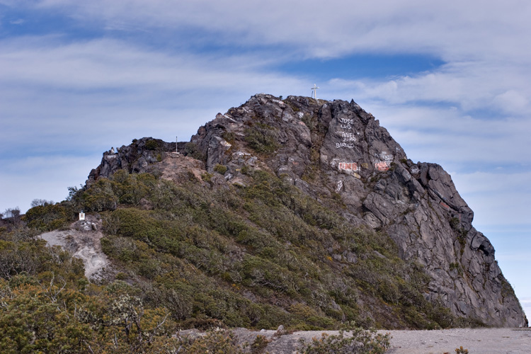
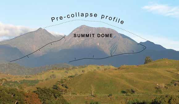
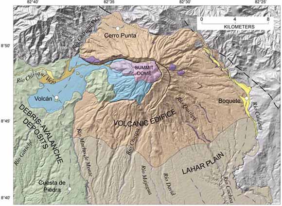
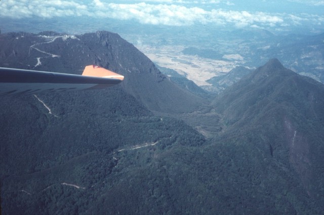
Baru, from the west, showing reconstructed profile of volcano before debris-avalanche collapse many thousands of years ago. Baru is a potentially active volcano.volcano has had four eruptive episodes during the past 1,600 years, including its most recent eruption about 400500 years ago. Several other eruptions occurred in the prior 10,000 years. Several seismic swarms in the 20th century and a recent swarm in 2006 serve as reminders of a restless tectonic terrane. Given this history, Baru likely will erupt again in the near or distant future, following some premonitory period of seismic activity and subtle ground deformation that may last for days or months. Future eruptions will likely be similar to past eruptionsexplosive and dangerous to those living on the volcanos flanks. Outlying towns and cities could endure several years of disruption in the wake of renewed volcanic activity. The caldera wall at this point rises about 300 m above the caldera moat, much of which has been filled in by growth of the summit lava dome complex. The massive horseshoe-shaped caldera formed as a result of edifice collapse and is about 10 km long and 6 km wide. The summit dome as well as the two forested lobes at the lower right are part of a compound dome complex that formed above the primary conduit near the headwall of the breached caldera. -http://pubs.usgs.gov/of/2007/1401/ http://keckgeology.org/panama2010 |
Described in this open-file report are reconnaissance mapping and stratigraphic studies, radiocarbon dating, lahar-inundation modeling, and hazard-analysis maps. Existing data have been compiled and included to make this report as comprehensive as possible. The report is prepared in coooperation with National Secretariat for Science, Technology and Innovation (SENACYT) of the Republic of Panamб and the U.S. Agency for International Development (USAID) -http://pubs.usgs.gov/of/2007/1401/.The summit lava dome complex of the volcano appears beyond the back wall of a large breached caldera that forms an irregular ridge near the summit. |
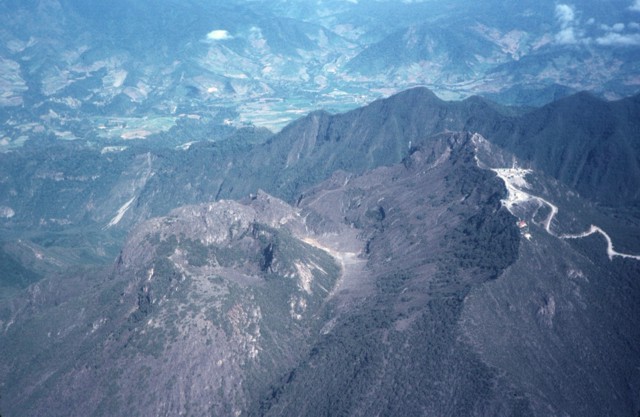
The 10-km-long northern wall of Baru horseshoe-shaped caldera extends from the grassy ridge at the lower left to the sharp peak at the upper left. The broad ridge at the center is the large lava dome complex that filled much of the breached caldera after its collapse. The light-colored flat valley floor of Rнo Macho de Monte in the foreground is underlain by pyroclastic-flow deposits related to growth of the summit lava domes. Baru, nature -http://www.naturephoto-cz.com/baru-volcano-2-photo-2040.html |
Baru is a complex dominantly andesitic stratovolcano in the Talamanca Range near the Costa Rica border. The forested 3474-m-high Baru -large 6-km-wide summit caldera breached widely to the west was formed by a large volcanic landslide, which created a massive debris-avalanche deposit that extends onto the Pacific coastal plain. Post-collapse eruptions have constructed lava domes inside the caldera that have grown to a height exceeding that of the caldera rim. A strong explosive eruption at about 700 AD ended human occupation at the Cerro Punta archaeological site NW of the volcano. Montessus de Ballore (1884) reported a strong eruption at Barъ in the mid-16th century. Sapper (1917) considered this report to be uncertain, but radiocarbon dates subsequently imply tephra deposits younger than about 500 years. Volcбn Barъ is the youngest major volcano in Panamб, and geothermal exploration projects have been undertaken to determine its energy potential. Baru was constructed on the SW flanks of the Talamanca Range, which extends into Costa Rica and contains grabbroic to granodioritic intrusions. The SW flanks of the volcano in this view are dominated by deposits produced by massive slope failure of Baru The absence of caldera collapse associated with magma chamber evacuation at Baru and Cerro Colorado volcano has made this area less promising for geothermal development than other areas in Panama.The summit itself is a large lava dome complex constructed inside the caldera near its eastern headwall. The forested horizontal N-S-trending ridge below and to the right of the summit dome complex consists of toreva blocks, which are segments of the former summit that slid to the west without disaggregating. Last eruption 1555 ago. The summit lava dome complex fills the frame in this view from the NE. The dome complex was emplaced within a large 6 x 10 km wide horseshoe-shaped caldera, whose eastern rim forms the ridge extending across the bottom of the photo. The peak at the far left is part of the SE rim of this caldera. Most pyroclastic deposits erupted after the formation of this horseshoe-shaped caldera have been dated at less than 12,400 years before present.http://www.volcano.si.edu/world/volcano.cfm?vnum=1406-01-&volpage=photos |
The wedge-shaped fields of Finca Respingo lie on the NW flank of Baru and are reached from the village of Cerro Punta. The breached caldera, whose northern rim forms the horizon, has funneled most products (including pyroclastic flows, debris avalanches, and lahars) to the west and south, while the northern side of the volcano has been affected mostly by airfall deposits.Photo by Kathleen Johnson, 1995 (University of New Orleans).http://www.volcano.si.edu/world/volcano.cfm?vnum=1406-01-&volpage=photos |
The light brown area in the center of the photo is the surface of lake sediments deposited in a former small lake ponded between the eastern caldera wall and the central lava dome complex that was constructed within the caldera. The irregular ridge in the center is the northern caldera wall. The steep switchbacked dirt road leads from Boquete up the outer flanks of the the volcano into the caldera moat and then ascends the flanks of the post-caldera dome complex to the summit of Baru (upper left). Photo by Kathleen Johnson, 1998 (University of New Orleans).http://www.volcano.si.edu/world/volcano.cfm?vnum=1406-01-&volpage=photos |
The lava dome complex in the center of the photo is the youngest feature of Baru.It was constructed immediately to the west of a remnant of an older lava dome that forms the horizon. Communications towers can be seen on the ridge to the right of the summit. The ridge on the left horizon is part of the NE wall of Baru''s breached caldera. Photo by Kathleen Johnson, 1998 (University of New Orleans).http://www.volcano.si.edu/world/volcano.cfm?vnum=1406-01-&volpage=photos |
http://keckgeology.org/panama2010 |
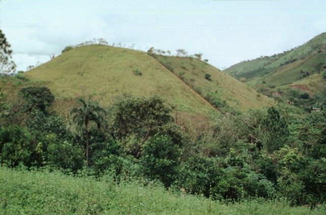
Cerro Totuma is a lava dome within Tisingal Volcano, a neighbor of Volcan Baru in western Panama |
|
|
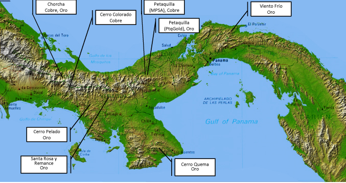
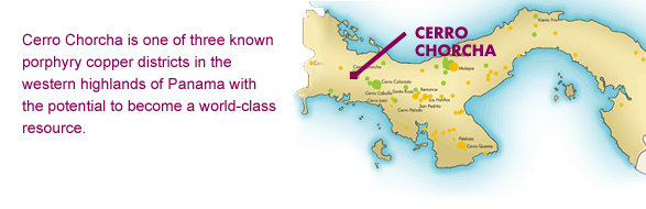
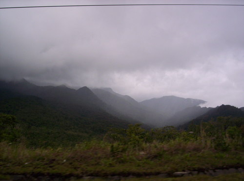
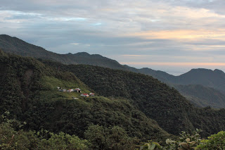
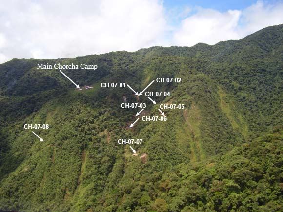
Cerro Chorcha -http://www.tripmondo.com/panama/provincia-de-bocas-del-toro/peje-bobo/picture-gallery-of-peje-bobo/ |
Cerro Chorcha |
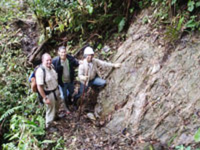
Dominion & Bellhaven Geologists at North-South Stockwork Cerro Chorcha |
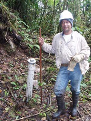
Drill Hole G95-8 244m of 0.53% Cu inc. 45m of 1.12%Cu http://www.dominionminerals.com/Projects/Cerro/ |
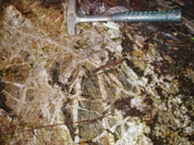
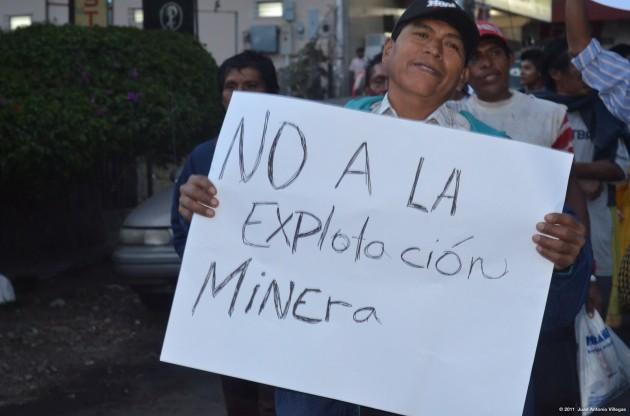
Intense Vein Breccia Cerro Chorcha. The Cerro Chorcha Project is an advanced porphyry copper prospect located in the western cordillera of Panama, roughly 35 kilometres west of the world-class Cerro Colorado porphyry copper deposit which contains a measured and indicated resource of over 1.75 billion tonnes grading 0.64% copper with a 0.5% cutoff.The porphyry copper (gold, silver, molybdenum) mineralization, thought to be between three and five million years old, occurs predominantly within a composite intrusion consisting of quarts diorite and diorite. The intrusive rocks have been affected by phyllic hydrothermal alteration producing quartz-magnetite-sulphide stockworks and sheeted veins zones accompanied by widespread sericite. This phyllic alteration assemblage is a good indicator of potentially economic copper mineralization and contains within it most of the mineralization encountered to date. Widespread propylitic alteration of both intrusive and nearby volcanic rocks surrounds the phyllic center. An east-northeast trending mineralized zone has been truncated by a north-northwest trending post mineral fault zone which appears to have uplifted the northeast side of the deposit and exposed it to erosion. On the northeast side, geochemistry, magnetics and one drill hole suggest that a small, barren core may be surrounded by relatively high grade mineralization. Surface rock chip geochemistry shows strong copper and gold anomalies over the zone and an irregular ring of molybdenum anomalies at its periphery.The known hydrothermal alteration and copper mineralization at the Cerro Chorcha Project covers a minimum of 2.5 square kilometers and is contained within diorite-quartz diorite exhibiting pervasive silicification, phyllic alteration, quartz stockwork veining, and local potassic alteration (secondary biotite). Copper mineralization (chalcopyrite and bornite) is associated with abundant magnetite (2% to 4% in phyllic altered rock, 10% to 15% in quartz stockworks) and lesser pyrite. The mineralization on the southwest side of the fault remains relatively unexposed by erosion and has not been well explored by drilling. At the surface, this part of the mineral complex is highly anomalous in molybdenum, but only weakly indicated by copper and gold. Volcanic rocks cover a segment of this portion of the mineralization. - http://www.dominionminerals.com/Projects/Cerro/ |
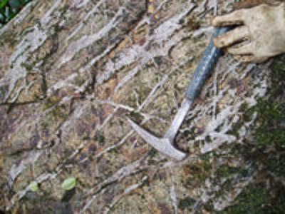
Quartz Magnetite Stockwork Cerro Chorcha |
La Chorcha explarationes |
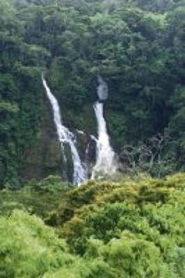
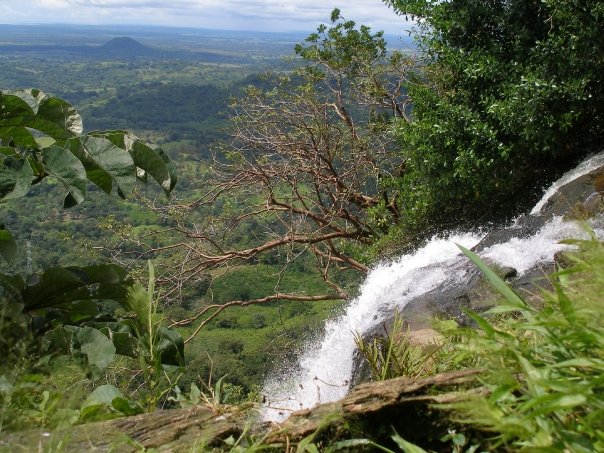
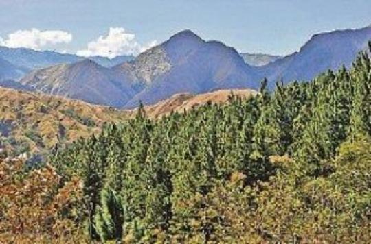
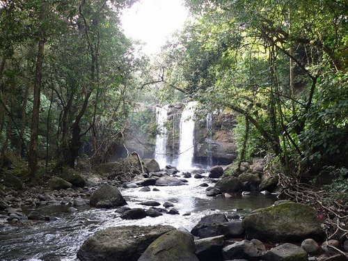
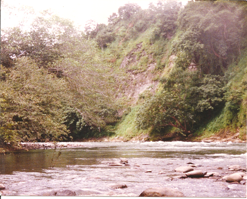
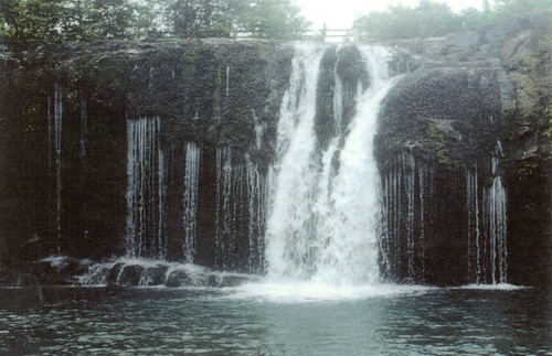
Cerro Chorcha and copper mines, cascades |
Chorcha |
Chorca waterfall |
El Valle |
The outer eastern flanks of the large horseshoe-shaped caldera of volcano Baru in the foreground, with the northern wall of the caldera forming the ridge at the right. The 10-km-long northern caldera wall ranges from a maximum altitude of 3300 m (the sharp peak at the right) to 600 m elevation at its base. The road at the left crosses over the caldera rim into its moat and then up to the top of a post-collapse lava dome complex that forms the summit of the volcano.Photo by Tom Casadevall, 1994 (U.S. Geological Survey). http://www.volcano.si.edu/world/volcano.cfm?vnum=1406-01-&volpage=photos |
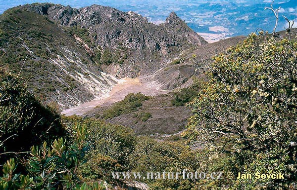
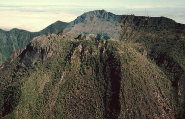
The youngest domes of the compound lava dome complex of Barulie across a narrow moat SW of the summit dome. These young domes rise about 80 m above the moat. The summit of the SE-most dome (left) is cut by a roughly 200-m-wide crater. Baru is Panama''s youngest major volcano, and harmonic tremor was detected beneath the Baru complex in 1963. Photo by Paul Kimberly, 1998 (Smithsonian Institution).http://www.volcano.si.edu/world/volcano.cfm?vnum=1406-01-&volpage=photos |
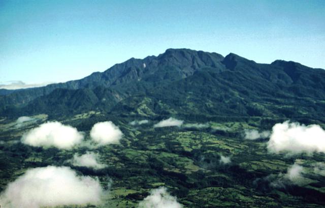
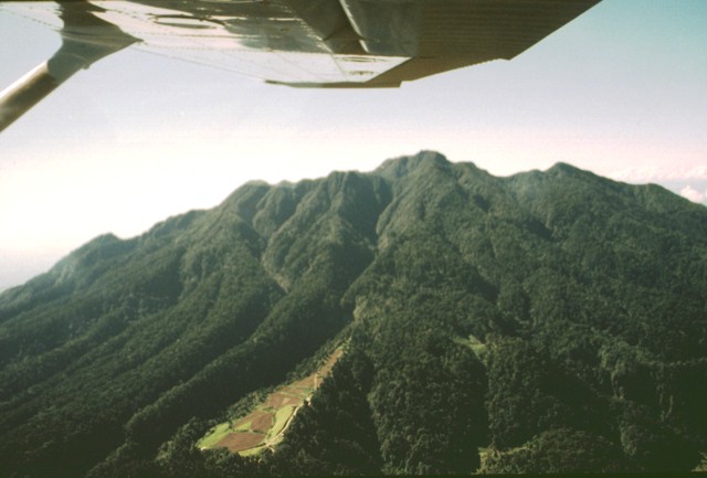
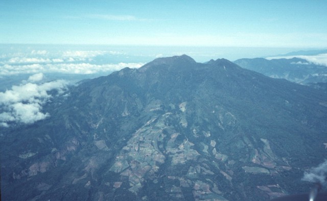
The summit lava dome complex of Baru is seen in an aerial view from the SE. The road at the right leads to communication towers at the summit of the volcano. The youngest domes of Baru one of which contains a prominent summit crater, are at the left center. The ridge extending across the photo beyond the domes is the northern wall of Baru''s large horseshoe-shaped caldera. The slopes of Volcan Colorado volcano appear at the upper left, and the rounded lava dome at the upper right is Cerro Punta, at the eastern foot of Volcan Colorado. Photo by Tom Casadevall, 1994 (U.S. Geological Survey).http://www.volcano.si.edu/world/volcano.cfm?vnum=1406-01-&volpage=photos |
The flat-topped peak beyond volcano Baru at the upper right is Volcan Colorado (also known as Tisingal), a Pleistocene volcano immediately NW of Baru.its summit has been truncated by a large breached caldera.Photo by Tom Casadevall, 1994 (U.S. Geological Survey).-http://www.volcano.si.edu/world/volcano.cfm?vnum=1406-01-&volpage=photos |
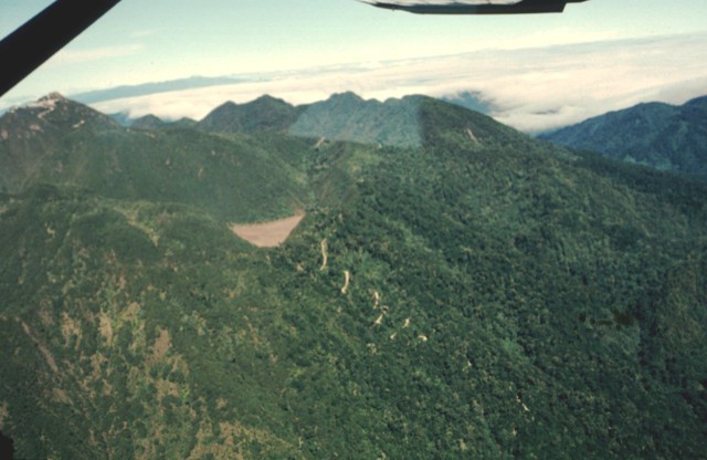
The irregular, hummocky terrain extending to the south toward the Pacific coastal plain is part of a massive debris-avalanche deposit that originated from edifice collapse of Colorado Volcano.This view is from Cerro Pando, a satellitic lava dome south of Volcбn Colorado. Both volcanoes of the Baru-Colorado complex underwent edifice failure, producing voluminous debris-avalanche deposits that form a broad blanket reaching beyond the Pan-American highway to the Pacific coastal plain.Photo by Lee Siebert, 1998 (Smithsonian Institution).http://www.volcano.si.edu/world/volcano.cfm?vnum=1406-01-&volpage=photos |
Las Lagunas, a group of small ponds west of Baru formed between hummocks of a massive debris avalanche that originated from collapse of the volcano. Las Lagunas lies 5 km WSW of the town of Hato del Volcanand 19 km from the headwall of the collapse scarp.Photo by Paul Kimberly, 1998 (Smithsonian Institution).http://www.volcano.si.edu/world/volcano.cfm?vnum=1406-01-&volpage=photos |
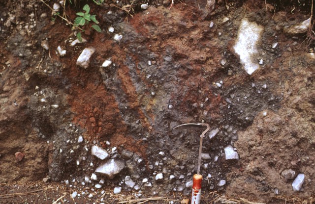
A color mottling characteristic of debris-avalanche deposits is visible in a roadcut near the town of Cuesta de Piedra, south of Baru along the road to Hato del Volcan A massive debris-avalanche deposit produced by collapse of the volcano extends southward to beyond the Pan-American highway.Photo by Lee Siebert, 1998 (Smithsonian Institution).http://www.volcano.si.edu/world/volcano.cfm?vnum=1406-01-&volpage=photos |
|
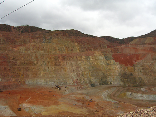
Cerro Colorado Copper Project Evaluated. Panama is Copper-Rich.Panama Tenders Cerro Colorado Mine |
Cerro Colorado Mine - one of the largest copper reserves in Latin Americahttp://en.centralamericadata.com/en/article/home/Panama_Tenders_Cerro_Colorado_Mine. |
Cerro Colorado cuprum mine |
Exploitation of mines in Panama |
|
Cerro Colorado |
Algarrobos |
Penias Fonseca |
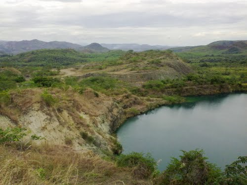
Cerro la Petra. The information regarding Cerro la Petra in Panama on this page is published from the data supplied by the National Geospatial-Intelligence Agency, a member of the Intelligence community of the United States of America, and a Department of Defense (DoD) Combat Support Agency. No claims are made regarding the accuracy of Cerro la Petra information contained here. All suggestions for corrections of any errors about Cerro la Petra should be addressed to the National Geospatial-Intelligence Agency. http://geographic.org/geographic_names/name.php?uni=-258944&fid=4802&c=panama. Cerro la Petra is a hill in Veraguas |
Lago Canazas -http://travelingluck.com/North+America/Panama/Veraguas/_3702997_Cerro+la+Petra.html http://www.panoramio.com/photo/34382868 |
Cerro San Felix Domo y Cono |
Cerro Santiago and San Felix area -http://janbirdingblog.blogspot.com/2010/09/mud-rain-and-endemics.html |
Cerro Santiago |
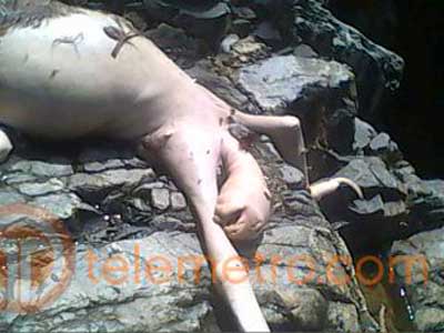
The Panamanian Blue Hill Monster (or Cerro Azul Monster) - http://scienceblogs.com/tetrapodzoology/2009/09/18/panamanian-blue-hill-monster/ una mutacion -http://www.estudio1panama.com/?p=18595 |
Cerro Viejo |
Cerro San Francisco |
San Francisco |
el Picacho del Ola |
Cerro Picacho del Ola, Coole |
Cerro Picacho del Ola |
El Pato is in Pacific West, Panama. The nearest places to El Pato are Corona (2 km north), Corregimiento La Laguna (2 km south), Llano Colorado (2 km south) -http://mapcarta.com/19766184 |
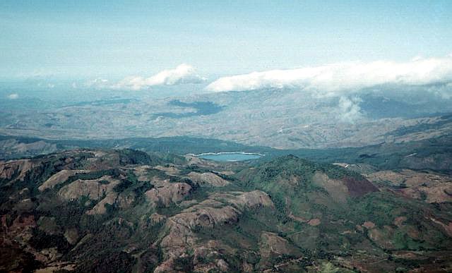
La Yeguada |
La Yeguada |
Complejo La Yeguada , stratovolcano, Pleistocene, 1273m, Pleistocene-Fumarolic (also known as Chitra-Calobre) is a massive volcanic complex.the mountain range was indeed not home for a volcano, but more for a caldera. La Yeguada, also known as Chitra-Calobre, is a massive volcanic complex was active from the Miocene into the Quaternary. The youngest major feature of La Yeguada is located within a large fault-bounded horst that forms the high point of the volcanic complex east of Laguna La Yeguada. The latest eruptions took place from the northern part of the horst about 220,000 years ago at Cerro Corero lava dome (also known as Cerro de la Charca), north of El Castillo. The youngest feature of the La Yeguada complex is the Media Luna cinder cone, which was erupted through Tertiary ignimbrite deposits at the NW side of the complex. The oldest peat layer within a small lake dammed by a basaltic lava flow originating from the cone was radiocarbon dated at about 300-350 years ago, but later dating has shown that flow was erupted about 45,000 years ago, and that the La Yeguada complex has not had Holocene eruptions. Warm springs are scattered throughout the complex, and the Chitra-Calobre geothermal field is one of three areas in Panamб that have been the object of intensive geothermal exploration. The uplifted central horst of La Yeguada volcanic complex rises in the foreground with Laguna La Yeguada (center) to the west. This massive volcanic center, also known as Chitra-Calobre, lies in west-central Panamб. El Castillo (left) is the high point of the complex, and Cerro Corero de la Charca (right) is a late-Pleistocene rhyodacitic compound lava dome. The youngest feature of La Yeguada complex is the Media Luna cinder cone, which lies at the NW margin of complex, out of view to the right.The topographic high point of the fault-bounded central horst of La Yeguada volcanic complex is Cerro el Castillo (right center). It and Cerro Novillo at the lower right are part of older Miocene rocks uplifted in the horst. Quaternary volcanism took place in the northern part of the horst, out of view to the right, about 220,000 years ago. In the background are extensive Tertiary ignimbrite deposits of La Yeguada formation, some of which are thought to have originated from vents in the central horst. Photo by Tom Casadevall, 1994 (U.S. Geological Survey).http://www.volcano.si.edu/world/volcano.cfm?vnum=140601-A&volpage=photos |
Es un complejo volcбnico masivo localizado en la provincia de Veraguas |
The grassy area in the sunlight at the left center is an explosion crater formed on the SW side of El Castillo volcanic horst, whose high point forms the right horizon. The breached crater is one of the Quaternary vents formed during reactivation of the horst.Photo by Lee Siebert, 1998 (Smithsonian Institution).http://www.volcano.si.edu/world/volcano.cfm?vnum=140601-A&volpage=photos |
Grass-covered Media Luna cinder cone in the center of the photo was constructed in the middle of the Media Luna valley immediately NW of the settlement of the same name. The cone contains two craters and is breached to the west. A lava flow from the base of the cone traveled about 3 km down the valley. A radiocarbon date of about 360 years ago was obtained from peat layers in a small lake formed by the flow.Media Luna cinder cone at the NW side of La Yeguada volcanic complex is its youngest feature. A basaltic lava flow issued from the western flank of the crater and traveled about 3 km to the west. A radiocarbon date of 360 +/- 90 years before present (BP) was obtained from sediment in a lake formed when the lava flow blocked a local drainage. A 310 +/- 80 years BP date was obtained from an apparent airfall deposit of unknown origin in Laguna la Yeguada.Photo by Paul Kimberly, 1998 (Smithsonian Institution).http://www.volcano.si.edu/world/volcano.cfm?vnum=140601-A&volpage=photos |
The vegetation-mantled slope at the center is the margin of a low-potassium basaltic lava flow erupted from the Media Luna cinder cone. The morphologically youthful flow traveled about 3 km down the Quebrada Media Luna, and diverted the stream to the northern side of the valley. Near its distal end the flow fills a broad valley, diverting the Rнo Chitra to the far western side of the valley. The lowest peat layer from a small lake created when the flow blocked a local drainage was radiocarbon dated at about 360 years ago.Photo by Lee Siebert, 1998 (Smithsonian Institution).http://www.volcano.si.edu/world/volcano.cfm?vnum=140601-A&volpage=photos |
El Castillo volcanic horst rises to the east of Laguna La Yeguada. In the center is Cerro Corero de la Charca, a rhyodacitic compound lava dome that was erupted at the northern end of the horst about 220,000 years ago within a small caldera cutting El Castillo (right horizon). The most recent activity at El Castillo occurred on its northern flanks at the intersection of major faults trending NNW, NW, and ENE. The Chitra-Colobre geothermal system at La Yeguada has been the site of extensive geothermal exploration.Photo by Paul Kimberly, 1998 (Smithsonian Institution). |
Cerro Corero de la Charca rising above the western shore of Laguna La Yeguada is the youngest silicic feature of La Yeguada complex (also known as Chitra-Calobre). The compound 1229-m-high rhyodacitic lava dome was erupted about 220,000 years ago within a 1.5-km-wide caldera and produced pyroclastic-flow deposits that extend to the SE. This eruption occurred at the northern end of the El Castillo horst and marked its latest activity.Photo by Paul Kimberly, 1998 (Smithsonian Institution).http://www.volcano.si.edu/world/volcano.cfm?vnum=140601-A&volpage=photos |
Cerro Guacamaya |
Cerro Guacamaya |
Cerro Guacamaya |
Cerro Guacamaya |
El Valle |
El Valle, 1185m, Holocene stratovolcano, last eruption unknown, is an active stratovolcano located in central Panama and is the easternmost volcano along the Central American Volcanic Arc which has been formed by the subduction of the Nazca Plate below Central America. Some time prior to 200,000 years ago, the volcano underwent a huge eruption event that caused the top of the volcano to collapse into the empty magma chamber below forming a large caldera. Several lava domes have developed inside the caldera since the collapse -- forming Cerro Pajita, Cerro Gaital and Cerro Caracoral peaks. Prior to research in the early 1990s, it was thought that no active volcanism existed within Panama. But redioactive dates from El Valle show that the volcano last erupted as recently as 200 KA. stratovolcano cut by a large compound Pleistocene caldera. The 6-km-wide El Valle de Antуn caldera was formed about 56,000 years ago in association with eruption of the dacitic El Hato pyroclastic flows. The caldera has steep, 200-300 m high walls overlooking a flat floor underlain by deposits of a former caldera lake and currently occupied by the town of El Valle. Cerro Pajita, Cerro Gaital, and Cerro Caracoral form a dacitic lava dome complex that was constructed along an E-W-trending lineament within the caldera and forms the 1185 m high point of the volcano. Major phreatomagmatic plinian eruptions produced when magma interacted with caldera-lake water as recently as about 34,600 years ago generated pyroclastic flows that reached the Pacific coast, 25 km to the south. Phreatic eruptions have occurred since then (the most recent dated eruption took place about 13,000 years ago), and activity may have continued into the Holocene (IRHE, 1987). A geothermal exploration program is currently underway to evaluate the energy potential of the caldera.Three compound lava domes were constructed along the northern margin of the youngest caldera of El Valle volcano, 80 km SW of Panama City. Cerro Pajita (left), Cerro Gaital (center), and Cerro Caracoral (right) rise above the flat caldera floor in this view from the SW caldera rim. The 6-km-wide El Valle de Antуn caldera was formed about 1 million years ago. Post-caldera eruptions have occurred as recently as about 13,000 years ago. A geothermal exploration program is currently underway to evaluate the energy potential of the caldera.Photo by Lee Siebert, 1998 (Smithsonian Institution).http://en.wikipedia.org/wiki/El_Valle_(volcano) http://www.volcano.si.edu/world/volcano.cfm?vnum=1406-03-&volpage=photos |
The unassuming profile of the broad irregular ridge on the horizon rising to the NE above the Pacific coastal plain is El Valle volcano, one of the youngest in Panama. El Valle de Antуn caldera truncates the volcanic complex and is drained by the Rнo Antуn through a breach in the caldera rim at left center. Post-caldera lava domes can be seen on the center horizon. Late-Pleistocene plinian eruptions from El Valle have produced pyroclastic flows that reached the coast. Tertiary volcanic centers surround the caldera complex.A dissected pyroclastic-flow apron extends to the SE from El Valle caldera. Pyroclastic flows from phreatomagmatic eruptions about 50,000 to 34,000 years ago traveled more than 25 km to the Pacific coast of Panama and their deposits blanket the southern and eastern flanks of the volcano. Tertiary volcanic centers at the right form dissected peaks beyond the eastern flanks of the caldera.Photo by Lee Siebert, 1998 (Smithsonian Institution).http://www.volcano.si.edu/world/volcano.cfm?vnum=1406-03-&volpage=photos |
The town of El Valle occupies the flat floor of El Valle de Anton caldera. This view from La India Dormida on the west caldera rim looks across the 6-km-wide caldera. A lake once covered the caldera floor, and large plinian phreatomagmatic eruptions took place during the latest Pleistocene from vents within the caldera. At the extreme left is Cerro Caracoral, the easternmost of three lava domes constructed along the northern caldera margin. The latest plinian eruptions originated from Mata Ahogado, east of the caldera rim at the left center.El Valle de Anton caldera is drenaged by the Rio Anton through a notch in its SW caldera rim (right). A late-Pleistocene lake occupying the caldera floor persisted until it drained sometime during the Holocene. Cerro Cara Iguana (upper left) on the caldera rim is capped by El Hato pyroclastic-flow deposits related to formation of the caldera about 1.1-1.3 million years ago. A well-preserved crater caldera rim was the inferred source of the India Dormida ignimbrite, erupted about 220 KA.The SE wall of El Valle de Anton caldera rises up to 300 m above the flat caldera floor. The caldera was formed during major explosive eruptions about 1.1-1.3 million years ago. Post-caldera phreatomagmatic and phreatic eruptions related to a former lake filling the caldera floor have continued until the latest Pleistocene. More than 90 m of lake sediments were deposited on the caldera floor prior to draining of the lake through a breach in the SW caldera rim. The peak at the right center is Cerro la Silla. Photo by Paul Kimberly, 1998 (Smithsonian Institution). http://www.volcano.si.edu/world/volcano.cfm?vnum=1406-03-&volpage=photos |
The post-caldera lava domes Cerro Pajita, Cerro Gaital, and Cerro Caracoral (seen left to right from La India Dormida on the west caldera rim) were formed along an E-W-trending lineament about 900,000 years ago. The easternmost dacitic dome (Cerro Caracoral) also contains andesitic rocks. Gabbroic xenoliths are common in the central dome, Cerro Gaital. The Rнo Mar pyroclastic flows were produced about 40,000-50,000 years ago from a vent on the caldera floor between the Gaital and Pajita domes.Photo by Paul Kimberly, 1998 (Smithsonian Institution).http://www.volcano.si.edu/world/volcano.cfm?vnum=1406-03-&volpage=photos |
La India Dormida ("The Sleeping Indian") is a portion of the western rim of El Valle de Anton caldera that forms a distinctive profile. A popular hiking trail leads to the saddle (left) at the foot of La India Dormida and then to its head, which rises 300 m above the flat caldera floor. The caldera wall exposes deposits of Tertiary Iguana pyroclastic flows that are capped by the Tertiary Piedra andesitic lava flow.Photo by Lee Siebert, 1998 (Smithsonian Institution).http://www.volcano.si.edu/world/volcano.cfm?vnum=1406-03-&volpage=photos |
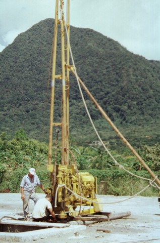
This drill rig on the floor of El Valle de Anton caldera is part of a major geothermal exploration program at El Valle volcano. In the background to the north is Cerro Gaital, the highest of three post-caldera lava domes constructed along the northern caldera rim.http://www.volcano.si.edu/world/volcano.cfm?vnum=1406-03-&volpage=photos |
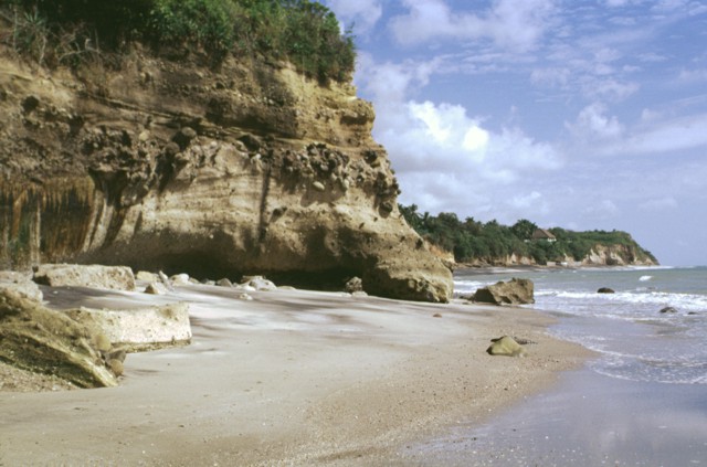
These headlands along the Pacific coast south of El Valle volcano consist of pyroclastic-flow deposits from late-Pleistocene eruptions. Perhaps the largest of these was the Rнo Mar eruption about 40,000-50,000 years ago that originated from a vent between Cerro Gaital and Cerro Pajita lava domes. The latest plinian eruption about 34,000 years ago produced pyroclastic flows that reached as far as 25 km from the volcano and extensively blanketed its southern and eastern flanks with their deposits.Sea cliffs along the southern coast of Panama west of Panama City expose pyroclastic-flow deposits from El Valle volcano. The largest of these post-caldera explosive eruptions took place about 40,000-50,000 years ago and is named from the Rнo Mar, where its deposits are well exposed. The latest plinian eruption about 34,000 years ago originated from the Mata Ahogado collapse caldera east of El Valle de Anton caldera. Photo by Lee Siebert, 1998 (Smithsonian Institution).http://www.volcano.si.edu/world/volcano.cfm?vnum=1406-03-&volpage=photos |
Cerro Chame, western Panama, is part of the old volcanic core of the Isthmus |
Cerro Cabra |
Cerro Cabra |
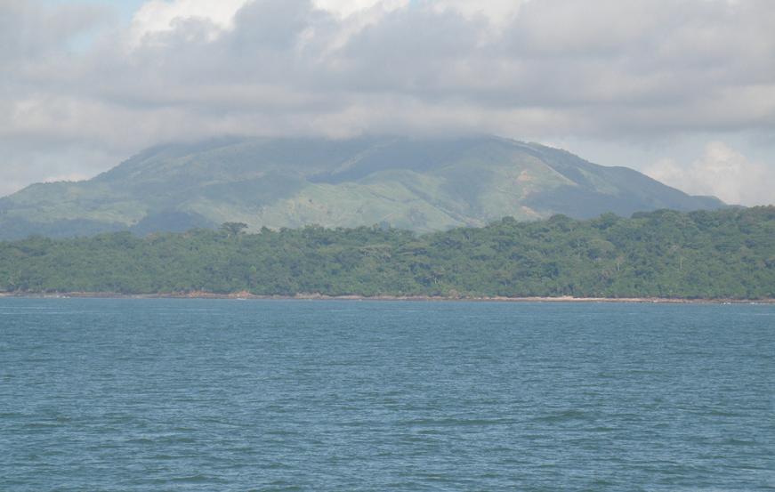
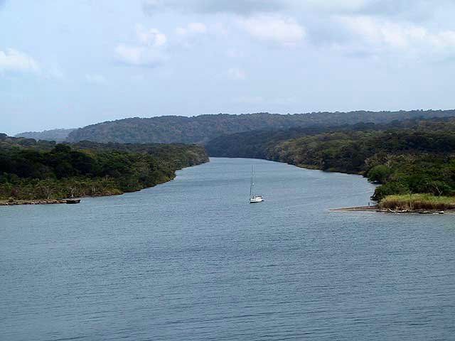
Otoque and Bono islands |
Otoque and Bono islands |
Miguel de la Borda |
Cerro San Miguel de la Borda |
Miguel de la Borda |


http://www.skyscrapercity.com/showthread.php?t=892280&page=24 rincon
Colorado-Tisingal
El Valle 1185 msnm
Cerro Pando
Barº 3474 msnm (Su ultima erupciµn se calcula hace 1550 aþos)
La Yaguada o Chitra-Calobre 1297 msnm
Cerro FÃbrega
Cerro Chorcha
Cerro Fonseca
Cerro Colorado
Cerro Santiago
Cerro Buenos Aires
Algarrobos
Gran Galera de Chorcha
Cerro San Felix
Cerro San Francisco
Cerro Viejo
Cerro Caþa de Nata
Cerro Guacamaya
Cerro Cermeþo
Cerro Cabra
Cerro San Miguel de la Borda
Isla Bono Otoque
Cerro Guayabal
Cerro Canaxa
Laguna del Pato
Cerro La Petra
Addition list - http://www.skyscrapercity.com/showthread.php?t=892280&page=100
A) CORDILLERA DE GUANACASTE
El Hacha
Orosi
Cacao
Fortuna
San Roque
Caþas Dulces
Cerro Gorgona
San Vicente
Braum
Von Seebach
Rincµn I
Rincµn II
Rincµn III
Santa Maria I
Santa Maria II
Santa Maria III
Caldera de Miravalles
Miravalles I
Miravalles II
Miravalles III
Miravalles IV
Olla de Carne
Bijagua I
Bijagua II
Montezuma
Tenorio I
Tenorio II
Cerro Barrera
Cerro Anunciaciµn
B) CORDILLERA VOLCANICA DE TILARAN
Cerro TilarÃn
Cerro Pelado y Delicias
Arenal
Cerro Chato
Perdidos I
Perdidos II
Chachaguita
C) CORDILLERA VOLCANICA CENTRAL
Agua Gata
Cerro San Miguel
Los Chiles
Valle Hermoso
Vuelta Kopper
Loma Barrantes
Juan Murillo
Buenos Aires
Loma Morera
Platanar
Porvenir
Viejo
Pelµn
Siete
Azufrado
Palmira
Quesada
Laguna Rio IV
Laguna Bosque Alegre
Cerro Congo
Von Francius
PoÃs I
PoÃs II
Espiritu Santo
Pata de Gallo
Cacho Negro
Barva I
Barva II
Barva III
Cerro Chompipe
Concepciµn I
Concepciµn II
Irazº I
Irazº II (A este lo llamamos VolcÃn Las Nubes, està en mi cantµn! )
Irazº III
Irazº IV
Quemados
Doussaints
PasquÚ
Turrialba
Cerro Negro
Chirripµ AtlÃntico
CocorÚ
Coronel I
Coronel II
Coronel III
Tortuguero
Cotµn I
Cotµn II
MorazÃn Nuevo para mi!! Donde quedarÃ??
Lomas I
Lomas II
Lomas III
Duan
Piedra de Fuego
D) CORDILLERA DE TALAMANCA
Sinsal
Durika I
Durika II
Durika II
Durika IV
Durika V
Durika VI
Durika VII
Dikar
Kamuk El segundo cerro mas alto del pais es un volcÃn! Otra novedad!
Mano de Tigre I
Mano de Tigre II
Mano de Tigre III
Coto Pelµn
Bola
E) ISLA DEL COCO Interesante!
Coco
Iglesias
satellite image http://geology.com/world/panama-satellite-image.shtml
http://www.capiradorada.com/en/capira/geology-and-mineralization
Caldera town, Panama
Panama
Geography Costa Rica
Photos of CAVA