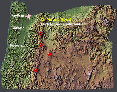
 | Oregon Volcanoes |
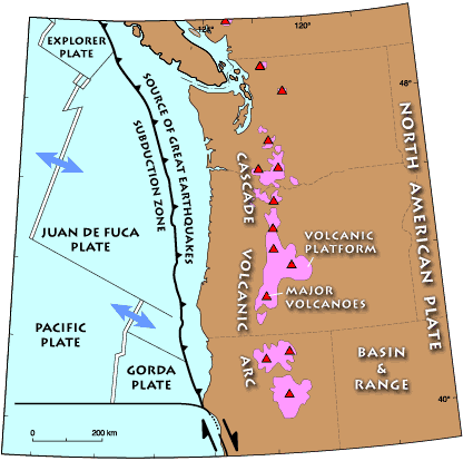
Large red triangles show volcanoes with known or inferred Holocene eruptions; small red triangles mark volcanoes with possible, but uncertain Holocene eruptions or Pleistocene volcanoes with major thermal activity. Yellow triangles distinguish volcanoes of other regions- http://www.volcano.si.edu/world/region.cfm?rnum=12 |
|
http://nationalatlas.gov/dynamic/dyn_vol-or.html |
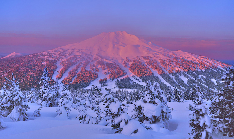
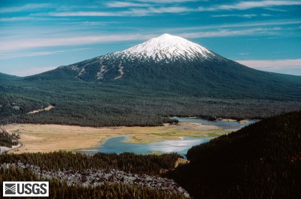
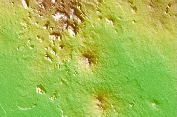
Карта вулкана Бачелор -http://vulcanism.ru/120209.html |
Bachelor,Oregon, стратовулкан,тефрохронологический,2763 (м) Последнее извержение-5800 год до н.э |
http://vulcan.wr.usgs.gov/Volcanoes/Bachelor/Locale/framework.html |
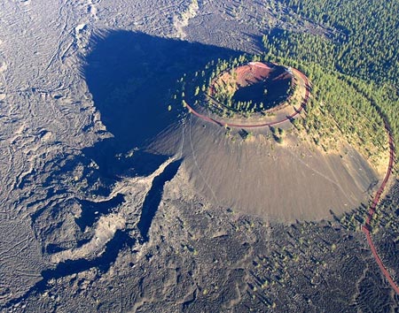
Карта вулкана Дэвис Лейк, вулканическое поле, 2163 (м). Последнее извержение- 2790 год до н.э.http://vulcanism.ru/120210.html |
Davis lake- http://vulcan.wr.usgs.gov/Volcanoes/CraterLake/description_crater_lake.html |
Newberry Volcano in Oregon Could Become a New Green Energy Source , http://en.wikipedia.org/wiki/Newberry_Volcano |
Newberry, Oregon, щитовой вулкан, 2434 (м). Последнее извержение 690 год - http://vulcanism.ru/120211.html. Newberry Caldera - http://vulcan.wr.usgs.gov/Volcanoes/Newberry/Locale/framework.html Newberry Caldera - http://vulcan.wr.usgs.gov/Volcanoes/Newberry/Locale/framework.html |
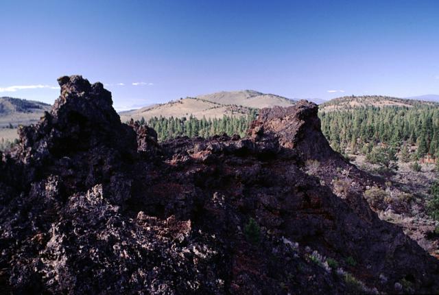
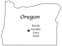
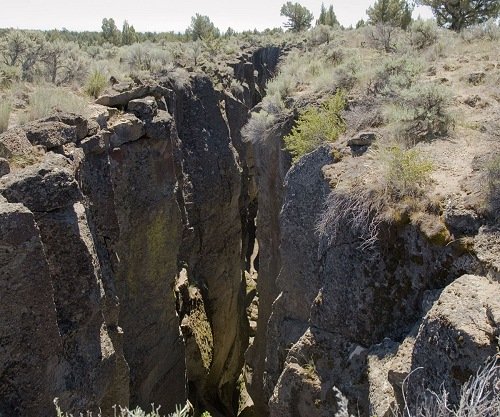
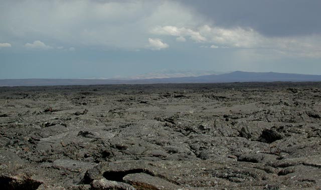
Devils Garden, Oregon, вулканическое поле, 16984 (м). http://vulcanism.ru/120212.html http://en.wikipedia.org/wiki/Devil''s_Garden_volcanic_field |
|
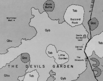
Geologic sketch map of the northern portion of the Devils Garden lava field (excerpted from Peterson and Groh 1965:23). Qyb = Youngest basalt flows of the Devils Garden; Qbu = Older basalts; Qcc = Basaltic cinder cones; Tab = Vitrophyre and rhyodacite domes of undertain age-http://www.obsidianlab.com/research/research_devgarden.html |
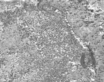
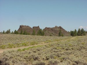
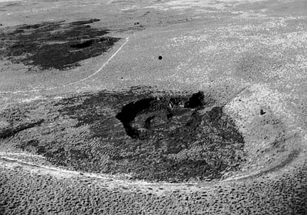
The cinder cone visible at the lower righthand corner of the photograph marks the main Devils Garden vent.A prominent lava channel runs to the north (up) from the vent. The major channel that fed the flow heads off to the south and soon leads to Derrick Cave, the largest lava tube found in the area |
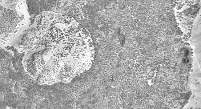
High altitude aerial photograph of the Little Garden area of the flow. The "Blowouts", two unusually large spatter cones, lie near the righthand edge of the photo. The darker elongated areas between the Little Garden and those cones are collapsed lava ponds that were originally filled by the lava tube tube running beneath them. When the eruption ceased, the cooled rock crust over the ponds collapsed into the void left by the drained basalt |
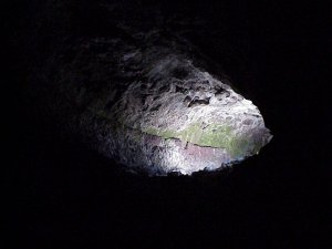
The entrance to a small perennial ice cave associated with the Derrick Lava Tube System. These year-round sources of water were often significant prehistoric resources in the arid Great Basin environment |
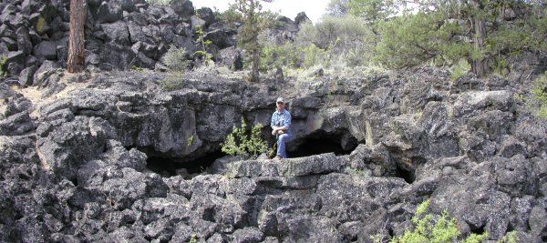
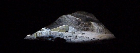
Derrick Cave, the largest uncollapsed segment of the Derrick Lava Tube System |
An unnamed lava blister cave that lies in the middle of the Devils Garden lava field. This small lava cave is one of many volcanic landforms associated with the Derrick Lava Tube System |
The Blowouts, two exceptionally large spatter cones found at the eastern margin of the flow |
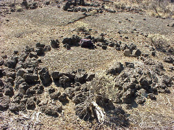
Two examples of the prehistoric stone circles that are sometimes found on the smooth pahoehoe surfaces of the basalt flow |
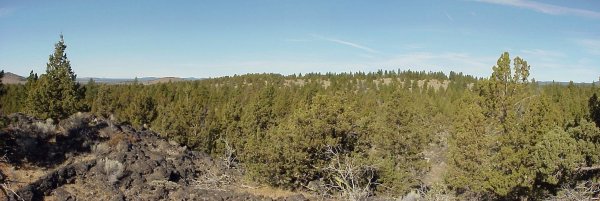
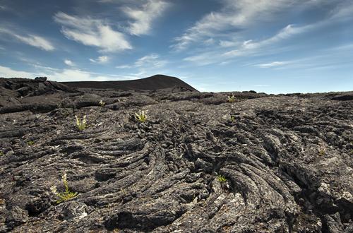
View of the Little Garden in the middle distance. This island of older rhyolitic rock (including a minor obsidian source) projects from the Devils Garden lava field. Taken facing east from a pressure plateau that rises above the Derrick Lava Tube System |
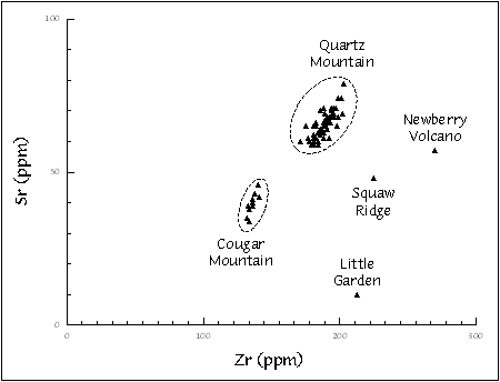
Scatterplot of strontium (Sr) plotted versus zirconium (Zr) for artifacts collected at a site near the Little Garden-http://www.obsidianlab.com/research/research_devgarden.html |
Карта вулкана Скво Ридж Лава Филд, Лавовое поле Фо Кратерз |
Four Craters Lava Field - http://www.mountain-forecast.com/peaks/Four-Craters-Lava-Field |
Squaw Ridge Lava Field - http://www.mountain-forecast.com/peaks/Squaw-Ridge-Lava-Field |
Squaw Ridge Lava Field, Oregon, вулканическое поле, 1711 (м)- http://vulcanism.ru/120213.html - http://en.wikipedia.org/wiki/Squaw_Ridge_Lava_Field |
Four Craters Lava Field, Oregon, вулканическое поле, 1501 (м)- http://vulcanism.ru/120214.html, http://en.wikipedia.org/wiki/Four_Craters_Lava_Field |
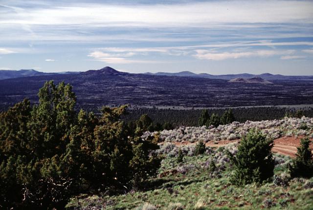
It is part of the larger Four Craters Lava Field in the Deschutes National Park |
The small, young Four Craters lava field north of the town of Christmas Valley depressed the ground around it slightly, creating this 3-kilometer fissure. |
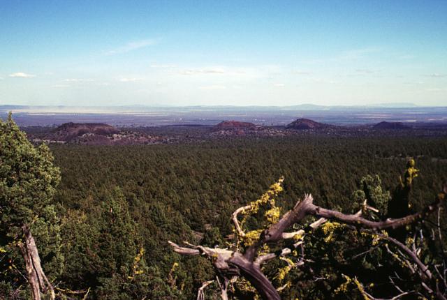
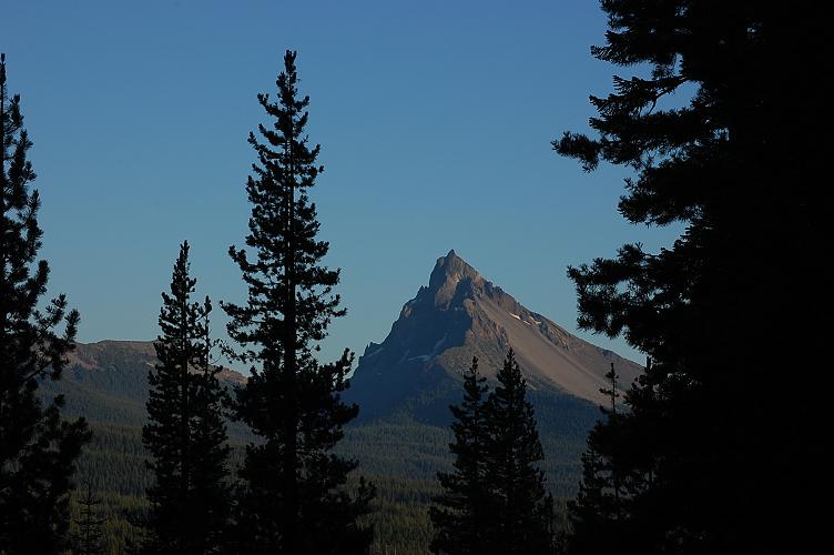
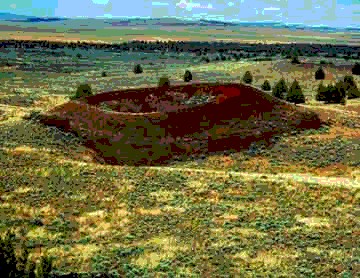
Cinnamon Butte, Oregon, шлаковый конус, 1956 (м)- http://vulcanism.ru/120215.html Thielsen from Cinnamon Butte Fire Lookout -http://wilderness.net/index.cfm?fuse=NWPS&sec=wildView&WID=385 |
Cinnamon Butte |
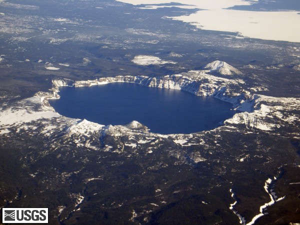
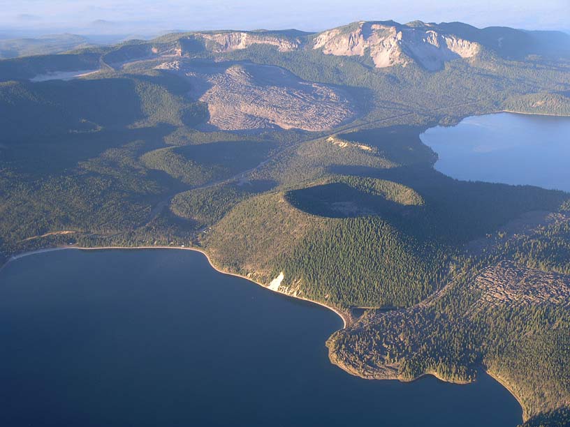
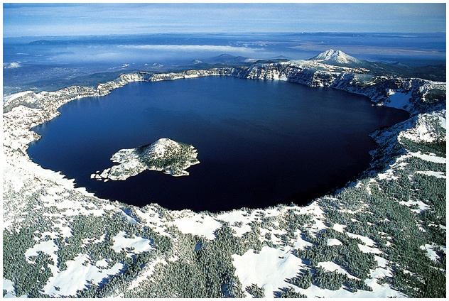
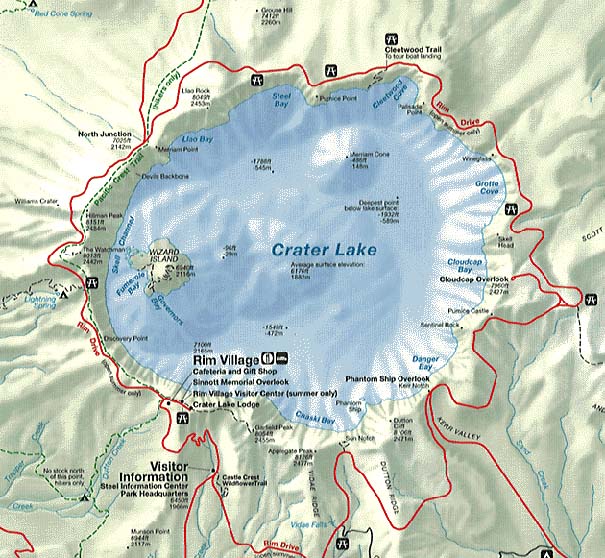
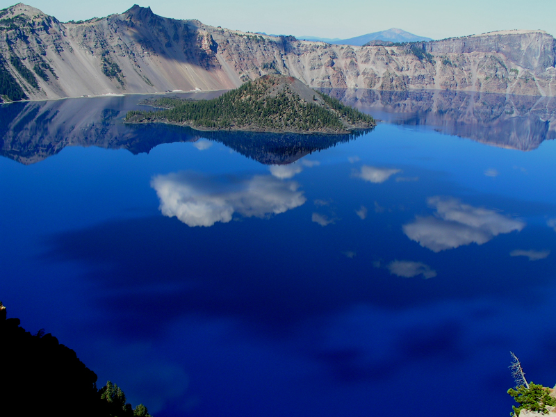
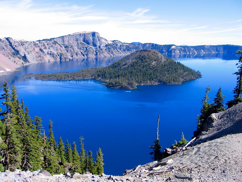
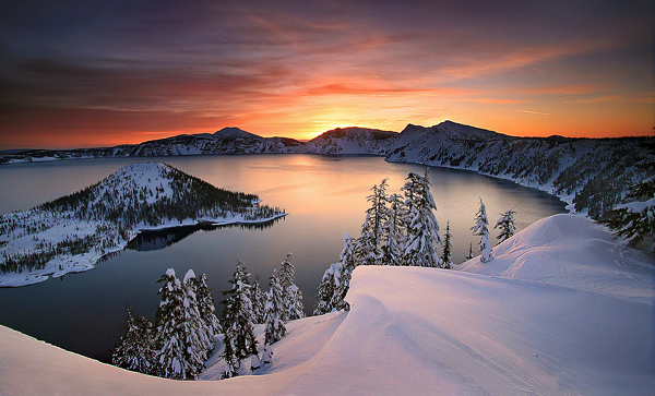
Crater Lake, Oregon, кальдера, 2487 (м). Последнее извержение 2850 год до н.э- http://vulcanism.ru/120216.html |
Crater Lake National Park, Oregon: Cycling the Rim - http://www.steephill.tv/galleries/2005/crater-lake/ |
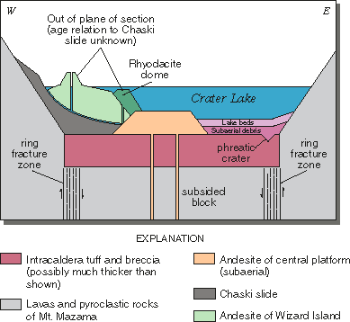
Schematic geologic cross section across the caldera floor of Crater Lake showing relationship and sequence of formation of post-caldera volcanic features, subaerial debris layers, and lake sediment beds. Not drawn to scale or as an exact cross section line- http://pubs.usgs.gov/fs/crater-lake/ |
|
|
|
Diamond Craters, Oregon, вулканическое поле, 1435 (м)- http://vulcanism.ru/120217.html |
Diamond Craters Management Area is a fascinating area that contains hundreds of pristine volcanic features, the area has some of the best and most diverse examples of basaltic volcanism in the United States. Features include blast craters, small calderas, unusual lava flow formations, a water-filled crater (maar), and unusual plant communities. |
Little Red Cone is a cinder cone in the Diamond Craters volcanic field, http://volcano.oregonstate.edu/vwdocs/volc_images/north_america/diamond_craters.html. |
Diamond Craters is a monogenetic volcanic field in southeast Oregon. The volcanoes are all Quaternary in age. Lava flows and tephra from the volcanoes cover an area of about 23 square miles (60 square km). This photo shows Keyhole Crater. Photo Rosemary Kenney |
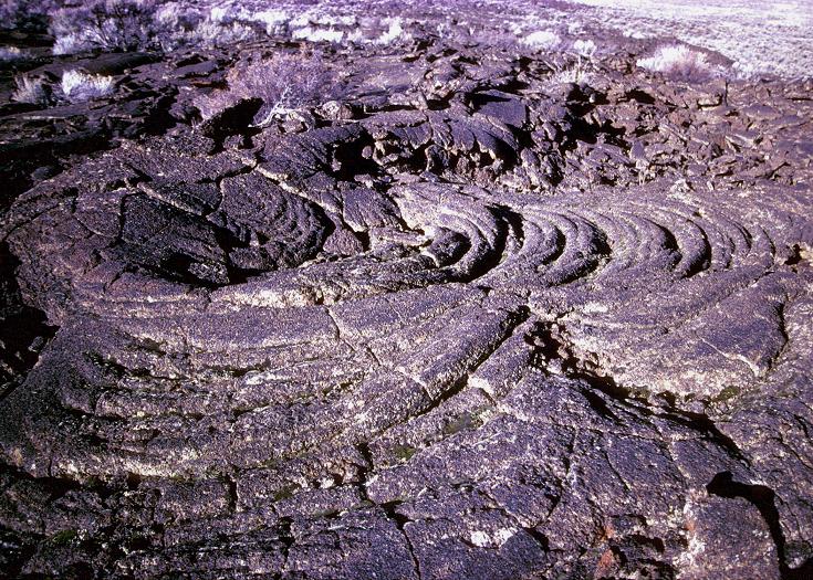
Spiral patterns were frozen for all time in this hardened lava at Diamond Craters |
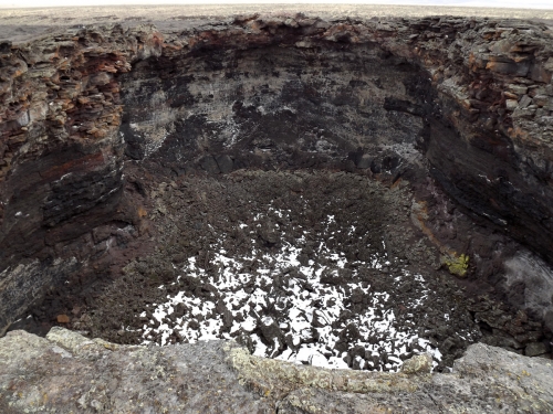
This is the overlook to Big Bomb Crater-http://bigbangblackhole.blogspot.com/2009/04/page-springs-campground-and-diamond.html |
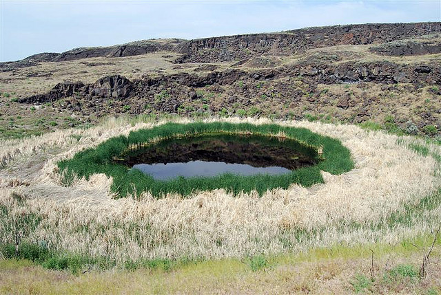
Malheur Maar, southeast Oregon. Water-filled volcano at Diamond Craters in high desert of Harney County |
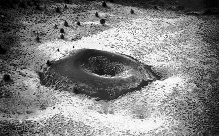
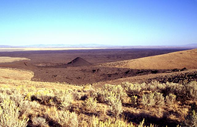
Jordan Craters, Oregon, вулканическое поле, 1473 (м). Последнее извержение 1250 год до н.э- http://vulcanism.ru/120219.html. Fig is Coffe Pot Crater |
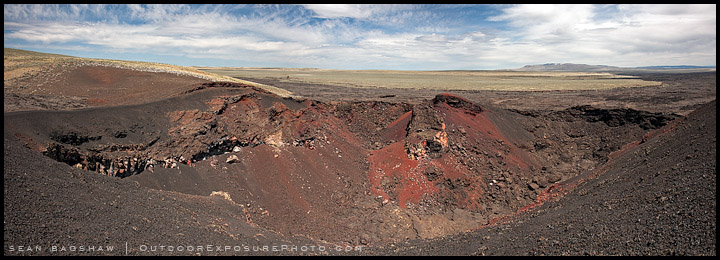
Jordan Craters -Coffee Pot Crater, the only feature to which there is vehicle access, covers about two-thirds of a square mile and is a well-preserved, steep-sided crater. One of the most interesting features in the vicinity of Coffee Pot is a sequence of roughly aligned spatter cones. They consist of blocks of lava, probably ejected in a semi-molten state, that have welded together, forming cones. The interiors of the cones have a glassy look because they were vents for hot gasses - http://www.blm.gov/or/resources/recreation/site_info.php?siteid=332, http://www.blm.gov/or/resources/recreation/files/brochures/Jordan%20Crater.pdf, The flows of Jordan Craters volcanic field are the youngest of a large Quaternary basalt fields in the eastern part of the U.S. state of Oregon. The most recent flows come from Coffeepot Crater, a large breached cinder cone. These flows show excellent examples of inflated lava. Coffeepot Crater (left center) was the source of voluminous basaltic lava flows in the Jordan Craters volcanic field - http://en.wikipedia.org/wiki/Jordan_Craters |
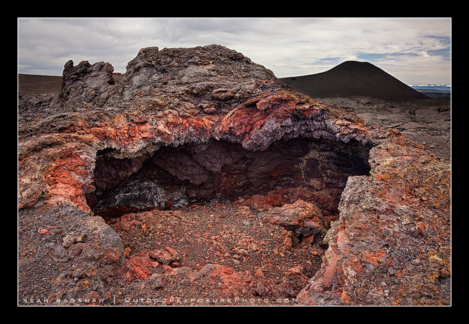
Spatter Cone at Jordan Craters- http://www.outdoorexposurephoto.com/photoblog/photography-travel-journal/953/ |
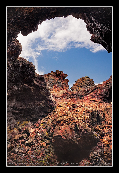
Lava cove inside a spatter cone |
Looking East Across Jordan Craters |
Pahoehoe at Jordan Craters |
The Birch Creek Historic Ranch and Jordan Craters are near the Owyhee River and northwest of Jordan Valley, Oregon- http://www.everytrail.com/guide/birch-creek-ranch-jordan-craters |
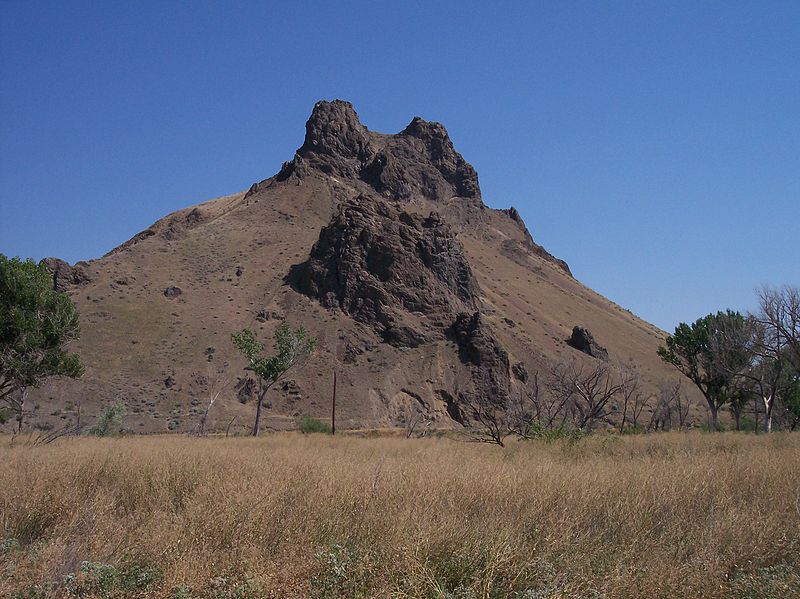
Malheur Butte is an extinct volcano located in Malheur County, Oregon. Malheur Butte is an extinct volcano located in Malheur County, Oregon. Between 20 and 15 million years ago, the region from north-central Washington to northeastern California experienced a series of volcanic eruptions and basalt lava floods that covered thousands of square miles. These ancient lava floods often dammed streams, creating lakes and swamps that may have lasted for millions of years before filling with sediment or draining as erosion slowly lowered their outlets. The western Snake River plain contained many such lakes, and geologists believe that between 8 and 2 million years ago, "Lake Idaho" covered much of central eastern Oregon. Sediment deposited in this lake once covered Malheur Butte, and during the last 2 million years the Malheur River and other eroding forces slowly exposed and shaped today''''s landmark.Although Malheur Butte has been inactive for millions of years, Malheur County is still alive with geothermal activity in the form of hot springs. Today, Oregon Trail Mushroom uses geothermal energy at their processing plant in Vale, and efforts are being made to further utilize this unique energy source throughout the country. http://en.wikipedia.org/wiki/Malheur_Butte |
http://vulcanism.ru/countries.html
http://www.obsidianlab.com/research/research_devgarden.html !!!
http://geology.about.com/od/geology_or/ig/ORgallery/ORdiamondcraters.htm
http://pubs.usgs.gov/fs/crater-lake/
http://www.outdoorexposurephoto.com/photoblog/photography-travel-journal/953/
http://www.nawwal.org/~mrgoff/photojournal/2004/winspr/index.html
Jordan Craters
California Volcanoes
http://plate-tectonic.narod.ru/volcanoam3photoalbum.html
http://plate-tectonic.narod.ru/volcanoam4photoalbum.html
http://plate-tectonic.narod.ru/volcanoam5photoalbum.html
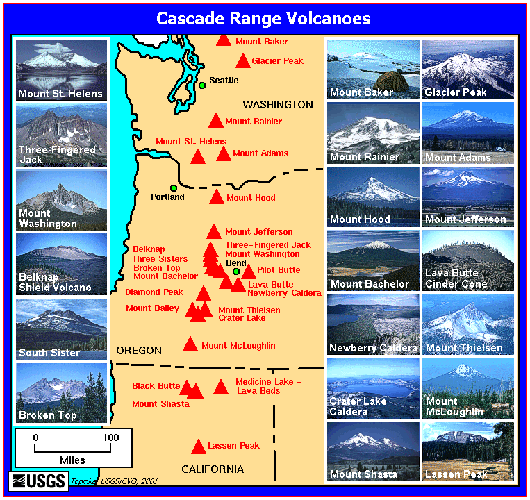
Cascade Volcanoes of Oregon