 | Volcanoes. Idaho, Yellowstone |
http://www.zimbio.com/Yellowstone+National+Park/articles/zo35X_lW-qd/yellowstone+volcano+caldera |
Snake River Hotspot Track. Geological records reveal that the Snake River Plain has been responsible for extremely large and devastating eruptions. Indeed, the Bruneau-Jarbridge and Twin Falls calderas which were active between 13 and 8 MA years ago appear to have displayed extremely unusual eruption characteristics. Based on studies of their eruption deposits, it has been proposed to name the extremely high-temperature silicic super-eruptions attributable to these eruptive centers "Snake River (SR)-Type" eruptions (Brannley et al., 2008. Bull. Volcanol. 70, p.293-314). These eruptions were collossal and involved rhyolite lava erupted at unusually high temperatures, resulting in thick and extensive deposits of extensively welded (almost lava-flow like) rhyolitic ignimbrites largely devoid of pumice, extensive parallel-laminated relatively coarse ash-deposits (deposited by massive pulsating pyroclastic density currents) and finer ashes deposited in large volumes many hundreds of kilometers from the eruptive centers, Unusually large and low-aspect ratio rhyolitic lava flow fields are also found, along with basaltic flows which were probably emplaced late in the eruption or in subsequent eruptive periods. Indeed the SRP is today largely covered with basaltic material. Rhyolitic lava is usually highly viscous due to its high silica content, yet it seems that eruption temperature and maybe magma composition (e.g. high fluorine) reduced silicate polymerization, leading to improved flow properties - http://www.photovolcanica.com/VolcanoInfo/Yellowstone/Yellowstone.html. - http://www.photovolcanica.com/VolcanoInfo/Yellowstone/Yellowstone.html |
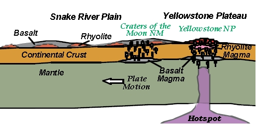
The progression of hotspot volanism can be seen along the Snake River Plain. Volcanic features at CRMO are the result of two different regionally extensive processes. The immediate area (where the visitorÆs center is located) is part of the Eastern Snake River Plain on the track of the Yellowstone hotspot. This region contains both old and young deposits. The larger regional area is part of the Basin and Range Province, a continental rift zone containing young volcanic deposits.Volcanism at Craters of the Moon National Monument and Preserve and the processes that drive it are complex. If you are interested in other volcanoes formed by the same processes, check out the geology in Hagerman Fossil Beds National Monument (ID), John Day Fossil Beds National Monument (OR), and Yellowstone National Park. A hotspot is thermally expanded buoyant mantle (bigger hot mantle that floats), which lifts an overlying plate. As hotspot material rises, the pressure drops so the hotspot begins to melt producing magma. It is unclear at what depth the Yellowstone hotspot originated. Some scientists argue for an origin in the lower mantle (closer to the center of the Earth), similar to the plumes postulated to have formed the Hawaiian Islands (i.e. Pierce and others, 2002) while others argue for an origin in the upper mantle as a result of a tectonic reorganization (i.e. Christiansen and others, 2002, Atwater, 1970). Timing of the impact of the plume on the upper crust near the border between Oregon and Nevada is generally agreed to be about 16 million years ago (Pierce and others, 2002 and Christiansen and others, 2002).Hotspots can be used to track the motion of tectonic plates. As the North American Plate moves, the hotspot stays stationary, resulting in a distinctive pattern of volcanism that can be traced through John Day Fossil Beds National Monument, CRMO, and Yellowstone National Park (Fig. 10). Partially melted mantle at the hotspot produces a dark, runny, basaltic magma at the start. As the basalt melts its way toward the surface of the Earth it becomes enriched in silica and produces light, sticky, rhyolite magma. As the plate continues to move over the hotspot, the channels to the surface become better established and magma becomes more depleted in silica. As a result, basaltic magma can once again make its way to the surface and covers the rhyolitic features. Remnants of the early, silicic phase of volcanism are easily visible in Craters of the Moon National Park and Preserve. They appear as domes along the Axial Volcanic Zone. These domes have rhyolite cores covered by late-stage basaltic lavas. Some of the most visible domes are Big Southern Butte, Middle Butte, Unnamed Butte, and East Butte (Hughes and others, 1999 and McCurry and others, 1999) - http://volcano.oregonstate.edu/craters-moon |
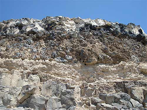
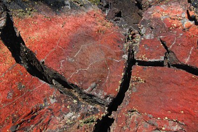
Basal Vitrophyrefrom Browns Bench escarpment near Rogerson : Due to its chemical makeup rhyolite magma not only is viscous but also is slow to crystallize when cooled. This leads to the situation seen at the base of most rhyolite bodies, both welded tuff layers and rhyolite lava flows, where the most rapidly cooled bottom material didn''t have a chance to crystallize, but remained in a glassy state. This glassy form of rhyolite, called vitrophyre by geologists, is black in color, in sharp contrast to more slowly cooled interior parts of rhyolite sheets that did crystallize and which typically are brown to red in color. Thus, even with the strong color contrast, both parts of a unit, like the one in this photo, formed at the same time from the same magma batch-http://idahoptv.org/outdoors/shows/geology/snakeRiverPlain.cfm |
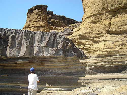
Balanced Rock Rhyolite near Castleford : There are many rhyolite lava flows, like the 8-million-year-old Balanced Rock flow near Castleford, within the Snake River Plain and Owyhee Plateau. Most are younger than the huge welded tuff layers, but are older than most of the basalt flows. These lavas form from rhyolite magmas with very low gas contents that just oozed out of the earth rather than erupting explosively. Low gas contents make rhyolite magmas very viscous, so they form flows that may be hundreds of feet thick and take years to cool. As they cool, prominent vertical fractures form in their interiors which, when exposed in canyon walls, typically guide the development of large vertical pillars -http://idahoptv.org/outdoors/shows/geology/snakeRiverPlain.cfm |
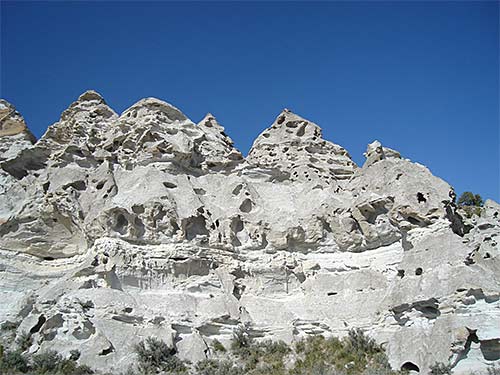
Teepee Rocksalong Trapper Creek, southwest of Oakley : These hoodoos, which resemble a row of teepees or an assembly of giant garden gnomes, are carved in a thick layer of volcanic ash known as the tuff of Ibex Peak exposed along Trapper Creek, southwest of Oakley. This ash accumulation, which in places is hundreds of feet thick, collected in a lake system along the Idaho-Utah border area between about 17 and 10 million years ago. The ash came from numerous large caldera-forming rhyolite eruptions at various places in the Owyhee Plateau and Snake River Plain in the early stages of the development of the Yellowstone hot spot. The holes in the teepees are the result of freeze/thaw action and wind erosion - http://idahoptv.org/outdoors/shows/geology/snakeRiverPlain.cfm |
Pillow basalt at the Snake River Canyon rim a few miles downstream from Perrine Bridge: Pillow Basalt: When a basalt flow runs into a lake or river it commonly breaks up into small blobs of lava, typically from a few inches to a few feet across, which cool rapidly into partly glassy basalt. Geologists call these rounded lava blobs pillows. The pillow basalt layer shown in the photo is in the Jerome Golf Course basalt flow, exposed at the Snake River Canyon rim a few miles downstream from Perrine Bridge. These pillows were formed tens of thousands of years ago when the basalt flow, which was spreading northward, ran into the Snake River. Clearly this happened before the river had eroded its canyon, since the layer of pillows is at the canyon rim. Pillow basalts occur at many other places in the Snake River Plain, especially where Lake Idaho once stood- http://idahoptv.org/outdoors/shows/geology/snakeRiverPlain.cfm |
Basaltic tuff, along the Snake River near Grand View [Credit: Bill Bonnichsen]: About a million years ago, just after Lake Idaho had drained away, the near-lake region may have been swampy and certainly had a high groundwater table. When basalt magma rose into this wet environment, as happened many places in the western Snake River Plain, large amounts of steam formed and erupted explosively, blowing out fragments of the basalt magma and the surrounding lake sediments. Such explosions are called phreatomagmatic eruptions; from them are deposited colorful layers of tuff like the ones illustrated from along the Snake River near Grand View. Also shown is the end of a thin basalt flow that was deposited during the phreatomagmatic eruptions. The thinness of this flow shows the basalt lava was very fluid, in contrast to the extreme stiffness of rhyolite lavas that permit only very thick flows to form- http://idahoptv.org/outdoors/shows/geology/snakeRiverPlain.cfm |
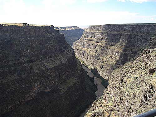
Bruneau Canyon: Bruneau Canyon is about 800 feet deep and only a few hundred feet wider at this scenic viewpoint south of Bruneau. The river rapidly cut down through many layers of basalt, ranging from 7 or 8 million years old at the bottom to 4 or 5 million years old at the canyon rim, as Lake Idaho drained away and afterwards. Once the lake was drained, the river''s base level became much lower; previously the high lake level had prevented the river from cutting down through the basalt- http://idahoptv.org/outdoors/shows/geology/snakeRiverPlain.cfm |
China Hat Dome, near Soda Springs [Credit: Bill Bonnichsen]. China Hat Dome: China Hat, a geologically young landmark near Soda Springs in the Blackfoot lava field, stands nearly 1000 feet high and is 1.4 miles long. It formed during a small rhyolite eruption only about 57,000 years ago, and is the largest of three domes lined up above a buried fissure that fed magma to the surface. The rhyolite magma was so viscous it couldn''t flow away from the vent; it just accumulated in a big pile. Since the volcanic activity in the Blackfoot lava field was so recent, the area is of considerable interest for geothermal energy. Domes similar to China Hat are a common type of volcanic landform that are built where small batches of viscous magma erupt- http://idahoptv.org/outdoors/shows/geology/snakeRiverPlain.cfm |
Buck Mountain Volcano: About 11.6 million years ago this small rhyolite volcano, in the Owyhee Mountains south of Homedale, was built during one of the eruptions that led to the formation of the Jump Creek rhyolite. In this view one is looking into the volcano''s crater area. A small rhyolite lava flow was extruded from the volcano, whereas the volcano''s slopes are an accumulation of small blobs of spatter that coalesced into the original conical form. When only small volumes of rhyolitic magma are erupted small volcanoes like Buck Mountain are built, whereas large volumes of rhyolitic magma typically erupt through long fissures along which the surface subsides to form calderas- http://idahoptv.org/outdoors/shows/geology/snakeRiverPlain.cfm |
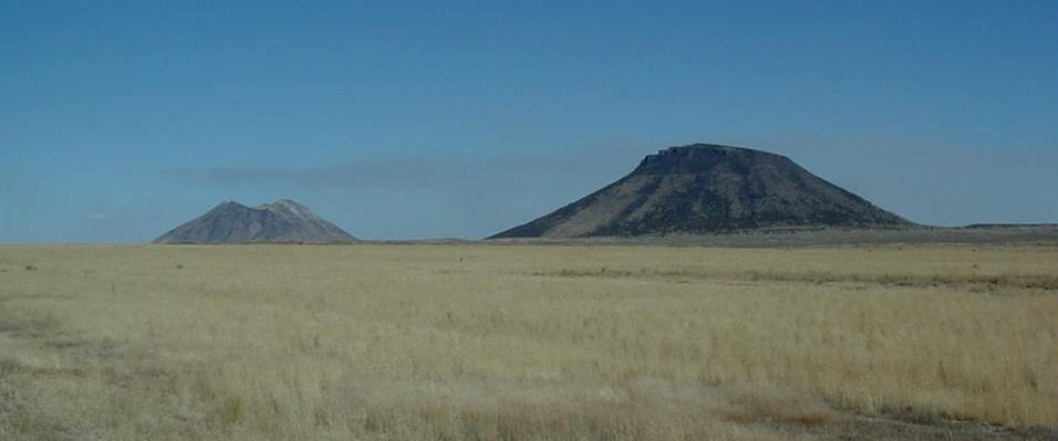
Twin Buttes, Idaho, EASTERN SNAKE RIVER PLAIN,consisting of Middle Butte (on the right) and Eastern Butte (on the left). Looking ~SE- http://www1.newark.ohio-state.edu/Professional/OSU/Faculty/jstjohn/IdahoGeology/Buttes.htm |
Middle Butte, Idaho |
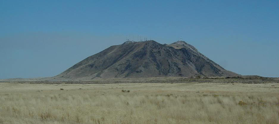
Eastern Butte, Idaho a ~600 ky volcanic dome consisting principally of rhyolite lavas - http://www1.newark.ohio-state.edu/Professional/OSU/Faculty/jstjohn/IdahoGeology/Buttes.htm |
The Shoshone lava field, Idaho, holocene shield volcano, 1478 m, last known eruption 8400 BC , is the westernmost of the young lava fields of the Snake River Plain. It lies north of Twin Falls, Idaho and created an L-shaped lava flow 2-to-5 km in width that extends 60 km south and then west. A single radiocarbon age of 10 KY obtained for lava flows from the Shoshone field straddles the Pleistocene-Holocene boundary (Kuntz et al. 1986). Black Butte Crater caps a lava shield that lies at the NE end of the flow field. The vent area contains a complex lava lake that forms a 6-part flower-petal like depression with steep-sided walls up to 30 m high that covers an area of 2 sq km. A lava tube and channel system extends 5 km SE of Black Butte Crater and displays both roofed and collapsed portions. The Big Wood and Little Wood rivers follow the northern and southern margins of the distal part of the lava flow, respectively. The voluminous flow diverted the river channels so that they now join 40 km west of their former confluence. One of a series of interlocking craters forming the complex summit of Black Butte, the vent of the Shoshone lava field, is seen here from the summit of the butte. The broad, low Shoshone shield volcano fed voluminous lava flows that traveled a small distance north towards the Mount Bennett Hills in the background, but the bulk of the flows traveled initially south and then west for a total distance of 60 km. The Shoshone lava field, erupted about 10,000 years ago, is the westernmost of the young volcanic fields of the Snake River Plain - http://www.volcano.si.edu/world/volcano.cfm?vnum=1204-01- |
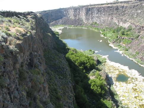
Snake River Gorge as viewed from Hansen Bridge overlook in southern Idaho |
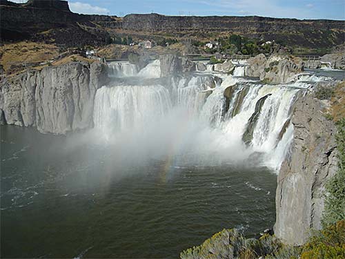
Shoshone Falls: This beautiful waterfall on the Snake River is carved into the upper part of the 6-million-year-old Shoshone Falls rhyolite lava flow. A nearby drill hole indicates the flow to be about 600 feet thick. This waterfall will be sustained for a long time because rhyolite is very hard and resistant to erosion, in contrast to the overlying, thin and pervasively jointed basalt flows from which blocks readily are broken out by natural processes. Shoshone Falls likely was developed into its present form during the Bonneville Flood, about 17,500 years ago, and has not changed much since then - http://idahoptv.org/outdoors/shows/geology/snakeRiverPlain.cfm |
Lava flow on the Snake River |
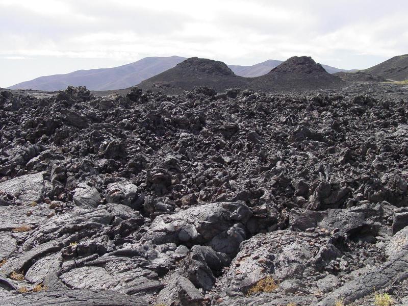
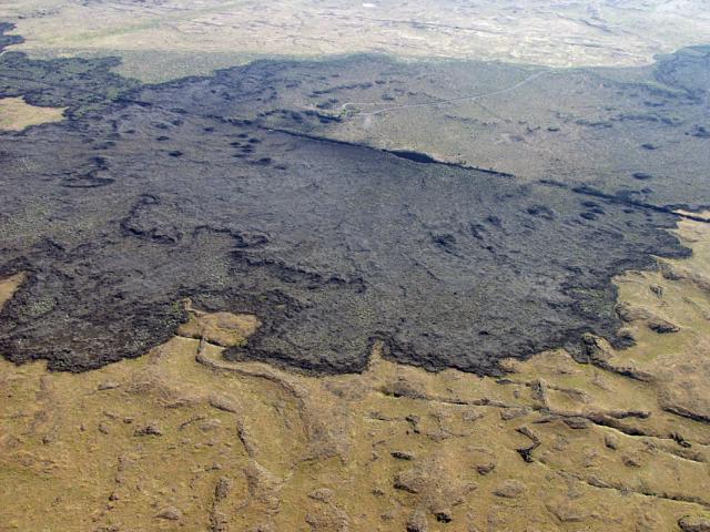
Craters of the Moon National Park and Preserve (CRMO) - "The strangest 75 square miles on the North American continent". The park is home to three basaltic lava fields: Craters of the Moon lava field, Kings Bowl lava field, and Wapi lava field. All of these lava fields were formed during eruptions from the Great Rift, a zone of parallel fissures that is 62 miles long! The eruptions began about 15KA. The last eruption was about 2,KA, but the volcanoes may still be active today (Kuntz and others, 1986b).Craters of the Moon lava field (1,600 km2) provides the most spectacular display of basaltic volcanism in the contemporaneous United States (Kuntz and others, 1987). It is the northernmost lava fiend in the park that formed from several eruptions (polygenetic). There are at least 60 lava flows, 25 cinder cones, and eight eruptive fissures documented in the field. The Kings Bowl lava field (3.3 km2) is the central lava field in the park. It contains an interesting set of volcanic landforms including explosion pits, lava lakes, and a tephra blanket.The Wapi lava field (326 km2) is a shield volcano that formed from a single eruption (monogenetic). It is characteristic of the low, broad shield volcanoes common on the eastern Snake River Plain. Even though it is a volcano, the Wapi lava field is very flat; it has slopes of 1 degree or less over tens of kilometers. Pahoehoe lava is common the Wapi field and interactions between different flows make up some of the unique surface textures seen in the field.Radiocarbon dates in the Kings Bowl (2,222 14C yrs.) lava field and the Wapi lava field (2,270 14C yrs) led researchers to believe that they erupted simultaneously, but that the eruption that formed the Kings Bowl field ended after a few hours while the eruption that formed the Wapi field continued (Kuntz and others, 1986b) - http://volcano.oregonstate.edu/craters-moon |
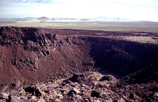
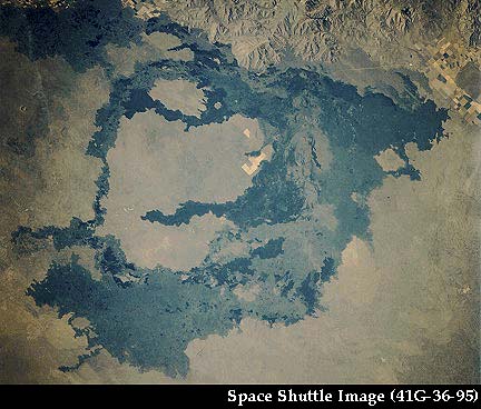
King''s Bowl lava field and the Great Rift zone of extension. The KingÆs Bowl (the giant hole) is a phreatic explosion pit, where magma erupting at the surface- http://volcano.oregonstate.edu/craters-moon |
Craters of the Moon, Idaho. Craters, cinder coves, lava tubes, deep cracks, |
Cinder Cones |
The area Craters of the Moon is still geologically active and part of the Yellowstone volcanic system |
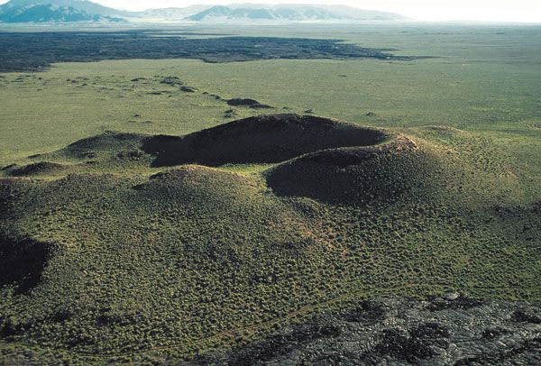
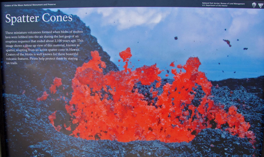
Spatter and cinders are formed from the same process but the characteristics of the lavas are different. Spatter forms from a lava with less gas, so it has a fluid shape while cinders tend to have more angular boundaries. When spatter collects near the vent, it builds a circular cone. Often these cones are aligned with the regional rift system. Sometimes spatter cones are welded together forming a rigid structure but sometimes they are not welded together and produce an unconsolidated cone similar to a cinder cone. Welded cones commonly have steeper sides because the particles can stick together so they preserve the initial shape of the cone for a longer period of time |
Shield volcanoes are broad, gently sloping volcanic cones that are usually tens or hundreds of square kilometers in extent. They form where large volumes of gas-poor basaltic magma erupted from vents along fissures. As successive eruptions build layers onto the volcano, it gains both area and elevation. Shield volcanoes at Craters of the Moon are common close the Great Rift. |
Craters of the Moon |
|
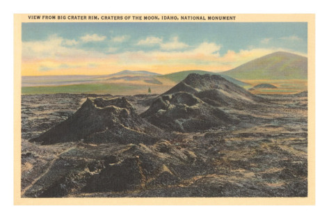
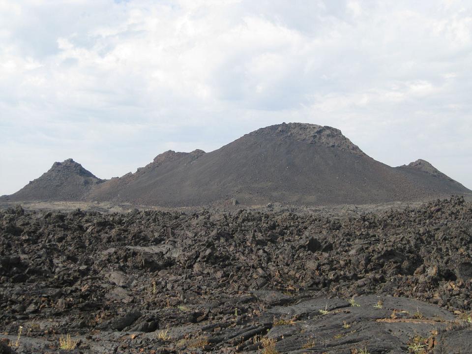
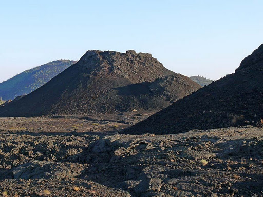
Craters of the Moon, Idaho, cinder cones, 2005 m , last known eruption 80-180 BC. Craters of the Moon, the largest lava field of the Snake River Plain, covers about 1600 sq km with more than 60 mappable lava flows erupted from eight fissure systems. About 25 cinder cones up to 250-m high formed primarily along a 45-km-long segment of the Great Rift, the principal 2-8 km wide fissure system that trends NW-SE through Craters of the Moon National Monument. Craters of the Moon lies at the NW part of the eastern Snake River Plain, and the northern part of the field laps up against the White Knob and Pioneer Mountains. The lava field was formed during eight eruptive episodes between about 15,000 and 2000 years ago separated by quiescent periods up to about 3000 years in duration. This contrasts with other Snake River Plain lava fields, which were formed during single eruptive episodes of relatively short duration. A complex assemblage of basaltic volcanic features is found at Craters of the Moon, and cinder cones are common, in contrast to other Snake River Plain lava fields. The Craters of the Moon lava field covers 1600 sq km of the Snake River Plain with lava flows erupted from NW-SE-trending fissures and cinder cones. The northern part of the lava field, seen from Big Cinder Butte with the Pioneer Mountains in the background to the north, contains many flows and cinder cones formed during the most recent eruptions about 2300 to 2100 years ago - http://www.volcano.si.edu/world/volcano.cfm?vnum=1204-02-&volpage=photo |
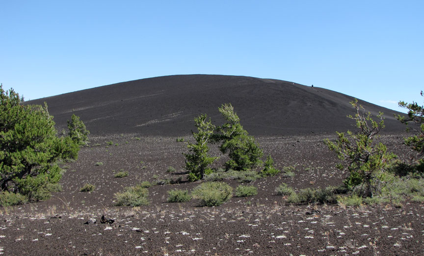
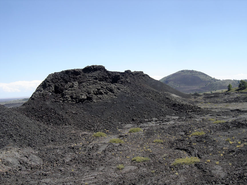
Craters of the Moon. Cinder Cones - During an eruption of gas-rich magma, small blobs of magma are ejected. When the small blobs cool and solidify, they are called cinders. When the cinders fall around the vent, they form a circular or oval cone called a cinder cone. Most cinder cones have a bowl crater at the summit, but some of the cinder cones at Craters of the Moon National monument and Preserve do not, for example Big Cinder Butte. Cinder cones tend to be well preserved because the cinders have a high porosity. This means water drains through them instead of along the surface so surface erosion is minimized. Cinder cones are some of the most striking features along vent systems that are part the Great Rift volcanic system. About 25 cones preserved (Kuntz and others, 1986).Many of the cones are nested, reflecting the migration of eruptions down the fissure system. Some cones are aligned with the rift system, for example cones at Big Craters are aligned with the fissure. Other cinder cones along the Great Rift include: Big Cinder Butte, Broken Top, Sunset Cone, Grassy Cone, Silent Cone, Inferno Cone, and Half Cone (Greeley, 1990; Kuntz and others, 1987). Cinder cones are big piles of loose material so they are easily altered by subsequent volcanic activity. For example, North Crater displays some cinder ōmonolithsö that appear to be fragments of larger cinder cones that were rafted to their present location (Greeley, 1990) -http://volcano.oregonstate.edu/craters-moon |
Craters of the Moon |
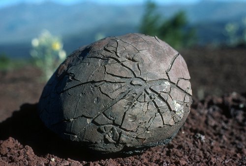
Craters of the Moon, volcanic bomb |
CRATERS OF THE MOON NATIONAL MONUMENT, LAVA FORMATION |
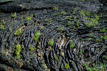
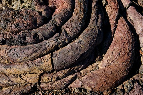
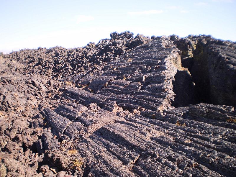
Pahoehoe lava, characterized by its smooth, rope-like appearance, is one of three types of lava. Pahoehoe''s ropy surface forms when a thin skin of cool lava is shoved into folds by hot, more-fluid lava just below the surface. This sample was found in Craters of the Moon National Monument, Idaho. Pahoehoe is pronounced Pa-hoy-hoy- http://www.livingwilderness.com/landscape/craters-moon-pahoehoe.html-.Pahoehoe "Ropy" Lava, Craters of the Moon |
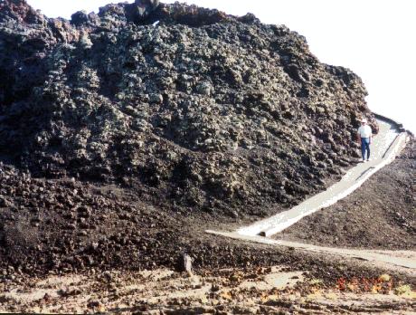
Craters of the Moon Natl Monument lava and Pahoehoe (rope) lava.Pahoehoe textures form when lava flows form a thin skin that is pushed into the folds of hotter, faster moving lava below the surface. It tends to occur when the volumetric flow rate of the lava is low so the flow can ōhealö small fractures in the surface skin (Walker, 2002). As the lava cools it thickens and the surface textures change. Slabby pahoehoe is composted of jumbled slabs of broken pahoehoe crust. Further cooling results in shelly pahoehoe, which forms when gas-rich lavas contain blisters and thin crusts. Further cooling results in a thick pasty lava with spiny pahoehoe surface textures formed from burst gas bubbles.Pahoehoe textures give way to aa textures as the volumetric flow rate increases. The transition from Pahoehoe to aa flows occurs when the flow rate is too high for the lava to ōhealö the fractures on the surface skin. Aa flows have a thick upper crust of loose clinkery or rubbly debris. Large aa flows record other flow features. They have surface waves up to 10 ft. (3m) in height that record flow direction (Kuntz and others, 1987). (If youÆre planning to visit Craters of the Moon NM, aa flows are in remote sections of the park and are not easily accessible by visitors.) Block lava are similar to aa flows, but they have smooth blocks on their surfaces. Examples of block lava flows in at CRMO are the Serrate flow (pictured), Devils Orchard (reachable by trail), and the Highway Flow visible from the saddle between Sunset Cone and Grassy Cone.Lava flows sometimes form lava caves and lava tubes. When the surface skin gets thick enough, the central portion of the flow is effective insulated. The rigid outer skin and molten inner core allows lava to effectively drain away from the source. When the eruption stops, the tubes empty leaving just the outer crust. Lava tube caves, such as Bear Trap Cave and Indian Cave, are popular attractions at Craters of the Moon National Monument-http://volcano.oregonstate.edu/craters-moon |
Background of volcanic rock from Craters of the Moon National Monument of Idaho, volcanic rocks |
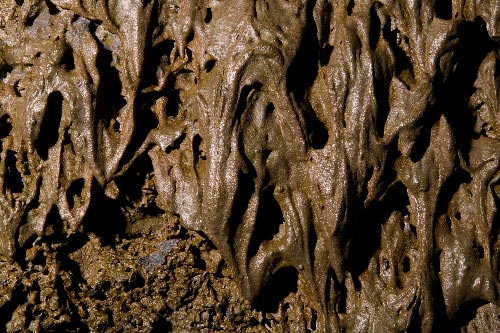
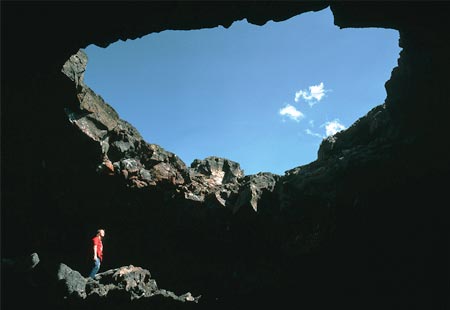
Stalactites form on the wall of the Boy Scout Cave in the Craters of the Moon National Monument, Idaho. The Boy Scout Cave is one of several lava tubes in the park. Stalactites form when hot lava drips and cools down the walls of the lava tube |
Numerous stalactites formed on the ceiling of the Boy Scout Cave, one of several lava tubes in Craters of the Moon National Monument, Idaho. These stalactites formed when hot lava dripped, cooled, and solidified from the ceiling of the lava tube |
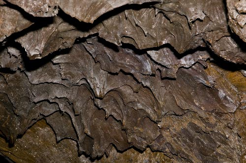
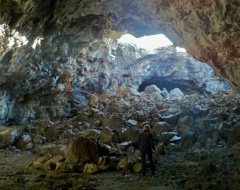
Craters of the Moon National Monument.The walls of Beauty Cave are completely in the dark once you are away from the entrance of the lava tube. Beauty Cave is one of several lava tubes in Craters of the Moon National Monument, Idaho. Lava tubes form during thick flows, when the outside cools and hardens, insulating the hot, flowing lava inside. Eventually, the lava inside the tube drains, leaving only the hard shell |
Craters of the Moon |
Craters of the Moon Monument Lava rivers once flooded this area |
Craters of the Moon |
Craters of the Moon - Idaho, - http://photo.net/photodb/photo?photo_id=12167378 |
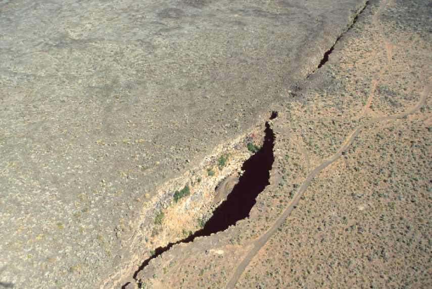
The largest rift zone in the Craters of the Moon National Monument and Preserve is the 62-mile long system of basalt crustal fractures appropriately named Great Rift. Located in the beautiful and rugged landscape of Idaho, the Craters of the Moon Lava Field were formed by magma that pushed up along the Great Rift. The Kings Bowl and Wapi lava fields were created from this fissure system as well. The magma that formed these National Park attractions came up along the Great Rift, but originated in a different magma chamber. The Great Rift begins at the base of the Pioneer Mountains north of the Monument and extends for more than 50 miles to the southeast. Like the other volcanic rifts on the Eastern Snake River Plain, the Great Rift is parallel to the basin and range faults to the north and south of the plain - http://www.visitusa.com/idaho/attractions/thegreat-rift.htm |
The Wapi lava field, 1604 m, last known eruption 300 BC (?) , shield volcano SE of the Craters of the Moon, covers about 325 sq km, and consists of a low shield volcano formed during an eruption about 2250 years ago that produced about 6 cu km of fluid pahoehoe lava flows. The small King''s Bowl rift immediately to the north was also formed at about the same time along a central eruptive fissure flanked by two parallel non-eruptive fissures. This eruption produced a phreatic explosion that created Kings Bowl, an 80-m-long, 30-m-deep explosion crater. Eruptions of the Wapi lava field also overlapped with the last eruptive period of the Craters of the Moon lava field. The vent area of the Wapi field lies along the Great Rift of the Craters of the Moon and consists of five major and a half dozen minor vents covering an area of 0.5 sq km. The largest of the vents contains several pit craters that truncate lava lakes that filled the crater. Pillar Butte, a mass of layered lava flows and agglutinates, forms the high point of the lava shield. The Split Butte maar to the west is partially overlapped by flows of the Wapi lava field. The dramatic Kings Bowl rift cutting diagonally across the top of the photo produced a small 6-sq-km lava field about 2250 years ago immediately north of the much larger Wapi lava field. Kings Bowl itself is the small elongated crater on the right-center side of the rift in this photo; it formed during a phreatic explosion that deposited lighter-colored tephra to the east (upper right). The massive Wapi lava field, located out of view south (right) of Kings Bowl, covers an area of about 325 sq km and originated from Pillar Butte, a small shield volcano- http://www.volcano.si.edu/world/volcano.cfm?vnum=1204-03- |
Hell''s Half Acre lava field,,shield volcano, 1631 m,erution 3250 BC the easternmost of the young basaltic lava fields of the Snake River Plain, covers an area of about 400 sq km SW of Idaho Falls and is the 2nd largest of the Snake River Plain. Basaltic lavas forming the broad, low shield volcano are dominantly pahoehoe flows that were erupted from a 3-km-long, NW-SE trending vent system at the NW part of the field during a brief eruptive episode about 5200 years ago. The summit vent area contains an irregular, elongate 0.8 x 0.3 km wide central depression that was the site of a former lava lake that fed late-stage flows. About 10 circular pit craters truncate the surface of the lava lake, and two prominent lava tube systems are located near the summit vent complex. Two major lava flow lobes, each about 5 km wide and 10 km long, extend to the south and SW along the flood plain of the Snake River and surround Morgans Pasture, a large kipuka. Interstate 15 highway crosses the SE margin of the lava field SW of the city of Idaho Falls.A broad frozen lava lake rises almost to the rim of the 800 x 300 m wide summit crater of Hell''s Half Acre shield volcano, the easternmost of the young basaltic lava fields of the Snake River Plain. The 300 x 800 m wide lava lake is seen from the summit of the low shield volcano, with East Butte and Middle Butte visible to the west on the upper right horizon. Dominantly pahoehoe lava flows were erupted from a 3-km-long, NW-SE trending vent system in the NW part of Hells Half Acre lava field about 5200 years ago -http://www.volcano.si.edu/world/volcano.cfm?vnum=1204-04- |
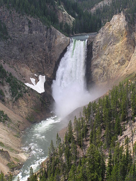
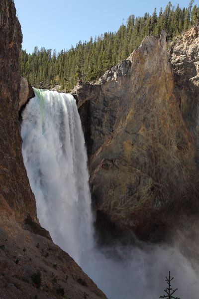
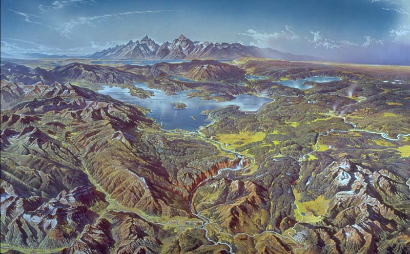
Yellowstone Supervolcano. Yellowstone volcano is the most recent in a succession of eruptive centers resulting from a hot-spot in the earths mantle. The North American Plate is gradually shifting in a southwestern direction over a stationary hotspot. Over the last about 17 million years, episodic activity in the region of the hotspot has resulted in a series of calderas which form a recognizable track in the surrounding topography with the most recently active Yellowstone caldera(s) being at its northeastern end. This track is referred to as the Snake River Plain. Whilst many "classic" volcanic features may not be immediately apparent in many parts of the park, a number of sites expose parts of the complex geological record of the area. Yellowstone Canyon cuts deep into the caldera floor, exposing many layers of volcanic deposits. The waterfalls mark the boundaries of erosion-resistant layers of rhyolitic lava. Also, for example at Sheepeaters cliff, exposed deposits of more recently erupted basaltic lava that have cooled to produce hexagonal columns can be easily viewed -http://pubs.usgs.gov/fs/2005/3024/images/fs2005-3024_fig_03_large.jpg |
Grand Canyon of Yellowstone -http://en.wikipedia.org/wiki/Yellowstone_National_Park |
Lower Falls |
Since its last cataclysmic volcanic eruption 640,000 years ago, the Yellowstone region has had about 40 eruptions of slow-moving lava flows of rhyolite (a variety of molten rock that is thick and sticky). Some of these flows cover more than 100 square miles, and many are very thick, like this approximately 180,000-year-old rhyolite flow exposed at Obsidian Cliff. Although no lava has been erupted at Yellowstone for 70,000 years, future such eruptions are likely to occur. (USGS photograph by Robert Christiansen.) -http://pubs.usgs.gov/fs/2005/3024/ |
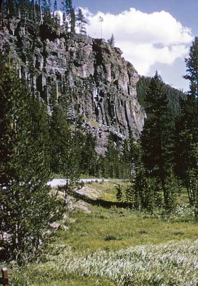
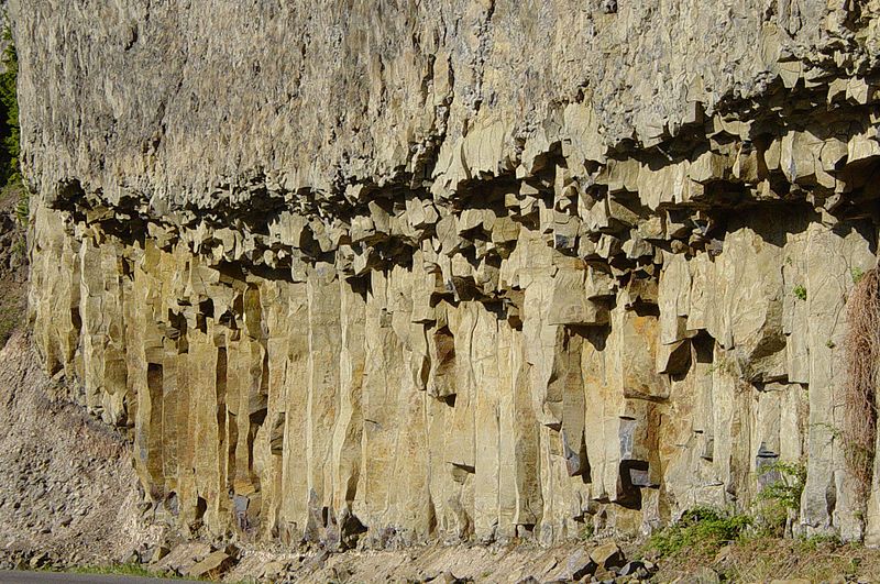
Columnar basalt near Tower Falls; large floods of basalt and other lava types preceded mega-eruptions of superheated ash and pumice |
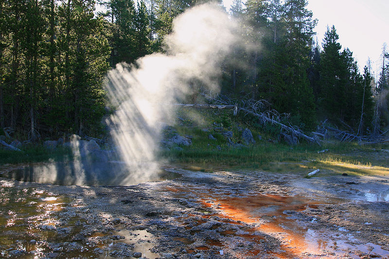
Morning Glory Pool. Eruptions at Yellowstone caldera do not conform to the SR-type, since deposits are pumice-rich and conform more closely to those of conventional explosive rhyolitic volcanism. This suggests that as location of the hot-spot under the surface has changed, the eruption mechanism has evolved. This is probably due to the fact that the archetypal SR-type eruptions occurred in a region of continental rifting during formation of the western Snake River Rift. Further, the lithosphere (earths crust) differs along the SR track. The lithosphere contributes to magma composition since basaltic magmas rising in the region of the hot-spot partially melt it, incorporating it in the developing magma. Differing magma chemistry may have an effect on eruption dynamics due to influence on e.g. fluidity of the eruption products. Nevertheless, whilst only retaining few SR-type characteristics, eruptions at Yellowstone have been similarly devastating to large swathes of surrounding landscape- http://www.photovolcanica.com/VolcanoInfo/Yellowstone/Yellowstone.html. http://www.crystalinks.com/yellowstone.html |
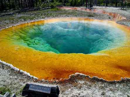
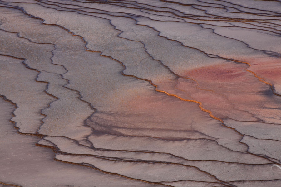
Chromatic Pool - Multiple Colours thanks to several microorganisms |
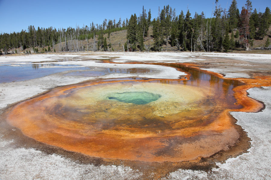
Heart Spring -http://www.photovolcanica.com/VolcanoInfo/Yellowstone/UpperGeyserBasin.html |
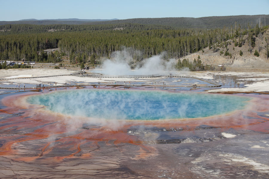
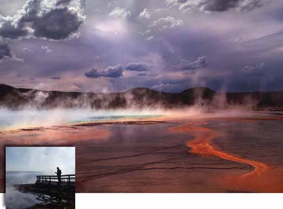
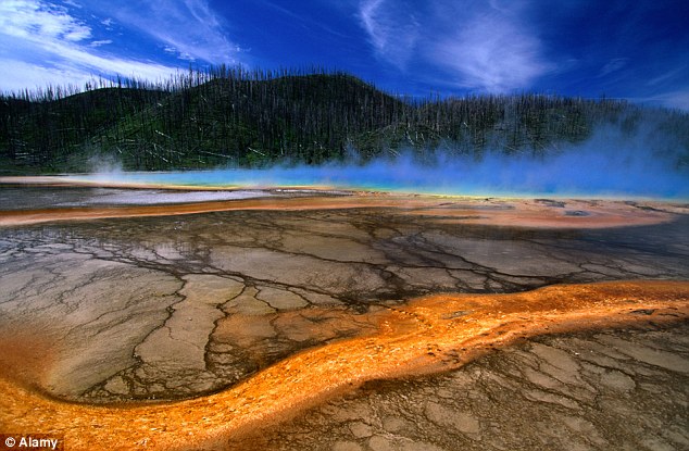
Grand Prismatic Spring-http://www.photovolcanica.com/VolcanoInfo/Yellowstone/UpperGeyserBasin.html |
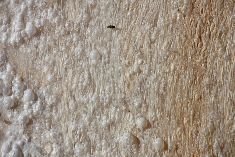
Cyanobacterial mat-covered sinter terraces, Grand Prismatic Spring |
Floating layer of microbes at Mammoth Hot Springs |
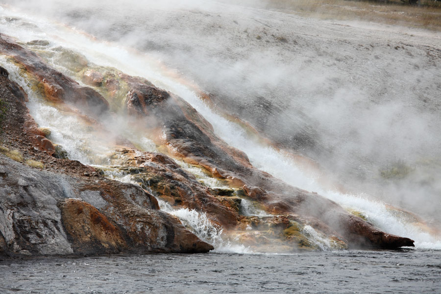
Excelsior Geyser Overflow into Firehole River |
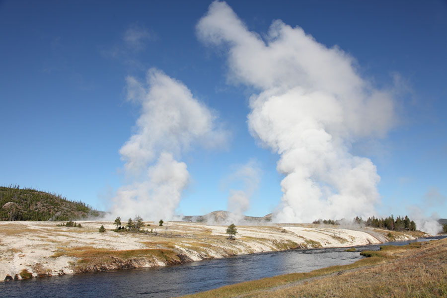
Steam Rising over Midway Geyser Basin |
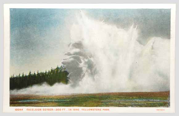
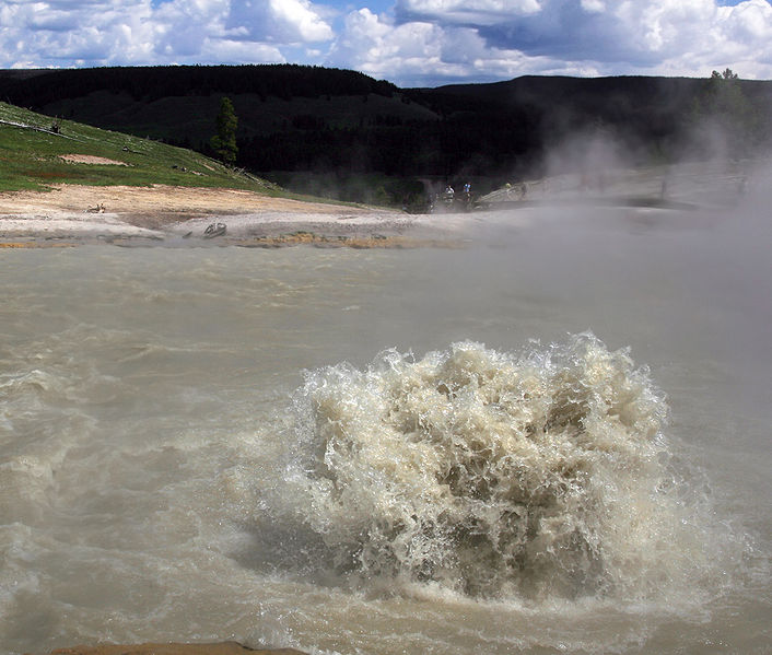
Excelsior Geyser erupted in a series of violent hydrothermal explosions in the 1880s and early 1890s; one of these eruptions is shown in this colorized postcard made from a photograph. These were the largest such events to occur in the Yellowstone region in historical times. (Original photograph by F. Jay Haynes, 1888; date on postcard is incorrect.). Geysers and hot springs are common expressions of a hydrothermal (hot water) system, but sometimes changes in ōplumbingö result in large volumes of water suddenly flashing into steam, causing violent hydrothermal explosions. A large hydrothermal explosion can hurl water and rock thousands of feet and create new landscapes of hills and craters. In YellowstoneÆs geologic past, hydrothermal explosions have occurred countless times.A more recent hydrothermal explosion occurred in 1989 at Porkchop Geyser in Norris Geyser Basin. The remains of this explosion are still clearly visible today as a 15-foot (5 m)-diameter apron of rock debris surrounding PorkchopÆs central spring. Much larger hydrothermal explosions have occurred at Yellowstone in the recent geologic past. The greatest concentration of hydrothermal-explosion craters lies around the north end of Yellowstone Lake. These craters owe their origins to spectacular explosions thousands of years ago- http://pubs.usgs.gov/fs/2005/3024/ |
Porkchop Geyser |
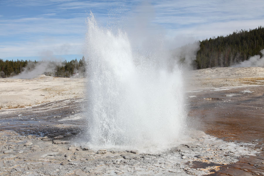
Daisy Geyser-http://www.photovolcanica.com/VolcanoInfo/Yellowstone/UpperGeyserBasin.html |
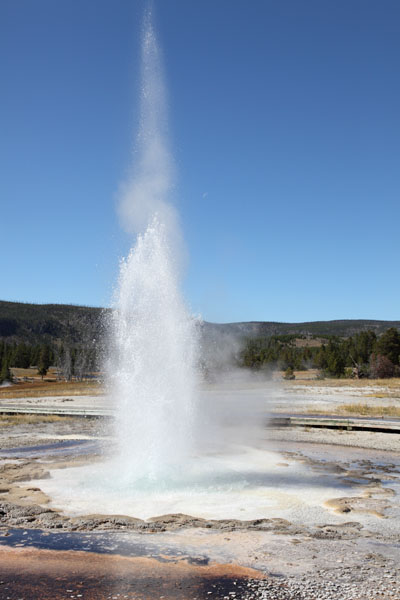
Beehive Geyser-http://www.photovolcanica.com/VolcanoInfo/Yellowstone/UpperGeyserBasin.html |
Lion Geyser-http://www.photovolcanica.com/VolcanoInfo/Yellowstone/UpperGeyserBasin.html |
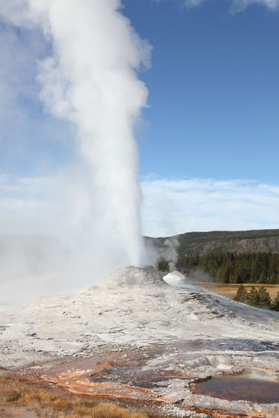
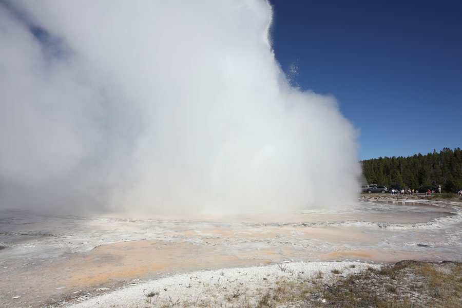
Old Faithful Geyser-http://www.photovolcanica.com/VolcanoInfo/Yellowstone/UpperGeyserBasin.html |
Sawmill Geyser-http://www.photovolcanica.com/VolcanoInfo/Yellowstone/UpperGeyserBasin.html |
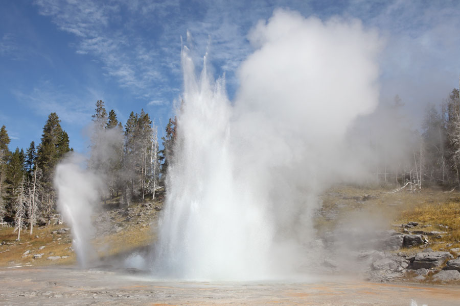
Grand Geyser-http://www.photovolcanica.com/VolcanoInfo/Yellowstone/UpperGeyserBasin.html |
Riverside Geyser - http://www.photovolcanica.com/VolcanoInfo/Yellowstone/Yellowstone.html |
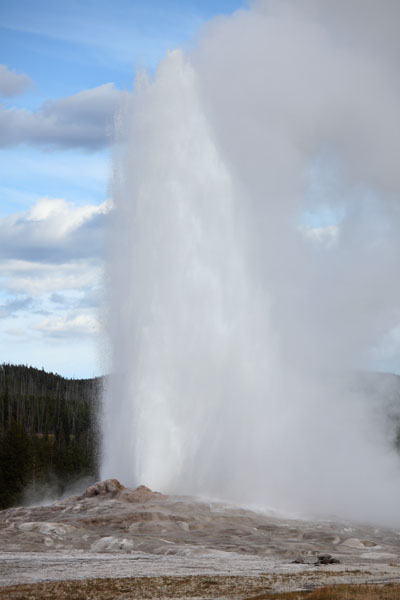
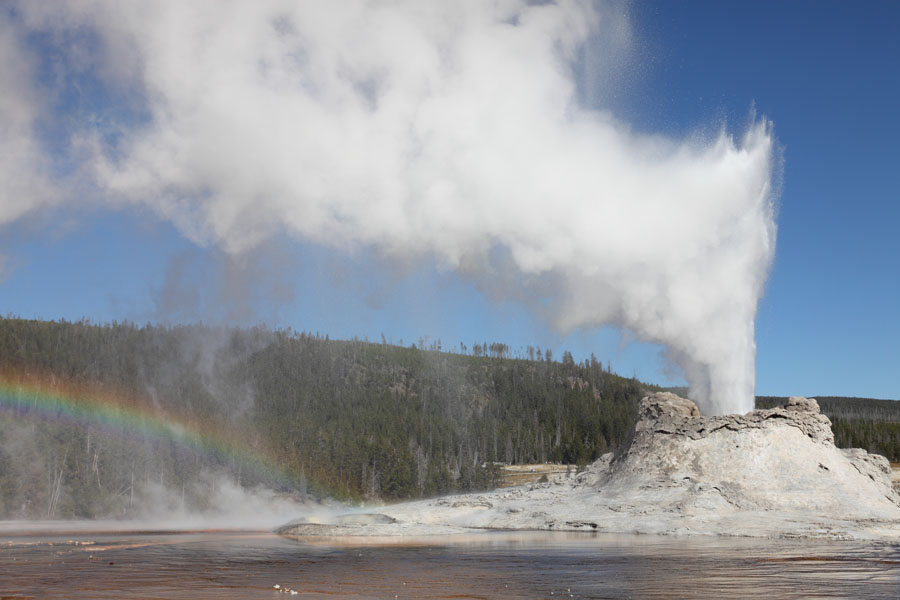
Castle Geyser - http://www.photovolcanica.com/VolcanoInfo/Yellowstone/Yellowstone.html |
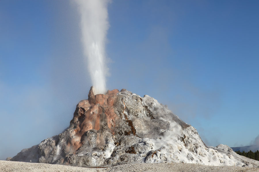
Dome Geyser (White Dome)-http://www.photovolcanica.com/VolcanoInfo/Yellowstone/UpperGeyserBasin.html |
Fountain Geyser (Great Fountain) |
|
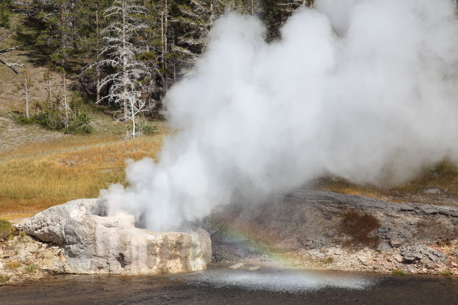
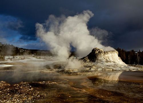
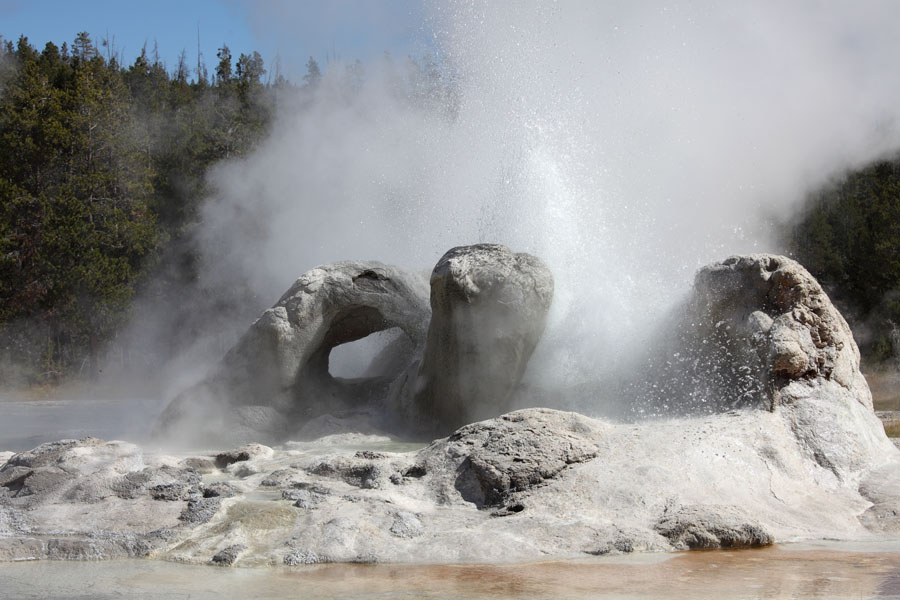
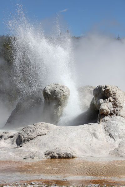
Grotto Geyser, Siliceous Sinter (Geyserite) Cone - http://www.photovolcanica.com/VolcanoInfo/Yellowstone/Yellowstone.html |
Grotto Geyser-http://www.photovolcanica.com/VolcanoInfo/Yellowstone/UpperGeyserBasin.html |
Plume Geyser-http://www.photovolcanica.com/VolcanoInfo/Yellowstone/UpperGeyserBasin.html |
Anemone Geyser-http://www.photovolcanica.com/VolcanoInfo/Yellowstone/UpperGeyserBasin.html |
Riverside Geyser-http://www.photovolcanica.com/VolcanoInfo/Yellowstone/UpperGeyserBasin.html |
Palette Spring, Travertine (Calcareous Sinter) Terraces |
Chocolate Pots, largely Ferrous Sinter |
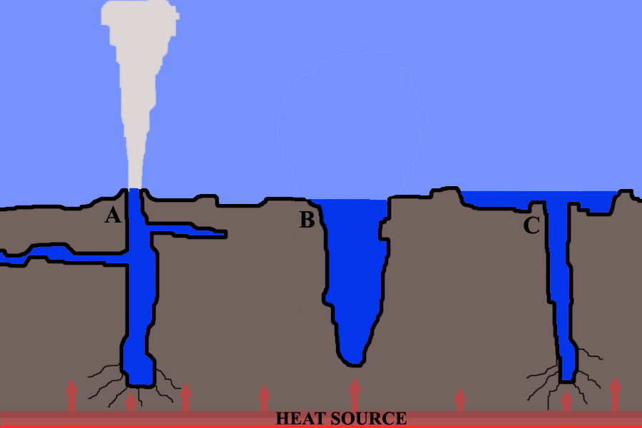
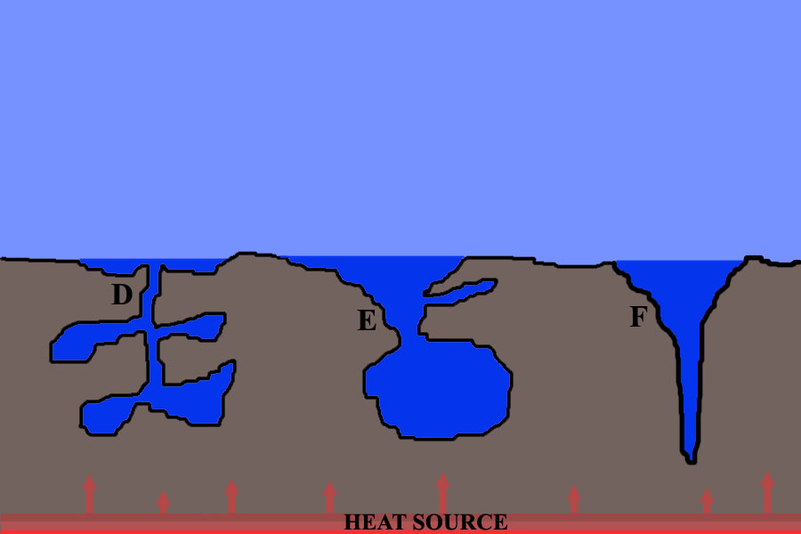
How do geysers work ? The exact plumbing systems of different geysers show great variation, whilst the basic principles underlying activity are relatively conserved. Geysers can be classified in a number of ways. A broad distinction is often made between dome geysers which erupt through a narrow vent, and fountain geysers which erupt from a broad pool. Geyser plumbing systems have been further classified into 6 basic types (A-F) according to shape and complexity of their plumbing systems (Rhinehart "Geysers and Geotherm. Energy" Springer-Verlag). Whilst this is an extreme oversimplification it nevertheless serves to illustrate some working models. Type A broadly corresponds to a classic dome geyser. Fountain geysers usually have types D-F-http://www.photovolcanica.com/VolcanoInfo/Yellowstone/Yellowstone.html |
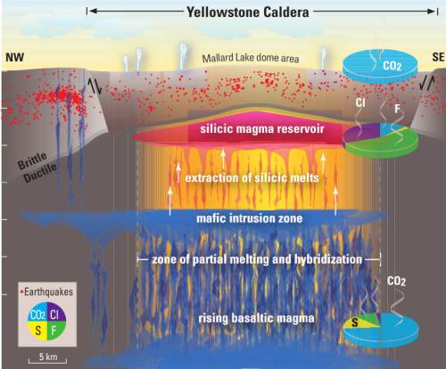
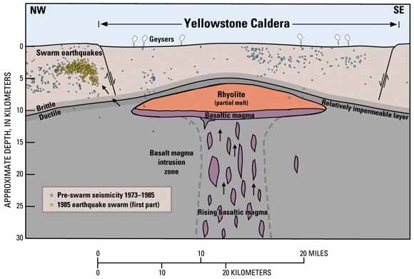
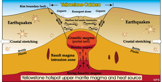
Geyser Types DEF. Of particular interest for visitors is the geothermal activity manifested by the over 10000 hot springs, mud-pots, fumaroles or geysers present in the caldera and in its vicinity. The underlying magma reservoir is thought to supply about 5500 MegaWatts of energy to this system. The geothermal system is driven by liquid dominated reservoirs in the western portion of the caldera, whilst the eastern portion is driven by steam-dominated reservoirs (Fournier 1989. Ann. Rev. Earth Planet. Sci. 17, p.13-53). Most of Yellowstones geothermal systems lie within the caldera itself, yet the Norris Geyser Basin and Mammoth Hot Springs lie along a complex subsidence structure extending northwards from the caldera which may be underlain by independent magma bodies in the vicinity of the two geothermal sites (Kharaka et al. 2000. J. Geochem. Explor. 69/70, p.201-205 and ref. therein). A number of rhyolitic and basaltic eruptive episodes after caldera formation were aligned along this structure (Hildreth et al. 1991. J. Petrol. 32, p.63-128).- http://www.photovolcanica.com/VolcanoInfo/Yellowstone/Yellowstone.html |
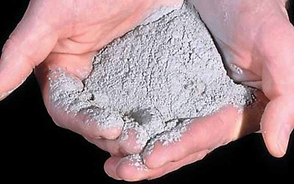
Volcanic ash, like this ash from the 1980 eruption of Mount St. Helens, is made up of tiny jagged particles of rock and glass. Even a light dusting of volcanic ash can pose a health hazard to people and animals and damage crops, electronics, and machinery. Heavy ash fall, such as that from a large caldera-forming eruption, would devastate the surrounding area and affected areas downwind - http://pubs.usgs.gov/fs/2005/3024/ |
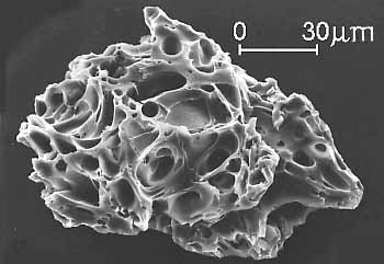
Ash particle magnified about 200 times. (USGS photographs.) |
Yellowstone Volcano Eruption - State of Emergency- http://www.zimbio.com/Yellowstone+National+Park/articles/zo35X_lW-qd/yellowstone+volcano+caldera |
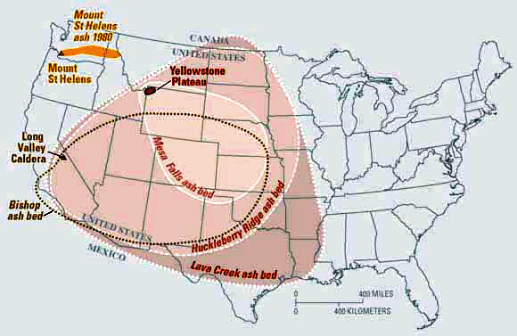
Yellowstone Fallout Ash Bed -http://www.earthmountainview.com/yellowstone/yellowstone.htm |
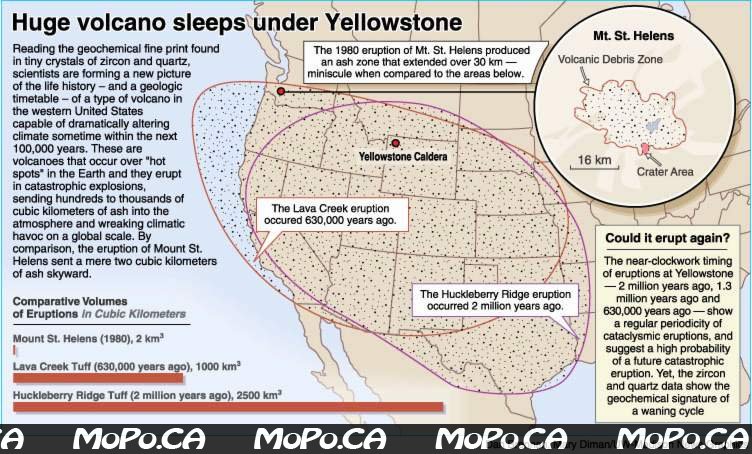
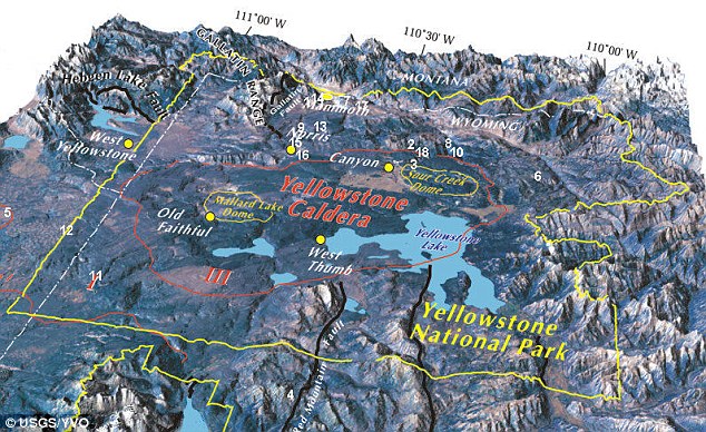
Yellowstone supervolcano -http://www.earthmountainview.com/yellowstone/yellowstone.htm The Yellowstone Plateau volcanic field developed through three volcanic cycles spanning two million years that included some of the world''s largest known eruptions. Eruption of the 2450 cu km Huckleberry Ridge Tuff about 2.1 MA created the more than 75-km-long Island Park caldera. The second cycle concluded with the eruption of the Mesa Falls Tuff around 1.3 million years ago, forming the 16-km-wide Henrys Fork caldera at the western end of the first caldera. Activity subsequently shifted to the present Yellowstone Plateau and culminated 640 KA with the eruption of the 1000 cu km Lava Creek Tuff and the formation of the present 45 x 85 km caldera. Resurgent doming subsequently occurred at both the NE and SW sides of the caldera and voluminous (1000 cu km) intracaldera rhyolitic lava flows were erupted between 150 and 70 KA. No magmatic eruptions have occurred since the late Pleistocene, but large hydrothermal eruptions took place near Yellowstone Lake during the Holocene. Yellowstone is presently the site of one of the world''s largest hydrothermal systems including Earth''s largest concentration of geysers - http://www.volcano.si.edu/world/volcano.cfm?vnum=1205-01- |
Yellowstone supervolcano earthquakes. The Yellowstone "supervolcano" rose at a record rate since mid-2004, likely because a Los Angeles-sized, pancake-shaped blob of molten rock was injected 9km beneath the slumbering giant, University of Utah scientists report in the journal Science-http://www.earthmountainview.com/yellowstone/yellowstone.htm |
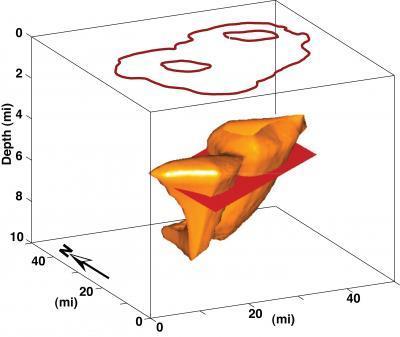
The orange shapes in this image represent the magma chamber -- a chamber of molten and partly molten rock -- beneath the giant volcanic crater known as the Yellowstone caldera, which is represented by the rusty-colored outline at the top. The red rectangular slab-like feature is a computer-generated representation of molten rock injected into the magma chamber since mid-2004, causing the caldera to rise at an unprecedented rate of almost 3 inches a year, according to a new University of Utah study. In reality, the injected magma probably is shaped more like a pancake than a slab. The two rusty circles within the caldera outline represent the resurgent volcanic domes above the magma chamber. (Credit: Wu-Lung Chang, University of Utah)-http://www.sciencedaily.com/releases/2007/11/071108141612.htm |
http://www.zimbio.com/Yellowstone+National+Park/articles/zo35X_lW-qd/yellowstone+volcano+caldera |
Caldera http://pubs.usgs.gov/fs/fs100-03/ |
Yellowstone Caldera Volcano 1- http://www.zimbio.com/Yellowstone+National+Park/articles/zo35X_lW-qd/yellowstone+volcano+caldera |
Caldera http://www.zimbio.com/Yellowstone+National+Park/articles/zo35X_lW-qd/yellowstone+volcano+caldera |
Yellowstone Supervolcano Caldera. Yellowstone is North America''s largest volcanic field, produced by a "hotspot" -- a gigantic plume of hot and molten rock -- that begins at least 600 km beneath Earth''s surface and rises to 45 km underground, where it widens to about 450 km across. There, blobs of magma or molten rock occasionally break off from the top of the plume, and rise farther, resupplying the magma chamber beneath the Yellowstone caldera. Previous research indicates the magma chamber begins about 7.8 km beneath Yellowstone and extends down to a depth of at least 15 km. Its heat powers Yellowstone''s geysers and hot springs -- the world''s largest hydrothermal field. As Earth''s crust moved southwest over the Yellowstone hotspot during the past 16.5 MA, it produced more than 140 cataclysmic explosions known as caldera eruptions, the largest but rarest volcanic eruptions known. Remnants of ancient calderas reveal the eruptions began at the Oregon-Idaho-Nevada border some 16.5 MA, then moved progressively northeast across what is now the Snake River Plain. The hotspot arrived under the Yellowstone area sometime after about 4 MA, producing gargantuan eruptions there 2 MA, 1.3 MA and 642 KA. These eruptions were 2,500, 280 and 1,000 times bigger, respectively, than the 1980 eruption of Mount St. Helens. The eruptions covered as much as half the continental United States with 3-30 cm of volcanic ash. The most recent giant eruption created the 60x 37 km oval-shaped Yellowstone caldera. The caldera walls have eroded away in many areas -- although they remain visible in the northwest portion of the park. Yellowstone Lake sits roughly half inside and half outside the eroded caldera. Many smaller volcanic eruptions occurred at Yellowstone between and since the three big blasts, most recently 70 KA. Smaller steam and hot water explosions have been more frequent and more recent - http://www.dailymail.co.uk/travel/article-1350340/Super-volcano-Yellowstones-National-Park-soon-erupt.html |
Hot rock down below is what drives the geysers of Yellowstone National Park. Rain water infiltrates into the ground and enters a ground water circulation system. Some of this water circulates deeply, is superheated and then blasted out of a geyser. Image by the National Park Service-http://geology.com/usgs/yellowstone-volcano/ |
http://www.zimbio.com/Yellowstone+National+Park/articles/zo35X_lW-qd/yellowstone+volcano+caldera |
Sketch based on USGS and NPS maps-http://www.photovolcanica.com/VolcanoInfo/Yellowstone/Yellowstone.html |
About 6 km beneath Yellowstone National Park''s beautiful scenery is a forty-mile-wide chamber full of molten rock under incredibly high pressure. This magma is what powers Yellowstone''s fantastic geysers and hot springs, but is it about to erupt in a cataclysmic explosion that will decimate the western United States and push mankind to the brink of extinction?- http://www.unmuseum.org/supervol.htm |
Midway Geyser Basin in Yellowstone National Park appears otherworldly beneath stormy skies. In the background, steam vigorously rises from the hot waters of Grand Prismatic Spring, known for its rainbow colors produced by thermophilic (ōheat lovingö) organisms. Grand Prismatic is the largest hot spring in Yellowstone and the third largest in the world. This and other hydrothermal (hot water) features are among the main attractions for visitors to the park (inset photo). These features are fueled by heat from a large reservoir of partially molten rock (magma), just a few miles beneath Yellowstone, that drives one of the worldÆs largest volcanic systems. (Photograph courtesy of Robert Fournier; inset courtesy of Susan Mayfield.) - http://pubs.usgs.gov/fs/2005/3024/ |
An artist''s interpretation of how the Midway Basin in the park might look after an eruption. Yellowstone: A Gigantic Volcano Atop a Hotspot. There is no evidence of an imminent volcanic eruption or hydrothermal explosion. A lot of calderas [worldwide go up and down over decades without erupting.The upward movement of the Yellowstone caldera floor -- almost 7 cm per year. The measurements showed that from mid-2004 through 2006, the Yellowstone caldera floor rose as fast as 7 cm per year -- and by a total of 18 cm during the 30-month period. The fastest rate of uplift previously observed at Yellowstone was about 2 cm per year between 1976 and 1985. Yellowstone''s recent upward motion is twice as fast as the average rate of horizontal movement along San Andreas fault. There will be a magma eruption or hydrothermal [hot water] eruption, we need more independent data.Calderas such as Yellowstone and California''s Long Valley huff upward and puff downward repeatedly for decades to tens of thousands of years without catastrophic eruptions - http://www.sciencedaily.com/releases/2007/11/071108141612.htm |
|
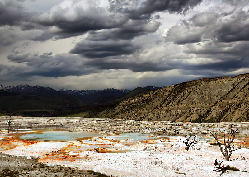
Dead trees in an area of intense deposition of calcium carbonate. Upper terrases on Mammoth hot spring - http://en.wikipedia.org/wiki/Yellowstone_National_Park. http://en.wikipedia.org/wiki/Geothermal_areas_of_Yellowstone#Mammoth_Hot_Springs |
yellowstone Churning Caldron |
On the verge of a catastrophe? Yellowstone National Park''s caldera has erupted three times in the last 2.1million years and scientists monitoring it say we could be in for another eruption.Could Yellowstone National ParkÆs caldera super-volcano be close to eruption?Yellowstone National ParkÆs caldera has erupted three times in the last 2.1MY. and researchers monitoring it say we could be in for another eruption. The super-volcano has been rising at a record rate since 2004 - its floor has gone up three inches per year for the last three years alone, the fastest rate since records began in 1923. It would explode with a force a thousand times more powerful than the Mount St Helens eruption in 1980.Spewing lava far into the sky, a cloud of plant-killing ash would fan out and dump a layer 3m deep up to 1500 km away. Two-thirds of the U.S. could become uninhabitable as toxic air sweeps through it, grounding thousands of flights. The Yellowstone Caldera is one of natureÆs most awesome creations and sits atop North AmericaÆs largest volcanic field. Its name means æcooking potÆ or æcauldronÆ and it is formed when land collapses following a volcanic explosion. In Yellowstone, some 600 km beneath the EarthÆs surface is a magma æhotspotÆ which rises to 45 km underground before spreading out over an area of 450 km across. Atop this, but still beneath the surface, sits the slumbering volcano. A swelling magma reservoir six miles underground may be causing the recent uplifts. A æpancake-shaped blobÆ of molten rock has a size of Los Angeles which was pressed into the volcano some time ago. Since the most recent blast 640 KA there have been around 30 smaller eruptions, the most recent of which was 70 KA.They filled the caldera with ash and lava and made the flat landscape that draws thousands of tourists to Yellowstone National Park every year.Some deep source of magma feeds Yellowstone, and since Yellowstone has erupted in the recent geological past, we know that there is magma at shallower depths too. There has to be magma in the crust and the hydrothermal activity.There is so much heat coming out of Yellowstone right now that if it wasn''t being reheated by magma, the whole system would have gone stone cold since the time of the last eruption 70KA -http://www.dailymail.co.uk/travel/article-1350340/Super-volcano-Yellowstones-National-Park-soon-erupt.html |
|
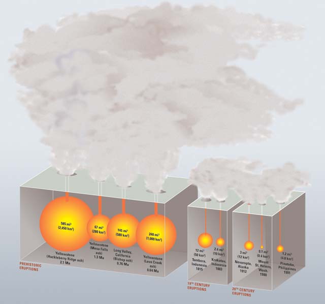
Explosive YellowstoneÆeruptions are best compared by recalculating the volume of erupted volcanic ash and pumice in terms of the original volume of molten rock (magma) released (shown in this diagram by orange spheres). On this basis, the 585 cubic miles of magma that was erupted from Yellowstone 2.1 Ma was nearly 6,000 times greater than the volume released in the 1980 eruption of Mount St. Helens, Washington.Even the 1815 Tambora, Indonesia, eruptionŚthe largest on Earth in the past two centuriesŚwas more than five times smaller than the smallest of YellowstoneÆs three great prehistoric eruptions at 1.3 Ma -http://pubs.usgs.gov/fs/2005/3024/ |
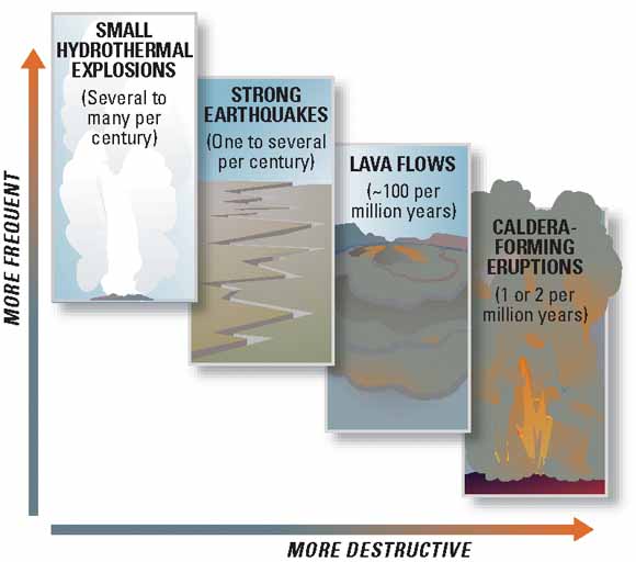
Scientists evaluate natural-hazard levels by combining their knowledge of the frequency and the severity of hazardous events. In the Yellowstone region, damaging hydrothermal explosions and earthquakes can occur several times a century. Lava flows and small volcanic eruptions occur only rarelyŚnone in the past 70,000 years. Massive caldera-forming eruptions, though the most potentially devastating of YellowstoneÆs hazards, are extremely rareŚonly three have occurred in the past several million years. U.S. Geological Survey, University of Utah, and National Park Service scientists with the Yellowstone Volcano Observatory (YVO) see no evidence that another such cataclysmic eruption will occur at Yellowstone in the foreseeable future. Recurrence intervals of these events are neither regular nor predictable- http://pubs.usgs.gov/fs/2005/3024/ |


From http://idahoptv.org/outdoors/shows/geology/snakeRiverPlain.cfm
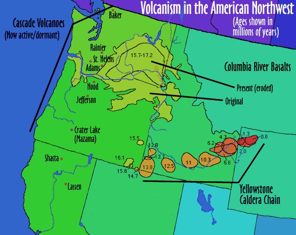
The Snake River Plain is a recent chapter of Idaho''s geological story. It started about 16 million years ago, just after the major pulse of Columbia River basalt volcanism. The first part of Snake River Plain development was not even in the Snake River Plain, but in the Owyhee Plateau area where Idaho, Oregon and Nevada meet. There, massive volcanism commenced as the Yellowstone hot spot began to develop. As time passed and North America moved southwestward, the hot spot cut a swath across southern Idaho and into the northwest corner of Wyoming, where the most recent massive volcanism occurred, less than a million years ago. During the continent''s trip over the hot spot, an adjacent zone developed as the Earth''s crust was pulled apart, forming a large topographic depression. This became the western Snake River Plain, and for a long time it held a giant lake, which geologists have named Lake Idaho.
Two fundamental types of volcanism were involved in the formation of the Owyhee Plateau and the Snake River Plain, as the wave of volcanism swept across southern Idaho. The first was the eruption of rhyolite from magmas with the same composition as granite, being rich in silica and alkali elements. These magmas mainly were materials melted out of the Earth''s crust, so its no wonder they have a granitic composition. The other type of volcanism was the eruption of basalt. These magmas came from deeper in the Earth, from the region geologists call the mantle, and were hotter than the rhyolite magmas. Basalt is much richer in iron and magnesium and poorer in silica than rhyolite.
Besides the volcanism, the deposition of sediments in the western Snake River Plain during the existence of Lake Idaho, and the cutting of canyons after it had drained were two major events occurring as the Snake River Plain landscape evolved. The final episode impacting the landscape along the Snake River was the Bonneville Flood. When Utah''s Lake Bonneville overflowed about 17,500 years ago, the deluge swept along the course of the river and modified the landscape in many interesting ways in its wake.
This photo essay [click on the thumbnails for larger images] should give a bit of flavor and add a few more details to these various major facets of the Snake River Plain''s evolution: the volcanism, Lake Idaho, canyon cutting and the Bonneville Flood.
--------------------------------------------------------------------------------
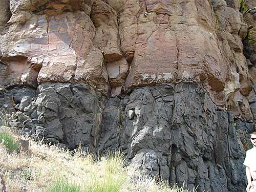
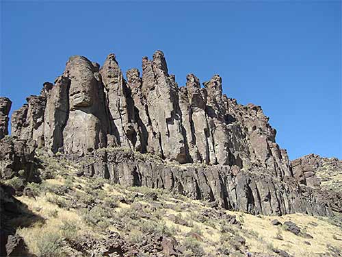
Blackrock Escarpment: Several welded tuff layers are magnificently exposed in this 1500-foot-high cliff in Bruneau Canyon near the Nevada border. Each layer is rhyolite that erupted explosively from the Bruneau-Jarbidge region, an early active portion of the Yellowstone hot spot. The layers range from 12.7 million years old at the base of the sequence to 10.3 million at the top. They make up the Cougar Point tuff, a volcanic unit widely distributed along the margins of the central Snake River Plain. In a geologic instant some of these enormous explosions erupted many hundreds of cubic miles of rhyolite magma as tiny molten particles that sped across the land buoyed up by hot gasses, blanketing areas more that 100 miles across. Welded tuff layers like these are believed to lie beneath much of the Snake River Plain and Owyhee Plateau.
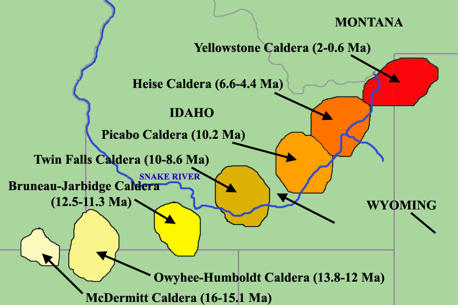
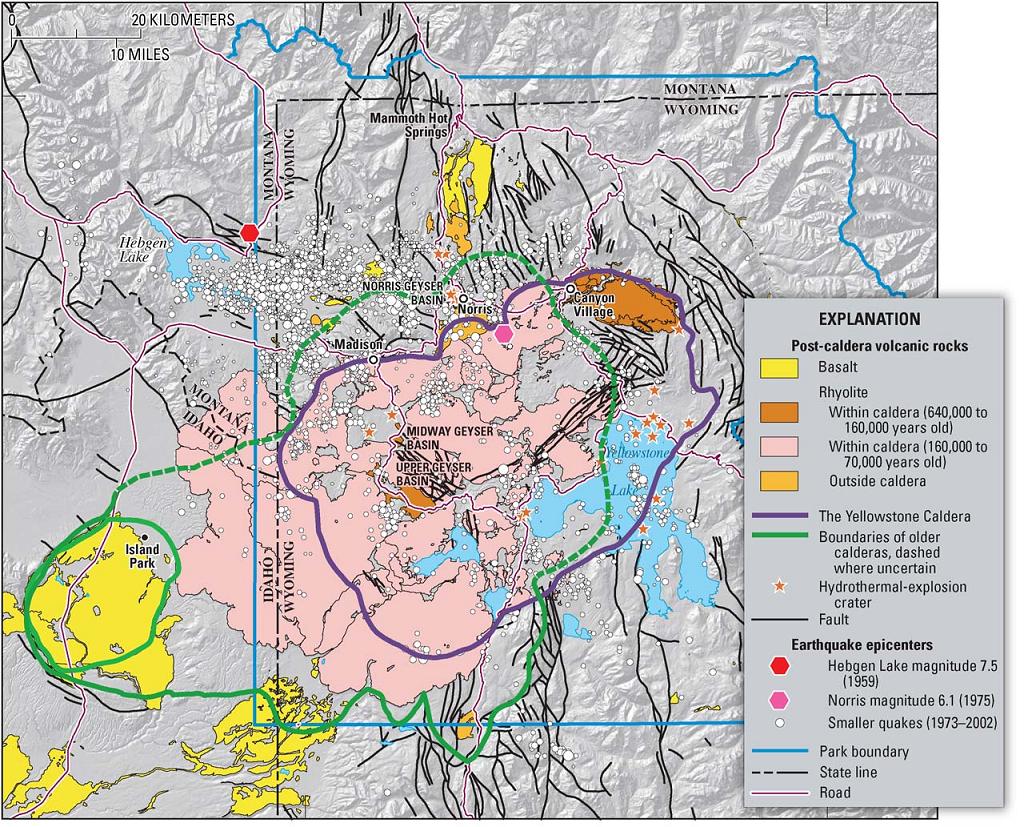
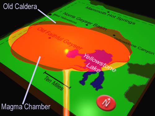
The Yellowstone Plateau has evolved due to the formation of three overlapping calderas in the last 2 MY (Christiansen 2001. USGS Prof. Paper 729-G). These are the massive Island Park (IP) Caldera (2.1 Ma), the smaller Henry''s Fork Caldera (1.3 Ma) which lies which lies outside the National Park Boundaries in the WSW corner of the IP Caldera and the more recent Yellowstone Caldera (640KY) which covers most of the eastern half of the IP Caldera and is about 52 by 75 km wide. It is thought that during the eruption of Yellowstone Caldera approximately 1000 cubic kilometers of material was erupted causing a succession of massive pyroclastic density currents covering thousands of cubic km of the surrounding landscape. The caldera resulting from collapse of the eruption chamber during the eruption is hardly recognizable today since largely filled with materials erupted in smaller post-caldera forming eruptions, with further modifications resulting from large hydrothermal explosions and extensive erosion. Significant Postcaldera eruptive events emplaced largely rhyolitic lavas. These occurred between 516-479 kA at the ring-fracture zone boundary at the perimeter of the caldera, about 260 kA ago, and most recently during several episodes 170, 150, 115, 100 and 75 kA ago when activity was located along two NW trending zones located along the SW flank of the caldera and in its center along a line passing through Norris Basin to the north of the caldera, respectively. These "recent" episodes are responsible for much of the topography of the area as we see it today, emplacing volumes of between 10 and 150 cubic km of rhyolitic lavas in at least 17 major flow units. These have covered much of the floor of the caldera and completely buried its SW rim. Comparison of the composition of these lavas reveals a gradual cooling trend of the post-caldera magma-reservoir with increasing magma fractionation, whilst some recharging continues to periodically occur (Vazquez et al. 2009. J. Volc. Geotherm. Res. (In Press)). Indeed, influx of fresh magma into the chamber is probably responsible for the ground swelling which is continually monitored in the park. The system is clearly still active and has the potential for further huge eruptions some time in the future. Seismic and gravitational studies are able to detect the plume of basaltic magma (hotspot) which still underlies the Yellowstone area (see Leeman et al. 2009. J. Volc. Geotherm. Res. (In Press) and references therein). This plume continues to supply magma to the crust where it incorporates crust material and differentiates into largely rhyolitic material. Basaltic eruptions appear to have followed the rhyolitic phases at most of the SR Track sites (Bonnichsen et al. 2008. Bull. Volcanol. 70, p.315-342). It is thought that Yellowstone will also eventually follow this trend.
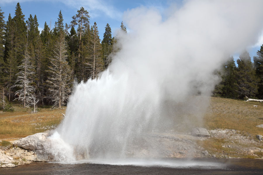
Basically, a geyser requires a heat source (cooling magma), a source of water, permeable rocks through superheated waters can rise and a pressure-tight (i.e. non-permeable) chamber or series of chambers where pressure can build up prior to eruption. Most geysers are found in highly silicic rhyolitic rocks. Superheated waters dissolve silica from these rocks at temperatures of around 300''C which exist in the high-pressure environment deep under the surface. Obsidian clast rich deposits are particularly susceptible to silica dissolution. Silica exsolves again and is deposited when the superheated waters boil or cool as pressure and temperature fall, respectively as they rise towards the surface. The deposited "geyserite" (largely hydrated silicon dioxide (a form of opal)) not only seals the geysers plumbing system, allowing it to pressurize. Basically, superheated waters rise into the geysers chamber(s), whilst cooler near-surface waters (may) also enter the chamber from above. These initially effectively cap the hotter water body below keeping it pressurized and allowing it to maintain temperatures well above boiling point under atmospheric pressure conditions. As the chamber fills, the superheated water body transfers heat to the cooler water above. Eventually, the upper water body reaches boiling point and bubbles of water vapour may rise through it to the surface. As heating continues the bubbling becomes more vigorous and water may start to be pushed out of the vent. The overflow and / or increasing concentration of bubbles decreases the mass of the upper water body, thus reducing the pressure acting on the body of superheated water below. This depressurization causes violent "run-away" vaporization of the water below, resulting in water and steam being violently expelled and leading to further depressurization which continues to drive the eruption.
Some geysers (e.g. Great Fountain) erupt in a number of consecutive bursts. This is largely accounted for by complex plumbing systems where pressure is consecutively released from a number of different chambers, although the exact mechanism is not known.
The superheated waters at yellowstone are thought to be of meteoric origin. It is estimated that these waters are at least 500 years old (in terms of time in the system) when they are expelled from the parks geysers. The fact that many of Yellowstones geyser basins lie alongside rivers suggests that these provide a good supply of cooler surface waters for the geysers.
Many geysers transport large amount of silica to the surface as evidenced by large geyserite deposits (e.g. Castle, Lone Star, Great Fountain, Grotto). Exsolution at the surface is enhanced by evaporation. Microorganisms are also thought to play a role in silica deposition. The large cones built up by some geysers are testimony to a long history of activity. Castle geyser was indeed thought to be thousands of years old until recent radiocarbon dating revealed an age of about 500 years. Nevertheless, most geysers appear to last for much shorter periods of time.
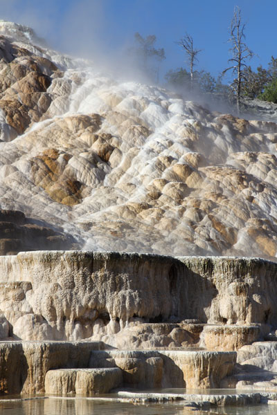
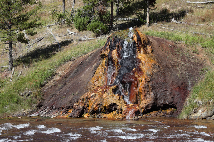
Yellowstone not only features significant deposits of geyserite, but also has a complex of travertine terraces at the Mammoth Hot Springs. Here, the underlying rocks differ from those in the geyser basins and include sandstone and limestone strata. Unlike in the geyser basins, the geothermal waters are not at boiling point at the surface and they contain high levels of carbonates, sulphates and magnesium. Consequently the precipitate travertine (calcareous sinter), not silicious sinter (geyserite). There are also rare examples of largely ferric sinter at the Chocolate Pots along Gibbon River south of Norris Basin. The pots comprise about 60% iron, aluminium, nickel and manganese oxides, with only about 17% silica. The high iron oxide content accounts for their rusty colour.
Hot Springs and Geysers are formed where geothermally heated waters rise to the surface. The difference between these features largely lies in their flow rate and the morphology of the system feeding them. Geysers usually require chambers in which waters can collect and pressurize before being expelled to the surface. Many hot springs may erupt as geysers if heat input to the system is increased.
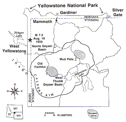
Flow of liquids / steam within the system is through areas of rock with high permeability and through interconnected channels such as fractures, veins and hollows. This is particularly evident following strong seismic events which can cause extensive formation of new cracks, thus modifying and often opening flow channels. Following the powerful Hebgen Lake Earthquake in 1959, numerous hot springs started to erupt as geysers, presumably due to increased pressure release from the deep geothermal reservoir and accompanying faster flow of ascending superheated waters (Marler and White, 1975. Geol. Soc. Am. Bull. 86, p.749-759). On the other hand, channels may gradually by blocked by deposition of silica (silicification) or other minerals (Dobson et al. 2003. J. Volc. Geotherm. Res. 123, p.313-324). In fact numerous factors appear to have an influence on geyser activity. There are indications that rainfall, barometric pressure or gravitational forces (relating to positioning of earth, sun and moon) may influence the behaviour of some geysers. Rainfall levels and indeed climatic trends over years have been demonstrated to influence the frequency of eruption of some Yellowstone geysers (Hurwitz et al. 2008. Geology 36(6), p.451-454). Increased gravitational forces may close channels and modify water flow into a geyser, thus changing activity. A similar "ground tension related effect" could account for changes in geyser activity observed in California in the days prior to several earthquakes (Silver and Valette-Silver 1992. Science 257, p.1363-1368)
- http://www.photovolcanica.com/VolcanoInfo/Yellowstone/Yellowstone.html.
Idaho. Graveyard of Old Volcanoes. Great Rift.
Craters of the Moon
YELLOWSTONE SUPERVOLCANO. Video
Steam Explosions, Earthquakes, and Volcanic EruptionsŚWhatÆs in YellowstoneÆs Future?
Volcanoes in US and Canada