 |
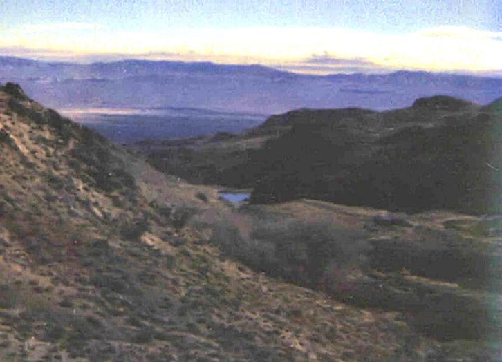
in Buffalo Valley southwest of Battle Mountain, NV |
in Buffalo Valley |
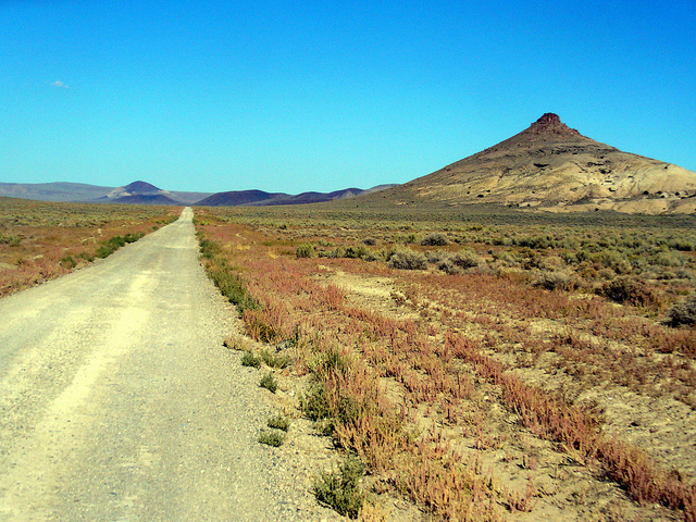
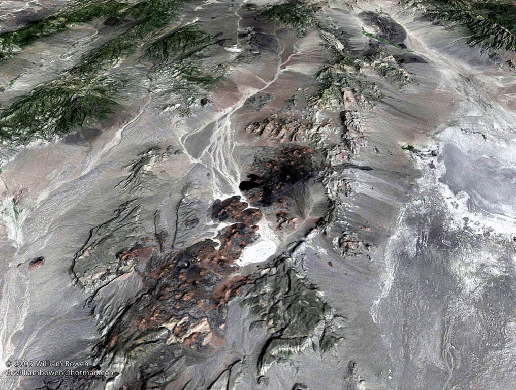
The Buffalo Valley volcanic field |
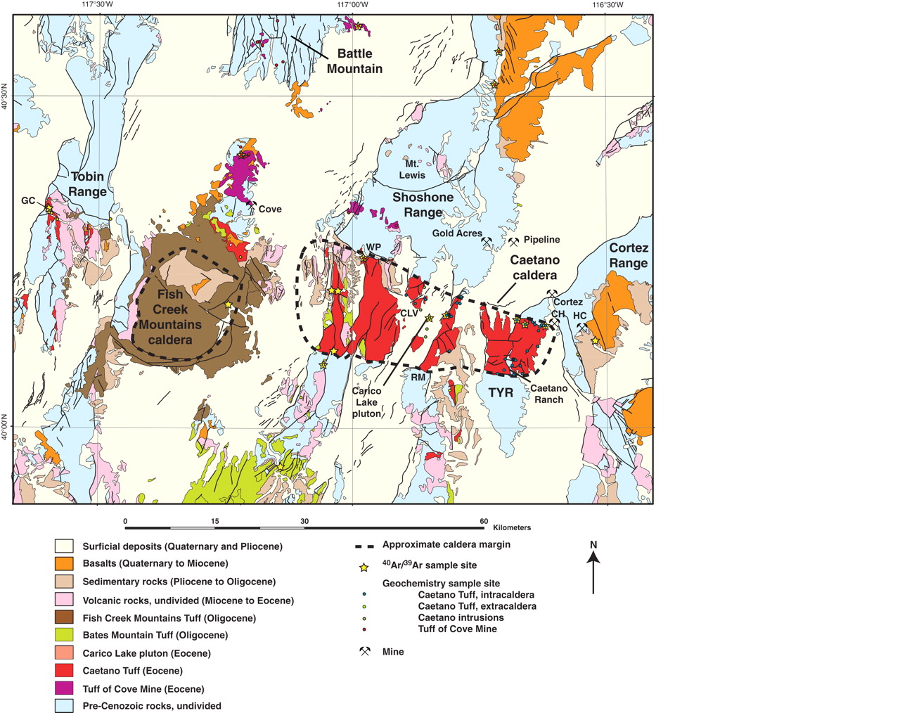
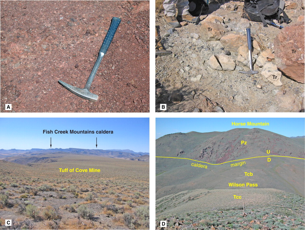
Generalized geologic map of the Caetano and Fish Creek Mountains |
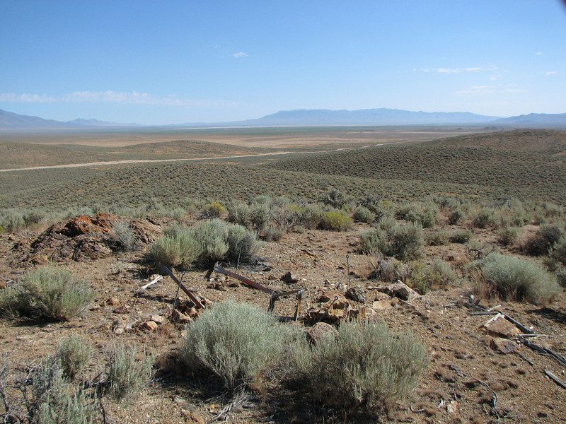
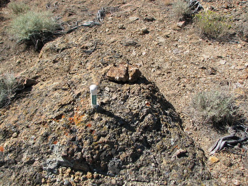
Photographs showing pre-Caetano caldera geology |
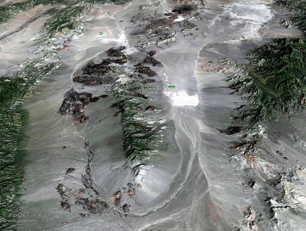
Clayton Valley Sand Dunes. Esmeralda County |
Clayton Valley |
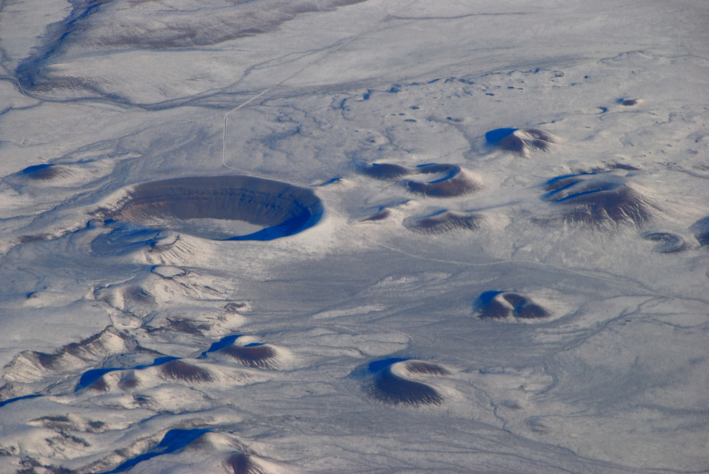
Lunar Crater volcanic field http://zsylvester.blogspot.com/2009/12/lunar-crater-volcanic-field-nevada.html |
Lunar Crater volcanic field http://www.rachel-nevada.com/places/lunar.html |
Lunar Crater |
Nye County Lunar Crater Volcanic Fielld http://130.166.124.2/nv_panorama_atlas/page14/files/page14-1032-full.html |
Nye County Reveille Range. http://130.166.124.2/nv_panorama_atlas/page14/files/page14-1058-full.html The Reveille Range is the Nye County, Nevada mountain range that is the location of the Reveille Range volcanic field ¢ map - http://en.wikipedia.org/wiki/Reveille_Range |
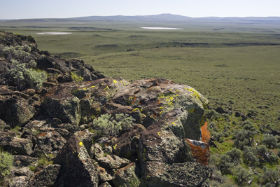
Charles Sheldon National Antelope Range. Expansive view from Guano Rim on the west side of the Sheldon Antelope Range |
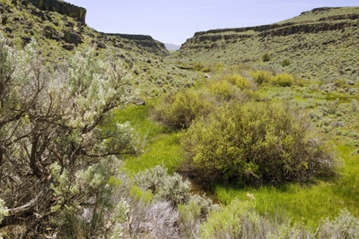
Narrow water course cuts through the highlands of Guano Rim on the west side of the Sheldon Antelope Range |
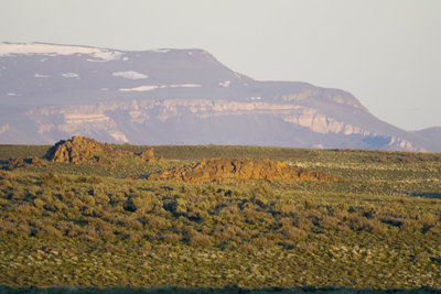
Devaney Mountain in the Sheldon Antelope Range |
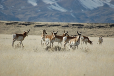
Antelope on the Sheldon Antelope Range - walderness - http://www.nevadawilderness.org/library/area.asp?nMode=1&nLibraryID=220 |
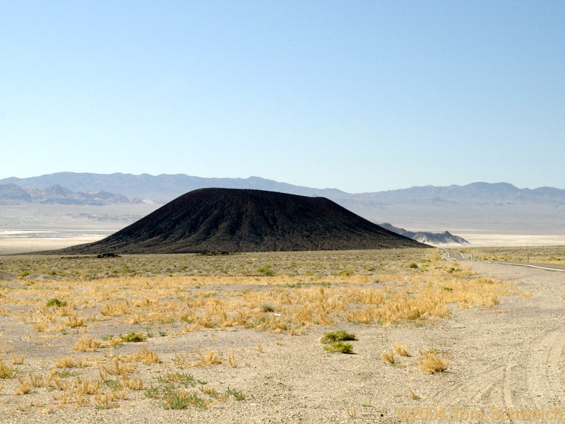
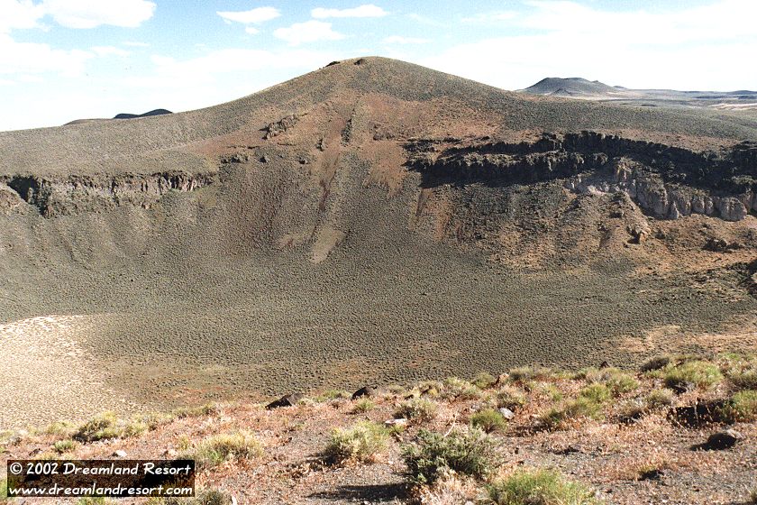
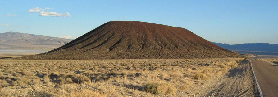
Silver Peak Caldera . This is a 1500 year old Cinder Cone (Caldera). Esmeralda County. Silver Peak is currently the major supplier of lithium in the United States |
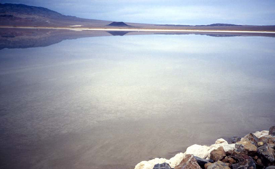
Cinder Cone in Clayton Valley Looking north across a lithium brine pond, in which the cinder cone is reflected. Clayton Valley is the site of the largest lithium mine in the United States of America. It is an unusual mine in that the lithium occurs in underground water in sediments that fill the valley. The lithium-rich water is pumped to the surface and partially evaporated, past the saturation point for halite (NaCl), the salt that coats the rocks in the foreground of this picture. The lithium-rich brine is then processed to produce useful products for batteries, medicines, and other uses. Contributed by J.G. Price and E.M. Price |
Cinder Cone in Clayton Valley View of cone from south |
Silver Peak Caldera Caldera Formation: A collapse is triggered by the emptying of the magma chamber beneath the volcano, usually as the result of a large volcanic eruption. If enough magma is erupted, the emptied chamber will not be able to support the weight of the volcanic edifice above it. A roughly circular fracture - the "Ring Fault" develops around the edge of the chamber. These ring fractures serve as feeders for fault intrusions which are also known as ring dykes. Secondary volcanic vents may form above the ring fracture. As the magma chamber empties, the center of the volcano within the ring fracture begins to collapse. The collapse may occur as the result of a single cataclysmic eruption, or it may occur in stages as the result of a series of eruptions |
Magma Chamber: A large underground pool of molten rock lying under the surface of the earth''s crust. The molten rock in such a chamber is under great pressure, and given enough time and pressure can gradually fracture the rock around it creating outlets for the magma. If it finds a way to the surface, then the result will be a volcanic eruption; consequently many volcanoes are situated over magma chambers. Magma chambers are hard to detect, and most of the known ones are therefore close to the surface of the Earth, commonly between 1 km and 10 km under the surface. In geological terms this is extremely close to the surface, although in human terms it is considerably deep undergrounds. Magma -a liquid carrying a load of mineral crystals. Because they solidified from a fluid state, igneous rocks tend to have an equigranular texture, a uniform fabric without layers, and the mineral grains are packed together tightly. Think of the texture of a piece of bread as a similar example. Silver Peak Caldera |
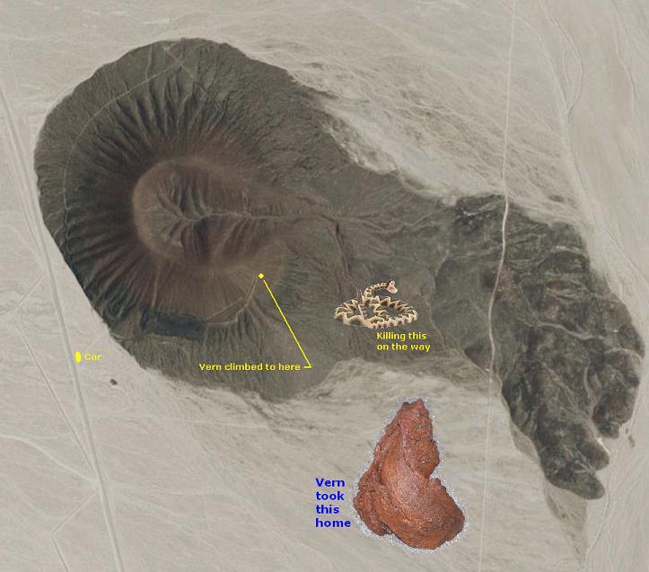
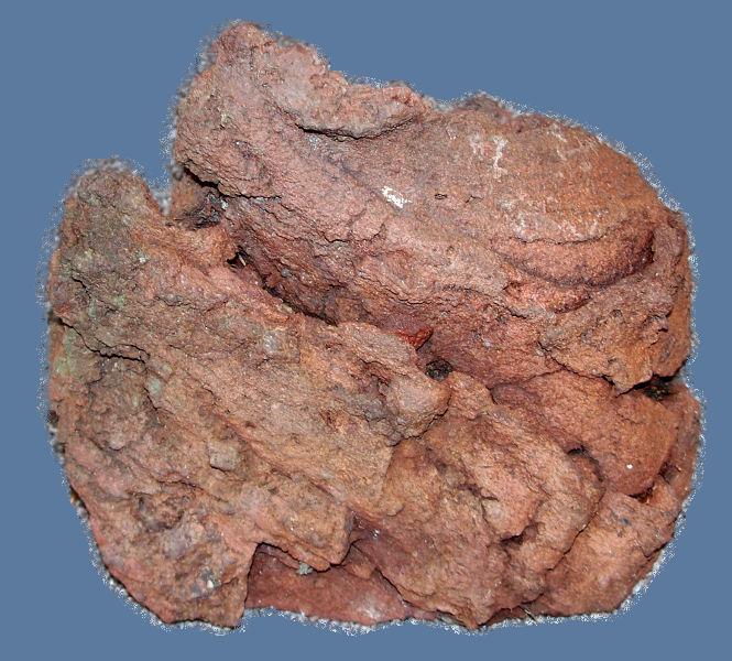
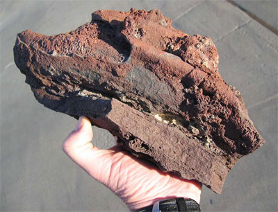
Volcanic bomb from the cinder cone in Clayton Valley. http://www.nbmg.unr.edu/ScienceEducation/EarthCaches/CinderConeClaytonValley.html !!! |
Virgin Valley. California Hot Springs on the banks of the River just west of downtown Elko NV |
Playa Flood in the Ivanpah Valley Area Clark couty. Volcanite on flood plain |
|
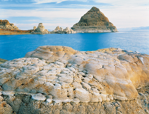
Pyramid Lake Indian Reservation.Unique among NevadaÆs six territories, Indian Territory is not bound by county lines, highways, or historical trails. Reservations, colonies, and other communities dot the countryside, but in truth, the entire state is Indian Territory, the ancestral lands of the Goshute, Mojave, Northern and Southern Paiute, Shoshone, and Washoe who have called the Great Basin and desert southwest home for thousands of years. Fossilized human remains found in the region have been dated to more than 9,000 years old, and barely a spot along its shoreŚfrom the Pyramid, Stone Mother, and Marble Bluff on the southeast coast, to the Needles in the northŚdoes not hold spiritual significance to the tribe |
|

http://www.volcano.si.edu/world/region.cfm?rnum=1206
Sierra Grande in the distance, from the summit of Capulin Volcano
http://myvintagecameras.blogspot.com/2010/08/weekly-volcano-32-san-francisco-peaks.html
Capulin Volcano National Monument is to the north of where these
The Raton-Clayton Volcanic Field
Cabezon Peak is the largest volcanic neck in the Mt. Taylor volcanic field
Jeff Davis Peak, one of the highest peaks entirely within, Nevada
http://www.photovolcanica.com/VolcanoInfo/Wai-O-Tapu/Wai-O-Tapu.html -new zealand
http://www.photovolcanica.com/VolcanoInfo/Dallol/Dallol.html
http://geology.com/volcanoes/types-of-volcanic-eruptions/ Types of Volcanic Eruptions
http://geology.com/rocks/igneous-rocks.shtml - Igneous Rocks
http://geology.com/volcanoes/ volcanos and map collection
http://www.alaskadispatch.com/article/alaskas-biggest-volcanic-eruptions alasca
http://geology.com/news/category/volcanoes.shtml geo
http://geology.com/satellite/arizona-satellite-image.shtml arizona
. http://geology.com/news/category/volcanoes.shtml
http://geology.com/news/category/volcanoes.shtml alaska
http://geology.com/novarupta/ alaska
http://geology.com/news/category/volcanoes.shtml
http://geology.com/volcanoes/
http://geology.com/articles/active-volcanoes-solar-system.shtml solar system volcanoes
http://geology.com/states/california.shtml california
More than 500 volcanic vents have been identified in the State of California. At least 76 of these vents have erupted, some repeatedly, during the last 10 KA.
http://www.sciencedaily.com/releases/2007/11/071108141612.htm -global warmong volcano Science dayly
http://www.boston.com/bigpicture/2010/09/around_the_solar_system.html mars sheld
http://nationalatlas.gov/dynamic/dyn_vol-ca.html
http://nationalatlas.gov/dynamic/dyn_vol-ak.html alaska
http://nationalatlas.gov/dynamic/dyn_vol-us.html other
http://www.goldengatephoto.com/geotours/cgp1.html geomorphology
http://maydamedia.com/Chapters/Chapter19/CA2.html physical geography
http://maydamedia.com/Chapters/Chapter19/CA1.html cal geo angelin
Summary of Holocene eruptive activity http://vulcan.wr.usgs.gov/Volcanoes/California/Hazards/Bulletin1847/table_holocene_volcanoes.html
http://www.volcano.si.edu/world/region.cfm?rnum=12&rpage=highlights volcanoes
http://vulcan.wr.usgs.gov/Volcanoes/California/framework.html
http://www.nps.gov/labe/index.htm lava beds medicine lake, http://vulcan.wr.usgs.gov/Volcanoes/MedicineLake/Locale/framework.html
http://www.volcano.si.edu/world/region.cfm?rnum=1203 california volcanoes 1111111
http://www.volcano.si.edu/world/region.cfm?rnum=1203 all parts
map
Large red triangles show volcanoes with known or inferred Holocene eruptions; small red triangles mark volcanoes with possible, but uncertain Holocene eruptions or Pleistocene volcanoes with major thermal activity. Yellow triangles distinguish volcanoes of other regions- http://www.volcano.si.edu/world/region.cfm?rnum=12
http://www.volcano.si.edu/world/region.cfm?rnum=1204
http://volcano.oregonstate.edu/craters-moon B&R
http://wapi.isu.edu/envgeo/EG6_volcano/volcanoes.htm
http://mms.nps.gov/yell/ofvec/exhibits/ecology/index.htm - hot spring ecology
http://en.wikipedia.org/wiki/List_of_lava_domes list of lava domes
http://www.thoughtsandplaces.org/heavenwait2008/devilsholeworkshop/dhwsfieldtrip2.htm DV
http://www.volcano.si.edu/world/region.cfm?rnum=1206
http://en.wikipedia.org/wiki/Black_Rock_Desert - Nevada black rock desert
The southern center of the Sleeping Butte group is visible from Highway 95, approximately 16 kilometers north of Beatty .
http://www.volcanodiscovery.com/timber_mountain.html
Buena Vista Valley, Lovelock, Nevada. Granite Mountain heading northeast
http://written-in-stone-seen-through-my-lens.blogspot.com/2011/01/ship-rock.html -Stately Ship Rock and the Navajo Volcanic Field
new mexico
Magmatic and tectonic evolution of the Caetano caldera, north-central Nevada: A tilted, mid-Tertiary eruptive center and source of the Caetano Tuff
David A. John1, Christopher D. Henry2 and Joseph P. Colgan3
+ Author Affiliations
1U.S. Geological Survey, 345 Middlefield Road, Menlo Park, California 94025, USA
2Nevada Bureau of Mines and Geology, University of Nevada, Reno, Nevada 89557, USA
3U.S. Geological Survey, 345 Middlefield Road, Menlo Park, California 94025, USA
Abstract
The Caetano Tuff is a late Eocene, rhyolite ash-flow tuff that crops out within an ∼90-km-long, east-west¢trending belt in north-central Nevada, previously interpreted as an elongate graben or ōvolcano-tectonic trough.ö New field, petrographic, geochemical, and geochronologic data show that: (1) the east half of the ōtroughö is actually the Caetano caldera, formed by eruption of the Caetano Tuff at 33.8 Ma and later structurally dismembered during Miocene extension; (2) the west half of the trough includes both the distinctly younger and unrelated Fish Creek Mountains caldera (ca. 24.7 Ma) and a west-trending paleovalley partly filled with outflow Caetano Tuff; and (3) the Caetano Tuff as previously defined actually consists of three distinct units, two units of the 33.8 Ma Caetano Tuff and an older (34.2 Ma) tuff, exposed north of the Caetano caldera, herein named the tuff of Cove Mine.
Miocene extensional faulting and tilting has exposed the Caetano caldera over a paleodepth range of >5 km, from the caldera floor through post-caldera sedimentary rocks, providing exceptional constraints on an evolutionary model of the caldera that are rarely available for other calderas. The Caetano caldera filled with more than 4 km of intracaldera Caetano Tuff, while outflow tuff flowed west and south of the caldera, primarily down Eocene paleovalleys. Caldera fill consists of two units of Caetano Tuff. The lower compound cooling unit is as much as 3600 m thick and is separated by a complete cooling break from a 500¢1000-m-thick upper unit that consists of multiple, thin, ash flows interbedded with sedimentary deposits. Multiple granite porphyries, including the 25-km2 Carico Lake pluton, intruded and domed the center of the caldera within 0.1 Ma of caldera formation; one of these porphyries is associated with pervasive argillic and advanced argillic alteration of the western half of the caldera. All exposed caldera-related rocks are rhyolites or granites (71¢77.5 wt% SiO2). Caldera collapse was significantly greater than the thickness of caldera fill and created a topographic depression that served as a depocenter until at least 25 Ma, filling with nearly 1 km of sediments and distally derived, ash-flow tuffs.
The caldera is presently exposed in a series of 40¢50░, east-tilted blocks bounded by north-striking, west-dipping normal faults that formed after 16 Ma. Slip on these faults accommodated ∼100% E-W extension, making the restored Caetano caldera ∼20 km east-west by 10¢18 km north-south. The estimated volume of intracaldera Caetano Tuff is, therefore, ∼840 km3, and the minimum estimated total eruptive volume is ∼1100 km3. Although the Caetano magmatic system was probably too young to supply heat for nearby Carlin-type gold deposits in the Cortez district, earlier nearby magmatic activity may have contributed to formation of these deposits. Reconstruction of the late Eocene, pre-Caetano caldera geologic setting, immediately prior to caldera formation, indicates that the Cortez Hills and Horse Canyon Carlin-type deposits formed at ≤1 km depths -http://geosphere.gsapubs.org/content/4/1/75.abstract
http://scienceblogs.com/eruptions/2009/12/mvp_18_antelope_hill_az.php Az volcanoes
http://www.thoughtsandplaces.org/heavenwait2008/devilsholeworkshop/dhwsfieldtrip2.htm dv
http://vulcan.wr.usgs.gov/Volcanoes/Nevada/description_nevada_volcanics.html
Magmatic and tectonic evolution of the Caetano caldera,north-central Nevada: A tilted, mid-Tertiary eruptive center and source of the Caetano Tuff
Nevada Atlas of Panoramic Aerial Images