 | Nevada Volcanoes |
|
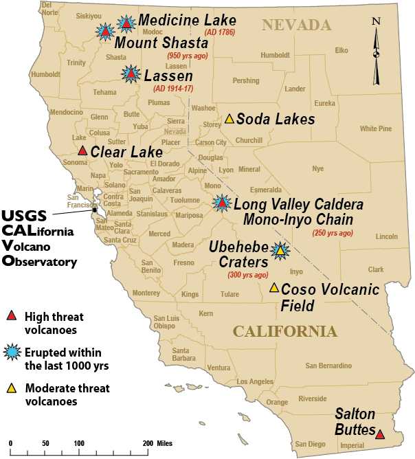
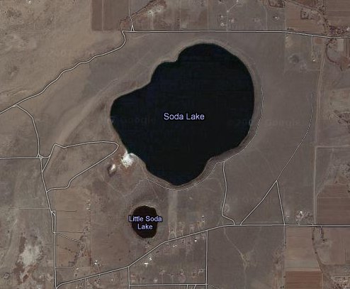
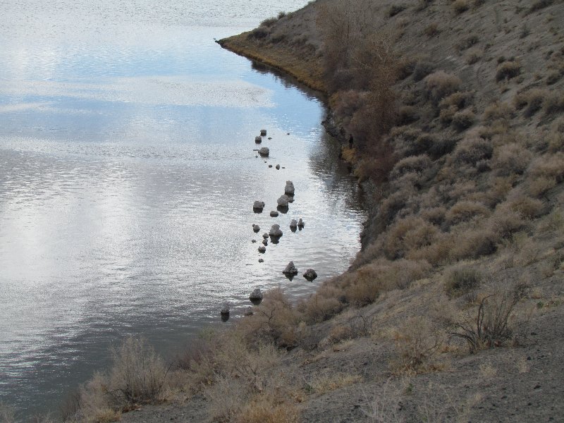
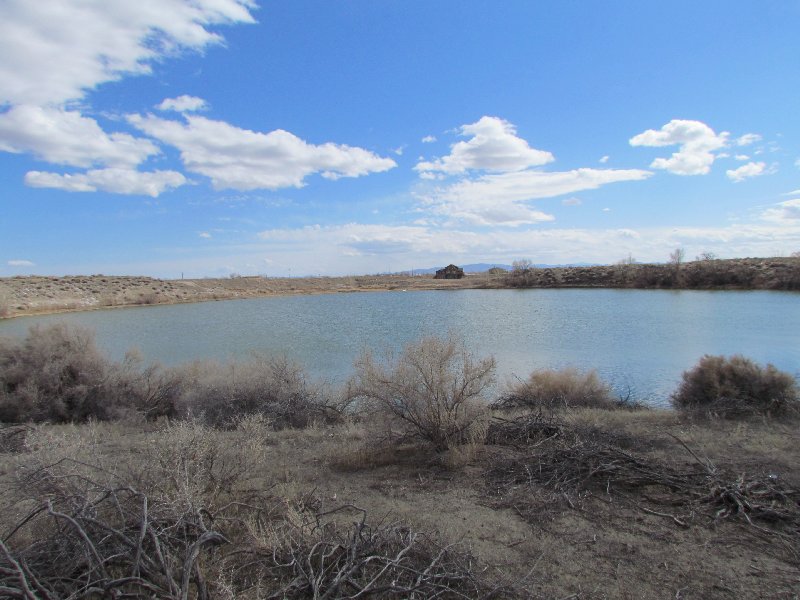
Soda lake maars. Soda Lake is a maar, a broad, low-relief, nearly circular volcanic crater. It probably formed when magma rose close to the surface, boiled the groundwater, and caused an explosive eruption.Two lake-filled maars, Soda Lake and Little Soda Lake, lie NW of the town of Fallon. The basaltic maars were formed subaerially, post-dating the Pleistocene glacial Lake Lahontan, and were estimated to be less than 10 KY and perhaps even less than 1500 years old (Garside and Schilling, 1979; Price and LaPointe, 1998). The larger maar, Soda Lake, is about 1.3x 2 km wide and is elongated in a NE-SW direction. The 300-m-wide Little Soda Lake lies south of Soda Lake. The late-Pleistocene Upsal Hogback cones lie to the NNE of Soda Lakes. |
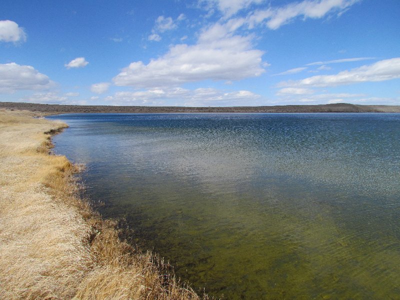
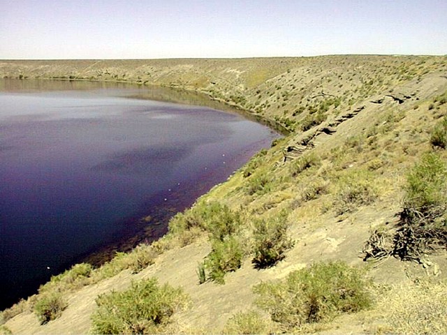
Soda Lake maar in west-central Nevada was erupted through sediments of the glacial Lake Lahontan. It is the larger of two lake-filled maars located NW of the town of Fallon. The basaltic maars were estimated to be less than 10 KY and perhaps even less than 1500 years old. Soda Lake is about 1.3x 2 km wide and is elongated in a NE-SW direction; its rim rises only about 35 m above the lake surface. The maars are the site of a geothermal prospect that may have discharged hot springs through the end of the 19th century. http://www.volcano.si.edu/world/volcano.cfm?vnum=1206-01- http://www.nbmg.unr.edu/dox/e28/guide.htm |
The Soda Lakes, 1251 m, are two lakes located northwest of Fallon, Nevada. They occupy two basaltic maar volcanoes which may have erupted in the last 1500 years. The larger lake (called Soda Lake) is somewhat elongated, stretching 2 km in length, while the smaller one (Little Soda Lake) is 200 meters (660 ft) across. Also called "tuff cones", maars are shallow, flat-floored craters that scientists interpret have formed above diatremes as a result of a violent expansion of magmatic gas or steam; deep erosion of a maar presumably would expose a diatreme. Maars range in size from 61 to 1,981 m across and from 9 to 198 m deep, and most are commonly filled with water to form natural lakes. Most maars have low rims composed of a mixture of loose fragments of volcanic rocks and rocks torn from the walls of the diatreme. http://www.molossia.org/volcanology/sodalake.html |
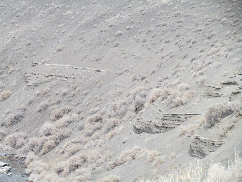
Crater Wall Up Close |
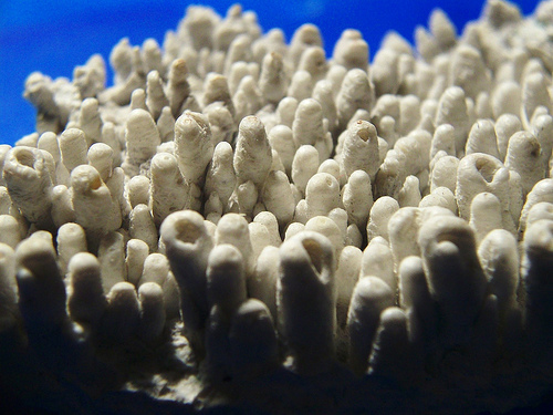
Tufa Domes |
Little Soda Lake, also a maar, and Soda Lake are probably the youngest volcanoes in Nevada. They erupted through sediments deposited in Lake Lahontan and are therefore less than 10,000 years old, perhaps even younger than 1,500 years |
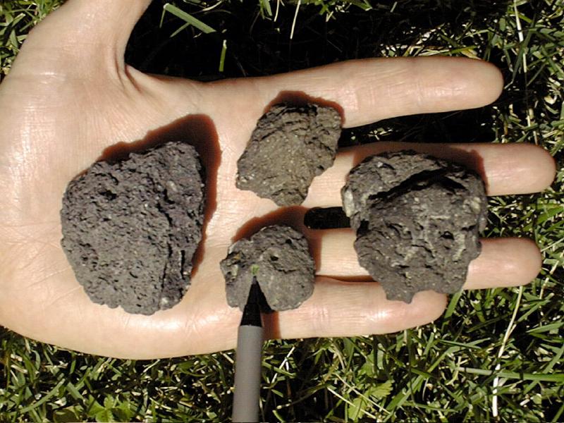
Soda Lakes Holocene maars. Basalt bombs erupted from the Soda Lake volcano. These samples contain large (greater than 1 mm to as much as 1 cm) crystals of abundant clear and white plagioclase feldspar and green olivine (peridot, the gem variety) and less common, black, vitreous clinopyroxene. The rock contains small grains of magnetite and is slightly magnetic-http://www.nbmg.unr.edu/dox/e28/guide.htm |
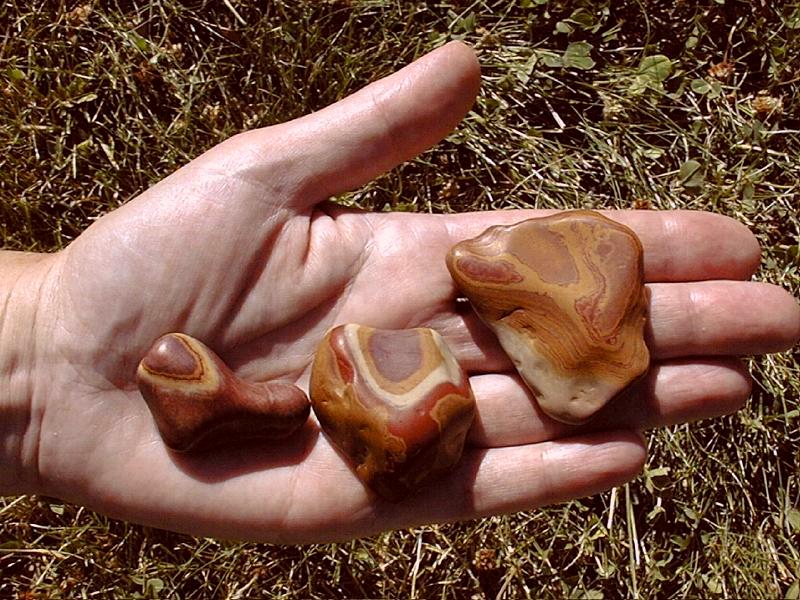
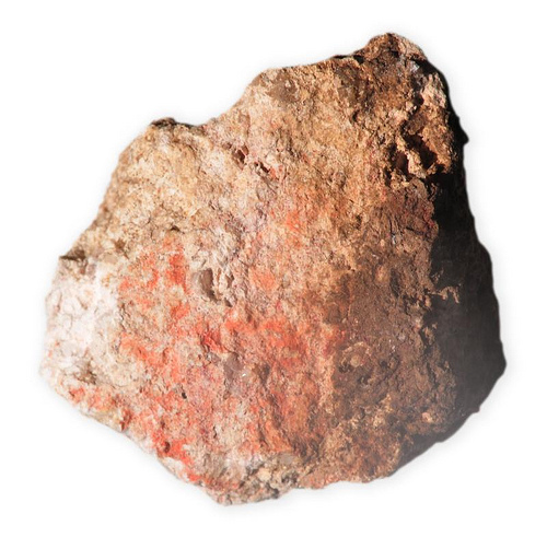
This volcanic rock is a rhyolitic air-fall tuff, material ejected from a volcano about 12 million years ago. The rock was altered by hot waters that deposited pyrite (FeS2) and quartz (SiO2). Rainwater penetrated the rock and oxidized the pyrite to form liesegang bands of red hematite (Fe2O3) and orange and brown goethite (FeO(OH)). Erosion broke pieces of the rock from its outcrop, and streams carried pebbles to the shore of Lake Lahontan, which covered much of western Nevada during the Pleistocene Epoch. These pebbles, found along the road two miles east of Grimes Point, were tumbled and polished by the streams and by wave action along the shore of the lake about 13,000 years ago |
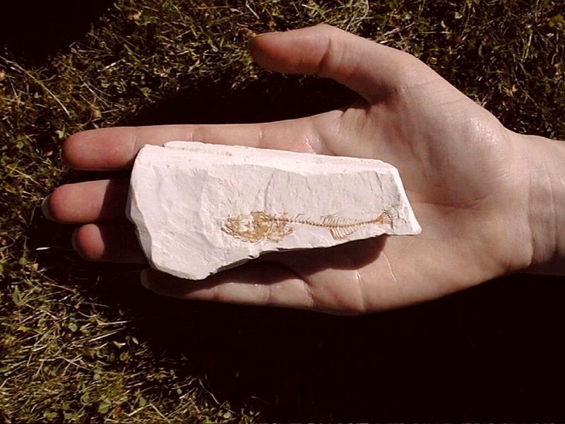
Fossil fish. (Gasterosteus doryssus or Nevada stickleback) in diatomite (a silica-rich rock composed of skeletal remains of diatoms, single-celled plants) from a Miocene freshwater lake, approximately 7 to 8 million years old, Hazen Pit, Churchill County, Nevada. Fossils of the Nevada killifish or top minnow (Fundulus nevadensis) are also common at this locality. Collectors must get permission from the owner, Eagle-Picher Minerals |
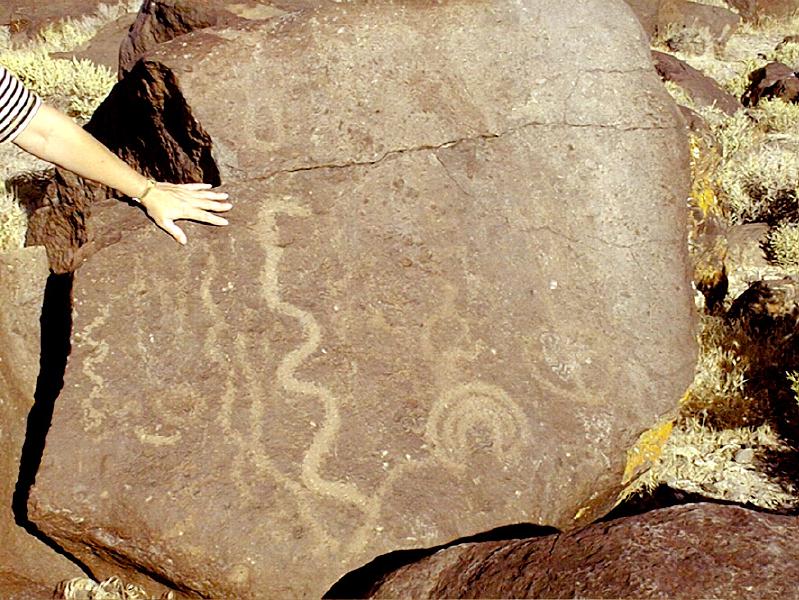
Petroglyphs at Grimes Point. Prehistoric natives drew petroglyphs in boulders of andesite lava flows along the shores of the ancient Lake Lahontan. The boulders are coated with rock varnish, a thin layer of dark brown to black iron and manganese oxides. The U.S. Bureau of Land Management has constructed a path along which you can view the petroglyphs |
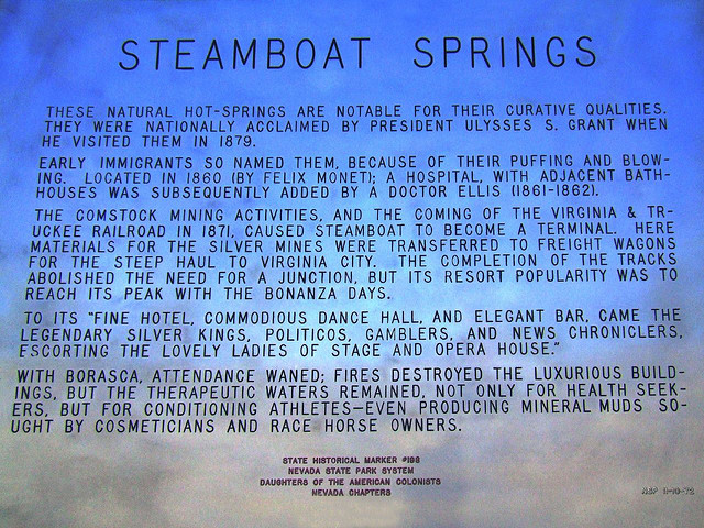
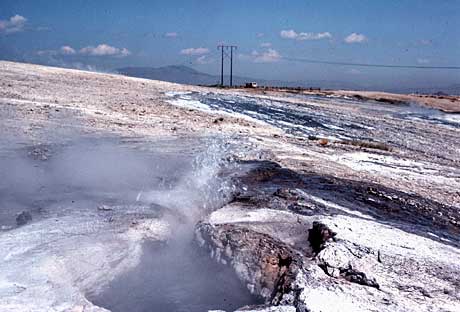
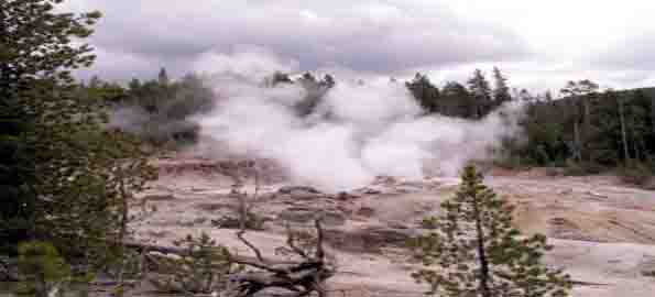
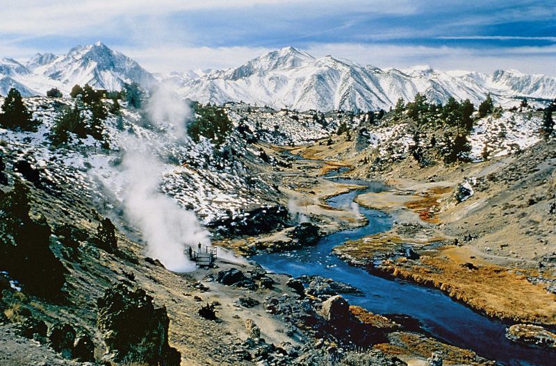
Hot Springs in Steamboat Springs, Nev |
Steamboat Springs Geyserite - http://flickeflu.com/set/72157603633469506 !!!! |
|
Located several miles south of Reno, Steamboat Hot Springs was an area of ever-changing hydrothermal activity. At one point, over 20 geysers were observed, making Steamboat one of the largest geyser fields in the world. |
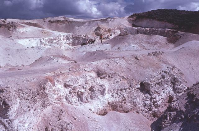
Rhyolite dome volcanic field, 1,415 meters elevation,. A small volcanic field of domes and flows occurs at the south end of Truckee Meadows from approximately 20 kilometers south-southwest of Reno. The western dome is 3 kilometers south-southwest of Steamboat Hot Springs, a questionable dome underlies the hot springs, and 4 other domes are northeast of the springs. The south-west dome and one of the northeast domes are the largest, being one kilometer in diameter and nearly 150 meters in maximum relief. ... Two domes have radiometric ages of 1.21 and 1.14 MY, but 2 obsidian whole-rock ages for one of the domes are approximately 3.0 MY; the anomaly is unresolved. The age of the thermal springs is possibly 3.0 MY. Certainly by 1.1 MA activity had started, and it continues to the present time. The active sinter deposits include gold, silver, mercury, antimony, arsenic, thallium, and boron; small quantities are commercial in grade- http://vulcan.wr.usgs.gov/Volcanoes/Nevada/description_nevada_volcanics.html#steamboat_springs |
Much of the Steamboat Springs area is underlain by Cretaceous granodiorite. Pleistocene basaltic andesite flows cap the hills to the south of the main hot springs area. The hot-spring system formed in the early Pleistocene, prior to the eruption of the basaltic andesite flows. Steamboat Springs is an example of a present-day, active epithermal gold-silver hydrothermal system. The thermal area is on a line connecting several rhyolite domes located to the southeast and northeast, and it has been proposed that another rhyolite intrusion may underlie the hot-spring area. The source of energy for the thermal system is most probably the completely crystallized magma chamber from which the rhyolite domes were emplaced. The basaltic andesites have been dated at approximately 2.5 MY and the rhyolite domes have been dated at 1.15 to 1.52 MY. Thus, the hot-spring system has been active, possibly intermittently, for over 2.5 MY - http://vulcan.wr.usgs.gov/Volcanoes/Nevada/description_nevada_volcanics.html#steamboat_springs |
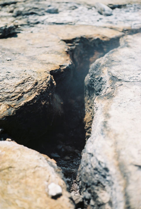
Lava domes, Pleistocene-Fumarolic Steamboat Springs is a small volcanic field of rhyolitic lava domes and flows in western Nevada, USA, located south of Reno. There is extensive geothermal activity in the area, including numerous hot springs, steam vents, and fumaroles. There were formerly a number of geysers in the area, but they have ceased to erupt because of geothermal drilling- http://en.wikipedia.org/wiki/Steamboat_Springs,_Nevada, http://vulcan.wr.usgs.gov/Volcanoes/Nevada/description_nevada_volcanics.html |
http://www.volcano.si.edu/world/volcano.cfm?vnum=120601-A&volpage=photo |
Geyserite from Steamboat Springs,siliceous sinter |
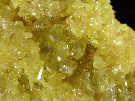
Sulfur from Steamboat Springs - http://www.johnbetts-fineminerals.com/jhbnyc/mineralmuseum/picshow.php?id=10843 |
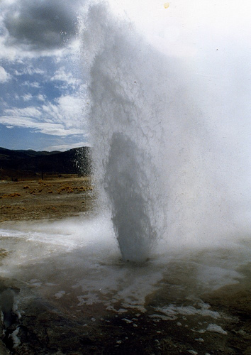
BEOWAWE. Geysers were first reported at Beowawe in 1869. The area contained at least 50 hot springs, many of which were capable of eruption. Geothermal exploration programs initiated in the 1950s caused the decline of many of the hydrothermal features, while a geothermal power plant destroyed the remainder. By 1987, all hot spring activity had ended at Beowawe. See also http://www.travelvivi.com/most-striking-geysers-on-earth/ photos !!!! |
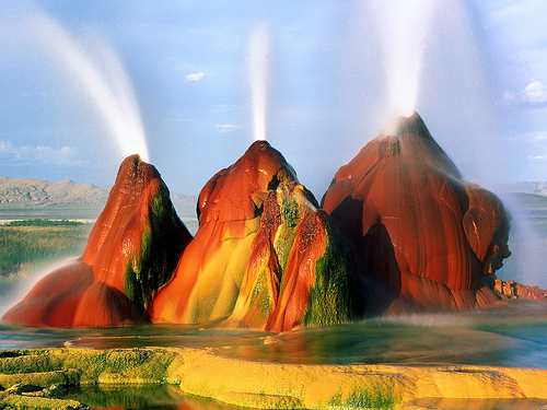
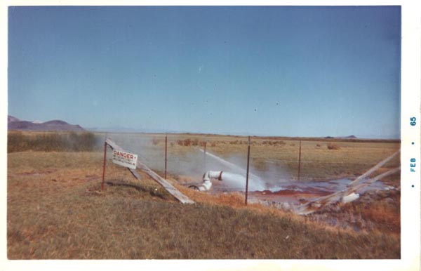
The Fly Geyser Ideally situated in the Black Rock Desert, Nevada, in the private property of the Fly Ranch that currently doesnít allow visitors, the Fly geyser is an amazing and yet undiscovered natural phenomena. It is not a real geyser; rather itís the accidental result of a well drill in the last century. The geyser has a complex mineral composition, including sulfur dioxide, which gives it its astonishing colors. This is something should be seen to be believed. If you give some effort this truly unique treasure can be spotted from the road - http://www.travelvivi.com/most-striking-geysers-on-earth/, http://en.wikipedia.org/wiki/Black_Rock_Desert, http://en.wikipedia.org/wiki/Fly_Geyser |
The Fly Geyser 1965 |
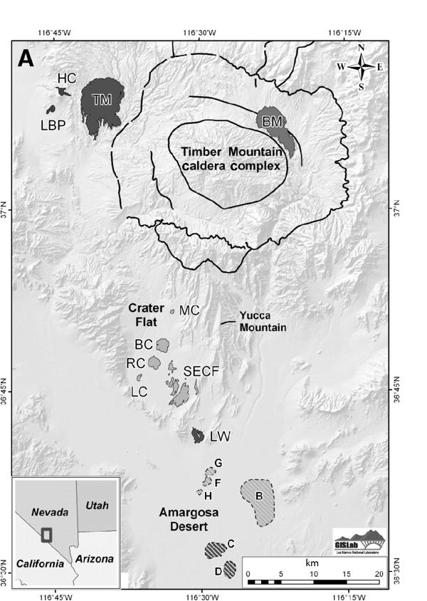
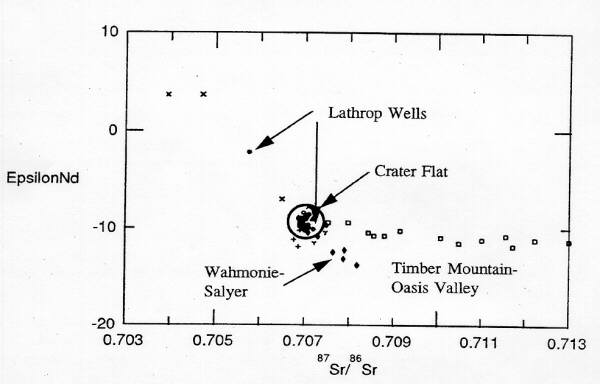
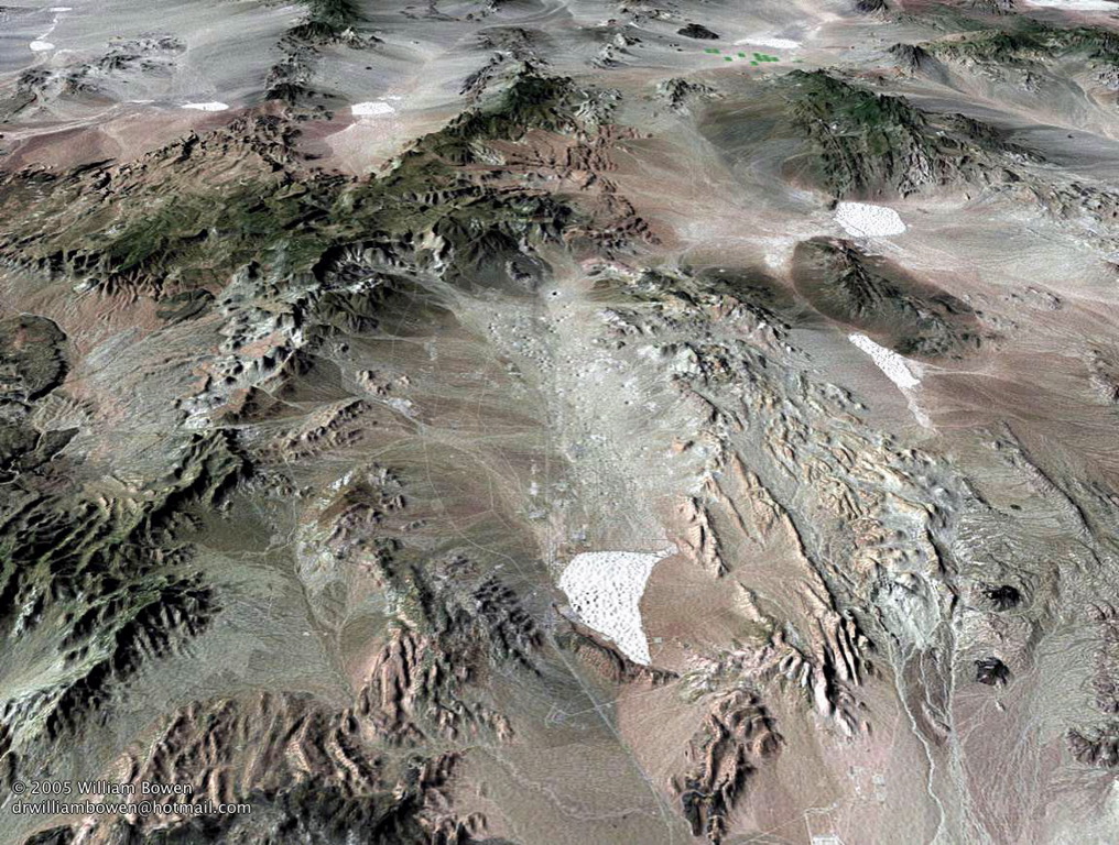
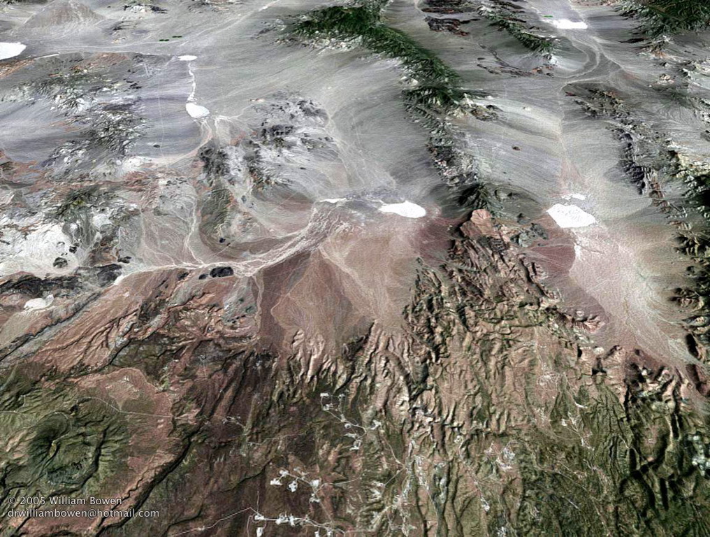
The Timer Mountain volcanic field located 150 km northwest of Las Vegas, Nevada, consists mainly of basaltic cinder cones and lava flows. It has been active in 3 major cycles, starting 12 MA. The most recent eruptions probably occurred less than 10 MA. Timber Mountain''s eruptive history consisted of 3 episodes: 12 to 8.5 MA, 9.0 to 6.5 MA, and 3.7 MA to less than 10 KA. The older volcanic centers of the Timber Mountain volcanic field include small basaltic scoria cones and lava flows, mainly in the northeastern part of the field. Basaltic eruptions resumed at 3.7 MY, with a progressive decline in the volume. All basaltic centers of the latest period of activity were in the southwest part of the volcanic field. There are 3 major centers of the younger activity in the Timber Mountain field: 1. Crater Flat contains a series of deeply eroded, 3.7 MY-old basalt scoria cones and lava flows in the eastern part. 4 more basaltic centers (1.2 MY old) are aligned along a NNE trending arc in the central area. The youngest center is the basalt of Lathrop Wells (100 to 10 KA old) at the south end of Crater Flat. 2. Buckboard Mesa: The basalt of Buckboard Mesa (2.8 MY old) erupted in the northeast part of Timber Mountain caldera. 3. Sleeping Butte: 2 other basalt centers (300 to 10 KA old) are located 30 kilometers north of Beatty, Nevada, on the south flank of the Black Mountain caldera complex. Buckboard and Sleeping Butte volcanic centers are within the controlled boundaries of the Nevada Test Site or the Nellis Bombing and Gunnary Range - http://www.volcanodiscovery.com/timber_mountain.html |
Polygenetic volcanic centers, 1,065 to 1,675 meters in elevation, hawaiite to alkali basalt in composition. Timber Mountain''s eruptive history consisted of three episodes: 12 to 8.5 MA (waning stage of Timber Mountain caldera cycle), 9.0 to 6.5 MA; and 3.7 MA to less than 10 KA. ... Late Cenozoic volcanic centers of the Timber Mountain volcanic field include spatially isolated small volume basaltic scoria cones and associated lava flows. Volcanic activity in this field switched from predominantly silicic to predominantly basaltic approximately 10 MA. The volume of basalt eruptions declined drastically approximately 8 MA, but small eruptions continued through 6.5 MY. Following a gap in activity, basaltic eruptions resumed at 3.7 MY, with a progressive decline in the volume through the Holocene. ... Basaltic centers associated with the oldest episode of activity were localized within and along ring-fracture zones of calderas of the Timber Mountain volcanic field. In association with the decline in eruption volume of basalt, volcanic activity was restricted to the northeast part of the Timber Mountain area. Since 3.7 million years ago, all basaltic centers have been in the southwest part of the volcanic field. There are three major occurrences of post-4 MA basaltic activity in the Timber Mountain field: Crater Flat: A series of deeply dissected 3.7-MYold basalt scoria cones and lava flows are present in eastern Crater Flat. Four more basaltic center (1.2 MY) are aligned along a north-northeast trending arc in central Crater Flat. The youngest center in this area is the basalt of Lathrop Wells (100 to 10 KY old), at the south end of Crater Flat. Buckboard Mesa: The basalt of Buckboard Mesa (2.8 MY old) erupted in the northeast segment of the moat zone of Timber Mountain caldera. Sleeping Butte: Two other Quaternary basalt centers occur at Sleeping Butte (300 to 10 KY years old), 30 kilometers north of Beatty, Nevada, on the south flank of the Black Mountain caldera complex. The Buckboard and Sleeping Butte volcanic centers are within the controlled boundaries of the Nevada Test Site or the Nellis Bombing and Gunnary Range. These sites are not accessible to the public. The southern center of the Sleeping Butte group is visible from Highway 95, approximately 16 kilometers north of Beatty. The Crater Flat volcanic field is approximately 150 kilometers northwest of Las Vegas, Nevada. http://vulcan.wr.usgs.gov/Volcanoes/Nevada/description_nevada_volcanics.html#steamboat_springs |
Timber Mountain Caldera, located within Nellis Air Force Gunnery Range and Nevada Test Site, is a restricted area containing a remnant of an elliptical caldera developed in the late Miocene and early Pliocene. It covers eight to ten miles and is surrounded by a moat-like depression extending to the rim of an older caldera |
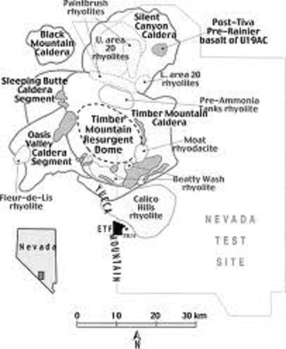
Timber Mountain/Oasis Valley caldera complex of South Western Nevada Volcanic field (SWNVF). Caldera rims for the four ash-flow sheets overlap. Eruptions of Paintbrush Group (Topopah Spring, Tiva Canyon tuffs, 12.8Ė12.7 Ma, 2,200 km3), and Timber Mountain Group (Rainier Mesa and Ammonia Tanks tuffs, 11.6Ė11.45 Ma, 2,200 km3) resulted in formation of Oasis Valley and Timber Mountain Calderas, respectively (Byers et al. 1976a, b; Christiansen et al. 1977). Smaller volume rhyolitic and basaltic (unmarked darker grey) lavas erupted following caldera collapses. Yucca Mountain is made of Topopah Spring and Tiva Canyon tuffs. Exploratory tunnel facility (ETF) for long-term storage of nuclear waste is shown. The magmatic activity in the SWNVF, one of the largest centers of silicic magmatism in the western USA, extended from 16 to <9 Ma - http://www.springerimages.com/Images/Geosciences/1-10.1007_s00410-006-0124-1-0 |
Oasis Vallley caldera |
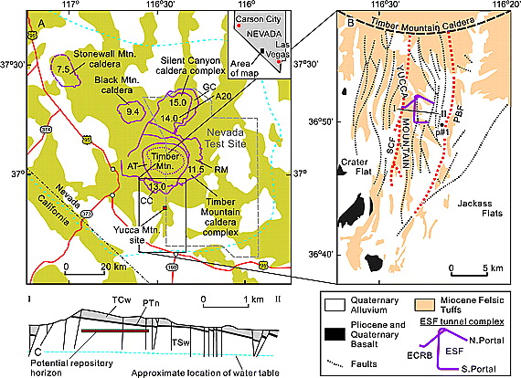
Geological setting. (a) Southwestern Nevada Volcanic Field (dashed line). Outlines of calderas are by Slate et al. [1999]; ages of caldera-forming eruptions, in Ma, are by Sawyer et al. [1994] and Weiss and Noble [1989]. Calderas: A20, Area 20; GC, Grouse Canyon; CC, Claim Canyon; RM, Rainier Mesa; and AT, Ammonia Tanks. Dotted contour shows approximate outline of the Timber Mountain resurgent dome. (b) Schematic geologic map of Yucca Mountain (by Day et al. [1998]) showing the footprint of the ESF exploratory tunnel complex; p#1, borehole UE25 p#1. Emphasized are the block-bounding faults, Solitario Canyon (SCF) and Paintbrush (PBF). (c) Schematic geologic transect along the IĖII line in Figure 1b (no vertical exaggeration); TCw, Tiva Canyon welded tuff; PTn, bedded nonwelded tuff; and TSw, Topopah Spring welded tuff. http://www.agu.org/journals/jb/jb0709/2006JB004597/figures.shtml |
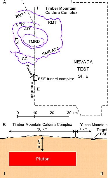
Schema of the conceptual model. (a) Outline of the Timber Mountain caldera boundaries (by Grauch et al. [1999]). (b) Schematic presentation of the ďconductive heatingĒ model shown as a cross-section along the IĖII line from Figure 2a. CC, segment of the Claim Canyon caldera (12.7Ė12.8 Ma); RM, boundary of the Rainier Mesa caldera (11.6 Ma); AT, boundary of the Ammonia Tanks caldera (11.45 Ma); and TMRD, Timber Mountain resurgent dome (post-11.45 Ma). S and T at the end of the caldera abbreviations denote the structural and topographic boundaries, respectively. http://www.agu.org/journals/jb/jb0709/2006JB004597/figures.shtml |
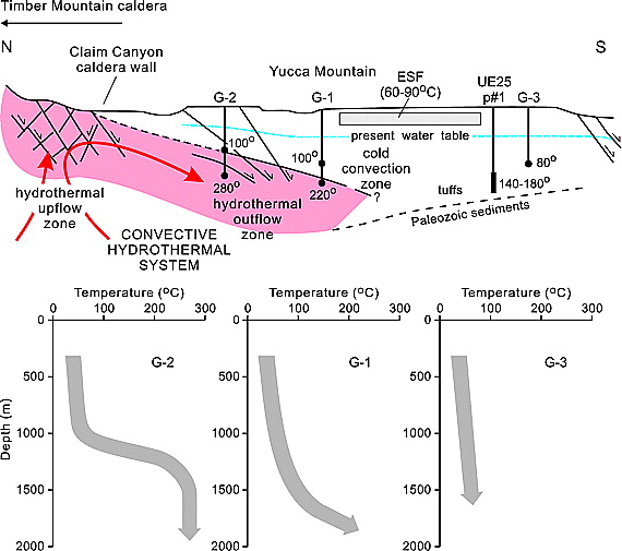
Reconstruction of the 10Ė11-Myr-old Timber Mountain Caldera hydrothermal system and schematic temperature profiles for boreholes USW G-1, G-2, and G-3 estimated from illite-smectite mineralogy and fluid inclusion data (slightly modified from Bish and Aronson [1993]). Black circles on the G-series boreholes and a rectangle on borehole UE25 p#1 (projected to the section) indicate approximate positions of the specified temperatures. Temperatures for UE25 p#1 are estimated on the basis of the conodont alteration index (by Carr et al. [1986]). Temperatures for the ESF-ECRB are established by fluid inclusion data from Dublyansky et al. [2001], Whelan et al. [2003], and Wilson et al. [2003].http://www.agu.org/journals/jb/jb0709/2006JB004597/figures.shtml |
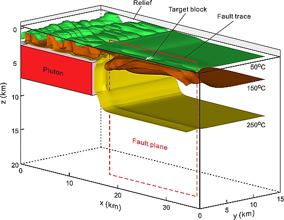
Configuration of the thermal field obtained in the fully 3-D, conduction-plus-advection model, which considered a 4 Myr-long preheating of the crust by basaltic magma emplaced at a depth of 30 km followed by emplacement of high-level silicic pluton. The model comprised two enhanced-permeability fault zones parallel to the xz plane. Isothermal surfaces are shown for the time of 10 ka, when the temperatures at the target block were the highest. Search for the cause-effect relationship between Miocene silicic volcanism and hydrothermal activity in the unsaturated zone of Yucca Mountainhttp://www.agu.org/journals/jb/jb0709/2006JB004597/figures.shtml |
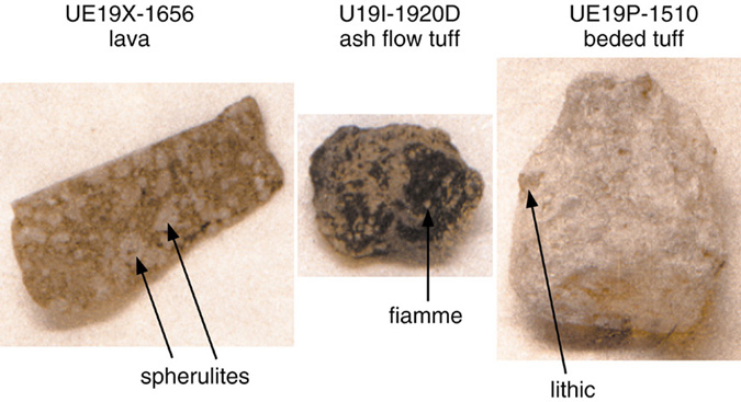
Southwestern Nevada volcanic field. Volcanic eruptions are often complex, and the eruption of a single magma can result in a variety of rock types, or lithologies. An example is rhyolite of Echo Peak . stratigraphic unit represents magma erupted 12.7 million years ago. Like many rhyolites, the ascending magma contained large amounts of volatile components, mostly water. Sudden outgassing from the top of the magma produced an eruptive column of ash that fell to form an initial deposit of bedded tuff. As the eruption progressed, perhaps in several stages, continued outgassing depleted later-erupted magma in volatiles, and eventually lava was erupted. This lava flowed over the bedded tuff, fusing the uppermost portion into a welded tuff. This eruptive history was first recognized by Byers et al. (1976a) from petrographic analyses of the different lithologies. The three constituent lithologies of rhyolite of Echo Peak are very different in appearance and physical character, and during field mapping, these lithologies were each assumed to represent a different stratigraphic unit. The welded tuff was initially thought to represent ash flow of the Pah Canyon Tuff. Photo shows three very different lithologies from rhyolite of Echo Peak, all produced from the same magma. Their intimate relationship was uncovered using the petrographic, chemical, and mineral chemical data in this database. Volcanic lithologies are often very complex, and the relationship between adjacent exposures of volcanic rock frequently cannot be determined using field methods- http://www.pggdb-swnvf.lanl.gov/report/apps.html |
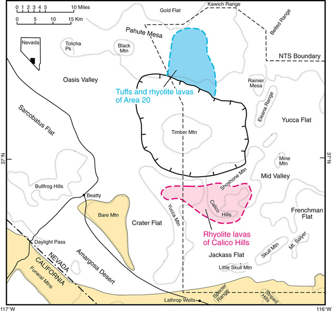
Location of tuffs and rhyolite lavas of Area 20 within Pahute Mesa region and rhyolite lavas of Calico Hills within Yucca Mountain region. These units are separated by the younger Timber Mountain caldera, and so cannot be correlated by field geologic methods. The application of petrographic analyses and mineral chemical analyses by Warren (1983b) demonstrated the magmatic equivalence of these two major units, now named the Calico Hills Formation. Volcanic rocks are absent within areas shaded yellow-http://www.pggdb-swnvf.lanl.gov/report/apps.html. |
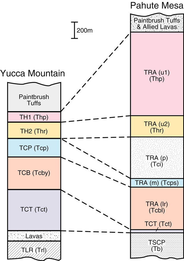
Correlation of stratigraphic units between the Pahute Mesa and Yucca Mountain regions, based on petrographic analyses and mineral chemical analyses by Warren (1983b). Symbols are for petrologic zones defined in the original paper; parenthetical symbols are those presently used for stratigraphic units.Petrographic analyses and mineral chemical analyses have also solved critical problems where two different stratigraphic units have identical field characteristics, and were miscorrelated. On the south face of Pahute Mesa, nonwelded ash flow tuffs occur beneath Tiva Canyon Tuff on opposite sides of the Scrugham Peak fault. This tuff was well characterized east of the fault as a very quartz-rich unit, the tuff of Blacktop Buttes.The correct stratigraphic assignment for ash flows on opposite sides of the fault also demonstrated that the Scrugham Peak fault was active during at least two different episodes, establishing an important feature of tectonism within the volcanic field.-http://www.pggdb-swnvf.lanl.gov/report/apps.html |
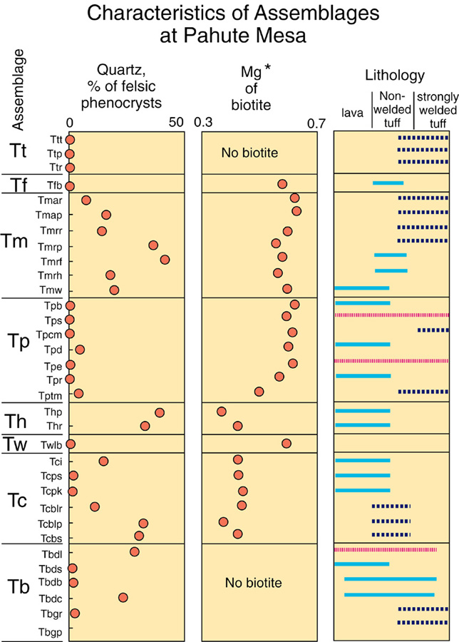
Selected petrographic, mineral chemical, and lithological analyses for some of the stratigraphic units within the SWNVF. The more than 300 volcanic units, for example Ttt, reside within volcanic assemblages such as Tt. Assemblages consist of a group of units that display similar petrographic, mineral chemical, and lithologic character. Parent-child relationships imbedded in the stratigraphic table allow easy extraction of data for related groups of stratigraphic units -http://www.pggdb-swnvf.lanl.gov/report/tablecontents.html |
Yucca Mountain has been proposed as the site for the nation''s first geologic repository for high-level radioactive waste. This chapter provides the geologic framework for the Yucca Mountain region. The regional geologic units range in age from late Precambrian through Holocene, and these are described briefly. Yucca Mountain is composed dominantly of pyroclastic units that range in age from 11.4 to 15.2 Ma. The proposed repository would be constructed within the Topopah Spring Tuff, which is the lower of two major zoned and welded ash-flow tuffs within the Paintbrush Group. The two welded tuffs are separated by the partly to nonwelded Pah Canyon Tuff and Yucca Mountain Tuff, which together figure prominently in the hydrology of the unsaturated zone. The Quaternary deposits are primarily alluvial sediments with minor basaltic cinder cones and flows. Both have been studied extensively because of their importance in predicting the long-term performance of the proposed repository. Basaltic volcanism began ca. 10 Ma and continued as recently as ca. 80 ka with the eruption of cones and flows at Lathrop Wells, 0 km south-southwest of Yucca Mountain. Geologic structure in the Yucca Mountain region is complex. During the latest Paleozoic and Mesozoic, strong compressional forces caused tight folding and thrust faulting. The present regional setting is one of extension, and normal faulting has been active from the Miocene through to the present. There are three major local tectonic domains: (1) Basin and Range, (2) Walker Lane, and (3) Inyo-Mono. Each domain has an effect on the stability of Yucca Mountain - http://www.state.nv.us/nucwaste/yucca/volcan01.htm |
Yukka Mountains -http://www.pggdb-swnvf.lanl.gov/report/tablecontents.html |
Buck Boart Mesa |
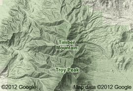
Timber Mountain |
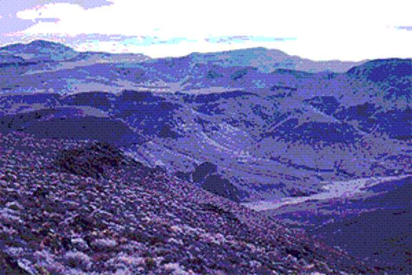
Timber Mountain rises in the distance, a Tertiary volcanic plug remnant . Nature -http://www.basinandrangewatch.org/OasisHabitats.html |
Nye County, Timber Mt |
Timber Mountain Buckboard Mesa - http://130.166.124.2/nv_panorama_atlas/page14/page14.html |
Nye County, Yukka Flat |
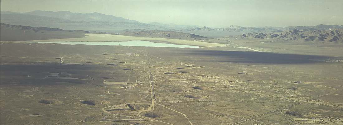
Nye County, Boxcar Crater |
The Mono Basin is to the left, or north of the spillway. The right, or south side, drains first to Adobe Valley, then the Chalfant Valley, and finally the Owens Valley -(California-Nevada) The Adobe Hills volcanic area is comprised of a sheetlike mass of overlapping olivine basalt flows that cover an irregularly shaped, generally east-west-trending area of approximately 800 km2. This area, which extends eastward for approximately 60 km from the eastern shore of Mono Lake, is roughly bisected by the California-Nevada border. The irregular sheet of basalt flows locally attains thicknesses of nearly 200 meters in its central part, where multiple flows overlap, but thins to individual flows, with thicknesses of less than 10 meters, along its northern and southern margins.Its highly irregular shape and subregional extent suggest an origin by numerous eruptions from a number of widely spaced centers - http://vulcan.wr.usgs.gov/Volcanoes/Nevada/description_nevada_volcanics.html#nevada_map |
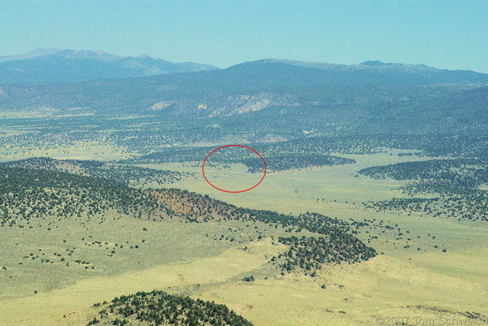
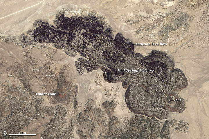
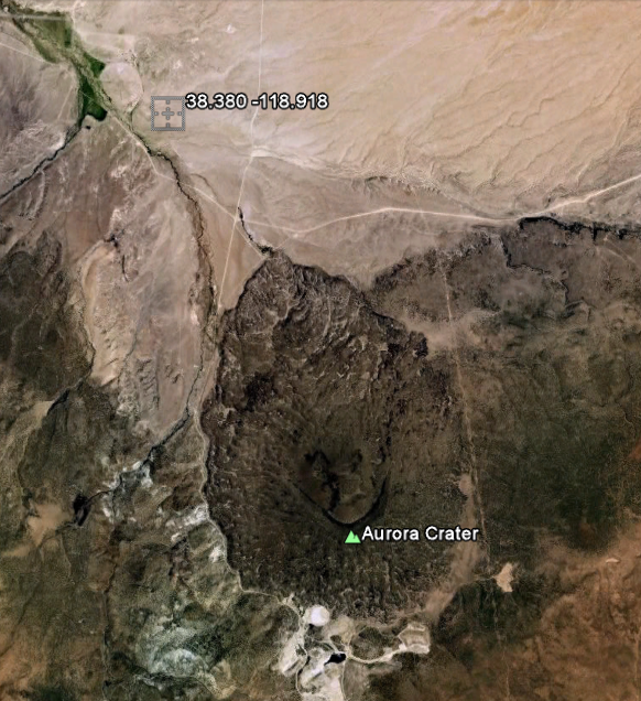
(California-Nevada) The Aurora-Bodie volcanic field occurs east-northeast of Mono Lake, between the Sierra Nevada and the Great Basin. Calc-alkaline andesite, dacite and trachyandesite lavas, breccias and ashflow tuffs, dated 15 to 8 MA, underlie a tighter concentration of younger alkaline-calcic cinder cones and flows. The older volcanics cover approximately 80 square kilometers with a volume of approximately 35 km3. Andesite domes and flows, 4.5 to 2 MA, occur at Cedar Hill and other areas in the field, and Pleistocene to late Holocene basaltic rocks forming well-preserved cinder cones and flows cover approximately 100 square kilometers. The probable late Pleistocene age Mud Springs volcano consists of a steep-fronted bulbous flow surrounding a depressed vent area, and a 7-kilometer-long ridged flow, together creating a remarkably distinctive landform. Although trees cover the flows, partially accounting for their dark color, the volcano is clearly one of the freshest in the Aurora-Bodie field. Aurora Crater, approximately 12 kms west of Mud Springs volcano, is a 1.7-km-wide breached crater of approximately 250 KY, totally surrounded by lava flows, with an estimated total volume of 2 km3. Many of the volcanoes are cut by faults, and Pleistocene basalt has been warped as well. The topography of the entire area has been softened by ash probably erupted by the younger Mono Craters to the southwest. Gold and silver found in quartz veins in the Miocene (but not younger) volcanic rocks were mined - http://vulcan.wr.usgs.gov/Volcanoes/Nevada/description_nevada_volcanics.html#nevada_map large photo- http://eoimages.gsfc.nasa.gov/images/imagerecords/50000/50493/mudsprings_wv2_2008187_lrg.jpg The Aurora-Bodie volcanic field in Nevada includes a series of small lava flows and scoria (cinder) cones that range in age from about 100KY (late Pleistocene) to more than 15 MY. It is part of the Basin and Range province, an area of extensive crustal stretching across the western United States.The volcanoes of the Aurora-Bodie field erupted lavas ranging from relatively fluid basalt to more viscous andesite. These eruptions produced distinctive thick and bulbous lava flows such as those of the Mud Springs Volcano, the youngest in the field. The lava from Mud Springs extends 7 km from the small vent near the southeastern end of the volcano. The dry Nevada climate has largely preserved the dark lava surface of Mud Springs, even though it is about 110KY. Individual trees are visible on flat areas, as well as on the surrounding, older volcanoes. The basin floor surrounding the volcano is largely barren.Most of the eruptions from Aurora-Bodie have been small, with an average eruptive rate of 200 m3/km2 per year since about 3.6 MY. This low rate of activity is evidence that the Aurora-Bodie volcanoes are fed by remelted basalt from the lower crust, rather than a stable magma chamber in the upper crust -http://earthobservatory.nasa.gov/IOTD/view.php?id=50493 |
Aurora crater |
http://www.volcano.si.edu/world/region.cfm?rnum=1206
Jeff Davis Peak, one of the highest peaks entirely within, Nevada
map
Large red triangles show volcanoes with known or inferred Holocene eruptions; small red triangles mark volcanoes with possible, but uncertain Holocene eruptions or Pleistocene volcanoes with major thermal activity. Yellow triangles distinguish volcanoes of other regions- http://www.volcano.si.edu/world/region.cfm?rnum=12
next
Nevada volcanoes
More volcanoes
Southwestern Nevada volcanic field
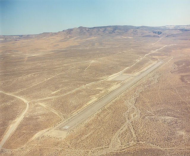
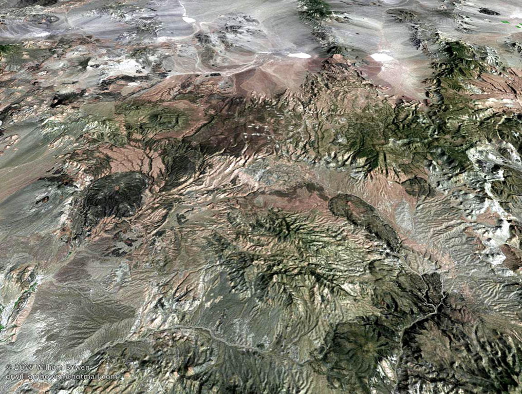
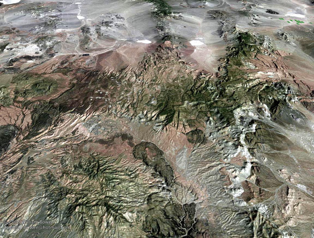
Aeral view
