 | New Mexico Volcanoes and Volcanics |
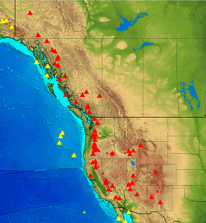
Large red triangles show volcanoes with known or inferred Holocene eruptions; small red triangles mark volcanoes with possible, but uncertain Holocene eruptions or Pleistocene volcanoes with major thermal activity. Yellow triangles distinguish volcanoes of other regions. |
|
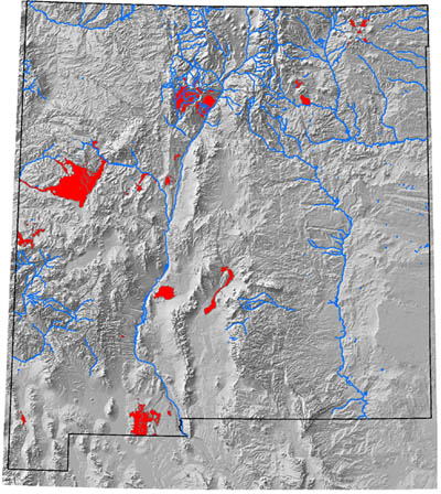
Map of the distribution of Quaternary volcanic rocks in New Mexico - http://geoinfo.nmt.edu/faq/volcanoes/ |
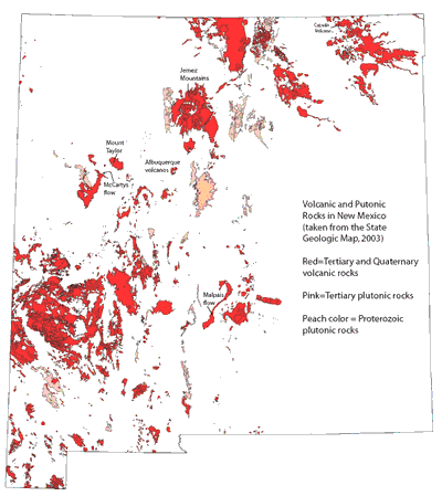
Map of Tertiary and Quaternary volcanic and plutonic rocks in New Mexico - http://geoinfo.nmt.edu/faq/volcanoes/ |
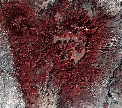
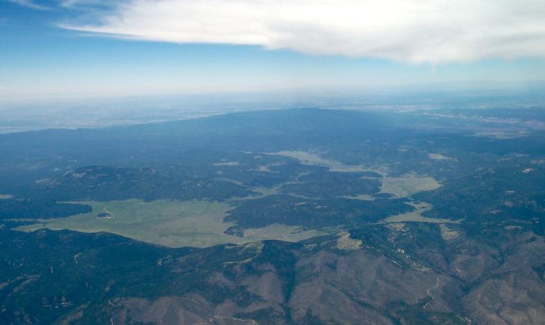
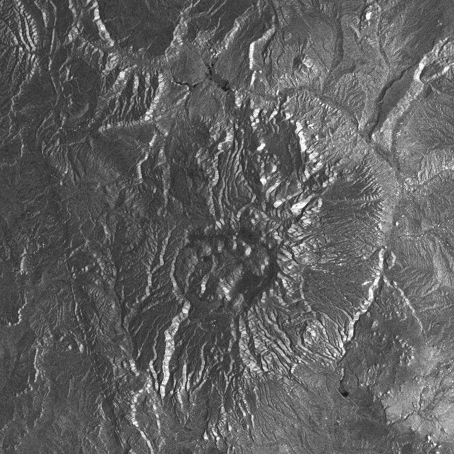
Landsat TM color composite of Valles Caldera, New Mexico, near Los Alamos. Valles Caldera is part of the Rio Grande Rift system |
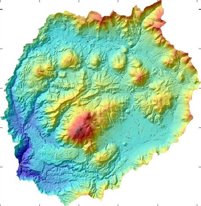
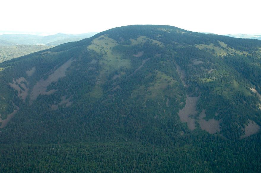
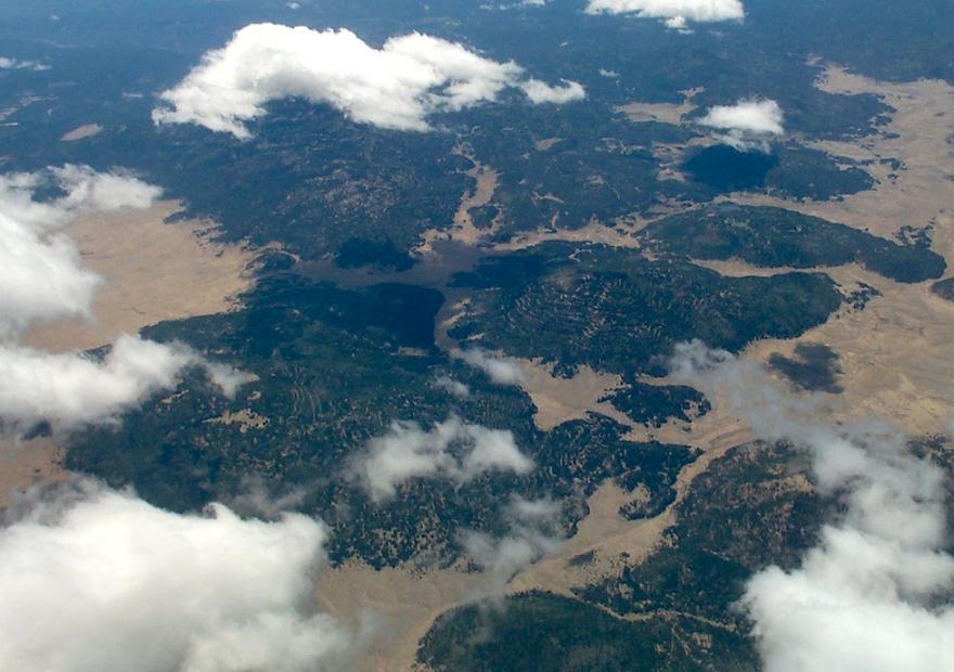
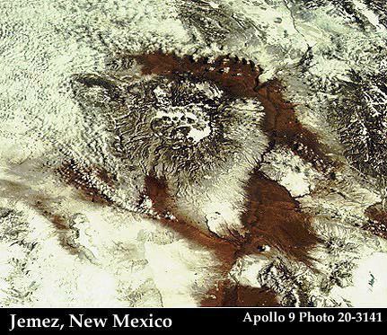
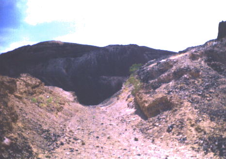
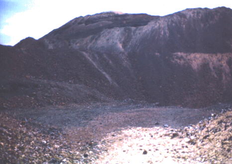
Valles Caldera (or Jemez Caldera), Pleistocene-Fumarolic volcano status, is a 22 km wide volcanic caldera in the Jemez Mountains of northern New Mexico. It is one of only six known land-based supervolcanoes. The highest point in the caldera is Redondo Peak, an 3430 m resurgent lava dome located entirely within the caldera. Also within the caldera, Valle Grande is the largest valle (grass valley). Caldera was formed as a result of two large volume eruptions that created the widespread Bandelier Tuff ignimbrite plateaus on all sides of the caldera. The lower member of the Bandelier Tuff, the Otawi, was emplaced about 1.7 Ma and resulted in the formation of most of the present-day Valles caldera, including the Toledo embayment at the NE side. The upper member, the Tshirege, is dated about 1.2 Ma, and also deposited voluminous welded pyroclastic flows over about the same area as the Otawi member. Post-caldera volcanism has included the emplacement of multiple ring-fracture lava domes and uplift of the caldera floor, forming the Redondo Peak resurgent dome. The El Cajete Pumice, Battleship Rock Ignimbrite, Banco Bonito Rhyolite, and the VC-1 Rhyolite were emplaced during the youngest eruption of Valles caldera, about 50-60 KA. Seismic investigations show that a low-velocity zone lies beneath the caldera, and an active geothermal system with hot springs and fumaroles exists today - http://www.volcano.si.edu/world/volcano.cfm?vnum=121002-D - http://web.hwr.arizona.edu/~surface/fieldsites/valles.html |
|
Valles caldera Panorama. The Valles Caldera Trust in Jemez Springs.Valles Caldera is one of the smaller volcanoes in the supervolcano class. The circular topographic rim of the caldera measures 19 km in diameter. The caldera and surrounding volcanic structures are the most thoroughly studied caldera complex in the United States. Research studies have concerned the fundamental processes of magmatism, hydrothermal systems, and ore deposition. Nearly 40 deep cores have been examined, resulting in extensive subsurface data . The Valles Caldera is the younger of two calderas known at this location, having collapsed over and buried the Toledo Caldera, which in turn may have collapsed over yet older calderas. The associated Cerros del Rio volcanic field, which forms the eastern Pajarito Plateau and the Caja del Rio, is older than the Toledo Caldera. These two large calderas formed during eruptions 1.47 - and 1.15 MA. The Caldera and surrounding area continue to be shaped by ongoing volcanic activity. The lower Bandelier tuff which can be seen along canyon walls west of the Valles Caldera, including San Diego Canyon, is related to the eruption and collapse of the Toledo Caldera. The upper Bandelier tuff is believed to have been deposited during eruption and collapse of the Valles Caldera. The now eroded and exposed orange-tan, light-colored Bandelier tuff from these events creates the stunning mesas of the Pajarito Plateau.These calderas and associated volcanic structures lie within the Jemez Volcanic Field. This volcanic field lies above the intersection of the Rio Grande Rift, which runs north-south through New Mexico, and the Jemez Lineament, which extends from southeastern Arizona northeast to western Oklahoma. The volcanic activity here is related to the tectonic movements of this intersection- http://en.wikipedia.org/wiki/Valles_Caldera |
Valles caldera |
Valles caldera. See view from the sky - http://vallescaldera.com/ |
Valle Grande Dome - http://en.wikipedia.org/wiki/Valles_Caldera |
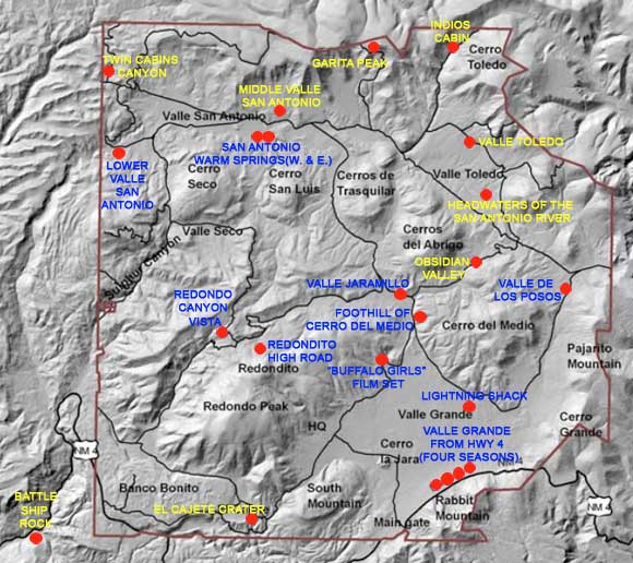
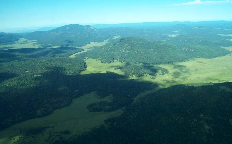
The Northeast Rim of the Valles Caldera forms the backdrop to this perspective. Beneath it is Valle Toledo, and in the foreground is Cerro Abrigo - http://vallescaldera.com/ |
El Cajete Crater – This three-quarter-mile long meadow near the southern base of Redondo Peak was the volcanic vent for a massive pyroclastic eruption that occurred 55,000 years ago — the El Cajete eruption. This produced a sizable layer of pumice that blanketed the Jemez Mountains. The eruption that occurred in this crater also created Battleship Rock- http://vallescaldera.com/ |
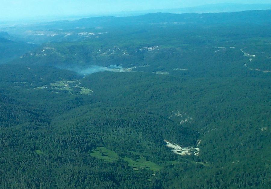
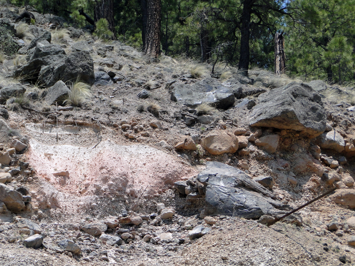
Sulphur Springs and San Diego Canyon — The bleached patch of earth on the lower right of this perspective is the Sulphur Springs complex, a private inholding within the boundaries of the Valles Caldera National Preserve. Sulphur Canyon flows into it from the bottom of the photo. In the distance is San Diego Canyon. The smoke visible is from the Valles Caldera community of La Cueva. This perspective faces southwest - http://vallescaldera.com/ |
Obsidian Valley is in the center of this photo, with Cerro Abrigo to its right. Further to the right is Valle Toledo, and Valle de los Posos is on the lower left.- http://vallescaldera.com/- http://vallescaldera.com/ |
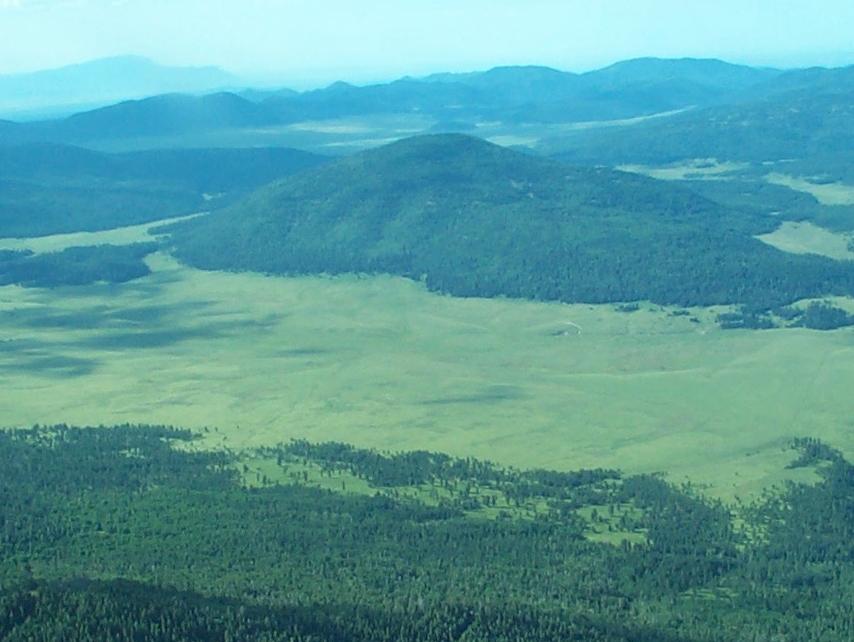
Valle Toledo, located between Cerro Abrigo (above) and the North Rim (below)-.http://vallescaldera.com/- http://vallescaldera.com/ |
Redondo peak |
The 22-km-wide Valles caldera in northern New Mexico was formed during a series of major eruptions ending with the eruption of the Bandelier Tuff about 1 million years ago. Post-caldera uplift formed a large resurgent dome in the center of the caldera. The latest eruptions occurred about 130 KA, but geothermal activity continues. This view from the caldera moat shows the rim of the 1.45 MY Toledo embayment to the north, with the edge of the Cerro del Medio rhyolitic lava dome at the extreme left -http://www.volcano.si.edu/world/volcano.cfm?vnum=121002-D&volpage=photos |
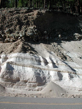
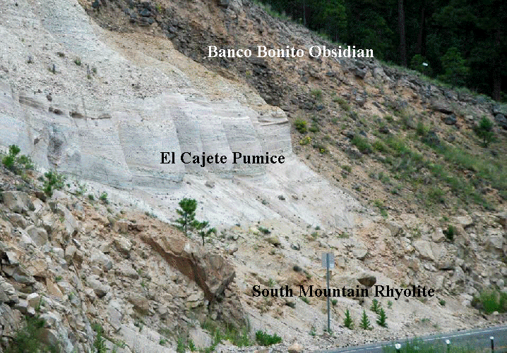
Tephra layers associated with emplacement of the overlying Banco Bonito obsidian flow. Located in the Jemez Mountains of Northern New Mexico, the "Yellowstone of the Southwest" features .... Shortly thereafter the Banco Bonito lava flow occurred -http://www.denison.edu/academics/departments/geosciences/fieldtrips/may_2001_field_trip.html http://vallescaldera.com/faq |
Three Rhyolites Roadcut (above & below) along Rt. 4 near the southern margin of the Valles Caldera. The three volcanic units exposed here have the same chemistry (rhyolitic), but are remarkably different in terms of rock texture and origin (eruptive style). The blocky-weathering lower unit is the South Mountain Rhyolite (521 k.y.). The whitish-gray, layered ash-pumice unit above that is the El Cajete Pumice (55-60 k.y.). The blackish, blocky-weathering unit at the top is the Banco Bonito Obsidian (50-55 k.y.).-http://www1.newark.ohio-state.edu/Professional/OSU/Faculty/jstjohn/New-Mexico-Geology/Valles-Caldera.htm |
The El Cajete Pumice-THE JEMEZ MOUNTAINS |
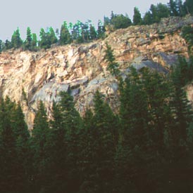
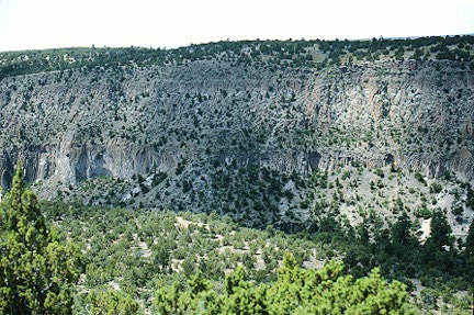
Thick deposits of welded pumice form cliffs along the Jemez River valley SW of the Valles caldera, capping darker-red, bedded sedimentary rocks at the base of the canyon. The lowermost pyroclastic-flow deposit, showing pronounced columnar jointing, is the Otowi member of the Bandelier Tuff. The top of the section is the Tshirege member of the Bandelier Tuff. The two eruptions, about 1.45 and 1.1 MA, ejected about 600 km2 of magma and resulted in the formation of Valles caldera - http://www.volcano.si.edu/world/volcano.cfm?vnum=121002-D&volpage=photos |
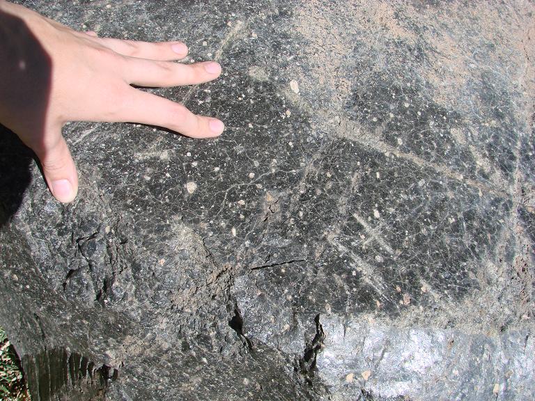
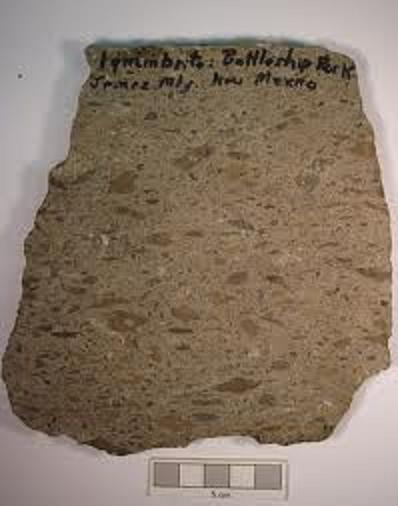
this bottle building cajete pumice, battleship rock location. Rhyolite |
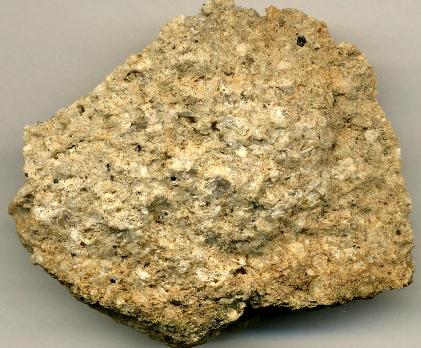
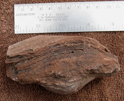
Rhyolitic volcanic breccia (6.2 cm across at its widest) - this pyroclastic flow breccia is from the South Mountain Rhyolite. It formed during the middle Middle Pleistocene, at about 521 k.y., from post-caldera volcanic activity at Valles Caldera. This sample comes from the basal unit exposed in the Three Rhyolites roadcut shown above- http://www1.newark.ohio-state.edu/Professional/OSU/Faculty/jstjohn/New-Mexico-Geology/Valles-Caldera.htm |
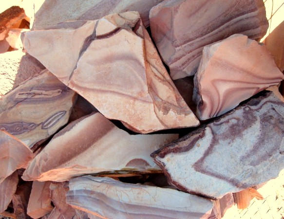
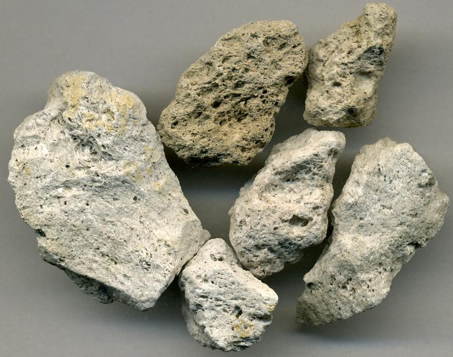
Rhyolitic pumice (specimen at left is 3.4 cm from top to bottom) - these pumice samples are from the El Cajete Pumice (see whitish middle unit in roadcut photo above). Material from this unit represents air-fall pumice deposits and pyroclastic surge deposits. The El Cajete Pumice was deposited during the Late Pleistocene, at about 55-60 k.y., from a volcanic center in the Valles Caldera- http://www1.newark.ohio-state.edu/Professional/OSU/Faculty/jstjohn/New-Mexico-Geology/Valles-Caldera.htm |
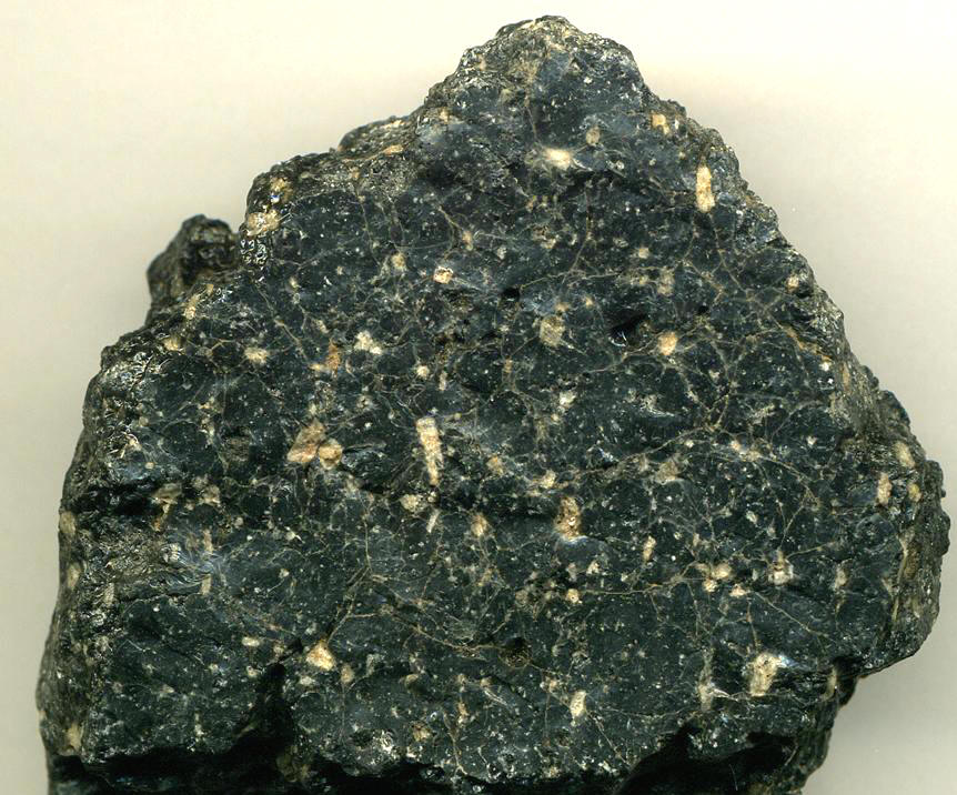
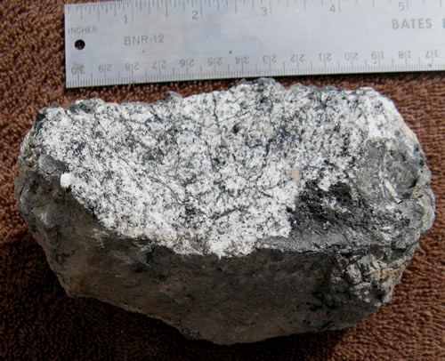
Porphyritic rhyolite obsidian (6.9 cm across at its widest) - this glassy lava flow sample is from the Banco Bonito Obsidian, one of several members of the Valles Rhyolite, which represents a series of Late Pleistocene, post-caldera volcanic eruptions. The Banco Bonito Obsidian dates to about 50-55 k.y. - http://www1.newark.ohio-state.edu/Professional/OSU/Faculty/jstjohn/New-Mexico-Geology/Valles-Caldera.htm |
Obsidian cliff at Jemez. Photo by Geoffrey Johnson-http://volcano.oregonstate.edu/vwdocs/volc_images/north_america/jemez3.html |
Soda Dam hot spring -http://volcano.oregonstate.edu/vwdocs/volc_images/north_america/jemez3.html |
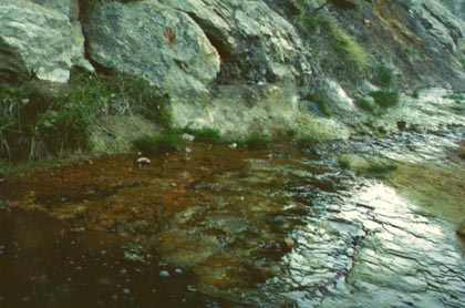
Soda Dam, along the Jemez River, is a travertine dam formed across a gorge in Precambrian granite-gneiss SW of the rim of Valles caldera. The travertine has been deposited over the past 5000 years by carbonated thermal waters discharged along the Jemez fault zone. About 15 hot springs related to the Valles caldera thermal system are found at this location - http://www.volcano.si.edu/world/volcano.cfm?vnum=121002-D&volpage=photos Soda Dam is a travertine deposit within the Jemez Caldera. Travertine is finely crystalline limestone formed by the precipitation of calcium carbonate from water. It is a common deposit at hot springs |
At Jemez, a hydrothermal system feeds water up to surface along a fault. The deposits are as old as 1 million years. The youngest deposit is about 5,000 years old and is about 100 m long-http://volcano.oregonstate.edu/vwdocs/volc_images/north_america/jemez3.html |
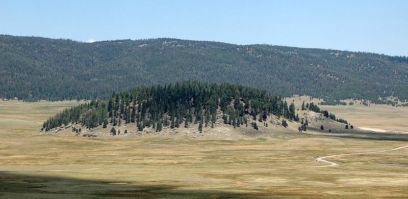
Redondo Peak in the center and Redondito peak on the right are the eastern half of a resurgent dome in the center of the Valles caldera, seen from the SE across the caldera moat, Valle Grande. The uplifted resurgent dome is formed primarily of densely welded Bandelier Tuff that was uplifted about 50-100,000 years after formation of the caldera. Cerro La Jara, the small hill on the caldera floor at the middle left, is a small rhyolitic lava dome erupted along ring-fractures- http://www.volcano.si.edu/world/volcano.cfm?vnum=121002-D&volpage=photos |
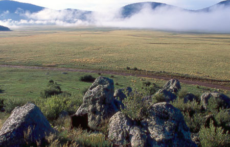
Ring Fracture Domes – High-altitude view of the oldest of the Caldera’s ring fracture domes, in order of eruption. From the left: Cerro del Medio, Cerro Abrigo, Cerro Santa Rosa (Cerro de Trasquilar is barely visible to the right), Cerro San Luis, and Cerro Seco |
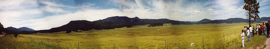
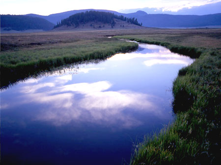
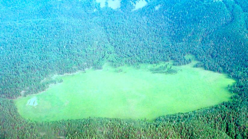
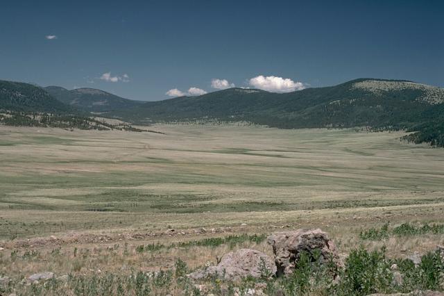
Verdant Caldera from the East – A green Valles Caldera as seen from the east. The Valle Grande is on the right - http://vallescaldera.com/ |
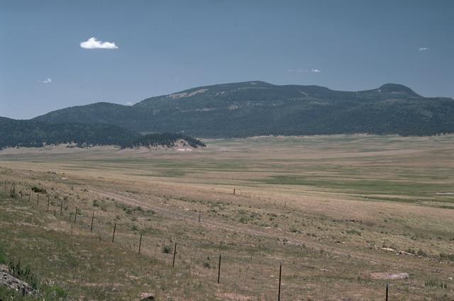
Caja del Rio, New Mexico. В Нью Мексико на вулканическом поле Каха дель Рио было сформировано около 60 шлаковых конусов.The Caja is not the only volcanic feature in this part of New Mexico. Approximately 32 km to its northwest is the Valles Caldera, a spectacular caldera which lies at the heart of the Jemez Mountains. This mountain range has been created by a series of eruptions since the Miocene. The ages of the first eruptions are difficult to determine, since the older rocks have been almost entirely buried by the material from younger eruptions. The oldest exposed volcanic rocks in the vicinity are approximately 16 MY. The Jemez area experienced an intense pulse of basalt volcanism between 9 and 11 MA. The lavas from this cycle had little silica, and originated in the mantle. Additional pulses of volcanism occurred between 7-10 MA, between 6-7 MA, between 3-6 MA, and between 2-3 MA. The last of these pulses is believed to have created the Cerros del Rio volcanic field, which covers the entire Caja del Rio Plateau - http://en.wikipedia.org/wiki/Caja_del_Rio |
The Jemez mountains are a volcanic field in north central New Mexico that overlies the west edge of the Rio Grande rift. Volcanism began 13 MA. The most recent activity was 130 KA. Magma ranging from basalt to rhyolite in composition has been erupted. The volcanic field is best known for the Valles caldera which formed 1.12 MA and produced the Bandelier Tuff. The Valles caldera is the most studied caldera in the United States (and probably the world). The geothermal and hot springs systems are caused by flow of groundwater through the caldera. The water flows near the top of a subsurface body of igneous rock that still may be partially molten (it is certainly still hot). Some of the water rises to the surface to supply fumaroles and hot springs. Geothermal activity continues. Based on the long history of the Jemez volcanic field and past cycles in activity it probably should be considered a dormant volcano that will probably erupt again- http://volcano.oregonstate.edu/vwdocs/volc_images/north_america/jemez.html |
Cerros del Rio volcanic field –the Bandelier tuff crops out of top -http://www.lanl.gov/source/orgs/ees/ees14/fieldtrip.shtml |
An outcrop of the Banco Bonito rhyolite (the dark rocks shining in the sunlight) -http://blogs.agu.org/magmacumlaude/2011/06/15/obsidian-hunting-in-the-jemez-mountains/ |
A chunk of rhyolitic Banco Bonito obsidian-http://blogs.agu.org/magmacumlaude/2011/06/10/valles-caldera/ |
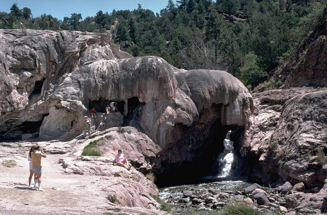
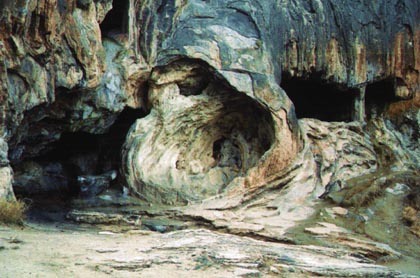
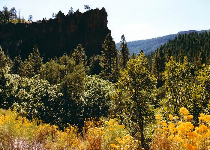
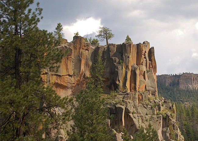
Battleship Rock |
Battleship Rock, the Jemez Mountains .A broad, circular ridge surrounds the Valles Caldera, a zone that gave birth to mountains made of rhyolite and Bandelier tuff. The high point in the range, Chicoma Peak, rises over 3900 m in an area governed by the Jemez Ranger District. One of the landmarks along Route 4, that parallels the Jemez Range, is presented in this scene, the impressive Battleship Rock. Formed of welded tuft (a pyroclastic deposit), Battleship Rock rises up nearly 70 m creating a good sized battleship. This day use park features McCauley Warm Springs and Hidden Falls. McCauley Springs, surrounded by a high mountain meadow, hovers around 99 degrees |
ignimbrite showing eutaxitic texture.Battleship Rock. Jemez Mountains, New Mexico |
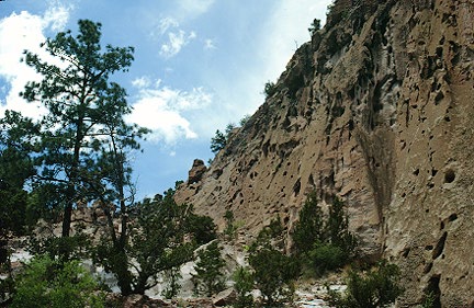
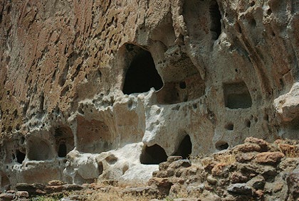
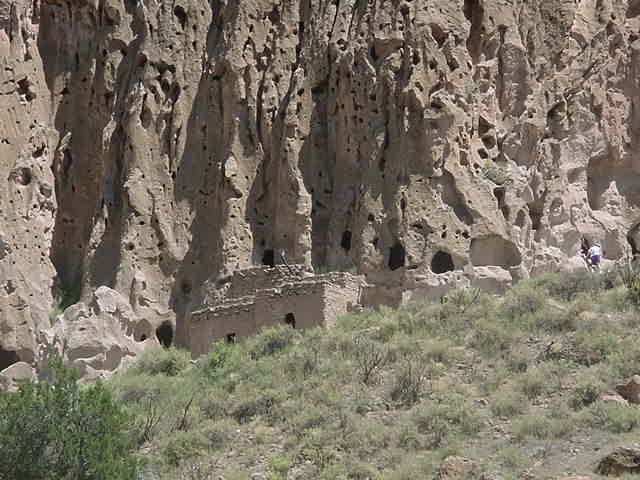
Bandelier Tuff in Bandelier National Monument. Photograph by Pranoti Asher-http://volcano.oregonstate.edu/vwdocs/volc_images/north_america/jemez.html |
Bandelier National Monument is also famous for the cliff dwellings that were carved into the tuff. Photograph by Pranoti Asher- http://volcano.oregonstate.edu/vwdocs/volc_images/north_america/jemez.html |
Ash-flow tuffs of the Jemez volcanic field. Photograph by Pranoti Asher-http://volcano.oregonstate.edu/vwdocs/volc_images/north_america/jemez.html |
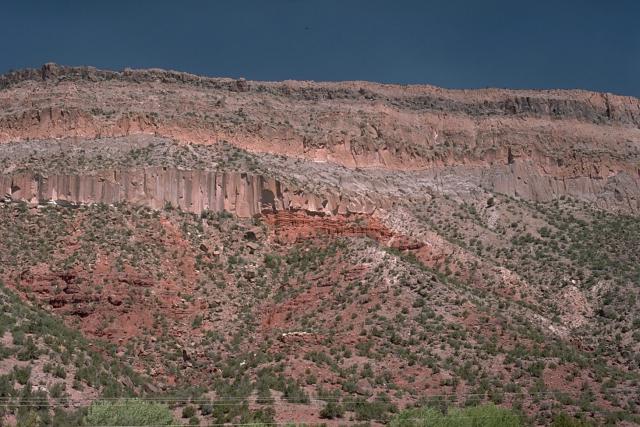
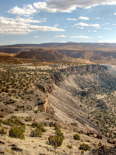
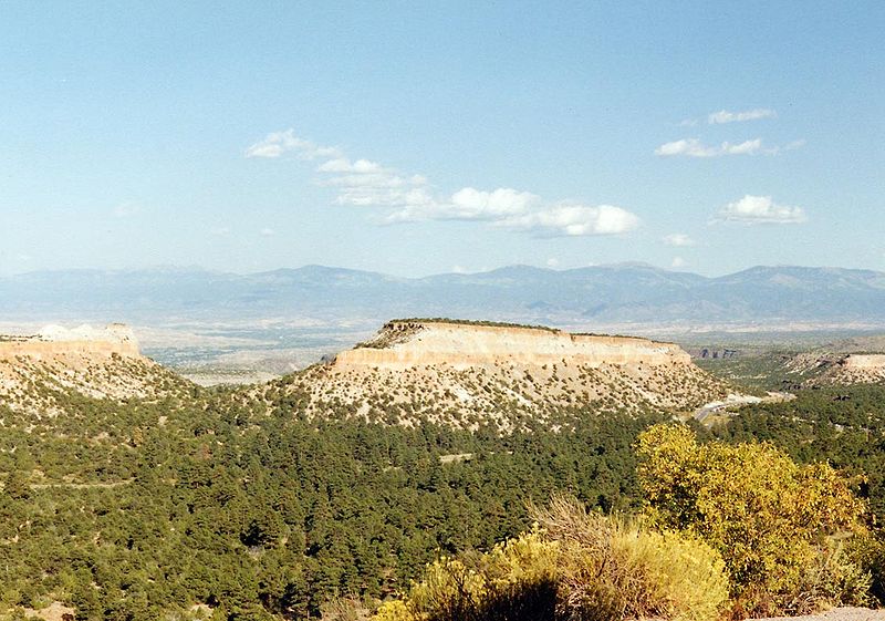
The Pajarito Plateau is a volcanic plateau. The plateau, part of the Jemez Mountains, is bounded on the west by the Valles Caldera and on the east by the White Rock Canyon of the Rio Grande. Elevations range from about 1700 m.The Pajarito Plateau is primarily composed of ignimbrite, a voluminous deposit of volcanic tuff laid down in an explosive eruption — in this case, a pair of eruptions from the nearby Valles Caldera. The two ignimbrite-forming eruptions occurred about 1.4 and 1.1 MA and ejected about 300 km3 of rock each. The orange-pink rock formations constituting the resulting ignimbrites are known as the Otowi and Tshirege Members of the Bandelier tuff. The soft, friable tuff is stabilized by basalt flows that interleave with the ignimbrites. The tuff lies on top of a volcanic field, exposed to the east, which formerly was continuous with the Caja del Rio (now across the Rio Grande). - http://en.wikipedia.org/wiki/Pajarito_Plateau |
Pajarito Plateau |
Cerros del Rio volcanic field -http://www.google.com/imgres?q=Cerros+del+Rio+volcanic+field&hl=en&gbv=2&tbm=isch&tbnid=dmjEdpBm8kPROM:&imgrefurl=http://www.doeal.gov/SWEIS/LANLDocuments/091%2520Road%2520Geology.pdf&docid=7WynssSCmlUVCM&imgurl=http://www.ees1.lanl.gov/roadgeology/figure2.jpg&w=708&h=572&ei=aM6QT_TsHqesiAKU6oDvAg&zoom=1&iact=hc&vpx=614&vpy=251&dur=5358&hovh=202&hovw=250&tx=129&ty=133&sig=105130125011463067269&page=1&tbnh=122&tbnw=168&start=0&ndsp=18&ved=1t:429,r:10,s:0,i:90&biw=1024&bih=587 |
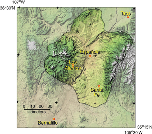
Espaniola Basin - http://crustal.usgs.gov/projects/rgb/EspanolaBasin/index.html |
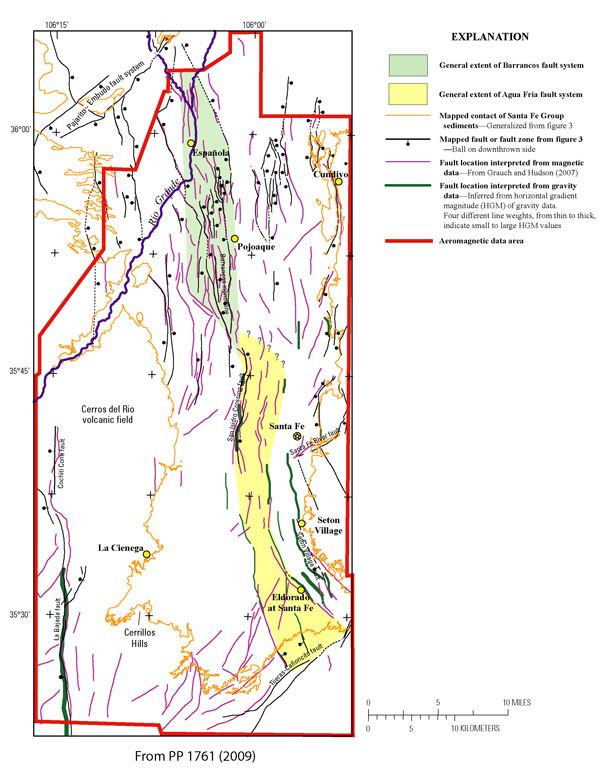
Mapped and geophysically interpreted faults. Faults interpreted from aeromagnetic data (magenta lines) are from Grauch and Hudson (2007). Faults interpreted from gravity data (green lines) are from the horizontal-gradient magnitude of the isostatic residual gravity- http://crustal.usgs.gov/projects/rgb/EspanolaBasin/index.html |
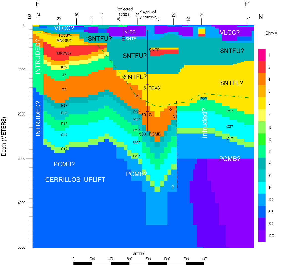
Resistivity model and possible nature of the bedrock high under the Cerros del Rio volcanic field from deep-looking electrical geophysical methods, from south to north-http://crustal.usgs.gov/projects/rgb/EspanolaBasin/index.html |
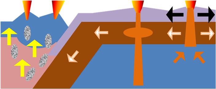
Origin - Volcanoes at subduction |
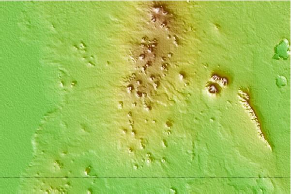
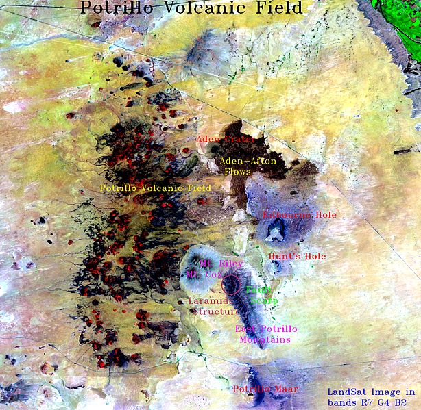
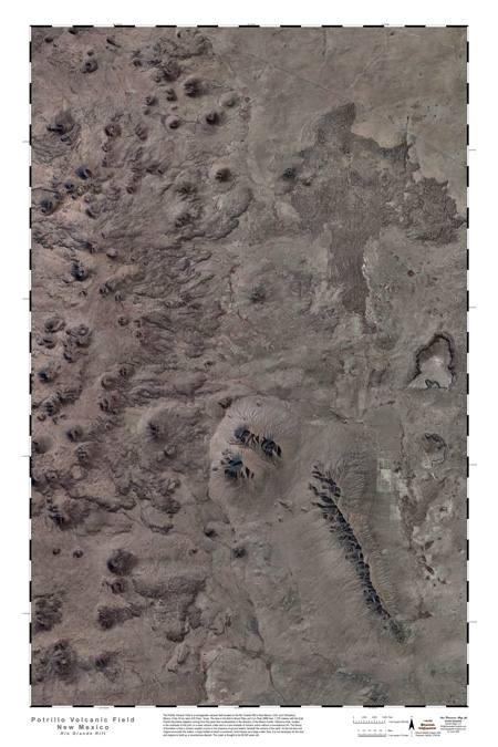
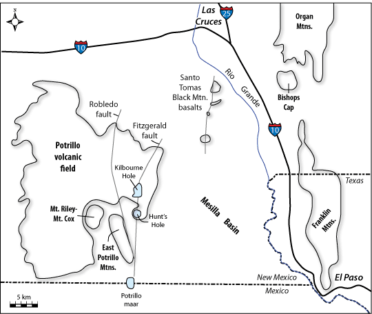
Potrillo volcanic field -http://www.mountain-forecast.com/peaks/Potrillo-volcanic-field |
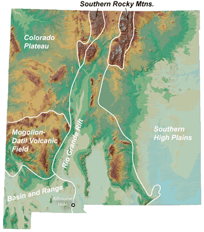
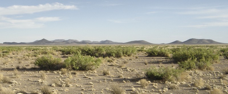
Potrillo Volcanic Field. The Potrillo Volcanic Field is a monogenetic volcanic field located on the Rio Grande Rift, in a portion of its rift valley, in southern New Mexico, USA and northern Chihuahua, Mexico .the Potrillo Volcanic Field – a Chihuahuan Desert landscape of lava flows, cinder and shield cones, immense craters, structural fracturing, low and sullen mountains, depositional and wind-blown sands, playa lakes, cacti and scrub brush – you feel that you can touch the pulse of our restless planet. - http://en.wikipedia.org/wiki/Potrillo_volcanic_field. The Potrillo Volcanic Field is a progeny of the titanic forces that have produced the 29 MY Rio Grande Rift, a still-active structural fault that begins in Colorado’s Rocky Mountains and extends southward for more than 1000 km, through the heart of New Mexico, across the western tip of Texas and into Mexico’s state of Chihuahua. The rift, triggered by a collision of tectonic plates, formed as the earth’s crust bulged, cracked and warped. Some parts of the crust rose thousands of feet, producing mountain ranges. Other parts subsided thousands of feet, yielding intervening basins. Crustal fractures opened avenues for molten rock, which sometimes issued forth or exploded violently onto the earth’s surface up and down the rift. Over time, the rift created the gorges and valleys that would become the home for the Rio Grande.For millions of years, the river, carrying waters and sediments derived from the rising mountains, emptied into an ephemeral land-locked body of water called Cabeza de Vaca Lake, which covered parts of western Texas, southern New Mexico and northern Chihuahua. Eventually, the ancestral Rio Grande breached its natural land barriers, joined with Chihuahua’s Concho River, and rushed to the sea. It drained Cabeza de Vaca Lake, leaving behind water-saturated deposits of sand hundreds to thousands of feet thick. |
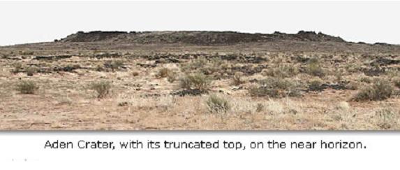
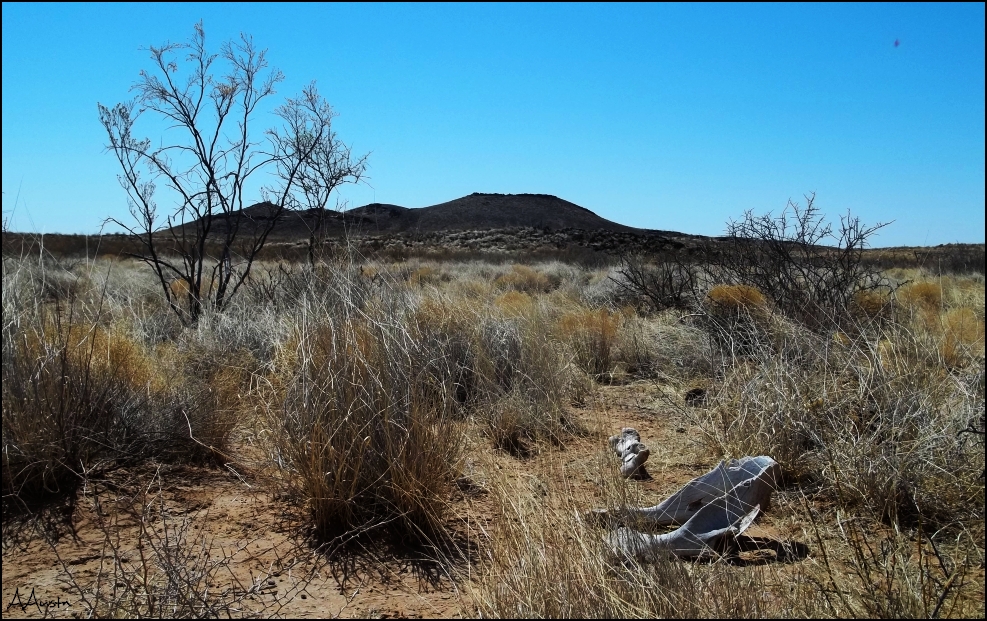
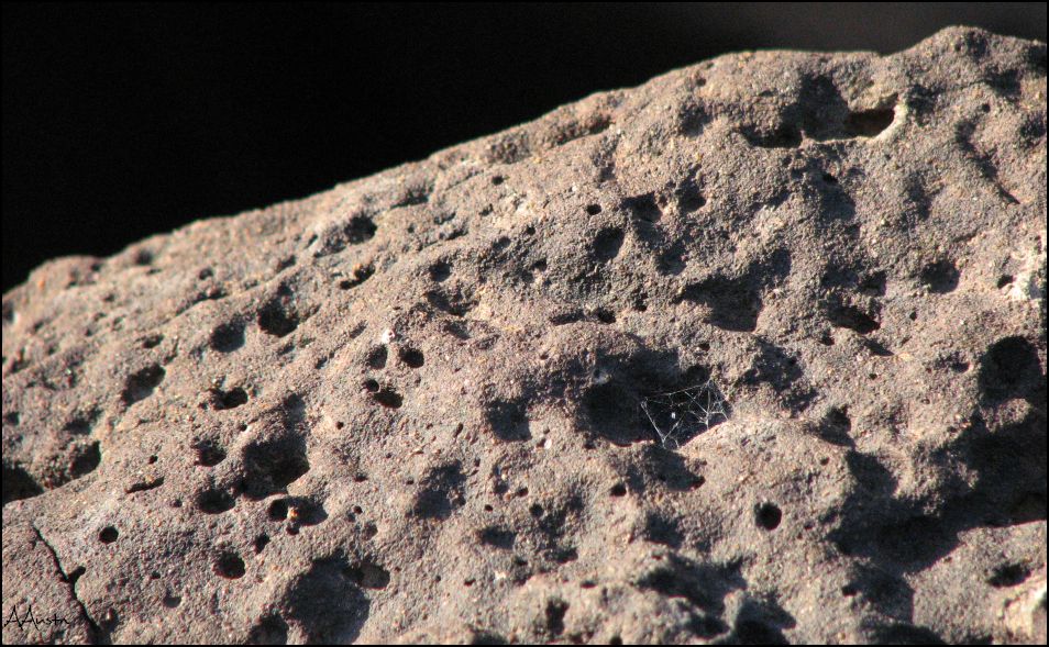
Potrillo Volcanic Field covers 4,600 km2 of Dona Ana County. It is a monogenetic volcanic field that can be divided in three volcanic regions; the West Potrillo Field that consists of more than 100 Cinder Cones, two maar volcanoes and associated flows that covers approximately 1,250 km2. The Aden-Afton field has a number of young flows, three cinder cones and three maar volcanoes, one of them is the Kilbourne Hole; Aden-Afton Field is approximately 230 km2.The current morphology of the Potrillo Volcanic Field consists of over 100 cinder cones within the area of the Rio Grande Rift in southern New Mexico. The most recent age dating study revealed the age to be from 1 million to 20,000 years old. It is a 50 skm2 field.The Potrillo volcanic field is a typical monogenetic volcanic field lying along the west margin of the Rio Grande rift in southern New Mexico. The Potrillo field can be divided into three volcanic regions: the West Potrillo field consists of more than 150 cinder cones, two maar volcanoes, and associated flows, all covering approximately 1,250 km2. The Aden-Afton field (230 km2) includes predominantly young flows, three cinder cones, 3 maar volcanoes (including Kilbourne Hole), and Aden Crater, a small shield cone. The Black Mountain - Santo Tomas basalt (40 km2) consists of four eruptive centers in a north-south line near the Rio Grande River. The West Potrillo field is apparently the oldest part of the entire Potrillo volcanic field, but radiometric ages up to 2.65 MY have been obtained from Santo Thomas. The most unusual feature in the volcanic field is Aden Crater, a beautifully preserved small shield volcano, formed in five stages: extrusion of thin lava flows to build a shield; construction of a spatter rampart around a lava lake dated at 530 KY; collapse of the western portion of the solidified lava lake; construction of small spatter mounds on the flanks and within the cone; and persisting fumaroles - http://vulcan.wr.usgs.gov/Volcanoes/NewMexico/description_new_mexico_volcanics.htmlhttp://vulcan.wr.usgs.gov/Glossary/Emissions/framework.html. |
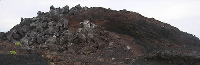
The most unusual feature in the Potrillo Volcanic Field is Aden Crater, a beautifully preserved small shield volcano.Aden Crater is a small shield cone, and it is the most unusual feature in the volcanic field because it has a lava tube, where a ground sloth skeleton was found. It is 11 KY, and is now at Yale''s Peabody Museum of Natural History. This ground sloth (Nothrotheriops shastense) is one of the few specimens of this age which have been found with patches of skin and hair preserved |
Aden Crater. the vast amount of lava, which gushed out, as Aden''s north wall gave way. This field is also mixed in with the older Afton Lava flow, the result of the Robledo fault, located somewhere below Aden Crater. The Afton lava flows will be discussed later on as will be driving over then to get to Aden crater. One of the wonderful things about the trip to Aden Crater is the fact that you will be driving over the Afton''s flows as well as Aden''s flows. Be very careful not to drive to fast over the flows, because they are very sharp, and can easily slash your tires if you are not respecting Mother Nature. Several months ago our brave Professor William Cornell was driving just a little to fast and as a result slashed one of your tires on the flow. - http://www.geo.utep.edu/loca/Volcanos/ADEN.HTML |
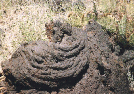
AFTON LAVA FLOWS -the place stuck between Hunts Kilbourne volcanoes and Aden crater. Lava ropes and lava tubes -http://www.geo.utep.edu/loca/Volcanos/AFTON.HTML |
Today, in the Potrillo Volcanic Field, you can find intrusive volcanic features (of uncertain age) in some of the low mountains. These include, for instance, dikes, which are linear masses of igneous rock that cut through overlying strata, and plugs, which are more vertical masses of igneous rock that filled, or “plugged,” volcanic vents. You can find more than 150 volcanic cinder cones, although most of them lie in the western and more inaccessible part of the field. Some of the cones, perhaps half a mile in diameter, rise more than 500 feet above the desert floor. You will discover various accessible shield volcanoes, five maar volcanoes and numerous lava flows. You can easily explore the particularly interesting Aden Crater, one of the shield volcanoes, and Kilbourne Hole, one of the several maar volcanoes within the field |
Several hundred thousand years ago, in the area that would become known as the Potrillo Volcanic Field, white-hot molten rock or magma, extruded by the internal pressures of our planet, rose from depths as deep as 50 miles up through structural fractures toward the surface. It would change the face of the landscape. |
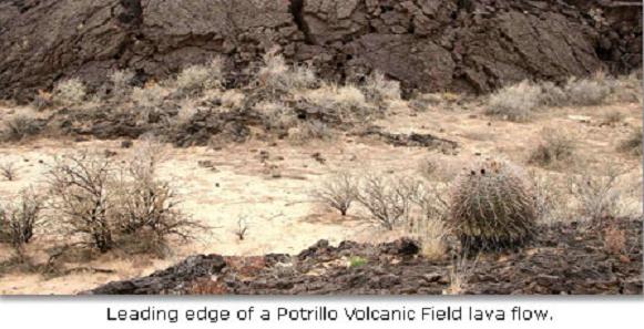
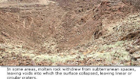
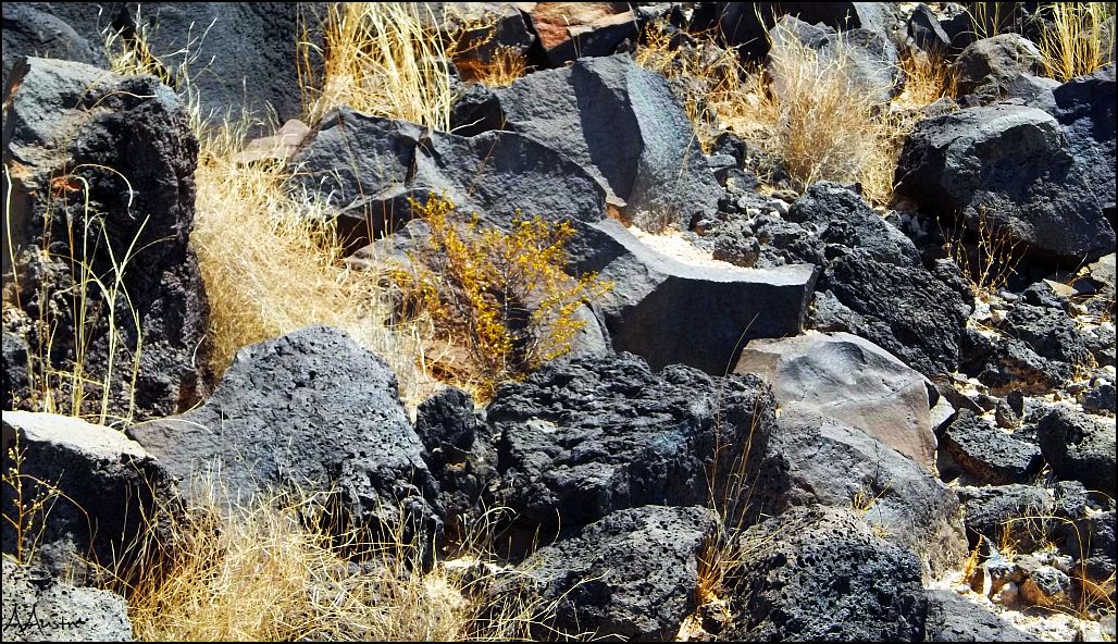
In some places, molten rock intruded into depositional sand but failed to erupt through the surface, leaving it to the forces of erosion to strip away the overburden, exposing igneous formations. In other places, molten rock erupted violently, explosively, ejecting clouds of congealed lava that fell back to earth as cinder, forming a cone around the vent. In some instances, it erupted over time as a succession of lava flows from a single vent or clustered vents, forming wide-spread basalt layers that took on the form of a Roman warrior’s shield lying flat on the sand, its battle side up. In some spectacular events, molten rock came into contact with the water-saturated sands left by the ancestral Rio Grande. It produced superheated and highly pressurized steam that exploded through the earth’s surface with monumental force, creating large craters that geologists call “maars” or lakes.Often, lava breached the walls of the cinder cone and shield volcanoes, spilling down the flanks and spreading across the surrounding sandy surface, leaving 10- to 20-foot thick blankets of basalt spread across miles of sand. In some places, the lava flows look like ocean waves that froze in place as they ran up onto a beach. In some areas, molten rock withdrew from subterranean spaces, leaving voids into which the surface collapsed, leaving linear or circular craters. Some 20,000 to 40,000 years ago, the molten rock of the Potrillo Volcanic Field at last grew still, leaving behind a landscape littered with volcanic landmarks and debris that speak to the violence of the past. As the earth quieted, winds gathered exposed sand and re-deposited it like a shroud over many the volcanic features |
Hunts Hole looking to the southwest,. Elevation 1,695 m. Age of rocks - 2.65MA, last eruption 150KA, volcanic arc/belt Rio Grande Rift. |
Hunts Hole lava |
Hunts Hole basalt - http://1000milesonmyowntwofeet.blogspot.com/2011/07/hunts-hole.html |
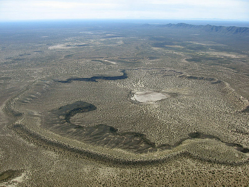
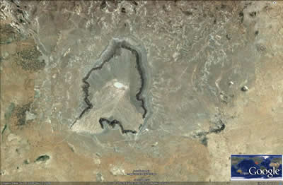
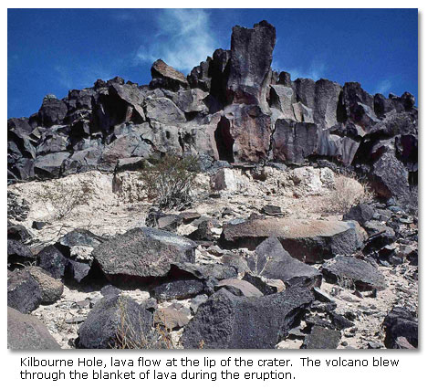
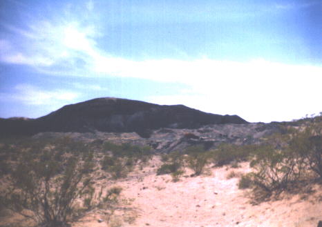
Regional physiographic setting of Kilbourne Hole. Kilbourne Hole is in the Mesilla Basin, one of a series of linked basins between central Colorado and west Texas that formed starting about 36 MA (McMillan, 2004) when the earth’s crust extended or stretched in an east-west direction. Normal faulting associated with extension led to the development of deep asymmetric basins and prominent rift-flank uplifts, producing a continental-scale extensional feature known as the Rio Grande rift. The Franklin and Organ mountains to the east and the East Portillo Mountains to the west of Kilbourne Hole are examples of rift-flank uplifts in south-central New Mexico. The rate of rift flank uplift and basin subsidence likely peaked between 4 and 10 million years ago (Seager and Mack, 1994). Crustal thinning during extension tends to trigger volcanic eruptions. The basalt lavas at Kilbourne Hole are on the eastern edge of the aerially-extensive Potrillo volcanic field, which was active between 1.2 million and 20,000 years ago (Hawley, 1981; Anthony et al., 1992; Williams, 1999). This youthful volcanism suggests that Rio Grande rift extension is still active in this region. Indeed, the range-bounding normal fault on the east side of the East Potrillo Mountains offsets pyroclastic surge deposits associated with the 180 KY Potrillo maar to the west and south of Kilbourne Hole (Seager and Mack, 1994). The more than 100 vents of the Potrillo volcanic field are aligned along older faults. Kilbourne Hole, Hunt’s Hole, and Potrillo maar are aligned along the Fitzgerald-Robledo fault system; Hoffer, 1976a,b; Parovani and Reid, 1989). Extension in this part of the Rio Grande rift began about 36 MA. Rock debris that eroded from the developing rift-flank highlands, as well as wind-blown and playa lake deposits, accumulated in the subsiding Mesilla Basin. These basin fill deposits, known as the Santa Fe Group, are 500 to 700 m thick beneath Kilbourne Hole (Hawley, 1984; Hawley and Lozinsky, 1993). The uppermost sand, silt, and clay of the Pliocene to early Pleistocene Camp Rice Formation, the youngest unit of the Santa Fe Group in this part of the basin, are exposed in the bottom of Kilbourne Hole. The Camp Rice Formation was deposited by a south-flowing braided river that emptied into a playa lake in the vicinity of El Paso. The La Mesa surface, a flat surface that developed on top of the Camp Rice Formation, represents the maximum basin fill of the Mesilla Basin at the end of Santa Fe Group deposition about 700, KA (Mack et al., 1994). This surface is about 100 m above the modern Rio Grande floodplain. The surface formed during a period of landscape stability. Basalt flows from the Portillo volcanic field are intercalated with the upper Camp Rice Formation and lie on the La Mesa surface. The Rio Grande started to cut down through the older Santa Fe Group deposits after 700 KA in response to both climatic changes and integration of the river system with the Gulf of Mexico. This downcutting was not a continuous process; there were several episodes of downcutting, back-filling, and renewed incision. This episodic development of the river system led to the formation of several terrace levels along the Rio Grande between Las Cruces and El Paso. Basalt that erupted about 70 to 81 Ka from a set of vents called the Afton cones located north-northeast of Kilbourne Hole flowed southward. The explosion that formed Kilbourne Hole erupted through the distal edges of the Afton basalt flows, indicating that the crater is younger than 70 to 81 KY. Pyroclastic surge beds and vent breccia blown from the crater overlie the Afton basalt flow. The crater formed druing the final stages of the eruption (Seager, 1987). - http://geoinfo.nmt.edu/tour/landmarks/kilbourne_hole/home.html |
Kilbourne hole |
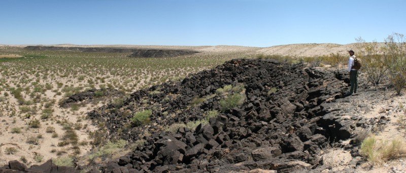
Satellite image of Kilbourne Hole from Google Earth. Kilbourne Hole, the best known of the Potrillo maar volcanoes, sits astride the north-south-trending Fitzgerald fault, surrounded by the late Cenozoic Afton basalt flow. The maar was formed by steam explosions due to the heating of water-saturated sand and silt strata by rising basaltic magma. From the bottom of the crater to the top of the rim the following units are exposed: (1) Santa Fe Group sediments, (2) olivine basalt (Afton basalt), (3) bedded hydroclastic tuffs (base surge and air fall) and vent breccia, and (4) Holocene wind-blown sand. Four other explosion craters occur in the Potrillo basalt field. Hunt''s Hole is a shallower and smaller (1,385 meters wide) version of Kilbourne Hole. Further south on the Mexican border is Potrillo Maar, a 4,920 x 3,385-m elliptical crater with several cinder cones and basalt flows on its floor. Malpais is a circular tuff ring approximately 1,230 m in diameter, 25 kilometers west of the Potrillo Maar in the West Potrillo Mountains. The ring is made of well-bedded ash, lapilli tuff, and lapilli breccia. Post-explosion activity constructed a cinder cone and basalt dikes and flows. Riley is a circular tuff cone, 925 m wide, approximately 12 kmorth of Malpais. Riley''s rim is made of poorly bedded hydroclastic lapilli tuff and tuff breccia, and the floor of the crater contains a basalt flow |
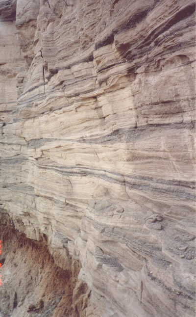
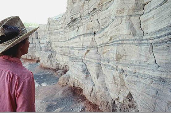
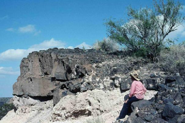
Surge beds. A pyroclastic surge is hot cloud that contains more gas or steam than ash or rock fragments. The turbulent cloud moves close to the ground surface, often leaving a delicately layered and cross-stratified deposit). The layering forms by unsteady and pulsating turbulence in the cloud - http://geoinfo.nmt.edu/tour/landmarks/kilbourne_hole/home.html |
Kilbourne hole''s festooned dunes. View of the cross-bedded surge beds (tan unit) on Camp Rice Formation (reddish unit) in Kilbourne Hole |
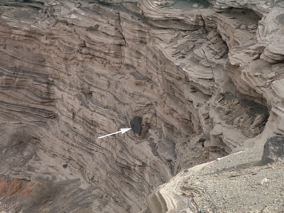
Hydromagmatic deposits exposed in cliffs of Kilbourne Hole. The arrow highlights a volcanic bomb that has deformed the underlying deposits. Bomb sags are common features in the pyroclastic suge beds. The sags form when ejected volcanic bombs impact into the finely stratified surge beds - http://geoinfo.nmt.edu/tour/landmarks/kilbourne_hole/home.html |
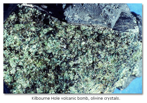
Volcanic bomb from Kilbourne Hole - http://geoinfo.nmt.edu/tour/landmarks/kilbourne_hole/home.html |
Crustal xenoliths from Kilbourne Hole. Many of the volcanic bombs at Kilbourne Hole contain xenoliths. Granulite, charnokite, and anorthosite are common; these xenoliths are interpreted to represent pieces of the lower to middle crust; Hamblock et al., 2007). The granulite may contain garnet and sillimantite, indicative of a metasedimentary origin, or the granulite may contain pyroxene, suggestive of an igneous origin (Padovani and Reid, 1989; Hamblock et al., 2007). Other upper crustal xenoliths include intermediate and silicic-composition volcanic rocks, clastic sedimentary rocks, basalt and basaltic andesite, and limestone (Padovani and Reid, 1989; French and McMillan, 1996). - http://geoinfo.nmt.edu/tour/landmarks/kilbourne_hole/home.html |
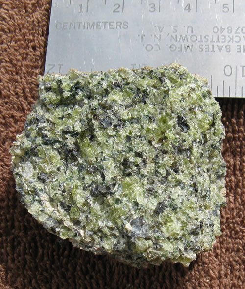
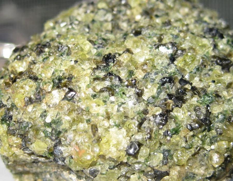
Mantle xenolith from Kilbourne Hole. Mantle xenoliths include spinel lherzolite, harzburgite, dunite, and clinopyroxenite. Study of these xenoliths has provided important data on the composition and temperature of the mantle at depths of 60 km beneath the earth''s surface (e.g., Parovani and Reid, 1989; Hamblock et al., 2007). Some olivine in the mantle xenoliths is of sufficient size and clarity to be considered gem-quality peridot, the August birthstone- http://geoinfo.nmt.edu/tour/landmarks/kilbourne_hole/home.html |
|
C http://www.desertusa.com/mag06/apr/volcanoes.html |
Among rock hounds, Kilbourne Hole is renowned for its “volcanic bombs,” or xenoliths, which encase olivine crystals and, with extremely good luck, gem-quality peridot. A volcanic bomb begins as a “glob” of liquid lava blown from the crater vent into the air. It cools and begins solidifying while airborne. If still sufficiently pliable when it falls back to earth, it may take on a roughly spherical shape as it tumbles over the surface. Within Kilbourne Hole’s volcanic bombs, the mineral olivine forms greenish or yellowish transparent or translucent crystals, sometimes of high enough quality to be considered a peridot.Kilbourne Hole, the best known of the Potrillo maar volcanoes, sits astride the north-south-trending Fitzgerald fault, surrounded by the late Cenozoic Afton basalt flow. The maar was formed by steam explosions due to the heating of water-saturated sand and silt strata by rising basaltic magma. From the bottom of the crater to the top of the rim the following units are exposed: Santa Fe Group sediments, olivine basalt (Afton basalt), bedded hydroclastic tuffs (base surge and air fall) and vent breccia, and (4) Holocene wind-blown sand. Four other explosion craters occur in the Potrillo basalt field. Hunt''s Hole is a shallower and smaller (1,385 meters wide) version of Kilbourne Hole. Further south on the Mexican border is Potrillo Maar, a 4,920 x 3,385-meter elliptical crater with several cinder cones and basalt flows on its floor. Malpais is a circular tuff ring approximately 1,230 meters in diameter, 25 kilometers west of the Potrillo Maar in the West Potrillo Mountains. The ring is made of well-bedded ash, lapilli tuff, and lapilli breccia. Post-explosion activity constructed a cinder cone and basalt dikes and flows. Riley is a circular tuff cone, 925 meters wide, approximately 12 kilometers north of Malpais. Riley''s rim is made of poorly bedded hydroclastic lapilli tuff and tuff breccia, and the floor of the crater contains a basalt flow- http://vulcan.wr.usgs.gov/Volcanoes/NewMexico/description_new_mexico_volcanics.html. |
One of the largest, best-preserved maar volcanoes in the world, Kilbourne Hole, which formed between 24-100 KA, extends for about 3 km in length and about a 1.5 km in width. Its bottom lies several hundred feet below the surrounding desert floor.Kilbourne Holel lava flow - http://www.desertusa.com/mag06/apr/volcanoes.html |
Hunt''s Hole, a volcanic maar in the Potrillo Volcanic Field of southern New Mexico - http://www.webpages.ttu.edu/dleverin/photos/photos.html A maar is a low relief volcanic crater produced by the interaction of rising magma and ground water and the product is shallow explosive eruptions. What happens is the heating and boiling of ground water when magma invades the ground water table and the explosions blast up through the surface. The result is a crater that looks similar to a hole that is often filled with water to form a lake. The range in size is from 60 to 2,000 metres across and form 10 to 200 metres . There is Hunt’s Hole and Kilbourne Hole .There are five maars volcanoes in Potrillo Volcanic Field.Potrillo Volcanic Field has two important xenolith localities that are Kilbourne Hole and Potrillo maar where mantle peridotites, feldspathic granulites and kaersutite occur. Alkali feldspar, olivine and basalt were erupted during the middle and late quaternary. Rock samples collected in the northern part of the pyroclastic deposit of the Potrillo maar, and lava associated with a cinder cone yielded potassium–argon ages, approximately 1.29 and 1.18 million years. The magmatism is entirely basaltic forming scattered scoria cones. Several short lava flows were originated from each cone. There is a diverse rock types beneath the Potrillo volcanics, the range is from Proterozoic granites through a Phanerozoic sedimentary succession to basalt-andesite volcanics of the southern fringes of the Sierra de las Uvas volcanic field. The Potrillo area is generally classified as part of the southern Rio Grande rift and shows the Tertiary tectonic evolution of that structure |
View to the west from Potrillo maar looking toward Mt. Riley and Mt. Cox, two middle Cenocoic dacite domes.Many of the features described above are also present at Hunt’s Hole and Potrillo maar (Figure 9), which are located to the south of Kilbourne Hole. Xenoliths are rare to absent at Hunt’s Hole (Padovani and Reid, 1989), but otherwise the maars are similar. In contrast to Kilbourne Hole, Potrillo maar is not rimmed by a basalt flow, and cinder cones and a younger basalt flow occupy the floor of Potrillo maar (Hoffer, 1976b) - http://geoinfo.nmt.edu/tour/landmarks/kilbourne_hole/home.html |
Cones of Potrillo Volcanic Field. A cinder cone also known as scoria cone, is a steep, conical hill formed on top of a vent. The cinder cones often occur in groups usually on the sides and around the shield volcanoes and the strato volcanoes. They are formed form lava fragments called cinders, it is magma that is glassy and has hundreds of gas bubbles that are frozen, it cools quickly after it is ejected into the air. The lava is expelled from the vent and formed around the vent when they fall back after it is ejected. Cinder cones are approximately 250 metres height and 500 metres in diameter.There are 3 groups of slope angles;Group 1: age of around 250 Ka years old.Group 2: age of around 125 Ka years old. Group 3: age of around 60 Ka years old. The cinder cone slope distribution in the Potrillo volcanic field suggests that volcanism occurred at different time intervals. In addition, trend line analysis provides a powerful and useful tool for predicting cinder cone ages in the Potrillo volcanic field. This area has arid climate & cone degradation is a product of mechanical weathering -http://museum2.utep.edu/chih19/intro/earth/earth.htm . |
This is a short -stage multi-cache placed in the vicinity of Santo Tomas Mountain. At the northeastern-most part of the Potrillo Volcanic Field, this cinder cone volcano is responsible for the Black Mesa lava-flow, a basalt formation which emenates from the mountain in a northeasterly direction. It seems that quite a bit of excavation was done here in the past as this type of rock is popular in landscaping; however, it appears the operation has since been terminated. But they did leave behind several pretty large boulders.The Potrillo Volcanic Field stretches as far west as the West Potrillo Mountains through to the central area (home to Aden Crater and Kilbourne Hole) then eastward to this area which contains four eruptive centers: (from S to N) Black Mountain, Little Black Mountain, San Miguel, and Santo Tomas Mountain. Black Mountains-Santo Tomas is made up of basalt, it consists of four different eruptive centers near the Rio Grande. The West Potrillo Field is the oldest part of the Potrillo Volcanic Field -. http://www.geo.utep.edu/loca/Volcanos/BLACK.HTML |
Black Mountains-Santo Tomas. Volcanic activity of the Black Mountain-Santo Tomas area consists of cinder and spatter cones with at least seven periods of extrusive olivine alkaline basalt. The basalt flows, on the basis of phenocryst mineralogy, can be classified into three groups: those with phenocrysts rich in plagioclase, flows rich in olivine phenocrysts, or flows with almost equal amounts of plagioclase and olivine phenocrysts. Phenocryst mineralogy of the flows, along with K-Ar dates, has been used to estab-lish tentative correlations from one center to another. Preliminary K-Ar dates from four individual flows suggest an age for the extrusive activity of from 1.5 to 2.5 million years. VOLCANIC HISTORY OF THE BLACK MOUNTAIN-SANTO TOMAS BASALTS POTRILLO VOLCANICS, DONA ANA COUNTY, NEW MEXICO • http://nmgs.nmt.edu/publications/guidebooks/downloads/20/20_p0108_p0115.pdf |
Black Mountains-Santo Tomas -http://www.geo.utep.edu/loca/Volcanos/BLACK.HTML |
Black Mountains-Santo Tomas -http://www.geo.utep.edu/loca/Volcanos/BLACK.HTML |
Aden Crater
Afton Basalt Flow
Bandelier National Monument
Black Mountain
Capulin Cinder Cone
Hunt''s Hole
Kilbourne Hole
Mora Volcanic Field
Ocate Volcanic Field
Potrillo Volcanic Field
Quemado Volcanic Field
Raton - Clayton Volcanic Field
Red Hill
Santo Tomas
Taos Plateau Volcanic Field
Zuni-Bandera Volcanic Field
Zuni Salt Lake Maar
http://vulcan.wr.usgs.gov/Volcanoes/ list
http://vulcan.wr.usgs.gov/Volcanoes/BlackButte/framework.html Ca - http://vulcan.wr.usgs.gov/Volcanoes/California/framework.html list
http://vulcan.wr.usgs.gov/Volcanoes/Oregon/BrownMountain/framework.html - http://vulcan.wr.usgs.gov/Volcanoes/Oregon/framework.html Oregon volcanos
http://vulcan.wr.usgs.gov/Volcanoes/Canada/framework.html Canada volcanism
http://arizonageology.blogspot.com/2011_02_01_archive.html arizona geo
http://scienceblogs.com/eruptions/2009/12/mvp_18_antelope_hill_az.php Az volcanoes
http://www.volcano.si.edu/world/region.cfm?rnum=1206
Sierra Grande in the distance, from the summit of Capulin Volcano
http://myvintagecameras.blogspot.com/2010/08/weekly-volcano-32-san-francisco-peaks.html
Capulin Volcano National Monument is to the north of where these
The Raton-Clayton Volcanic Field
Cabezon Peak is the largest volcanic neck in the Mt. Taylor volcanic field
Jeff Davis Peak, one of the highest peaks entirely within, Nevada
http://www.photovolcanica.com/VolcanoInfo/Wai-O-Tapu/Wai-O-Tapu.html -new zealand
http://www.photovolcanica.com/VolcanoInfo/Dallol/Dallol.html
http://geology.com/volcanoes/types-of-volcanic-eruptions/ Types of Volcanic Eruptions
http://geology.com/rocks/igneous-rocks.shtml - Igneous Rocks
http://geology.com/volcanoes/ volcanos and map collection
http://www.alaskadispatch.com/article/alaskas-biggest-volcanic-eruptions alasca
http://geology.com/news/category/volcanoes.shtml geo
http://geology.com/satellite/arizona-satellite-image.shtml arizona
. http://geology.com/news/category/volcanoes.shtml
http://geology.com/news/category/volcanoes.shtml alaska
http://geology.com/novarupta/ alaska
http://geology.com/news/category/volcanoes.shtml
http://geology.com/volcanoes/
http://geology.com/articles/active-volcanoes-solar-system.shtml solar system volcanoes
http://geology.com/states/california.shtml california
More than 500 volcanic vents have been identified in the State of California. At least 76 of these vents have erupted, some repeatedly, during the last 10 KA.
http://www.sciencedaily.com/releases/2007/11/071108141612.htm -global warmong volcano Science dayly
http://www.boston.com/bigpicture/2010/09/around_the_solar_system.html mars sheld
http://nationalatlas.gov/dynamic/dyn_vol-ca.html
http://nationalatlas.gov/dynamic/dyn_vol-ak.html alaska
http://nationalatlas.gov/dynamic/dyn_vol-us.html other
http://www.goldengatephoto.com/geotours/cgp1.html geomorphology
http://maydamedia.com/Chapters/Chapter19/CA2.html physical geography
http://maydamedia.com/Chapters/Chapter19/CA1.html cal geo angelin
Summary of Holocene eruptive activity http://vulcan.wr.usgs.gov/Volcanoes/California/Hazards/Bulletin1847/table_holocene_volcanoes.html
http://www.volcano.si.edu/world/region.cfm?rnum=12&rpage=highlights volcanoes
http://vulcan.wr.usgs.gov/Volcanoes/California/framework.html
http://www.nps.gov/labe/index.htm lava beds medicine lake, http://vulcan.wr.usgs.gov/Volcanoes/MedicineLake/Locale/framework.html
http://www.volcano.si.edu/world/region.cfm?rnum=1203 california volcanoes 1111111
http://www.volcano.si.edu/world/region.cfm?rnum=1203 all parts
map
Large red triangles show volcanoes with known or inferred Holocene eruptions; small red triangles mark volcanoes with possible, but uncertain Holocene eruptions or Pleistocene volcanoes with major thermal activity. Yellow triangles distinguish volcanoes of other regions- http://www.volcano.si.edu/world/region.cfm?rnum=12
http://www.volcano.si.edu/world/region.cfm?rnum=1204
http://volcano.oregonstate.edu/craters-moon B&R
http://wapi.isu.edu/envgeo/EG6_volcano/volcanoes.htm
http://mms.nps.gov/yell/ofvec/exhibits/ecology/index.htm - hot spring ecology
http://en.wikipedia.org/wiki/List_of_lava_domes list of lava domes
http://www.thoughtsandplaces.org/heavenwait2008/devilsholeworkshop/dhwsfieldtrip2.htm DV
http://www.volcano.si.edu/world/region.cfm?rnum=1206
http://en.wikipedia.org/wiki/Black_Rock_Desert - Nevada black rock desert
The southern center of the Sleeping Butte group is visible from Highway 95, approximately 16 kilometers north of Beatty .
http://www.volcanodiscovery.com/timber_mountain.html
http://en.wikipedia.org/wiki/South_Rim - Grand Canyon
http://en.wikipedia.org/wiki/Lava_flow
http://en.wikipedia.org/wiki/List_of_volcanoes_in_the_United_States_of_America - List of volcanoes in the United States
http://tucsoncitizen.com/wryheat/tag/arizona/ sanfrmnt
http://tucsoncitizen.com/wryheat/tag/pinacate/ -az
http://www.library.illinois.edu/gex/bibs/geol315-415ariz.html
C http://en.wikipedia.org/wiki/Potrillo_volcanic_field
The Rio Grande rift is a tectonically active structure that has evolved during two stages.
1. The first phase was from the late Oligocene to early Miocene and at that time thirty to fifty percent of the Rio Grande rift was made; volcanism at that time included basaltic andesites, andesites, and silicic ash flow tuffs.
2. The second stage began around the mid-Miocene to Quaternary and continues to the present. It is about ten percent of the Rio Grande extension; there is some evidence of the continuous rifting including young fault scarps, seismicity, high heat flow, and ongoing uplift as established by geodetic measurements. Mafic volcanism is related to this stage.
What is thought is that molten rock went into crustal cracks which sometimes exploded violently onto the earth’s surface up and down the rift. Several thousand years ago, here in Potrillo Volcanic Field, white-hot magma rose from 80 km under the surface up through structural fractures toward the surface to change all the landscape appearance.
In some places molten rock intruded into depositional sand but it failed to erupt through the surface, so erosion took place to expose the igneous formations. In other places molten rock erupted explosively, producing clouds of solidified lava that later fell back to earth as ash, forming a cone around the vent. In some cases, it erupted several times as a succession of lava flows from a single vent forming widespread basalt layers taking on the form of a shield. At times, molten rock came into contact with water-saturated sand and it produced superheated and highly pressurized water vapor that exploded though the earth’s surface with a devastating force creating large craters known as maars or lakes.
In the Potrillo volcanic field, there are 5 m thick layers of basalt spread across the volcanic field, from lava breaching the walls of the cinder cone and shield volcanoes, spilling down the flanks and spreading across the surrounding surface. The Potrillo area is generally classified as part of the southern Rio Grande rift and shows the Tertiary tectonic evolution of that structure. Extension took place in an intense 30–20 Ma phase, involving low-angle normal faults, and a less intense <10 Ma phase, involving high-angle normal. The Quaternary magmatism reached the surface via a transfer zone linking two adjacent N–S-trending, long-lived, extensional structures—the West Robledo and Camel Mountain faults.
The Potrillo Volcanic Field is separated into three areas; the eastern, central and western alignments. This division is based on the essentially north-south distribution of volcanic centers, which is delineated by units east of the east Robledo fault. It goes across from north to south, the eastern alignment includes Santo Tomas, San Miguel, Little Clack Mountain and Black Mountain. Most of the eastern alignment are scoria cones with and without breach flows with pahoehoe surface.
The central alignment includes Aden, Afton, the Gardner cones, and the two maars; the Kilburne hole and Hunt’s hole. The two maars erupted through portions of pre-existing Afton series. The Afton flows may be a fissure-emplaced upon which the Gardner cones were made. Aden is a shield site of many tube-fed lavas with explosive characteristics.
The Western alignment affects The Western Potrillo Mountains, a cavalcade of hundreds of coalescing cones and flows formed upon older, thick platform was the result from possibly fissure-fed stacked flows. Also within the western area are several maars: Riley, Malpais and Potrillo. Potrillo maar is included with the western alignment due to its position west of the East Robledo fault.
The structural geology of the East Potrillo Mountains was defined during three main periods:
Laramide
Middle Tertiary
Late Tertiary
During the Laramide, the thrust faults were overturned due to compression (Late Cretaceous – Early Tertiary).
Deformation occurred during the Middle Tertiary, and it is believed it involved either northeast or north-south extension (in the Rio Grande Rift). The system of low angle normal faults that resulted were closely spaced and consequently cut the Laramide structures. The extensional tectonics continued throughout the Middle Tertiary.
Finally, during the Late Tertiary tectonic uplift took place as a result of movement on high angle normal faults
Fault scarps The approximate age of the East Potrillo’s faulting is estimated to be around 57 – 377 KY. The age of the faulting was determined by the utilization of three different processes that show similar results on the dates of the faulting on the east Potrillo mountains that is caused by the Rio Grande rift. The first method to determine age was the scarp heightslope- angle relationship created by Buckman and Anderson in 1979. The maximum scarp angle increases approximately linearly with the logarithm of the scarp height. In other terms, plotting the maximum height of a slope versus the maximum slope angle allows the age of the fault to be estimated; since the shallower the angle is the older the fault scrap becomes.
http://www.webpages.ttu.edu/dleverin/photos/photos.html 1111
http://www.eoearth.org/topics/view/49461/ 1111- ecology
http://en.wikipedia.org/wiki/Volcano
next
New Mexico Volcanoes and Volcanics
New Mexico Geology links
Potrillo volcanic field
Rio Grande Rift Geology