 | Colorado volcanoes |
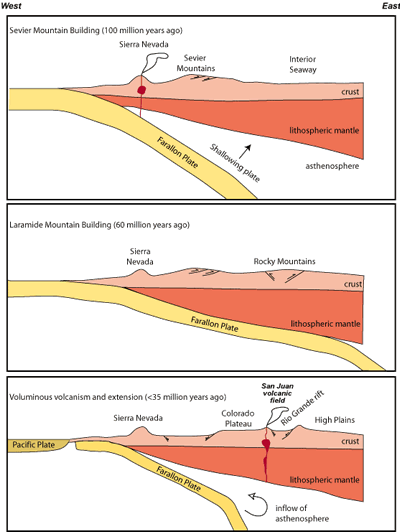
Plate tectonic setting of the western United States through time (modified from Humphreys et al., 2003). The North American plate is composed of continental crust (light pink) and lithospheric mantle (dark pink). Together, the crust and the lithospheric mantle form the rigid outer layer of our planet. The base of the lithosphere (asthenosphere) is marked by the temperature where the mantle exhibits ductile (plastic) flow - http://geoinfo.nmt.edu/tour/landmarks/cumbres_toltec/home.html#fig2,http://geoinfo.nmt.edu/tour/landmarks/cumbres_toltec/home.html |
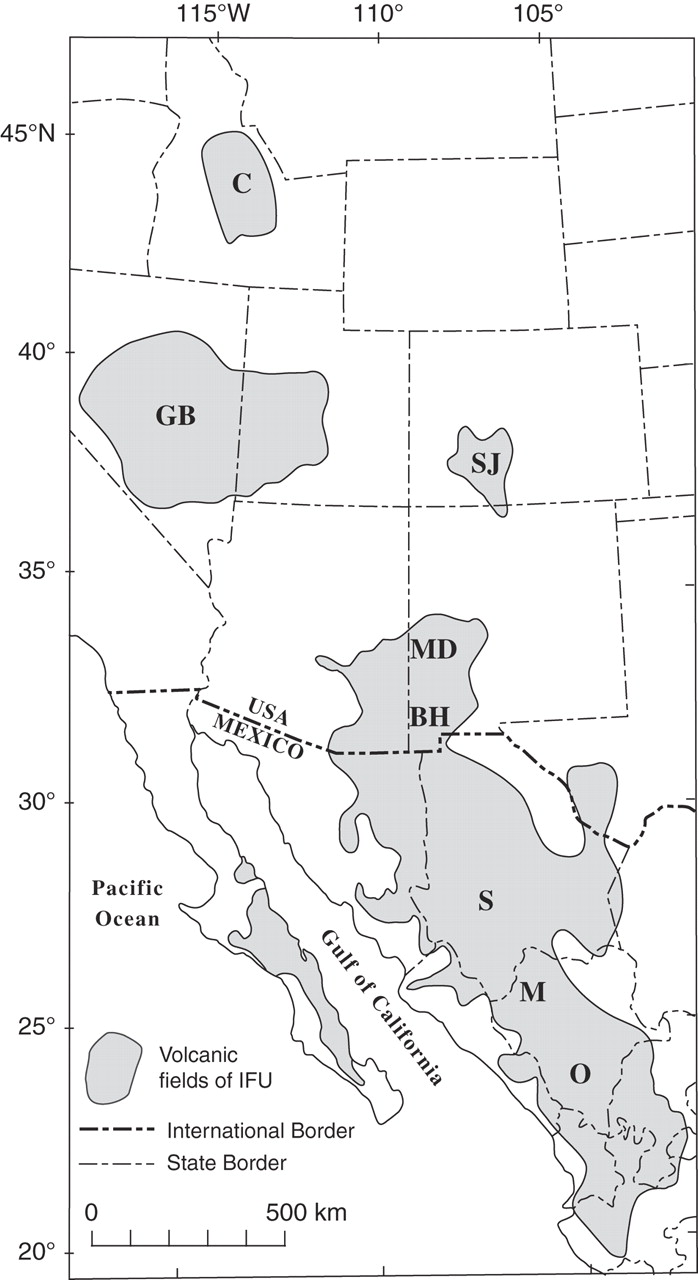
C- Challis, Idaho; SJ - San Juan, MD - Mogollon-Datil, Bh - Bootheel, and GB - Great Basin |
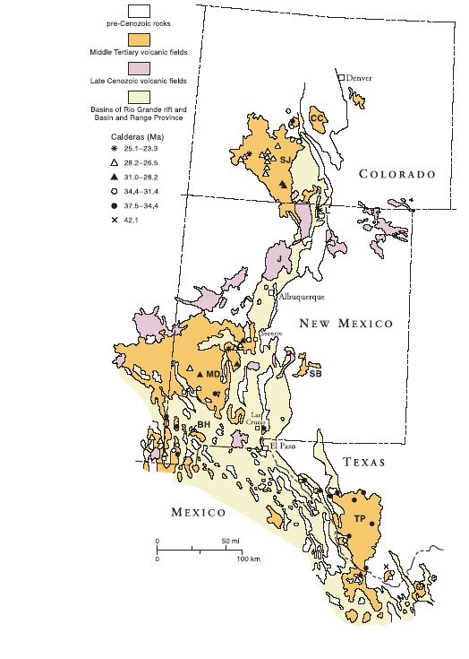
Map showing the Mogollon-Datil volcanic field of New Mexico with respect to other Cenozoic volcanic fields in Colorado, Texas, and New Mexico. MD= Mogollon-Datil, BH=Bootheel, TP=Trans=Pecos, SB = Sierra Blanca, SJ=San Juan,CC=Cripple Creek, J=Jemez. From Chapin et al. (2004). |
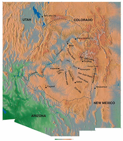
Colorado Platea - San Juan Basin -http://geoinfo.nmt.edu/tour/state/navaho_lake/home.html |
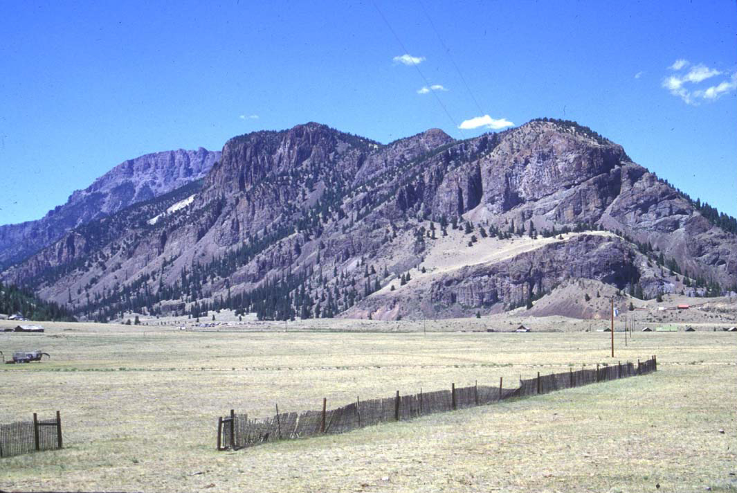
The central Colorado volcanic field, late Eocene/Oligocene |
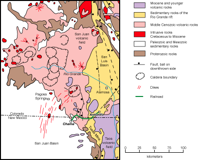
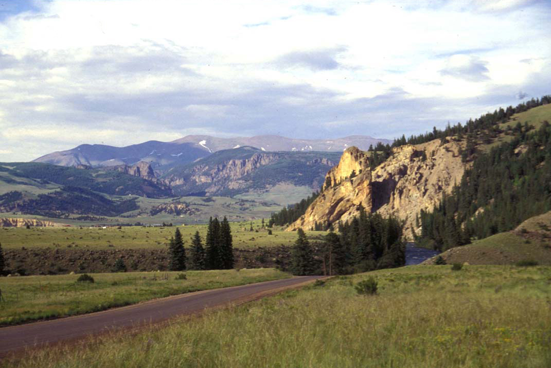
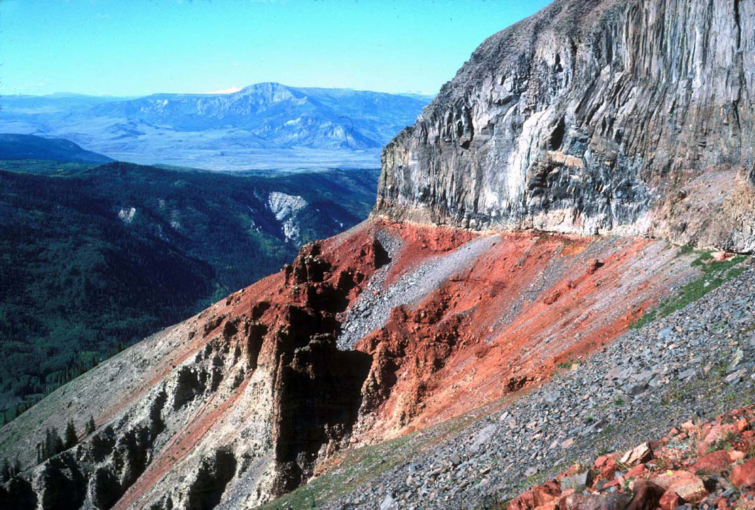
http://geoinfo.nmt.edu/tour/landmarks/cumbres_toltec/home.html, map - http://geoinfo.nmt.edu/tour/landmarks/cumbres_toltec/regional_setting.pdf . Bachelor Caldera, (27.5Ma), Blue Creek, concealed caldera, (27.11Ma) , Bonanza Caldera, (33.2 Ma), concealed or inferred, Cebolla Creek Caldera, (~27Ma), Cochetopa Park Caldera, (26.9Ma) , Creede Caldera, (26.9Ma), La Garita Caldera, (27.8Ma), size: 35 x 75 km, La Garita, North Caldera (Saguache), La Garita, Central Caldera, La Garita, South Caldera, Lake City Caldera, (23.0Ma), Lost Lake Caldera, (28.2Ma), concealed or inferred, Marshall Creek Caldera, (33.8Ma) , Mount Hope, Caldera, (28.4) concealed or inferred, Nelson Mountain Caldera, (~25.7Ma), North Pass Caldera, (32.2Ma), Platoro Caldera, (29.4Ma, Rat Creek Caldera, (~26.5Ma) , San Juan Caldera, (28.3 Ma) , concealed or inferred, San Luis Caldera, (~26Ц27Ma), Silverton Caldera, (~27-28Ma), South River Caldera, (27.25Ma), Summitville Caldera, (28.8Ma) , Uncompahgre Caldera, (28.1 Ma) , Ute Creek Caldera, (28.3 Ma), concealed or inferred. Cumbres and Toltec Scenic Railroad, which winds its way across the New Mexico-Colorado state line between Chama, New Mexico and Antonito, Colorado. The railroad crosses the San Juan Basin (white), the southern part of the San Juan volcanic field (pink), the northern Tusas Mountains (pink, brown, and gold), and the western margin of the Rio Grande rift (gold). Map modified from Lipman (2006).http://geoinfo.nmt.edu/tour/landmarks/cumbres_toltec/home.html#fig2. The Tusas Mountain highland and the San Juan Basin were then partially covered by lava flows and ash-flow tuffs derived from cataclysmic eruptions of 38-to-19 MY volcanoes in the San Juan Mountains to the north . Andesitic stratovolcanoes dominated the landscape during the early history of the volcanic field. Later, several violent caldera-forming eruptions in the San Juan Mountains blanketed large portions of southwestern Colorado and north-central New Mexico with rhyolitic ash-flow tuff.. Younger volcanic debris eroded from the volcanoes later lapped onto the northeast margin of the Tusas Mountains.. As the volcanoes in the San Juan Mountains eroded, this part of New Mexico and Colorado was stretched by east-west extension, causing eruption of basalts and the formation of deep sediment-filled basins. This extensional feature, known as the Rio Grande rift, started forming in this area about 25 MA. The youngest rift-related basaltic volcanism in this region (1 to 5 MY, Appelt, 1998) is in the Taos Plateau volcanic field.Eruptive and noneruptive calderas, northeastern San Juan Mountains, Colorado: Where did the ignimbrites come from. The northeastern San Juan Mountains, the least studied portion of this well-known segment of the Southern Rocky Mountains Volcanic Field are the site of several newly identified and reinterpreted ignimbrite calderas. These calderas document some unique eruptive features not described before from large volcanic systems elsewhere, as based on recent mapping, petrologic data, and a large array of newly determined high-precision, laser-fusion 40Ar/39Ar ages (140 samples). Tightly grouped sanidine ages document exceptionally brief durations of 50иC100 k.y. or less for individual Oligocene caldera cycles; biotite ages are more variable and commonly as much as several hundred k.y. older than sanidine from the same volcanic unit. A previously unknown ignimbrite caldera at North Pass, along the Continental Divide in the Cochetopa Hills, was the source of the newly distinguished 32.25-Ma Saguache Creek Tuff (~400иC500 km3). This regionally distinctive crystal-poor alkalic rhyolite helps fill an apparent gap in the southwestward migration from older explosive activity, from calderas along the N-S Sawatch locus in central Colorado (youngest, Bonanza Tuff at 33.2 Ma), to the culmination of Tertiary volcanism in the San Juan region, where large-volume ignimbrite eruptions started at ca. 29.5 Ma and peaked with the enormous Fish Canyon Tuff (5000 km3) at 28.0 Ma. The entire North Pass cycle, including caldera-forming Saguache Creek Tuff, thick caldera-filling lavas, and a smaller volume late tuff sheet, is tightly bracketed at 32.25иC32.17 Ma. No large ignimbrites were erupted in the interval 32иC29 Ma, but a previously unmapped cluster of dacite-rhyolite lava flows and small tuffs, areally associated with a newly recognized intermediate-composition intrusion 5 з╣ 10 km across (largest subvolcanic intrusion in San Juan region) centered 15 km north of the North Pass caldera, marks a near- caldera-size silicic system active at 29.8 Ma. In contrast to the completely filled North Pass caldera that has little surviving topographic expression, no voluminous tuffs vented directly from the adjacent Cochetopa Park caldera, which is morphologically beautifully preserved. Instead, Cochetopa Park subsided passively as the >500 km3 Nelson Mountain Tuff vented at 26.9 Ma from an б░underfitб▒ caldera (youngest of the San Luis complex) 30 km to the SW. Three separate regional ignimbrites were erupted sequentially from San Luis calderas within an interval of less than 50иC100 k.y., a more rapid recurrence rate for large explosive eruptions than previously documented elsewhere. In eruptive processes, volcanic compositions, areal extent, duration of activity, and magmatic production rates and volumes, the Southern Rocky Mountains Volcanic Field represents present-day erosional remnants of a composite volcanic field, comparable to younger ignimbrite terranes of the Central Andes. http://gsabulletin.gsapubs.org/content/120/7-8/771.abstract |
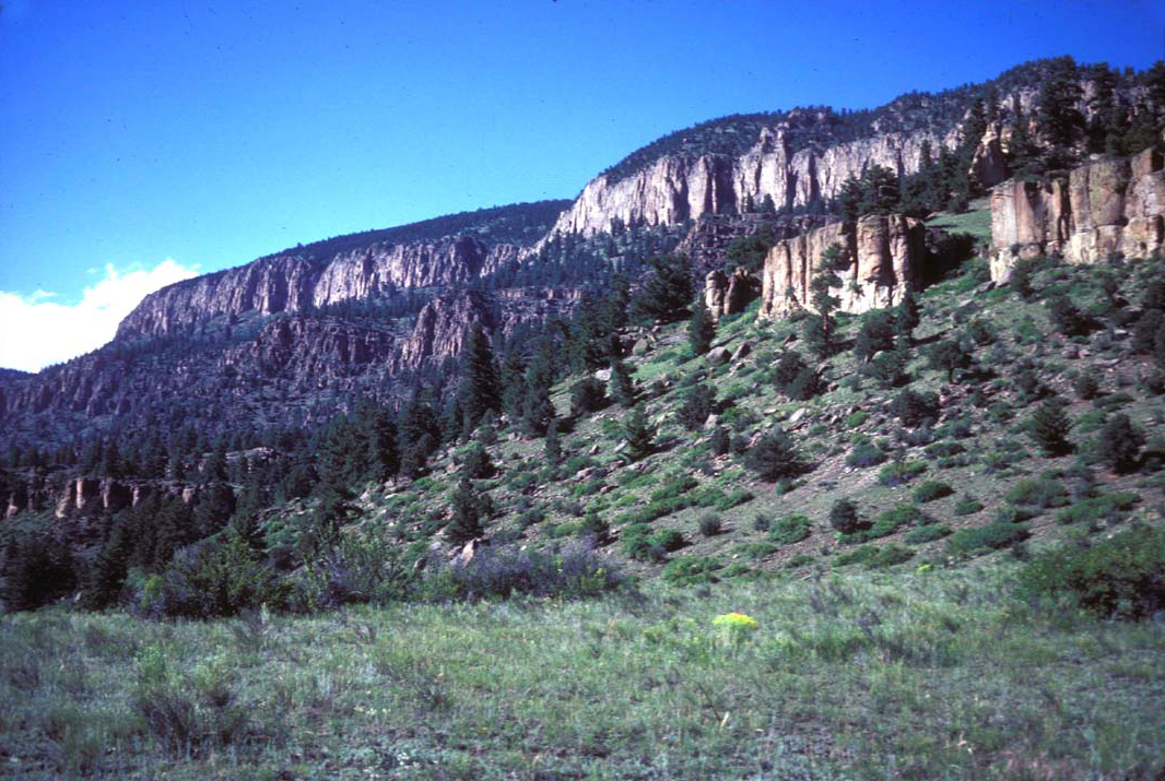
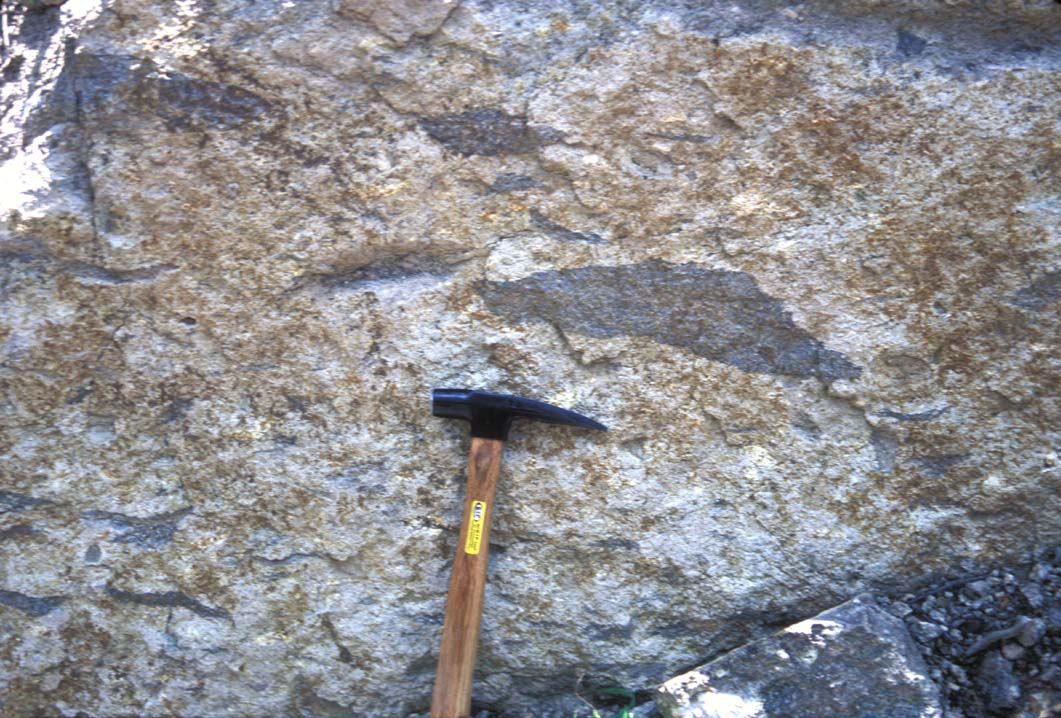
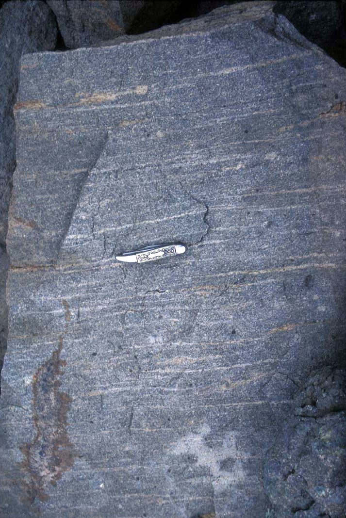
Two typical ignimbrites from San Juan VF.The San Juan volcanic field, located in southwestern Colorado, contains two distinct phases of volcanism. The earlier volcanism is Oligocene in age, and consists of largely intermediate composition lavas and breccias. A few ash flow tuffs also constitute this phase of volcanism. Later volcanism is MioceneЦPliocene in age, and is basaltic in composition. The Oligocene volcanism probably was related to subduction along the western margin of North America, and the Miocene-Pliocene volcanism is best interpreted as a partial melt of the lower crust that was erupted onto the surface. Notable features: La Garita Caldera, Nelson Mountain Caldera, Bachelor Caldera, Creede Caldera, Lake City calderas, Platoro calderas - http://en.wikipedia.org/wiki/San_Juan_volcanic_field, http://en.wikipedia.org/wiki/Category:Volcanoes_of_Colorado |
http://www.sciencedirect.com/science/article/pii/S0377027304003002 |
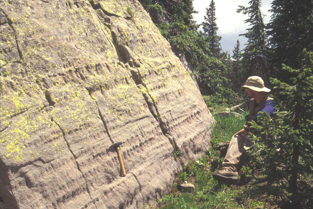
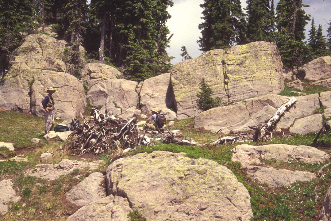
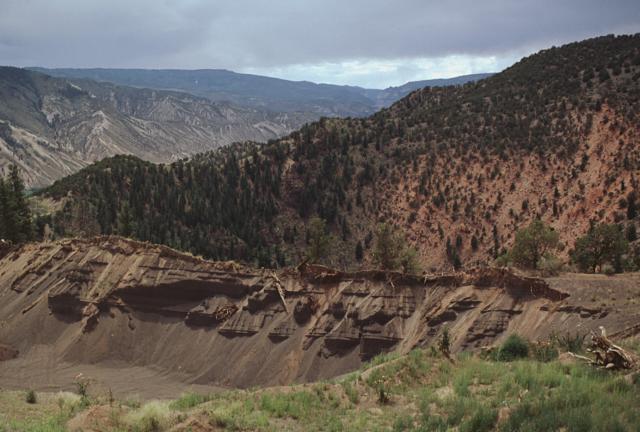
Early Tuff Sheets. Masonic Park Tuff.Welded surge-bedded and pumiceous partings, abruptly overlie weakly welded zone in basal Masonic Park Tuff (unit Tslm), by trail along Turkey Creek (western Saddle Mountain quad). Note geologist for scale near center of the left side of the photograph.Photograph by P.W. Lipman -http://pubs.usgs.gov/imap/i2799/photos.html |
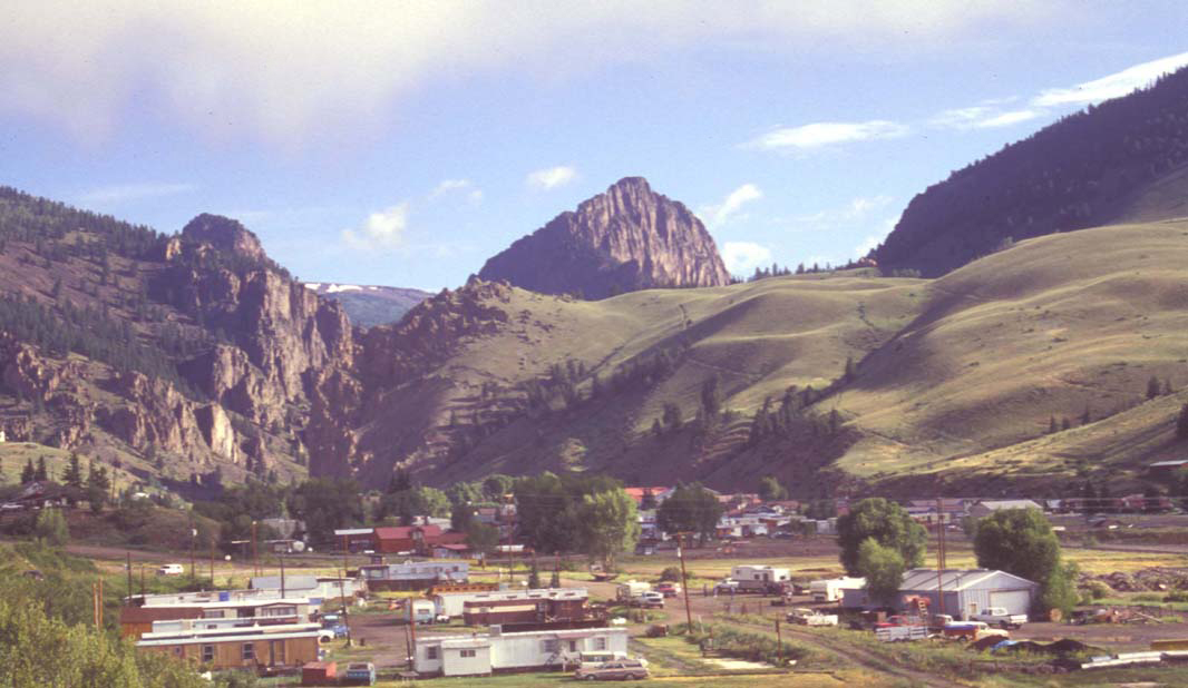
Early Tuff Sheets. Saddle Mountain 1. Ash-flow sheets of Treasure Moutain Group (erupted 29.5-28.2 Ma; from Platoro caldera in southeastern San Juan region) form banded midslope outcrops on landslide break-away scarp, east slope of Saddle Mountain. Underlying laharic conglomerates (from intermediate-composition lava flows of Conejos Formation) crop out in foreground and on lower slopes of Saddle Mountain. Dark capping units on Saddle Mountain are Pagosa Peak Dacite and Fish Canyon Tuff. View west from Hwy 160, south of Wolf Creek Pass (Saddle Mountain quad).http://pubs.usgs.gov/imap/i2799/photos.html |
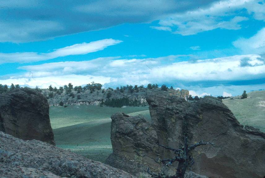
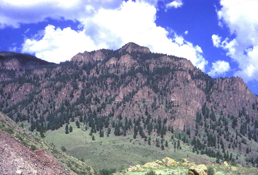
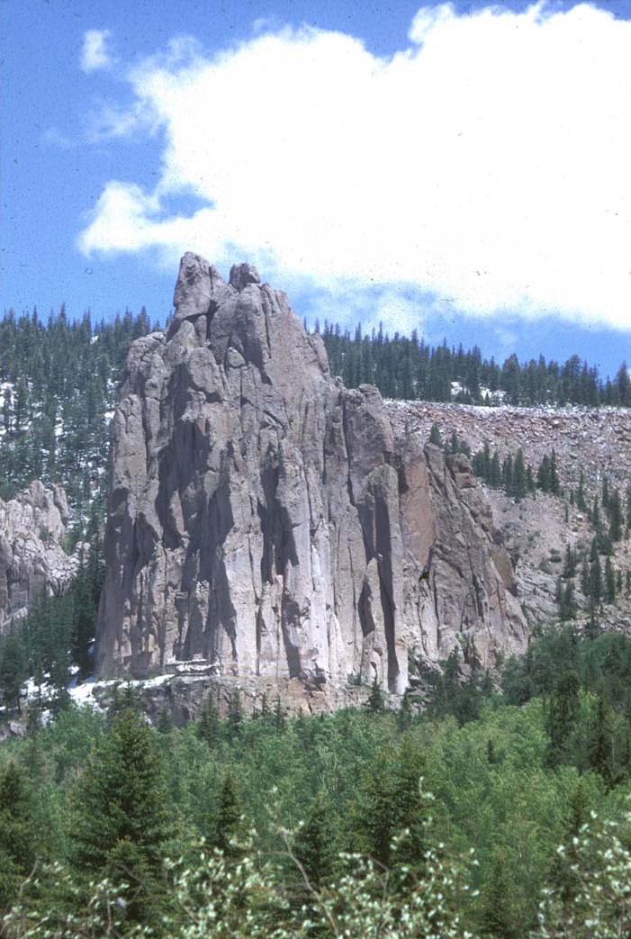
Thirtynine Mountain Volcanic Field. The Thirtynine Mile volcanic area, Central Colorado volcanic field, is an extinct volcanic area located in Park and Teller counties, Colorado, northwest of Cripple Creek and southeast of South Park.[1] The area was the site of significant volcanism in the Paleogene Period about 35 million years ago. Ashfall and lahars (mudflows) from the volcanoes created the conditions for fossilization at what is now Florissant Fossil Beds National Monument.The field is named for Thirtynine Mile Mountain, a local peak that is composed of volcanic rocks from the field. The field also contains the Guffey volcanic center. http://en.wikipedia.org/wiki/Thirtynine_Mile_volcanic_area. The unusual "Devil''s Dunce Cap" formations are the eroded remnants of a 1200-square-mile volcanic ash flow. This Gribbles Park Tuff was deposited 29 million years ago during the Oligocene. Although located within the Thirtynine Mountain Volcanic Field, the tuff''s source is thought to be outside of the field to the west. The exact source is unknown, and research on this may be useful in determining the timing of the opening of the upper Arkansas valley. |
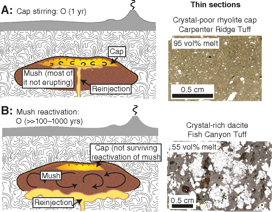
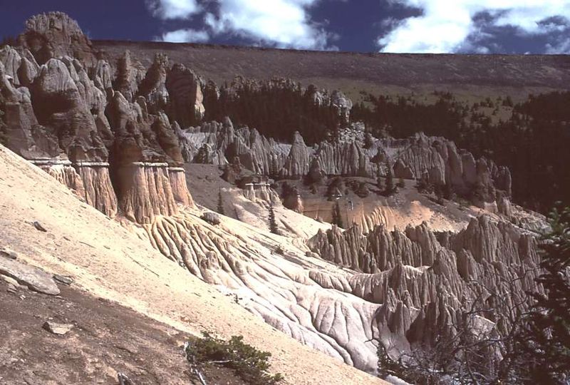
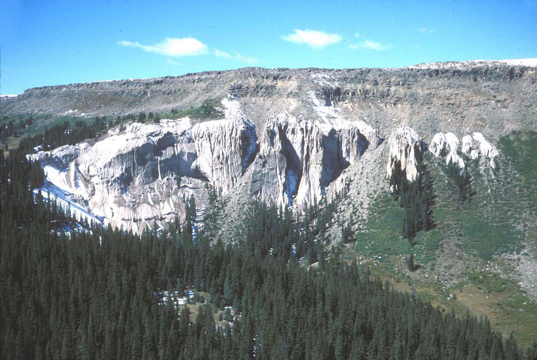
La Garita Caldera. Ash formations of La Garita Caldera, looking northeast. (Wheeler Geologic Monument). La Garita Caldera is a large volcanic caldera located in the San Juan volcanic field in the San Juan Mountains. La Garita Caldera is often described as the largest known explosive eruption in Earth''s history, although recent research has identified several larger ones.Last eruption 26.3 Ma (Fish Canyon Tuff 27.8 Ma).The La Garita Caldera is one of a number of calderas that formed during a massive ignimbrite flare-up in Colorado, Utah and Nevada from 40Ц25 million years ago, and was the site of truly enormous eruptions about 28Ц26 million years ago, during the Oligocene Epoch. The area devastated by the La Garita eruption is thought to have covered a significant portion of what is now Colorado, and ash could have fallen as far as the east coast of North America and the Caribbean. The scale of La Garita volcanism was far beyond anything known in human history. The resulting deposit, known as the Fish Canyon tuff, has a volume of approximately 5,000 km3, enough material to fill Lake Michigan (in comparison, the May 18, 1980 eruption of Mt. St. Helens was only 0.25 cubic miles (1.0 km3) in volume). The eruption was energetically equivalent to 240,000 megatons of TNT.By contrast, the most powerful human-made explosive device ever detonated, the Tsar Bomba or King of the Bombs, had a yield of 50 megatons, whereas the eruption at La Garita was about 5,000 times more powerful. It is one of the most energetic events on Earth since the Chicxulub impact, which was 400 times more powerful. The Fish Canyon Tuff, made of dacite, is known to be remarkably uniform in its petrological composition and forms a single cooling unit despite the huge volume. Dacite is a silicic volcanic rock common in explosive eruptions, lava domes and short thick lava flows. There are also large intracaldera lavas composed of andesite, a volcanic rock compositionally intermediate between basalt (poor in silica content) and dacite (higher silica content) in the La Garita Caldera.The caldera itself, like the eruption of Fish Canyon Tuff, is quite large in scale. It is 35 by 75 km oblong shape. Most supervolcano calderas of explosive origin are slightly ovoid or oblong in shape. Because of the vast scale and erosion, it took scientists over 30 years to fully determine the size of the caldera. La Garita can be considered a "supervolcano", albeit an extinct one.La Garita is also the source of at least 7 major eruptions of welded tuff deposits over a time span of 1.5 MY since the Fish Canyon Tuff eruption. The caldera is also known to have extensive outcrops of a very unusual lava-like rock made of dacite that is very similar to that of the Fish Canyon Tuff. This rock, which has characteristics of both lava and welded tuff, was erupted probably shortly before the Fish Canyon Tuff. The lava-like rock has been interpreted as having erupted as thick spatter during low-energy lava fountaining. The lava-like rock is also voluminous Ч up to 200Ц300 km3.. http://en.wikipedia.org/wiki/La_Garita_Caldera |
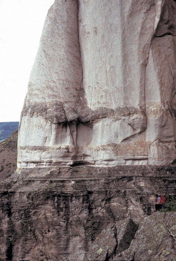
La Garita Caldera Cycle (27.6 Ma) Lava-like Pagosa Peak Dacite (unit Tpl), with flow layers showing pull-apart fractures within devitrified dacite (Rock Lake, northwestern Wolf Creek Pass quad).Photograph by P.W. Lipman http://pubs.usgs.gov/imap/i2799/photos.html |
La Garita Caldera Pagosa Peak Dacite (unit Tpl), a low-energy pyroclastic deposit that is a precursor to eruption of the petrologically identical Fish Canyon Tuff (Bachmann and others, 2001), forms rheomorphic lava-like rocks in areas of thick accumulations. In this outcrop at Rock Lake (northwestern Wolf Creek Pass quad), massive flow-layered lava-like rocks (unit Tpl) abruptly overlie the pyroclastic blob-and-ash unit (unit Tpb). Contact is along grassy bench, with dead branches (note two geologists, for scale). |
La Garita Caldera Dark-colored lavas of Huerto Andesite and interlayered light-gray laharic breccias, overlying the weakly indurated top of intracaldera Fish Canyon Tuff (grassy area in foreground), south of Puerto Blanco (Palomino Mountain quad). Light-colored cap at right end of ridge is thin erosional scab of Carpenter Ridge Tuff. Note horse pack-string for scale (lower left).Photograph by P.W. Lipman http://pubs.usgs.gov/imap/i2799/photos.html |
La Garita Caldera Fish Canyon Tuff (upper columnar cliff-forming unit) overlies compound welding zones in Masonic Park Tuff, along Rio Grande near Masonic Park (South Fork West quad).Photograph by P.W. Lipman http://pubs.usgs.gov/imap/i2799/photos.html |
La Garita Caldera Cycle. Base of Fish Canyon Tuff. Large-scale surge bedding at base of nonwelded basal Fish Canyon Tuff, Hwy 160, south of South Fork (southern South Fork West quad).. Photograph by P.W. Lipman http://pubs.usgs.gov/imap/i2799/photos.html |
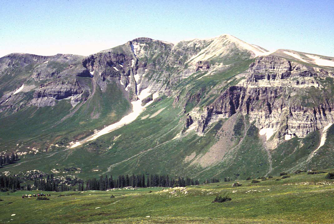
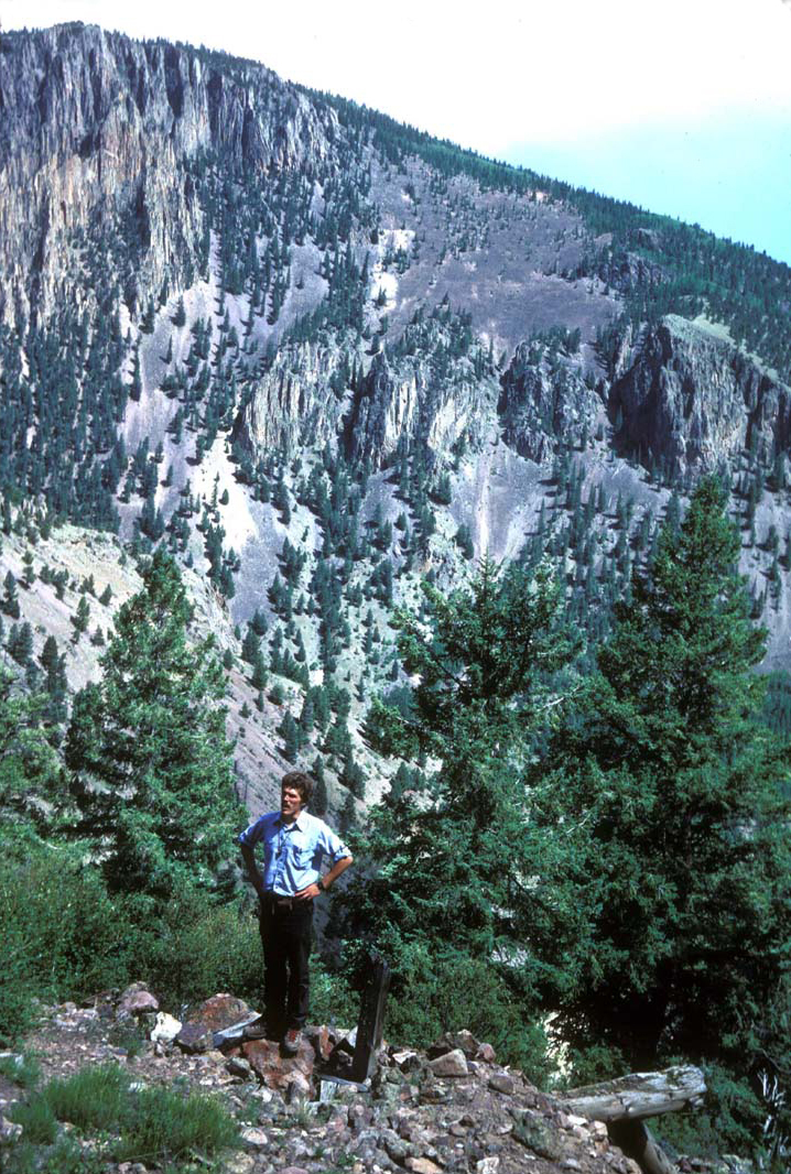
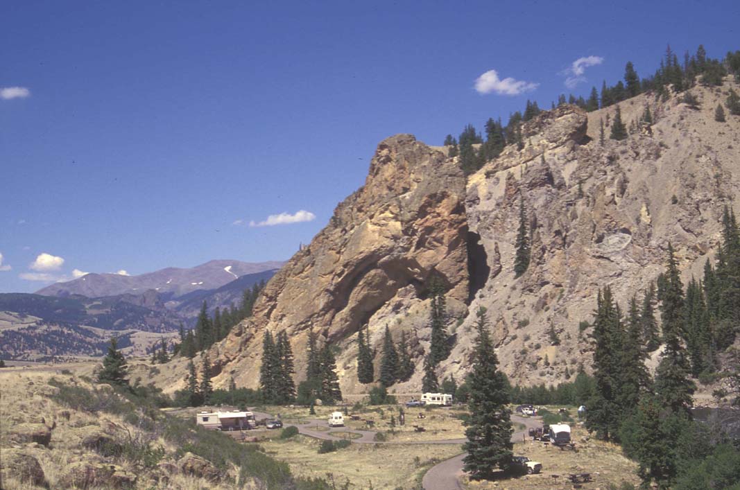
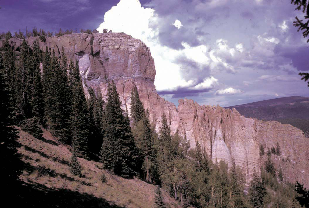
La Garita Caldera Cycle (27.6 Ma) Bristol Head 10. View of Bristol Head from the southeast (near Bristol Head-Workman Creek quad boundary). Tilted andesitic lavas of the Conejos Formation and overlying Masonic Park Tuff and thick intracaldera Fish Canyon Tuff (forming prominent cliff in middle distance) are interpreted as the floor of La Garita caldera, tilted by postcollapse resurgent uplift. High point on Bristol Head (in distance, on left) is capped by andesite of Bristol Head, overlying thick flows and breccias of Huerto Andesite, which accumulated against west wall of La Garita caldera.Photograph by P.W. Lipman http://pubs.usgs.gov/imap/i2799/photos.html |
Three calderas, looking northeast from the informally known Point of Rocks (Creede quad). High distant ridge of La Garita Mountains, above tree line, is resurgent block of intracaldera Fish Canyon Tuff within northern segment of La Garita caldera. Steep slopes on southwest flank of La Garita Mountains mark northeast topographic wall of Bachelor caldera. Prominent cliffs in middle distance are fill of Bachelor caldera, mainly intracaldera Carpenter Ridge Tuff above town of Creede, where truncated by north topographic wall of Creede caldera. In foreground, at Point of Rocks, landslide breccia of intracaldera Carpenter Ridge Tuff is faulted against northwest flank of resurgently domed intracaldera Snowshoe Mountain Tuff within the Creede caldera -Photograph by P.W. Lipman http://pubs.usgs.gov/imap/i2799/photos.html |
Bachelor Caldera . Carpenter Ridge Tuff lithophysae 12. Gas cavity zone (lithophysae) in typical outflow Carpenter Ridge Tuff (unit Tcr), Nellie Creek (Lake City caldera west of map area; see Lipman, 1976).Photograph by P.W. Lipman http://pubs.usgs.gov/imap/i2799/photos.html |
Bachelor Caldera. Giant gas cavity in Carpenter Ridge Tuff, where ponded over wet sediment, north moat of La Garita caldera (west of South Fork Saguache Creek, Mineral Mountain quad).Photograph by P.W. Lipman http://pubs.usgs.gov/imap/i2799/photos.html |
Bachelor Caldera Cycle (27.3 Ma) Mafic scoria lenses Mafic alkalic scoria lenses (unit Tcrf), in upper part of outflow Carpenter Ridge Tuff, Ribbon Mesa road (Baldy Cinco quad).Photograph by P.W. Lipman http://pubs.usgs.gov/imap/i2799/photos.html |
Bachelor Caldera. Intracaldera Carpenter Ridge Tuff. Thick cliff-forming Willow Creek unit (unit Tcbw) of intracaldera Carpenter Ridge Tuff. View is east across Willow Creek (Creede quad) toward Inspiration Point - Photograph by P.W. Lipman http://pubs.usgs.gov/imap/i2799/photos.html |
Bachelor Caldera. Megabreccia clast. Andesite megabreccia clast in matrix of weakly welded Carpenter Ridge Tuff (unit Tcwb), within Bachelor caldera. Near mouth of Goose Creek (southern Wagon Wheel Gap quad).Photograph by P.W. Lipman http://pubs.usgs.gov/imap/i2799/photos.html |
Blue Creek (27.2-27.1 Ma) Thick section (~250 m) of uniform dacitic Blue Creek Tuff (unit Tbc), capped by two dacite flows (Lava flows of McClelland Mountain, unit Tmd). View to east of mouth of Blue Creek (Wagon Wheel Gap quad; see Ratte and Steven, 1967, p. H25-H33).Photograph by P.W. Lipman http://pubs.usgs.gov/imap/i2799/photos.html |
South River Caldera Cycle (27.2-27.1 Ma) . South River Volcanics. Andesite lava flow of South River Volcanics (unit Tsrm) within South River caldera (source of Wason Park Tuff). Andesite flow baked and oxidized the underlying volcaniclastic sedimentary rocks. View north, along west side of Red Mountain (northeastern Palomino Mountain quad). Bristol Head is in center distance across lower Clear Creek graben - Photograph by P.W. Lipman http://pubs.usgs.gov/imap/i2799/photos.html |
San Luis Caldera Complex (27.0-26.8 Ma) Nelson Mountain Tuff at head of Miners Creek Outflow Nelson Mountain Tuff, thick nonwelded rhyolite (unit Tnn), overlain by densely welded, ledge-forming dacite (unit Tnd) at head of Miners Creek (central Baldy Cinco quad).Intracaldera Nelson Mountain Tuff (dark-gray-brown) exposed in Equity Mine area, viewed from West Willow Creek (San Luis Peak quad). Steeply dipping orange-brown oxidized zone marks trace of Equity fault, along which triangular block of intracaldera rhyolitic Carpenter Ridge Tuff (light-gray; unit Tcbw) has been juxtaposed against gray-brown dacitic intracaldera Nelson Mountain Tuff (unit Tnde).Photograph by P.W. Lipman. http://pubs.usgs.gov/imap/i2799/photos.html |
San Luis Caldera Complex . Nelson Mountain Tuff at Cathedral. Nonwelded rhyolitic Nelson Moutain Tuff (unit Tnn) ponded against wall of Cebolla Creek caldera (Cathedral Creek, west margin of Stewart Peak quad).Photograph by P.W. Lipman http://pubs.usgs.gov/imap/i2799/photos.html |
San Luis Caldera Complex . Nelson Mountain Cathedral base.Basal surge and nonwelded rhyolitic Nelson Mountain Tuff (unit Tnn) overlies reworked tuff (from Mineral Mountain Rhyolite?; west margin of Stewart Peak quad).Photograph by P.W. Lipman http://pubs.usgs.gov/imap/i2799/photos.html |
Block of Nelson Mountain Tuff. Densely welded (fluidal) intracaldera Equity facies of Nelson Mountain Tuff (unit Tnde), head of Spring Creek (San Luis Peak quad).Photograph by P.W. Lipman http://pubs.usgs.gov/imap/i2799/photos.html |
San Luis Caldera Complex . Stewart Peak andesite. Sequence of andesitic lava flows (unit Tsa, Stewart Peak Volcanics) within Nelson Mountain caldera of San Luis complex, on west flank of Stewart Peak volcano. View north along ridge between Spring and Mineral Creeks (west margin of San Luis Peak quad).Photograph by P.W. Lipman http://pubs.usgs.gov/imap/i2799/photos.html |
Creede Caldera Cycle (26.7 Ma) North Creede caldera wall.North topographic wall of Creede caldera, defined by cliffs of intracaldera Carpenter Ridge Tuff (Bachelor Mountain Member), north of town of Creede. Geographic Nelson Mountain is on skyline at head of valley (Creede, San Luis Peak quads). Photograph by P.W. Lipman http://pubs.usgs.gov/imap/i2799/photos.html |
Creede Caldera Cycle Upper part of intracaldera Snowshoe Mountain Tuff (unit Ts) in fault contact with caldera landslide breccia consisting of monolithologic clasts of Carpenter Ridge Tuff (unit Tslc), on northwest flank of Creede resurgent dome at the informally known Point of Rocks.Weakly welded outflow Snowshoe Mountain Tuff, (Creede quad).Photograph by P.W. Lipman http://pubs.usgs.gov/imap/i2799/photos.html |
Miocene Basalt and Rhyolite of Hinsdale Formation. Beaver Creek vent-dome complex. Aphyric rhyolite of Hinsdale Formation (unit Thr; 22.4 Ma): flow-layered lava overlies pyroclastic-vent cone; basal vitrophyre zone contains relict nonhydrated obsidian nodules (Apache tears) in perlitic matrix (Lipman, 1975, p. 93-97). In distance to right of image, basaltic lava flows of the Hinsdale Formation cap Handkerchief Mesa (southeastern Beaver Creek Reservoir quad).Photograph by P.W. Lipman http://pubs.usgs.gov/imap/i2799/photos.html |
Dotsero maar in central Colorado near the junction of the Colorado and Eagle rivers.Dotsero is a 700-m wide by 400-m deep maar volcano. It is classified as a scoria cone with evaporitic rock, basaltic tephra, and oxidized sandstone. Erupting approximately 4200 years ago, it is the youngest volcano in Colorado.This Holocene volcano erupted in the year 2220 б└ 300 years B.C. When Dotsero blew, it created small scoria cones that were constructed along a NNE-SSW line on either side of the maar. The eruption date is based upon radiocarbon dating of wood found underneath some of the scoria. It is one of the youngest eruptions in the continental U.S. and it produced an explosion crater, a lahar, and a 3-km long lava flow.Volcanoes that have erupted in the past 10,000 years are more likely to become active again. Interstate 70 cuts across the lava flow -http://en.wikipedia.org/wiki/Dotsero The most recent eruptions produced an explosion crater, lahars, and 3 km long lava flow. The volcano consists of a crater some 700 m across by 400.The crater floor is roughly flat, and covered by talus. Features of the volcano include Triangle Peak, and Willow Peak. |
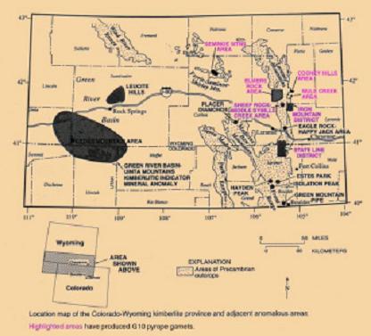
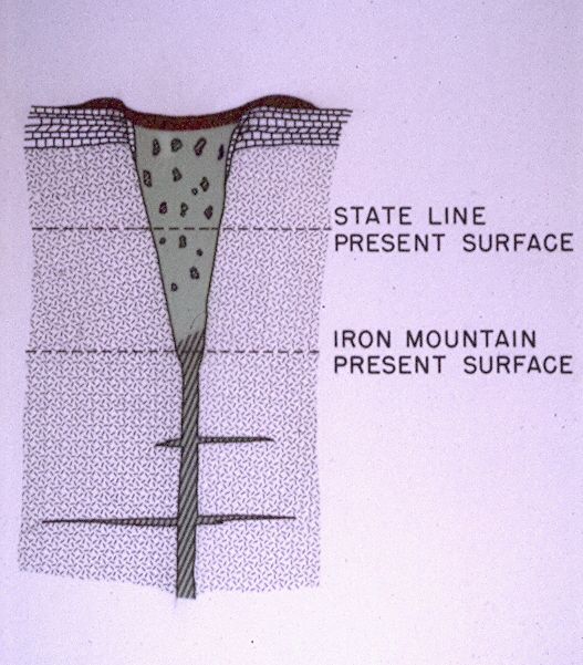
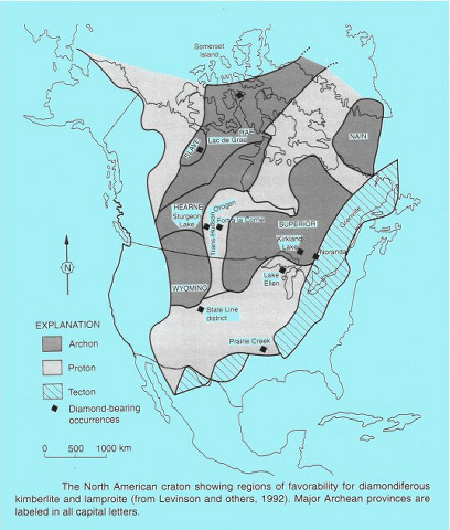
the Colorado-Wyoming State Line district (1), this was followed by mapping of a small kimberlite blow in the Sheep Rock district (2), a major dike-blow complex in the Iron Mountain district (3), and the mapping of a major lamproite district in the Leucite Hills field. World-wide only 14% of Kimberlite deposits are diamondiferious. Here almost all of the Kimberlite deposits. The area is thought to have been formed by a backarc thrust belt caused when the Pacific coast lithosphere - http://starmon.com/diamonds.html |
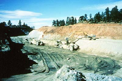
Kelsey Lake Diamond Mine is a defunct diamond mine in Colorado, USA. It is located in the State Line Kimberlite District, near the Wyoming border, and consists of nine kimberlite volcanic pipes, of which two were open pit mined. At the time it was operating, it was the United States'''' only modern diamond mine, and only the second commercial diamond mining operation in North America, the first being in the Crater of Diamonds State Park, Arkansas which was mined in the early 1900s. Diamonds had first been found in 1976., the nine volcanic pipes found,. These two pipes are each approximately 4.2 ha in area, are at least 110 m deep, and are situated 0.80 km. In 1996 the largest diamond found at the mine was discovered. Named the "Colorado Diamond," it was a 28.3-carat (5.7 g) yellow stone and the fifth-largest diamond found in North America. http://www.coloradogeohikes.0catch.com/Colorado/SJVF/BasicCalderaInfo.html |
Kelsey Lake Hw |
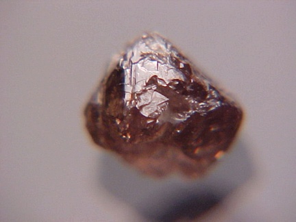
Diamond from Kelsey Lake |
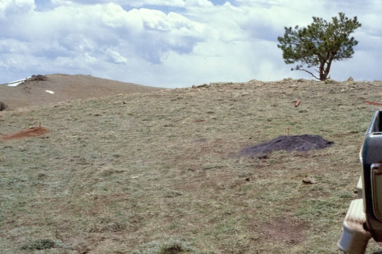
Cross section of Colorado-Wyoming kimberlite The kimberlites occur as pipes, dikes and blows. Most appear to be deeply eroded suggsting a possibility for significant diamond placers downstream. Even so, there has been absolutely no exploration for diamond placers in this region although one Ft. Collins prospector recovered diamonds in the early 1970s while looking for gold in Rabbit Creek, another panned a diamond with little effort in George Creek, and placer diamonds were recovered in Fish Creek during exploration of Kelsey Lake (including a 6.2 carat diamond). Kimberlites found to date are primarily diatreme facies with lesser hypabyssal facies. Many were initially found based on blue ground exposures, vegetation anomalies, KIMs, mantle nodues, and depressions. http://diamondprospector.webs.com/kimberlite.htm These carrot or funnel shaped volcanic breccias were produced when explosive igneous intrusions burst through the areas Proterozoic granite & gneiss terrain. Fracturing the overlying limestone from the Cambrian, Ordovician and SILURIAN periods. It had been thought that since Colorado was above the sea or the layers were eroded |
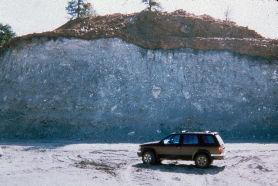
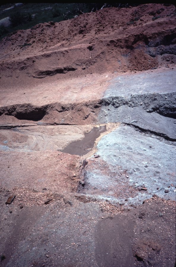
blue ground at Aultman kimberlite, Wyoming exposed by badger. Drilling at Aultman kimberlite intersects kimberlite at shallow depth (dark gray soil) and granite (reddish soil). Contact exposed at Schaffer kimberlite showing the knife sharp contact between the blue ground kimberlite and the sheared granite -http://diamondprospector.webs.com/kimberlite.htm |
Kimberlite - Granite Contact, Schaffer Complex -http://diamondprospector.webs.com/kimberlite.htm |
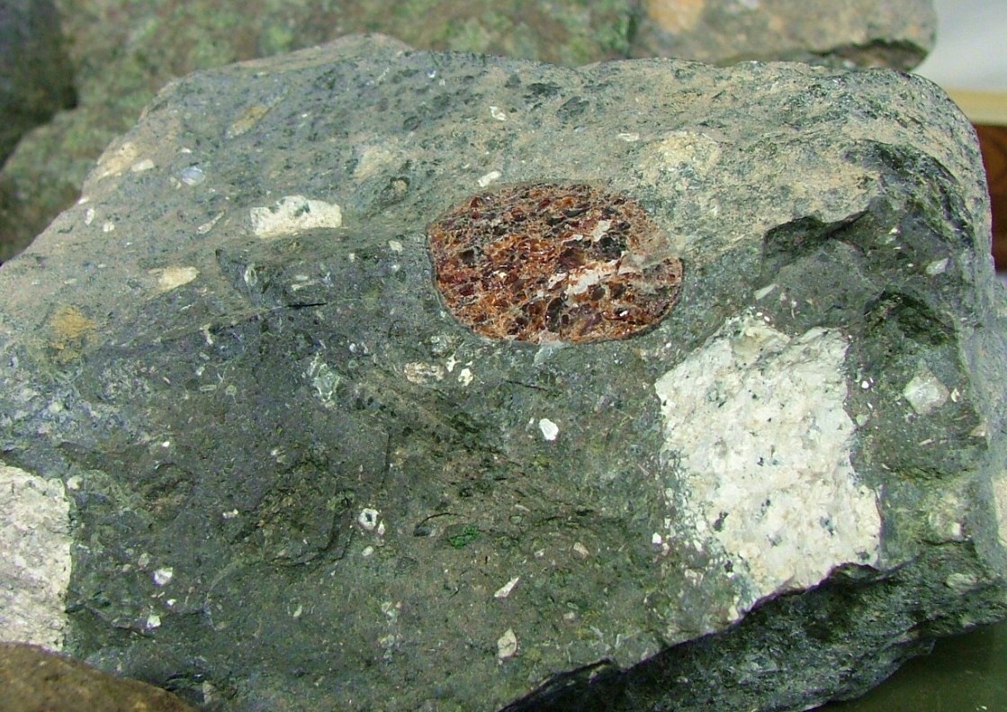
Hypabyssal facies diamondiferous kimberlite at the Sloan Ranch, Colorado. Note the large pyrope megacryst (gem-quality Cape Ruby) - http://diamondprospector.webs.com/kimberlite.htm |
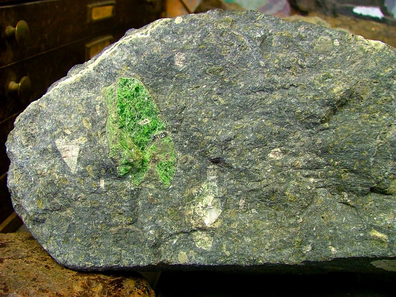
Hypabyssal facies diamondiferous kimberlite with large chromian diopside (Cape Emerald) in matrix - http://diamondprospector.webs.com/kimberlite.htm |
It was thought early on in the discovery process that the Kimberlite/Lamproite pipes were of the Early Devonian age (390 ma), but more recently it has been determined by radiometric dating that some of these diatremes are as old as 640-570- that''s Precambrian age! Yet pipes can be found in the world as young as 20 million years - http://starmon.com/diamonds.html |

http://vulcan.wr.usgs.gov/Photo/Volcanoes/framework.html
Marysvale volcanic field -utah
This large Volcanic Field is located in south-central Colorado and adjacent parts of New Mexico and is part of the larger Southern Rocky Mountian Volcanic Field (SRMVF). The following towns are within its location....Creede, Gunnison, Lake City, Platoro, Silverton, South Fork. In New Mexico, its Questa and Red River. The Continental Divide snakes through the SJVF, which is an erosional remnant of an extensive volcanic field that formed on a dissected dome structer created during the Laramide orogeny.
We have divided the SJVF up into two parts, the western part was explored in 2005, 2006 & 2007. We will explore the Eastern part in 2011. Here are some basic terms for those not familar with Caldera volcanoes.
A particularly deep negative gravity anomaly exists in the Southern Colorado Rocky Mountains where the overall density of rock, below the Colorado Mineral Belt (COMB) formation, is somewhat low. Two northeast-trending basement batholiths are postulated from gravity lows of >-300MGals in a zone of Laramide and older magmatism that extends greater than 200 km across central Colorado. This coincides with one of the most negative Bouguer gravity anomalies in the US.
The West San Juan Volcanism, had three main general stages...
1. Volcanism
2. Caldera Subsidence
3. Mineralization
A few basic questions we will try to understand are this year are;
Why is the SJVF roughly "T" shaped?
What is the relationship to the "RGR"?
What is the relationship to the Colorado Plateau?
What is the relationship to the COMB?
What is the relationship to the Uncomphage Plateau?
What caused the long lasting activity?
SJVF Overview Map
The San Juan volcanic field, located in southwestern Colorado, contains two distinct phases of volcanism. The earlier volcanism is Oligocene in age, and consists of largely intermediate composition lavas and breccias. A few ash flow tuffs also constitute this phase of volcanism. Later volcanism is MioceneиCPliocene in age, and is basaltic in composition. The Oligocene volcanism probably was related to subduction along the western margin of North America, and the Miocene-Pliocene volcanism is best interpreted as a partial melt of the lower crust that was erupted onto the surface
It should be noted that peak volcanism occurred around 33Ma, then caldera eruptions peaked at ~28Ma. The Lake city caldera at ~23Ma was the last. The last big event was mineralization of the previous volcanics between ~22 to ~10 ma.
***** Ancestral Rocky Mountains *****
In the southern Rocky Mountains, near present-day Colorado, these ancestral rocks were disturbed by mountain building approximately 300Ma, during the Pennsylvanian. This mountain building produced the Ancestral Rocky Mountains. The uplift created two large mountainous islands, known to geologists as Frontrangia and Uncompahgria, located roughly in the current locations of the Front Range and the San Juan Mountains. They consisted largely of Precambrian metamorphic rock forced upward through layers of the limestone laid down in the shallow sea. The mountains eroded throughout the late Paleozoic and early Mesozoic, leaving extensive deposits of sedimentary rock.
Simplified geological history of the SJVF area
Ice age
500,000 to 10,000 years ago
Three glacial periods,
Miocene and early Pliocene rifting
Rifting was accompanied by quiet
eruptions of basalt
Establishment of the Rio Grande rift
28иC26 Ma,
Bimodal assemblage dominated by basalt and
rhyolite, concurrently with the onset of regional extension
SJ Caldera
30иC26 Ma from caldera sources.
caldera subsidence
First, SJ volcanoes
~35иC30 Ma
~30иC22 Ma The earliest volcanic
activity in the SJVF
Precaldera stratovolcanoes.
San Juan highlands, emplacement of the
Colorado Mineral Belt. The calderas of the SJVF formed within a cluster of precaldera stratovolcanoes.
Laramide Orogeny
80иC55Ma, early Cenozoic
Cretaceous seaway
Late Jurassic and Early Cretaceous time ~160иC96Ma
Western Interior Seaway, Sevier orogeny
Late Triassic & Early Jurassic
~210 Ma
Great deposits of windblown sands
Early Mesozoic
250иC230 Ma
Erosion of the Ancestral Rocky Mountains continued.
Ancestral Rockies
320-270Ma
Uplifts and Basins, Uncompahgria
Early Paleozoic
540Ma
Shallow seas, sandstones,
carbonates, clay and shales
Time between Precambrian & Paleozoic
~1.2 billion years
Weathering and erosion stripped off Precambrian rocks
Precambrian...Yavapai tectonostratigraphic
province, (new lithosphere)
1.8-1.7Ga
Also intrusions at б╓1.7, 1.4 &1.1Ga
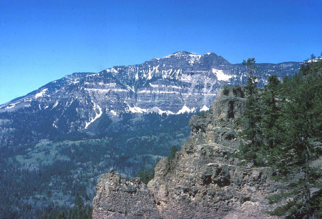
San Juan Mountains: Credit the USGS... "About 28 million years ago, a series of volcanic ash flows that originated from the San Juan Mountains blanketed much of southern Colorado. The tremendous caldera eruptions of the San Juans were characterized by turbulent, flowing clouds of hot incandescent ash, gasses and tiny shards of volcanic glass. Such plinian-type eruptions are sometimes referred to as nuижe ardentes or "glowing avalanches". As the turbulent ash clouds settled out, the burning-hot ash and glass shards welded together to form a dense, erosion-resistant rock called welded tuff. The various layers of welded tuff serve as cap rocks that protect the softer rocks beneath them and give the mesas of Curecanti their flat top (mesa means "table" in Spanish)".
The mountains that you see while driving along Red Mountain Pass were shaped over billions of years through multiple episodes of mountain building and uplift, ancient seas, volcanic upheavals, and icy glaciers. In the San Juan Mountains we see evidence of rock formations that span a vast amount of geologic time. From recent landslide features and relatively young volcanic events to billion-year-old basement rocks, we see a large part of the geologic time scale represented in these rocks. The San Juan Mountains are mostly composed of rocks that erupted from Tertiary volcanoes beginning about 40 million years ago. The volcanic activity continued sporadically for another 30 million years. Lava flows covered vast areas and mixed with older rocks to form conglomerates and breccias. Underlying the volcanic rocks, the older geologic sequence is visible in the Ouray area and south along the Uncompahgre River Canyon. Small outcrops are present in Ironton Park. Precambrian rocks (>600 million years before present) in much of Colorado are igneous or extensively metamorphosed rocks, but the Precambrian Uncompahgre Formation near Ouray comprises former sedimentary rocks that have been only moderately metamorphosed, and retain much of their original character. Sandstones have become quartzites; shales and mudstones have become slate. In Ouray and south to the vicinity of Bear Creek, sedimentary rocks from the Paleozoic era outcrop on the canyon walls. The rocks unconformably overlie the Uncompahgre Formation. Paleozoic rocks include the Ouray Limestone of Devonian age, the Leadville Limestone of Mississippian age, the Pennsylvanian Molas and Hermosa Formations, and the Permian Cutler Formation. The horizontally bedded, tan rocks to the east of the hot springs are part of the Ouray Limestone. Unconformably overlying the Paleozoic sequence are the Mesozoic rocks of the Triassic Dolores Formation, Jurassic Wanakah and Morrison Formations, and the Cretaceous Dakota Formation. These rocks are exposed north and west of Ouray, but are not visible south along the Uncompahgre River Canyon. After the Mesozoic sediments were deposited, a time of uplift and erosion ensued and the Tertiary Eocene Telluride Conglomerate was deposited. Another period of erosion removed most of the Telluride Conglomerate in this area. Subsequent volcanic activity began in the area of the San Juan Mountains. The San Juan Formation volcanic material was erupted from stratovolcanoes (like Mount St. Helens) and was deposited unconformably above the older formations exposed at the surface. The San Juan Formation volcanics are predominately andesites. Subsequent to deposition of the San Juan Formation, the Silverton Volcanic Group was deposited. The early members of this volcanic sequence are contemporaneous with caldera development in this area. Its members, from oldest to youngest, are the Eureka Member (rhyolite), Burns Member (andesite, rhyodacite), Henson Formation (andesite), and a pyroxene andesite member. The San Juan, Uncompahgre, Silverton, and Lake City Calderas and their associated volcanic deposits record a 15-20 million-year history of volcanism in the Ouray-Silverton area.Bachelor Caldera, (27.5Ma), Blue Creek, concealed caldera, (27.11Ma) , Bonanza Caldera, (33.2 Ma), concealed or inferred, Cebolla Creek Caldera, (~27Ma), Cochetopa Park Caldera, (26.9Ma) , Creede Caldera, (26.9Ma), La Garita Caldera, (27.8Ma), size: 35 x 75 km, La Garita, North Caldera (Saguache), La Garita, Central Caldera, La Garita, South Caldera, Lake City Caldera, (23.0Ma), Lost Lake Caldera, (28.2Ma), concealed or inferred, Marshall Creek Caldera, (33.8Ma) , Mount Hope, Caldera, (28.4) concealed or inferred, Nelson Mountain Caldera, (~25.7Ma), North Pass Caldera, (32.2Ma), Platoro Caldera, (29.4Ma, Rat Creek Caldera, (~26.5Ma) , San Juan Caldera, (28.3 Ma) , concealed or inferred, San Luis Caldera, (~26Ц27Ma), Silverton Caldera, (~27-28Ma), South River Caldera, (27.25Ma), Summitville Caldera, (28.8Ma) , Uncompahgre Caldera, (28.1 Ma) , Ute Creek Caldera, (28.3 Ma), concealed or inferred
http://www.coloradogeohikes.0catch.com/Colorado/SJVF/SJVF.html
http://www.coloradogeohikes.0catch.com/Colorado/SJVF/SJVF.html
Apophyses or Tongues=dikes or veins which can be traced to larger intrusive bodies as the source of magmatic supply of dike or vein.
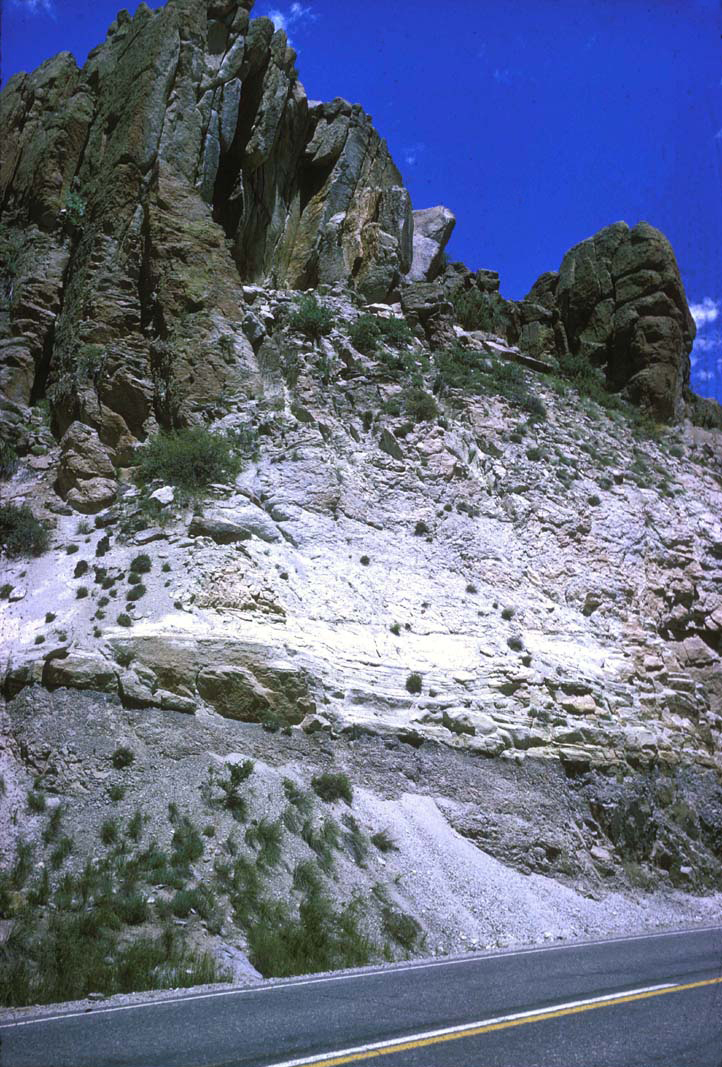
Ash flow tuffs=A pyroclastic flow consisting predominantly of ash-sized (less than 4 millimeters in diameter) particles that make up a volcanic ash matrix. Tuff sheets are compositionally zoned.
Batholith=Batholiths are large plutons with more than about 38.6 mi2 (100 km2) of surface exposure, although most are even larger covering hundreds to thousands of square miles. Batholiths are generally not comprised of one continuous magmatic intrusion, but rather, they are produced by repeated intrusions, and most batholiths are made up of multiple individual plutons. The Sierra Nevada Mountains, a granitic batholith, are comprised of hundreds of individual plutons intruded over a period of several million years. Forceful injection is probably responsible for most emplacement.
Calderas=Roughly circular volcanic depressions greater than 2km in diameter formed by collapse or explosion. Collapse occurs following magma withdrawal by pyroclastic volcanism. Rhyolite Calderas are the largest and most spectacular volcanic landform.
Cauldrons= Eroded analogs of calderas, the topographic rim has been removed through extensive erosion.
Cupola=#1...A domelike rock formation projecting from the upper part of a batholith or stock. #2...An isolated, upward-projecting body of plutonic rock that rises from a batholith. A cupola can form part of the buried batholith ridge.
Diapirs=Are bodies of buoyant magma that push slowly upward through country rock.
Ignimbrites (ash-flow tuffs)=is welded tuff from pyroclasic eruptions and are an abundant and voluminous product of explosive volcanism,
Ignimbrite eruptions=result from the fracturing of the roof above granite batholiths and the escape of the magma of the batholith at the surface.
Large ash flow eruptions=involve compositionally zoned magmas
Pluton=An igneous intrusion smaller than a batholith, usually of granitoid texture.
Resurgence dome=is formed by swelling or rising of a caldera floor due to upward movement in the magma chamber below.
Stock=Irregular igneous intrusion, usually an offshoot of a batholith.
Tuffs=Volcanic rock made up of rock and mineral fragments in a volcanic ash matrix
http://www.planetgoofball.com/the_denver_volcano.htm
The two distinct mesas 10 miles west of Denver at the foothills of the Rockies are remnants of a lava flow. The prehistoric volcano that produced them erupted about 26 to 65 million years ago as a result of tectonic activity associated with the Rio Grande rift. Today, however, it is an extinct system. The leftovers of the originating eruption is called Ralston dike and the material is being used by a paving company to produce asphalt
To Find Diamonds:
Start searching for placer diamonds, work a pan upstream, since diamonds are quite dense, they will
settle to the bottom of the pan much like gold. When searching for pipes in-situ, take note that being a breccia, Kimberlite,
will easily erode on top of the ground, but be aware of craters or maars, unless this is an area of intense glacialization.
At the surface oxidized Kimberlite appears yellow, at depth itТs bluish, while unaltered it exhibits a dark greenish-brown color.
Then also look for characteristic indicator minerals such as::
Diopside- CaMgSi2O6
Enstatite- MgSiO3
Pyrope Garnet- Mg3Al2(SiO4)3
Ilmenite- FeTiO3
Magnetite- MnO(OH)
Olivine- (Mg,Fe)2SiO4
Phlogopite- K Mg3 AlSi3 O10 (OH)2
Perovskite- CaTiO3
Spinel- MgAl2O4
mud volcanos Ca - http://www.sandiegohistory.org/journal/81winter/mud.htm
mount rainier volcano siettle
Large volume volcanic eruptions in the Basin and Range Province
Geology
Map
Central Colorado volcanic field